OGC API Features#
Overview#
This notebook explains the use of the OGC API Features [RD20] interface with GeoJSON and other response formats. It uses the OWSLib [RD31] library to access part of the interface. The visualisation of search results is borrowed from the ODC notebook available at [RD19].
URL_LANDING_PAGE = 'https://fedeo.ceos.org/'
w = ApiFeatures(URL_LANDING_PAGE)
w.url
'https://fedeo.ceos.org/'
Conformance#
The conformance classes supported by OGC API Features interface are listed at https://fedeo.ceos.org/conformance.
conformance = w.conformance()
conformance
{'conformsTo': ['http://www.opengis.net/spec/owc-geojson/1.0/conf/core',
'http://www.opengis.net/spec/os-geojson/1.0/conf/core',
'http://www.opengis.net/spec/eopad-geojson/1.0/conf/core',
'http://www.opengis.net/spec/ogcapi-features-1/1.0/conf/core',
'http://www.opengis.net/spec/ogcapi-features-1/1.0/conf/oas30',
'http://www.opengis.net/spec/ogcapi-features-1/1.0/conf/geojson',
'http://www.opengis.net/spec/ogcapi-features-3/1.0/conf/queryables',
'http://www.opengis.net/spec/ogcapi-features-3/1.0/conf/queryables-query-parameters',
'http://www.opengis.net/spec/ogcapi-features-3/1.0/conf/filter',
'http://www.opengis.net/spec/ogcapi-features-3/1.0/conf/features-filter',
'http://www.opengis.net/spec/ogcapi-records-1/1.0/conf/core',
'http://www.opengis.net/spec/ogcapi-records-1/1.0/conf/record-collection',
'http://www.opengis.net/spec/ogcapi-records-1/1.0/conf/record-api',
'http://www.opengis.net/spec/ogcapi-records-1/1.0/conf/cql',
'http://www.opengis.net/spec/ogcapi-records-1/1.0/conf/json',
'http://www.opengis.net/spec/ogcapi-records-1/1.0/conf/html',
'http://www.opengis.net/spec/ogcapi-common-1/1.0/conf/core',
'http://www.opengis.net/spec/ogcapi-common-2/1.0/conf/collections',
'http://www.opengis.net/spec/ogcapi-common-2/1.0/conf/simple-query',
'http://www.opengis.net/spec/cql2/1.0/conf/basic-cql2',
'http://www.opengis.net/spec/cql2/1.0/conf/cql2-text']}
Same request with curl.
curl -X GET -G https://fedeo.ceos.org/conformance
The conformance response lists supported conformance classes. For example:
http://www.opengis.net/spec/ogcapi-features-3/1.0/conf/queryablesfrom OGC API Features Part 3 [RD21] indicates that collection-specific search parameters are advertised at/collections/{collection-id}/queryables.http://www.opengis.net/spec/ogcapi-features-3/1.0/conf/queryables-query-parametersfrom OGC API Features Part 3 [RD21] indicates that queryables advertised at/collections/{collection-id}/queryablescan be used as HTTP query parameter.http://www.opengis.net/spec/ogcapi-features-3/1.0/conf/filterfrom OGC API Features Part 3 [RD21] indicates that queryables advertised at/collections/{collection-id}/queryablescan be used in a CQL2 filter expression.
These conformance classes have an equivalent conformance class declared by the STAC API. The STAC conformance classes are reported inside the Landing Page.
Access API Description#
curl -X GET -G https://fedeo.ceos.org/api
# Get OpenAPI definition
jstr = json.dumps(w.api(), indent=3)
md("```json\n" + jstr + "\n```\n")
{
"x-@context": {
"geo": "http://a9.com/-/opensearch/extensions/geo/1.0/",
"semantic": "http://a9.com/-/opensearch/extensions/semantic/1.0/",
"referrer": "http://a9.com/-/opensearch/extensions/referrer/1.0/",
"os": "http://a9.com/-/spec/opensearch/1.1/",
"sru": "http://a9.com/-/opensearch/extensions/sru/2.0/",
"eo": "http://a9.com/-/opensearch/extensions/eo/1.0/",
"time": "http://a9.com/-/opensearch/extensions/time/1.0/",
"dc": "http://purl.org/dc/elements/1.1/"
},
"components": {
"schemas": {
"MultiPoint": {
"additionalProperties": false,
"title": "MultiPoint",
"type": "object",
"properties": {
"coordinates": {
"minItems": 1,
"description": "Array of positions",
"title": "coordinates",
"type": "array",
"items": {
"minItems": 2,
"maxItems": 2,
"description": "One position",
"type": "array",
"items": {
"type": "number"
}
}
},
"type": {
"type": "string",
"enum": [
"MultiPoint"
]
}
},
"required": [
"coordinates",
"type"
]
},
"extent": {
"type": "object",
"properties": {
"trs": {
"default": "http://www.opengis.net/def/uom/ISO-8601/0/Gregorian",
"description": "Temporal reference system of the coordinates in the temporal extent (property `temporal`). In the Core, only the Gregorian calendar is supported. Extensions may support additional temporal reference systems.",
"type": "string",
"enum": [
"http://www.opengis.net/def/uom/ISO-8601/0/Gregorian"
]
},
"crs": {
"default": "http://www.opengis.net/def/crs/OGC/1.3/CRS84",
"description": "Coordinate reference system of the coordinates in the spatial extent (property `spatial`). In the Core, only WGS84 longitude/latitude is supported. Extensions may support additional coordinate reference systems.",
"type": "string",
"enum": [
"http://www.opengis.net/def/crs/OGC/1.3/CRS84"
]
},
"spatial": {
"minItems": 4,
"maxItems": 4,
"description": "West, south, east, north edges of the spatial extent. The minimum and maximum values apply to the coordinate reference system WGS84 longitude/latitude that is supported in the Core. If, for example, a projected coordinate reference system is used, the minimum and maximum values need to be adjusted.",
"type": "array",
"items": {
"maximum": 180,
"type": "number",
"minimum": -180
},
"example": [
-180,
-90,
180,
90
]
},
"temporal": {
"minItems": 2,
"maxItems": 2,
"description": "Begin and end times of the temporal extent.",
"type": "array",
"items": {
"format": "dateTime",
"type": "string"
},
"example": [
"2011-11-11T12:22:11Z",
"2012-11-24T12:32:43Z"
]
}
}
},
"MultiLineString": {
"additionalProperties": false,
"title": "MultiLineString",
"type": "object",
"properties": {
"coordinates": {
"minItems": 1,
"description": "Array of linestring",
"title": "coordinates",
"type": "array",
"items": {
"minItems": 2,
"description": "Linestring, i.e. array of positions",
"type": "array",
"items": {
"minItems": 2,
"maxItems": 2,
"description": "Position (longitude, lattitude)",
"type": "array",
"items": {
"type": "number"
}
}
}
},
"type": {
"type": "string",
"enum": [
"MultiLineString"
]
}
},
"required": [
"coordinates",
"type"
]
},
"Queries": {
"description": "Object with queries grouped by \"role\". See also http://www.opensearch.org/Specifications/OpenSearch/1.1#OpenSearch_Query_element",
"additionalProperties": {
"minItems": 1,
"description": "Additional role values as per http://www.opensearch.org/Specifications/OpenSearch/1.1#Role_values.",
"type": "array",
"items": {
"$ref": "#/components/schemas/Query"
}
},
"type": "object",
"properties": {
"type": {
"type": "string",
"enum": [
"Queries"
]
},
"@context": {
"type": "object"
}
}
},
"Category": {
"description": "OGC 14-055r2 \u00a77.1.1.15",
"additionalProperties": false,
"type": "object",
"properties": {
"scheme": {
"format": "uri",
"type": "string"
},
"term": {
"type": "string"
},
"label": {
"type": "string"
},
"type": {
"type": "string",
"enum": [
"Category"
]
}
},
"required": [
"term"
]
},
"Query": {
"description": "OpenSearch Query element as defined at http://www.opensearch.org/Specifications/OpenSearch/1.1#OpenSearch_Query_element.",
"additionalProperties": true,
"type": "object",
"properties": {
"inputEncoding": {
"type": "string"
},
"totalResults": {
"type": "integer",
"minimum": 0
},
"startIndex": {
"type": "integer",
"minimum": 0
},
"startPage": {
"type": "integer",
"minimum": 0
},
"outputEncoding": {
"type": "string"
},
"searchTerms": {
"type": "string"
},
"count": {
"type": "integer",
"minimum": 0
},
"language": {
"type": "string"
},
"type": {
"type": "string",
"enum": [
"Query"
]
},
"title": {
"type": "string"
}
}
},
"ExceptionReport": {
"description": "OGC 06-121r9",
"type": "object",
"properties": {
"type": {
"type": "string",
"enum": [
"ExceptionReport"
]
},
"exceptions": {
"type": "array",
"items": {
"$ref": "#/components/schemas/Exception"
}
}
}
},
"link": {
"type": "object",
"required": [
"href"
],
"properties": {
"hreflang": {
"type": "string",
"example": "en"
},
"rel": {
"type": "string",
"example": "prev"
},
"href": {
"type": "string"
},
"type": {
"type": "string",
"example": "application/geo+json"
},
"title": {
"type": "string",
"example": "previous page"
}
}
},
"req-classes": {
"type": "object",
"required": [
"conformsTo"
],
"properties": {
"conformsTo": {
"type": "array",
"items": {
"type": "string"
},
"example": [
"http://www.opengis.net/spec/eopad-geojson/1.0/req/core",
"http://www.opengis.net/spec/os-geojson/1.0/req/core",
"http://www.opengis.net/spec/owc-geojson/1.0/req/core"
]
}
}
},
"Properties": {
"allOf": [
{
"type": "object",
"properties": {
"creator": {
"description": "OGC 14-055r2",
"type": "string"
},
"subtitle": {
"description": "OGC 14-055r2",
"type": "string"
},
"generator": {
"$ref": "#/components/schemas/Agent"
},
"links": {
"$ref": "#/components/schemas/Links"
},
"lang": {
"minLength": 2,
"description": "OGC 14-055r2",
"type": "string"
}
},
"required": [
"lang",
"links"
]
},
{
"$ref": "#/components/schemas/CommonProperties"
}
],
"title": "Properties",
"type": "object"
},
"Feature": {
"description": "GeoJSON Feature",
"type": "object",
"properties": {
"bbox": {
"minItems": 4,
"maxItems": 4,
"type": "array",
"items": {
"type": "number"
}
},
"geometry": {
"oneOf": [
{
"$ref": "#/components/schemas/Geometry"
}
],
"nullable": true
},
"id": {
"format": "uri",
"type": "string"
},
"type": {
"title": "type",
"type": "string",
"enum": [
"Feature"
]
},
"properties": {
"$ref": "#/components/schemas/Properties_"
}
},
"required": [
"type",
"id",
"properties"
]
},
"collections": {
"type": "array",
"items": {
"$ref": "#/components/schemas/collection"
}
},
"root": {
"type": "object",
"required": [
"links"
],
"properties": {
"links": {
"type": "array",
"items": {
"$ref": "#/components/schemas/link"
}
}
}
},
"ControlInformation": {
"type": "object",
"properties": {
"totalResults": {
"type": "integer",
"minimum": 0
},
"startIndex": {
"type": "integer",
"minimum": 0
},
"itemsPerPage": {
"type": "integer",
"minimum": 0
},
"queries": {
"$ref": "#/components/schemas/Queries"
}
},
"required": [
"totalResults",
"startIndex",
"itemsPerPage"
]
},
"Polygon": {
"additionalProperties": false,
"title": "Polygon",
"type": "object",
"properties": {
"coordinates": {
"minItems": 1,
"description": "Array of linestrings",
"title": "coordinates",
"type": "array",
"items": {
"minItems": 1,
"description": "Linear ring, i.e. linestring or array of positions",
"type": "array",
"items": {
"minItems": 2,
"maxItems": 2,
"description": "One position",
"type": "array",
"items": {
"type": "number"
}
}
}
},
"type": {
"type": "string",
"enum": [
"Polygon"
]
}
},
"required": [
"coordinates",
"type"
]
},
"Agent": {
"description": "RFC4287 \ufffd3.2 and OGC 14-055r2 \ufffd7.1.1.7, \ufffd7.1.8",
"type": "object",
"properties": {
"name": {
"type": "string"
},
"type": {
"type": "string",
"enum": [
"Agent",
"Person",
"Organization"
]
},
"title": {
"description": "OGC 14-055r2 \u00a77.1.8",
"type": "string"
},
"uri": {
"format": "uri",
"type": "string"
},
"version": {
"description": "OGC 14-055r2 \u00a77.1.8",
"type": "string"
},
"email": {
"format": "email",
"type": "string"
}
},
"minProperties": 1
},
"Properties_": {},
"Point": {
"additionalProperties": false,
"title": "Point",
"type": "object",
"properties": {
"coordinates": {
"minItems": 2,
"maxItems": 2,
"description": "One position (longitude, latitude)",
"title": "coordinates",
"type": "array",
"items": {
"type": "number"
}
},
"type": {
"type": "string",
"enum": [
"Point"
]
}
},
"required": [
"coordinates",
"type"
]
},
"collection": {
"type": "object",
"required": [
"id",
"links"
],
"properties": {
"extent": {
"$ref": "#/components/schemas/extent"
},
"crs": {
"default": [
"http://www.opengis.net/def/crs/OGC/1.3/CRS84"
],
"description": "the list of coordinate reference systems supported by the API; the first item is the default coordinate reference system",
"type": "array",
"items": {
"type": "string"
},
"example": [
"http://www.opengis.net/def/crs/OGC/1.3/CRS84",
"http://www.opengis.net/def/crs/EPSG/0/4326"
]
},
"description": {
"type": "string"
},
"links": {
"type": "array",
"items": {
"$ref": "#/components/schemas/link"
}
},
"id": {
"type": "string"
},
"title": {
"type": "string"
}
}
},
"Offering": {
"description": "Offering as defined in OGC 14-055r2",
"title": "Offering",
"type": "object",
"properties": {
"code": {
"format": "uri",
"type": "string"
},
"operations": {
"type": "array",
"items": {
"type": "object"
}
},
"contents": {
"type": "array",
"items": {
"type": "object"
}
},
"styles": {
"type": "array",
"items": {
"type": "object"
}
}
},
"required": [
"code"
]
},
"CommonProperties": {
"type": "object",
"properties": {
"date": {
"description": "OGC 14-055r2",
"type": "string"
},
"rights": {
"description": "OGC 14-055r2",
"type": "string"
},
"publisher": {
"description": "OGC 14-055r2",
"type": "string"
},
"categories": {
"minItems": 1,
"description": "OGC 14-055r2",
"type": "array",
"items": {
"$ref": "#/components/schemas/Category"
}
},
"type": {
"type": "string",
"enum": [
"Properties"
]
},
"title": {
"description": "OGC 14-055r2",
"type": "string"
},
"updated": {
"format": "date-time",
"description": "OGC 14-055r2",
"type": "string"
},
"authors": {
"minItems": 1,
"description": "OGC 14-055r2",
"type": "array",
"items": {
"$ref": "#/components/schemas/Agent"
}
}
},
"required": [
"title",
"updated"
]
},
"Exception": {
"description": "OGC 06-121r9",
"additionalProperties": false,
"type": "object",
"properties": {
"exceptionText": {
"description": "Represents ows:exceptionText",
"type": "string"
},
"exceptionCode": {
"format": "uri",
"description": "Represents ows:exceptionCode",
"type": "string"
},
"locator": {
"description": "Represents ows:locator.",
"type": "string"
}
},
"required": [
"exceptionCode"
]
},
"Geometry": {
"oneOf": [
{
"$ref": "#/components/schemas/Point"
},
{
"$ref": "#/components/schemas/MultiPoint"
},
{
"$ref": "#/components/schemas/LineString"
},
{
"$ref": "#/components/schemas/MultiLineString"
},
{
"$ref": "#/components/schemas/Polygon"
},
{
"$ref": "#/components/schemas/MultiPolygon"
}
],
"title": "Geometry",
"type": "object"
},
"LineString": {
"additionalProperties": false,
"title": "LineString",
"type": "object",
"properties": {
"coordinates": {
"minItems": 2,
"description": "Array of positions",
"title": "coordinates",
"type": "array",
"items": {
"minItems": 2,
"maxItems": 2,
"description": "One position",
"type": "array",
"items": {
"type": "number"
}
}
},
"type": {
"type": "string",
"enum": [
"LineString"
]
}
},
"required": [
"coordinates",
"type"
]
},
"MultiPolygon": {
"additionalProperties": false,
"title": "MultiPolygon",
"type": "object",
"properties": {
"coordinates": {
"minItems": 1,
"description": "Array of Polygons",
"title": "coordinates",
"type": "array",
"items": {
"minItems": 1,
"description": "Array of linestrings",
"type": "array",
"items": {
"description": "Linear ring, i.e. linestring or array of positions",
"type": "array",
"items": {
"minItems": 2,
"maxItems": 2,
"description": "One position",
"type": "array",
"items": {
"type": "number"
}
}
}
}
},
"type": {
"type": "string",
"enum": [
"MultiPolygon"
]
}
},
"required": [
"coordinates",
"type"
]
},
"FeatureCollection": {
"allOf": [
{
"type": "object",
"properties": {
"features": {
"minItems": 0,
"type": "array",
"items": {
"$ref": "#/components/schemas/Feature"
}
},
"bbox": {
"type": "array",
"items": {
"type": "object"
}
},
"id": {
"format": "uri",
"description": "OGC 14-055r2",
"type": "string"
},
"type": {
"description": "OGC 14-055r2",
"type": "string",
"enum": [
"FeatureCollection"
]
},
"@context": {
"type": "string"
},
"properties": {
"$ref": "#/components/schemas/Properties"
},
"exceptions": {
"minItems": 1,
"type": "array",
"items": {
"$ref": "#/components/schemas/Exception"
}
}
},
"required": [
"type",
"id",
"features"
]
},
{
"$ref": "#/components/schemas/ControlInformation"
}
],
"description": "GeoJSON FeatureCollection",
"type": "object"
},
"Links": {
"description": "OGC 14-055r2",
"additionalProperties": {
"minItems": 1,
"type": "array",
"items": {
"$ref": "#/components/schemas/Link"
}
},
"title": "Links",
"type": "object",
"properties": {
"next": {
"minItems": 1,
"type": "array",
"items": {
"$ref": "#/components/schemas/Link"
}
},
"search": {
"minItems": 1,
"type": "array",
"items": {
"$ref": "#/components/schemas/Link"
}
},
"related": {
"minItems": 1,
"description": "OGC 14-055r2",
"type": "array",
"items": {
"$ref": "#/components/schemas/Link"
}
},
"last": {
"minItems": 1,
"type": "array",
"items": {
"$ref": "#/components/schemas/Link"
}
},
"previous": {
"minItems": 1,
"type": "array",
"items": {
"$ref": "#/components/schemas/Link"
}
},
"profiles": {
"minItems": 1,
"description": "OGC 14-055r2",
"type": "array",
"items": {
"$ref": "#/components/schemas/Link"
}
},
"describedby": {
"minItems": 1,
"type": "array",
"items": {
"$ref": "#/components/schemas/Link"
}
},
"type": {
"type": "string",
"enum": [
"Links"
]
},
"alternates": {
"minItems": 1,
"description": "OGC 14-055r2",
"type": "array",
"items": {
"$ref": "#/components/schemas/Link"
}
},
"first": {
"minItems": 1,
"type": "array",
"items": {
"$ref": "#/components/schemas/Link"
}
},
"via": {
"minItems": 1,
"description": "OGC 14-055r2",
"type": "array",
"items": {
"$ref": "#/components/schemas/Link"
}
}
}
},
"Link": {
"description": "OGC 14-055r2",
"type": "object",
"properties": {
"length": {
"type": "integer",
"exclusiveMinimum": true,
"minimum": 0
},
"href": {
"format": "uri",
"type": "string"
},
"type": {
"description": "MIME type",
"type": "string"
},
"title": {
"type": "string"
},
"lang": {
"description": "RFC-3066",
"type": "string"
}
},
"required": [
"href"
]
}
},
"securitySchemes": {
"BasicAuth": {
"scheme": "basic",
"type": "http"
}
}
},
"servers": [
{
"url": "https://fedeo.ceos.org"
}
],
"openapi": "3.0.0",
"x-queries": {
"example": [
{
"eo:parentIdentifier": "TropForest",
"time:start": "2009-04-01T00:00:00Z",
"time:end": "2009-04-10T00:00:00Z"
}
]
},
"paths": {
"/collections/datasets/items": {
"post": {
"security": [
{
"BasicAuth": []
}
],
"requestBody": {
"description": "Insert a new dataset in the catalogue.",
"required": true,
"content": {
"application/xml": {
"schema": {}
},
"application/gml+xml": {
"schema": {}
},
"application/gml+xml;profile=\"http://www.opengis.net/spec/EOMPOM/1.1\"": {
"schema": {}
},
"application/gml+xml;profile=\"http://www.opengis.net/spec/EOMPOM/1.0\"": {
"schema": {}
},
"application/zip": {
"schema": {}
},
"application/geo+json": {
"schema": {
"$ref": "#/components/schemas/Feature"
}
}
}
},
"description": "Insert a new dataset in the catalogue.",
"operationId": "Insert",
"responses": {
"201": {
"description": "Datasets have been successfully inserted."
},
"400": {
"description": "Bad request."
},
"401": {
"description": "Unauthorized."
},
"500": {
"description": "Unexpected error."
},
"415": {
"description": "Unsupported Media Type."
}
},
"parameters": [
{
"schema": {
"type": "string"
},
"examples": {
"LANDSAT.ETM.GTC": {
"summary": "LANDSAT.ETM.GTC",
"value": "LANDSAT.ETM.GTC"
}
},
"in": "query",
"name": "parentIdentifier",
"description": "Series identifier.",
"x-value": "{eo:parentIdentifier}",
"required": false
}
],
"tags": [
"Datasets"
]
},
"get": {
"summary": "Dataset search (rel=\"results\")",
"description": "The endpoint returns information about the *EO* dataset matching specific filtering criteria such as platform, instrument and lists the datasets .\n",
"responses": {
"200": {
"description": "An array of datasets",
"content": {
"application/ld+json": {
"schema": {}
},
"application/atom+xml": {
"schema": {}
},
"text/turtle;profile=\"https://schema.org\"": {
"schema": {}
},
"application/rdf+xml": {
"schema": {}
},
"application/ld+json;profile=\"http://www.opengis.net/spec/os-geojson/1.0\"": {
"schema": {}
},
"application/geo+json;profile=\"https://stacspec.org\"": {
"schema": {}
},
"application/rdf+xml;profile=\"http://www.opengis.net/spec/os-geojson/1.0\"": {
"schema": {}
},
"text/turtle": {
"schema": {}
},
"text/turtle;profile=\"http://www.opengis.net/spec/os-geojson/1.0\"": {
"schema": {}
},
"application/geo+json;profile=\"http://www.opengis.net/spec/ogcapi-features-1/1.0\"": {
"schema": {}
},
"application/rdf+xml;profile=\"http://data.europa.eu/930/\"": {
"schema": {}
},
"text/html": {
"schema": {}
},
"text/turtle;profile=\"http://data.europa.eu/930/\"": {
"schema": {}
},
"application/ld+json;profile=\"https://schema.org\"": {
"schema": {}
},
"application/geo+json;profile=\"http://www.opengis.net/spec/os-geojson/1.0\"": {
"schema": {}
},
"application/rdf+xml;profile=\"https://schema.org\"": {
"schema": {}
},
"application/geo+json": {
"schema": {}
},
"application/ld+json;profile=\"http://data.europa.eu/930/\"": {
"schema": {}
}
}
},
"400": {
"description": "Bad request"
},
"500": {
"description": "Unexpected error"
},
"415": {
"description": "Unsupported Media Type."
}
},
"parameters": [
{
"schema": {
"default": "application/geo+json",
"type": "string",
"enum": [
"application/atom+xml",
"application/geo+json",
"application/geo+json;profile=\"http://www.opengis.net/spec/ogcapi-features-1/1.0\"",
"application/geo+json;profile=\"http://www.opengis.net/spec/os-geojson/1.0\"",
"application/geo+json;profile=\"https://stacspec.org\"",
"application/ld+json",
"application/ld+json;profile=\"http://data.europa.eu/930/\"",
"application/ld+json;profile=\"http://www.opengis.net/spec/os-geojson/1.0\"",
"application/ld+json;profile=\"https://schema.org\"",
"application/rdf+xml",
"application/rdf+xml;profile=\"http://data.europa.eu/930/\"",
"application/rdf+xml;profile=\"http://www.opengis.net/spec/os-geojson/1.0\"",
"application/rdf+xml;profile=\"https://schema.org\"",
"text/html",
"text/turtle",
"text/turtle;profile=\"http://data.europa.eu/930/\"",
"text/turtle;profile=\"http://www.opengis.net/spec/os-geojson/1.0\"",
"text/turtle;profile=\"https://schema.org\""
]
},
"in": "query",
"name": "httpAccept",
"description": "Query parameter to define expected response type.",
"required": false
},
{
"schema": {
"exclusiveMaximum": false,
"default": 10,
"format": "int32",
"maximum": 50,
"type": "integer",
"exclusiveMinimum": false,
"minimum": 0
},
"in": "query",
"name": "limit",
"description": "Number of records {os:count}.",
"x-value": "{count}",
"required": false
},
{
"schema": {
"type": "string"
},
"in": "query",
"name": "acquisitionSubType",
"description": "Acquisition sub type {eo:acquisitionSubType}.",
"x-value": "{eo:acquisitionSubType}",
"required": false
},
{
"schema": {
"type": "string"
},
"in": "query",
"name": "offering",
"description": "offering {eo:offering}.",
"x-value": "{eo:offering}",
"required": false
},
{
"schema": {
"type": "string"
},
"in": "query",
"name": "track",
"description": "Track {eo:track}.",
"x-value": "{eo:track}",
"required": false
},
{
"schema": {
"type": "string",
"enum": [
"dataset"
]
},
"in": "query",
"name": "type",
"description": "Query parameter to define which type of resource to be retrieved {dc:type}.",
"x-value": "{dc:type}",
"required": false
},
{
"schema": {
"type": "string"
},
"in": "query",
"name": "spectralRange",
"description": "Spectral range {eo:spectralRange}.",
"x-value": "{eo:spectralRange}",
"required": false
},
{
"schema": {
"type": "string"
},
"in": "query",
"name": "source",
"description": "source {referrer:source}.",
"x-value": "{referrer:source}",
"required": false
},
{
"schema": {
"type": "string"
},
"in": "query",
"name": "processingCenter",
"description": "Processing center {eo:processingCenter}.",
"x-value": "{eo:processingCenter}",
"required": false
},
{
"schema": {
"type": "string"
},
"in": "query",
"name": "doi",
"description": "Doi {eo:doi}.",
"x-value": "{eo:doi}",
"required": false
},
{
"schema": {
"format": "double",
"type": "number"
},
"in": "query",
"name": "lowestLocation",
"description": "Lowest location {eo:lowestLocation}.",
"x-value": "{eo:lowestLocation}",
"required": false
},
{
"schema": {
"type": "array",
"items": {
"type": "string"
}
},
"in": "query",
"explode": false,
"name": "q",
"description": "Free text search {API Records}.",
"required": false
},
{
"schema": {
"type": "string",
"enum": [
"NOMINAL",
"CALIBRATION",
"OTHER"
]
},
"in": "query",
"name": "acquisitionType",
"description": "{eo:acquisitionType}",
"x-value": "{eo:acquisitionType}",
"required": false
},
{
"schema": {
"type": "string"
},
"in": "query",
"allowEmptyValue": true,
"name": "datetime",
"description": "Start and(or) end datetime of temporal constraint {time:start}/{time:end}.",
"x-value": "{time:start}/{time:end}",
"required": false
},
{
"schema": {
"type": "string"
},
"in": "query",
"name": "query",
"description": "Free text search term {os:searchTerms}.",
"x-value": "{searchTerms}",
"required": false
},
{
"schema": {
"type": "string"
},
"in": "query",
"name": "sensorType",
"description": "{eo:sensorType}",
"x-value": "{eo:sensorType}",
"required": false
},
{
"schema": {
"exclusiveMaximum": false,
"format": "double",
"maximum": 180,
"type": "number",
"exclusiveMinimum": false,
"minimum": -180
},
"in": "query",
"name": "lon",
"description": "Longitude of center of area of interest {geo:lon}.",
"x-value": "{geo:lon}",
"required": false
},
{
"schema": {
"format": "date-time",
"type": "string"
},
"in": "query",
"name": "modificationDate",
"description": "Modification date of the series/services/dataset metadata {eo:modificationDate}.",
"x-value": "{eo:modificationDate}",
"required": false
},
{
"schema": {
"type": "string"
},
"in": "query",
"name": "availabilityTime",
"description": "Availability time {eo:availabilityTime}.",
"x-value": "{eo:availabilityTime}",
"required": false
},
{
"schema": {
"type": "string"
},
"in": "query",
"name": "facetLimit",
"description": "facetLimit {sru:facetLimit}.",
"x-value": "{sru:facetLimit}",
"required": false
},
{
"schema": {
"format": "double",
"type": "number"
},
"in": "query",
"name": "illuminationZenithAngle",
"description": "Illumination zenit angle {eo:illuminationZenithAngle}.",
"x-value": "{eo:illuminationZenithAngle}",
"required": false
},
{
"schema": {
"type": "string"
},
"in": "query",
"name": "frame",
"description": "Frame {eo:frame}.",
"x-value": "{eo:frame}",
"required": false
},
{
"schema": {
"type": "string"
},
"in": "query",
"name": "nativeProductFormat",
"description": "Native product format",
"x-value": "{eo:nativeProductFormat}",
"required": false
},
{
"schema": {
"type": "string"
},
"in": "query",
"name": "filter",
"description": "filter expression applied when retrieving resources",
"required": false
},
{
"schema": {
"type": "string"
},
"in": "query",
"name": "swathIdentifier",
"description": "Swath identifier {eo:swathIdentifier}.",
"x-value": "{eo:swathIdentifier}",
"required": false
},
{
"schema": {
"type": "string"
},
"in": "query",
"name": "processorName",
"description": "Processor mame {eo:processorName}.",
"x-value": "{eo:processorName}",
"required": false
},
{
"schema": {
"type": "string"
},
"in": "query",
"name": "processingLevel",
"description": "Processing level {eo:processingLevel}.",
"x-value": "{eo:processingLevel}",
"required": false
},
{
"schema": {
"type": "string"
},
"in": "query",
"name": "uid",
"description": "Local identifier {geo:uid} of the series/service/dataset returned as dc:identifier in response.",
"x-value": "{geo:uid}",
"required": false
},
{
"schema": {
"type": "string"
},
"in": "query",
"name": "instrument",
"description": "Instrument name {eo:instrument}.",
"x-value": "{eo:instrument}",
"required": false
},
{
"schema": {
"format": "uri",
"type": "string"
},
"in": "query",
"name": "classifiedAs",
"description": "Keyword URI appearing in metadata record {semantic:classifiedAs}.",
"x-value": "{semantic:classifiedAs}",
"required": false
},
{
"schema": {
"type": "string"
},
"in": "query",
"name": "parentIdentifier",
"description": "Parent identifier {eo:parentIdentifier}.",
"x-value": "{eo:parentIdentifier}",
"required": false
},
{
"schema": {
"type": "string"
},
"in": "query",
"name": "orbitType",
"description": "Orbit type {eo:orbitType}.",
"x-value": "{eo:orbitType}",
"required": false
},
{
"schema": {
"type": "string",
"enum": [
"om",
"om10",
"om11",
"server-choice",
"http://www.opengis.net/eop/2.0",
"http://www.opengis.net/eop/2.1"
]
},
"in": "query",
"name": "recordSchema",
"description": "Record schema {sru:recordSchema}.",
"x-value": "{sru:recordSchema}",
"required": false
},
{
"schema": {
"format": "double",
"type": "number"
},
"in": "query",
"name": "illuminationAzimuthAngle",
"description": "Illumination azimuth angle {eo:illuminationAzimuthAngle}.",
"x-value": "{eo:illuminationAzimuthAngle}",
"required": false
},
{
"schema": {
"type": "string"
},
"in": "query",
"name": "bbox",
"description": "Area of interest {geo:box}.",
"x-value": "{geo:box}",
"required": false
},
{
"schema": {
"format": "double",
"type": "number"
},
"in": "query",
"name": "highestLocation",
"description": "Highest location {eo:highestLocation}.",
"x-value": "{eo:highestLocation}",
"required": false
},
{
"schema": {
"type": "string"
},
"in": "query",
"name": "compositeType",
"description": "Composite type {eo:compositeType}.",
"x-value": "{eo:compositeType}",
"required": false
},
{
"schema": {
"type": "string"
},
"in": "query",
"name": "productQualityDegradationTag",
"description": "Product quality degradation tag {eo:productQualityDegradationTag}.",
"x-value": "{eo:productQualityDegradationTag}",
"required": false
},
{
"schema": {
"format": "date-time",
"type": "string"
},
"in": "query",
"name": "creationDate",
"description": "Creation date of the series/services/dataset metadata {eo:creationDate}.",
"x-value": "{eo:creationDate}",
"required": false
},
{
"schema": {
"type": "string",
"enum": [
"ARCHIVED",
"ACQUIRED",
"CANCELLED",
"FAILED",
"PLANNED",
"POTENTIAL",
"REJECTED",
"QUALITYDEGRADED"
]
},
"in": "query",
"name": "productionStatus",
"description": "Status of the datasets {eo:productionStatus}.",
"x-value": "{eo:productionStatus}",
"required": false
},
{
"schema": {
"type": "string"
},
"in": "query",
"name": "platformSerialIdentifier",
"description": "Satellite serial identifier {eo:platformSerialIdentifier}.",
"x-value": "{eo:platformSerialIdentifier}",
"required": false
},
{
"schema": {
"type": "string"
},
"in": "query",
"name": "processingMode",
"description": "Processing mode {eo:processingMode}.",
"x-value": "{eo:processingMode}",
"required": false
},
{
"schema": {
"type": "array",
"items": {
"type": "string"
}
},
"in": "query",
"explode": false,
"name": "externalId",
"description": "Search by external identifier {API Records}.",
"required": false
},
{
"schema": {
"type": "string"
},
"in": "query",
"name": "archivingCenter",
"description": "Archiving center {eo:archivingCenter}.",
"x-value": "{eo:archivingCenter}",
"required": false
},
{
"schema": {
"format": "double",
"type": "number",
"exclusiveMinimum": false,
"minimum": 0
},
"in": "query",
"name": "radius",
"description": "Radius of area of interest {geo:radius} in meters. Is combined with {geo:lon} and {geo:lat} or {geo:name}.",
"x-value": "{geo:radius}",
"required": false
},
{
"schema": {
"format": "double",
"type": "number"
},
"in": "query",
"name": "resolution",
"description": "{eo:resolution}",
"x-value": "{eo:resolution}",
"required": false
},
{
"schema": {
"type": "string"
},
"in": "query",
"name": "name",
"description": "Name of area of interest {geo:name}.",
"x-value": "{geo:name}",
"required": false
},
{
"schema": {
"type": "string"
},
"in": "query",
"name": "sensorMode",
"description": "Sensor mode {eo:sensorMode}.",
"x-value": "{eo:sensorMode}",
"required": false
},
{
"schema": {
"format": "double",
"type": "number"
},
"in": "query",
"name": "completionTimeFromAscendingNode",
"description": "Completion time from ascending node {eo:completionTimeFromAscendingNode}.",
"x-value": "{eo:completionTimeFromAscendingNode}",
"required": false
},
{
"schema": {
"format": "double",
"type": "number"
},
"in": "query",
"name": "illuminationElevationAngle",
"description": "Illumination elevation angle {eo:illuminationElevationAngle}.",
"x-value": "{eo:illuminationElevationAngle}",
"required": false
},
{
"schema": {
"format": "int32",
"type": "integer"
},
"in": "query",
"name": "wavelengths",
"description": "Wavre length {eo:wavelengths}.",
"x-value": "{eo:wavelengths}",
"required": false
},
{
"schema": {
"type": "string"
},
"in": "query",
"name": "acquisitionStation",
"description": "Acquisition station {eo:acquisitionStation}.",
"x-value": "{eo:acquisitionStation}",
"required": false
},
{
"schema": {
"type": "string"
},
"in": "query",
"name": "platform",
"description": "Satellite name {eo:platform}.",
"x-value": "{eo:platform}",
"required": false
},
{
"schema": {
"default": 1,
"format": "int32",
"type": "integer",
"minimum": 1
},
"in": "query",
"name": "startPage",
"description": "Start index of first result page {os:startPage}.",
"x-value": "{startPage}",
"required": false
},
{
"schema": {
"type": "string",
"enum": [
"cql2-text"
]
},
"in": "query",
"name": "filter-lang",
"description": "specific language that is being used for filtering",
"required": false
},
{
"schema": {
"format": "double",
"type": "number"
},
"in": "query",
"name": "startTimeFromAscendingNode",
"description": "Start time from ascending node {eo:startTimeFromAscendingNode}.",
"x-value": "{eo:startTimeFromAscendingNode}",
"required": false
},
{
"schema": {
"format": "int32",
"type": "integer"
},
"in": "query",
"name": "orbitNumber",
"description": "Orbit number {eo:orbitNumber}.",
"x-value": "{eo:orbitNumber}",
"required": false
},
{
"schema": {
"type": "string"
},
"in": "query",
"name": "productQualityStatus",
"description": "Product quality status {eo:productQualityStatus}.",
"x-value": "{eo:productQualityStatus}",
"required": false
},
{
"schema": {
"type": "string",
"enum": [
"ASCENDING",
"DESCENDING"
]
},
"in": "query",
"name": "orbitDirection",
"description": "Orbit direction{eo:orbitDirection}.",
"x-value": "{eo:orbitDirection}",
"required": false
},
{
"schema": {
"exclusiveMaximum": false,
"format": "double",
"maximum": 90,
"type": "number",
"exclusiveMinimum": false,
"minimum": -90
},
"in": "query",
"name": "lat",
"description": "Latitude of center of area of interest {geo:lat}.",
"x-value": "{geo:lat}",
"required": false
},
{
"schema": {
"type": "string"
},
"in": "query",
"name": "productVersion",
"description": "Product version {eo:productVersion}.",
"x-value": "{eo:productVersion}",
"required": false
},
{
"schema": {
"type": "string"
},
"in": "query",
"name": "productType",
"description": "Product Type {eo:productType}.",
"x-value": "{eo:productType}",
"required": false
},
{
"schema": {
"format": "date-time",
"type": "string"
},
"in": "query",
"name": "processingDate",
"description": "Processing date {eo:processingDate}.",
"x-value": "{eo:processingDate}",
"required": false
},
{
"schema": {
"type": "string"
},
"in": "query",
"name": "sortKeys",
"description": "sortKeys {sru:sortKeys}.",
"x-value": "{sru:sortKeys}",
"required": false
},
{
"schema": {
"type": "string"
},
"in": "query",
"name": "geometry",
"description": "Area of interest in WKT format {geo:geometry}.",
"x-value": "{geo:geometry}",
"required": false
},
{
"schema": {
"default": 1,
"format": "int32",
"type": "integer",
"minimum": 1
},
"in": "query",
"name": "startRecord",
"description": "Start index of first result {os:startIndex}.",
"x-value": "{startIndex}",
"required": false
},
{
"schema": {
"format": "double",
"type": "number"
},
"in": "query",
"name": "cloudCover",
"description": "Cloud cover {eo:cloudCover}.",
"x-value": "{eo:cloudCover}",
"required": false
},
{
"schema": {
"format": "double",
"type": "number"
},
"in": "query",
"name": "snowCover",
"description": "Snow cover {eo:snowCover}.",
"x-value": "{eo:snowCover}",
"required": false
},
{
"schema": {
"format": "double",
"type": "number"
},
"in": "query",
"name": "dopplerFrequency",
"description": "Doppler frequency {eo:dopplerFrequency}.",
"x-value": "{eo:dopplerFrequency}",
"required": false
},
{
"schema": {
"format": "double",
"type": "number"
},
"in": "query",
"name": "maximumIncidenceAngle",
"description": "Maximum incidence angle {eo:maximumIncidenceAngle}.",
"x-value": "{eo:maximumIncidenceAngle}",
"required": false
},
{
"schema": {
"format": "double",
"type": "number"
},
"in": "query",
"name": "incidenceAngleVariation",
"description": "Incidence angle variation {eo:incidenceAngleVariation}.",
"x-value": "{eo:incidenceAngleVariation}",
"required": false
},
{
"schema": {
"type": "string"
},
"in": "query",
"name": "polarisationChannels",
"description": "Polarisation Channels {eo:polarisationChannels}.",
"x-value": "{eo:polarisationChannels}",
"required": false
},
{
"schema": {
"type": "string",
"enum": [
"S",
"D",
"Q",
"UNDEFINED"
]
},
"in": "query",
"name": "polarisationMode",
"description": "Polarisation Mode {eo:polarisationMode}.\"",
"x-value": "{eo:polarisationMode}",
"required": false
},
{
"schema": {
"type": "string",
"enum": [
"LEFT",
"RIGHT"
]
},
"in": "query",
"name": "antennaLookDirection",
"description": "Antenna look direction {eo:antennaLookDirection}.",
"x-value": "{eo:antennaLookDirection}",
"required": false
},
{
"schema": {
"format": "double",
"type": "number"
},
"in": "query",
"name": "minimumIncidenceAngle",
"description": "Minimum incidence angle {eo:minimumIncidenceAngle}.",
"x-value": "{eo:minimumIncidenceAngle}",
"required": false
}
],
"tags": [
"Datasets"
]
},
"delete": {
"security": [
{
"BasicAuth": []
}
],
"description": "Delete all datasets of a dataset series.",
"responses": {
"401": {
"description": "Unauthorized."
},
"500": {
"description": "Unexpected error"
},
"204": {
"description": "Dataset has been deleted."
}
},
"parameters": [
{
"schema": {
"type": "string"
},
"in": "query",
"name": "parentIdentifier",
"description": "Series identifier.",
"x-value": "{eo:parentIdentifier}",
"required": false
}
],
"tags": [
"Datasets"
]
}
},
"/collections/{collectionId}/queryables": {
"get": {
"summary": "Queryables supported by a collection",
"description": "Queryables supported by a collection.",
"responses": {
"200": {
"description": "Queryables supported by a collection is successfully returned",
"content": {
"application/schema+json": {
"schema": {}
}
}
},
"500": {
"description": "Unexpected error"
}
},
"parameters": [
{
"schema": {
"type": "string"
},
"in": "path",
"name": "collectionId",
"description": "Collection identifier.",
"required": true
}
],
"tags": [
"Collections"
]
}
},
"/search": {
"post": {
"summary": "Dataset search.",
"security": [
{
"BasicAuth": []
}
],
"requestBody": {
"description": "JSON object representing a query and filter.",
"required": true,
"content": {
"application/json": {
"schema": {}
}
}
},
"description": "The endpoint returns information about the *EO* dataset matching specific filtering criteria such as datetime, bbox and lists the datasets .\n",
"responses": {
"200": {
"description": "An array of datasets",
"content": {
"application/ld+json": {
"schema": {}
},
"application/atom+xml": {
"schema": {}
},
"text/turtle;profile=\"https://schema.org\"": {
"schema": {}
},
"application/rdf+xml": {
"schema": {}
},
"application/ld+json;profile=\"http://www.opengis.net/spec/os-geojson/1.0\"": {
"schema": {}
},
"application/geo+json;profile=\"https://stacspec.org\"": {
"schema": {}
},
"application/rdf+xml;profile=\"http://www.opengis.net/spec/os-geojson/1.0\"": {
"schema": {}
},
"text/turtle": {
"schema": {}
},
"text/turtle;profile=\"http://www.opengis.net/spec/os-geojson/1.0\"": {
"schema": {}
},
"application/geo+json;profile=\"http://www.opengis.net/spec/ogcapi-features-1/1.0\"": {
"schema": {}
},
"application/rdf+xml;profile=\"http://data.europa.eu/930/\"": {
"schema": {}
},
"text/html": {
"schema": {}
},
"text/turtle;profile=\"http://data.europa.eu/930/\"": {
"schema": {}
},
"application/ld+json;profile=\"https://schema.org\"": {
"schema": {}
},
"application/geo+json;profile=\"http://www.opengis.net/spec/os-geojson/1.0\"": {
"schema": {}
},
"application/rdf+xml;profile=\"https://schema.org\"": {
"schema": {}
},
"application/geo+json": {
"schema": {}
},
"application/ld+json;profile=\"http://data.europa.eu/930/\"": {
"schema": {}
}
}
},
"400": {
"description": "Bad request"
},
"500": {
"description": "Unexpected error"
},
"415": {
"description": "Unsupported Media Type."
}
},
"tags": [
"Datasets",
"Search"
]
},
"get": {
"summary": "Dataset search.",
"description": "The endpoint returns information about the *EO* dataset matching specific filtering criteria such as platform, instrument and lists the datasets .\n",
"responses": {
"200": {
"description": "An array of datasets",
"content": {
"application/ld+json": {
"schema": {}
},
"application/atom+xml": {
"schema": {}
},
"text/turtle;profile=\"https://schema.org\"": {
"schema": {}
},
"application/rdf+xml": {
"schema": {}
},
"application/ld+json;profile=\"http://www.opengis.net/spec/os-geojson/1.0\"": {
"schema": {}
},
"application/geo+json;profile=\"https://stacspec.org\"": {
"schema": {}
},
"application/rdf+xml;profile=\"http://www.opengis.net/spec/os-geojson/1.0\"": {
"schema": {}
},
"text/turtle": {
"schema": {}
},
"text/turtle;profile=\"http://www.opengis.net/spec/os-geojson/1.0\"": {
"schema": {}
},
"application/geo+json;profile=\"http://www.opengis.net/spec/ogcapi-features-1/1.0\"": {
"schema": {}
},
"application/rdf+xml;profile=\"http://data.europa.eu/930/\"": {
"schema": {}
},
"text/html": {
"schema": {}
},
"text/turtle;profile=\"http://data.europa.eu/930/\"": {
"schema": {}
},
"application/ld+json;profile=\"https://schema.org\"": {
"schema": {}
},
"application/geo+json;profile=\"http://www.opengis.net/spec/os-geojson/1.0\"": {
"schema": {}
},
"application/rdf+xml;profile=\"https://schema.org\"": {
"schema": {}
},
"application/geo+json": {
"schema": {}
},
"application/ld+json;profile=\"http://data.europa.eu/930/\"": {
"schema": {}
}
}
},
"400": {
"description": "Bad request"
},
"500": {
"description": "Unexpected error"
},
"415": {
"description": "Unsupported Media Type."
}
},
"parameters": [
{
"schema": {
"default": "application/geo+json;profile=\"https://stacspec.org\"",
"type": "string",
"enum": [
"application/atom+xml",
"application/geo+json",
"application/geo+json;profile=\"http://www.opengis.net/spec/ogcapi-features-1/1.0\"",
"application/geo+json;profile=\"http://www.opengis.net/spec/os-geojson/1.0\"",
"application/geo+json;profile=\"https://stacspec.org\"",
"application/ld+json",
"application/ld+json;profile=\"http://data.europa.eu/930/\"",
"application/ld+json;profile=\"http://www.opengis.net/spec/os-geojson/1.0\"",
"application/ld+json;profile=\"https://schema.org\"",
"application/rdf+xml",
"application/rdf+xml;profile=\"http://data.europa.eu/930/\"",
"application/rdf+xml;profile=\"http://www.opengis.net/spec/os-geojson/1.0\"",
"application/rdf+xml;profile=\"https://schema.org\"",
"text/html",
"text/turtle",
"text/turtle;profile=\"http://data.europa.eu/930/\"",
"text/turtle;profile=\"http://www.opengis.net/spec/os-geojson/1.0\"",
"text/turtle;profile=\"https://schema.org\""
]
},
"in": "query",
"name": "httpAccept",
"description": "Query parameter to define expected response type.",
"required": false
},
{
"schema": {
"exclusiveMaximum": false,
"default": 10,
"format": "int32",
"maximum": 50,
"type": "integer",
"exclusiveMinimum": false,
"minimum": 0
},
"in": "query",
"name": "limit",
"description": "Number of records {os:count}.",
"x-value": "{count}",
"required": false
},
{
"schema": {
"type": "string"
},
"in": "query",
"name": "acquisitionSubType",
"description": "Acquisition sub type {eo:acquisitionSubType}.",
"x-value": "{eo:acquisitionSubType}",
"required": false
},
{
"schema": {
"type": "string"
},
"in": "query",
"name": "offering",
"description": "offering {eo:offering}.",
"x-value": "{eo:offering}",
"required": false
},
{
"schema": {
"type": "string"
},
"in": "query",
"name": "track",
"description": "Track {eo:track}.",
"x-value": "{eo:track}",
"required": false
},
{
"schema": {
"type": "string"
},
"in": "query",
"name": "spectralRange",
"description": "Spectral range {eo:spectralRange}.",
"x-value": "{eo:spectralRange}",
"required": false
},
{
"schema": {
"type": "string"
},
"in": "query",
"name": "source",
"description": "source {referrer:source}.",
"x-value": "{referrer:source}",
"required": false
},
{
"schema": {
"type": "string"
},
"in": "query",
"name": "processingCenter",
"description": "Processing center {eo:processingCenter}.",
"x-value": "{eo:processingCenter}",
"required": false
},
{
"schema": {
"type": "string"
},
"in": "query",
"name": "doi",
"description": "Doi {eo:doi}.",
"x-value": "{eo:doi}",
"required": false
},
{
"schema": {
"format": "double",
"type": "number"
},
"in": "query",
"name": "lowestLocation",
"description": "Lowest location {eo:lowestLocation}.",
"x-value": "{eo:lowestLocation}",
"required": false
},
{
"schema": {
"type": "array",
"items": {
"type": "string"
}
},
"in": "query",
"explode": false,
"name": "q",
"description": "Free text search {API Records}.",
"required": false
},
{
"schema": {
"type": "string",
"enum": [
"NOMINAL",
"CALIBRATION",
"OTHER"
]
},
"in": "query",
"name": "acquisitionType",
"description": "{eo:acquisitionType}",
"x-value": "{eo:acquisitionType}",
"required": false
},
{
"schema": {
"type": "string"
},
"in": "query",
"allowEmptyValue": true,
"name": "datetime",
"description": "Start and(or) end datetime of temporal constraint {time:start}/{time:end}.",
"x-value": "{time:start}/{time:end}",
"required": false
},
{
"schema": {
"type": "string"
},
"in": "query",
"name": "query",
"description": "Free text search term {os:searchTerms}.",
"x-value": "{searchTerms}",
"required": false
},
{
"schema": {
"type": "string"
},
"in": "query",
"name": "ids",
"description": "Local identifiers of the datasets returned as dc:identifier in response.",
"required": false
},
{
"schema": {
"type": "string"
},
"in": "query",
"name": "sensorType",
"description": "{eo:sensorType}",
"x-value": "{eo:sensorType}",
"required": false
},
{
"schema": {
"exclusiveMaximum": false,
"format": "double",
"maximum": 180,
"type": "number",
"exclusiveMinimum": false,
"minimum": -180
},
"in": "query",
"name": "lon",
"description": "Longitude of center of area of interest {geo:lon}.",
"x-value": "{geo:lon}",
"required": false
},
{
"schema": {
"format": "date-time",
"type": "string"
},
"in": "query",
"name": "modificationDate",
"description": "Modification date of the series/services/dataset metadata {eo:modificationDate}.",
"x-value": "{eo:modificationDate}",
"required": false
},
{
"schema": {
"type": "string"
},
"in": "query",
"name": "availabilityTime",
"description": "Availability time {eo:availabilityTime}.",
"x-value": "{eo:availabilityTime}",
"required": false
},
{
"schema": {
"format": "double",
"type": "number"
},
"in": "query",
"name": "illuminationZenithAngle",
"description": "Illumination zenit angle {eo:illuminationZenithAngle}.",
"x-value": "{eo:illuminationZenithAngle}",
"required": false
},
{
"schema": {
"type": "string"
},
"in": "query",
"name": "frame",
"description": "Frame {eo:frame}.",
"x-value": "{eo:frame}",
"required": false
},
{
"schema": {
"type": "string"
},
"in": "query",
"name": "nativeProductFormat",
"description": "Native product format",
"x-value": "{eo:nativeProductFormat}",
"required": false
},
{
"schema": {
"type": "string"
},
"in": "query",
"name": "filter",
"description": "filter expression applied when retrieving resources",
"required": false
},
{
"schema": {
"type": "string"
},
"in": "query",
"name": "swathIdentifier",
"description": "Swath identifier {eo:swathIdentifier}.",
"x-value": "{eo:swathIdentifier}",
"required": false
},
{
"schema": {
"type": "string"
},
"in": "query",
"name": "processorName",
"description": "Processor mame {eo:processorName}.",
"x-value": "{eo:processorName}",
"required": false
},
{
"schema": {
"type": "string"
},
"in": "query",
"name": "processingLevel",
"description": "Processing level {eo:processingLevel}.",
"x-value": "{eo:processingLevel}",
"required": false
},
{
"schema": {
"type": "string"
},
"in": "query",
"name": "uid",
"description": "Local identifier {geo:uid} of the series/service/dataset returned as dc:identifier in response.",
"x-value": "{geo:uid}",
"required": false
},
{
"schema": {
"type": "string"
},
"in": "query",
"name": "instrument",
"description": "Instrument name {eo:instrument}.",
"x-value": "{eo:instrument}",
"required": false
},
{
"schema": {
"format": "uri",
"type": "string"
},
"in": "query",
"name": "classifiedAs",
"description": "Keyword URI appearing in metadata record {semantic:classifiedAs}.",
"x-value": "{semantic:classifiedAs}",
"required": false
},
{
"schema": {
"type": "string"
},
"in": "query",
"name": "parentIdentifier",
"description": "Parent identifier {eo:parentIdentifier}.",
"x-value": "{eo:parentIdentifier}",
"required": false
},
{
"schema": {
"type": "string"
},
"in": "query",
"name": "orbitType",
"description": "Orbit type {eo:orbitType}.",
"x-value": "{eo:orbitType}",
"required": false
},
{
"schema": {
"format": "double",
"type": "number"
},
"in": "query",
"name": "illuminationAzimuthAngle",
"description": "Illumination azimuth angle {eo:illuminationAzimuthAngle}.",
"x-value": "{eo:illuminationAzimuthAngle}",
"required": false
},
{
"schema": {
"type": "string"
},
"in": "query",
"name": "bbox",
"description": "Area of interest {geo:box}.",
"x-value": "{geo:box}",
"required": false
},
{
"schema": {
"format": "double",
"type": "number"
},
"in": "query",
"name": "highestLocation",
"description": "Highest location {eo:highestLocation}.",
"x-value": "{eo:highestLocation}",
"required": false
},
{
"schema": {
"type": "string"
},
"in": "query",
"name": "compositeType",
"description": "Composite type {eo:compositeType}.",
"x-value": "{eo:compositeType}",
"required": false
},
{
"schema": {
"type": "string"
},
"in": "query",
"name": "productQualityDegradationTag",
"description": "Product quality degradation tag {eo:productQualityDegradationTag}.",
"x-value": "{eo:productQualityDegradationTag}",
"required": false
},
{
"schema": {
"format": "date-time",
"type": "string"
},
"in": "query",
"name": "creationDate",
"description": "Creation date of the series/services/dataset metadata {eo:creationDate}.",
"x-value": "{eo:creationDate}",
"required": false
},
{
"schema": {
"type": "string",
"enum": [
"ARCHIVED",
"ACQUIRED",
"CANCELLED",
"FAILED",
"PLANNED",
"POTENTIAL",
"REJECTED",
"QUALITYDEGRADED"
]
},
"in": "query",
"name": "productionStatus",
"description": "Status of the datasets {eo:productionStatus}.",
"x-value": "{eo:productionStatus}",
"required": false
},
{
"schema": {
"type": "string"
},
"in": "query",
"name": "intersects",
"description": "GeoJSON Geometry that the dataset should intersec with",
"required": false
},
{
"schema": {
"type": "string"
},
"in": "query",
"name": "platformSerialIdentifier",
"description": "Satellite serial identifier {eo:platformSerialIdentifier}.",
"x-value": "{eo:platformSerialIdentifier}",
"required": false
},
{
"schema": {
"type": "string"
},
"in": "query",
"name": "processingMode",
"description": "Processing mode {eo:processingMode}.",
"x-value": "{eo:processingMode}",
"required": false
},
{
"schema": {
"type": "array",
"items": {
"type": "string"
}
},
"in": "query",
"explode": false,
"name": "externalId",
"description": "Search by external identifier {API Records}.",
"required": false
},
{
"schema": {
"type": "string"
},
"in": "query",
"name": "collections",
"description": "Identifiers of collections that the datasets belong to.",
"required": false
},
{
"schema": {
"type": "string"
},
"in": "query",
"name": "archivingCenter",
"description": "Archiving center {eo:archivingCenter}.",
"x-value": "{eo:archivingCenter}",
"required": false
},
{
"schema": {
"format": "double",
"type": "number",
"exclusiveMinimum": false,
"minimum": 0
},
"in": "query",
"name": "radius",
"description": "Radius of area of interest {geo:radius} in meters. Is combined with {geo:lon} and {geo:lat} or {geo:name}.",
"x-value": "{geo:radius}",
"required": false
},
{
"schema": {
"format": "double",
"type": "number"
},
"in": "query",
"name": "resolution",
"description": "{eo:resolution}",
"x-value": "{eo:resolution}",
"required": false
},
{
"schema": {
"type": "string"
},
"in": "query",
"name": "name",
"description": "Name of area of interest {geo:name}.",
"x-value": "{geo:name}",
"required": false
},
{
"schema": {
"type": "string"
},
"in": "query",
"name": "sensorMode",
"description": "Sensor mode {eo:sensorMode}.",
"x-value": "{eo:sensorMode}",
"required": false
},
{
"schema": {
"format": "double",
"type": "number"
},
"in": "query",
"name": "completionTimeFromAscendingNode",
"description": "Completion time from ascending node {eo:completionTimeFromAscendingNode}.",
"x-value": "{eo:completionTimeFromAscendingNode}",
"required": false
},
{
"schema": {
"format": "double",
"type": "number"
},
"in": "query",
"name": "illuminationElevationAngle",
"description": "Illumination elevation angle {eo:illuminationElevationAngle}.",
"x-value": "{eo:illuminationElevationAngle}",
"required": false
},
{
"schema": {
"format": "int32",
"type": "integer"
},
"in": "query",
"name": "wavelengths",
"description": "Wavre length {eo:wavelengths}.",
"x-value": "{eo:wavelengths}",
"required": false
},
{
"schema": {
"type": "string"
},
"in": "query",
"name": "acquisitionStation",
"description": "Acquisition station {eo:acquisitionStation}.",
"x-value": "{eo:acquisitionStation}",
"required": false
},
{
"schema": {
"type": "string"
},
"in": "query",
"name": "platform",
"description": "Satellite name {eo:platform}.",
"x-value": "{eo:platform}",
"required": false
},
{
"schema": {
"default": 1,
"format": "int32",
"type": "integer",
"minimum": 1
},
"in": "query",
"name": "startPage",
"description": "Start index of first result page {os:startPage}.",
"x-value": "{startPage}",
"required": false
},
{
"schema": {
"type": "string",
"enum": [
"cql2-text"
]
},
"in": "query",
"name": "filter-lang",
"description": "specific language that is being used for filtering",
"required": false
},
{
"schema": {
"format": "double",
"type": "number"
},
"in": "query",
"name": "startTimeFromAscendingNode",
"description": "Start time from ascending node {eo:startTimeFromAscendingNode}.",
"x-value": "{eo:startTimeFromAscendingNode}",
"required": false
},
{
"schema": {
"format": "int32",
"type": "integer"
},
"in": "query",
"name": "orbitNumber",
"description": "Orbit number {eo:orbitNumber}.",
"x-value": "{eo:orbitNumber}",
"required": false
},
{
"schema": {
"type": "string"
},
"in": "query",
"name": "productQualityStatus",
"description": "Product quality status {eo:productQualityStatus}.",
"x-value": "{eo:productQualityStatus}",
"required": false
},
{
"schema": {
"type": "string",
"enum": [
"ASCENDING",
"DESCENDING"
]
},
"in": "query",
"name": "orbitDirection",
"description": "Orbit direction{eo:orbitDirection}.",
"x-value": "{eo:orbitDirection}",
"required": false
},
{
"schema": {
"exclusiveMaximum": false,
"format": "double",
"maximum": 90,
"type": "number",
"exclusiveMinimum": false,
"minimum": -90
},
"in": "query",
"name": "lat",
"description": "Latitude of center of area of interest {geo:lat}.",
"x-value": "{geo:lat}",
"required": false
},
{
"schema": {
"type": "string"
},
"in": "query",
"name": "productVersion",
"description": "Product version {eo:productVersion}.",
"x-value": "{eo:productVersion}",
"required": false
},
{
"schema": {
"type": "string"
},
"in": "query",
"name": "productType",
"description": "Product Type {eo:productType}.",
"x-value": "{eo:productType}",
"required": false
},
{
"schema": {
"format": "date-time",
"type": "string"
},
"in": "query",
"name": "processingDate",
"description": "Processing date {eo:processingDate}.",
"x-value": "{eo:processingDate}",
"required": false
},
{
"schema": {
"type": "string"
},
"in": "query",
"name": "sortKeys",
"description": "sortKeys {sru:sortKeys}.",
"x-value": "{sru:sortKeys}",
"required": false
},
{
"schema": {
"type": "string"
},
"in": "query",
"name": "geometry",
"description": "Area of interest in WKT format {geo:geometry}.",
"x-value": "{geo:geometry}",
"required": false
},
{
"schema": {
"default": 1,
"format": "int32",
"type": "integer",
"minimum": 1
},
"in": "query",
"name": "startRecord",
"description": "Start index of first result {os:startIndex}.",
"x-value": "{startIndex}",
"required": false
},
{
"schema": {
"format": "double",
"type": "number"
},
"in": "query",
"name": "cloudCover",
"description": "Cloud cover {eo:cloudCover}.",
"x-value": "{eo:cloudCover}",
"required": false
},
{
"schema": {
"format": "double",
"type": "number"
},
"in": "query",
"name": "snowCover",
"description": "Snow cover {eo:snowCover}.",
"x-value": "{eo:snowCover}",
"required": false
},
{
"schema": {
"format": "double",
"type": "number"
},
"in": "query",
"name": "dopplerFrequency",
"description": "Doppler frequency {eo:dopplerFrequency}.",
"x-value": "{eo:dopplerFrequency}",
"required": false
},
{
"schema": {
"format": "double",
"type": "number"
},
"in": "query",
"name": "maximumIncidenceAngle",
"description": "Maximum incidence angle {eo:maximumIncidenceAngle}.",
"x-value": "{eo:maximumIncidenceAngle}",
"required": false
},
{
"schema": {
"format": "double",
"type": "number"
},
"in": "query",
"name": "incidenceAngleVariation",
"description": "Incidence angle variation {eo:incidenceAngleVariation}.",
"x-value": "{eo:incidenceAngleVariation}",
"required": false
},
{
"schema": {
"type": "string"
},
"in": "query",
"name": "polarisationChannels",
"description": "Polarisation Channels {eo:polarisationChannels}.",
"x-value": "{eo:polarisationChannels}",
"required": false
},
{
"schema": {
"type": "string",
"enum": [
"S",
"D",
"Q",
"UNDEFINED"
]
},
"in": "query",
"name": "polarisationMode",
"description": "Polarisation Mode {eo:polarisationMode}.\"",
"x-value": "{eo:polarisationMode}",
"required": false
},
{
"schema": {
"type": "string",
"enum": [
"LEFT",
"RIGHT"
]
},
"in": "query",
"name": "antennaLookDirection",
"description": "Antenna look direction {eo:antennaLookDirection}.",
"x-value": "{eo:antennaLookDirection}",
"required": false
},
{
"schema": {
"format": "double",
"type": "number"
},
"in": "query",
"name": "minimumIncidenceAngle",
"description": "Minimum incidence angle {eo:minimumIncidenceAngle}.",
"x-value": "{eo:minimumIncidenceAngle}",
"required": false
}
],
"tags": [
"Datasets",
"Search"
]
}
},
"/collections/series/items/{seriesId}": {
"get": {
"description": "Search a series from the catalogue.",
"responses": {
"200": {
"description": "The requested series.",
"content": {
"application/vnd.iso.19139+xml": {
"schema": {}
},
"application/xml": {
"schema": {}
},
"application/ld+json": {
"schema": {}
},
"application/json": {
"schema": {}
},
"application/atom+xml": {
"schema": {}
},
"application/geo+json;profile=\"http://www.opengis.net/spec/eoc-geojson/1.0\"": {
"schema": {}
},
"text/turtle;profile=\"https://schema.org\"": {
"schema": {}
},
"application/rdf+xml": {
"schema": {}
},
"text/turtle": {
"schema": {}
},
"application/geo+json;profile=\"http://www.opengis.net/spec/ogcapi-features-1/1.0\"": {
"schema": {}
},
"application/rdf+xml;profile=\"http://data.europa.eu/930/\"": {
"schema": {}
},
"application/dif10+xml": {
"schema": {}
},
"text/html": {
"schema": {}
},
"text/turtle;profile=\"http://data.europa.eu/930/\"": {
"schema": {}
},
"application/vnd.iso.19115-3+xml": {
"schema": {}
},
"application/ld+json;profile=\"https://schema.org\"": {
"schema": {}
},
"application/vnd.iso.19139-2+xml": {
"schema": {}
},
"application/rdf+xml;profile=\"https://schema.org\"": {
"schema": {}
},
"application/geo+json": {
"schema": {}
},
"application/ld+json;profile=\"http://data.europa.eu/930/\"": {
"schema": {}
}
}
},
"400": {
"description": "Bad request."
},
"500": {
"description": "Unexpected error."
},
"404": {
"description": "Series not found"
},
"415": {
"description": "Unsupported Media Type."
}
},
"parameters": [
{
"schema": {
"type": "string"
},
"in": "path",
"name": "seriesId",
"description": "series identifier.",
"x-value": "{geo:uid}",
"required": true
},
{
"schema": {
"default": "application/geo+json",
"type": "string",
"enum": [
"application/atom+xml",
"application/dif10+xml",
"application/geo+json",
"application/geo+json;profile=\"http://www.opengis.net/spec/eoc-geojson/1.0\"",
"application/geo+json;profile=\"http://www.opengis.net/spec/ogcapi-features-1/1.0\"",
"application/json",
"application/ld+json",
"application/ld+json;profile=\"http://data.europa.eu/930/\"",
"application/ld+json;profile=\"https://schema.org\"",
"application/rdf+xml",
"application/rdf+xml;profile=\"http://data.europa.eu/930/\"",
"application/rdf+xml;profile=\"https://schema.org\"",
"application/vnd.iso.19115-3+xml",
"application/vnd.iso.19139+xml",
"application/vnd.iso.19139-2+xml",
"application/xml",
"text/html",
"text/turtle",
"text/turtle;profile=\"http://data.europa.eu/930/\"",
"text/turtle;profile=\"https://schema.org\""
]
},
"in": "query",
"name": "httpAccept",
"description": "Query parameter to define expected response type.",
"required": false
}
],
"tags": [
"aSeries"
]
},
"delete": {
"security": [
{
"BasicAuth": []
}
],
"description": "Delete a series.",
"responses": {
"401": {
"description": "Unauthorized."
},
"500": {
"description": "Unexpected error"
},
"204": {
"description": "Series has been deleted."
}
},
"parameters": [
{
"schema": {
"type": "string"
},
"in": "path",
"name": "seriesId",
"description": "series identifier.",
"x-value": "{geo:uid}",
"required": true
}
],
"tags": [
"aSeries"
]
},
"put": {
"security": [
{
"BasicAuth": []
}
],
"requestBody": {
"description": "Update a series in the catalogue.",
"required": true,
"content": {
"application/xml": {
"schema": {}
},
"application/vnd.iso.19139+xml": {
"schema": {}
},
"application/vnd.iso.19139-2+xml": {
"schema": {}
},
"application/geo+json": {
"schema": {
"$ref": "#/components/schemas/Feature"
}
}
}
},
"description": "Update a series in the catalogue.",
"responses": {
"200": {
"description": "Series has been successfully updated."
},
"400": {
"description": "Bad request."
},
"401": {
"description": "Unauthorized."
},
"500": {
"description": "Unexpected error"
},
"404": {
"description": "Series not found."
},
"415": {
"description": "Unsupported Media Type."
}
},
"parameters": [
{
"schema": {
"type": "string"
},
"in": "path",
"name": "seriesId",
"description": "series identifier.",
"x-value": "{geo:uid}",
"required": true
}
],
"tags": [
"aSeries"
]
}
},
"/collections/{collectionId}": {
"get": {
"summary": "Metadata about a collection",
"description": "Metadata about a collection.",
"responses": {
"200": {
"description": "metadata about a collection is successfully returned",
"content": {
"application/vnd.iso.19139+xml": {
"schema": {}
},
"application/xml": {
"schema": {}
},
"application/ld+json": {
"schema": {}
},
"application/json": {
"schema": {}
},
"application/atom+xml": {
"schema": {}
},
"application/geo+json;profile=\"http://www.opengis.net/spec/eoc-geojson/1.0\"": {
"schema": {}
},
"text/turtle;profile=\"https://schema.org\"": {
"schema": {}
},
"application/rdf+xml": {
"schema": {}
},
"text/turtle": {
"schema": {}
},
"application/geo+json;profile=\"http://www.opengis.net/spec/ogcapi-features-1/1.0\"": {
"schema": {}
},
"application/rdf+xml;profile=\"http://data.europa.eu/930/\"": {
"schema": {}
},
"application/dif10+xml": {
"schema": {}
},
"text/html": {
"schema": {}
},
"text/turtle;profile=\"http://data.europa.eu/930/\"": {
"schema": {}
},
"application/vnd.iso.19115-3+xml": {
"schema": {}
},
"application/ld+json;profile=\"https://schema.org\"": {
"schema": {}
},
"application/vnd.iso.19139-2+xml": {
"schema": {}
},
"application/rdf+xml;profile=\"https://schema.org\"": {
"schema": {}
},
"application/geo+json": {
"schema": {}
},
"application/ld+json;profile=\"http://data.europa.eu/930/\"": {
"schema": {}
}
}
},
"500": {
"description": "Unexpected error"
},
"415": {
"description": "Unsupported Media Type."
}
},
"parameters": [
{
"schema": {
"type": "string"
},
"in": "path",
"name": "collectionId",
"description": "Collection identifier.",
"required": true
},
{
"schema": {
"default": "application/json",
"type": "string",
"enum": [
"application/atom+xml",
"application/dif10+xml",
"application/geo+json",
"application/geo+json;profile=\"http://www.opengis.net/spec/eoc-geojson/1.0\"",
"application/geo+json;profile=\"http://www.opengis.net/spec/ogcapi-features-1/1.0\"",
"application/json",
"application/ld+json",
"application/ld+json;profile=\"http://data.europa.eu/930/\"",
"application/ld+json;profile=\"https://schema.org\"",
"application/rdf+xml",
"application/rdf+xml;profile=\"http://data.europa.eu/930/\"",
"application/rdf+xml;profile=\"https://schema.org\"",
"application/vnd.iso.19115-3+xml",
"application/vnd.iso.19139+xml",
"application/vnd.iso.19139-2+xml",
"application/xml",
"text/html",
"text/turtle",
"text/turtle;profile=\"http://data.europa.eu/930/\"",
"text/turtle;profile=\"https://schema.org\""
]
},
"in": "query",
"name": "httpAccept",
"description": "Query parameter to define expected response type.",
"required": false
}
],
"tags": [
"Collections"
]
}
},
"/collections/series/items/{seriesId}/api": {
"get": {
"description": "Get OSDD of a series.",
"responses": {
"200": {
"description": "OSDD is successfully returned"
},
"400": {
"description": "Bad request."
},
"500": {
"description": "Unexpected error"
},
"404": {
"description": "Dataset series not searchable."
},
"415": {
"description": "Unsupported Media Type."
}
},
"parameters": [
{
"schema": {
"type": "string"
},
"in": "path",
"name": "seriesId",
"description": "Series identifier.",
"x-value": "{eo:parentIdentifier}",
"required": true
}
],
"tags": [
"APIDefinition"
]
}
},
"/": {
"get": {
"summary": "provide landing page (rel=\"self\").",
"description": "Get Landing Page.",
"responses": {
"200": {
"description": "Landing Page is successfully returned",
"content": {
"application/rdf+xml;profile=\"http://data.europa.eu/930/\"": {
"schema": {}
},
"application/ld+json": {
"schema": {
"$ref": "#/components/schemas/root"
}
},
"text/html": {
"schema": {}
},
"application/json": {
"schema": {
"$ref": "#/components/schemas/root"
}
},
"text/turtle;profile=\"http://data.europa.eu/930/\"": {
"schema": {}
},
"text/turtle;profile=\"https://schema.org\"": {
"schema": {}
},
"application/rdf+xml": {
"schema": {}
},
"application/ld+json;profile=\"https://schema.org\"": {
"schema": {
"$ref": "#/components/schemas/root"
}
},
"text/turtle": {
"schema": {}
},
"application/rdf+xml;profile=\"https://schema.org\"": {
"schema": {}
},
"application/ld+json;profile=\"http://data.europa.eu/930/\"": {
"schema": {}
}
}
},
"500": {
"description": "Unexpected error"
},
"415": {
"description": "Unsupported Media Type."
}
},
"parameters": [
{
"schema": {
"default": "application/json",
"type": "string",
"enum": [
"application/json",
"text/html",
"application/ld+json",
"application/ld+json;profile=\"https://schema.org\"",
"application/ld+json;profile=\"http://data.europa.eu/930/\"",
"application/rdf+xml",
"application/rdf+xml;profile=\"https://schema.org\"",
"application/rdf+xml;profile=\"http://data.europa.eu/930/\"",
"text/turtle",
"text/turtle;profile=\"https://schema.org\"",
"text/turtle;profile=\"http://data.europa.eu/930/\""
]
},
"in": "query",
"name": "httpAccept",
"description": "Query parameter to define expected response type.",
"required": false
}
],
"tags": [
"LandingPage"
]
}
},
"/collections/services/items/{serviceId}": {
"get": {
"description": "Search a service rom the catalogue.",
"responses": {
"200": {
"description": "The requested service.",
"content": {
"application/vnd.iso.19139+xml": {
"schema": {}
},
"application/ld+json": {
"schema": {}
},
"application/atom+xml": {
"schema": {}
},
"text/turtle;profile=\"https://schema.org\"": {
"schema": {}
},
"application/rdf+xml": {
"schema": {}
},
"text/turtle": {
"schema": {}
},
"application/geo+json;profile=\"http://www.opengis.net/spec/ogcapi-features-1/1.0\"": {
"schema": {}
},
"application/rdf+xml;profile=\"http://data.europa.eu/930/\"": {
"schema": {}
},
"text/html": {
"schema": {}
},
"text/turtle;profile=\"http://data.europa.eu/930/\"": {
"schema": {}
},
"application/ld+json;profile=\"https://schema.org\"": {
"schema": {}
},
"application/rdf+xml;profile=\"https://schema.org\"": {
"schema": {}
},
"application/geo+json": {
"schema": {}
},
"application/ld+json;profile=\"http://data.europa.eu/930/\"": {
"schema": {}
},
"application/geo+json;profile=\"http://www.opengis.net/spec/eopad-geojson/1.0\"": {
"schema": {}
}
}
},
"400": {
"description": "Bad request."
},
"500": {
"description": "Unexpected error."
},
"404": {
"description": "Service not found"
},
"415": {
"description": "Unsupported Media Type."
}
},
"parameters": [
{
"schema": {
"type": "string"
},
"in": "path",
"name": "serviceId",
"description": "service identifier.",
"x-value": "{geo:uid}",
"required": true
},
{
"schema": {
"default": "application/geo+json",
"type": "string",
"enum": [
"application/atom+xml",
"application/geo+json",
"application/geo+json;profile=\"http://www.opengis.net/spec/eopad-geojson/1.0\"",
"application/geo+json;profile=\"http://www.opengis.net/spec/ogcapi-features-1/1.0\"",
"application/ld+json",
"application/ld+json;profile=\"http://data.europa.eu/930/\"",
"application/ld+json;profile=\"https://schema.org\"",
"application/rdf+xml",
"application/rdf+xml;profile=\"http://data.europa.eu/930/\"",
"application/rdf+xml;profile=\"https://schema.org\"",
"application/vnd.iso.19139+xml",
"text/html",
"text/turtle",
"text/turtle;profile=\"http://data.europa.eu/930/\"",
"text/turtle;profile=\"https://schema.org\""
]
},
"in": "query",
"name": "httpAccept",
"description": "Query parameter to define expected response type.",
"required": false
}
],
"tags": [
"Service"
]
},
"delete": {
"security": [
{
"BasicAuth": []
}
],
"description": "Delete a service.",
"responses": {
"401": {
"description": "Unauthorized."
},
"500": {
"description": "Unexpected error"
},
"204": {
"description": "Service has been deleted."
}
},
"parameters": [
{
"schema": {
"type": "string"
},
"in": "path",
"name": "serviceId",
"description": "service identifier.",
"x-value": "{geo:uid}",
"required": true
}
],
"tags": [
"Service"
]
},
"put": {
"security": [
{
"BasicAuth": []
}
],
"requestBody": {
"description": "Update a service in the catalogue.",
"required": true,
"content": {
"application/xml": {
"schema": {}
},
"application/vnd.iso.19139+xml": {
"schema": {}
},
"application/geo+json": {
"schema": {
"$ref": "#/components/schemas/Feature"
}
}
}
},
"description": "Update a service in the catalogue.",
"responses": {
"200": {
"description": "Service has been successfully updated."
},
"400": {
"description": "Bad request."
},
"401": {
"description": "Unauthorized."
},
"500": {
"description": "Unexpected error"
},
"404": {
"description": "Service not found."
},
"415": {
"description": "Unsupported Media Type."
}
},
"parameters": [
{
"schema": {
"type": "string"
},
"in": "path",
"name": "serviceId",
"description": "service identifier.",
"x-value": "{geo:uid}",
"required": true
}
],
"tags": [
"Service"
]
}
},
"/conformance": {
"get": {
"summary": "provide conformance class information (rel=\"conformance\").",
"description": "Get conformance class information.",
"responses": {
"200": {
"description": "conformance class information is successfully returned",
"content": {
"application/ld+json": {
"schema": {}
},
"text/html": {
"schema": {}
},
"application/json": {
"schema": {
"$ref": "#/components/schemas/req-classes"
},
"example": {
"conformsTo": [
"http://www.opengis.net/spec/eopad-geojson/1.0/req/core",
"http://www.opengis.net/spec/os-geojson/1.0/req/core",
"http://www.opengis.net/spec/owc-geojson/1.0/req/core"
]
}
}
}
},
"500": {
"description": "Unexpected error"
},
"415": {
"description": "Unsupported Media Type."
}
},
"parameters": [
{
"schema": {
"default": "application/json",
"type": "string",
"enum": [
"application/json",
"text/html"
]
},
"in": "query",
"name": "httpAccept",
"description": "Query parameter to define expected response type.",
"required": false
}
],
"tags": [
"Conformance"
]
}
},
"/collections/{seriesId}/items": {
"get": {
"description": "The endpoint returns information about the *EO* dataset matching specific filtering criteria such as platform, instrument and lists the datasets .\n",
"responses": {
"200": {
"description": "An array of datasets",
"content": {
"application/ld+json": {
"schema": {}
},
"application/atom+xml": {
"schema": {}
},
"text/turtle;profile=\"https://schema.org\"": {
"schema": {}
},
"application/rdf+xml": {
"schema": {}
},
"application/ld+json;profile=\"http://www.opengis.net/spec/os-geojson/1.0\"": {
"schema": {}
},
"application/geo+json;profile=\"https://stacspec.org\"": {
"schema": {}
},
"application/rdf+xml;profile=\"http://www.opengis.net/spec/os-geojson/1.0\"": {
"schema": {}
},
"text/turtle": {
"schema": {}
},
"text/turtle;profile=\"http://www.opengis.net/spec/os-geojson/1.0\"": {
"schema": {}
},
"application/geo+json;profile=\"http://www.opengis.net/spec/ogcapi-features-1/1.0\"": {
"schema": {}
},
"application/rdf+xml;profile=\"http://data.europa.eu/930/\"": {
"schema": {}
},
"text/html": {
"schema": {}
},
"text/turtle;profile=\"http://data.europa.eu/930/\"": {
"schema": {}
},
"application/ld+json;profile=\"https://schema.org\"": {
"schema": {}
},
"application/geo+json;profile=\"http://www.opengis.net/spec/os-geojson/1.0\"": {
"schema": {}
},
"application/rdf+xml;profile=\"https://schema.org\"": {
"schema": {}
},
"application/geo+json": {
"schema": {}
},
"application/ld+json;profile=\"http://data.europa.eu/930/\"": {
"schema": {}
}
}
},
"400": {
"description": "Bad request"
},
"500": {
"description": "Unexpected error"
},
"415": {
"description": "Unsupported Media Type."
}
},
"parameters": [
{
"schema": {
"default": "application/geo+json",
"type": "string",
"enum": [
"application/atom+xml",
"application/geo+json",
"application/geo+json;profile=\"http://www.opengis.net/spec/ogcapi-features-1/1.0\"",
"application/geo+json;profile=\"http://www.opengis.net/spec/os-geojson/1.0\"",
"application/geo+json;profile=\"https://stacspec.org\"",
"application/ld+json",
"application/ld+json;profile=\"http://data.europa.eu/930/\"",
"application/ld+json;profile=\"http://www.opengis.net/spec/os-geojson/1.0\"",
"application/ld+json;profile=\"https://schema.org\"",
"application/rdf+xml",
"application/rdf+xml;profile=\"http://data.europa.eu/930/\"",
"application/rdf+xml;profile=\"http://www.opengis.net/spec/os-geojson/1.0\"",
"application/rdf+xml;profile=\"https://schema.org\"",
"text/html",
"text/turtle",
"text/turtle;profile=\"http://data.europa.eu/930/\"",
"text/turtle;profile=\"http://www.opengis.net/spec/os-geojson/1.0\"",
"text/turtle;profile=\"https://schema.org\""
]
},
"in": "query",
"name": "httpAccept",
"description": "Query parameter to define expected response type.",
"required": false
},
{
"schema": {
"type": "string"
},
"in": "path",
"name": "seriesId",
"description": "Series identifier.",
"x-value": "{eo:parentIdentifier}",
"required": true
},
{
"schema": {
"exclusiveMaximum": false,
"default": 10,
"format": "int32",
"maximum": 50,
"type": "integer",
"exclusiveMinimum": false,
"minimum": 0
},
"in": "query",
"name": "limit",
"description": "Number of records {os:count}.",
"x-value": "{count}",
"required": false
},
{
"schema": {
"type": "string"
},
"in": "query",
"name": "acquisitionSubType",
"description": "Acquisition sub type {eo:acquisitionSubType}.",
"x-value": "{eo:acquisitionSubType}",
"required": false
},
{
"schema": {
"type": "string"
},
"in": "query",
"name": "offering",
"description": "offering {eo:offering}.",
"x-value": "{eo:offering}",
"required": false
},
{
"schema": {
"type": "string"
},
"in": "query",
"name": "track",
"description": "Track {eo:track}.",
"x-value": "{eo:track}",
"required": false
},
{
"schema": {
"type": "string",
"enum": [
"dataset"
]
},
"in": "query",
"name": "type",
"description": "Query parameter to define which type of resource to be retrieved {dc:type}.",
"x-value": "{dc:type}",
"required": false
},
{
"schema": {
"type": "string"
},
"in": "query",
"name": "spectralRange",
"description": "Spectral range {eo:spectralRange}.",
"x-value": "{eo:spectralRange}",
"required": false
},
{
"schema": {
"type": "string"
},
"in": "query",
"name": "source",
"description": "source {referrer:source}.",
"x-value": "{referrer:source}",
"required": false
},
{
"schema": {
"type": "string"
},
"in": "query",
"name": "processingCenter",
"description": "Processing center {eo:processingCenter}.",
"x-value": "{eo:processingCenter}",
"required": false
},
{
"schema": {
"type": "string"
},
"in": "query",
"name": "doi",
"description": "Doi {eo:doi}.",
"x-value": "{eo:doi}",
"required": false
},
{
"schema": {
"format": "double",
"type": "number"
},
"in": "query",
"name": "lowestLocation",
"description": "Lowest location {eo:lowestLocation}.",
"x-value": "{eo:lowestLocation}",
"required": false
},
{
"schema": {
"type": "array",
"items": {
"type": "string"
}
},
"in": "query",
"explode": false,
"name": "q",
"description": "Free text search {API Records}.",
"required": false
},
{
"schema": {
"type": "string",
"enum": [
"NOMINAL",
"CALIBRATION",
"OTHER"
]
},
"in": "query",
"name": "acquisitionType",
"description": "{eo:acquisitionType}",
"x-value": "{eo:acquisitionType}",
"required": false
},
{
"schema": {
"type": "string"
},
"in": "query",
"allowEmptyValue": true,
"name": "datetime",
"description": "Start and(or) end datetime of temporal constraint {time:start}/{time:end}.",
"x-value": "{time:start}/{time:end}",
"required": false
},
{
"schema": {
"type": "string"
},
"in": "query",
"name": "query",
"description": "Free text search term {os:searchTerms}.",
"x-value": "{searchTerms}",
"required": false
},
{
"schema": {
"type": "string"
},
"in": "query",
"name": "sensorType",
"description": "{eo:sensorType}",
"x-value": "{eo:sensorType}",
"required": false
},
{
"schema": {
"exclusiveMaximum": false,
"format": "double",
"maximum": 180,
"type": "number",
"exclusiveMinimum": false,
"minimum": -180
},
"in": "query",
"name": "lon",
"description": "Longitude of center of area of interest {geo:lon}.",
"x-value": "{geo:lon}",
"required": false
},
{
"schema": {
"format": "date-time",
"type": "string"
},
"in": "query",
"name": "modificationDate",
"description": "Modification date of the series/services/dataset metadata {eo:modificationDate}.",
"x-value": "{eo:modificationDate}",
"required": false
},
{
"schema": {
"type": "string"
},
"in": "query",
"name": "availabilityTime",
"description": "Availability time {eo:availabilityTime}.",
"x-value": "{eo:availabilityTime}",
"required": false
},
{
"schema": {
"type": "string"
},
"in": "query",
"name": "facetLimit",
"description": "facetLimit {sru:facetLimit}.",
"x-value": "{sru:facetLimit}",
"required": false
},
{
"schema": {
"format": "double",
"type": "number"
},
"in": "query",
"name": "illuminationZenithAngle",
"description": "Illumination zenit angle {eo:illuminationZenithAngle}.",
"x-value": "{eo:illuminationZenithAngle}",
"required": false
},
{
"schema": {
"type": "string"
},
"in": "query",
"name": "frame",
"description": "Frame {eo:frame}.",
"x-value": "{eo:frame}",
"required": false
},
{
"schema": {
"type": "string"
},
"in": "query",
"name": "nativeProductFormat",
"description": "Native product format",
"x-value": "{eo:nativeProductFormat}",
"required": false
},
{
"schema": {
"type": "string"
},
"in": "query",
"name": "filter",
"description": "filter expression applied when retrieving resources",
"required": false
},
{
"schema": {
"type": "string"
},
"in": "query",
"name": "swathIdentifier",
"description": "Swath identifier {eo:swathIdentifier}.",
"x-value": "{eo:swathIdentifier}",
"required": false
},
{
"schema": {
"type": "string"
},
"in": "query",
"name": "processorName",
"description": "Processor mame {eo:processorName}.",
"x-value": "{eo:processorName}",
"required": false
},
{
"schema": {
"type": "string"
},
"in": "query",
"name": "processingLevel",
"description": "Processing level {eo:processingLevel}.",
"x-value": "{eo:processingLevel}",
"required": false
},
{
"schema": {
"type": "string"
},
"in": "query",
"name": "uid",
"description": "Local identifier {geo:uid} of the series/service/dataset returned as dc:identifier in response.",
"x-value": "{geo:uid}",
"required": false
},
{
"schema": {
"type": "string"
},
"in": "query",
"name": "instrument",
"description": "Instrument name {eo:instrument}.",
"x-value": "{eo:instrument}",
"required": false
},
{
"schema": {
"format": "uri",
"type": "string"
},
"in": "query",
"name": "classifiedAs",
"description": "Keyword URI appearing in metadata record {semantic:classifiedAs}.",
"x-value": "{semantic:classifiedAs}",
"required": false
},
{
"schema": {
"type": "string"
},
"in": "query",
"name": "orbitType",
"description": "Orbit type {eo:orbitType}.",
"x-value": "{eo:orbitType}",
"required": false
},
{
"schema": {
"type": "string",
"enum": [
"om",
"om10",
"om11",
"server-choice",
"http://www.opengis.net/eop/2.0",
"http://www.opengis.net/eop/2.1"
]
},
"in": "query",
"name": "recordSchema",
"description": "Record schema {sru:recordSchema}.",
"x-value": "{sru:recordSchema}",
"required": false
},
{
"schema": {
"format": "double",
"type": "number"
},
"in": "query",
"name": "illuminationAzimuthAngle",
"description": "Illumination azimuth angle {eo:illuminationAzimuthAngle}.",
"x-value": "{eo:illuminationAzimuthAngle}",
"required": false
},
{
"schema": {
"type": "string"
},
"in": "query",
"name": "bbox",
"description": "Area of interest {geo:box}.",
"x-value": "{geo:box}",
"required": false
},
{
"schema": {
"format": "double",
"type": "number"
},
"in": "query",
"name": "highestLocation",
"description": "Highest location {eo:highestLocation}.",
"x-value": "{eo:highestLocation}",
"required": false
},
{
"schema": {
"type": "string"
},
"in": "query",
"name": "compositeType",
"description": "Composite type {eo:compositeType}.",
"x-value": "{eo:compositeType}",
"required": false
},
{
"schema": {
"type": "string"
},
"in": "query",
"name": "productQualityDegradationTag",
"description": "Product quality degradation tag {eo:productQualityDegradationTag}.",
"x-value": "{eo:productQualityDegradationTag}",
"required": false
},
{
"schema": {
"format": "date-time",
"type": "string"
},
"in": "query",
"name": "creationDate",
"description": "Creation date of the series/services/dataset metadata {eo:creationDate}.",
"x-value": "{eo:creationDate}",
"required": false
},
{
"schema": {
"type": "string",
"enum": [
"ARCHIVED",
"ACQUIRED",
"CANCELLED",
"FAILED",
"PLANNED",
"POTENTIAL",
"REJECTED",
"QUALITYDEGRADED"
]
},
"in": "query",
"name": "productionStatus",
"description": "Status of the datasets {eo:productionStatus}.",
"x-value": "{eo:productionStatus}",
"required": false
},
{
"schema": {
"type": "string"
},
"in": "query",
"name": "platformSerialIdentifier",
"description": "Satellite serial identifier {eo:platformSerialIdentifier}.",
"x-value": "{eo:platformSerialIdentifier}",
"required": false
},
{
"schema": {
"type": "string"
},
"in": "query",
"name": "processingMode",
"description": "Processing mode {eo:processingMode}.",
"x-value": "{eo:processingMode}",
"required": false
},
{
"schema": {
"type": "array",
"items": {
"type": "string"
}
},
"in": "query",
"explode": false,
"name": "externalId",
"description": "Search by external identifier {API Records}.",
"required": false
},
{
"schema": {
"type": "string"
},
"in": "query",
"name": "archivingCenter",
"description": "Archiving center {eo:archivingCenter}.",
"x-value": "{eo:archivingCenter}",
"required": false
},
{
"schema": {
"format": "double",
"type": "number",
"exclusiveMinimum": false,
"minimum": 0
},
"in": "query",
"name": "radius",
"description": "Radius of area of interest {geo:radius} in meters. Is combined with {geo:lon} and {geo:lat} or {geo:name}.",
"x-value": "{geo:radius}",
"required": false
},
{
"schema": {
"format": "double",
"type": "number"
},
"in": "query",
"name": "resolution",
"description": "{eo:resolution}",
"x-value": "{eo:resolution}",
"required": false
},
{
"schema": {
"type": "string"
},
"in": "query",
"name": "name",
"description": "Name of area of interest {geo:name}.",
"x-value": "{geo:name}",
"required": false
},
{
"schema": {
"type": "string"
},
"in": "query",
"name": "sensorMode",
"description": "Sensor mode {eo:sensorMode}.",
"x-value": "{eo:sensorMode}",
"required": false
},
{
"schema": {
"format": "double",
"type": "number"
},
"in": "query",
"name": "completionTimeFromAscendingNode",
"description": "Completion time from ascending node {eo:completionTimeFromAscendingNode}.",
"x-value": "{eo:completionTimeFromAscendingNode}",
"required": false
},
{
"schema": {
"format": "double",
"type": "number"
},
"in": "query",
"name": "illuminationElevationAngle",
"description": "Illumination elevation angle {eo:illuminationElevationAngle}.",
"x-value": "{eo:illuminationElevationAngle}",
"required": false
},
{
"schema": {
"format": "int32",
"type": "integer"
},
"in": "query",
"name": "wavelengths",
"description": "Wavre length {eo:wavelengths}.",
"x-value": "{eo:wavelengths}",
"required": false
},
{
"schema": {
"type": "string"
},
"in": "query",
"name": "acquisitionStation",
"description": "Acquisition station {eo:acquisitionStation}.",
"x-value": "{eo:acquisitionStation}",
"required": false
},
{
"schema": {
"type": "string"
},
"in": "query",
"name": "platform",
"description": "Satellite name {eo:platform}.",
"x-value": "{eo:platform}",
"required": false
},
{
"schema": {
"default": 1,
"format": "int32",
"type": "integer",
"minimum": 1
},
"in": "query",
"name": "startPage",
"description": "Start index of first result page {os:startPage}.",
"x-value": "{startPage}",
"required": false
},
{
"schema": {
"type": "string",
"enum": [
"cql2-text"
]
},
"in": "query",
"name": "filter-lang",
"description": "specific language that is being used for filtering",
"required": false
},
{
"schema": {
"format": "double",
"type": "number"
},
"in": "query",
"name": "startTimeFromAscendingNode",
"description": "Start time from ascending node {eo:startTimeFromAscendingNode}.",
"x-value": "{eo:startTimeFromAscendingNode}",
"required": false
},
{
"schema": {
"format": "int32",
"type": "integer"
},
"in": "query",
"name": "orbitNumber",
"description": "Orbit number {eo:orbitNumber}.",
"x-value": "{eo:orbitNumber}",
"required": false
},
{
"schema": {
"type": "string"
},
"in": "query",
"name": "productQualityStatus",
"description": "Product quality status {eo:productQualityStatus}.",
"x-value": "{eo:productQualityStatus}",
"required": false
},
{
"schema": {
"type": "string",
"enum": [
"ASCENDING",
"DESCENDING"
]
},
"in": "query",
"name": "orbitDirection",
"description": "Orbit direction{eo:orbitDirection}.",
"x-value": "{eo:orbitDirection}",
"required": false
},
{
"schema": {
"exclusiveMaximum": false,
"format": "double",
"maximum": 90,
"type": "number",
"exclusiveMinimum": false,
"minimum": -90
},
"in": "query",
"name": "lat",
"description": "Latitude of center of area of interest {geo:lat}.",
"x-value": "{geo:lat}",
"required": false
},
{
"schema": {
"type": "string"
},
"in": "query",
"name": "productVersion",
"description": "Product version {eo:productVersion}.",
"x-value": "{eo:productVersion}",
"required": false
},
{
"schema": {
"type": "string"
},
"in": "query",
"name": "productType",
"description": "Product Type {eo:productType}.",
"x-value": "{eo:productType}",
"required": false
},
{
"schema": {
"format": "date-time",
"type": "string"
},
"in": "query",
"name": "processingDate",
"description": "Processing date {eo:processingDate}.",
"x-value": "{eo:processingDate}",
"required": false
},
{
"schema": {
"type": "string"
},
"in": "query",
"name": "sortKeys",
"description": "sortKeys {sru:sortKeys}.",
"x-value": "{sru:sortKeys}",
"required": false
},
{
"schema": {
"type": "string"
},
"in": "query",
"name": "geometry",
"description": "Area of interest in WKT format {geo:geometry}.",
"x-value": "{geo:geometry}",
"required": false
},
{
"schema": {
"default": 1,
"format": "int32",
"type": "integer",
"minimum": 1
},
"in": "query",
"name": "startRecord",
"description": "Start index of first result {os:startIndex}.",
"x-value": "{startIndex}",
"required": false
},
{
"schema": {
"format": "double",
"type": "number"
},
"in": "query",
"name": "cloudCover",
"description": "Cloud cover {eo:cloudCover}.",
"x-value": "{eo:cloudCover}",
"required": false
},
{
"schema": {
"format": "double",
"type": "number"
},
"in": "query",
"name": "snowCover",
"description": "Snow cover {eo:snowCover}.",
"x-value": "{eo:snowCover}",
"required": false
},
{
"schema": {
"format": "double",
"type": "number"
},
"in": "query",
"name": "dopplerFrequency",
"description": "Doppler frequency {eo:dopplerFrequency}.",
"x-value": "{eo:dopplerFrequency}",
"required": false
},
{
"schema": {
"format": "double",
"type": "number"
},
"in": "query",
"name": "maximumIncidenceAngle",
"description": "Maximum incidence angle {eo:maximumIncidenceAngle}.",
"x-value": "{eo:maximumIncidenceAngle}",
"required": false
},
{
"schema": {
"format": "double",
"type": "number"
},
"in": "query",
"name": "incidenceAngleVariation",
"description": "Incidence angle variation {eo:incidenceAngleVariation}.",
"x-value": "{eo:incidenceAngleVariation}",
"required": false
},
{
"schema": {
"type": "string"
},
"in": "query",
"name": "polarisationChannels",
"description": "Polarisation Channels {eo:polarisationChannels}.",
"x-value": "{eo:polarisationChannels}",
"required": false
},
{
"schema": {
"type": "string",
"enum": [
"S",
"D",
"Q",
"UNDEFINED"
]
},
"in": "query",
"name": "polarisationMode",
"description": "Polarisation Mode {eo:polarisationMode}.\"",
"x-value": "{eo:polarisationMode}",
"required": false
},
{
"schema": {
"type": "string",
"enum": [
"LEFT",
"RIGHT"
]
},
"in": "query",
"name": "antennaLookDirection",
"description": "Antenna look direction {eo:antennaLookDirection}.",
"x-value": "{eo:antennaLookDirection}",
"required": false
},
{
"schema": {
"format": "double",
"type": "number"
},
"in": "query",
"name": "minimumIncidenceAngle",
"description": "Minimum incidence angle {eo:minimumIncidenceAngle}.",
"x-value": "{eo:minimumIncidenceAngle}",
"required": false
}
],
"tags": [
"Datasets"
]
}
},
"/collections/{seriesId}/items/{datasetId}": {
"get": {
"description": "Search a dataset of a collection from the catalogue.",
"operationId": "Search",
"responses": {
"200": {
"description": "The requested dataset",
"content": {
"application/vnd.iso.19139+xml": {
"schema": {}
},
"application/gml+xml": {
"schema": {}
},
"application/ld+json": {
"schema": {}
},
"application/gml+xml;profile=\"http://www.opengis.net/spec/EOMPOM/1.1\"": {
"schema": {}
},
"application/atom+xml": {
"schema": {}
},
"text/turtle;profile=\"https://schema.org\"": {
"schema": {}
},
"application/rdf+xml": {
"schema": {}
},
"application/geo+json;profile=\"http://www.opengis.net/spec/eo-geojson/1.0\"": {
"schema": {}
},
"application/geo+json;profile=\"https://stacspec.org\"": {
"schema": {}
},
"text/turtle": {
"schema": {}
},
"application/geo+json;profile=\"http://www.opengis.net/spec/ogcapi-features-1/1.0\"": {
"schema": {}
},
"application/rdf+xml;profile=\"http://data.europa.eu/930/\"": {
"schema": {}
},
"text/html": {
"schema": {}
},
"text/turtle;profile=\"http://data.europa.eu/930/\"": {
"schema": {}
},
"application/ld+json;profile=\"https://schema.org\"": {
"schema": {}
},
"application/rdf+xml;profile=\"https://schema.org\"": {
"schema": {}
},
"application/geo+json": {
"schema": {}
},
"application/ld+json;profile=\"http://data.europa.eu/930/\"": {
"schema": {}
}
}
},
"400": {
"description": "Bad request"
},
"500": {
"description": "Unexpected error"
},
"404": {
"description": "Dataset not found"
},
"415": {
"description": "Unsupported Media Type."
}
},
"parameters": [
{
"schema": {
"type": "string"
},
"in": "path",
"name": "seriesId",
"description": "Series identifier.",
"x-value": "{eo:parentIdentifier}",
"required": true
},
{
"schema": {
"type": "string"
},
"in": "path",
"name": "datasetId",
"description": "Dataset identifier.",
"x-value": "{geo:uid}",
"required": true
},
{
"schema": {
"default": "application/geo+json",
"type": "string",
"enum": [
"application/atom+xml",
"application/geo+json",
"application/geo+json;profile=\"http://www.opengis.net/spec/eo-geojson/1.0\"",
"application/geo+json;profile=\"http://www.opengis.net/spec/ogcapi-features-1/1.0\"",
"application/geo+json;profile=\"https://stacspec.org\"",
"application/gml+xml",
"application/gml+xml;profile=\"http://www.opengis.net/spec/EOMPOM/1.1\"",
"application/ld+json",
"application/ld+json;profile=\"http://data.europa.eu/930/\"",
"application/ld+json;profile=\"https://schema.org\"",
"application/rdf+xml",
"application/rdf+xml;profile=\"http://data.europa.eu/930/\"",
"application/rdf+xml;profile=\"https://schema.org\"",
"application/vnd.iso.19139+xml",
"text/html",
"text/turtle",
"text/turtle;profile=\"http://data.europa.eu/930/\"",
"text/turtle;profile=\"https://schema.org\""
]
},
"in": "query",
"name": "httpAccept",
"description": "Query parameter to define expected response type.",
"required": false
}
],
"tags": [
"Dataset"
]
}
},
"/collections/series/items": {
"post": {
"security": [
{
"BasicAuth": []
}
],
"requestBody": {
"description": "Insert a new series in the catalogue.",
"required": true,
"content": {
"application/xml": {
"schema": {}
},
"application/vnd.iso.19139+xml": {
"schema": {}
},
"application/vnd.iso.19139-2+xml": {
"schema": {}
},
"application/zip": {
"schema": {}
},
"application/geo+json": {
"schema": {
"$ref": "#/components/schemas/Feature"
}
}
}
},
"description": "Insert a new series in the catalogue.",
"responses": {
"201": {
"description": "Series have been successfully inserted."
},
"400": {
"description": "Bad request."
},
"401": {
"description": "Unauthorized."
},
"500": {
"description": "Unexpected error."
},
"415": {
"description": "Unsupported Media Type."
}
},
"tags": [
"Series"
]
},
"get": {
"description": "Search for series from the catalogue.",
"responses": {
"200": {
"description": "An array of series",
"content": {
"application/ld+json": {
"schema": {}
},
"application/atom+xml": {
"schema": {}
},
"text/turtle;profile=\"https://schema.org\"": {
"schema": {}
},
"application/rdf+xml": {
"schema": {}
},
"application/ld+json;profile=\"http://www.opengis.net/spec/os-geojson/1.0\"": {
"schema": {}
},
"application/geo+json;profile=\"https://stacspec.org\"": {
"schema": {}
},
"application/rdf+xml;profile=\"http://www.opengis.net/spec/os-geojson/1.0\"": {
"schema": {}
},
"text/turtle": {
"schema": {}
},
"text/turtle;profile=\"http://www.opengis.net/spec/os-geojson/1.0\"": {
"schema": {}
},
"application/geo+json;profile=\"http://www.opengis.net/spec/ogcapi-features-1/1.0\"": {
"schema": {}
},
"application/rdf+xml;profile=\"http://data.europa.eu/930/\"": {
"schema": {}
},
"text/html": {
"schema": {}
},
"text/turtle;profile=\"http://data.europa.eu/930/\"": {
"schema": {}
},
"application/ld+json;profile=\"https://schema.org\"": {
"schema": {}
},
"application/geo+json;profile=\"http://www.opengis.net/spec/os-geojson/1.0\"": {
"schema": {}
},
"application/rdf+xml;profile=\"https://schema.org\"": {
"schema": {}
},
"application/geo+json": {
"schema": {}
},
"application/ld+json;profile=\"http://data.europa.eu/930/\"": {
"schema": {}
}
}
},
"400": {
"description": "Bad request."
},
"500": {
"description": "Unexpected error."
},
"415": {
"description": "Unsupported Media Type."
}
},
"parameters": [
{
"schema": {
"default": "application/geo+json",
"type": "string",
"enum": [
"application/atom+xml",
"application/geo+json",
"application/geo+json;profile=\"http://www.opengis.net/spec/ogcapi-features-1/1.0\"",
"application/geo+json;profile=\"http://www.opengis.net/spec/os-geojson/1.0\"",
"application/geo+json;profile=\"https://stacspec.org\"",
"application/ld+json",
"application/ld+json;profile=\"http://data.europa.eu/930/\"",
"application/ld+json;profile=\"http://www.opengis.net/spec/os-geojson/1.0\"",
"application/ld+json;profile=\"https://schema.org\"",
"application/rdf+xml",
"application/rdf+xml;profile=\"http://data.europa.eu/930/\"",
"application/rdf+xml;profile=\"http://www.opengis.net/spec/os-geojson/1.0\"",
"application/rdf+xml;profile=\"https://schema.org\"",
"text/html",
"text/turtle",
"text/turtle;profile=\"http://data.europa.eu/930/\"",
"text/turtle;profile=\"http://www.opengis.net/spec/os-geojson/1.0\"",
"text/turtle;profile=\"https://schema.org\""
]
},
"in": "query",
"name": "httpAccept",
"description": "Query parameter to define expected response type.",
"required": false
},
{
"schema": {
"exclusiveMaximum": false,
"default": 10,
"format": "int32",
"maximum": 50,
"type": "integer",
"exclusiveMinimum": false,
"minimum": 0
},
"in": "query",
"name": "limit",
"description": "Number of records {os:count}.",
"x-value": "{count}",
"required": false
},
{
"schema": {
"type": "string"
},
"in": "query",
"name": "offering",
"description": "offering {eo:offering}.",
"x-value": "{eo:offering}",
"required": false
},
{
"schema": {
"type": "string",
"enum": [
"collection"
]
},
"in": "query",
"name": "type",
"description": "Query parameter to define which type of resource to be retrieved {dc:type}.",
"x-value": "{dc:type}",
"required": false
},
{
"schema": {
"type": "string"
},
"in": "query",
"name": "source",
"description": "source {referrer:source}.",
"x-value": "{referrer:source}",
"required": false
},
{
"schema": {
"type": "string"
},
"in": "query",
"name": "organisationName",
"description": "Name of data provider {eo:organisationName}.",
"x-value": "{eo:organisationName}",
"required": false
},
{
"schema": {
"type": "string"
},
"in": "query",
"name": "doi",
"description": "Doi {eo:doi}.",
"x-value": "{eo:doi}",
"required": false
},
{
"schema": {
"type": "array",
"items": {
"type": "string"
}
},
"in": "query",
"explode": false,
"name": "q",
"description": "Free text search {API Records}.",
"required": false
},
{
"schema": {
"type": "string"
},
"in": "query",
"allowEmptyValue": true,
"name": "datetime",
"description": "Start and(or) end datetime of temporal constraint {time:start}/{time:end}.",
"x-value": "{time:start}/{time:end}",
"required": false
},
{
"schema": {
"type": "string"
},
"in": "query",
"name": "query",
"description": "Free text search term {os:searchTerms}.",
"x-value": "{searchTerms}",
"required": false
},
{
"schema": {
"type": "string"
},
"in": "query",
"name": "sensorType",
"description": "{eo:sensorType}",
"x-value": "{eo:sensorType}",
"required": false
},
{
"schema": {
"exclusiveMaximum": false,
"format": "double",
"maximum": 180,
"type": "number",
"exclusiveMinimum": false,
"minimum": -180
},
"in": "query",
"name": "lon",
"description": "Longitude of center of area of interest {geo:lon}.",
"x-value": "{geo:lon}",
"required": false
},
{
"schema": {
"format": "date-time",
"type": "string"
},
"in": "query",
"name": "modificationDate",
"description": "Modification date of the series/services/dataset metadata {eo:modificationDate}.",
"x-value": "{eo:modificationDate}",
"required": false
},
{
"schema": {
"type": "string"
},
"in": "query",
"name": "facetLimit",
"description": "facetLimit {sru:facetLimit}.",
"x-value": "{sru:facetLimit}",
"required": false
},
{
"schema": {
"type": "string"
},
"in": "query",
"name": "filter",
"description": "filter expression applied when retrieving resources",
"required": false
},
{
"schema": {
"type": "string"
},
"in": "query",
"name": "processingLevel",
"description": "Processing level {eo:processingLevel}.",
"x-value": "{eo:processingLevel}",
"required": false
},
{
"schema": {
"type": "string"
},
"in": "query",
"name": "uid",
"description": "Local identifier {geo:uid} of the series/service/dataset returned as dc:identifier in response.",
"x-value": "{geo:uid}",
"required": false
},
{
"schema": {
"type": "string"
},
"in": "query",
"name": "instrument",
"description": "Instrument name {eo:instrument}.",
"x-value": "{eo:instrument}",
"required": false
},
{
"schema": {
"format": "uri",
"type": "string"
},
"in": "query",
"name": "classifiedAs",
"description": "Keyword URI appearing in metadata record {semantic:classifiedAs}.",
"x-value": "{semantic:classifiedAs}",
"required": false
},
{
"schema": {
"type": "string"
},
"in": "query",
"name": "parentIdentifier",
"description": "Parent identifier {eo:parentIdentifier}.",
"x-value": "{eo:parentIdentifier}",
"required": false
},
{
"schema": {
"type": "string",
"enum": [
"iso",
"iso19139",
"iso19139-2",
"iso19115-3",
"dc",
"dif10",
"server-choice",
"http://www.isotc211.org/2005/gmi",
"http://www.isotc211.org/2005/gmd",
"info:srw/schema/1/dc-v1.1",
"https://cdn.earthdata.nasa.gov/dif/10.x",
"http://standards.iso.org/iso/19115/-3/mdb/1.0"
]
},
"in": "query",
"name": "recordSchema",
"description": "Record schema {sru:recordSchema}.",
"x-value": "{sru:recordSchema}",
"required": false
},
{
"schema": {
"type": "string"
},
"in": "query",
"name": "bbox",
"description": "Area of interest {geo:box}.",
"x-value": "{geo:box}",
"required": false
},
{
"schema": {
"type": "string"
},
"in": "query",
"name": "useLimitation",
"description": "use limitation {eo:useLimitation}.",
"x-value": "{eo:useLimitation}",
"required": false
},
{
"schema": {
"type": "array",
"items": {
"type": "string"
}
},
"in": "query",
"explode": false,
"name": "externalId",
"description": "Search by external identifier {API Records}.",
"required": false
},
{
"schema": {
"type": "string"
},
"in": "query",
"name": "otherConstraint",
"description": "other constraint {eo:otherConstraint}.",
"x-value": "{eo:otherConstraint}",
"required": false
},
{
"schema": {
"type": "string"
},
"in": "query",
"name": "publisher",
"description": "Name of data provider {dc:publisher}.",
"x-value": "{dc:publisher}",
"required": false
},
{
"schema": {
"format": "double",
"type": "number",
"exclusiveMinimum": false,
"minimum": 0
},
"in": "query",
"name": "radius",
"description": "Radius of area of interest {geo:radius} in meters. Is combined with {geo:lon} and {geo:lat} or {geo:name}.",
"x-value": "{geo:radius}",
"required": false
},
{
"schema": {
"type": "string"
},
"in": "query",
"name": "name",
"description": "Name of area of interest {geo:name}.",
"x-value": "{geo:name}",
"required": false
},
{
"schema": {
"type": "string"
},
"in": "query",
"name": "platform",
"description": "Satellite name {eo:platform}.",
"x-value": "{eo:platform}",
"required": false
},
{
"schema": {
"default": 1,
"format": "int32",
"type": "integer",
"minimum": 1
},
"in": "query",
"name": "startPage",
"description": "Start index of first result page {os:startPage}.",
"x-value": "{startPage}",
"required": false
},
{
"schema": {
"type": "string"
},
"in": "query",
"name": "title",
"description": "Metadata record title {dc:title}.",
"x-value": "{dc:title}",
"required": false
},
{
"schema": {
"type": "string",
"enum": [
"cql2-text"
]
},
"in": "query",
"name": "filter-lang",
"description": "specific language that is being used for filtering",
"required": false
},
{
"schema": {
"type": "string"
},
"in": "query",
"name": "language",
"description": "{dc:language}",
"x-value": "{dc:language}",
"required": false
},
{
"schema": {
"exclusiveMaximum": false,
"format": "double",
"maximum": 90,
"type": "number",
"exclusiveMinimum": false,
"minimum": -90
},
"in": "query",
"name": "lat",
"description": "Latitude of center of area of interest {geo:lat}.",
"x-value": "{geo:lat}",
"required": false
},
{
"schema": {
"type": "string"
},
"in": "query",
"name": "subject",
"description": "Keyword appearing in metadata record {dc:subject}.",
"x-value": "{dc:subject}",
"required": false
},
{
"schema": {
"type": "string"
},
"in": "query",
"name": "sortKeys",
"description": "sortKeys {sru:sortKeys}.",
"x-value": "{sru:sortKeys}",
"required": false
},
{
"schema": {
"type": "string"
},
"in": "query",
"name": "geometry",
"description": "Area of interest in WKT format {geo:geometry}.",
"x-value": "{geo:geometry}",
"required": false
},
{
"schema": {
"default": 1,
"format": "int32",
"type": "integer",
"minimum": 1
},
"in": "query",
"name": "startRecord",
"description": "Start index of first result {os:startIndex}.",
"x-value": "{startIndex}",
"required": false
}
],
"tags": [
"Series"
]
},
"delete": {
"security": [
{
"BasicAuth": []
}
],
"description": "Delete series.",
"responses": {
"401": {
"description": "Unauthorized."
},
"500": {
"description": "Unexpected error"
},
"204": {
"description": "Series has been deleted."
}
},
"parameters": [
{
"schema": {
"type": "string"
},
"in": "query",
"name": "parentIdentifier",
"description": "parent (endpoint) identifier.",
"x-value": "{eo:parentIdentifier}",
"required": false
}
],
"tags": [
"Series"
]
}
},
"/collections/datasets/items/{datasetId}": {
"get": {
"description": "Search a dataset from the catalogue.",
"operationId": "Search",
"responses": {
"200": {
"description": "The requested dataset",
"content": {
"application/vnd.iso.19139+xml": {
"schema": {}
},
"application/gml+xml": {
"schema": {}
},
"application/ld+json": {
"schema": {}
},
"application/gml+xml;profile=\"http://www.opengis.net/spec/EOMPOM/1.1\"": {
"schema": {}
},
"application/atom+xml": {
"schema": {}
},
"text/turtle;profile=\"https://schema.org\"": {
"schema": {}
},
"application/rdf+xml": {
"schema": {}
},
"application/geo+json;profile=\"http://www.opengis.net/spec/eo-geojson/1.0\"": {
"schema": {}
},
"application/geo+json;profile=\"https://stacspec.org\"": {
"schema": {}
},
"text/turtle": {
"schema": {}
},
"application/geo+json;profile=\"http://www.opengis.net/spec/ogcapi-features-1/1.0\"": {
"schema": {}
},
"application/rdf+xml;profile=\"http://data.europa.eu/930/\"": {
"schema": {}
},
"text/html": {
"schema": {}
},
"text/turtle;profile=\"http://data.europa.eu/930/\"": {
"schema": {}
},
"application/ld+json;profile=\"https://schema.org\"": {
"schema": {}
},
"application/rdf+xml;profile=\"https://schema.org\"": {
"schema": {}
},
"application/geo+json": {
"schema": {}
},
"application/ld+json;profile=\"http://data.europa.eu/930/\"": {
"schema": {}
}
}
},
"400": {
"description": "Bad request"
},
"500": {
"description": "Unexpected error"
},
"404": {
"description": "Dataset not found"
},
"415": {
"description": "Unsupported Media Type."
}
},
"parameters": [
{
"schema": {
"type": "string"
},
"in": "path",
"name": "datasetId",
"description": "Dataset identifier.",
"x-value": "{geo:uid}",
"required": true
},
{
"schema": {
"default": "application/geo+json",
"type": "string",
"enum": [
"application/atom+xml",
"application/geo+json",
"application/geo+json;profile=\"http://www.opengis.net/spec/eo-geojson/1.0\"",
"application/geo+json;profile=\"http://www.opengis.net/spec/ogcapi-features-1/1.0\"",
"application/geo+json;profile=\"https://stacspec.org\"",
"application/gml+xml",
"application/gml+xml;profile=\"http://www.opengis.net/spec/EOMPOM/1.1\"",
"application/ld+json",
"application/ld+json;profile=\"http://data.europa.eu/930/\"",
"application/ld+json;profile=\"https://schema.org\"",
"application/rdf+xml",
"application/rdf+xml;profile=\"http://data.europa.eu/930/\"",
"application/rdf+xml;profile=\"https://schema.org\"",
"application/vnd.iso.19139+xml",
"text/html",
"text/turtle",
"text/turtle;profile=\"http://data.europa.eu/930/\"",
"text/turtle;profile=\"https://schema.org\""
]
},
"in": "query",
"name": "httpAccept",
"description": "Query parameter to define expected response type.",
"required": false
}
],
"tags": [
"Dataset"
]
},
"delete": {
"security": [
{
"BasicAuth": []
}
],
"description": "Delete a dataset from the catalogue.",
"operationId": "Delete",
"responses": {
"401": {
"description": "Unauthorized."
},
"500": {
"description": "Unexpected error"
},
"204": {
"description": "Dataset has been deleted."
}
},
"parameters": [
{
"schema": {
"type": "string"
},
"in": "path",
"name": "datasetId",
"description": "Dataset identifier.",
"x-value": "{geo:uid}",
"required": true
}
],
"tags": [
"Dataset"
]
},
"put": {
"security": [
{
"BasicAuth": []
}
],
"requestBody": {
"description": "Update a dataset in the catalogue.",
"required": true,
"content": {
"application/xml": {
"schema": {}
},
"application/gml+xml": {
"schema": {}
},
"application/gml+xml;profile=\"http://www.opengis.net/spec/EOMPOM/1.1\"": {
"schema": {}
},
"application/gml+xml;profile=\"http://www.opengis.net/spec/EOMPOM/1.0\"": {
"schema": {}
},
"application/geo+json": {
"schema": {
"$ref": "#/components/schemas/Feature"
}
}
}
},
"description": "Update a dataset in the catalogue.",
"operationId": "Update",
"responses": {
"200": {
"description": "Dataset has been successfully updated."
},
"400": {
"description": "Bad request."
},
"401": {
"description": "Unauthorized."
},
"500": {
"description": "Unexpected error"
},
"404": {
"description": "Dataset not found."
},
"415": {
"description": "Unsupported Media Type."
}
},
"parameters": [
{
"schema": {
"type": "string"
},
"in": "path",
"name": "datasetId",
"description": "Dataset identifier.",
"x-value": "{geo:uid}",
"required": true
}
],
"tags": [
"Dataset"
]
}
},
"/collections": {
"get": {
"summary": "Metadata about the feature collections",
"description": "Metadata about the feature collections.",
"responses": {
"200": {
"description": "metadata about the feature collections is successfully returned",
"content": {
"application/ld+json": {
"schema": {}
},
"application/atom+xml": {
"schema": {}
},
"text/turtle;profile=\"https://schema.org\"": {
"schema": {}
},
"application/rdf+xml": {
"schema": {}
},
"application/ld+json;profile=\"http://www.opengis.net/spec/os-geojson/1.0\"": {
"schema": {}
},
"application/geo+json;profile=\"https://stacspec.org\"": {
"schema": {}
},
"application/rdf+xml;profile=\"http://www.opengis.net/spec/os-geojson/1.0\"": {
"schema": {}
},
"text/turtle": {
"schema": {}
},
"text/turtle;profile=\"http://www.opengis.net/spec/os-geojson/1.0\"": {
"schema": {}
},
"application/geo+json;profile=\"http://www.opengis.net/spec/ogcapi-features-1/1.0\"": {
"schema": {}
},
"application/rdf+xml;profile=\"http://data.europa.eu/930/\"": {
"schema": {}
},
"text/html": {
"schema": {}
},
"text/turtle;profile=\"http://data.europa.eu/930/\"": {
"schema": {}
},
"application/ld+json;profile=\"https://schema.org\"": {
"schema": {}
},
"application/geo+json;profile=\"http://www.opengis.net/spec/os-geojson/1.0\"": {
"schema": {}
},
"application/rdf+xml;profile=\"https://schema.org\"": {
"schema": {}
},
"application/geo+json": {
"schema": {}
},
"application/ld+json;profile=\"http://data.europa.eu/930/\"": {
"schema": {}
}
}
},
"500": {
"description": "Unexpected error"
},
"415": {
"description": "Unsupported Media Type."
}
},
"parameters": [
{
"schema": {
"default": "application/json",
"type": "string",
"enum": [
"application/atom+xml",
"application/geo+json",
"application/geo+json;profile=\"http://www.opengis.net/spec/ogcapi-features-1/1.0\"",
"application/geo+json;profile=\"http://www.opengis.net/spec/os-geojson/1.0\"",
"application/geo+json;profile=\"https://stacspec.org\"",
"application/ld+json",
"application/ld+json;profile=\"http://data.europa.eu/930/\"",
"application/ld+json;profile=\"http://www.opengis.net/spec/os-geojson/1.0\"",
"application/ld+json;profile=\"https://schema.org\"",
"application/rdf+xml",
"application/rdf+xml;profile=\"http://data.europa.eu/930/\"",
"application/rdf+xml;profile=\"http://www.opengis.net/spec/os-geojson/1.0\"",
"application/rdf+xml;profile=\"https://schema.org\"",
"text/html",
"text/turtle",
"text/turtle;profile=\"http://data.europa.eu/930/\"",
"text/turtle;profile=\"http://www.opengis.net/spec/os-geojson/1.0\"",
"text/turtle;profile=\"https://schema.org\""
]
},
"in": "query",
"name": "httpAccept",
"description": "Query parameter to define expected response type.",
"required": false
},
{
"schema": {
"exclusiveMaximum": false,
"default": 10,
"format": "int32",
"maximum": 50,
"type": "integer",
"exclusiveMinimum": false,
"minimum": 0
},
"in": "query",
"name": "limit",
"description": "Number of records {os:count}.",
"x-value": "{count}",
"required": false
},
{
"schema": {
"type": "string"
},
"in": "query",
"name": "offering",
"description": "offering {eo:offering}.",
"x-value": "{eo:offering}",
"required": false
},
{
"schema": {
"type": "string"
},
"in": "query",
"name": "source",
"description": "source {referrer:source}.",
"x-value": "{referrer:source}",
"required": false
},
{
"schema": {
"type": "string"
},
"in": "query",
"name": "organisationName",
"description": "Name of data provider {eo:organisationName}.",
"x-value": "{eo:organisationName}",
"required": false
},
{
"schema": {
"type": "string"
},
"in": "query",
"name": "doi",
"description": "Doi {eo:doi}.",
"x-value": "{eo:doi}",
"required": false
},
{
"schema": {
"type": "array",
"items": {
"type": "string"
}
},
"in": "query",
"explode": false,
"name": "q",
"description": "Free text search {API Records}.",
"required": false
},
{
"schema": {
"type": "string"
},
"in": "query",
"allowEmptyValue": true,
"name": "datetime",
"description": "Start and(or) end datetime of temporal constraint {time:start}/{time:end}.",
"x-value": "{time:start}/{time:end}",
"required": false
},
{
"schema": {
"type": "string"
},
"in": "query",
"name": "query",
"description": "Free text search term {os:searchTerms}.",
"x-value": "{searchTerms}",
"required": false
},
{
"schema": {
"type": "string"
},
"in": "query",
"name": "sensorType",
"description": "{eo:sensorType}",
"x-value": "{eo:sensorType}",
"required": false
},
{
"schema": {
"exclusiveMaximum": false,
"format": "double",
"maximum": 180,
"type": "number",
"exclusiveMinimum": false,
"minimum": -180
},
"in": "query",
"name": "lon",
"description": "Longitude of center of area of interest {geo:lon}.",
"x-value": "{geo:lon}",
"required": false
},
{
"schema": {
"format": "date-time",
"type": "string"
},
"in": "query",
"name": "modificationDate",
"description": "Modification date of the series/services/dataset metadata {eo:modificationDate}.",
"x-value": "{eo:modificationDate}",
"required": false
},
{
"schema": {
"type": "string"
},
"in": "query",
"name": "filter",
"description": "filter expression applied when retrieving resources",
"required": false
},
{
"schema": {
"type": "string"
},
"in": "query",
"name": "processingLevel",
"description": "Processing level {eo:processingLevel}.",
"x-value": "{eo:processingLevel}",
"required": false
},
{
"schema": {
"type": "string"
},
"in": "query",
"name": "uid",
"description": "Local identifier {geo:uid} of the series/service/dataset returned as dc:identifier in response.",
"x-value": "{geo:uid}",
"required": false
},
{
"schema": {
"type": "string"
},
"in": "query",
"name": "instrument",
"description": "Instrument name {eo:instrument}.",
"x-value": "{eo:instrument}",
"required": false
},
{
"schema": {
"format": "uri",
"type": "string"
},
"in": "query",
"name": "classifiedAs",
"description": "Keyword URI appearing in metadata record {semantic:classifiedAs}.",
"x-value": "{semantic:classifiedAs}",
"required": false
},
{
"schema": {
"type": "string"
},
"in": "query",
"name": "parentIdentifier",
"description": "Parent identifier {eo:parentIdentifier}.",
"x-value": "{eo:parentIdentifier}",
"required": false
},
{
"schema": {
"type": "string"
},
"in": "query",
"name": "bbox",
"description": "Area of interest {geo:box}.",
"x-value": "{geo:box}",
"required": false
},
{
"schema": {
"type": "string"
},
"in": "query",
"name": "useLimitation",
"description": "use limitation {eo:useLimitation}.",
"x-value": "{eo:useLimitation}",
"required": false
},
{
"schema": {
"type": "array",
"items": {
"type": "string"
}
},
"in": "query",
"explode": false,
"name": "externalId",
"description": "Search by external identifier {API Records}.",
"required": false
},
{
"schema": {
"type": "string"
},
"in": "query",
"name": "otherConstraint",
"description": "other constraint {eo:otherConstraint}.",
"x-value": "{eo:otherConstraint}",
"required": false
},
{
"schema": {
"type": "string"
},
"in": "query",
"name": "publisher",
"description": "Name of data provider {dc:publisher}.",
"x-value": "{dc:publisher}",
"required": false
},
{
"schema": {
"format": "double",
"type": "number",
"exclusiveMinimum": false,
"minimum": 0
},
"in": "query",
"name": "radius",
"description": "Radius of area of interest {geo:radius} in meters. Is combined with {geo:lon} and {geo:lat} or {geo:name}.",
"x-value": "{geo:radius}",
"required": false
},
{
"schema": {
"type": "string"
},
"in": "query",
"name": "name",
"description": "Name of area of interest {geo:name}.",
"x-value": "{geo:name}",
"required": false
},
{
"schema": {
"type": "string"
},
"in": "query",
"name": "platform",
"description": "Satellite name {eo:platform}.",
"x-value": "{eo:platform}",
"required": false
},
{
"schema": {
"default": 1,
"format": "int32",
"type": "integer",
"minimum": 1
},
"in": "query",
"name": "startPage",
"description": "Start index of first result page {os:startPage}.",
"x-value": "{startPage}",
"required": false
},
{
"schema": {
"type": "string"
},
"in": "query",
"name": "title",
"description": "Metadata record title {dc:title}.",
"x-value": "{dc:title}",
"required": false
},
{
"schema": {
"type": "string",
"enum": [
"cql2-text"
]
},
"in": "query",
"name": "filter-lang",
"description": "specific language that is being used for filtering",
"required": false
},
{
"schema": {
"type": "string"
},
"in": "query",
"name": "language",
"description": "{dc:language}",
"x-value": "{dc:language}",
"required": false
},
{
"schema": {
"exclusiveMaximum": false,
"format": "double",
"maximum": 90,
"type": "number",
"exclusiveMinimum": false,
"minimum": -90
},
"in": "query",
"name": "lat",
"description": "Latitude of center of area of interest {geo:lat}.",
"x-value": "{geo:lat}",
"required": false
},
{
"schema": {
"type": "string"
},
"in": "query",
"name": "subject",
"description": "Keyword appearing in metadata record {dc:subject}.",
"x-value": "{dc:subject}",
"required": false
},
{
"schema": {
"type": "string"
},
"in": "query",
"name": "sortKeys",
"description": "sortKeys {sru:sortKeys}.",
"x-value": "{sru:sortKeys}",
"required": false
},
{
"schema": {
"type": "string"
},
"in": "query",
"name": "geometry",
"description": "Area of interest in WKT format {geo:geometry}.",
"x-value": "{geo:geometry}",
"required": false
},
{
"schema": {
"default": 1,
"format": "int32",
"type": "integer",
"minimum": 1
},
"in": "query",
"name": "startRecord",
"description": "Start index of first result {os:startIndex}.",
"x-value": "{startIndex}",
"required": false
}
],
"tags": [
"Collections"
]
}
},
"/api": {
"get": {
"summary": "Describe the catalogue interface (rel=\"service-desc\")",
"description": "Get catalogue interface description.",
"operationId": "Describe",
"responses": {
"200": {
"description": "OSDD is successfully returned",
"content": {
"application/vnd.oai.openapi+json;version=3.0": {},
"application/opensearchdescription+xml": {},
"application/sru+xml": {},
"application/json;profile=http://explain.z3950.org/dtd/2.0/": {}
}
},
"400": {
"description": "Bad request."
},
"500": {
"description": "Unexpected error"
},
"415": {
"description": "Unsupported Media Type."
}
},
"parameters": [
{
"schema": {
"default": "application/vnd.oai.openapi+json;version=3.0",
"type": "string",
"enum": [
"application/opensearchdescription+xml",
"application/sru+xml",
"application/json;profile=http://explain.z3950.org/dtd/2.0/",
"application/vnd.oai.openapi+json;version=3.0"
]
},
"in": "query",
"name": "httpAccept",
"description": "Query parameter to define expected response type.",
"required": false
},
{
"schema": {
"type": "string"
},
"in": "query",
"name": "source",
"description": "source {referrer:source}.",
"x-value": "{referrer:source}",
"required": false
}
],
"tags": [
"APIDefinition"
]
}
},
"/collections/services/items": {
"post": {
"security": [
{
"BasicAuth": []
}
],
"requestBody": {
"description": "Insert a new service in the catalogue.",
"required": true,
"content": {
"application/xml": {
"schema": {}
},
"application/vnd.iso.19139+xml": {
"schema": {}
},
"application/zip": {
"schema": {}
},
"application/geo+json": {
"schema": {
"$ref": "#/components/schemas/Feature"
}
}
}
},
"description": "Insert a new service in the catalogue.",
"responses": {
"201": {
"description": "Services have been successfully inserted."
},
"400": {
"description": "Bad request."
},
"401": {
"description": "Unauthorized."
},
"500": {
"description": "Unexpected error."
},
"415": {
"description": "Unsupported Media Type."
}
},
"tags": [
"Services"
]
},
"get": {
"description": "Search for service from the catalogue.",
"responses": {
"200": {
"description": "An array of services",
"content": {
"application/ld+json": {
"schema": {}
},
"application/atom+xml": {
"schema": {}
},
"text/turtle;profile=\"https://schema.org\"": {
"schema": {}
},
"application/rdf+xml": {
"schema": {}
},
"application/ld+json;profile=\"http://www.opengis.net/spec/os-geojson/1.0\"": {
"schema": {}
},
"application/geo+json;profile=\"https://stacspec.org\"": {
"schema": {}
},
"application/rdf+xml;profile=\"http://www.opengis.net/spec/os-geojson/1.0\"": {
"schema": {}
},
"text/turtle": {
"schema": {}
},
"text/turtle;profile=\"http://www.opengis.net/spec/os-geojson/1.0\"": {
"schema": {}
},
"application/geo+json;profile=\"http://www.opengis.net/spec/ogcapi-features-1/1.0\"": {
"schema": {}
},
"application/rdf+xml;profile=\"http://data.europa.eu/930/\"": {
"schema": {}
},
"text/html": {
"schema": {}
},
"text/turtle;profile=\"http://data.europa.eu/930/\"": {
"schema": {}
},
"application/ld+json;profile=\"https://schema.org\"": {
"schema": {}
},
"application/geo+json;profile=\"http://www.opengis.net/spec/os-geojson/1.0\"": {
"schema": {}
},
"application/rdf+xml;profile=\"https://schema.org\"": {
"schema": {}
},
"application/geo+json": {
"schema": {}
},
"application/ld+json;profile=\"http://data.europa.eu/930/\"": {
"schema": {}
}
}
},
"400": {
"description": "Bad request."
},
"500": {
"description": "Unexpected error."
},
"415": {
"description": "Unsupported Media Type."
}
},
"parameters": [
{
"schema": {
"default": "application/geo+json",
"type": "string",
"enum": [
"application/atom+xml",
"application/geo+json",
"application/geo+json;profile=\"http://www.opengis.net/spec/ogcapi-features-1/1.0\"",
"application/geo+json;profile=\"http://www.opengis.net/spec/os-geojson/1.0\"",
"application/geo+json;profile=\"https://stacspec.org\"",
"application/ld+json",
"application/ld+json;profile=\"http://data.europa.eu/930/\"",
"application/ld+json;profile=\"http://www.opengis.net/spec/os-geojson/1.0\"",
"application/ld+json;profile=\"https://schema.org\"",
"application/rdf+xml",
"application/rdf+xml;profile=\"http://data.europa.eu/930/\"",
"application/rdf+xml;profile=\"http://www.opengis.net/spec/os-geojson/1.0\"",
"application/rdf+xml;profile=\"https://schema.org\"",
"text/html",
"text/turtle",
"text/turtle;profile=\"http://data.europa.eu/930/\"",
"text/turtle;profile=\"http://www.opengis.net/spec/os-geojson/1.0\"",
"text/turtle;profile=\"https://schema.org\""
]
},
"in": "query",
"name": "httpAccept",
"description": "Query parameter to define expected response type.",
"required": false
},
{
"schema": {
"exclusiveMaximum": false,
"default": 10,
"format": "int32",
"maximum": 50,
"type": "integer",
"exclusiveMinimum": false,
"minimum": 0
},
"in": "query",
"name": "limit",
"description": "Number of records {os:count}.",
"x-value": "{count}",
"required": false
},
{
"schema": {
"type": "string"
},
"in": "query",
"name": "offering",
"description": "offering {eo:offering}.",
"x-value": "{eo:offering}",
"required": false
},
{
"schema": {
"type": "string",
"enum": [
"service"
]
},
"in": "query",
"name": "type",
"description": "Query parameter to define which type of resource to be retrieved {dc:type}.",
"x-value": "{dc:type}",
"required": false
},
{
"schema": {
"type": "string"
},
"in": "query",
"name": "source",
"description": "source {referrer:source}.",
"x-value": "{referrer:source}",
"required": false
},
{
"schema": {
"type": "string"
},
"in": "query",
"name": "organisationName",
"description": "Name of data provider {eo:organisationName}.",
"x-value": "{eo:organisationName}",
"required": false
},
{
"schema": {
"type": "string"
},
"in": "query",
"allowEmptyValue": true,
"name": "datetime",
"description": "Start and(or) end datetime of temporal constraint {time:start}/{time:end}.",
"x-value": "{time:start}/{time:end}",
"required": false
},
{
"schema": {
"type": "string"
},
"in": "query",
"name": "query",
"description": "Free text search term {os:searchTerms}.",
"x-value": "{searchTerms}",
"required": false
},
{
"schema": {
"type": "string"
},
"in": "query",
"name": "sensorType",
"description": "{eo:sensorType}",
"x-value": "{eo:sensorType}",
"required": false
},
{
"schema": {
"exclusiveMaximum": false,
"format": "double",
"maximum": 180,
"type": "number",
"exclusiveMinimum": false,
"minimum": -180
},
"in": "query",
"name": "lon",
"description": "Longitude of center of area of interest {geo:lon}.",
"x-value": "{geo:lon}",
"required": false
},
{
"schema": {
"format": "date-time",
"type": "string"
},
"in": "query",
"name": "modificationDate",
"description": "Modification date of the series/services/dataset metadata {eo:modificationDate}.",
"x-value": "{eo:modificationDate}",
"required": false
},
{
"schema": {
"type": "string"
},
"in": "query",
"name": "facetLimit",
"description": "facetLimit {sru:facetLimit}.",
"x-value": "{sru:facetLimit}",
"required": false
},
{
"schema": {
"type": "string"
},
"in": "query",
"name": "filter",
"description": "filter expression applied when retrieving resources",
"required": false
},
{
"schema": {
"type": "string"
},
"in": "query",
"name": "uid",
"description": "Local identifier {geo:uid} of the series/service/dataset returned as dc:identifier in response.",
"x-value": "{geo:uid}",
"required": false
},
{
"schema": {
"type": "string"
},
"in": "query",
"name": "instrument",
"description": "Instrument name {eo:instrument}.",
"x-value": "{eo:instrument}",
"required": false
},
{
"schema": {
"format": "uri",
"type": "string"
},
"in": "query",
"name": "classifiedAs",
"description": "Keyword URI appearing in metadata record {semantic:classifiedAs}.",
"x-value": "{semantic:classifiedAs}",
"required": false
},
{
"schema": {
"type": "string",
"enum": [
"iso",
"iso19139",
"server-choice"
]
},
"in": "query",
"name": "recordSchema",
"description": "Record schema {sru:recordSchema}.",
"x-value": "{sru:recordSchema}",
"required": false
},
{
"schema": {
"type": "string"
},
"in": "query",
"name": "bbox",
"description": "Area of interest {geo:box}.",
"x-value": "{geo:box}",
"required": false
},
{
"schema": {
"type": "string"
},
"in": "query",
"name": "useLimitation",
"description": "use limitation {eo:useLimitation}.",
"x-value": "{eo:useLimitation}",
"required": false
},
{
"schema": {
"type": "string"
},
"in": "query",
"name": "otherConstraint",
"description": "other constraint {eo:otherConstraint}.",
"x-value": "{eo:otherConstraint}",
"required": false
},
{
"schema": {
"type": "string"
},
"in": "query",
"name": "publisher",
"description": "Name of data provider {dc:publisher}.",
"x-value": "{dc:publisher}",
"required": false
},
{
"schema": {
"format": "double",
"type": "number",
"exclusiveMinimum": false,
"minimum": 0
},
"in": "query",
"name": "radius",
"description": "Radius of area of interest {geo:radius} in meters. Is combined with {geo:lon} and {geo:lat} or {geo:name}.",
"x-value": "{geo:radius}",
"required": false
},
{
"schema": {
"type": "string"
},
"in": "query",
"name": "name",
"description": "Name of area of interest {geo:name}.",
"x-value": "{geo:name}",
"required": false
},
{
"schema": {
"type": "string"
},
"in": "query",
"name": "platform",
"description": "Satellite name {eo:platform}.",
"x-value": "{eo:platform}",
"required": false
},
{
"schema": {
"default": 1,
"format": "int32",
"type": "integer",
"minimum": 1
},
"in": "query",
"name": "startPage",
"description": "Start index of first result page {os:startPage}.",
"x-value": "{startPage}",
"required": false
},
{
"schema": {
"type": "string"
},
"in": "query",
"name": "title",
"description": "Metadata record title {dc:title}.",
"x-value": "{dc:title}",
"required": false
},
{
"schema": {
"type": "string",
"enum": [
"cql2-text"
]
},
"in": "query",
"name": "filter-lang",
"description": "specific language that is being used for filtering",
"required": false
},
{
"schema": {
"type": "string"
},
"in": "query",
"name": "language",
"description": "{dc:language}",
"x-value": "{dc:language}",
"required": false
},
{
"schema": {
"exclusiveMaximum": false,
"format": "double",
"maximum": 90,
"type": "number",
"exclusiveMinimum": false,
"minimum": -90
},
"in": "query",
"name": "lat",
"description": "Latitude of center of area of interest {geo:lat}.",
"x-value": "{geo:lat}",
"required": false
},
{
"schema": {
"type": "string"
},
"in": "query",
"name": "subject",
"description": "Keyword appearing in metadata record {dc:subject}.",
"x-value": "{dc:subject}",
"required": false
},
{
"schema": {
"type": "string"
},
"in": "query",
"name": "sortKeys",
"description": "sortKeys {sru:sortKeys}.",
"x-value": "{sru:sortKeys}",
"required": false
},
{
"schema": {
"type": "string"
},
"in": "query",
"name": "geometry",
"description": "Area of interest in WKT format {geo:geometry}.",
"x-value": "{geo:geometry}",
"required": false
},
{
"schema": {
"default": 1,
"format": "int32",
"type": "integer",
"minimum": 1
},
"in": "query",
"name": "startRecord",
"description": "Start index of first result {os:startIndex}.",
"x-value": "{startIndex}",
"required": false
}
],
"tags": [
"Services"
]
},
"delete": {
"security": [
{
"BasicAuth": []
}
],
"description": "Delete services.",
"responses": {
"401": {
"description": "Unauthorized."
},
"500": {
"description": "Unexpected error"
},
"204": {
"description": "Services has been deleted."
}
},
"tags": [
"Services"
]
}
}
},
"info": {
"x-providerName": "Copyright 2017-2023, European Space Agency.",
"contact": {
"name": "European Space Agency",
"url": "https://esa.int",
"email": "eohelp@eo.esa.int"
},
"description": "FedEO Clearinghouse provides interoperable access, following ISO/OGC interface guidelines, to Earth Observation metadata.\nYou can try all HTTP operations described in this OpenAPI 3.0 specification.",
"x-serviceName": "FedEO",
"title": "FedEO Clearinghouse",
"x-origin": [
{
"format": "OpenSearch Description Document",
"url": "https://fedeo.ceos.org/api"
}
],
"version": "1.0.0"
},
"tags": [
{
"name": "LandingPage",
"description": "Provide Landing page of the catalog."
},
{
"name": "Conformance",
"description": "Provide conformance class information."
},
{
"name": "APIDefinition",
"description": "Describe the catalogue interface."
},
{
"name": "Collections",
"description": "Metadata about the feature collections."
},
{
"name": "Series",
"description": "Operations for series."
},
{
"name": "aSeries",
"description": "Operations for a series."
},
{
"name": "Services",
"description": "Operations for services."
},
{
"name": "Service",
"description": "Operations for a service."
},
{
"name": "Datasets",
"description": "Operations for datasets."
},
{
"name": "Dataset",
"description": "Operations for a dataset."
}
]
}
Collections#
Collections are accessible at the endpoint identified via rel=”data” in the landing page.
collections = w.collections()
collections
{'collections': [{'extent': {'spatial': {'bbox': [[-180, -90, 180, 90]]},
'temporal': {'interval': [[None, None]]}},
'stac_version': '1.0.0',
'license': 'various',
'itemType': 'feature',
'description': 'Metadata records representing EO series (a.k.a. EO collections).',
'links': [{'rel': 'self',
'href': 'https://fedeo.ceos.org/collections/series',
'type': 'application/json'},
{'rel': 'root',
'href': 'https://fedeo.ceos.org',
'type': 'application/json',
'title': 'FedEO Clearinghouse'},
{'rel': 'parent',
'href': 'https://fedeo.ceos.org',
'type': 'application/json',
'title': 'FedEO Clearinghouse'},
{'rel': 'items',
'href': 'https://fedeo.ceos.org/collections/series/items',
'type': 'application/geo+json',
'title': 'Series'},
{'rel': 'alternate',
'href': 'https://fedeo.ceos.org/collections/series?httpAccept=text/html',
'type': 'text/html',
'title': 'Self as HTML'},
{'rel': 'alternate',
'href': 'https://fedeo.ceos.org/collections/series?httpAccept=application/ld%2Bjson',
'type': 'application/ld+json',
'title': 'Self as JSON-LD'},
{'rel': 'http://www.opengis.net/def/rel/ogc/1.0/queryables',
'href': 'https://fedeo.ceos.org/collections/series/queryables',
'type': 'application/schema+json',
'title': 'Queryables for series'},
{'rel': 'describedBy',
'href': 'http://schemas.opengis.net/eoc-geojson/1.0/eoc-geojson-schema.json',
'type': 'application/schema+json',
'title': 'JSON schema for items belonging to this collection'}],
'id': 'series',
'title': 'EO Series',
'type': 'Collection'},
{'extent': {'spatial': {'bbox': [[-180, -90, 180, 90]]},
'temporal': {'interval': [[None, None]]}},
'stac_version': '1.0.0',
'license': 'various',
'itemType': 'feature',
'description': 'Metadata records representing EO datasets (a.k.a. EO products)',
'links': [{'rel': 'self',
'href': 'https://fedeo.ceos.org/collections/datasets',
'type': 'application/json'},
{'rel': 'root',
'href': 'https://fedeo.ceos.org',
'type': 'application/json',
'title': 'FedEO Clearinghouse'},
{'rel': 'parent',
'href': 'https://fedeo.ceos.org',
'type': 'application/json',
'title': 'FedEO Clearinghouse'},
{'rel': 'items',
'href': 'https://fedeo.ceos.org/collections/datasets/items?httpAccept=application/geo%2Bjson;profile=https://stacspec.org',
'type': 'application/geo+json',
'title': 'Datasets'},
{'rel': 'alternate',
'href': 'https://fedeo.ceos.org/collections/datasets?httpAccept=text/html',
'type': 'text/html',
'title': 'Self as HTML'},
{'rel': 'alternate',
'href': 'https://fedeo.ceos.org/collections/datasets?httpAccept=application/ld%2Bjson',
'type': 'application/ld+json',
'title': 'Self as JSON-LD'},
{'rel': 'describedBy',
'href': 'http://schemas.opengis.net/eo-geojson/1.0/eo-geojson-schema.json',
'type': 'application/schema+json',
'title': 'JSON schema for items belonging to this collection'}],
'id': 'datasets',
'title': 'EO Products',
'type': 'Collection'},
{'extent': {'spatial': {'bbox': [[-180, -90, 180, 90]]},
'temporal': {'interval': [[None, None]]}},
'stac_version': '1.0.0',
'license': 'various',
'itemType': 'feature',
'description': 'Metadata records representing EO services and applications',
'links': [{'rel': 'self',
'href': 'https://fedeo.ceos.org/collections/services',
'type': 'application/json'},
{'rel': 'root',
'href': 'https://fedeo.ceos.org',
'type': 'application/json',
'title': 'FedEO Clearinghouse'},
{'rel': 'parent',
'href': 'https://fedeo.ceos.org',
'type': 'application/json',
'title': 'FedEO Clearinghouse'},
{'rel': 'items',
'href': 'https://fedeo.ceos.org/collections/services/items?httpAccept=application/geo%2Bjson;profile=https://stacspec.org',
'type': 'application/geo+json',
'title': 'Services and applications'},
{'rel': 'alternate',
'href': 'https://fedeo.ceos.org/collections/services?httpAccept=text/html',
'type': 'text/html',
'title': 'Self as HTML'},
{'rel': 'alternate',
'href': 'https://fedeo.ceos.org/collections/services?httpAccept=application/ld%2Bjson',
'type': 'application/ld+json',
'title': 'Self as JSON-LD'},
{'rel': 'http://www.opengis.net/def/rel/ogc/1.0/queryables',
'href': 'https://fedeo.ceos.org/collections/services/queryables',
'type': 'application/schema+json',
'title': 'Queryables for services'},
{'rel': 'describedBy',
'href': 'http://schemas.opengis.net/eopad-geojson/1.0/eopad-geojson-schema.json',
'type': 'application/schema+json',
'title': 'JSON schema for items belonging to this collection'}],
'id': 'services',
'title': 'EO services and applications',
'type': 'Collection'},
{'extent': {'spatial': {'bbox': [[-180, -90, 180, 90]]},
'temporal': {'interval': [[None, None]]}},
'stac_version': '1.0.0',
'keywords': ['DIF10',
'FedEO',
'THEIA',
'muscate',
'level2A',
'reflectance',
'landsat',
'CNES',
'Geology',
'Land cover',
'EARTH SCIENCE > ATMOSPHERE > ATMOSPHERIC RADIATION > REFLECTANCE',
'LANDSAT-5',
'LANDSAT-7',
'LANDSAT-8',
'TM',
'ETM',
'OLI'],
'created': '2015-08-14T00:00:00.00Z',
'description': 'Reflectance Landsat images (Level 2A) processed by the Theia Land Data Center (http://www.theia-land.fr) for the CNES French Space Agency (http://www.cnes.fr). The processing center developed by CNES uses the MACCS prototype L2A chain developed and designed by CESBIO. LANDSAT 8 L1T Input data come from USGS (http://earthexplorer.usgs.gov) that we would like to thank for releasing freely the LANDSAT 8 datasets.',
'type': 'Collection',
'title': 'Landsat Level2A images (Theia)',
'license': 'various',
'assets': {'search': {'roles': ['search'],
'href': 'https://fedeo-client.ceos.org?url=https://fedeo.ceos.org/api?httpAccept=application/opensearchdescription%252Bxml&uid=EOP:CNES:THEIA:Landsat',
'type': 'text/html',
'title': 'Search client'},
'metadata_ogc_17_069r3': {'roles': ['metadata'],
'href': 'https://fedeo.ceos.org/collections/',
'title': 'OGC 17-069r3 metadata',
'type': 'application/geo+json;profile="http://www.opengis.net/spec/ogcapi-features-1/1.0"'},
'metadata_iso_19139': {'roles': ['metadata'],
'href': 'https://fedeo.ceos.org/collections/?httpAccept=application/vnd.iso.19139%2Bxml',
'title': 'ISO 19139 metadata',
'type': 'application/vnd.iso.19139+xml'},
'metadata_iso_19139_2': {'roles': ['metadata'],
'href': 'https://fedeo.ceos.org/collections/?httpAccept=application/vnd.iso.19139-2%2Bxml',
'title': 'ISO 19139-2 metadata',
'type': 'application/vnd.iso.19139-2+xml'},
'metadata_dif_10': {'roles': ['metadata'],
'href': 'https://fedeo.ceos.org/collections/?httpAccept=application/dif10%2Bxml',
'title': 'DIF-10 metadata',
'type': 'application/dif10+xml'},
'metadata_ogc_17_084r1': {'roles': ['metadata'],
'href': 'https://fedeo.ceos.org/collections/?mode=owc',
'title': 'OGC 17-084r1 metadata',
'type': 'application/geo+json;profile="http://www.opengis.net/spec/eoc-geojson/1.0"'},
'metadata_html': {'roles': ['metadata'],
'href': 'https://fedeo.ceos.org/collections/?httpAccept=text/html',
'title': 'HTML',
'type': 'text/html'},
'metadata_iso_191115_3': {'roles': ['metadata'],
'href': 'https://fedeo.ceos.org/collections/?httpAccept=application/vnd.iso.19115-3%2Bxml',
'title': 'ISO 19115-3 metadata',
'type': 'application/vnd.iso.19115-3+xml'}},
'links': [{'rel': 'self',
'href': 'https://fedeo.ceos.org/collections/EOP:CNES:THEIA:Landsat',
'type': 'application/json'},
{'rel': 'root',
'href': 'https://fedeo.ceos.org',
'type': 'application/json',
'title': 'FedEO Clearinghouse'},
{'rel': 'parent',
'href': 'https://fedeo.ceos.org',
'title': 'collections',
'type': 'application/json'},
{'rel': 'items',
'href': 'https://fedeo.ceos.org/collections/EOP:CNES:THEIA:Landsat/items?httpAccept=application/geo%2Bjson;profile=https://stacspec.org',
'type': 'application/geo+json',
'title': 'Datasets search for the series EOP:CNES:THEIA:Landsat'},
{'rel': 'http://www.opengis.net/def/rel/ogc/1.0/queryables',
'href': 'https://fedeo.ceos.org/collections/EOP:CNES:THEIA:Landsat/queryables',
'type': 'application/schema+json',
'title': 'Queryables for EOP:CNES:THEIA:Landsat'},
{'rel': 'search',
'href': 'https://fedeo.esa.int/opensearch/description.xml?parentIdentifier=EOP:CNES:THEIA:Landsat&subject=Landsat',
'title': 'FedEO Clearinghouse - FedEO Clearinghouse'},
{'rel': 'search',
'href': 'https://fedeo.ceos.org/collections/series/items/EOP:CNES:THEIA:Landsat/api?subject=Landsat',
'type': 'application/opensearchdescription+xml',
'title': 'OpenSearch Description Document'},
{'rel': 'alternate',
'href': 'https://fedeo.ceos.org/collections/EOP:CNES:THEIA:Landsat?httpAccept=application/atom%2Bxml',
'type': 'application/atom+xml',
'title': 'Atom format'},
{'rel': 'alternate',
'href': 'https://fedeo.ceos.org/collections/EOP:CNES:THEIA:Landsat?httpAccept=application/xml',
'type': 'application/xml',
'title': 'Dublin Core metadata'},
{'rel': 'alternate',
'href': 'https://fedeo.ceos.org/collections/EOP:CNES:THEIA:Landsat?httpAccept=application/ld%2Bjson',
'type': 'application/ld+json',
'title': 'JSON-LD metadata'},
{'rel': 'alternate',
'href': 'https://fedeo.ceos.org/collections/EOP:CNES:THEIA:Landsat?httpAccept=application/ld%2Bjson;profile=https://schema.org',
'type': 'application/ld+json;profile="https://schema.org"',
'title': 'JSON-LD (schema.org) metadata'},
{'rel': 'alternate',
'href': 'https://fedeo.ceos.org/collections/EOP:CNES:THEIA:Landsat?httpAccept=application/ld%2Bjson;profile=http://data.europa.eu/930/',
'type': 'application/ld+json;profile="http://data.europa.eu/930/"',
'title': 'JSON-LD (GeoDCAT-AP) metadata'},
{'rel': 'alternate',
'href': 'https://fedeo.ceos.org/collections/EOP:CNES:THEIA:Landsat?httpAccept=application/rdf%2Bxml',
'type': 'application/rdf+xml',
'title': 'RDF/XML metadata'},
{'rel': 'alternate',
'href': 'https://fedeo.ceos.org/collections/EOP:CNES:THEIA:Landsat?httpAccept=application/rdf%2Bxml;profile=https://schema.org',
'type': 'application/rdf+xml;profile="https://schema.org"',
'title': 'RDF/XML (schema.org) metadata'},
{'rel': 'alternate',
'href': 'https://fedeo.ceos.org/collections/EOP:CNES:THEIA:Landsat?httpAccept=application/rdf%2Bxml;profile=http://data.europa.eu/930/',
'type': 'application/rdf+xml;profile="http://data.europa.eu/930/"',
'title': 'RDF/XML (GeoDCAT-AP) metadata'},
{'rel': 'alternate',
'href': 'https://fedeo.ceos.org/collections/EOP:CNES:THEIA:Landsat?httpAccept=text/turtle',
'type': 'text/turtle',
'title': 'Turtle metadata'},
{'rel': 'alternate',
'href': 'https://fedeo.ceos.org/collections/EOP:CNES:THEIA:Landsat?httpAccept=text/turtle;profile=https://schema.org',
'type': 'text/turtle;profile="https://schema.org"',
'title': 'Turtle (schema.org) metadata'},
{'rel': 'alternate',
'href': 'https://fedeo.ceos.org/collections/EOP:CNES:THEIA:Landsat?httpAccept=text/turtle;profile=http://data.europa.eu/930/',
'type': 'text/turtle;profile="http://data.europa.eu/930/"',
'title': 'Turtle (GeoDCAT-AP) metadata'},
{'rel': 'related',
'href': 'https://fedeo.ceos.org/series/eo:organisationName/FR@CNES',
'title': 'More collections for FR/CNES'},
{'rel': 'related',
'href': 'https://fedeo.ceos.org/series/eo:platform/LANDSAT-5',
'title': 'More collections for LANDSAT-5 platform'},
{'rel': 'related',
'href': 'https://fedeo.ceos.org/series/eo:platform/LANDSAT-7',
'title': 'More collections for LANDSAT-7 platform'},
{'rel': 'related',
'href': 'https://fedeo.ceos.org/series/eo:platform/LANDSAT-8',
'title': 'More collections for LANDSAT-8 platform'},
{'rel': 'related',
'href': 'https://fedeo.ceos.org/concepts/instruments/tm',
'title': 'More collections for TM instrument'},
{'rel': 'related',
'href': 'https://fedeo.ceos.org/concepts/instruments/oli',
'title': 'More collections for OLI instrument'},
{'rel': 'related',
'href': 'https://fedeo.ceos.org/concepts/instruments/etm',
'title': 'More collections for ETM instrument'}],
'id': 'EOP:CNES:THEIA:Landsat',
'updated': '2017-04-30T00:00:00.00Z',
'providers': [{'roles': ['producer'], 'name': 'FR/CNES'},
{'roles': ['host'],
'name': 'FedEO',
'url': 'https://fedeo.ceos.org/readme.html'}],
'summaries': {'instruments': ['TM', 'ETM', 'OLI'],
'platform': ['LANDSAT-5', 'LANDSAT-7', 'LANDSAT-8']}},
{'extent': {'spatial': {'bbox': [[-180, -90, 180, 90]]},
'temporal': {'interval': [['2013-07-01T00:00:00.000Z', None]]}},
'stac_version': '1.0.0',
'keywords': ['EO IPT',
'Poland',
'FedEO',
'OGC Testbed-14',
'DIF10',
'soil',
'landscape',
'vegetation',
'Science Keywords > Earth Science > Spectral/Engineering > Visible Wavelengths > Visible Imagery',
'Science Keywords > Earth Science > Spectral/Engineering > Infrared Wavelengths > Thermal Infrared',
'TIRS'],
'created': '2017-04-15T00:00:00.00Z',
'description': ' Landsat-8 products stored in the catalog provided by the Earth Observation Innovative Platform Testbed Poland. Landsat 8 level 1 products combine data from the 2 Landsat instruments; OLI and TIRS. The level 1 products generated can be either L1T or L1gT. \t\t\t\tLevel 1T data products consist of radiometrically corrected image data derived from L0 data scaled to at-aperture spectral radiance or reflectance that are resampled for registration to a cartographic projection (referenced to the WGS84, G873 or current version). The L1T product is orthorectified, and corrected for terrain relief. The geometric corrections use observatory ephemeris data and ground control points; DEM data is used to correct for terrain relief.\t\t\t\tGeometrically corrected products L1gT data products consist of L0 product data with systematic radiometric, geometric and terrain corrections applied and resampled for registration to a cartographic projection, referenced to the WGS84, G873, or current version. L1gT data products assume the use of on-board positional information or definitive ephemeris, as well as the use of controlled elevation data to correct for parallax errors. In case of insufficient GCP, caused by extensive snow/cloud cover, which makes the orthorectification impossible, products of this level are produced instead of L1T.\t\t\t\t',
'type': 'Collection',
'title': 'Landsat-8 Collection (EO IPT.PL)',
'license': 'various',
'assets': {'search': {'roles': ['search'],
'href': 'https://fedeo-client.ceos.org?url=https://fedeo.ceos.org/api?httpAccept=application/opensearchdescription%252Bxml&uid=EOP:IPT:Landsat8',
'type': 'text/html',
'title': 'Search client'},
'metadata_ogc_17_069r3': {'roles': ['metadata'],
'href': 'https://fedeo.ceos.org/collections/',
'title': 'OGC 17-069r3 metadata',
'type': 'application/geo+json;profile="http://www.opengis.net/spec/ogcapi-features-1/1.0"'},
'metadata_iso_19139': {'roles': ['metadata'],
'href': 'https://fedeo.ceos.org/collections/?httpAccept=application/vnd.iso.19139%2Bxml',
'title': 'ISO 19139 metadata',
'type': 'application/vnd.iso.19139+xml'},
'metadata_iso_19139_2': {'roles': ['metadata'],
'href': 'https://fedeo.ceos.org/collections/?httpAccept=application/vnd.iso.19139-2%2Bxml',
'title': 'ISO 19139-2 metadata',
'type': 'application/vnd.iso.19139-2+xml'},
'metadata_dif_10': {'roles': ['metadata'],
'href': 'https://fedeo.ceos.org/collections/?httpAccept=application/dif10%2Bxml',
'title': 'DIF-10 metadata',
'type': 'application/dif10+xml'},
'metadata_ogc_17_084r1': {'roles': ['metadata'],
'href': 'https://fedeo.ceos.org/collections/?mode=owc',
'title': 'OGC 17-084r1 metadata',
'type': 'application/geo+json;profile="http://www.opengis.net/spec/eoc-geojson/1.0"'},
'metadata_html': {'roles': ['metadata'],
'href': 'https://fedeo.ceos.org/collections/?httpAccept=text/html',
'title': 'HTML',
'type': 'text/html'},
'metadata_iso_191115_3': {'roles': ['metadata'],
'href': 'https://fedeo.ceos.org/collections/?httpAccept=application/vnd.iso.19115-3%2Bxml',
'title': 'ISO 19115-3 metadata',
'type': 'application/vnd.iso.19115-3+xml'}},
'links': [{'rel': 'self',
'href': 'https://fedeo.ceos.org/collections/EOP:IPT:Landsat8',
'type': 'application/json'},
{'rel': 'root',
'href': 'https://fedeo.ceos.org',
'type': 'application/json',
'title': 'FedEO Clearinghouse'},
{'rel': 'parent',
'href': 'https://fedeo.ceos.org',
'title': 'collections',
'type': 'application/json'},
{'rel': 'items',
'href': 'https://fedeo.ceos.org/collections/EOP:IPT:Landsat8/items?httpAccept=application/geo%2Bjson;profile=https://stacspec.org',
'type': 'application/geo+json',
'title': 'Datasets search for the series EOP:IPT:Landsat8'},
{'rel': 'http://www.opengis.net/def/rel/ogc/1.0/queryables',
'href': 'https://fedeo.ceos.org/collections/EOP:IPT:Landsat8/queryables',
'type': 'application/schema+json',
'title': 'Queryables for EOP:IPT:Landsat8'},
{'rel': 'search',
'href': 'https://fedeo.esa.int/opensearch/description.xml?parentIdentifier=EOP:IPT:Landsat8&sensorType=OPTICAL',
'title': 'FedEO Clearinghouse - FedEO Clearinghouse'},
{'rel': 'search',
'href': 'https://fedeo.ceos.org/collections/series/items/EOP:IPT:Landsat8/api?sensorType=OPTICAL',
'type': 'application/opensearchdescription+xml',
'title': 'OpenSearch Description Document'},
{'rel': 'describedby',
'href': 'https://earth.esa.int/web/guest/-/landsat-oli-tirs-european-coverage'},
{'rel': 'alternate',
'href': 'https://fedeo.ceos.org/collections/EOP:IPT:Landsat8?httpAccept=application/atom%2Bxml',
'type': 'application/atom+xml',
'title': 'Atom format'},
{'rel': 'alternate',
'href': 'https://fedeo.ceos.org/collections/EOP:IPT:Landsat8?httpAccept=application/xml',
'type': 'application/xml',
'title': 'Dublin Core metadata'},
{'rel': 'alternate',
'href': 'https://fedeo.ceos.org/collections/EOP:IPT:Landsat8?httpAccept=application/ld%2Bjson',
'type': 'application/ld+json',
'title': 'JSON-LD metadata'},
{'rel': 'alternate',
'href': 'https://fedeo.ceos.org/collections/EOP:IPT:Landsat8?httpAccept=application/ld%2Bjson;profile=https://schema.org',
'type': 'application/ld+json;profile="https://schema.org"',
'title': 'JSON-LD (schema.org) metadata'},
{'rel': 'alternate',
'href': 'https://fedeo.ceos.org/collections/EOP:IPT:Landsat8?httpAccept=application/ld%2Bjson;profile=http://data.europa.eu/930/',
'type': 'application/ld+json;profile="http://data.europa.eu/930/"',
'title': 'JSON-LD (GeoDCAT-AP) metadata'},
{'rel': 'alternate',
'href': 'https://fedeo.ceos.org/collections/EOP:IPT:Landsat8?httpAccept=application/rdf%2Bxml',
'type': 'application/rdf+xml',
'title': 'RDF/XML metadata'},
{'rel': 'alternate',
'href': 'https://fedeo.ceos.org/collections/EOP:IPT:Landsat8?httpAccept=application/rdf%2Bxml;profile=https://schema.org',
'type': 'application/rdf+xml;profile="https://schema.org"',
'title': 'RDF/XML (schema.org) metadata'},
{'rel': 'alternate',
'href': 'https://fedeo.ceos.org/collections/EOP:IPT:Landsat8?httpAccept=application/rdf%2Bxml;profile=http://data.europa.eu/930/',
'type': 'application/rdf+xml;profile="http://data.europa.eu/930/"',
'title': 'RDF/XML (GeoDCAT-AP) metadata'},
{'rel': 'alternate',
'href': 'https://fedeo.ceos.org/collections/EOP:IPT:Landsat8?httpAccept=text/turtle',
'type': 'text/turtle',
'title': 'Turtle metadata'},
{'rel': 'alternate',
'href': 'https://fedeo.ceos.org/collections/EOP:IPT:Landsat8?httpAccept=text/turtle;profile=https://schema.org',
'type': 'text/turtle;profile="https://schema.org"',
'title': 'Turtle (schema.org) metadata'},
{'rel': 'alternate',
'href': 'https://fedeo.ceos.org/collections/EOP:IPT:Landsat8?httpAccept=text/turtle;profile=http://data.europa.eu/930/',
'type': 'text/turtle;profile="http://data.europa.eu/930/"',
'title': 'Turtle (GeoDCAT-AP) metadata'},
{'rel': 'related',
'href': 'https://fedeo.ceos.org/series/eo:organisationName/CloudFerro',
'title': 'More collections for CloudFerro'},
{'rel': 'related',
'href': 'https://fedeo.ceos.org/series/eo:platform/Landsat-8',
'title': 'More collections for Landsat-8 platform'},
{'rel': 'related',
'href': 'https://fedeo.ceos.org/concepts/instruments/tirs',
'title': 'More collections for TIRS instrument'}],
'id': 'EOP:IPT:Landsat8',
'updated': '2017-04-30T00:00:00.00Z',
'providers': [{'roles': ['producer'], 'name': 'CloudFerro'},
{'roles': ['host'],
'name': 'FedEO',
'url': 'https://fedeo.ceos.org/readme.html'}],
'summaries': {'instruments': ['TIRS'], 'platform': ['Landsat-8']}},
{'extent': {'spatial': {'bbox': [[-180, -90, 180, 90]]},
'temporal': {'interval': [[None, None]]}},
'stac_version': '1.0.0',
'keywords': ['FedEO',
'DIF10',
'THEIA',
'spotworldheritage',
'level2A',
'reflectance',
'spot',
'CNES',
'Geology',
'Land cover',
'EARTH SCIENCE > LAND USE/LAND COVER',
'SPOT 1',
'SPOT 2',
'SPOT 4',
'SPOT 5',
'HRV',
'HRVIR',
'HRG',
'HRS'],
'created': '2015-08-14T00:00:00.00Z',
'description': 'Multispectral decametric images from the Spot 1-5 archive of more than 5 years old, acquired in the framework of the Spot World Heritage programme, based on a partnership between CNES and Airbus Defence and Space. The images are available on a free and open basis for any user, provided usage is non-commercial',
'type': 'Collection',
'title': 'SpotWorldHeritage (Theia)',
'license': 'various',
'assets': {'search': {'roles': ['search'],
'href': 'https://fedeo-client.ceos.org?url=https://fedeo.ceos.org/api?httpAccept=application/opensearchdescription%252Bxml&uid=EOP:CNES:THEIA:SpotWorldHeritage',
'type': 'text/html',
'title': 'Search client'},
'metadata_ogc_17_069r3': {'roles': ['metadata'],
'href': 'https://fedeo.ceos.org/collections/',
'title': 'OGC 17-069r3 metadata',
'type': 'application/geo+json;profile="http://www.opengis.net/spec/ogcapi-features-1/1.0"'},
'metadata_iso_19139': {'roles': ['metadata'],
'href': 'https://fedeo.ceos.org/collections/?httpAccept=application/vnd.iso.19139%2Bxml',
'title': 'ISO 19139 metadata',
'type': 'application/vnd.iso.19139+xml'},
'metadata_iso_19139_2': {'roles': ['metadata'],
'href': 'https://fedeo.ceos.org/collections/?httpAccept=application/vnd.iso.19139-2%2Bxml',
'title': 'ISO 19139-2 metadata',
'type': 'application/vnd.iso.19139-2+xml'},
'metadata_dif_10': {'roles': ['metadata'],
'href': 'https://fedeo.ceos.org/collections/?httpAccept=application/dif10%2Bxml',
'title': 'DIF-10 metadata',
'type': 'application/dif10+xml'},
'metadata_ogc_17_084r1': {'roles': ['metadata'],
'href': 'https://fedeo.ceos.org/collections/?mode=owc',
'title': 'OGC 17-084r1 metadata',
'type': 'application/geo+json;profile="http://www.opengis.net/spec/eoc-geojson/1.0"'},
'metadata_html': {'roles': ['metadata'],
'href': 'https://fedeo.ceos.org/collections/?httpAccept=text/html',
'title': 'HTML',
'type': 'text/html'},
'metadata_iso_191115_3': {'roles': ['metadata'],
'href': 'https://fedeo.ceos.org/collections/?httpAccept=application/vnd.iso.19115-3%2Bxml',
'title': 'ISO 19115-3 metadata',
'type': 'application/vnd.iso.19115-3+xml'}},
'links': [{'rel': 'self',
'href': 'https://fedeo.ceos.org/collections/EOP:CNES:THEIA:SpotWorldHeritage',
'type': 'application/json'},
{'rel': 'root',
'href': 'https://fedeo.ceos.org',
'type': 'application/json',
'title': 'FedEO Clearinghouse'},
{'rel': 'parent',
'href': 'https://fedeo.ceos.org',
'title': 'collections',
'type': 'application/json'},
{'rel': 'items',
'href': 'https://fedeo.ceos.org/collections/EOP:CNES:THEIA:SpotWorldHeritage/items?httpAccept=application/geo%2Bjson;profile=https://stacspec.org',
'type': 'application/geo+json',
'title': 'Datasets search for the series EOP:CNES:THEIA:SpotWorldHeritage'},
{'rel': 'http://www.opengis.net/def/rel/ogc/1.0/queryables',
'href': 'https://fedeo.ceos.org/collections/EOP:CNES:THEIA:SpotWorldHeritage/queryables',
'type': 'application/schema+json',
'title': 'Queryables for EOP:CNES:THEIA:SpotWorldHeritage'},
{'rel': 'search',
'href': 'https://fedeo.esa.int/opensearch/description.xml?parentIdentifier=EOP:CNES:THEIA:SpotWorldHeritage&sensorType=OPTICAL&subject=SpotWorldHeritage',
'title': 'FedEO Clearinghouse - FedEO Clearinghouse'},
{'rel': 'search',
'href': 'https://fedeo.ceos.org/collections/series/items/EOP:CNES:THEIA:SpotWorldHeritage/api?sensorType=OPTICAL&subject=SpotWorldHeritage',
'type': 'application/opensearchdescription+xml',
'title': 'OpenSearch Description Document'},
{'rel': 'alternate',
'href': 'https://fedeo.ceos.org/collections/EOP:CNES:THEIA:SpotWorldHeritage?httpAccept=application/atom%2Bxml',
'type': 'application/atom+xml',
'title': 'Atom format'},
{'rel': 'alternate',
'href': 'https://fedeo.ceos.org/collections/EOP:CNES:THEIA:SpotWorldHeritage?httpAccept=application/xml',
'type': 'application/xml',
'title': 'Dublin Core metadata'},
{'rel': 'alternate',
'href': 'https://fedeo.ceos.org/collections/EOP:CNES:THEIA:SpotWorldHeritage?httpAccept=application/ld%2Bjson',
'type': 'application/ld+json',
'title': 'JSON-LD metadata'},
{'rel': 'alternate',
'href': 'https://fedeo.ceos.org/collections/EOP:CNES:THEIA:SpotWorldHeritage?httpAccept=application/ld%2Bjson;profile=https://schema.org',
'type': 'application/ld+json;profile="https://schema.org"',
'title': 'JSON-LD (schema.org) metadata'},
{'rel': 'alternate',
'href': 'https://fedeo.ceos.org/collections/EOP:CNES:THEIA:SpotWorldHeritage?httpAccept=application/ld%2Bjson;profile=http://data.europa.eu/930/',
'type': 'application/ld+json;profile="http://data.europa.eu/930/"',
'title': 'JSON-LD (GeoDCAT-AP) metadata'},
{'rel': 'alternate',
'href': 'https://fedeo.ceos.org/collections/EOP:CNES:THEIA:SpotWorldHeritage?httpAccept=application/rdf%2Bxml',
'type': 'application/rdf+xml',
'title': 'RDF/XML metadata'},
{'rel': 'alternate',
'href': 'https://fedeo.ceos.org/collections/EOP:CNES:THEIA:SpotWorldHeritage?httpAccept=application/rdf%2Bxml;profile=https://schema.org',
'type': 'application/rdf+xml;profile="https://schema.org"',
'title': 'RDF/XML (schema.org) metadata'},
{'rel': 'alternate',
'href': 'https://fedeo.ceos.org/collections/EOP:CNES:THEIA:SpotWorldHeritage?httpAccept=application/rdf%2Bxml;profile=http://data.europa.eu/930/',
'type': 'application/rdf+xml;profile="http://data.europa.eu/930/"',
'title': 'RDF/XML (GeoDCAT-AP) metadata'},
{'rel': 'alternate',
'href': 'https://fedeo.ceos.org/collections/EOP:CNES:THEIA:SpotWorldHeritage?httpAccept=text/turtle',
'type': 'text/turtle',
'title': 'Turtle metadata'},
{'rel': 'alternate',
'href': 'https://fedeo.ceos.org/collections/EOP:CNES:THEIA:SpotWorldHeritage?httpAccept=text/turtle;profile=https://schema.org',
'type': 'text/turtle;profile="https://schema.org"',
'title': 'Turtle (schema.org) metadata'},
{'rel': 'alternate',
'href': 'https://fedeo.ceos.org/collections/EOP:CNES:THEIA:SpotWorldHeritage?httpAccept=text/turtle;profile=http://data.europa.eu/930/',
'type': 'text/turtle;profile="http://data.europa.eu/930/"',
'title': 'Turtle (GeoDCAT-AP) metadata'},
{'rel': 'related',
'href': 'https://fedeo.ceos.org/series/eo:organisationName/FR@CNES',
'title': 'More collections for FR/CNES'},
{'rel': 'related',
'href': 'https://fedeo.ceos.org/series/eo:platform/SPOT%201',
'title': 'More collections for SPOT 1 platform'},
{'rel': 'related',
'href': 'https://fedeo.ceos.org/series/eo:platform/SPOT%202',
'title': 'More collections for SPOT 2 platform'},
{'rel': 'related',
'href': 'https://fedeo.ceos.org/series/eo:platform/SPOT%204',
'title': 'More collections for SPOT 4 platform'},
{'rel': 'related',
'href': 'https://fedeo.ceos.org/series/eo:platform/SPOT%205',
'title': 'More collections for SPOT 5 platform'},
{'rel': 'related',
'href': 'https://fedeo.ceos.org/concepts/instruments/hrs',
'title': 'More collections for HRS instrument'},
{'rel': 'related',
'href': 'https://fedeo.ceos.org/concepts/instruments/hrvir',
'title': 'More collections for HRVIR instrument'},
{'rel': 'related',
'href': 'https://fedeo.ceos.org/concepts/instruments/hrv',
'title': 'More collections for HRV instrument'}],
'id': 'EOP:CNES:THEIA:SpotWorldHeritage',
'updated': '2017-04-30T00:00:00.00Z',
'providers': [{'roles': ['producer'], 'name': 'FR/CNES'},
{'roles': ['host'],
'name': 'FedEO',
'url': 'https://fedeo.ceos.org/readme.html'}],
'summaries': {'instruments': ['HRV', 'HRV', 'HRVIR', 'HRS'],
'platform': ['SPOT 1', 'SPOT 2', 'SPOT 4', 'SPOT 5']}},
{'extent': {'spatial': {'bbox': [[-180, -90, 180, 90]]},
'temporal': {'interval': [[None, None]]}},
'stac_version': '1.0.0',
'keywords': ['FedEO',
'DIF10',
'THEIA',
'spirit',
'polar',
'LEGOS',
'SPOT5',
'IGN',
'Astrium',
'CNES',
'Geology',
'Land cover',
'EARTH SCIENCE > CRYOSPHERE > GLACIERS/ICE SHEETS',
'SPOT 5',
'HRS'],
'created': '2015-08-14T00:00:00.00Z',
'description': 'Astrium Services and CNES supplied satellite data for the international Polar Year research programmes. Earth-observing satellites are mapping the poles to provide scientists with a more precise picture of how glaciers are changing and to help them understand the impacts of climate change on our planet. Astrium Services and CNES joined the SPIRIT project (SPOT 5 stereoscopic survey of Polar Ice: Reference Images and Topographies) in partnership with French survey, the French mapping agency IGN and the LEGOS, space geophysics and oceanography research laboratory. During two years, from 2007 to 2009, an archive of SPOT 5 HRS images was compiled over polar ice in order to produce DTMs and ortho-image',
'type': 'Collection',
'title': 'SPOT5 stereoscopic survey of Polar Ice (Theia)',
'license': 'various',
'assets': {'search': {'roles': ['search'],
'href': 'https://fedeo-client.ceos.org?url=https://fedeo.ceos.org/api?httpAccept=application/opensearchdescription%252Bxml&uid=EOP:CNES:THEIA:Spirit',
'type': 'text/html',
'title': 'Search client'},
'metadata_ogc_17_069r3': {'roles': ['metadata'],
'href': 'https://fedeo.ceos.org/collections/',
'title': 'OGC 17-069r3 metadata',
'type': 'application/geo+json;profile="http://www.opengis.net/spec/ogcapi-features-1/1.0"'},
'metadata_iso_19139': {'roles': ['metadata'],
'href': 'https://fedeo.ceos.org/collections/?httpAccept=application/vnd.iso.19139%2Bxml',
'title': 'ISO 19139 metadata',
'type': 'application/vnd.iso.19139+xml'},
'metadata_iso_19139_2': {'roles': ['metadata'],
'href': 'https://fedeo.ceos.org/collections/?httpAccept=application/vnd.iso.19139-2%2Bxml',
'title': 'ISO 19139-2 metadata',
'type': 'application/vnd.iso.19139-2+xml'},
'metadata_dif_10': {'roles': ['metadata'],
'href': 'https://fedeo.ceos.org/collections/?httpAccept=application/dif10%2Bxml',
'title': 'DIF-10 metadata',
'type': 'application/dif10+xml'},
'metadata_ogc_17_084r1': {'roles': ['metadata'],
'href': 'https://fedeo.ceos.org/collections/?mode=owc',
'title': 'OGC 17-084r1 metadata',
'type': 'application/geo+json;profile="http://www.opengis.net/spec/eoc-geojson/1.0"'},
'metadata_html': {'roles': ['metadata'],
'href': 'https://fedeo.ceos.org/collections/?httpAccept=text/html',
'title': 'HTML',
'type': 'text/html'},
'metadata_iso_191115_3': {'roles': ['metadata'],
'href': 'https://fedeo.ceos.org/collections/?httpAccept=application/vnd.iso.19115-3%2Bxml',
'title': 'ISO 19115-3 metadata',
'type': 'application/vnd.iso.19115-3+xml'}},
'links': [{'rel': 'self',
'href': 'https://fedeo.ceos.org/collections/EOP:CNES:THEIA:Spirit',
'type': 'application/json'},
{'rel': 'root',
'href': 'https://fedeo.ceos.org',
'type': 'application/json',
'title': 'FedEO Clearinghouse'},
{'rel': 'parent',
'href': 'https://fedeo.ceos.org',
'title': 'collections',
'type': 'application/json'},
{'rel': 'items',
'href': 'https://fedeo.ceos.org/collections/EOP:CNES:THEIA:Spirit/items?httpAccept=application/geo%2Bjson;profile=https://stacspec.org',
'type': 'application/geo+json',
'title': 'Datasets search for the series EOP:CNES:THEIA:Spirit'},
{'rel': 'http://www.opengis.net/def/rel/ogc/1.0/queryables',
'href': 'https://fedeo.ceos.org/collections/EOP:CNES:THEIA:Spirit/queryables',
'type': 'application/schema+json',
'title': 'Queryables for EOP:CNES:THEIA:Spirit'},
{'rel': 'search',
'href': 'https://fedeo.esa.int/opensearch/description.xml?parentIdentifier=EOP:CNES:THEIA:Spirit&sensorType=OPTICAL&subject=Spirit',
'title': 'FedEO Clearinghouse - FedEO Clearinghouse'},
{'rel': 'search',
'href': 'https://fedeo.ceos.org/collections/series/items/EOP:CNES:THEIA:Spirit/api?sensorType=OPTICAL&subject=Spirit',
'type': 'application/opensearchdescription+xml',
'title': 'OpenSearch Description Document'},
{'rel': 'alternate',
'href': 'https://fedeo.ceos.org/collections/EOP:CNES:THEIA:Spirit?httpAccept=application/atom%2Bxml',
'type': 'application/atom+xml',
'title': 'Atom format'},
{'rel': 'alternate',
'href': 'https://fedeo.ceos.org/collections/EOP:CNES:THEIA:Spirit?httpAccept=application/xml',
'type': 'application/xml',
'title': 'Dublin Core metadata'},
{'rel': 'alternate',
'href': 'https://fedeo.ceos.org/collections/EOP:CNES:THEIA:Spirit?httpAccept=application/ld%2Bjson',
'type': 'application/ld+json',
'title': 'JSON-LD metadata'},
{'rel': 'alternate',
'href': 'https://fedeo.ceos.org/collections/EOP:CNES:THEIA:Spirit?httpAccept=application/ld%2Bjson;profile=https://schema.org',
'type': 'application/ld+json;profile="https://schema.org"',
'title': 'JSON-LD (schema.org) metadata'},
{'rel': 'alternate',
'href': 'https://fedeo.ceos.org/collections/EOP:CNES:THEIA:Spirit?httpAccept=application/ld%2Bjson;profile=http://data.europa.eu/930/',
'type': 'application/ld+json;profile="http://data.europa.eu/930/"',
'title': 'JSON-LD (GeoDCAT-AP) metadata'},
{'rel': 'alternate',
'href': 'https://fedeo.ceos.org/collections/EOP:CNES:THEIA:Spirit?httpAccept=application/rdf%2Bxml',
'type': 'application/rdf+xml',
'title': 'RDF/XML metadata'},
{'rel': 'alternate',
'href': 'https://fedeo.ceos.org/collections/EOP:CNES:THEIA:Spirit?httpAccept=application/rdf%2Bxml;profile=https://schema.org',
'type': 'application/rdf+xml;profile="https://schema.org"',
'title': 'RDF/XML (schema.org) metadata'},
{'rel': 'alternate',
'href': 'https://fedeo.ceos.org/collections/EOP:CNES:THEIA:Spirit?httpAccept=application/rdf%2Bxml;profile=http://data.europa.eu/930/',
'type': 'application/rdf+xml;profile="http://data.europa.eu/930/"',
'title': 'RDF/XML (GeoDCAT-AP) metadata'},
{'rel': 'alternate',
'href': 'https://fedeo.ceos.org/collections/EOP:CNES:THEIA:Spirit?httpAccept=text/turtle',
'type': 'text/turtle',
'title': 'Turtle metadata'},
{'rel': 'alternate',
'href': 'https://fedeo.ceos.org/collections/EOP:CNES:THEIA:Spirit?httpAccept=text/turtle;profile=https://schema.org',
'type': 'text/turtle;profile="https://schema.org"',
'title': 'Turtle (schema.org) metadata'},
{'rel': 'alternate',
'href': 'https://fedeo.ceos.org/collections/EOP:CNES:THEIA:Spirit?httpAccept=text/turtle;profile=http://data.europa.eu/930/',
'type': 'text/turtle;profile="http://data.europa.eu/930/"',
'title': 'Turtle (GeoDCAT-AP) metadata'},
{'rel': 'related',
'href': 'https://fedeo.ceos.org/series/eo:organisationName/FR@CNES',
'title': 'More collections for FR/CNES'},
{'rel': 'related',
'href': 'https://fedeo.ceos.org/series/eo:platform/SPOT%205',
'title': 'More collections for SPOT 5 platform'},
{'rel': 'related',
'href': 'https://fedeo.ceos.org/concepts/instruments/hrs',
'title': 'More collections for HRS instrument'}],
'id': 'EOP:CNES:THEIA:Spirit',
'updated': '2017-04-30T00:00:00.00Z',
'providers': [{'roles': ['producer'], 'name': 'FR/CNES'},
{'roles': ['host'],
'name': 'FedEO',
'url': 'https://fedeo.ceos.org/readme.html'}],
'summaries': {'instruments': ['HRS'], 'platform': ['SPOT 5']}},
{'extent': {'spatial': {'bbox': [[-180, -90, 180, 90]]},
'temporal': {'interval': [['2015-06-23T00:00:00.000Z', None]]}},
'stac_version': '1.0.0',
'keywords': ['FedEO',
'DIF10',
'THEIA',
'PEPS',
'CNES',
'optical',
'sentinel2',
'EARTH SCIENCE > LAND USE/LAND COVER',
'land',
'land cover',
'chlorophyll',
'natural disaster',
'Sentinel-2',
'MSI'],
'created': '2015-06-23T00:00:00.00Z',
'description': 'The SENTINEL-2 mission is a land monitoring constellation of two satellites each equipped with a MSI (Multispectral Imager) instrument covering 13 spectral bands providing high resolution optical imagery (i.e., 10m, 20m, 60 m) every 10 days with one satellite and 5 days with two satellites.',
'type': 'Collection',
'title': 'Sentinel-2 (PEPS)',
'license': 'various',
'assets': {'search': {'roles': ['search'],
'href': 'https://fedeo-client.ceos.org?url=https://fedeo.ceos.org/api?httpAccept=application/opensearchdescription%252Bxml&uid=EOP:CNES:PEPS:S2',
'type': 'text/html',
'title': 'Search client'},
'metadata_ogc_17_069r3': {'roles': ['metadata'],
'href': 'https://fedeo.ceos.org/collections/',
'title': 'OGC 17-069r3 metadata',
'type': 'application/geo+json;profile="http://www.opengis.net/spec/ogcapi-features-1/1.0"'},
'metadata_iso_19139': {'roles': ['metadata'],
'href': 'https://fedeo.ceos.org/collections/?httpAccept=application/vnd.iso.19139%2Bxml',
'title': 'ISO 19139 metadata',
'type': 'application/vnd.iso.19139+xml'},
'metadata_iso_19139_2': {'roles': ['metadata'],
'href': 'https://fedeo.ceos.org/collections/?httpAccept=application/vnd.iso.19139-2%2Bxml',
'title': 'ISO 19139-2 metadata',
'type': 'application/vnd.iso.19139-2+xml'},
'metadata_dif_10': {'roles': ['metadata'],
'href': 'https://fedeo.ceos.org/collections/?httpAccept=application/dif10%2Bxml',
'title': 'DIF-10 metadata',
'type': 'application/dif10+xml'},
'metadata_ogc_17_084r1': {'roles': ['metadata'],
'href': 'https://fedeo.ceos.org/collections/?mode=owc',
'title': 'OGC 17-084r1 metadata',
'type': 'application/geo+json;profile="http://www.opengis.net/spec/eoc-geojson/1.0"'},
'metadata_html': {'roles': ['metadata'],
'href': 'https://fedeo.ceos.org/collections/?httpAccept=text/html',
'title': 'HTML',
'type': 'text/html'},
'metadata_iso_191115_3': {'roles': ['metadata'],
'href': 'https://fedeo.ceos.org/collections/?httpAccept=application/vnd.iso.19115-3%2Bxml',
'title': 'ISO 19115-3 metadata',
'type': 'application/vnd.iso.19115-3+xml'}},
'links': [{'rel': 'self',
'href': 'https://fedeo.ceos.org/collections/EOP:CNES:PEPS:S2',
'type': 'application/json'},
{'rel': 'root',
'href': 'https://fedeo.ceos.org',
'type': 'application/json',
'title': 'FedEO Clearinghouse'},
{'rel': 'parent',
'href': 'https://fedeo.ceos.org',
'title': 'collections',
'type': 'application/json'},
{'rel': 'items',
'href': 'https://fedeo.ceos.org/collections/EOP:CNES:PEPS:S2/items?httpAccept=application/geo%2Bjson;profile=https://stacspec.org',
'type': 'application/geo+json',
'title': 'Datasets search for the series EOP:CNES:PEPS:S2'},
{'rel': 'http://www.opengis.net/def/rel/ogc/1.0/queryables',
'href': 'https://fedeo.ceos.org/collections/EOP:CNES:PEPS:S2/queryables',
'type': 'application/schema+json',
'title': 'Queryables for EOP:CNES:PEPS:S2'},
{'rel': 'search',
'href': 'https://fedeo.esa.int/opensearch/description.xml?parentIdentifier=EOP:CNES:PEPS:S2&sensorType=OPTICAL&platform=S2A',
'title': 'FedEO Clearinghouse - FedEO Clearinghouse'},
{'rel': 'search',
'href': 'https://fedeo.ceos.org/collections/series/items/EOP:CNES:PEPS:S2/api?sensorType=OPTICAL&platform=S2A',
'type': 'application/opensearchdescription+xml',
'title': 'OpenSearch Description Document'},
{'rel': 'alternate',
'href': 'https://fedeo.ceos.org/collections/EOP:CNES:PEPS:S2?httpAccept=application/atom%2Bxml',
'type': 'application/atom+xml',
'title': 'Atom format'},
{'rel': 'alternate',
'href': 'https://fedeo.ceos.org/collections/EOP:CNES:PEPS:S2?httpAccept=application/xml',
'type': 'application/xml',
'title': 'Dublin Core metadata'},
{'rel': 'alternate',
'href': 'https://fedeo.ceos.org/collections/EOP:CNES:PEPS:S2?httpAccept=application/ld%2Bjson',
'type': 'application/ld+json',
'title': 'JSON-LD metadata'},
{'rel': 'alternate',
'href': 'https://fedeo.ceos.org/collections/EOP:CNES:PEPS:S2?httpAccept=application/ld%2Bjson;profile=https://schema.org',
'type': 'application/ld+json;profile="https://schema.org"',
'title': 'JSON-LD (schema.org) metadata'},
{'rel': 'alternate',
'href': 'https://fedeo.ceos.org/collections/EOP:CNES:PEPS:S2?httpAccept=application/ld%2Bjson;profile=http://data.europa.eu/930/',
'type': 'application/ld+json;profile="http://data.europa.eu/930/"',
'title': 'JSON-LD (GeoDCAT-AP) metadata'},
{'rel': 'alternate',
'href': 'https://fedeo.ceos.org/collections/EOP:CNES:PEPS:S2?httpAccept=application/rdf%2Bxml',
'type': 'application/rdf+xml',
'title': 'RDF/XML metadata'},
{'rel': 'alternate',
'href': 'https://fedeo.ceos.org/collections/EOP:CNES:PEPS:S2?httpAccept=application/rdf%2Bxml;profile=https://schema.org',
'type': 'application/rdf+xml;profile="https://schema.org"',
'title': 'RDF/XML (schema.org) metadata'},
{'rel': 'alternate',
'href': 'https://fedeo.ceos.org/collections/EOP:CNES:PEPS:S2?httpAccept=application/rdf%2Bxml;profile=http://data.europa.eu/930/',
'type': 'application/rdf+xml;profile="http://data.europa.eu/930/"',
'title': 'RDF/XML (GeoDCAT-AP) metadata'},
{'rel': 'alternate',
'href': 'https://fedeo.ceos.org/collections/EOP:CNES:PEPS:S2?httpAccept=text/turtle',
'type': 'text/turtle',
'title': 'Turtle metadata'},
{'rel': 'alternate',
'href': 'https://fedeo.ceos.org/collections/EOP:CNES:PEPS:S2?httpAccept=text/turtle;profile=https://schema.org',
'type': 'text/turtle;profile="https://schema.org"',
'title': 'Turtle (schema.org) metadata'},
{'rel': 'alternate',
'href': 'https://fedeo.ceos.org/collections/EOP:CNES:PEPS:S2?httpAccept=text/turtle;profile=http://data.europa.eu/930/',
'type': 'text/turtle;profile="http://data.europa.eu/930/"',
'title': 'Turtle (GeoDCAT-AP) metadata'},
{'rel': 'related',
'href': 'https://fedeo.ceos.org/series/eo:organisationName/FR@CNES',
'title': 'More collections for FR/CNES'},
{'rel': 'related',
'href': 'https://fedeo.ceos.org/series/eo:platform/Sentinel-2',
'title': 'More collections for Sentinel-2 platform'},
{'rel': 'related',
'href': 'https://fedeo.ceos.org/concepts/instruments/s2-msi',
'title': 'More collections for MSI instrument'}],
'id': 'EOP:CNES:PEPS:S2',
'updated': '2017-04-30T00:00:00.00Z',
'providers': [{'roles': ['producer'], 'name': 'FR/CNES'},
{'roles': ['host'],
'name': 'FedEO',
'url': 'https://fedeo.ceos.org/readme.html'}],
'summaries': {'instruments': ['MSI'], 'platform': ['Sentinel-2']}},
{'extent': {'spatial': {'bbox': [[-180, -90, 180, 90]]},
'temporal': {'interval': [['2014-04-03T00:00:00.000Z', None]]}},
'stac_version': '1.0.0',
'keywords': ['FedEO',
'SCIHUB',
'DIF10',
'land',
'land cover',
'sea',
'ice',
'natural disaster',
'Soils',
'Land Use and Land Cover',
'Natural Hazards and Disaster Risk',
'EARTH SCIENCE > AGRICULTURE > SOILS',
'EARTH SCIENCE > LAND SURFACE > SOILS',
'EARTH SCIENCE > LAND SURFACE > LAND USE/LAND COVER',
'EARTH SCIENCE > HUMAN DIMENSIONS > NATURAL HAZARDS',
'Imaging Radars',
'Sentinel-1A',
'Sentinel-1B',
'SAR'],
'created': '2014-04-03T00:00:00.00Z',
'description': "Sentinel-1 is a polar-orbiting, all-weather, day-and-night radar imaging mission for land and ocean services. The first Sentinel-1 satellite was launched on a Soyuz rocket from Europe's Spaceport in French Guiana on 3 April 2014. This collection groups both the SAR Level-0 products and SAR Level-1 that includes the Single Look Complex (SLC), Ground Range Detected (GRD) products. Level-2 Ocean (OCN) products for retrieved geophysical parameters of the ocean are also part of this collection.",
'type': 'Collection',
'title': 'Sentinel-1 Products',
'license': 'various',
'assets': {'search': {'roles': ['search'],
'href': 'https://fedeo-client.ceos.org?url=https://fedeo.ceos.org/api?httpAccept=application/opensearchdescription%252Bxml&uid=EOP:ESA:SCIHUB:S1',
'type': 'text/html',
'title': 'Search client'},
'metadata_ogc_17_069r3': {'roles': ['metadata'],
'href': 'https://fedeo.ceos.org/collections/',
'title': 'OGC 17-069r3 metadata',
'type': 'application/geo+json;profile="http://www.opengis.net/spec/ogcapi-features-1/1.0"'},
'metadata_iso_19139': {'roles': ['metadata'],
'href': 'https://fedeo.ceos.org/collections/?httpAccept=application/vnd.iso.19139%2Bxml',
'title': 'ISO 19139 metadata',
'type': 'application/vnd.iso.19139+xml'},
'metadata_iso_19139_2': {'roles': ['metadata'],
'href': 'https://fedeo.ceos.org/collections/?httpAccept=application/vnd.iso.19139-2%2Bxml',
'title': 'ISO 19139-2 metadata',
'type': 'application/vnd.iso.19139-2+xml'},
'metadata_dif_10': {'roles': ['metadata'],
'href': 'https://fedeo.ceos.org/collections/?httpAccept=application/dif10%2Bxml',
'title': 'DIF-10 metadata',
'type': 'application/dif10+xml'},
'metadata_ogc_17_084r1': {'roles': ['metadata'],
'href': 'https://fedeo.ceos.org/collections/?mode=owc',
'title': 'OGC 17-084r1 metadata',
'type': 'application/geo+json;profile="http://www.opengis.net/spec/eoc-geojson/1.0"'},
'metadata_html': {'roles': ['metadata'],
'href': 'https://fedeo.ceos.org/collections/?httpAccept=text/html',
'title': 'HTML',
'type': 'text/html'},
'metadata_iso_191115_3': {'roles': ['metadata'],
'href': 'https://fedeo.ceos.org/collections/?httpAccept=application/vnd.iso.19115-3%2Bxml',
'title': 'ISO 19115-3 metadata',
'type': 'application/vnd.iso.19115-3+xml'}},
'links': [{'rel': 'self',
'href': 'https://fedeo.ceos.org/collections/EOP:ESA:Sentinel-1',
'type': 'application/json'},
{'rel': 'root',
'href': 'https://fedeo.ceos.org',
'type': 'application/json',
'title': 'FedEO Clearinghouse'},
{'rel': 'parent',
'href': 'https://fedeo.ceos.org',
'title': 'collections',
'type': 'application/json'},
{'rel': 'items',
'href': 'https://fedeo.ceos.org/collections/EOP:ESA:Sentinel-1/items?httpAccept=application/geo%2Bjson;profile=https://stacspec.org',
'type': 'application/geo+json',
'title': 'Datasets search for the series EOP:ESA:Sentinel-1'},
{'rel': 'http://www.opengis.net/def/rel/ogc/1.0/queryables',
'href': 'https://fedeo.ceos.org/collections/EOP:ESA:SCIHUB:S1/queryables',
'type': 'application/schema+json',
'title': 'Queryables for EOP:ESA:SCIHUB:S1'},
{'rel': 'search',
'href': 'https://dataspace.copernicus.eu',
'title': 'Copernicus Data Space Ecosystem - Copernicus Data Space Ecosystem'},
{'rel': 'search',
'href': 'https://fedeo.ceos.org/opensearch/description.xml?parentIdentifier=EOP:ESA:SCIHUB:S1',
'title': 'FedEO Clearinghouse - FedEO Clearinghouse'},
{'rel': 'search',
'href': 'https://fedeo.ceos.org/collections/series/items/EOP:ESA:SCIHUB:S1/api',
'type': 'application/opensearchdescription+xml',
'title': 'OpenSearch Description Document'},
{'rel': 'describedby',
'href': 'https://sentinel.esa.int/web/sentinel/missions/sentinel-1',
'title': 'ESA Sentinel Online'},
{'rel': 'alternate',
'href': 'https://fedeo.ceos.org/collections/EOP:ESA:Sentinel-1?parentIdentifier=EOP:EU:DATASPACE&httpAccept=application/atom%2Bxml',
'type': 'application/atom+xml',
'title': 'Atom format'},
{'rel': 'alternate',
'href': 'https://fedeo.ceos.org/collections/EOP:ESA:Sentinel-1?parentIdentifier=EOP:EU:DATASPACE&httpAccept=application/xml',
'type': 'application/xml',
'title': 'Dublin Core metadata'},
{'rel': 'alternate',
'href': 'https://fedeo.ceos.org/collections/EOP:ESA:Sentinel-1?parentIdentifier=EOP:EU:DATASPACE&httpAccept=application/ld%2Bjson',
'type': 'application/ld+json',
'title': 'JSON-LD metadata'},
{'rel': 'alternate',
'href': 'https://fedeo.ceos.org/collections/EOP:ESA:Sentinel-1?parentIdentifier=EOP:EU:DATASPACE&httpAccept=application/ld%2Bjson;profile=https://schema.org',
'type': 'application/ld+json;profile="https://schema.org"',
'title': 'JSON-LD (schema.org) metadata'},
{'rel': 'alternate',
'href': 'https://fedeo.ceos.org/collections/EOP:ESA:Sentinel-1?parentIdentifier=EOP:EU:DATASPACE&httpAccept=application/ld%2Bjson;profile=http://data.europa.eu/930/',
'type': 'application/ld+json;profile="http://data.europa.eu/930/"',
'title': 'JSON-LD (GeoDCAT-AP) metadata'},
{'rel': 'alternate',
'href': 'https://fedeo.ceos.org/collections/EOP:ESA:Sentinel-1?parentIdentifier=EOP:EU:DATASPACE&httpAccept=application/rdf%2Bxml',
'type': 'application/rdf+xml',
'title': 'RDF/XML metadata'},
{'rel': 'alternate',
'href': 'https://fedeo.ceos.org/collections/EOP:ESA:Sentinel-1?parentIdentifier=EOP:EU:DATASPACE&httpAccept=application/rdf%2Bxml;profile=https://schema.org',
'type': 'application/rdf+xml;profile="https://schema.org"',
'title': 'RDF/XML (schema.org) metadata'},
{'rel': 'alternate',
'href': 'https://fedeo.ceos.org/collections/EOP:ESA:Sentinel-1?parentIdentifier=EOP:EU:DATASPACE&httpAccept=application/rdf%2Bxml;profile=http://data.europa.eu/930/',
'type': 'application/rdf+xml;profile="http://data.europa.eu/930/"',
'title': 'RDF/XML (GeoDCAT-AP) metadata'},
{'rel': 'alternate',
'href': 'https://fedeo.ceos.org/collections/EOP:ESA:Sentinel-1?parentIdentifier=EOP:EU:DATASPACE&httpAccept=text/turtle',
'type': 'text/turtle',
'title': 'Turtle metadata'},
{'rel': 'alternate',
'href': 'https://fedeo.ceos.org/collections/EOP:ESA:Sentinel-1?parentIdentifier=EOP:EU:DATASPACE&httpAccept=text/turtle;profile=https://schema.org',
'type': 'text/turtle;profile="https://schema.org"',
'title': 'Turtle (schema.org) metadata'},
{'rel': 'alternate',
'href': 'https://fedeo.ceos.org/collections/EOP:ESA:Sentinel-1?parentIdentifier=EOP:EU:DATASPACE&httpAccept=text/turtle;profile=http://data.europa.eu/930/',
'type': 'text/turtle;profile="http://data.europa.eu/930/"',
'title': 'Turtle (GeoDCAT-AP) metadata'},
{'rel': 'related',
'href': 'https://fedeo.ceos.org/series/eo:organisationName/ESA@ESRIN',
'title': 'More collections for ESA/ESRIN'},
{'rel': 'related',
'href': 'https://fedeo.ceos.org/series/eo:platform/Sentinel-1A',
'title': 'More collections for Sentinel-1A platform'},
{'rel': 'related',
'href': 'https://fedeo.ceos.org/series/eo:platform/Sentinel-1B',
'title': 'More collections for Sentinel-1B platform'},
{'rel': 'related',
'href': 'https://fedeo.ceos.org/concepts/instruments/a2cb7dbe-6433-5737-9d3c-b974e6f643b2',
'title': 'More collections for SAR instrument'}],
'id': 'EOP:ESA:Sentinel-1',
'updated': '2017-04-30T00:00:00.00Z',
'providers': [{'roles': ['producer'], 'name': 'ESA/ESRIN'},
{'roles': ['host'],
'name': 'FedEO',
'url': 'https://fedeo.ceos.org/readme.html'}],
'summaries': {'instruments': ['SAR', 'SAR'],
'platform': ['Sentinel-1A', 'Sentinel-1B']}},
{'extent': {'spatial': {'bbox': [[-180, -90, 180, 90]]},
'temporal': {'interval': [['2016-02-16T00:00:00.000Z', None]]}},
'stac_version': '1.0.0',
'keywords': ['FedEO',
'SCIHUB',
'DIF10',
'land',
'ocean',
'Land Use and Land Cover',
'Oceans',
'EARTH SCIENCE > LAND SURFACE > LAND USE/LAND COVER',
'EARTH SCIENCE > OCEANS',
'Sentinel-3',
'OLCI',
'SRAL',
'SLSTR'],
'created': '2016-02-16T00:00:00.00Z',
'description': 'The main objective of the SENTINEL-3 mission is to measure sea surface topography, sea and land surface temperature, and ocean and land surface colour with high accuracy and reliability to support ocean forecasting systems, environmental monitoring and climate monitoring. This collection represents the Level-1 and Level-2 Full OLCI products. These products include Top-Of-Atmosphere (TOA) radiometric measurements, radiometrically corrected, calibrated and spectrally characterised. It is quality controlled, ortho-geolocated (latitude and longitude coordinates, altitude) and annotated with satellite position and pointing, landmarks and preliminary pixel classification (e.g. land/water/cloud masks). Products are generated in FR (300 m) for the whole globe with the same coverage. This collection also provides SAR Radar Altimeter (SRAL) level-1 products and land products level-2 (SR_2_LAN) products and SLSTR products.',
'type': 'Collection',
'title': 'Sentinel-3 Products',
'license': 'various',
'assets': {'search': {'roles': ['search'],
'href': 'https://fedeo-client.ceos.org?url=https://fedeo.ceos.org/api?httpAccept=application/opensearchdescription%252Bxml&uid=EOP:ESA:SCIHUB:S3',
'type': 'text/html',
'title': 'Search client'},
'metadata_ogc_17_069r3': {'roles': ['metadata'],
'href': 'https://fedeo.ceos.org/collections/',
'title': 'OGC 17-069r3 metadata',
'type': 'application/geo+json;profile="http://www.opengis.net/spec/ogcapi-features-1/1.0"'},
'metadata_iso_19139': {'roles': ['metadata'],
'href': 'https://fedeo.ceos.org/collections/?httpAccept=application/vnd.iso.19139%2Bxml',
'title': 'ISO 19139 metadata',
'type': 'application/vnd.iso.19139+xml'},
'metadata_iso_19139_2': {'roles': ['metadata'],
'href': 'https://fedeo.ceos.org/collections/?httpAccept=application/vnd.iso.19139-2%2Bxml',
'title': 'ISO 19139-2 metadata',
'type': 'application/vnd.iso.19139-2+xml'},
'metadata_dif_10': {'roles': ['metadata'],
'href': 'https://fedeo.ceos.org/collections/?httpAccept=application/dif10%2Bxml',
'title': 'DIF-10 metadata',
'type': 'application/dif10+xml'},
'metadata_ogc_17_084r1': {'roles': ['metadata'],
'href': 'https://fedeo.ceos.org/collections/?mode=owc',
'title': 'OGC 17-084r1 metadata',
'type': 'application/geo+json;profile="http://www.opengis.net/spec/eoc-geojson/1.0"'},
'metadata_html': {'roles': ['metadata'],
'href': 'https://fedeo.ceos.org/collections/?httpAccept=text/html',
'title': 'HTML',
'type': 'text/html'},
'metadata_iso_191115_3': {'roles': ['metadata'],
'href': 'https://fedeo.ceos.org/collections/?httpAccept=application/vnd.iso.19115-3%2Bxml',
'title': 'ISO 19115-3 metadata',
'type': 'application/vnd.iso.19115-3+xml'}},
'links': [{'rel': 'self',
'href': 'https://fedeo.ceos.org/collections/EOP:ESA:Sentinel-3',
'type': 'application/json'},
{'rel': 'root',
'href': 'https://fedeo.ceos.org',
'type': 'application/json',
'title': 'FedEO Clearinghouse'},
{'rel': 'parent',
'href': 'https://fedeo.ceos.org',
'title': 'collections',
'type': 'application/json'},
{'rel': 'items',
'href': 'https://fedeo.ceos.org/collections/EOP:ESA:Sentinel-3/items?httpAccept=application/geo%2Bjson;profile=https://stacspec.org',
'type': 'application/geo+json',
'title': 'Datasets search for the series EOP:ESA:Sentinel-3'},
{'rel': 'http://www.opengis.net/def/rel/ogc/1.0/queryables',
'href': 'https://fedeo.ceos.org/collections/EOP:ESA:SCIHUB:S3/queryables',
'type': 'application/schema+json',
'title': 'Queryables for EOP:ESA:SCIHUB:S3'},
{'rel': 'search',
'href': 'https://dataspace.copernicus.eu',
'title': 'Copernicus Data Space Ecosystem - Copernicus Data Space Ecosystem'},
{'rel': 'search',
'href': 'https://fedeo.ceos.org/opensearch/description.xml?parentIdentifier=EOP:ESA:SCIHUB:S3',
'title': 'FedEO Clearinghouse - FedEO Clearinghouse'},
{'rel': 'search',
'href': 'https://fedeo.ceos.org/collections/series/items/EOP:ESA:SCIHUB:S3/api',
'type': 'application/opensearchdescription+xml',
'title': 'OpenSearch Description Document'},
{'rel': 'describedby',
'href': 'https://sentinel.esa.int/web/sentinel/missions/sentinel-3',
'title': 'ESA Sentinel Online'},
{'rel': 'alternate',
'href': 'https://fedeo.ceos.org/collections/EOP:ESA:Sentinel-3?parentIdentifier=EOP:EU:DATASPACE&httpAccept=application/atom%2Bxml',
'type': 'application/atom+xml',
'title': 'Atom format'},
{'rel': 'alternate',
'href': 'https://fedeo.ceos.org/collections/EOP:ESA:Sentinel-3?parentIdentifier=EOP:EU:DATASPACE&httpAccept=application/xml',
'type': 'application/xml',
'title': 'Dublin Core metadata'},
{'rel': 'alternate',
'href': 'https://fedeo.ceos.org/collections/EOP:ESA:Sentinel-3?parentIdentifier=EOP:EU:DATASPACE&httpAccept=application/ld%2Bjson',
'type': 'application/ld+json',
'title': 'JSON-LD metadata'},
{'rel': 'alternate',
'href': 'https://fedeo.ceos.org/collections/EOP:ESA:Sentinel-3?parentIdentifier=EOP:EU:DATASPACE&httpAccept=application/ld%2Bjson;profile=https://schema.org',
'type': 'application/ld+json;profile="https://schema.org"',
'title': 'JSON-LD (schema.org) metadata'},
{'rel': 'alternate',
'href': 'https://fedeo.ceos.org/collections/EOP:ESA:Sentinel-3?parentIdentifier=EOP:EU:DATASPACE&httpAccept=application/ld%2Bjson;profile=http://data.europa.eu/930/',
'type': 'application/ld+json;profile="http://data.europa.eu/930/"',
'title': 'JSON-LD (GeoDCAT-AP) metadata'},
{'rel': 'alternate',
'href': 'https://fedeo.ceos.org/collections/EOP:ESA:Sentinel-3?parentIdentifier=EOP:EU:DATASPACE&httpAccept=application/rdf%2Bxml',
'type': 'application/rdf+xml',
'title': 'RDF/XML metadata'},
{'rel': 'alternate',
'href': 'https://fedeo.ceos.org/collections/EOP:ESA:Sentinel-3?parentIdentifier=EOP:EU:DATASPACE&httpAccept=application/rdf%2Bxml;profile=https://schema.org',
'type': 'application/rdf+xml;profile="https://schema.org"',
'title': 'RDF/XML (schema.org) metadata'},
{'rel': 'alternate',
'href': 'https://fedeo.ceos.org/collections/EOP:ESA:Sentinel-3?parentIdentifier=EOP:EU:DATASPACE&httpAccept=application/rdf%2Bxml;profile=http://data.europa.eu/930/',
'type': 'application/rdf+xml;profile="http://data.europa.eu/930/"',
'title': 'RDF/XML (GeoDCAT-AP) metadata'},
{'rel': 'alternate',
'href': 'https://fedeo.ceos.org/collections/EOP:ESA:Sentinel-3?parentIdentifier=EOP:EU:DATASPACE&httpAccept=text/turtle',
'type': 'text/turtle',
'title': 'Turtle metadata'},
{'rel': 'alternate',
'href': 'https://fedeo.ceos.org/collections/EOP:ESA:Sentinel-3?parentIdentifier=EOP:EU:DATASPACE&httpAccept=text/turtle;profile=https://schema.org',
'type': 'text/turtle;profile="https://schema.org"',
'title': 'Turtle (schema.org) metadata'},
{'rel': 'alternate',
'href': 'https://fedeo.ceos.org/collections/EOP:ESA:Sentinel-3?parentIdentifier=EOP:EU:DATASPACE&httpAccept=text/turtle;profile=http://data.europa.eu/930/',
'type': 'text/turtle;profile="http://data.europa.eu/930/"',
'title': 'Turtle (GeoDCAT-AP) metadata'},
{'rel': 'related',
'href': 'https://fedeo.ceos.org/series/eo:organisationName/ESA@ESRIN',
'title': 'More collections for ESA/ESRIN'},
{'rel': 'related',
'href': 'https://fedeo.ceos.org/series/eo:platform/Sentinel-3',
'title': 'More collections for Sentinel-3 platform'},
{'rel': 'related',
'href': 'https://fedeo.ceos.org/concepts/instruments/cb64234b-e08f-545f-b508-b47ce03c4123',
'title': 'More collections for SLSTR instrument'}],
'id': 'EOP:ESA:Sentinel-3',
'updated': '2017-04-30T00:00:00.00Z',
'providers': [{'roles': ['producer'], 'name': 'ESA/ESRIN'},
{'roles': ['host'],
'name': 'FedEO',
'url': 'https://fedeo.ceos.org/readme.html'}],
'summaries': {'instruments': ['SLSTR'], 'platform': ['Sentinel-3']}}],
'numberReturned': 10,
'links': [{'rel': 'self',
'href': 'https://fedeo.ceos.org/collections',
'type': 'application/json',
'title': 'This document'},
{'rel': 'next',
'href': 'https://fedeo.ceos.org/collections?startRecord=11',
'type': 'application/json',
'title': 'Next results'},
{'rel': 'http://www.opengis.net/def/rel/ogc/1.0/queryables',
'href': 'https://fedeo.ceos.org/collections/queryables',
'type': 'application/schema+json',
'title': 'Queryables for collection search'}],
'numberMatched': 2731}
print(f"{collections['numberMatched']} items found.")
2731 items found.
df = pd.json_normalize(collections, record_path=['collections'], max_level = 0)
df[['id', 'title']]
# df
| id | title | |
|---|---|---|
| 0 | series | EO Series |
| 1 | datasets | EO Products |
| 2 | services | EO services and applications |
| 3 | EOP:CNES:THEIA:Landsat | Landsat Level2A images (Theia) |
| 4 | EOP:IPT:Landsat8 | Landsat-8 Collection (EO IPT.PL) |
| 5 | EOP:CNES:THEIA:SpotWorldHeritage | SpotWorldHeritage (Theia) |
| 6 | EOP:CNES:THEIA:Spirit | SPOT5 stereoscopic survey of Polar Ice (Theia) |
| 7 | EOP:CNES:PEPS:S2 | Sentinel-2 (PEPS) |
| 8 | EOP:ESA:Sentinel-1 | Sentinel-1 Products |
| 9 | EOP:ESA:Sentinel-3 | Sentinel-3 Products |
# Collections with itemType = 'feature'
feature_collections = w.feature_collections()
feature_collections
['series', 'datasets', 'services']
Collection#
fc = w.collection('series')
fc['id']
'series'
fc
{'extent': {'spatial': {'bbox': [[-180, -90, 180, 90]]},
'temporal': {'interval': [[None, None]]}},
'stac_version': '1.0.0',
'license': 'various',
'itemType': 'feature',
'description': 'Metadata records representing EO series (a.k.a. EO collections).',
'links': [{'rel': 'self',
'href': 'https://fedeo.ceos.org/collections/series',
'type': 'application/json'},
{'rel': 'root',
'href': 'https://fedeo.ceos.org',
'type': 'application/json',
'title': 'FedEO Clearinghouse'},
{'rel': 'parent',
'href': 'https://fedeo.ceos.org',
'type': 'application/json',
'title': 'FedEO Clearinghouse'},
{'rel': 'items',
'href': 'https://fedeo.ceos.org/collections/series/items',
'type': 'application/geo+json',
'title': 'Series'},
{'rel': 'alternate',
'href': 'https://fedeo.ceos.org/collections/series?httpAccept=text/html',
'type': 'text/html',
'title': 'Self as HTML'},
{'rel': 'alternate',
'href': 'https://fedeo.ceos.org/collections/series?httpAccept=application/ld%2Bjson',
'type': 'application/ld+json',
'title': 'Self as JSON-LD'},
{'rel': 'http://www.opengis.net/def/rel/ogc/1.0/queryables',
'href': 'https://fedeo.ceos.org/collections/series/queryables',
'type': 'application/schema+json',
'title': 'Queryables for series'},
{'rel': 'describedBy',
'href': 'http://schemas.opengis.net/eoc-geojson/1.0/eoc-geojson-schema.json',
'type': 'application/schema+json',
'title': 'JSON schema for items belonging to this collection'}],
'id': 'series',
'title': 'EO Series',
'type': 'Collection'}
The Python library provides access to collection_queryables which correspond to the queryables that can be used inside filter expressions.
# query parameters for 'series' collection.
w.collection_queryables('series')
{'$schema': 'https://json-schema.org/draft/2019-09/schema',
'description': 'Queryable names for the STAC API Item Search filter.',
'type': 'object',
'title': 'Queryables for the STAC API',
'properties': {'subject': {'description': '{dc:subject}',
'title': 'Subject',
'type': 'string'},
'query': {'description': '{os:searchTerms}',
'title': 'Query',
'type': 'string'},
'parentIdentifier': {'description': '{eo:parentIdentifier}',
'title': 'Parent identifier',
'type': 'string',
'enum': ['EOP:DLR:GEOSERVICE',
'EOP:ESA:EARTH-ONLINE',
'EOP:ESA:ECV',
'EOP:EU:CMEMS',
'EOP:EU:DATASPACE',
'EOP:EUMETSAT',
'EOP:INPE:DATA',
'EOP:JAXA:G-PORTAL',
'EOP:STFC:CEDA-CCI',
'EOP:VITO:GLOBALLAND',
'EOP:VITO:TERRASCOPE',
'EOP:NASA:CMR']},
'instrument': {'description': '{eo:instrument}',
'title': 'Instrument',
'type': 'string',
'enum': ['GEOTON-L1',
'GSA',
'MSS',
'PSS',
'SHMSA_SR',
'SHMSA_VR',
'AATSR',
'ABI',
'ACC',
'ACE-FTS',
'ACGS',
'AIRSAFE',
'ALADIN',
'ALTIKA',
'AMI/SAR',
'AMI/Scatterometer',
'AMR-C',
'AMSR',
'AMSR-E',
'AMSR2',
'AMSU-B',
'ASAR',
'ASCAT',
'ASM',
'ASTER',
'ATLID',
'ATSR-1',
'ATSR-2',
'AVHRR',
'AVHRR-2',
'AVHRR-3',
'AVNIR',
'AVNIR-2',
'AwiFS',
'BBR',
'BGI',
'BLACKJACK',
'BUV',
'C-SAR',
'CALIOP',
'CAMERA',
'CAPI',
'CHRIS',
'CIRC',
'CPR',
'CSG-SAR',
'DESIS',
'DORIS',
'DPR',
'EFI',
'EGG',
'EOC',
'ETM',
'GEOTON-L1',
'GERB',
'GIS',
'GLI',
'GMI',
'GOES I-M IMAGER',
'GOES N-P IMAGER',
'GOES-13 IMAGER',
'GOME',
'GOME-2',
'GOMOS',
'GPSR',
'GRACE ACC',
'GRACE INTERFEROMETER',
'GRACE LRR',
'GRACE SCA',
'GRAS',
'GSA',
'HALOE',
'HIRS/2',
'HIRS/3',
'HIRS/4',
'HRC',
'HRG',
'HRS',
'HRV',
'HRVIR',
'HSI',
'HiRAIS',
'HiRI',
'HyperScout-2',
'IASI',
'IIR',
'JAMI',
'KBR',
'LIMS',
'LISS-3',
'LISS-4',
'LRR',
'MAESTRO',
'MERIS',
'MESSR',
'MGM',
'MHS',
'MIPAS',
'MIRAS',
'MODIS',
'MSC',
'MSI',
'MSS',
'MTSAT 2 IMAGER',
'MVIRI',
'MWHS-1',
'MWR',
'NAOMI',
'NRA',
'OCM-2',
'OCTS',
'OLCI',
'OLI Instrument',
'OLI',
'OLI-2',
'OLS',
'OMI',
'OPS',
'OSA',
'OSCAT',
'OSIRIS',
'P-SAR',
'PALSAR',
'PALSAR-2',
'PAN',
'PANMUX',
'PAZ-SAR',
'PNEO',
'POAM-II',
'POAM-III',
'POLDER',
'POSEIDON-2',
'POSEIDON-3',
'POSEIDON-4',
'PR',
'PRARE',
'PRISM',
'PSS',
'PlanetScope Camera',
'RA',
'RA-2',
'RBV',
'SAGE-I',
'SAOCOM-SAR',
'SAPHIR',
'SAR',
'SBUV',
'SBUV/2',
'SCARAB',
'SCAT',
'SCIAMACHY',
'SENSE',
'SEVIRI',
'SGLI',
'SHMSA_SR',
'SHMSA_VR',
'SIM',
'SIRAL',
'SLIM6',
'SLSTR',
'SMMR',
'SMR',
'SOLSTICE',
'SRAL',
'SSALT',
'SSM/I',
'SSM/T-2',
'SSMIS',
'SSTI',
'SSTL S1-4',
'STR',
'STRATOS',
'SWIM',
'SeaWiFS',
'SeaWinds',
'SkySat Camera',
'SpaceView-110',
'TANSO-CAI',
'TANSO-CAI-2',
'TANSO-FTS',
'TANSO-FTS-2',
'TDX-1',
'TIM',
'TIROS-N',
'TIRS',
'TIRS-2',
'TM',
'TMI',
'TOMS',
'TROPOMI',
'TSX-1',
'VAS',
'VFM',
'VG1',
'VG2',
'VGT',
'VHRR',
'VISSR',
'VISSR-GMS',
'VTIR',
'WAF-P',
'WFC',
'WFI',
'WIF',
'WINDSAT',
'WPM',
'WV110',
'WV60',
'X-SAR']},
'title': {'description': '{dc:title}', 'title': 'Title', 'type': 'string'},
'otherConstraint': {'description': '{eo:otherConstraint}',
'title': 'Other constraint',
'type': 'string'},
'platform': {'description': '{eo:platform}',
'title': 'Platform',
'type': 'string',
'enum': ['ADEOS-I',
'ADEOS-II',
'AEM-2',
'ALOS',
'ALOS-1',
'ALOS-2',
'AQUA',
'Aeolus',
'Amazonia-1',
'Aura',
'BIROS',
'Beijing-1',
'BelKA',
'Biomass',
'CALIPSO',
'CBERS',
'CBERS-4',
'CBERS-4A',
'CFOSAT',
'CHAMP',
'COSMO-SkyMed Second Generation',
'COSMO-SkyMed',
'CloudSat',
'CryoSat-2',
'DMSP 5D-1/F2',
'DMSP 5D-1/F3',
'DMSP 5D-1/F4',
'DMSP 5D-2/F10',
'DMSP 5D-2/F11',
'DMSP 5D-2/F12',
'DMSP 5D-2/F13',
'DMSP 5D-2/F14',
'DMSP 5D-2/F8',
'DMSP 5D-3/F15',
'DMSP 5D-3/F16',
'DMSP 5D-3/F17',
'DMSP 5D-3/F18',
'DMSP 5D-3/F19',
'DMSP',
'ERS-1',
'ERS-2',
'EarthCARE',
'Elektro-L-N1',
'EnMAP',
'Envisat',
'FORMOSAT-2',
'FSSCAT',
'FY-3A',
'FY-3B',
'FY-3C',
'FireBIRD',
'GCOM-C1',
'GCOM-W1',
'GEOSAT-1',
'GEOSAT-2',
'GHGSat-C1',
'GHGSat-C2',
'GMS-1',
'GMS-2',
'GMS-3',
'GMS-4',
'GMS-5',
'GOCE',
'GOES',
'GOES-1',
'GOES-10',
'GOES-11',
'GOES-12',
'GOES-13',
'GOES-14',
'GOES-15',
'GOES-16',
'GOES-2',
'GOES-3',
'GOES-4',
'GOES-5',
'GOES-6',
'GOES-7',
'GOES-8',
'GOES-9',
'GOSAT-1',
'GOSAT-2',
'GPM',
'GRACE',
'GeoEye-1',
'ICEYE',
'IKONOS',
'IKONOS-2',
'IRS-1C',
'IRS-1D',
'IRS-P5',
'IRS-P6',
'IRS-R2',
'ISS',
'JASON-3',
'JERS-1',
'JPSS-1',
'Jason-1',
'Jason-2',
'KANOPUS_V1',
'KOMPSAT-1',
'KOMPSAT-2',
'Landsat',
'Landsat-1',
'Landsat-2',
'Landsat-3',
'Landsat-4',
'Landsat-5',
'Landsat-7',
'Landsat-8',
'Landsat-9',
'METEOR-3M',
'MFG',
'MONITOR-E',
'MOS-1A',
'MOS-1B',
'MSG',
'MTSAT-1R',
'MTSAT-2',
'Megha-Tropiques',
'Meteosat-10',
'Meteosat-11',
'Meteosat-2',
'Meteosat-3',
'Meteosat-4',
'Meteosat-5',
'Meteosat-6',
'Meteosat-7',
'Meteosat-8',
'Meteosat-9',
'Metop-A',
'Metop-B',
'Metop-C',
'NOAA POES',
'NOAA-10',
'NOAA-11',
'NOAA-12',
'NOAA-14',
'NOAA-15',
'NOAA-16',
'NOAA-17',
'NOAA-18',
'NOAA-19',
'NOAA-2',
'NOAA-3',
'NOAA-4',
'NOAA-5',
'NOAA-6',
'NOAA-7',
'NOAA-8',
'NOAA-9',
'NigeriaSat-1',
'Nimbus-4',
'Nimbus-7',
'ODIN',
'OceanSat-2',
'OrbView-2',
'PAZ',
'PROBA-1',
'PROBA-V',
'Parasol-1',
'PlanetScope',
'Pleiades Neo',
'Pleiades',
'Pleiades-1A',
'Pleiades-1B',
'QUICKBIRD',
'QuickBird-2',
'QuikSCAT',
'RADARSAT-1',
'RADARSAT-2',
'RESURS-DK1',
'RESURS-P1',
'RESURS-P2',
'RapidEye',
'SAC-D',
'SAOCOM-1A',
'SAOCOM-1B',
'SARAL',
'SCISAT-1',
'SMAP',
'SMOS',
'SMS-1',
'SMS-2',
'SORCE',
'SPOT 1',
'SPOT 2',
'SPOT 4',
'SPOT 5',
'SPOT',
'SPOT-1',
'SPOT-2',
'SPOT-3',
'SPOT-4',
'SPOT-5',
'SPOT-6',
'SPOT-7',
'Seasat',
'Sentinel-1',
'Sentinel-1A',
'Sentinel-1B',
'Sentinel-2',
'Sentinel-2B',
'Sentinel-3',
'Sentinel-3A',
'Sentinel-3B',
'Sentinel-5P',
'Sentinel-6',
'SkySat',
'Spire',
'Swarm',
'TERRA',
'TET-1',
'TIROS-N',
'TOPEX/POSEIDON',
'TRMM',
'TanDEM-X',
'TanSat',
'TerraSAR-X',
'UARS',
'UAV',
'UK-DMC-1',
'Vision-1',
'WindSat',
'WorldView-1',
'WorldView-2',
'WorldView-3',
'WorldView-4']},
'organisationName': {'description': '{eo:organisationName}',
'title': 'Organisation name',
'type': 'string',
'enum': ['Airbus Defence and Space Geo',
'Airbus Defence and Space GmbH',
'BR/INPE',
'CEDA',
'CMEMS',
'CloudFerro',
'DE/DLR',
'DOC/NOAA',
'DOC/NOAA/NESDIS/NCEI',
'DOI/USGS',
'EC',
'ECMWF',
'EEA',
'ESA/ESRIN',
'EU/C3S',
'EUMETSAT',
'EUMETSAT/CMSAF',
'EUMETSAT/OSISAF',
'FR/CNES',
'FR/Meteo-France',
'JP/JAXA/SAOC',
'JP/JMA',
'Japan Aerospace Exploration Agency (JAXA)',
'NASA',
'NL/KNMI',
'NO/MET',
'ROSCOSMOS',
'SatOC',
'Sinergise',
'UC-LONDON/CPOM',
'UK/CCLRC/RAL',
'VITO']},
'modificationDate': {'format': 'date-time',
'description': '{eo:modificationDate}',
'title': 'Modification date',
'type': 'string'},
'processingLevel': {'description': '{eo:processingLevel}',
'title': 'Processing level',
'type': 'string',
'enum': ['level 0',
'level 1',
'level 1.5',
'level 1a',
'level 1b',
'level 1b+',
'level 1c',
'level 1d',
'level 1g',
'level 1gt',
'level 1r',
'level 1t',
'level 2',
'level 2a',
'level 2b',
'level 2c',
'level 3',
'level 3a',
'level 3b',
'level 4',
'level-a',
'level-a+',
'multiple']},
'useLimitation': {'description': '{eo:useLimitation}',
'title': 'Use limitation',
'type': 'string'},
'offering': {'description': '{eo:offering}',
'title': 'Offering',
'type': 'string',
'enum': ['download-1.0-ftp--download',
'http',
'https',
'link-1.0-http--link',
'link-1.0-http--partners',
'link-1.0-http--related',
'wcs',
'wms']},
'publisher': {'description': '{dc:publisher}',
'title': 'Publisher',
'type': 'string'},
'doi': {'description': '{eo:doi}', 'title': 'Doi', 'type': 'string'},
'classifiedAs': {'format': 'uri',
'description': '{semantic:classifiedAs}',
'title': 'Classified as',
'type': 'string'}},
'$id': 'https://fedeo.ceos.org/collections/series/queryables'}
fc = w.collection('datasets')
fc['id']
'datasets'
services = w.collection('services')
services['id']
'services'
services['title']
'EO services and applications'
services['description']
'Metadata records representing EO services and applications'
w.collection_queryables('services')
{'$schema': 'https://json-schema.org/draft/2019-09/schema',
'description': 'Queryable names for the STAC API Item Search filter.',
'type': 'object',
'title': 'Queryables for the STAC API',
'properties': {'subject': {'description': '{dc:subject}',
'title': 'Subject',
'type': 'string'},
'query': {'description': '{os:searchTerms}',
'title': 'Query',
'type': 'string'},
'instrument': {'description': '{eo:instrument}',
'title': 'Instrument',
'type': 'string',
'enum': ['AATSR',
'ACC',
'AIRS',
'ALADIN',
'AMSR-E',
'ASAR',
'ASM',
'ASTER',
'ATSR-1',
'ATSR-2',
'AVNIR-2',
'Accelerometers',
'Active Remote Sensing',
'Altimeters',
'C-SAR',
'CHRIS',
'Cameras',
'DORIS',
'DPR',
'EFI',
'EGG',
'ETM',
'Earth Remote Sensing Instrument',
'GMI',
'GOME',
'GOME-2',
'GOMOS',
'GPS',
'GPSR',
'IIR',
'Imaging Radars',
'Imaging Spectrometers/Radiometers',
'Interferometers',
'Interferometric Radiometers',
'LISS-4',
'LRR',
'Laser Ranging',
'Lidar/Laser Sounders',
'MAGNETOMETERS',
'MERIS',
'MIPAS',
'MIRAS',
'MODIS',
'MSI',
'MWR',
'Magnetic Field/Electric Field Instruments',
'Magnetic/Motion Sensors',
'NAOMI',
'OCTS',
'OLCI',
'OLI',
'OMI',
'PRISM',
'Passive Remote Sensing',
'Photon/Optical Detectors',
'Positioning/Navigation',
'Profilers/Sounders',
'RA',
'RA-2',
'Radar Altimeters',
'Radio',
'Radiometers',
'SAR',
'SCIAMACHY',
'SIRAL',
'SLSTR',
'SMR',
'SSTI',
'STR',
'Scatterometers',
'SeaWiFS',
'SeaWinds',
'Spectrometers',
'Spectrometers/Radiometers',
'Star Tracker',
'TANSO-CAI',
'TANSO-CAI-2',
'TANSO-FTS',
'TANSO-FTS-2',
'TM',
'TOMS',
'TROPOMI',
'Thermal/Radiation Detectors',
'VFM',
'VGT',
'VIIRS']},
'title': {'description': '{dc:title}', 'title': 'Title', 'type': 'string'},
'otherConstraint': {'description': '{eo:otherConstraint}',
'title': 'Other constraint',
'type': 'string'},
'platform': {'description': '{eo:platform}',
'title': 'Platform',
'type': 'string',
'enum': ['ADEOS-I',
'ALOS',
'ALOS-1',
'ALOS-2',
'AQUA',
'Aeolus',
'Aura',
'Biomass',
'CALIPSO',
'CHAMP',
'COSMO-SkyMed',
'CloudSat',
'CryoSat',
'DMC First Generation',
'DMC',
'Deimos',
'ERS',
'ERS-1',
'ERS-2',
'Earth Observation Satellite',
'EarthCARE',
'Envisat',
'FLEX',
'GEOSAT',
'GEOSAT-1',
'GEOSAT-2',
'GOCE',
'GOSAT',
'GPM',
'GRACE',
'GeoEye',
'ICEYE',
'IKONOS',
'IKONOS-2',
'IRS',
'IRS-1C',
'IRS-1D',
'IRS-P5',
'IRS-P6',
'ISS',
'JERS',
'JERS-1',
'Jason',
'Jason-1',
'Jason-2',
'KOMPSAT',
'KOMPSAT-1',
'KOMPSAT-2',
'Landsat',
'Landsat-1',
'Landsat-2',
'Landsat-3',
'Landsat-4',
'Landsat-5',
'Landsat-7',
'Landsat-8',
'Meteosat',
'Metop',
'Metop-A',
'Metop-B',
'NOAA POES',
'NOAA-15',
'Nimbus',
'Nimbus-7',
'ODIN',
'OceanSat',
'OrbView-2',
'PAZ',
'PROBA-1',
'PROBA-V',
'PlanetScope',
'Pleiades',
'QuickBird',
'QuickBird-2',
'QuikSCAT',
'RADARSAT',
'RADARSAT-1',
'RADARSAT-2',
'RapidEye',
'SAOCOM',
'SMAP',
'SMOS',
'SORCE',
'SPOT 1',
'SPOT 2',
'SPOT 3',
'SPOT 4',
'SPOT 5',
'SPOT 6',
'SPOT 7',
'SPOT',
'SUOMI-NPP',
'Seasat',
'Sentinel-1',
'Sentinel-1A',
'Sentinel-1B',
'Sentinel-2',
'Sentinel-2A',
'Sentinel-2B',
'Sentinel-3',
'Sentinel-3A',
'Sentinel-3B',
'Sentinel-5P',
'SkySat',
'Swarm',
'TERRA',
'TOPEX/POSEIDON',
'TRMM',
'TanDEM-X',
'TerraSAR-X',
'UARS',
'WorldView',
'WorldView-1',
'WorldView-2',
'WorldView-3']},
'q': {'description': 'Free text search {API Records}',
'title': 'API Records Query',
'type': 'string'},
'organisationName': {'description': '{eo:organisationName}',
'title': 'Organisation name',
'type': 'string',
'enum': ['ASI',
'Airbus',
'Amazon',
'Apache Software Foundation (ASF)',
'BMVI (Bundesministerium f�r Verkehr und digitale Infrastruktur)',
'CEOS',
'CNES',
'CloudEO AG',
'Dr. ir Rob L.G. LemmensUni Twente/ITC',
'ESA',
'ESA-NASA joint project',
'ESA/ESRIN',
'Earth Observation Data Centre for Water Resources Monitoring',
'Esri',
'European Association of Remote Sensing (EARSC)',
'Geoscience Australia',
'Google',
'IBM',
'Institute of Hydrology Meteorology and Environmental Studies IDEAM',
'JAPAN',
'LP DAAC User Services',
'Land Processes Distributed Active Archive Center',
'NASA',
'NASA/GSFC/EOS/EOSDIS/EMD',
'NATIONAL OBSERVATORY OF ATHENS',
'NSF EarthCube',
'OSGeo',
'Physical Oceanography DAAC',
'Physical Oceanography Distributed Active Archive Center, Jet Propulsion Laboratory, NASA',
'Planet',
'SAP HANA',
'Satellite Applications Catapult',
'Spacebel SA',
'VITO',
'Vietnam National Space Center (VNSC)',
'jeobrowser']},
'modificationDate': {'format': 'date-time',
'description': '{eo:modificationDate}',
'title': 'Modification date',
'type': 'string'},
'processingLevel': {'description': '{eo:processingLevel}',
'title': 'Processing level',
'type': 'string'},
'useLimitation': {'description': '{eo:useLimitation}',
'title': 'Use limitation',
'type': 'string'},
'offering': {'description': '{eo:offering}',
'title': 'Offering',
'type': 'string',
'enum': ['csw', 'image', 'ipynb', 'wcs', 'wfs', 'wms', 'wmts', 'wps']},
'publisher': {'description': '{dc:publisher}',
'title': 'Publisher',
'type': 'string'},
'doi': {'description': '{eo:doi}', 'title': 'Doi', 'type': 'string'},
'classifiedAs': {'format': 'uri',
'description': '{semantic:classifiedAs}',
'title': 'Classified as',
'type': 'string'}},
'$id': 'https://fedeo.ceos.org/collections/services/queryables'}
Item Search (Collections)#
Access API description#
The following search parameters for series (collections) are declared in the /collections/series/items section of the OpenAPI definition. The x-value column provides the name of the corresponding OpenSearch parameter.
| name | description | x-value | |
|---|---|---|---|
| 21 | bbox | Area of interest {geo:box}. | {geo:box} |
| 18 | classifiedAs | Keyword URI appearing in metadata record {sema... | {semantic:classifiedAs} |
| 8 | datetime | Start and(or) end datetime of temporal constra... | {time:start}/{time:end} |
| 6 | doi | Doi {eo:doi}. | {eo:doi} |
| 23 | externalId | Search by external identifier {API Records}. | NaN |
| 13 | facetLimit | facetLimit {sru:facetLimit}. | {sru:facetLimit} |
| 14 | filter | filter expression applied when retrieving reso... | NaN |
| 31 | filter-lang | specific language that is being used for filte... | NaN |
| 36 | geometry | Area of interest in WKT format {geo:geometry}. | {geo:geometry} |
| 0 | httpAccept | Query parameter to define expected response type. | NaN |
| 17 | instrument | Instrument name {eo:instrument}. | {eo:instrument} |
| 32 | language | {dc:language} | {dc:language} |
| 33 | lat | Latitude of center of area of interest {geo:lat}. | {geo:lat} |
| 1 | limit | Number of records {os:count}. | {count} |
| 11 | lon | Longitude of center of area of interest {geo:l... | {geo:lon} |
| 12 | modificationDate | Modification date of the series/services/datas... | {eo:modificationDate} |
| 27 | name | Name of area of interest {geo:name}. | {geo:name} |
| 2 | offering | offering {eo:offering}. | {eo:offering} |
| 5 | organisationName | Name of data provider {eo:organisationName}. | {eo:organisationName} |
| 24 | otherConstraint | other constraint {eo:otherConstraint}. | {eo:otherConstraint} |
| 19 | parentIdentifier | Parent identifier {eo:parentIdentifier}. | {eo:parentIdentifier} |
| 28 | platform | Satellite name {eo:platform}. | {eo:platform} |
| 15 | processingLevel | Processing level {eo:processingLevel}. | {eo:processingLevel} |
| 25 | publisher | Name of data provider {dc:publisher}. | {dc:publisher} |
| 7 | q | Free text search {API Records}. | NaN |
| 9 | query | Free text search term {os:searchTerms}. | {searchTerms} |
| 26 | radius | Radius of area of interest {geo:radius} in met... | {geo:radius} |
| 20 | recordSchema | Record schema {sru:recordSchema}. | {sru:recordSchema} |
| 10 | sensorType | {eo:sensorType} | {eo:sensorType} |
| 35 | sortKeys | sortKeys {sru:sortKeys}. | {sru:sortKeys} |
| 4 | source | source {referrer:source}. | {referrer:source} |
| 29 | startPage | Start index of first result page {os:startPage}. | {startPage} |
| 37 | startRecord | Start index of first result {os:startIndex}. | {startIndex} |
| 34 | subject | Keyword appearing in metadata record {dc:subje... | {dc:subject} |
| 30 | title | Metadata record title {dc:title}. | {dc:title} |
| 3 | type | Query parameter to define which type of resour... | {dc:type} |
| 16 | uid | Local identifier {geo:uid} of the series/servi... | {geo:uid} |
| 22 | useLimitation | use limitation {eo:useLimitation}. | {eo:useLimitation} |
Search response formats#
The following response formats (media types) for series (collections) are declared in the /collections/series/items section of the OpenAPI definition. The media type can be requested via the Accept header parameter or the httpAccept query parameter.
ref = apidoc['paths']['/collections/series/items']['get']['responses']['200']['content']
df = pd.json_normalize(ref, max_level = 0)
sorted(ref.keys())
['application/atom+xml',
'application/geo+json',
'application/geo+json;profile="http://www.opengis.net/spec/ogcapi-features-1/1.0"',
'application/geo+json;profile="http://www.opengis.net/spec/os-geojson/1.0"',
'application/geo+json;profile="https://stacspec.org"',
'application/ld+json',
'application/ld+json;profile="http://data.europa.eu/930/"',
'application/ld+json;profile="http://www.opengis.net/spec/os-geojson/1.0"',
'application/ld+json;profile="https://schema.org"',
'application/rdf+xml',
'application/rdf+xml;profile="http://data.europa.eu/930/"',
'application/rdf+xml;profile="http://www.opengis.net/spec/os-geojson/1.0"',
'application/rdf+xml;profile="https://schema.org"',
'text/html',
'text/turtle',
'text/turtle;profile="http://data.europa.eu/930/"',
'text/turtle;profile="http://www.opengis.net/spec/os-geojson/1.0"',
'text/turtle;profile="https://schema.org"']
Search by free text#
Example: 1.1
Search collections by free text (
query).
results = w.collection_items(
collection_id = 'series',
limit = 10,
query = 'temperature'
)
curl -X GET -G https://fedeo.ceos.org/collections/series/items \
--data-urlencode "limit=10" \
--data-urlencode "query=temperature"
print(f"{results['numberMatched']} items found.")
612 items found.
gdf = gpd.GeoDataFrame.from_features(results)
gdf[['title','abstract']]
| title | abstract | |
|---|---|---|
| 0 | Sentinel-3 Products | {'text/plain': 'The main objective of the SENT... |
| 1 | Products derived from Meteor-3M N1 mission (RO... | {'text/plain': 'The Meteor-3M satellite missio... |
| 2 | Envisat ASAR Wave Cross Spectra Imagette L1 [A... | {'text/plain': 'This ASAR Wave Mode product is... |
| 3 | SMOS NRT Data Products | {'text/plain': 'The SMOS Near Real Time produc... |
| 4 | GRACE-A and GRACE-B Level 1B, Level 1B combin... | {'text/plain': 'Level-1A Data Products are the... |
| 5 | ERS-1/2 Radar Altimeter REAPER METEO Product -... | {'text/plain': 'This is a RA Meteo product con... |
| 6 | Envisat MIPAS L1 - Geo-located and calibrated ... | {'text/plain': 'This MIPAS Level 1 data produc... |
| 7 | Fundamental Data Records for Radiometry [MWR_F... | {'text/plain': 'This dataset is a Fundamental ... |
| 8 | SMOS Level 3C Sea Ice Thickness | {'text/plain': 'The SMOS Level 3 Sea Ice Thick... |
| 9 | GOSAT-2 TANSO FTS-2 and CAI-2 full archive and... | {'text/plain': 'The TANSO-FTS-2 (Thermal And N... |
jstr = json.dumps(results, indent=3)
md("```json\n" + jstr + "\n```\n")
{
"features": [
{
"geometry": {
"coordinates": [
[
[
-180,
-90
],
[
180,
-90
],
[
180,
90
],
[
-180,
90
],
[
-180,
-90
]
]
],
"type": "Polygon"
},
"links": [
{
"rel": "self",
"href": "https://fedeo.ceos.org/collections/series/items/EOP:ESA:Sentinel-3",
"type": "application/geo+json"
},
{
"rel": "collection",
"href": "https://fedeo.ceos.org/collections/series",
"type": "application/json",
"title": "the collection document"
},
{
"rel": "search",
"href": "https://dataspace.copernicus.eu",
"title": "Copernicus Data Space Ecosystem - Copernicus Data Space Ecosystem"
},
{
"rel": "search",
"href": "https://fedeo.ceos.org/opensearch/description.xml?parentIdentifier=EOP:ESA:SCIHUB:S3",
"title": "FedEO Clearinghouse - FedEO Clearinghouse"
},
{
"rel": "search",
"href": "https://fedeo.ceos.org/collections/series/items/EOP:ESA:SCIHUB:S3/api",
"type": "application/opensearchdescription+xml",
"title": "OpenSearch Description Document"
},
{
"rel": "describedby",
"href": "https://sentinel.esa.int/web/sentinel/missions/sentinel-3",
"title": "ESA Sentinel Online"
},
{
"rel": "alternate",
"href": "https://fedeo.ceos.org/collections/series/items/EOP:ESA:Sentinel-3?httpAccept=application/atom%2Bxml",
"type": "application/atom+xml",
"title": "Atom format"
},
{
"rel": "alternate",
"href": "https://fedeo.ceos.org/collections/series/items/EOP:ESA:Sentinel-3?httpAccept=application/vnd.iso.19139%2Bxml",
"type": "application/vnd.iso.19139+xml",
"title": "ISO 19139 metadata"
},
{
"rel": "alternate",
"href": "https://fedeo.ceos.org/collections/series/items/EOP:ESA:Sentinel-3?httpAccept=application/vnd.iso.19139-2%2Bxml",
"type": "application/vnd.iso.19139-2+xml",
"title": "ISO 19139-2 metadata"
},
{
"rel": "alternate",
"href": "https://fedeo.ceos.org/collections/series/items/EOP:ESA:Sentinel-3?httpAccept=application/vnd.iso.19115-3%2Bxml",
"type": "application/vnd.iso.19115-3+xml",
"title": "ISO 19115-3 metadata"
},
{
"rel": "alternate",
"href": "https://fedeo.ceos.org/collections/series/items/EOP:ESA:Sentinel-3?httpAccept=application/dif10%2Bxml",
"type": "application/dif10+xml",
"title": "DIF-10 metadata"
},
{
"rel": "alternate",
"href": "https://fedeo.ceos.org/collections/series/items/EOP:ESA:Sentinel-3?httpAccept=application/xml",
"type": "application/xml",
"title": "Dublin Core metadata"
},
{
"rel": "alternate",
"href": "https://fedeo.ceos.org/collections/series/items/EOP:ESA:Sentinel-3?mode=owc",
"type": "application/geo+json;profile=\"http://www.opengis.net/spec/eoc-geojson/1.0\"",
"title": "OGC 17-084r1 metadata"
},
{
"rel": "alternate",
"href": "https://fedeo.ceos.org/collections/series/items/EOP:ESA:Sentinel-3?httpAccept=application/json",
"type": "application/json",
"title": "STAC metadata"
},
{
"rel": "alternate",
"href": "https://fedeo.ceos.org/collections/series/items/EOP:ESA:Sentinel-3?httpAccept=application/ld%2Bjson",
"type": "application/ld+json",
"title": "JSON-LD metadata"
},
{
"rel": "alternate",
"href": "https://fedeo.ceos.org/collections/series/items/EOP:ESA:Sentinel-3?httpAccept=application/ld%2Bjson;profile=https://schema.org",
"type": "application/ld+json;profile=\"https://schema.org\"",
"title": "JSON-LD (schema.org) metadata"
},
{
"rel": "alternate",
"href": "https://fedeo.ceos.org/collections/series/items/EOP:ESA:Sentinel-3?httpAccept=application/ld%2Bjson;profile=http://data.europa.eu/930/",
"type": "application/ld+json;profile=\"http://data.europa.eu/930/\"",
"title": "JSON-LD (GeoDCAT-AP) metadata"
},
{
"rel": "alternate",
"href": "https://fedeo.ceos.org/collections/series/items/EOP:ESA:Sentinel-3?httpAccept=application/rdf%2Bxml",
"type": "application/rdf+xml",
"title": "RDF/XML metadata"
},
{
"rel": "alternate",
"href": "https://fedeo.ceos.org/collections/series/items/EOP:ESA:Sentinel-3?httpAccept=application/rdf%2Bxml;profile=https://schema.org",
"type": "application/rdf+xml;profile=\"https://schema.org\"",
"title": "RDF/XML (schema.org) metadata"
},
{
"rel": "alternate",
"href": "https://fedeo.ceos.org/collections/series/items/EOP:ESA:Sentinel-3?httpAccept=application/rdf%2Bxml;profile=http://data.europa.eu/930/",
"type": "application/rdf+xml;profile=\"http://data.europa.eu/930/\"",
"title": "RDF/XML (GeoDCAT-AP) metadata"
},
{
"rel": "alternate",
"href": "https://fedeo.ceos.org/collections/series/items/EOP:ESA:Sentinel-3?httpAccept=text/turtle",
"type": "text/turtle",
"title": "Turtle metadata"
},
{
"rel": "alternate",
"href": "https://fedeo.ceos.org/collections/series/items/EOP:ESA:Sentinel-3?httpAccept=text/turtle;profile=https://schema.org",
"type": "text/turtle;profile=\"https://schema.org\"",
"title": "Turtle (schema.org) metadata"
},
{
"rel": "alternate",
"href": "https://fedeo.ceos.org/collections/series/items/EOP:ESA:Sentinel-3?httpAccept=text/turtle;profile=http://data.europa.eu/930/",
"type": "text/turtle;profile=\"http://data.europa.eu/930/\"",
"title": "Turtle (GeoDCAT-AP) metadata"
},
{
"rel": "alternate",
"href": "https://fedeo.ceos.org/collections/series/items/EOP:ESA:Sentinel-3?httpAccept=text/html",
"type": "text/html",
"title": "HTML"
}
],
"id": "EOP:ESA:Sentinel-3",
"collection": "series",
"type": "Feature",
"properties": {
"date": "2016-02-16T00:00:00.000Z/",
"wasUsedBy": [
{
"generated": {
"degree": "http://inspire.ec.europa.eu/metadata-codelist/DegreeOfConformity/notConformant",
"description": "not tested",
"type": "Entity"
},
"qualifiedAssociation": {
"hadPlan": {
"wasDerivedFrom": {
"type": "Standard",
"title": "COMMISSION REGULATION (EU) No 1089/2010 of 23 November 2010 implementing Directive 2007/2/EC of the European Parliament and of the Council as regards interoperability of spatial data sets and services",
"issued": "2010-12-08T00:00:00.00Z"
},
"type": "Plan"
},
"type": "Association"
},
"type": "Activity"
}
],
"contactPoint": [
{
"name": "ESA/ESRIN",
"type": "Organization",
"email": "contactesrin@esa.int"
}
],
"kind": "http://purl.org/dc/dcmitype/Collection",
"created": "2016-02-16T00:00:00.000Z",
"subject": [
{
"term": "http://inspire.ec.europa.eu/metadata-codelist/TopicCategory/geoscientificInformation",
"label": "Geoscientific Information"
}
],
"abstract": {
"text/plain": "The main objective of the SENTINEL-3 mission is to measure sea surface topography, sea and land surface temperature, and ocean and land surface colour with high accuracy and reliability to support ocean forecasting systems, environmental monitoring and climate monitoring. This collection represents the Level-1 and Level-2 Full OLCI products. These products include Top-Of-Atmosphere (TOA) radiometric measurements, radiometrically corrected, calibrated and spectrally characterised. It is quality controlled, ortho-geolocated (latitude and longitude coordinates, altitude) and annotated with satellite position and pointing, landmarks and preliminary pixel classification (e.g. land/water/cloud masks). Products are generated in FR (300 m) for the whole globe with the same coverage. This collection also provides SAR Radar Altimeter (SRAL) level-1 products and land products level-2 (SR_2_LAN) products and SLSTR products."
},
"title": "Sentinel-3 Products",
"license": [
{
"label": "To be able to access the Sentinel dataset catalog, user should obtain a user/password. More information can be found at https://sentinel.esa.int/web/sentinel/sentinel-data-access.",
"type": "LicenseDocument"
}
],
"provenance": [
{
"label": "Sentinel-3 is primarily an ocean mission, however, the mission will also be able to provide atmospheric and land applications. The mission will provide data continuity for the ERS, Envisat and SPOT satellites.",
"type": "ProvenanceStatement"
}
],
"categories": [
{
"scheme": "http://www.eionet.europa.eu/gemet",
"term": "http://www.eionet.europa.eu/gemet/concept/4599",
"label": "land"
},
{
"scheme": "http://www.eionet.europa.eu/gemet",
"term": "http://www.eionet.europa.eu/gemet/concept/5789",
"label": "ocean"
},
{
"scheme": "https://earth.esa.int/concepts/concept_scheme/earth-topics",
"term": "https://earth.esa.int/concept/b7b22d64-0523-501c-90b2-ca31d5d6fd3c",
"label": "Land Use and Land Cover"
},
{
"scheme": "https://earth.esa.int/concepts/concept_scheme/earth-topics",
"term": "https://earth.esa.int/concept/8dc47b68-6cad-59ce-836f-7328372de417",
"label": "Oceans"
},
{
"scheme": "https://gcmd.earthdata.nasa.gov/kms/concepts/concept_scheme/sciencekeywords",
"term": "https://gcmd.earthdata.nasa.gov/kms/concept/e5815f58-8232-4c7f-b50d-ea71d73891a9",
"label": "EARTH SCIENCE > LAND SURFACE > LAND USE/LAND COVER"
},
{
"scheme": "https://gcmd.earthdata.nasa.gov/kms/concepts/concept_scheme/sciencekeywords",
"term": "https://gcmd.earthdata.nasa.gov/kms/concept/91697b7d-8f2b-4954-850e-61d5f61c867d",
"label": "EARTH SCIENCE > OCEANS"
},
{
"scheme": "https://earth.esa.int/concepts/concept_scheme/platforms",
"term": "https://earth.esa.int/concept/48a68d1f-63e0-563a-b94e-67fee77706bb",
"label": "Sentinel-3"
},
{
"scheme": "https://earth.esa.int/concepts/concept_scheme/instruments",
"term": "https://earth.esa.int/concept/08071848-9a68-5a42-887d-235260cadbf3",
"label": "OLCI"
},
{
"scheme": "https://earth.esa.int/concepts/concept_scheme/instruments",
"term": "https://earth.esa.int/concept/7ee4616d-7cce-5a96-ba11-7bcc2cb8b41f",
"label": "SRAL"
},
{
"scheme": "https://earth.esa.int/concepts/concept_scheme/instruments",
"term": "https://earth.esa.int/concept/cb64234b-e08f-545f-b508-b47ce03c4123",
"label": "SLSTR"
}
],
"accessRights": [
{
"label": "The free, full and open data policy adopted for the Copernicus programme foresees access available to all users for the Sentinel data products, via a simple pre-registration (see https://sentinel.esa.int/web/sentinel/sentinel-data-access).",
"type": "RightsStatement"
}
],
"isPrimaryTopicOf": {
"created": "2016-02-16T00:00:00.00Z",
"conformsTo": {
"versionInfo": "2005/Cor.1:2006",
"type": "Standard",
"title": "ISO19115"
},
"type": "CatalogRecord",
"lang": "en",
"updated": "2017-04-30T00:00:00.00Z"
},
"keyword": [
"FedEO",
"SCIHUB",
"DIF10"
],
"updated": "2018-10-09T00:00:00.000Z",
"qualifiedAttribution": [
{
"agent": [
{
"hasAddress": {
"postal-code": "00044",
"street-address": "Largo Galileo Galilei 1",
"locality": "Frascati (Roma)",
"country-name": "Italy"
},
"phone": "tel:+39 06 941801",
"name": "ESA/ESRIN",
"type": "Organization",
"uri": "https://www.esa.int",
"email": "contactesrin@esa.int"
}
],
"role": "originator",
"type": "Attribution"
}
],
"acquisitionInformation": [
{
"instrument": {
"instrumentShortName": "SLSTR",
"id": "https://earth.esa.int/concept/cb64234b-e08f-545f-b508-b47ce03c4123"
},
"platform": {
"platformShortName": "Sentinel-3",
"id": "https://earth.esa.int/concept/48a68d1f-63e0-563a-b94e-67fee77706bb"
}
}
]
}
},
{
"geometry": {
"coordinates": [
[
[
-180,
-90
],
[
180,
-90
],
[
180,
90
],
[
-180,
90
],
[
-180,
-90
]
]
],
"type": "Polygon"
},
"links": [
{
"rel": "self",
"href": "https://fedeo.ceos.org/collections/series/items/M3M1",
"type": "application/geo+json"
},
{
"rel": "collection",
"href": "https://fedeo.ceos.org/collections/series",
"type": "application/json",
"title": "the collection document"
},
{
"rel": "search",
"href": "https://fedeo.esa.int/opensearch/description.xml?parentIdentifier=EOP:ROSCOSMOS&platform=225",
"title": "FedEO Clearinghouse - FedEO Clearinghouse"
},
{
"rel": "describedby",
"href": "http://gptl.ru"
},
{
"rel": "alternate",
"href": "https://fedeo.ceos.org/collections/series/items/M3M1?httpAccept=application/atom%2Bxml",
"type": "application/atom+xml",
"title": "Atom format"
},
{
"rel": "alternate",
"href": "https://fedeo.ceos.org/collections/series/items/M3M1?httpAccept=application/vnd.iso.19139%2Bxml",
"type": "application/vnd.iso.19139+xml",
"title": "ISO 19139 metadata"
},
{
"rel": "alternate",
"href": "https://fedeo.ceos.org/collections/series/items/M3M1?httpAccept=application/vnd.iso.19139-2%2Bxml",
"type": "application/vnd.iso.19139-2+xml",
"title": "ISO 19139-2 metadata"
},
{
"rel": "alternate",
"href": "https://fedeo.ceos.org/collections/series/items/M3M1?httpAccept=application/vnd.iso.19115-3%2Bxml",
"type": "application/vnd.iso.19115-3+xml",
"title": "ISO 19115-3 metadata"
},
{
"rel": "alternate",
"href": "https://fedeo.ceos.org/collections/series/items/M3M1?httpAccept=application/dif10%2Bxml",
"type": "application/dif10+xml",
"title": "DIF-10 metadata"
},
{
"rel": "alternate",
"href": "https://fedeo.ceos.org/collections/series/items/M3M1?httpAccept=application/xml",
"type": "application/xml",
"title": "Dublin Core metadata"
},
{
"rel": "alternate",
"href": "https://fedeo.ceos.org/collections/series/items/M3M1?mode=owc",
"type": "application/geo+json;profile=\"http://www.opengis.net/spec/eoc-geojson/1.0\"",
"title": "OGC 17-084r1 metadata"
},
{
"rel": "alternate",
"href": "https://fedeo.ceos.org/collections/series/items/M3M1?httpAccept=application/json",
"type": "application/json",
"title": "STAC metadata"
},
{
"rel": "alternate",
"href": "https://fedeo.ceos.org/collections/series/items/M3M1?httpAccept=application/ld%2Bjson",
"type": "application/ld+json",
"title": "JSON-LD metadata"
},
{
"rel": "alternate",
"href": "https://fedeo.ceos.org/collections/series/items/M3M1?httpAccept=application/ld%2Bjson;profile=https://schema.org",
"type": "application/ld+json;profile=\"https://schema.org\"",
"title": "JSON-LD (schema.org) metadata"
},
{
"rel": "alternate",
"href": "https://fedeo.ceos.org/collections/series/items/M3M1?httpAccept=application/ld%2Bjson;profile=http://data.europa.eu/930/",
"type": "application/ld+json;profile=\"http://data.europa.eu/930/\"",
"title": "JSON-LD (GeoDCAT-AP) metadata"
},
{
"rel": "alternate",
"href": "https://fedeo.ceos.org/collections/series/items/M3M1?httpAccept=application/rdf%2Bxml",
"type": "application/rdf+xml",
"title": "RDF/XML metadata"
},
{
"rel": "alternate",
"href": "https://fedeo.ceos.org/collections/series/items/M3M1?httpAccept=application/rdf%2Bxml;profile=https://schema.org",
"type": "application/rdf+xml;profile=\"https://schema.org\"",
"title": "RDF/XML (schema.org) metadata"
},
{
"rel": "alternate",
"href": "https://fedeo.ceos.org/collections/series/items/M3M1?httpAccept=application/rdf%2Bxml;profile=http://data.europa.eu/930/",
"type": "application/rdf+xml;profile=\"http://data.europa.eu/930/\"",
"title": "RDF/XML (GeoDCAT-AP) metadata"
},
{
"rel": "alternate",
"href": "https://fedeo.ceos.org/collections/series/items/M3M1?httpAccept=text/turtle",
"type": "text/turtle",
"title": "Turtle metadata"
},
{
"rel": "alternate",
"href": "https://fedeo.ceos.org/collections/series/items/M3M1?httpAccept=text/turtle;profile=https://schema.org",
"type": "text/turtle;profile=\"https://schema.org\"",
"title": "Turtle (schema.org) metadata"
},
{
"rel": "alternate",
"href": "https://fedeo.ceos.org/collections/series/items/M3M1?httpAccept=text/turtle;profile=http://data.europa.eu/930/",
"type": "text/turtle;profile=\"http://data.europa.eu/930/\"",
"title": "Turtle (GeoDCAT-AP) metadata"
},
{
"rel": "alternate",
"href": "https://fedeo.ceos.org/collections/series/items/M3M1?httpAccept=text/html",
"type": "text/html",
"title": "HTML"
}
],
"id": "M3M1",
"collection": "series",
"type": "Feature",
"properties": {
"date": "2001-12-10T00:00:00.000Z/",
"kind": "http://purl.org/dc/dcmitype/Collection",
"subject": [
{
"term": "http://inspire.ec.europa.eu/metadata-codelist/TopicCategory/imageryBaseMapsEarthCover",
"label": "Imagery Base Maps Earth Cover"
}
],
"abstract": {
"text/plain": "The Meteor-3M satellite mission is a joint partnership between NASA and the Russian Aviation and Space Agency (RASA).The payload includes SAGE III and other instruments. Measurements Taken: 1. temperature and humidity profiles 2. clouds, 3. surface properties 4. high energy particles in the upper atmosphere. Solar measurements are collected twice each orbit when the satellite ascends or descends from behind the Earth. (Source https://gcmd.earthdata.nasa.gov/static/kms/platforms/platforms.rdf)."
},
"published": "2017-04-30T00:00:00.000Z",
"title": "Products derived from Meteor-3M N1 mission (ROSCOSMOS)",
"provenance": [
{
"label": "",
"type": "ProvenanceStatement"
}
],
"categories": [
{
"term": "https://gcmd.earthdata.nasa.gov/kms/concept/5a326a88-e23a-42c3-967a-7150bbf2acda",
"label": "METEOR-3M"
}
],
"accessRights": [
{
"label": "Limited. Data are available on request",
"type": "RightsStatement"
}
],
"isPrimaryTopicOf": {
"published": "2017-04-30T00:00:00.00Z",
"type": "CatalogRecord",
"updated": "2015-09-11T00:00:00.00Z"
},
"keyword": [
"Environmental Satellite",
"Russian Space Program",
"RUSSIA/ROSCOSMOS",
"CEOS"
],
"updated": "2001-12-10T00:00:00.000Z",
"qualifiedAttribution": [
{
"agent": [
{
"name": "ROSCOSMOS",
"type": "Organization"
}
],
"role": "originator",
"type": "Attribution"
}
],
"acquisitionInformation": [
{
"platform": {
"platformShortName": "METEOR-3M",
"id": "https://gcmd.earthdata.nasa.gov/kms/concept/5a326a88-e23a-42c3-967a-7150bbf2acda"
}
}
]
}
},
{
"geometry": {
"coordinates": [
[
[
-180,
-90
],
[
180,
-90
],
[
180,
90
],
[
-180,
90
],
[
-180,
-90
]
]
],
"type": "Polygon"
},
"links": [
{
"rel": "self",
"href": "https://fedeo.ceos.org/collections/series/items/ENVISAT.ASA.WVS_1P",
"type": "application/geo+json"
},
{
"rel": "collection",
"href": "https://fedeo.ceos.org/collections/series",
"type": "application/json",
"title": "the collection document"
},
{
"rel": "search",
"href": "https://fedeo.ceos.org/collections/series/items/ENVISAT.ASA.WVS_1P/api",
"type": "application/opensearchdescription+xml",
"title": "OpenSearch Description Document"
},
{
"rel": "enclosure",
"href": "https://esar-ds.eo.esa.int/oads/meta/ENVISAT_ASA_WVS_1P/index/",
"type": "text/html",
"title": "OADS repository - OADS repository"
},
{
"rel": "describedby",
"href": "https://earth.esa.int/eogateway/documents/20142/37627/Envisat%20ASAR%20products%20specification",
"type": "application/pdf",
"title": "ASAR Products Specification - Revision C - Product Specifications"
},
{
"rel": "describedby",
"href": "https://earth.esa.int/eogateway/instruments/asar/products-information",
"type": "text/html",
"title": "Envisat ASAR Sensor Performance, Products and Algorithms - Product Information"
},
{
"rel": "describedby",
"href": "https://earth.esa.int/eogateway/instruments/asar/auxiliary-data",
"type": "text/html",
"title": "ASAR auxiliary data - Auxiliary Data"
},
{
"rel": "describedby",
"href": "https://earth.esa.int/eogateway/documents/20142/37627/Envisat-ASAR-science-and-applications.pdf",
"type": "application/pdf",
"title": "Envisat ASAR Science and Applications - Technical Note"
},
{
"rel": "describedby",
"href": "https://earth.esa.int/eogateway/documents/20142/37627/ASAR-Product-Handbook.pdf",
"type": "application/pdf",
"title": "ASAR Product Handbook - User Manual"
},
{
"rel": "describedby",
"href": "https://earth.esa.int/eogateway/search?text=&category=learn-and-discover&instrument=asar&learn_and_discover_type=product+specifications",
"type": "text/html",
"title": "More ASAR Documents - Product Specifications"
},
{
"rel": "describedby",
"href": "https://earth.esa.int/eogateway/search?category=tools+and+toolboxes&mission=envisat&tools_type=analysis%2Cprocessing&instrument=asar",
"type": "text/html",
"title": "ASAR Software tools - Software Tools"
},
{
"rel": "describedby",
"href": "https://esatellus.service-now.com/csp?id=esa_simple_request",
"type": "text/html",
"title": "Get Help? - ESA Earth Observation User Services Portal"
},
{
"rel": "alternate",
"href": "https://fedeo.ceos.org/collections/series/items/ENVISAT.ASA.WVS_1P?httpAccept=application/atom%2Bxml",
"type": "application/atom+xml",
"title": "Atom format"
},
{
"rel": "alternate",
"href": "https://fedeo.ceos.org/collections/series/items/ENVISAT.ASA.WVS_1P?httpAccept=application/vnd.iso.19139%2Bxml",
"type": "application/vnd.iso.19139+xml",
"title": "ISO 19139 metadata"
},
{
"rel": "alternate",
"href": "https://fedeo.ceos.org/collections/series/items/ENVISAT.ASA.WVS_1P?httpAccept=application/vnd.iso.19139-2%2Bxml",
"type": "application/vnd.iso.19139-2+xml",
"title": "ISO 19139-2 metadata"
},
{
"rel": "alternate",
"href": "https://fedeo.ceos.org/collections/series/items/ENVISAT.ASA.WVS_1P?httpAccept=application/vnd.iso.19115-3%2Bxml",
"type": "application/vnd.iso.19115-3+xml",
"title": "ISO 19115-3 metadata"
},
{
"rel": "alternate",
"href": "https://fedeo.ceos.org/collections/series/items/ENVISAT.ASA.WVS_1P?httpAccept=application/dif10%2Bxml",
"type": "application/dif10+xml",
"title": "DIF-10 metadata"
},
{
"rel": "alternate",
"href": "https://fedeo.ceos.org/collections/series/items/ENVISAT.ASA.WVS_1P?httpAccept=application/xml",
"type": "application/xml",
"title": "Dublin Core metadata"
},
{
"rel": "alternate",
"href": "https://fedeo.ceos.org/collections/series/items/ENVISAT.ASA.WVS_1P?mode=owc",
"type": "application/geo+json;profile=\"http://www.opengis.net/spec/eoc-geojson/1.0\"",
"title": "OGC 17-084r1 metadata"
},
{
"rel": "alternate",
"href": "https://fedeo.ceos.org/collections/series/items/ENVISAT.ASA.WVS_1P?httpAccept=application/json",
"type": "application/json",
"title": "STAC metadata"
},
{
"rel": "alternate",
"href": "https://fedeo.ceos.org/collections/series/items/ENVISAT.ASA.WVS_1P?httpAccept=application/ld%2Bjson",
"type": "application/ld+json",
"title": "JSON-LD metadata"
},
{
"rel": "alternate",
"href": "https://fedeo.ceos.org/collections/series/items/ENVISAT.ASA.WVS_1P?httpAccept=application/ld%2Bjson;profile=https://schema.org",
"type": "application/ld+json;profile=\"https://schema.org\"",
"title": "JSON-LD (schema.org) metadata"
},
{
"rel": "alternate",
"href": "https://fedeo.ceos.org/collections/series/items/ENVISAT.ASA.WVS_1P?httpAccept=application/ld%2Bjson;profile=http://data.europa.eu/930/",
"type": "application/ld+json;profile=\"http://data.europa.eu/930/\"",
"title": "JSON-LD (GeoDCAT-AP) metadata"
},
{
"rel": "alternate",
"href": "https://fedeo.ceos.org/collections/series/items/ENVISAT.ASA.WVS_1P?httpAccept=application/rdf%2Bxml",
"type": "application/rdf+xml",
"title": "RDF/XML metadata"
},
{
"rel": "alternate",
"href": "https://fedeo.ceos.org/collections/series/items/ENVISAT.ASA.WVS_1P?httpAccept=application/rdf%2Bxml;profile=https://schema.org",
"type": "application/rdf+xml;profile=\"https://schema.org\"",
"title": "RDF/XML (schema.org) metadata"
},
{
"rel": "alternate",
"href": "https://fedeo.ceos.org/collections/series/items/ENVISAT.ASA.WVS_1P?httpAccept=application/rdf%2Bxml;profile=http://data.europa.eu/930/",
"type": "application/rdf+xml;profile=\"http://data.europa.eu/930/\"",
"title": "RDF/XML (GeoDCAT-AP) metadata"
},
{
"rel": "alternate",
"href": "https://fedeo.ceos.org/collections/series/items/ENVISAT.ASA.WVS_1P?httpAccept=text/turtle",
"type": "text/turtle",
"title": "Turtle metadata"
},
{
"rel": "alternate",
"href": "https://fedeo.ceos.org/collections/series/items/ENVISAT.ASA.WVS_1P?httpAccept=text/turtle;profile=https://schema.org",
"type": "text/turtle;profile=\"https://schema.org\"",
"title": "Turtle (schema.org) metadata"
},
{
"rel": "alternate",
"href": "https://fedeo.ceos.org/collections/series/items/ENVISAT.ASA.WVS_1P?httpAccept=text/turtle;profile=http://data.europa.eu/930/",
"type": "text/turtle;profile=\"http://data.europa.eu/930/\"",
"title": "Turtle (GeoDCAT-AP) metadata"
},
{
"rel": "alternate",
"href": "https://fedeo.ceos.org/collections/series/items/ENVISAT.ASA.WVS_1P?httpAccept=text/html",
"type": "text/html",
"title": "HTML"
}
],
"id": "ENVISAT.ASA.WVS_1P",
"collection": "series",
"type": "Feature",
"properties": {
"date": "2002-12-10T00:00:00.000Z/2012-04-08T23:59:59.999Z",
"contactPoint": [
{
"hasAddress": {
"postal-code": "00044",
"street-address": "Largo Galileo Galilei 1",
"locality": "Frascati (Roma)",
"country-name": "Italy"
},
"phone": "tel:+3906941801",
"name": "ESA/ESRIN",
"type": "Organization",
"uri": "http://www.esa.int",
"email": "eohelp@esa.int"
}
],
"kind": "http://purl.org/dc/dcmitype/Collection",
"created": "2019-05-30T00:00:00.000Z",
"subject": [
{
"term": "http://inspire.ec.europa.eu/metadata-codelist/TopicCategory/imageryBaseMapsEarthCover",
"label": "Imagery Base Maps Earth Cover"
}
],
"abstract": {
"text/plain": "This ASAR Wave Mode product is extracted from the combined SLC and Cross Spectra product,(_$$ASA_WVI_1P$$ https://earth.esa.int/eogateway/catalog/envisat-asar-wave-slc-and-cross-spectra-imagettes-l1-asa_wvi_1p-), which is generated from data collected when the instrument was in Wave Mode using the Cross Spectra methodology.\r\rThe product is meant for Meteo users. The spatial coverage is up to 20 spectra acquired every 100 km, with a minimum coverage of 5km x 5km.\r\rThe file size has a maximum of 0.2 Mbytes. Auxiliary data include Orbit state vector, Time correlation parameters, Wave Processing parameters ADS, Wave Geolocation ADS, and SQ ADS.\r\r\rThe product provides a continuation of the ERS -SAR Wave Mode data. \r\rThe ASAR Wave products were processed operationally using the version of PF-ASAR available at the time of .processing and are available in Envisat format.\r\rOutput: Wavelength range from 20 to 1000 m in 24 logarithmic steps."
},
"title": "Envisat ASAR Wave Cross Spectra Imagette L1 [ASA_WVS_1P]",
"license": [
{
"label": "Utilisation of this data is subject to ESA's Earth Observation Terms and Conditions https://earth.esa.int/eogateway/documents/20142/1564626/Terms-and-Conditions-for-the-use-of-ESA-Data.pdf",
"type": "LicenseDocument"
}
],
"bibliographicCitation": "European Space Agency, 2016, Envisat ASAR Wave Cross Spectra Imagette L1 [ASA_WVS_1P]. Version P.",
"categories": [
{
"scheme": "https://gcmd.earthdata.nasa.gov/kms/concepts/concept_scheme/sciencekeywords",
"term": "https://gcmd.earthdata.nasa.gov/kms/concept/91697b7d-8f2b-4954-850e-61d5f61c867d",
"label": "EARTH SCIENCE>OCEANS"
},
{
"scheme": "https://gcmd.earthdata.nasa.gov/kms/concepts/concept_scheme/sciencekeywords",
"term": "https://gcmd.earthdata.nasa.gov/kms/concept/6eb3919b-85ce-4988-8b78-9d0018fd8089",
"label": "EARTH SCIENCE>OCEANS>OCEAN CHEMISTRY"
},
{
"scheme": "https://gcmd.earthdata.nasa.gov/kms/concepts/concept_scheme/sciencekeywords",
"term": "https://gcmd.earthdata.nasa.gov/kms/concept/68f93a0c-1525-4f5a-9545-5d94191a3dbf",
"label": "EARTH SCIENCE>OCEANS>SEA SURFACE TOPOGRAPHY"
},
{
"scheme": "https://gcmd.earthdata.nasa.gov/kms/concepts/concept_scheme/sciencekeywords",
"term": "https://gcmd.earthdata.nasa.gov/kms/concept/251c87cd-03b3-464f-8390-8ede2fec28fc",
"label": "EARTH SCIENCE>OCEANS>OCEAN TEMPERATURE"
},
{
"scheme": "https://gcmd.earthdata.nasa.gov/kms/concepts/concept_scheme/sciencekeywords",
"term": "https://gcmd.earthdata.nasa.gov/kms/concept/a04804d5-1064-48fd-a7a7-8da8e10399e1",
"label": "EARTH SCIENCE>OCEANS>OCEAN WAVES"
},
{
"scheme": "https://gcmd.earthdata.nasa.gov/kms/concepts/concept_scheme/sciencekeywords",
"term": "https://gcmd.earthdata.nasa.gov/kms/concept/56e4dd42-e393-4aa2-b4d9-9e96d85c9768",
"label": "EARTH SCIENCE>OCEANS>MARINE ENVIRONMENT MONITORING>MARINE OBSTRUCTIONS"
},
{
"scheme": "https://gcmd.earthdata.nasa.gov/kms/concepts/concept_scheme/platforms",
"term": "https://gcmd.earthdata.nasa.gov/kms/concept/a1498dff-002d-4d67-9091-16822c608221",
"label": "ENVISAT"
},
{
"scheme": "https://gcmd.earthdata.nasa.gov/kms/concepts/concept_scheme/instruments",
"term": "https://gcmd.earthdata.nasa.gov/kms/concept/912c3308-23bc-4e12-b7fb-9d82e9fc5fe9",
"label": "ASAR"
},
{
"scheme": "https://earth.esa.int/concepts/concept_scheme/earth-topics",
"term": "https://earth.esa.int/concept/8dc47b68-6cad-59ce-836f-7328372de417",
"label": "Oceans"
},
{
"scheme": "https://earth.esa.int/concepts/concept_scheme/earth-topics",
"term": "https://earth.esa.int/concept/c4386b8f-77d3-55a3-949e-ab4dd68c3786",
"label": "Ocean Chemistry"
},
{
"scheme": "https://earth.esa.int/concepts/concept_scheme/earth-topics",
"term": "https://earth.esa.int/concept/3e46a23c-66b7-544a-87a7-2785e840bc5b",
"label": "Sea Surface Topography"
},
{
"scheme": "https://earth.esa.int/concepts/concept_scheme/earth-topics",
"term": "https://earth.esa.int/concept/e087f008-815f-5a21-a175-9b62a8cf8c9e",
"label": "Ocean Temperature"
},
{
"scheme": "https://earth.esa.int/concepts/concept_scheme/earth-topics",
"term": "https://earth.esa.int/concept/312fe245-e4fe-5842-af14-e2bc11bb60eb",
"label": "Ocean Waves"
},
{
"scheme": "https://earth.esa.int/concepts/concept_scheme/earth-topics",
"term": "https://earth.esa.int/concept/8708840c-9978-56e1-bd80-096b7d861cb0",
"label": "Coastal Processes"
},
{
"scheme": "http://www.opengis.net/eop/2.1/",
"term": "http://www.opengis.net/eop/2.1/orbitType",
"label": "Sun-synchronous"
},
{
"scheme": "https://earth.esa.int/eop-ext/",
"term": "https://earth.esa.int/eop-ext/orbitHeight",
"label": "800 km"
},
{
"scheme": "https://earth.esa.int/eop-ext/",
"term": "https://earth.esa.int/eop-ext/swathWidth",
"label": "5 - 1150 km"
},
{
"scheme": "https://earth.esa.int/concepts/concept_scheme/instruments",
"term": "https://earth.esa.int/concept/8f86e1ce-97c3-534d-b370-2692352992fe",
"label": "Imaging Radars"
},
{
"scheme": "https://earth.esa.int/concepts/concept_scheme/platforms",
"term": "https://earth.esa.int/concept/11ea961b-1d0b-5d6d-a55a-b58aed01d430",
"label": "Envisat"
},
{
"scheme": "https://earth.esa.int/concepts/concept_scheme/instruments",
"term": "https://earth.esa.int/concept/ef96a1b4-a13f-5c0a-a67a-6589f9bdb833",
"label": "ASAR"
}
],
"accessRights": [
{
"label": "EO Sign In Authentication",
"type": "RightsStatement"
},
{
"label": "Open Data",
"type": "RightsStatement"
},
{
"label": "EO Sign In Authentication (Open) 1.\tGo to the _$$Dissemination Service$$ https://esar-ds.eo.esa.int/oads/access/collection/ENVISAT_ASA_WVS_1P 2.\tFind the product you want via a map using the catalogue search 3.\tRegister or log in to EO Sign In 4.\tDownload (via HTTPS)",
"type": "RightsStatement"
},
{
"label": "The ESA (A)SAR On-The-Fly (OTF) data processing and _$$dissemination service$$ https://esar-ds.eo.esa.int/oads/access/ allows end-users to gain direct access to the (A)SAR archive from the ERS-1, ERS-2 and Envisat Missions. The ASAR Wave Mode data is collection based and allows data browsing and download via treeview, filename or geographical _$$catalogue search$$ http://esar-ds.eo.esa.int/socat/ENVISAT_ASA_WVS_1P based on area of interest and metadata. Data download is available via HTTPS, including bulk download functionality. ESA internal users can use their ESAAD account to access the HTTPS Dissemination Service. For information on the (A)SAR On-The-Fly service please refer to the _$$OTF User Manual$$ https://earth.esa.int/eogateway/documents/20142/37627/ASAR-OTF-user-manual.pdf . The data can also be discovered through _$$ESA's EO Catalogue (EO CAT)$$ https://eocat.esa.int/sec/#data-services-area/search?osParameters=%7B%22EOCAT-ENVISAT.ASA.WVS_1P%22%3A%22%22%2C%22commonCriteria%22%3A%22start%3D2012-03-09T00%3A00%3A00.000Z%26stop%3D2012-04-08T23%3A59%3A59.999Z%26bbox%3D-107.06%2C-22.74%2C89.29%2C64.53%22%7D , which allows users to browse and download products among the available datasets from ESA and Third Party Missions and instruments, using various criteria (spatial, temporal). New users can register an account on EO Sign In. For further information about the EO Sign In Service you can visit _$$TellUs$$ https://esatellus.service-now.com/csp?id=esa_faq&kb_category=3e0b38dedb212700ee849785ca96194 . Should you need support to access the data, please contact _$$EOHelp$$ http://esatellus.service-now.com/csp?id=esa_simple_request&sys_id=f27b38f9dbdffe40e3cedb11ce961958 .",
"type": "RightsStatement"
},
{
"label": "World Wide",
"type": "RightsStatement"
}
],
"isPrimaryTopicOf": {
"created": "2019-05-30T00:00:00.00Z",
"conformsTo": {
"versionInfo": "2005/Cor.1:2006",
"type": "Standard",
"title": "ISO19115"
},
"type": "CatalogRecord",
"lang": "en",
"updated": "2024-12-20T15:52:45Z"
},
"keyword": [
"DIF10"
],
"updated": "2019-05-30T00:00:00.000Z",
"qualifiedAttribution": [
{
"agent": [
{
"hasAddress": {
"postal-code": "00044",
"street-address": "Largo Galileo Galilei 1",
"locality": "Frascati (Roma)",
"country-name": "Italy"
},
"phone": "tel:+3906941801",
"name": "ESA/ESRIN",
"type": "Organization",
"uri": "http://www.esa.int",
"email": "eohelp@esa.int"
}
],
"role": "originator",
"type": "Attribution"
}
],
"acquisitionInformation": [
{
"instrument": {
"instrumentShortName": "ASAR",
"id": "https://earth.esa.int/concept/ef96a1b4-a13f-5c0a-a67a-6589f9bdb833"
},
"platform": {
"platformShortName": "Envisat",
"id": "https://earth.esa.int/concept/11ea961b-1d0b-5d6d-a55a-b58aed01d430"
}
}
],
"doi": "10.5270/EN1-eqvj8vs"
}
},
{
"geometry": {
"coordinates": [
[
[
-180,
-90
],
[
180,
-90
],
[
180,
90
],
[
-180,
90
],
[
-180,
-90
]
]
],
"type": "Polygon"
},
"links": [
{
"rel": "self",
"href": "https://fedeo.ceos.org/collections/series/items/NRT_Open",
"type": "application/geo+json"
},
{
"rel": "collection",
"href": "https://fedeo.ceos.org/collections/series",
"type": "application/json",
"title": "the collection document"
},
{
"rel": "search",
"href": "https://fedeo.ceos.org/collections/series/items/NRT_Open/api",
"type": "application/opensearchdescription+xml",
"title": "OpenSearch Description Document"
},
{
"rel": "enclosure",
"href": "https://smos-diss.eo.esa.int/oads/meta/NRT_Open/index/",
"type": "text/html",
"title": "OADS repository - OADS repository"
},
{
"rel": "describedby",
"href": "https://earth.esa.int/eogateway/documents/20142/37627/SMOS-NRT-Product-Format.pdf",
"type": "application/pdf",
"title": "SMOS Near Real Time Product Format Specifications - Product Specifications"
},
{
"rel": "describedby",
"href": "https://earth.esa.int/eogateway/documents/20142/37627/SMOS-NRT-BUFR-Specification.pdf",
"type": "application/pdf",
"title": "SMOS Near Real Time BUFR Specifications - Product Specifications"
},
{
"rel": "describedby",
"href": "https://earth.esa.int/eogateway/documents/20142/37627/Read-me-first-note-for-the-release-of-the-SMOS-Level-1-data-products",
"type": "application/pdf",
"title": "Read-me-first note for the release of SMOS Level 1 data products - Release Note"
},
{
"rel": "describedby",
"href": "https://earth.esa.int/eogateway/documents/20142/37627/SMOS-level-2-Soil-Moisture-NRT-V200-release-note.pdf",
"type": "application/pdf",
"title": "Read-me-first note for the release of SMOS Level 2 Soil Moisture NRT Neural Network data products - Release Note"
},
{
"rel": "describedby",
"href": "https://earth.esa.int/eogateway/search?category=tools+and+toolboxes&mission=smos&tools_type=analysis%2Cprocessing%2Cvisualisation",
"type": "text/html",
"title": "SMOS Software Tools - Software Tools"
},
{
"rel": "describedby",
"href": "https://esatellus.service-now.com/csp?id=esa_simple_request",
"type": "text/html",
"title": "Get Help? - ESA Earth Observation User Services Portal"
},
{
"rel": "alternate",
"href": "https://fedeo.ceos.org/collections/series/items/NRT_Open?httpAccept=application/atom%2Bxml",
"type": "application/atom+xml",
"title": "Atom format"
},
{
"rel": "alternate",
"href": "https://fedeo.ceos.org/collections/series/items/NRT_Open?httpAccept=application/vnd.iso.19139%2Bxml",
"type": "application/vnd.iso.19139+xml",
"title": "ISO 19139 metadata"
},
{
"rel": "alternate",
"href": "https://fedeo.ceos.org/collections/series/items/NRT_Open?httpAccept=application/vnd.iso.19139-2%2Bxml",
"type": "application/vnd.iso.19139-2+xml",
"title": "ISO 19139-2 metadata"
},
{
"rel": "alternate",
"href": "https://fedeo.ceos.org/collections/series/items/NRT_Open?httpAccept=application/vnd.iso.19115-3%2Bxml",
"type": "application/vnd.iso.19115-3+xml",
"title": "ISO 19115-3 metadata"
},
{
"rel": "alternate",
"href": "https://fedeo.ceos.org/collections/series/items/NRT_Open?httpAccept=application/dif10%2Bxml",
"type": "application/dif10+xml",
"title": "DIF-10 metadata"
},
{
"rel": "alternate",
"href": "https://fedeo.ceos.org/collections/series/items/NRT_Open?httpAccept=application/xml",
"type": "application/xml",
"title": "Dublin Core metadata"
},
{
"rel": "alternate",
"href": "https://fedeo.ceos.org/collections/series/items/NRT_Open?mode=owc",
"type": "application/geo+json;profile=\"http://www.opengis.net/spec/eoc-geojson/1.0\"",
"title": "OGC 17-084r1 metadata"
},
{
"rel": "alternate",
"href": "https://fedeo.ceos.org/collections/series/items/NRT_Open?httpAccept=application/json",
"type": "application/json",
"title": "STAC metadata"
},
{
"rel": "alternate",
"href": "https://fedeo.ceos.org/collections/series/items/NRT_Open?httpAccept=application/ld%2Bjson",
"type": "application/ld+json",
"title": "JSON-LD metadata"
},
{
"rel": "alternate",
"href": "https://fedeo.ceos.org/collections/series/items/NRT_Open?httpAccept=application/ld%2Bjson;profile=https://schema.org",
"type": "application/ld+json;profile=\"https://schema.org\"",
"title": "JSON-LD (schema.org) metadata"
},
{
"rel": "alternate",
"href": "https://fedeo.ceos.org/collections/series/items/NRT_Open?httpAccept=application/ld%2Bjson;profile=http://data.europa.eu/930/",
"type": "application/ld+json;profile=\"http://data.europa.eu/930/\"",
"title": "JSON-LD (GeoDCAT-AP) metadata"
},
{
"rel": "alternate",
"href": "https://fedeo.ceos.org/collections/series/items/NRT_Open?httpAccept=application/rdf%2Bxml",
"type": "application/rdf+xml",
"title": "RDF/XML metadata"
},
{
"rel": "alternate",
"href": "https://fedeo.ceos.org/collections/series/items/NRT_Open?httpAccept=application/rdf%2Bxml;profile=https://schema.org",
"type": "application/rdf+xml;profile=\"https://schema.org\"",
"title": "RDF/XML (schema.org) metadata"
},
{
"rel": "alternate",
"href": "https://fedeo.ceos.org/collections/series/items/NRT_Open?httpAccept=application/rdf%2Bxml;profile=http://data.europa.eu/930/",
"type": "application/rdf+xml;profile=\"http://data.europa.eu/930/\"",
"title": "RDF/XML (GeoDCAT-AP) metadata"
},
{
"rel": "alternate",
"href": "https://fedeo.ceos.org/collections/series/items/NRT_Open?httpAccept=text/turtle",
"type": "text/turtle",
"title": "Turtle metadata"
},
{
"rel": "alternate",
"href": "https://fedeo.ceos.org/collections/series/items/NRT_Open?httpAccept=text/turtle;profile=https://schema.org",
"type": "text/turtle;profile=\"https://schema.org\"",
"title": "Turtle (schema.org) metadata"
},
{
"rel": "alternate",
"href": "https://fedeo.ceos.org/collections/series/items/NRT_Open?httpAccept=text/turtle;profile=http://data.europa.eu/930/",
"type": "text/turtle;profile=\"http://data.europa.eu/930/\"",
"title": "Turtle (GeoDCAT-AP) metadata"
},
{
"rel": "alternate",
"href": "https://fedeo.ceos.org/collections/series/items/NRT_Open?httpAccept=text/html",
"type": "text/html",
"title": "HTML"
}
],
"id": "NRT_Open",
"collection": "series",
"type": "Feature",
"properties": {
"date": "2015-05-09T00:00:00.000Z/",
"contactPoint": [
{
"hasAddress": {
"postal-code": "00044",
"street-address": "Largo Galileo Galilei 1",
"locality": "Frascati (Roma)",
"country-name": "Italy"
},
"phone": "tel:+3906941801",
"name": "ESA/ESRIN",
"type": "Organization",
"uri": "http://www.esa.int",
"email": "eohelp@esa.int"
}
],
"kind": "http://purl.org/dc/dcmitype/Collection",
"created": "2019-05-31T00:00:00.000Z",
"subject": [
{
"term": "http://inspire.ec.europa.eu/metadata-codelist/TopicCategory/climatologyMeteorologyAtmosphere",
"label": "Climatology Meteorology Atmosphere"
}
],
"abstract": {
"text/plain": "The SMOS Near Real Time products include Level 1 geo-located brightness temperature and Level 2 geo-located soil moisture estimation. The SMOS NRT L1 Light BUFR product contains brightness temperature geo-located on a reduced Gaussian grid (T511/N256), only for "land" pixels but keeping the full angular resolution. The pixels are consolidated in a full orbit dump segment (i.e. around 100 minutes of sensing time) with a maximum size of about 30MB per orbit. Spatial resolution is in the range of 30-50 km. This product is distributed in BUFR format. The SMOS NRT L2 Soil Moisture Neural Network (NN) product provides NRT soil moisture data based on the statistical coefficients estimated by a neural network. It is provided in the SMOS DGG grid and only at the satellite track. It also provides an estimation of the uncertainty of the estimated soil moisture product, and the probability that a soil moisture value is contaminated by Radio Frequency Interference (RFI). This product is distributed in NetCDF format. The L2 data product is also distributed via the EUMETCast Europe Service (DVB), upon registration on the EUMETSAT Earth Observation Portal (https://eoportal.eumetsat.int/userMgmt/gateway.faces). The Ku-band DVB reception station must be situated within the service coverage in Europe. SMOS NRT data is also regularly delivered to the UK Met-Office, then made available to operational agencies and research and development institutes via the WMO GTS Network. For an optimal exploitation of the SMOS NRT products please consult the read-me-first notes available in the Resources section below."
},
"title": "SMOS NRT Data Products",
"license": [
{
"label": "Utilisation of this data is subject to ESA's Earth Observation Terms and Conditions https://earth.esa.int/eogateway/documents/20142/1564626/Terms-and-Conditions-for-the-use-of-ESA-Data.pdf",
"type": "LicenseDocument"
}
],
"categories": [
{
"scheme": "https://gcmd.earthdata.nasa.gov/kms/concepts/concept_scheme/sciencekeywords",
"term": "https://gcmd.earthdata.nasa.gov/kms/concept/6a426480-c58f-4b6b-8e35-0975b7f6edb5",
"label": "EARTH SCIENCE>LAND SURFACE"
},
{
"scheme": "https://gcmd.earthdata.nasa.gov/kms/concepts/concept_scheme/sciencekeywords",
"term": "https://gcmd.earthdata.nasa.gov/kms/concept/199e3af8-4cf3-48ba-8b28-b9b54756b3db",
"label": "EARTH SCIENCE>AGRICULTURE>SOILS"
},
{
"scheme": "https://gcmd.earthdata.nasa.gov/kms/concepts/concept_scheme/sciencekeywords",
"term": "https://gcmd.earthdata.nasa.gov/kms/concept/88e1a654-5cfd-423f-9350-0ef48d85e085",
"label": "EARTH SCIENCE>AGRICULTURE>SOILS>SOIL MOISTURE/WATER CONTENT"
},
{
"scheme": "https://gcmd.earthdata.nasa.gov/kms/concepts/concept_scheme/platforms",
"term": "https://gcmd.earthdata.nasa.gov/kms/concept/a641c997-0bd2-41aa-ba43-8e03066c3c2a",
"label": "SMOS"
},
{
"scheme": "https://gcmd.earthdata.nasa.gov/kms/concepts/concept_scheme/instruments",
"term": "https://gcmd.earthdata.nasa.gov/kms/concept/8df8e3d1-6e77-4146-bd7e-59d64564595b",
"label": "MIRAS"
},
{
"scheme": "https://earth.esa.int/concepts/concept_scheme/earth-topics",
"term": "https://earth.esa.int/concept/e4d01e03-0ef5-5b4c-b40f-2b5f49667f53",
"label": "Land Surface"
},
{
"scheme": "https://earth.esa.int/concepts/concept_scheme/earth-topics",
"term": "https://earth.esa.int/concept/988355eb-a637-53f2-beb3-20379a7653e4",
"label": "Soils"
},
{
"scheme": "https://earth.esa.int/concepts/concept_scheme/earth-topics",
"term": "https://earth.esa.int/concept/f2620568-6da1-5e71-b255-c06205735f4b",
"label": "Soil Moisture"
},
{
"scheme": "http://www.opengis.net/eop/2.1/",
"term": "http://www.opengis.net/eop/2.1/wavelengthInformation",
"label": "L-Band (19.4 - 76.9 cm)"
},
{
"scheme": "http://www.opengis.net/eop/2.1/",
"term": "http://www.opengis.net/eop/2.1/orbitType",
"label": "Sun-synchronous"
},
{
"scheme": "https://earth.esa.int/eop-ext/",
"term": "https://earth.esa.int/eop-ext/orbitHeight",
"label": "758 km"
},
{
"scheme": "https://earth.esa.int/eop-ext/",
"term": "https://earth.esa.int/eop-ext/swathWidth",
"label": "1000 km"
},
{
"scheme": "https://earth.esa.int/concepts/concept_scheme/instruments",
"term": "https://earth.esa.int/concept/dc948e0f-27fa-5a02-b8ef-66a5119dec83",
"label": "Interferometric Radiometers"
},
{
"scheme": "https://earth.esa.int/concepts/concept_scheme/platforms",
"term": "https://earth.esa.int/concept/7eb92e2a-7b12-56a7-be1a-a71c97778559",
"label": "SMOS"
},
{
"scheme": "https://earth.esa.int/concepts/concept_scheme/instruments",
"term": "https://earth.esa.int/concept/5cda1e1d-7fb8-59c0-8a37-eaceff0ce027",
"label": "MIRAS"
}
],
"accessRights": [
{
"label": "EO Sign In Authentication",
"type": "RightsStatement"
},
{
"label": "Open Data",
"type": "RightsStatement"
},
{
"label": "EO Sign In Authentication (Open) Access via HTTPS 1. Go to the _$$Dissemination Service$$ https://smos-diss.eo.esa.int/ 2. Find the product you want 3. Register or log in to EO Sign In 4. Download",
"type": "RightsStatement"
},
{
"label": "Access via FTP 1. Open ftps://smos-diss.eo.esa.int/ via an _$$FTP$$ ftps://smos-diss.eo.esa.int/ client 2. Log in with an active EO Sign In account 3. Find the product you want 4. Download All SMOS products are freely accessible in accordance with ESA\u2019s Earth observation data policy. An active EO Sign In account is required to download the products. New users can register an account on EO Sign In. For further information about the EO Sign In Service you can visit _$$TellUs$$ https://esatellus.service-now.com/csp?id=esa_faq&kb_category=3e0b38dedb212700ee849785ca96194e. Should you need support please contact _$$EOHelp$$ https://esatellus.service-now.com/csp?id=esa_simple_request&sys_id=f27b38f9dbdffe40e3cedb11ce961958",
"type": "RightsStatement"
},
{
"label": "Available to residents of the following countries: Worldwide",
"type": "RightsStatement"
}
],
"isPrimaryTopicOf": {
"created": "2019-05-31T00:00:00.00Z",
"conformsTo": {
"versionInfo": "2005/Cor.1:2006",
"type": "Standard",
"title": "ISO19115"
},
"type": "CatalogRecord",
"lang": "en",
"updated": "2024-07-15T07:18:12Z"
},
"keyword": [
"DIF10"
],
"updated": "2019-05-31T00:00:00.000Z",
"qualifiedAttribution": [
{
"agent": [
{
"hasAddress": {
"postal-code": "00044",
"street-address": "Largo Galileo Galilei 1",
"locality": "Frascati (Roma)",
"country-name": "Italy"
},
"phone": "tel:+3906941801",
"name": "ESA/ESRIN",
"type": "Organization",
"uri": "http://www.esa.int",
"email": "eohelp@esa.int"
}
],
"role": "originator",
"type": "Attribution"
}
],
"acquisitionInformation": [
{
"instrument": {
"instrumentShortName": "MIRAS",
"id": "https://earth.esa.int/concept/5cda1e1d-7fb8-59c0-8a37-eaceff0ce027"
},
"platform": {
"platformShortName": "SMOS",
"id": "https://earth.esa.int/concept/7eb92e2a-7b12-56a7-be1a-a71c97778559"
}
}
]
}
},
{
"geometry": {
"coordinates": [
[
[
-180,
-90
],
[
180,
-90
],
[
180,
90
],
[
-180,
90
],
[
-180,
-90
]
]
],
"type": "Polygon"
},
"links": [
{
"rel": "self",
"href": "https://fedeo.ceos.org/collections/series/items/GRACE-A.and.GRACE-B.Level1B.Level1Bcombined.Level2",
"type": "application/geo+json"
},
{
"rel": "collection",
"href": "https://fedeo.ceos.org/collections/series",
"type": "application/json",
"title": "the collection document"
},
{
"rel": "describedby",
"href": "https://earth.esa.int/eogateway/documents/20142/37627/GRACE-DLFE-1410.pdf.pdf",
"type": "application/pdf",
"title": "GRACE Gravity Field Solution Data Format - User Manual"
},
{
"rel": "describedby",
"href": "https://earth.esa.int/eogateway/documents/20142/37627/GRACE-L1B-Handbook-v1.3.pdf",
"type": "application/pdf",
"title": "GRACE L1B Product Data User Handbook V1.3 - User Manual"
},
{
"rel": "describedby",
"href": "https://earth.esa.int/eogateway/documents/20142/37627/GRACE-AOD1B-PDD-20070413.pdf",
"type": "application/pdf",
"title": "GRACE AOD1B Product Description Document - Product Specification"
},
{
"rel": "describedby",
"href": "https://earth.esa.int/eogateway/documents/20142/37627/GRACE-DLFE-1410.pdf.pdf",
"type": "application/pdf",
"title": "Grace Software Tool - Software Tools"
},
{
"rel": "describedby",
"href": "https://esatellus.service-now.com/csp?id=esa_simple_request",
"type": "text/html",
"title": "Get Help? - ESA Earth Observation User Services Portal"
},
{
"rel": "alternate",
"href": "https://fedeo.ceos.org/collections/series/items/GRACE-A.and.GRACE-B.Level1B.Level1Bcombined.Level2?httpAccept=application/atom%2Bxml",
"type": "application/atom+xml",
"title": "Atom format"
},
{
"rel": "alternate",
"href": "https://fedeo.ceos.org/collections/series/items/GRACE-A.and.GRACE-B.Level1B.Level1Bcombined.Level2?httpAccept=application/vnd.iso.19139%2Bxml",
"type": "application/vnd.iso.19139+xml",
"title": "ISO 19139 metadata"
},
{
"rel": "alternate",
"href": "https://fedeo.ceos.org/collections/series/items/GRACE-A.and.GRACE-B.Level1B.Level1Bcombined.Level2?httpAccept=application/vnd.iso.19139-2%2Bxml",
"type": "application/vnd.iso.19139-2+xml",
"title": "ISO 19139-2 metadata"
},
{
"rel": "alternate",
"href": "https://fedeo.ceos.org/collections/series/items/GRACE-A.and.GRACE-B.Level1B.Level1Bcombined.Level2?httpAccept=application/vnd.iso.19115-3%2Bxml",
"type": "application/vnd.iso.19115-3+xml",
"title": "ISO 19115-3 metadata"
},
{
"rel": "alternate",
"href": "https://fedeo.ceos.org/collections/series/items/GRACE-A.and.GRACE-B.Level1B.Level1Bcombined.Level2?httpAccept=application/dif10%2Bxml",
"type": "application/dif10+xml",
"title": "DIF-10 metadata"
},
{
"rel": "alternate",
"href": "https://fedeo.ceos.org/collections/series/items/GRACE-A.and.GRACE-B.Level1B.Level1Bcombined.Level2?httpAccept=application/xml",
"type": "application/xml",
"title": "Dublin Core metadata"
},
{
"rel": "alternate",
"href": "https://fedeo.ceos.org/collections/series/items/GRACE-A.and.GRACE-B.Level1B.Level1Bcombined.Level2?mode=owc",
"type": "application/geo+json;profile=\"http://www.opengis.net/spec/eoc-geojson/1.0\"",
"title": "OGC 17-084r1 metadata"
},
{
"rel": "alternate",
"href": "https://fedeo.ceos.org/collections/series/items/GRACE-A.and.GRACE-B.Level1B.Level1Bcombined.Level2?httpAccept=application/json",
"type": "application/json",
"title": "STAC metadata"
},
{
"rel": "alternate",
"href": "https://fedeo.ceos.org/collections/series/items/GRACE-A.and.GRACE-B.Level1B.Level1Bcombined.Level2?httpAccept=application/ld%2Bjson",
"type": "application/ld+json",
"title": "JSON-LD metadata"
},
{
"rel": "alternate",
"href": "https://fedeo.ceos.org/collections/series/items/GRACE-A.and.GRACE-B.Level1B.Level1Bcombined.Level2?httpAccept=application/ld%2Bjson;profile=https://schema.org",
"type": "application/ld+json;profile=\"https://schema.org\"",
"title": "JSON-LD (schema.org) metadata"
},
{
"rel": "alternate",
"href": "https://fedeo.ceos.org/collections/series/items/GRACE-A.and.GRACE-B.Level1B.Level1Bcombined.Level2?httpAccept=application/ld%2Bjson;profile=http://data.europa.eu/930/",
"type": "application/ld+json;profile=\"http://data.europa.eu/930/\"",
"title": "JSON-LD (GeoDCAT-AP) metadata"
},
{
"rel": "alternate",
"href": "https://fedeo.ceos.org/collections/series/items/GRACE-A.and.GRACE-B.Level1B.Level1Bcombined.Level2?httpAccept=application/rdf%2Bxml",
"type": "application/rdf+xml",
"title": "RDF/XML metadata"
},
{
"rel": "alternate",
"href": "https://fedeo.ceos.org/collections/series/items/GRACE-A.and.GRACE-B.Level1B.Level1Bcombined.Level2?httpAccept=application/rdf%2Bxml;profile=https://schema.org",
"type": "application/rdf+xml;profile=\"https://schema.org\"",
"title": "RDF/XML (schema.org) metadata"
},
{
"rel": "alternate",
"href": "https://fedeo.ceos.org/collections/series/items/GRACE-A.and.GRACE-B.Level1B.Level1Bcombined.Level2?httpAccept=application/rdf%2Bxml;profile=http://data.europa.eu/930/",
"type": "application/rdf+xml;profile=\"http://data.europa.eu/930/\"",
"title": "RDF/XML (GeoDCAT-AP) metadata"
},
{
"rel": "alternate",
"href": "https://fedeo.ceos.org/collections/series/items/GRACE-A.and.GRACE-B.Level1B.Level1Bcombined.Level2?httpAccept=text/turtle",
"type": "text/turtle",
"title": "Turtle metadata"
},
{
"rel": "alternate",
"href": "https://fedeo.ceos.org/collections/series/items/GRACE-A.and.GRACE-B.Level1B.Level1Bcombined.Level2?httpAccept=text/turtle;profile=https://schema.org",
"type": "text/turtle;profile=\"https://schema.org\"",
"title": "Turtle (schema.org) metadata"
},
{
"rel": "alternate",
"href": "https://fedeo.ceos.org/collections/series/items/GRACE-A.and.GRACE-B.Level1B.Level1Bcombined.Level2?httpAccept=text/turtle;profile=http://data.europa.eu/930/",
"type": "text/turtle;profile=\"http://data.europa.eu/930/\"",
"title": "Turtle (GeoDCAT-AP) metadata"
},
{
"rel": "alternate",
"href": "https://fedeo.ceos.org/collections/series/items/GRACE-A.and.GRACE-B.Level1B.Level1Bcombined.Level2?httpAccept=text/html",
"type": "text/html",
"title": "HTML"
}
],
"id": "GRACE-A.and.GRACE-B.Level1B.Level1Bcombined.Level2",
"collection": "series",
"type": "Feature",
"properties": {
"date": "2002-04-01T00:00:00.000Z/2017-10-27T23:59:59.999Z",
"contactPoint": [
{
"hasAddress": {
"postal-code": "00044",
"street-address": "Largo Galileo Galilei 1",
"locality": "Frascati (Roma)",
"country-name": "Italy"
},
"phone": "tel:+3906941801",
"name": "ESA/ESRIN",
"type": "Organization",
"uri": "http://www.esa.int",
"email": "eohelp@esa.int"
}
],
"kind": "http://purl.org/dc/dcmitype/Collection",
"created": "2019-07-17T00:00:00.000Z",
"subject": [
{
"term": "http://inspire.ec.europa.eu/metadata-codelist/TopicCategory/imageryBaseMapsEarthCover",
"label": "Imagery Base Maps Earth Cover"
}
],
"abstract": {
"text/plain": "Level-1A Data Products are the result of a non-destructive processing applied to the Level-0 data at NASA/JPL. The sensor calibration factors are applied in order to convert the binary encoded measurements to engineering units. Where necessary, time tag integer second ambiguity is resolved and data are time tagged to the respective satellite receiver clock time. Editing and quality control flags are added, and the data is reformatted for further processing. The Level-1A data are reversible to Level-0, except for the bad data packets. This level also includes the ancillary data products needed for processing to the next data level. The Level-1B Data Products are the result of a possibly destructive, or irreversible, processing applied to both the Level-1A and Level-0 data at NASA/JPL. The data are correctly time-tagged, and data sample rate is reduced from the higher rates of the previous levels. Collectively, the processing from Level-0 to Level-1B is called the Level-1 Processing. This level also includes the ancillary data products generated during this processing, and the additional data needed for further processing. The Level-2 data products include the static and time-variable (monthly) gravity field and related data products derived from the application of Level-2 processing at GFZ, UTCSR and JPL to the previous level data products. This level also includes the ancillary data products such as GFZ's Level-1B short-term atmosphere and ocean de-aliasing product (AOD1B) generated during this processing. GRACE-A and GRACE-B Level-1B Data Product \u2022 Satellite clock solution [GA-OG-1B-CLKDAT, GB-OG-1B-CLKDAT, GRACE CLKDAT]: Offset of the satellite receiver clock relative to GPS time, obtained by linear fit to raw on-board clock offset estimates. \u2022 GPS flight data [GA-OG-1B-GPSDAT, GB-OG-1B-GPSDAT, GRACE GPSDAT]: Preprocessed and calibrated GPS code and phase tracking data edited and decimated from instrument high-rate (10 s (code) or 1 s (phase)) to low-rate (10 s) samples for science use (1 file per day, level-1 format) \u2022 Accelerometer Housekeeping data [GA-OG-1B-ACCHKP, GB-OG-1B-ACCHKP, GRACE ACCHKP]: Accelerometer proof-mass bias voltages, capacitive sensor outputs, instrument control unit (ICU) and sensor unit (SU) temperatures, reference voltages, primary and secondary power supply voltages (1 file per day, level-1 format). \u2022 Accelerometer data [GA-OG-1B-ACCDAT, GB-OG-1B-ACCDAT, GRACE ACCDAT]: Preprocessed and calibrated Level-1B accelerometer data edited and decimated from instrument high-rate (0.1 s) to low-rate (1s) samples for science use (1 file per day, level-1 format). \u2022 Intermediate clock solution [GA-OG-1B-INTCLK, GB-OG-1B-INTCLK, GRACE INTCLK]: derived with GIPSY POD software (300 s sample rate) (1 file per day, GIPSY format) \u2022 Instrument processing unit (IPU) Housekeeping data [GA-OG-1B-IPUHKP, GB-OG-1B-IPUHKP, GRACE IPUHKP]: edited and decimated from high-rate (TBD s) to low-rate (TBD s) samples for science use (1 file per day, level-1 format) \u2022 Spacecraft Mass Housekeeping data [GA-OG-1B-MASDAT, GB-OG-1B-MASDAT, GRACE MASDAT]: Level 1B Data as a function of time \u2022 GPS navigation solution data [GA-OG-1B-NAVSOL, GB-OG-1B-NAVSOL, GRACE NAVSOL]: edited and decimated from instrument high-rate (60 s) to low-rate (30 s) samples for science use (1 file per day, level-1 format) \u2022 OBDH time mapping to GPS time Housekeeping data [GA-OG-1B-OBDHTM, GB-OG-1B-OBDHTM, GRACE OBDHTM]: On-board data handling (OBDH) time mapping data (OBDH time to receiver time \u2022 Star camera data [GA-OG-1B-SCAATT, GB-OG-1B-SCAATT, GRACE SCAATT]: Preprocessed and calibrated star camera quaternion data edited and decimated from instrument high-rate (1 s) to low-rate (5 s) samples for science use (1 file per day, level-1 format) \u2022 Thruster activation Housekeeping data [GA-OG-1B-THRDAT, GB-OG-1B-THRDAT, GRACE THRDAT]: GN2 thruster data used for attitude (10 mN) and orbit (40 mN) control \u2022 GN2 tank temperature and pressure Housekeeping data [GA-OG-1B-TNKDAT, GB-OG-1B-TNKDAT, GRACE TNKDAT]: GN2 tank temperature and pressure data \u2022 Oscillator frequency data [GA-OG-1B-USODAT, GB-OG-1B-USODAT, GRACE USODAT]: derived from POD productGRACE-A and GRACE-B Combined Level-1B Data Product \u2022 Preprocessed and calibrated k-band ranging data [GA-OG-1B-KBRDAT, GB-OG-1B-KBRDAT, GRACE KBRDAT]: range, range-rate and range-acceleration data edited and decimated from instrument high-rate (0.1 s) to low-rate (5 s) samples for science use (1 file per day, level-1 format) \u2022 Atmosphere and Ocean De-aliasing Product [GA-OG-1B-ATMOCN, GB-OG-1B-ATMOCN, GRACE ATMOCN]: GRACE Atmosphere and Ocean De-aliasing Product GRACE Level-2 Data Product \u2022 GAC [GA-OG-_2-GAC, GB-OG-_2-GAC, GRACE GAC]: Combination of non-tidal atmosphere and ocean spherical harmonic coefficients provided as average over certain time span (same as corresponding GSM product) based on level-1 AOD1B product (1file per time span, level-2 format) \u2022 GCM [GA-OG-_2-GCM, GB-OG-_2-GCM, GRACE GCM]: Spherical harmonic coefficients and standard deviations of the long-term static gravity field estimated by combination of GRACE satellite instrument data and other information for a dedicated time span (multiple years) and spatial resolution (1 file per time span, level-2 format) \u2022 GAB [GA-OG-_2-GAB, GB-OG-_2-GAB, GRACE GAB]: Non-tidal ocean spherical harmonic coefficients provided as average over certain time span (same as corresponding GSM product) based on level-1 AOD1B product (1file per time span, level-2 format) \u2022 GAD [GA-OG-_2-GAD, GB-OG-_2-GAD, GRACE GAD]: bottom pressure product - combination of surface pressure and ocean (over the oceans, and zero over land). Spherical harmonic coefficients provided as average over certain time span (same as corresponding GSM product) based on level-1 AOD1B product (1file per time span, level-2 format) \u2022 GSM [GA-OG-_2-GSM, GB-OG-_2-GSM, GRACE GSM]: Spherical harmonic coefficients and standard deviations of the static gravity field estimated from GRACE satellite instrument data only for a dedicated time span (e.g. weekly, monthly, multiple years) and spatial resolution (1 file per time span, level-2 format)."
},
"title": "GRACE-A and GRACE-B Level 1B, Level 1B combined and Level 2 Data Products",
"license": [
{
"label": "ESA Terms and Conditions are not applicable to this dataset, as the data are available via a third party organisation.",
"type": "LicenseDocument"
}
],
"categories": [
{
"scheme": "https://gcmd.earthdata.nasa.gov/kms/concepts/concept_scheme/sciencekeywords",
"term": "https://gcmd.earthdata.nasa.gov/kms/concept/221386f6-ef9b-4990-82b3-f990b0fe39fa",
"label": "EARTH SCIENCE>SOLID EARTH>GRAVITY/GRAVITATIONAL FIELD"
},
{
"scheme": "https://gcmd.earthdata.nasa.gov/kms/concepts/concept_scheme/sciencekeywords",
"term": "https://gcmd.earthdata.nasa.gov/kms/concept/88e1a654-5cfd-423f-9350-0ef48d85e085",
"label": "EARTH SCIENCE>AGRICULTURE>SOILS>SOIL MOISTURE/WATER CONTENT"
},
{
"scheme": "https://gcmd.earthdata.nasa.gov/kms/concepts/concept_scheme/sciencekeywords",
"term": "https://gcmd.earthdata.nasa.gov/kms/concept/68f93a0c-1525-4f5a-9545-5d94191a3dbf",
"label": "EARTH SCIENCE>OCEANS>SEA SURFACE TOPOGRAPHY"
},
{
"scheme": "https://gcmd.earthdata.nasa.gov/kms/concepts/concept_scheme/sciencekeywords",
"term": "https://gcmd.earthdata.nasa.gov/kms/concept/910013d7-1e6a-4d1a-9921-be32d792a290",
"label": "EARTH SCIENCE>SOLID EARTH>GEOMAGNETISM"
},
{
"scheme": "https://gcmd.earthdata.nasa.gov/kms/concepts/concept_scheme/sciencekeywords",
"term": "https://gcmd.earthdata.nasa.gov/kms/concept/c7b5c02c-724d-4a19-b824-98180f3900c9",
"label": "EARTH SCIENCE>BIOSPHERE>VEGETATION"
},
{
"scheme": "https://gcmd.earthdata.nasa.gov/kms/concepts/concept_scheme/platforms",
"term": "https://gcmd.earthdata.nasa.gov/kms/concept/2e7aa2e6-9d25-4c6e-aef3-6e86d3773bac",
"label": "GRACE"
},
{
"scheme": "https://gcmd.earthdata.nasa.gov/kms/concepts/concept_scheme/instruments",
"term": "https://gcmd.earthdata.nasa.gov/kms/concept/843cf5f8-b983-463c-8191-4fbdc943d765",
"label": "GRACE ACC"
},
{
"scheme": "https://gcmd.earthdata.nasa.gov/kms/concepts/concept_scheme/instruments",
"term": "https://gcmd.earthdata.nasa.gov/kms/concept/38312ec1-55a7-488e-9253-fe779a2ff457",
"label": "GRACE SCA"
},
{
"scheme": "https://gcmd.earthdata.nasa.gov/kms/concepts/concept_scheme/instruments",
"term": "https://gcmd.earthdata.nasa.gov/kms/concept/be0d7200-fd15-41e0-99c9-76675ba81bf6",
"label": "GRACE LRR"
},
{
"scheme": "https://gcmd.earthdata.nasa.gov/kms/concepts/concept_scheme/instruments",
"term": "https://gcmd.earthdata.nasa.gov/kms/concept/ad46b854-7c4a-47f6-b134-808f1e1a1dd8",
"label": "GRACE INTERFEROMETER"
},
{
"scheme": "https://gcmd.earthdata.nasa.gov/kms/concepts/concept_scheme/instruments",
"term": "https://gcmd.earthdata.nasa.gov/kms/concept/478ad687-00a6-48f8-b00d-b61f43f37cd4",
"label": "KBR"
},
{
"scheme": "https://earth.esa.int/concepts/concept_scheme/earth-topics",
"term": "https://earth.esa.int/concept/b39b03eb-85b0-56ab-b294-2ab4e176de64",
"label": "Geodesy Gravity"
},
{
"scheme": "https://earth.esa.int/concepts/concept_scheme/earth-topics",
"term": "https://earth.esa.int/concept/f2620568-6da1-5e71-b255-c06205735f4b",
"label": "Soil Moisture"
},
{
"scheme": "https://earth.esa.int/concepts/concept_scheme/earth-topics",
"term": "https://earth.esa.int/concept/3e46a23c-66b7-544a-87a7-2785e840bc5b",
"label": "Sea Surface Topography"
},
{
"scheme": "https://earth.esa.int/concepts/concept_scheme/earth-topics",
"term": "https://earth.esa.int/concept/a8cb3d4b-f4b2-59ef-9893-47f47406ee3a",
"label": "Geomagnetism"
},
{
"scheme": "https://earth.esa.int/concepts/concept_scheme/earth-topics",
"term": "https://earth.esa.int/concept/3bf4cc22-5dad-5652-8575-8347564c4a0c",
"label": "Vegetation"
},
{
"scheme": "http://www.opengis.net/eop/2.1/",
"term": "http://www.opengis.net/eop/2.1/wavelengthInformation",
"label": "K-Band (0.83 - 2.8 cm)"
},
{
"scheme": "http://www.opengis.net/eop/2.1/",
"term": "http://www.opengis.net/eop/2.1/orbitType",
"label": "Inclined, non-sun-synchronous"
},
{
"scheme": "http://www.opengis.net/eop/2.1/",
"term": "http://www.opengis.net/eop/2.1/resolution",
"label": "Very Low Resolution - VLR (> 1200 m)"
},
{
"scheme": "https://earth.esa.int/eop-ext/",
"term": "https://earth.esa.int/eop-ext/orbitHeight",
"label": "382 km"
},
{
"scheme": "https://earth.esa.int/concepts/concept_scheme/instruments",
"term": "https://earth.esa.int/concept/60130ec3-6913-5d82-9fbf-5a3cb3208a6e",
"label": "Accelerometers"
},
{
"scheme": "https://earth.esa.int/concepts/concept_scheme/instruments",
"term": "https://earth.esa.int/concept/764a170a-e361-5ea8-838e-e56994de69b7",
"label": "Cameras"
},
{
"scheme": "https://earth.esa.int/concepts/concept_scheme/instruments",
"term": "https://earth.esa.int/concept/b092eeb4-5408-5499-99bd-7fabf92e1f8f",
"label": "Laser Ranging"
},
{
"scheme": "https://earth.esa.int/concepts/concept_scheme/instruments",
"term": "https://earth.esa.int/concept/a96dd665-e520-51e2-bb0c-dd2a60344234",
"label": "Interferometers"
},
{
"scheme": "https://earth.esa.int/concepts/concept_scheme/instruments",
"term": "https://earth.esa.int/concept/9a043c1c-b79e-56ea-8d29-ce17037667ef",
"label": "Radar Altimeters"
},
{
"scheme": "https://earth.esa.int/concepts/concept_scheme/platforms",
"term": "https://earth.esa.int/concept/2e207578-6fac-58c4-9f0c-f67519ea14e0",
"label": "GRACE"
},
{
"scheme": "https://earth.esa.int/concepts/concept_scheme/instruments",
"term": "https://earth.esa.int/concept/f228ac8d-9417-5479-9901-457304184f1d",
"label": "GRACE ACC"
},
{
"scheme": "https://earth.esa.int/concepts/concept_scheme/instruments",
"term": "https://earth.esa.int/concept/643af034-8b45-5c80-9322-770ba3ec4949",
"label": "GRACE SCA"
},
{
"scheme": "https://earth.esa.int/concepts/concept_scheme/instruments",
"term": "https://earth.esa.int/concept/a78f3fcd-3ad5-5392-ba5d-955b5bfde2e7",
"label": "GRACE LRR"
},
{
"scheme": "https://earth.esa.int/concepts/concept_scheme/instruments",
"term": "https://earth.esa.int/concept/a0b83137-150b-5324-9964-810c941a3e75",
"label": "GRACE INTERFEROMETER"
},
{
"scheme": "https://earth.esa.int/concepts/concept_scheme/instruments",
"term": "https://earth.esa.int/concept/2fb591c7-8c8b-515d-b7a9-dc73bfbb3b20",
"label": "KBR"
}
],
"accessRights": [
{
"label": "External Data",
"type": "RightsStatement"
},
{
"label": "Restrained Data",
"type": "RightsStatement"
},
{
"label": "External Data (Restrained) The data is offered through Geo Forschungs Zentrum Potsdam (GFZ) 1. Go to _$$ftp://isdcftp.gfz-potsdam.de/grace$$ ftp://isdcftp.gfz-potsdam.de/grace using an FTP client 2. Follow the steps described on the website to access the data",
"type": "RightsStatement"
},
{
"label": "Should you need support to access the data, please contact _$$EOHelp$$ https://esatellus.service-now.com/csp?id=esa_simple_request&sys_id=f27b38f9dbdffe40e3cedb11ce961958",
"type": "RightsStatement"
},
{
"label": "Access to this data collection is managed and provided by an external party",
"type": "RightsStatement"
}
],
"isPrimaryTopicOf": {
"created": "2019-07-17T00:00:00.00Z",
"conformsTo": {
"versionInfo": "2005/Cor.1:2006",
"type": "Standard",
"title": "ISO19115"
},
"type": "CatalogRecord",
"lang": "en",
"updated": "2024-07-11T11:28:56Z"
},
"keyword": [
"DIF10"
],
"updated": "2019-07-17T00:00:00.000Z",
"qualifiedAttribution": [
{
"agent": [
{
"hasAddress": {
"postal-code": "00044",
"street-address": "Largo Galileo Galilei 1",
"locality": "Frascati (Roma)",
"country-name": "Italy"
},
"phone": "tel:+3906941801",
"name": "ESA/ESRIN",
"type": "Organization",
"uri": "http://www.esa.int",
"email": "eohelp@esa.int"
}
],
"role": "originator",
"type": "Attribution"
}
],
"acquisitionInformation": [
{
"instrument": {
"instrumentShortName": "KBR",
"id": "https://earth.esa.int/concept/2fb591c7-8c8b-515d-b7a9-dc73bfbb3b20"
},
"platform": {
"platformShortName": "GRACE",
"id": "https://earth.esa.int/concept/2e207578-6fac-58c4-9f0c-f67519ea14e0"
}
}
]
}
},
{
"geometry": {
"coordinates": [
[
[
-180,
-82
],
[
180,
-82
],
[
180,
82
],
[
-180,
82
],
[
-180,
-82
]
]
],
"type": "Polygon"
},
"links": [
{
"rel": "self",
"href": "https://fedeo.ceos.org/collections/series/items/ERS_ALT_2M",
"type": "application/geo+json"
},
{
"rel": "collection",
"href": "https://fedeo.ceos.org/collections/series",
"type": "application/json",
"title": "the collection document"
},
{
"rel": "describedby",
"href": "https://earth.esa.int/eogateway/activities/reaper",
"type": "text/html",
"title": "ERS Reaper Activity - Product Specifications"
},
{
"rel": "describedby",
"href": "https://earth.esa.int/eogateway/instruments/ra-ers/products-information",
"type": "text/html",
"title": "Envisat RA Sensor Performance, Products and Algorithms - Product Information"
},
{
"rel": "describedby",
"href": "https://earth.esa.int/eogateway/search?text=&category=Document%20library&filter=ra",
"type": "text/html",
"title": "More RA Documents - Product Specifications"
},
{
"rel": "describedby",
"href": "http://www.altimetry.info/toolbox/",
"type": "text/html",
"title": "RA Software Tools - Tools"
},
{
"rel": "describedby",
"href": "https://earth.esa.int/eogateway/tools/broadview-radar-altimetry-toolbox",
"type": "text/html",
"title": "ERS Software tools - Software Tools"
},
{
"rel": "describedby",
"href": "https://esatellus.service-now.com/csp?id=esa_simple_request",
"type": "text/html",
"title": "Get Help? - ESA Earth Observation User Services Portal"
},
{
"rel": "alternate",
"href": "https://fedeo.ceos.org/collections/series/items/ERS_ALT_2M?httpAccept=application/atom%2Bxml",
"type": "application/atom+xml",
"title": "Atom format"
},
{
"rel": "alternate",
"href": "https://fedeo.ceos.org/collections/series/items/ERS_ALT_2M?httpAccept=application/vnd.iso.19139%2Bxml",
"type": "application/vnd.iso.19139+xml",
"title": "ISO 19139 metadata"
},
{
"rel": "alternate",
"href": "https://fedeo.ceos.org/collections/series/items/ERS_ALT_2M?httpAccept=application/vnd.iso.19139-2%2Bxml",
"type": "application/vnd.iso.19139-2+xml",
"title": "ISO 19139-2 metadata"
},
{
"rel": "alternate",
"href": "https://fedeo.ceos.org/collections/series/items/ERS_ALT_2M?httpAccept=application/vnd.iso.19115-3%2Bxml",
"type": "application/vnd.iso.19115-3+xml",
"title": "ISO 19115-3 metadata"
},
{
"rel": "alternate",
"href": "https://fedeo.ceos.org/collections/series/items/ERS_ALT_2M?httpAccept=application/dif10%2Bxml",
"type": "application/dif10+xml",
"title": "DIF-10 metadata"
},
{
"rel": "alternate",
"href": "https://fedeo.ceos.org/collections/series/items/ERS_ALT_2M?httpAccept=application/xml",
"type": "application/xml",
"title": "Dublin Core metadata"
},
{
"rel": "alternate",
"href": "https://fedeo.ceos.org/collections/series/items/ERS_ALT_2M?mode=owc",
"type": "application/geo+json;profile=\"http://www.opengis.net/spec/eoc-geojson/1.0\"",
"title": "OGC 17-084r1 metadata"
},
{
"rel": "alternate",
"href": "https://fedeo.ceos.org/collections/series/items/ERS_ALT_2M?httpAccept=application/json",
"type": "application/json",
"title": "STAC metadata"
},
{
"rel": "alternate",
"href": "https://fedeo.ceos.org/collections/series/items/ERS_ALT_2M?httpAccept=application/ld%2Bjson",
"type": "application/ld+json",
"title": "JSON-LD metadata"
},
{
"rel": "alternate",
"href": "https://fedeo.ceos.org/collections/series/items/ERS_ALT_2M?httpAccept=application/ld%2Bjson;profile=https://schema.org",
"type": "application/ld+json;profile=\"https://schema.org\"",
"title": "JSON-LD (schema.org) metadata"
},
{
"rel": "alternate",
"href": "https://fedeo.ceos.org/collections/series/items/ERS_ALT_2M?httpAccept=application/ld%2Bjson;profile=http://data.europa.eu/930/",
"type": "application/ld+json;profile=\"http://data.europa.eu/930/\"",
"title": "JSON-LD (GeoDCAT-AP) metadata"
},
{
"rel": "alternate",
"href": "https://fedeo.ceos.org/collections/series/items/ERS_ALT_2M?httpAccept=application/rdf%2Bxml",
"type": "application/rdf+xml",
"title": "RDF/XML metadata"
},
{
"rel": "alternate",
"href": "https://fedeo.ceos.org/collections/series/items/ERS_ALT_2M?httpAccept=application/rdf%2Bxml;profile=https://schema.org",
"type": "application/rdf+xml;profile=\"https://schema.org\"",
"title": "RDF/XML (schema.org) metadata"
},
{
"rel": "alternate",
"href": "https://fedeo.ceos.org/collections/series/items/ERS_ALT_2M?httpAccept=application/rdf%2Bxml;profile=http://data.europa.eu/930/",
"type": "application/rdf+xml;profile=\"http://data.europa.eu/930/\"",
"title": "RDF/XML (GeoDCAT-AP) metadata"
},
{
"rel": "alternate",
"href": "https://fedeo.ceos.org/collections/series/items/ERS_ALT_2M?httpAccept=text/turtle",
"type": "text/turtle",
"title": "Turtle metadata"
},
{
"rel": "alternate",
"href": "https://fedeo.ceos.org/collections/series/items/ERS_ALT_2M?httpAccept=text/turtle;profile=https://schema.org",
"type": "text/turtle;profile=\"https://schema.org\"",
"title": "Turtle (schema.org) metadata"
},
{
"rel": "alternate",
"href": "https://fedeo.ceos.org/collections/series/items/ERS_ALT_2M?httpAccept=text/turtle;profile=http://data.europa.eu/930/",
"type": "text/turtle;profile=\"http://data.europa.eu/930/\"",
"title": "Turtle (GeoDCAT-AP) metadata"
},
{
"rel": "alternate",
"href": "https://fedeo.ceos.org/collections/series/items/ERS_ALT_2M?httpAccept=text/html",
"type": "text/html",
"title": "HTML"
}
],
"id": "ERS_ALT_2M",
"collection": "series",
"type": "Feature",
"properties": {
"date": "1991-08-03T00:00:00.000Z/2003-07-02T23:59:59.999Z",
"contactPoint": [
{
"hasAddress": {
"postal-code": "00044",
"street-address": "Largo Galileo Galilei 1",
"locality": "Frascati (Roma)",
"country-name": "Italy"
},
"phone": "tel:+3906941801",
"name": "ESA/ESRIN",
"type": "Organization",
"uri": "http://www.esa.int",
"email": "eohelp@esa.int"
}
],
"kind": "http://purl.org/dc/dcmitype/Collection",
"created": "2019-05-29T00:00:00.000Z",
"subject": [
{
"term": "http://inspire.ec.europa.eu/metadata-codelist/TopicCategory/climatologyMeteorologyAtmosphere",
"label": "Climatology Meteorology Atmosphere"
}
],
"abstract": {
"text/plain": "This is a RA Meteo product containing only the 1 Hz parameters for altimeter (surface range, satellite altitude, wind speed and significant wave height at nadir) and MWR/MWS data (brightness temperature at 23.8 GHz and 36.5 GHz, water vapour content, liquid water content) used to correct altimeter measurements. It also contains the full geophysical corrections. This product corresponds to a subset of the REAPER GDR product (ERS_ALT_2_). The REAPER (REprocessing of Altimeter Products for ERS) product is generated by applying a similar processing as for Envisat RA-2 on the Level 1b consolidated waveforms using 4 different re-trackers, RA calibration improvement, new precise orbit solution (POD), new ionospheric corrections (NICO09 until 1998 and GIM up to 2003), ECMWF ERA-interim model and updated SSB tables. This product contains only the low rate of 1Hz data. The REAPER Meteo (ERS_ALT_2M) is a global product including data over ocean, ice and land. It should be noted that this product differs from the Envisat RA2 in the following ways: the product format; which is NetCDF (more details can be found in the Product Handbook https://earth.esa.int/eogateway/documents/20142/37627/reaper-product-handbook-for-ers-altimetry-reprocessed-products.pdf), and not PDS the product is delivered based on orbit acquisition and not per pass (pole-to-pole) This product is extended through Envisat RA-2 data\rThe creation of the Fundamental Data Records (FDR4ALT) datasets _$$released in March 2024$$ https://earth.esa.int/eogateway/news/fdr4alt-esa-unveils-new-cutting-edge-ers-envisat-altimeter-and-microwave-radiometer-dataset , represent the new reference data for the ERS/Envisat altimetry missions, superseding any previous mission data. \rUsers are therefore strongly encouraged to make use of these new datasets for optimal results. \rThe records are aimed at different user communities and include the following datasets:\r1.\t_$$Fundamental Data Records for Altimetry$$ https://earth.esa.int/eogateway/catalog/fdr-for-altimetry\r2.\t_$$Fundamental Data Records for Radiometry$$ https://earth.esa.int/eogateway/catalog/fdr-for-radiometry\r3.\t_$$Atmospheric Thematic Data Product$$ https://earth.esa.int/eogateway/catalog/tdp-for-atmosphere\r4.\t_$$Inland Waters Thematic Data Product$$ https://earth.esa.int/eogateway/catalog/tdp-for-inland-water\r5.\t_$$Land Ice Thematic Data Product$$ https://earth.esa.int/eogateway/catalog/tdp-for-land-ice\r6.\t_$$Ocean & Coastal Topography Thematic Data Product$$ https://earth.esa.int/eogateway/catalog/tdp-for-ocean-and-coastal-topography\r7.\t_$$Ocean Waves Thematic Data Product$$ https://earth.esa.int/eogateway/catalog/tdp-for-ocean-waves\r8.\t_$$Sea Ice Thematic Data Product$$ https://earth.esa.int/eogateway/catalog/tdp-for-sea-ice\r"
},
"title": "ERS-1/2 Radar Altimeter REAPER METEO Product - [ERS_ALT_2M]",
"license": [
{
"label": "Utilisation of this data is subject to ESA's Earth Observation Terms and Conditions https://earth.esa.int/eogateway/documents/20142/1564626/Terms-and-Conditions-for-the-use-of-ESA-Data.pdf",
"type": "LicenseDocument"
}
],
"bibliographicCitation": "European Space Agency, 2014, ERS-1/2 Radar Altimeter REAPER METEO Product - [ERS_ALT_2M], Version 1.08.",
"categories": [
{
"scheme": "https://gcmd.earthdata.nasa.gov/kms/concepts/concept_scheme/sciencekeywords",
"term": "https://gcmd.earthdata.nasa.gov/kms/concept/6a426480-c58f-4b6b-8e35-0975b7f6edb5",
"label": "EARTH SCIENCE>LAND SURFACE"
},
{
"scheme": "https://gcmd.earthdata.nasa.gov/kms/concepts/concept_scheme/sciencekeywords",
"term": "https://gcmd.earthdata.nasa.gov/kms/concept/3e822484-c94a-457b-a32f-376fcbd6fd35",
"label": "EARTH SCIENCE>LAND SURFACE>TOPOGRAPHY"
},
{
"scheme": "https://gcmd.earthdata.nasa.gov/kms/concepts/concept_scheme/sciencekeywords",
"term": "https://gcmd.earthdata.nasa.gov/kms/concept/91697b7d-8f2b-4954-850e-61d5f61c867d",
"label": "EARTH SCIENCE>OCEANS"
},
{
"scheme": "https://gcmd.earthdata.nasa.gov/kms/concepts/concept_scheme/sciencekeywords",
"term": "https://gcmd.earthdata.nasa.gov/kms/concept/68f93a0c-1525-4f5a-9545-5d94191a3dbf",
"label": "EARTH SCIENCE>OCEANS>SEA SURFACE TOPOGRAPHY"
},
{
"scheme": "https://gcmd.earthdata.nasa.gov/kms/concepts/concept_scheme/sciencekeywords",
"term": "https://gcmd.earthdata.nasa.gov/kms/concept/2b9ad978-d986-4d63-b477-0f5efc8ace72",
"label": "EARTH SCIENCE>SOLID EARTH"
},
{
"scheme": "https://gcmd.earthdata.nasa.gov/kms/concepts/concept_scheme/sciencekeywords",
"term": "https://gcmd.earthdata.nasa.gov/kms/concept/c47f6052-634e-40ef-a5ac-13f69f6f4c2a",
"label": "EARTH SCIENCE>ATMOSPHERE"
},
{
"scheme": "https://gcmd.earthdata.nasa.gov/kms/concepts/concept_scheme/sciencekeywords",
"term": "https://gcmd.earthdata.nasa.gov/kms/concept/df160e31-ae45-41a4-9093-a80fe5303cea",
"label": "EARTH SCIENCE>ATMOSPHERE>ATMOSPHERIC WINDS"
},
{
"scheme": "https://gcmd.earthdata.nasa.gov/kms/concepts/concept_scheme/platforms",
"term": "https://gcmd.earthdata.nasa.gov/kms/concept/02c85d04-228e-4bf3-bb03-d72c22681dff",
"label": "ERS-1"
},
{
"scheme": "https://gcmd.earthdata.nasa.gov/kms/concepts/concept_scheme/platforms",
"term": "https://gcmd.earthdata.nasa.gov/kms/concept/affbd015-9373-4413-b76f-e91d01c4f5e3",
"label": "ERS-2"
},
{
"scheme": "https://gcmd.earthdata.nasa.gov/kms/concepts/concept_scheme/instruments",
"term": "https://gcmd.earthdata.nasa.gov/kms/concept/9873d448-7c5c-4d0b-b699-8683aa37dd4c",
"label": "RA"
},
{
"scheme": "https://gcmd.earthdata.nasa.gov/kms/concepts/concept_scheme/instruments",
"term": "https://gcmd.earthdata.nasa.gov/kms/concept/24536b41-a968-4626-9516-7cf4c158334c",
"label": "MWR"
},
{
"scheme": "https://earth.esa.int/concepts/concept_scheme/earth-topics",
"term": "https://earth.esa.int/concept/e4d01e03-0ef5-5b4c-b40f-2b5f49667f53",
"label": "Land Surface"
},
{
"scheme": "https://earth.esa.int/concepts/concept_scheme/earth-topics",
"term": "https://earth.esa.int/concept/2b4b455b-1328-50fb-a57c-6832e12b2316",
"label": "Topography"
},
{
"scheme": "https://earth.esa.int/concepts/concept_scheme/earth-topics",
"term": "https://earth.esa.int/concept/8dc47b68-6cad-59ce-836f-7328372de417",
"label": "Oceans"
},
{
"scheme": "https://earth.esa.int/concepts/concept_scheme/earth-topics",
"term": "https://earth.esa.int/concept/3e46a23c-66b7-544a-87a7-2785e840bc5b",
"label": "Sea Surface Topography"
},
{
"scheme": "https://earth.esa.int/concepts/concept_scheme/earth-topics",
"term": "https://earth.esa.int/concept/1589db19-32b2-5945-ad4b-6c3b13713176",
"label": "Solid Earth"
},
{
"scheme": "https://earth.esa.int/concepts/concept_scheme/earth-topics",
"term": "https://earth.esa.int/concept/0d2133c5-b0bb-5ce2-b000-243ade6a65b8",
"label": "Atmosphere"
},
{
"scheme": "https://earth.esa.int/concepts/concept_scheme/earth-topics",
"term": "https://earth.esa.int/concept/b3125798-c99e-50e1-b109-ef54c38c61a9",
"label": "Atmospheric Winds"
},
{
"scheme": "http://www.opengis.net/eop/2.1/",
"term": "http://www.opengis.net/eop/2.1/orbitType",
"label": "Sun-synchronous"
},
{
"scheme": "https://earth.esa.int/eop-ext/",
"term": "https://earth.esa.int/eop-ext/orbitHeight",
"label": "782 to 785 km"
},
{
"scheme": "https://earth.esa.int/eop-ext/",
"term": "https://earth.esa.int/eop-ext/swathWidth",
"label": "5 km"
},
{
"scheme": "https://earth.esa.int/concepts/concept_scheme/instruments",
"term": "https://earth.esa.int/concept/9a043c1c-b79e-56ea-8d29-ce17037667ef",
"label": "Radar Altimeters"
},
{
"scheme": "https://earth.esa.int/concepts/concept_scheme/instruments",
"term": "https://earth.esa.int/concept/66ab957a-0434-5953-8b33-be95150a9ecb",
"label": "Imaging Spectrometers/Radiometers"
},
{
"scheme": "https://earth.esa.int/concepts/concept_scheme/platforms",
"term": "https://earth.esa.int/concept/41660a0e-b024-5f96-bac7-03d20444800b",
"label": "ERS-1"
},
{
"scheme": "https://earth.esa.int/concepts/concept_scheme/platforms",
"term": "https://earth.esa.int/concept/ccf4c4fa-e698-5c16-a074-f958ccabce5e",
"label": "ERS-2"
},
{
"scheme": "https://earth.esa.int/concepts/concept_scheme/instruments",
"term": "https://earth.esa.int/concept/27547a00-7d37-5113-b10f-666ccbfd86d4",
"label": "RA"
},
{
"scheme": "https://earth.esa.int/concepts/concept_scheme/instruments",
"term": "https://earth.esa.int/concept/90c5a05d-6f00-5187-90b5-2963273124ed",
"label": "MWR"
}
],
"accessRights": [
{
"label": "Fast Registration with immediate access",
"type": "RightsStatement"
},
{
"label": "Open Data",
"type": "RightsStatement"
},
{
"label": "Fast Registration with Immediate Access (Open) 1. Go to the _$$ESA User Services Portal$$ https://esatellus.service-now.com/csp?id=dar_fast&dataset=ERS_ALT_2M 2. Register or log in to EO Sign In 3. Fill in and submit the form for accessing the data 4. You will receive an email with your user name 5. A second email will follow with your password to download the data from the _$$ra-ftp-ds.eo.esa.int$$ ftp://ra-ftp-ds.eo.esa.int/ ftp server via an FTP client (see Read More for connection details) or, alternatively, from command line using L-FTP",
"type": "RightsStatement"
},
{
"label": "The data can be downloaded via an FTP client (e.g., FileZilla or WinSCP) using the options \"explicit FTP over TLS if available\" or \"Require explicit FTP over TLS\". For further information about the EO Sign In Service you can visit _$$TellUs$$ https://esatellus.service-now.com/csp?id=esa_faq&kb_category=3e0b38dedb212700ee849785ca96194e Should you need support to access the data, please contact _$$EOHelp$$ https://esatellus.service-now.com/csp?id=esa_simple_request&sys_id=f27b38f9dbdffe40e3cedb11ce961958",
"type": "RightsStatement"
},
{
"label": "World Wide",
"type": "RightsStatement"
}
],
"isPrimaryTopicOf": {
"created": "2019-05-29T00:00:00.00Z",
"conformsTo": {
"versionInfo": "2005/Cor.1:2006",
"type": "Standard",
"title": "ISO19115"
},
"type": "CatalogRecord",
"lang": "en",
"updated": "2024-10-29T08:27:38Z"
},
"keyword": [
"DIF10"
],
"updated": "2019-05-29T00:00:00.000Z",
"qualifiedAttribution": [
{
"agent": [
{
"hasAddress": {
"postal-code": "00044",
"street-address": "Largo Galileo Galilei 1",
"locality": "Frascati (Roma)",
"country-name": "Italy"
},
"phone": "tel:+3906941801",
"name": "ESA/ESRIN",
"type": "Organization",
"uri": "http://www.esa.int",
"email": "eohelp@esa.int"
}
],
"role": "originator",
"type": "Attribution"
}
],
"acquisitionInformation": [
{
"instrument": {
"instrumentShortName": "MWR",
"id": "https://earth.esa.int/concept/90c5a05d-6f00-5187-90b5-2963273124ed"
},
"platform": {
"platformShortName": "ERS-1",
"id": "https://earth.esa.int/concept/41660a0e-b024-5f96-bac7-03d20444800b"
}
},
{
"instrument": {
"instrumentShortName": "MWR",
"id": "https://earth.esa.int/concept/90c5a05d-6f00-5187-90b5-2963273124ed"
},
"platform": {
"platformShortName": "ERS-2",
"id": "https://earth.esa.int/concept/ccf4c4fa-e698-5c16-a074-f958ccabce5e"
}
}
],
"doi": "10.57780/ers-a4fc002"
}
},
{
"geometry": {
"coordinates": [
[
[
-180,
-90
],
[
180,
-90
],
[
180,
90
],
[
-180,
90
],
[
-180,
-90
]
]
],
"type": "Polygon"
},
"links": [
{
"rel": "self",
"href": "https://fedeo.ceos.org/collections/series/items/ENVISAT.MIP.NL__1P",
"type": "application/geo+json"
},
{
"rel": "collection",
"href": "https://fedeo.ceos.org/collections/series",
"type": "application/json",
"title": "the collection document"
},
{
"rel": "search",
"href": "https://fedeo.ceos.org/collections/series/items/ENVISAT.MIP.NL__1P/api",
"type": "application/opensearchdescription+xml",
"title": "OpenSearch Description Document"
},
{
"rel": "enclosure",
"href": "https://hm-atmos-ds.eo.esa.int/oads/meta/EnvisatMIPASL1/index/",
"type": "text/html",
"title": "OADS repository - OADS repository"
},
{
"rel": "describedby",
"href": "https://earth.esa.int/eogateway/documents/20142/37627/Read_Me_File_MIP_NL__1PY_ESA-EOPG-EBA-TN-1-issue1.1.pdf",
"type": "application/pdf",
"title": "MIPAS Level 1 v8.03 Product Quality Readme File - Product Specifications"
},
{
"rel": "describedby",
"href": "https://earth.esa.int/eogateway/instruments/mipas/products-information",
"type": "text/html",
"title": "MIPAS Level 1 v8.03 Reprocessing \u2013 Technical Documentation - Product Specifications"
},
{
"rel": "describedby",
"href": "https://earth.esa.int/eogateway/search?skipDetection=true&text=&category=Document%20library&filter=mipas",
"type": "text/html",
"title": "More MIPAS Documents - Other"
},
{
"rel": "describedby",
"href": "https://earth.esa.int/eogateway/search?skipDetection=true&text=&category=Tools%20and%20toolboxes&filter=mipas",
"type": "text/html",
"title": "MIPAS Software Tools - Tools"
},
{
"rel": "describedby",
"href": "https://earth.esa.int/eogateway/instruments/mipas/auxiliary-data",
"type": "text/html",
"title": "MIPAS auxiliary data - Auxiliary Data"
},
{
"rel": "describedby",
"href": "https://earth.esa.int/eogateway/search?category=tools+and+toolboxes&mission=envisat&instrument=mipas&tools_type=processing%2Cvisualisation",
"type": "text/html",
"title": "ENVISAT Software tools - Software Tools"
},
{
"rel": "describedby",
"href": "https://esatellus.service-now.com/csp?id=esa_simple_request",
"type": "text/html",
"title": "Get Help? - ESA Earth Observation User Services Portal"
},
{
"rel": "alternate",
"href": "https://fedeo.ceos.org/collections/series/items/ENVISAT.MIP.NL__1P?httpAccept=application/atom%2Bxml",
"type": "application/atom+xml",
"title": "Atom format"
},
{
"rel": "alternate",
"href": "https://fedeo.ceos.org/collections/series/items/ENVISAT.MIP.NL__1P?httpAccept=application/vnd.iso.19139%2Bxml",
"type": "application/vnd.iso.19139+xml",
"title": "ISO 19139 metadata"
},
{
"rel": "alternate",
"href": "https://fedeo.ceos.org/collections/series/items/ENVISAT.MIP.NL__1P?httpAccept=application/vnd.iso.19139-2%2Bxml",
"type": "application/vnd.iso.19139-2+xml",
"title": "ISO 19139-2 metadata"
},
{
"rel": "alternate",
"href": "https://fedeo.ceos.org/collections/series/items/ENVISAT.MIP.NL__1P?httpAccept=application/vnd.iso.19115-3%2Bxml",
"type": "application/vnd.iso.19115-3+xml",
"title": "ISO 19115-3 metadata"
},
{
"rel": "alternate",
"href": "https://fedeo.ceos.org/collections/series/items/ENVISAT.MIP.NL__1P?httpAccept=application/dif10%2Bxml",
"type": "application/dif10+xml",
"title": "DIF-10 metadata"
},
{
"rel": "alternate",
"href": "https://fedeo.ceos.org/collections/series/items/ENVISAT.MIP.NL__1P?httpAccept=application/xml",
"type": "application/xml",
"title": "Dublin Core metadata"
},
{
"rel": "alternate",
"href": "https://fedeo.ceos.org/collections/series/items/ENVISAT.MIP.NL__1P?mode=owc",
"type": "application/geo+json;profile=\"http://www.opengis.net/spec/eoc-geojson/1.0\"",
"title": "OGC 17-084r1 metadata"
},
{
"rel": "alternate",
"href": "https://fedeo.ceos.org/collections/series/items/ENVISAT.MIP.NL__1P?httpAccept=application/json",
"type": "application/json",
"title": "STAC metadata"
},
{
"rel": "alternate",
"href": "https://fedeo.ceos.org/collections/series/items/ENVISAT.MIP.NL__1P?httpAccept=application/ld%2Bjson",
"type": "application/ld+json",
"title": "JSON-LD metadata"
},
{
"rel": "alternate",
"href": "https://fedeo.ceos.org/collections/series/items/ENVISAT.MIP.NL__1P?httpAccept=application/ld%2Bjson;profile=https://schema.org",
"type": "application/ld+json;profile=\"https://schema.org\"",
"title": "JSON-LD (schema.org) metadata"
},
{
"rel": "alternate",
"href": "https://fedeo.ceos.org/collections/series/items/ENVISAT.MIP.NL__1P?httpAccept=application/ld%2Bjson;profile=http://data.europa.eu/930/",
"type": "application/ld+json;profile=\"http://data.europa.eu/930/\"",
"title": "JSON-LD (GeoDCAT-AP) metadata"
},
{
"rel": "alternate",
"href": "https://fedeo.ceos.org/collections/series/items/ENVISAT.MIP.NL__1P?httpAccept=application/rdf%2Bxml",
"type": "application/rdf+xml",
"title": "RDF/XML metadata"
},
{
"rel": "alternate",
"href": "https://fedeo.ceos.org/collections/series/items/ENVISAT.MIP.NL__1P?httpAccept=application/rdf%2Bxml;profile=https://schema.org",
"type": "application/rdf+xml;profile=\"https://schema.org\"",
"title": "RDF/XML (schema.org) metadata"
},
{
"rel": "alternate",
"href": "https://fedeo.ceos.org/collections/series/items/ENVISAT.MIP.NL__1P?httpAccept=application/rdf%2Bxml;profile=http://data.europa.eu/930/",
"type": "application/rdf+xml;profile=\"http://data.europa.eu/930/\"",
"title": "RDF/XML (GeoDCAT-AP) metadata"
},
{
"rel": "alternate",
"href": "https://fedeo.ceos.org/collections/series/items/ENVISAT.MIP.NL__1P?httpAccept=text/turtle",
"type": "text/turtle",
"title": "Turtle metadata"
},
{
"rel": "alternate",
"href": "https://fedeo.ceos.org/collections/series/items/ENVISAT.MIP.NL__1P?httpAccept=text/turtle;profile=https://schema.org",
"type": "text/turtle;profile=\"https://schema.org\"",
"title": "Turtle (schema.org) metadata"
},
{
"rel": "alternate",
"href": "https://fedeo.ceos.org/collections/series/items/ENVISAT.MIP.NL__1P?httpAccept=text/turtle;profile=http://data.europa.eu/930/",
"type": "text/turtle;profile=\"http://data.europa.eu/930/\"",
"title": "Turtle (GeoDCAT-AP) metadata"
},
{
"rel": "alternate",
"href": "https://fedeo.ceos.org/collections/series/items/ENVISAT.MIP.NL__1P?httpAccept=text/html",
"type": "text/html",
"title": "HTML"
}
],
"id": "ENVISAT.MIP.NL__1P",
"collection": "series",
"type": "Feature",
"properties": {
"date": "2002-07-01T00:00:00.000Z/2012-04-08T23:59:59.999Z",
"contactPoint": [
{
"hasAddress": {
"postal-code": "00044",
"street-address": "Largo Galileo Galilei 1",
"locality": "Frascati (Roma)",
"country-name": "Italy"
},
"phone": "tel:+3906941801",
"name": "ESA/ESRIN",
"type": "Organization",
"uri": "http://www.esa.int",
"email": "eohelp@esa.int"
}
],
"kind": "http://purl.org/dc/dcmitype/Collection",
"created": "2019-05-29T00:00:00.000Z",
"subject": [
{
"term": "http://inspire.ec.europa.eu/metadata-codelist/TopicCategory/imageryBaseMapsEarthCover",
"label": "Imagery Base Maps Earth Cover"
}
],
"abstract": {
"text/plain": "This MIPAS Level 1 data product covers the geo-located, spectrally and radiometrically calibrated limb emission spectra in the 685-2410 cm-1 wave number range. It comprises 5 bands: 685-980 cm-1, 1010-1180 cm-1, 1205-1510 cm-1, 1560-1760 cm-1, 1810-2410 cm-1 and covers the following spatial ranges: -Tangent height range: 5 to 170 km -Pointing range: (azimuth pointing range relative to satellite velocity vector): 160 deg - 195 deg (rearward anti-flight direction); 80 deg - 110 deg (sideward anti-Sun direction) The instantaneous field of view (IFOV) is 0.05230 (elevation) x 0.5230 (azimuth) deg. The length of measurement cell for an individual height step is approximately 300-500 km (dependent on tangent height and optical properties of the atmosphere). The spectral resolution spans from 0.030 to 0.035 cm-1, with a radiometric sensitivity of 4.2 to 50 nW / cm-1 / sr / cm2. The resolution range of the dataset is: 3 km (vertical) x 30 km (horizontal) at the tangent point. Please consult the Product Quality Readme - https://earth.esa.int/documents/700255/3711375/Read_Me_File_MIP_NL__1PY_ESA-EOPG-EBA-TN-1+issue1.1.pdf - file for MIPAS Level 1b IPF 8.03 before using the data."
},
"title": "Envisat MIPAS L1 - Geo-located and calibrated atmospheric spectra [MIP_NL__1P]",
"license": [
{
"label": "Utilisation of this data is subject to ESA's Earth Observation Terms and Conditions https://earth.esa.int/eogateway/documents/20142/1564626/Terms-and-Conditions-for-the-use-of-ESA-Data.pdf",
"type": "LicenseDocument"
}
],
"bibliographicCitation": "European Space Agency, 2019, Envisat MIPAS L1 - Geo-located and Calibrated Atmospheric Spectra Product. Version 8.03.",
"categories": [
{
"scheme": "https://gcmd.earthdata.nasa.gov/kms/concepts/concept_scheme/sciencekeywords",
"term": "https://gcmd.earthdata.nasa.gov/kms/concept/c47f6052-634e-40ef-a5ac-13f69f6f4c2a",
"label": "EARTH SCIENCE>ATMOSPHERE"
},
{
"scheme": "https://gcmd.earthdata.nasa.gov/kms/concepts/concept_scheme/sciencekeywords",
"term": "https://gcmd.earthdata.nasa.gov/kms/concept/b9c56939-c624-467d-b196-e56a5b660334",
"label": "EARTH SCIENCE>ATMOSPHERE>ATMOSPHERIC CHEMISTRY"
},
{
"scheme": "https://gcmd.earthdata.nasa.gov/kms/concepts/concept_scheme/sciencekeywords",
"term": "https://gcmd.earthdata.nasa.gov/kms/concept/4ad0c52d-6449-48ff-8678-adc6b2cebcb7",
"label": "EARTH SCIENCE>ATMOSPHERE>ATMOSPHERIC RADIATION"
},
{
"scheme": "https://gcmd.earthdata.nasa.gov/kms/concepts/concept_scheme/sciencekeywords",
"term": "https://gcmd.earthdata.nasa.gov/kms/concept/35e1f93b-99b3-4430-b477-0ecafa80d67a",
"label": "EARTH SCIENCE>ATMOSPHERE>ATMOSPHERIC TEMPERATURE"
},
{
"scheme": "https://gcmd.earthdata.nasa.gov/kms/concepts/concept_scheme/sciencekeywords",
"term": "https://gcmd.earthdata.nasa.gov/kms/concept/23703b6b-ee15-4512-b5b2-f441547e2edf",
"label": "EARTH SCIENCE>CLIMATE INDICATORS"
},
{
"scheme": "https://gcmd.earthdata.nasa.gov/kms/concepts/concept_scheme/platforms",
"term": "https://gcmd.earthdata.nasa.gov/kms/concept/a1498dff-002d-4d67-9091-16822c608221",
"label": "ENVISAT"
},
{
"scheme": "https://gcmd.earthdata.nasa.gov/kms/concepts/concept_scheme/instruments",
"term": "https://gcmd.earthdata.nasa.gov/kms/concept/334b0c35-71bc-4a04-aa14-e0cd35e465a7",
"label": "MIPAS"
},
{
"scheme": "https://earth.esa.int/concepts/concept_scheme/earth-topics",
"term": "https://earth.esa.int/concept/0d2133c5-b0bb-5ce2-b000-243ade6a65b8",
"label": "Atmosphere"
},
{
"scheme": "https://earth.esa.int/concepts/concept_scheme/earth-topics",
"term": "https://earth.esa.int/concept/068e361e-639e-5823-8219-f8ee3e90c4d7",
"label": "Atmospheric Chemistry"
},
{
"scheme": "https://earth.esa.int/concepts/concept_scheme/earth-topics",
"term": "https://earth.esa.int/concept/78d1cd62-c034-5fdd-b98d-efc51d7e177c",
"label": "Atmospheric Radiation"
},
{
"scheme": "https://earth.esa.int/concepts/concept_scheme/earth-topics",
"term": "https://earth.esa.int/concept/2ce8f4e1-dcb1-5de6-8717-a611722d7458",
"label": "Atmospheric Temperature"
},
{
"scheme": "https://earth.esa.int/concepts/concept_scheme/earth-topics",
"term": "https://earth.esa.int/concept/4ca68be3-d205-5dea-a292-6f0a7ab35595",
"label": "Climate"
},
{
"scheme": "http://www.opengis.net/eop/2.1/",
"term": "http://www.opengis.net/eop/2.1/orbitType",
"label": "Sun-synchronous"
},
{
"scheme": "https://earth.esa.int/eop-ext/",
"term": "https://earth.esa.int/eop-ext/orbitHeight",
"label": "800 km"
},
{
"scheme": "https://earth.esa.int/eop-ext/",
"term": "https://earth.esa.int/eop-ext/swathWidth",
"label": "5 - 1150 km"
},
{
"scheme": "https://earth.esa.int/concepts/concept_scheme/instruments",
"term": "https://earth.esa.int/concept/650ca201-212a-5134-a5dd-ee346f87d813",
"label": "Interferometers"
},
{
"scheme": "https://earth.esa.int/concepts/concept_scheme/platforms",
"term": "https://earth.esa.int/concept/11ea961b-1d0b-5d6d-a55a-b58aed01d430",
"label": "Envisat"
},
{
"scheme": "https://earth.esa.int/concepts/concept_scheme/instruments",
"term": "https://earth.esa.int/concept/722d6f1d-b0d3-59be-b097-76efdb148ff9",
"label": "MIPAS"
}
],
"accessRights": [
{
"label": "EO Sign In Authentication",
"type": "RightsStatement"
},
{
"label": "Open Data",
"type": "RightsStatement"
},
{
"label": "EO Sign In Authentication (Open) 1.\tGo to the _$$ Dissemination Service $$ https://hm-atmos-ds.eo.esa.int/oads/access/collection 2.\tFind the product you want using the search options 3.\tRegister or log in to EO Sign In 4.\tDownload (via HTTPS or FTPS )",
"type": "RightsStatement"
},
{
"label": "The service provides the latest reprocessed Envisat MIPAS Level 1 data (IPF v8.03). See _$$MIPAS products$$ https://earth.esa.int/eogateway/documents/20142/37627/Envisat-MIPAS-products-availability.pdf availability table. The data is collection based and allows data browsing and download via treeview, filename or advanced catalogue search. Data download is available via HTTPS, including bulk download functionality. ESA internal users can use their ESAAD account to access the HTTPS Dissemination Service. Access to _$$ftps://hm-atmos-ds.eo.esa.int$$ ftps://hm-atmos-ds.eo.esa.int is available via common FTP clients using implicit FTP over TLS and your own EO Sign In credentials. For internal ESA users the ESAAD account cannot be used for FTP access. New users can register an account on EO Sign In. For further information about the EO Sign In Service you can visit _$$TellUs$$ https://esatellus.service-now.com/csp?id=esa_faq&kb_category=3e0b38dedb212700ee849785ca96194e . Should you need support to access the data, please contact _$$EOHelp$$ https://esatellus.service-now.com/csp?id=esa_simple_request&sys_id=f27b38f9dbdffe40e3cedb11ce961958 .",
"type": "RightsStatement"
},
{
"label": "World Wide",
"type": "RightsStatement"
}
],
"isPrimaryTopicOf": {
"created": "2019-05-29T00:00:00.00Z",
"conformsTo": {
"versionInfo": "2005/Cor.1:2006",
"type": "Standard",
"title": "ISO19115"
},
"type": "CatalogRecord",
"lang": "en",
"updated": "2024-10-08T07:06:32Z"
},
"keyword": [
"DIF10"
],
"updated": "2019-05-29T00:00:00.000Z",
"qualifiedAttribution": [
{
"agent": [
{
"hasAddress": {
"postal-code": "00044",
"street-address": "Largo Galileo Galilei 1",
"locality": "Frascati (Roma)",
"country-name": "Italy"
},
"phone": "tel:+3906941801",
"name": "ESA/ESRIN",
"type": "Organization",
"uri": "http://www.esa.int",
"email": "eohelp@esa.int"
}
],
"role": "originator",
"type": "Attribution"
}
],
"acquisitionInformation": [
{
"instrument": {
"instrumentShortName": "MIPAS",
"id": "https://earth.esa.int/concept/722d6f1d-b0d3-59be-b097-76efdb148ff9"
},
"platform": {
"platformShortName": "Envisat",
"id": "https://earth.esa.int/concept/11ea961b-1d0b-5d6d-a55a-b58aed01d430"
}
}
],
"doi": "10.5270/EN1-77pi5sd"
}
},
{
"geometry": {
"coordinates": [
[
[
-180,
-90
],
[
180,
-90
],
[
180,
90
],
[
-180,
90
],
[
-180,
-90
]
]
],
"type": "Polygon"
},
"links": [
{
"rel": "self",
"href": "https://fedeo.ceos.org/collections/series/items/FDRforRadiometry",
"type": "application/geo+json"
},
{
"rel": "collection",
"href": "https://fedeo.ceos.org/collections/series",
"type": "application/json",
"title": "the collection document"
},
{
"rel": "search",
"href": "https://fedeo.ceos.org/collections/series/items/FDRforRadiometry/api",
"type": "application/opensearchdescription+xml",
"title": "OpenSearch Description Document"
},
{
"rel": "enclosure",
"href": "https://hm-lbr-ds.eo.esa.int/oads/meta/FDRforRadiometry/index/",
"type": "text/html",
"title": "OADS repository - OADS repository"
},
{
"rel": "alternate",
"href": "https://fedeo.ceos.org/collections/series/items/FDRforRadiometry?httpAccept=application/atom%2Bxml",
"type": "application/atom+xml",
"title": "Atom format"
},
{
"rel": "alternate",
"href": "https://fedeo.ceos.org/collections/series/items/FDRforRadiometry?httpAccept=application/vnd.iso.19139%2Bxml",
"type": "application/vnd.iso.19139+xml",
"title": "ISO 19139 metadata"
},
{
"rel": "alternate",
"href": "https://fedeo.ceos.org/collections/series/items/FDRforRadiometry?httpAccept=application/vnd.iso.19139-2%2Bxml",
"type": "application/vnd.iso.19139-2+xml",
"title": "ISO 19139-2 metadata"
},
{
"rel": "alternate",
"href": "https://fedeo.ceos.org/collections/series/items/FDRforRadiometry?httpAccept=application/vnd.iso.19115-3%2Bxml",
"type": "application/vnd.iso.19115-3+xml",
"title": "ISO 19115-3 metadata"
},
{
"rel": "alternate",
"href": "https://fedeo.ceos.org/collections/series/items/FDRforRadiometry?httpAccept=application/dif10%2Bxml",
"type": "application/dif10+xml",
"title": "DIF-10 metadata"
},
{
"rel": "alternate",
"href": "https://fedeo.ceos.org/collections/series/items/FDRforRadiometry?httpAccept=application/xml",
"type": "application/xml",
"title": "Dublin Core metadata"
},
{
"rel": "alternate",
"href": "https://fedeo.ceos.org/collections/series/items/FDRforRadiometry?mode=owc",
"type": "application/geo+json;profile=\"http://www.opengis.net/spec/eoc-geojson/1.0\"",
"title": "OGC 17-084r1 metadata"
},
{
"rel": "alternate",
"href": "https://fedeo.ceos.org/collections/series/items/FDRforRadiometry?httpAccept=application/json",
"type": "application/json",
"title": "STAC metadata"
},
{
"rel": "alternate",
"href": "https://fedeo.ceos.org/collections/series/items/FDRforRadiometry?httpAccept=application/ld%2Bjson",
"type": "application/ld+json",
"title": "JSON-LD metadata"
},
{
"rel": "alternate",
"href": "https://fedeo.ceos.org/collections/series/items/FDRforRadiometry?httpAccept=application/ld%2Bjson;profile=https://schema.org",
"type": "application/ld+json;profile=\"https://schema.org\"",
"title": "JSON-LD (schema.org) metadata"
},
{
"rel": "alternate",
"href": "https://fedeo.ceos.org/collections/series/items/FDRforRadiometry?httpAccept=application/ld%2Bjson;profile=http://data.europa.eu/930/",
"type": "application/ld+json;profile=\"http://data.europa.eu/930/\"",
"title": "JSON-LD (GeoDCAT-AP) metadata"
},
{
"rel": "alternate",
"href": "https://fedeo.ceos.org/collections/series/items/FDRforRadiometry?httpAccept=application/rdf%2Bxml",
"type": "application/rdf+xml",
"title": "RDF/XML metadata"
},
{
"rel": "alternate",
"href": "https://fedeo.ceos.org/collections/series/items/FDRforRadiometry?httpAccept=application/rdf%2Bxml;profile=https://schema.org",
"type": "application/rdf+xml;profile=\"https://schema.org\"",
"title": "RDF/XML (schema.org) metadata"
},
{
"rel": "alternate",
"href": "https://fedeo.ceos.org/collections/series/items/FDRforRadiometry?httpAccept=application/rdf%2Bxml;profile=http://data.europa.eu/930/",
"type": "application/rdf+xml;profile=\"http://data.europa.eu/930/\"",
"title": "RDF/XML (GeoDCAT-AP) metadata"
},
{
"rel": "alternate",
"href": "https://fedeo.ceos.org/collections/series/items/FDRforRadiometry?httpAccept=text/turtle",
"type": "text/turtle",
"title": "Turtle metadata"
},
{
"rel": "alternate",
"href": "https://fedeo.ceos.org/collections/series/items/FDRforRadiometry?httpAccept=text/turtle;profile=https://schema.org",
"type": "text/turtle;profile=\"https://schema.org\"",
"title": "Turtle (schema.org) metadata"
},
{
"rel": "alternate",
"href": "https://fedeo.ceos.org/collections/series/items/FDRforRadiometry?httpAccept=text/turtle;profile=http://data.europa.eu/930/",
"type": "text/turtle;profile=\"http://data.europa.eu/930/\"",
"title": "Turtle (GeoDCAT-AP) metadata"
},
{
"rel": "alternate",
"href": "https://fedeo.ceos.org/collections/series/items/FDRforRadiometry?httpAccept=text/html",
"type": "text/html",
"title": "HTML"
}
],
"id": "FDRforRadiometry",
"collection": "series",
"type": "Feature",
"properties": {
"date": "1991-08-03T00:00:00.000Z/2012-04-08T23:59:59.999Z",
"contactPoint": [
{
"hasAddress": {
"postal-code": "00044",
"street-address": "Largo Galileo Galilei 1",
"locality": "Frascati",
"country-name": "Italy"
},
"phone": "tel:39 06 94180777",
"name": "ESA/ESRIN",
"type": "Organization",
"uri": "https://earth.esa.int",
"email": "eohelp@eo.esa.int"
}
],
"kind": "http://purl.org/dc/dcmitype/Collection",
"created": "2024-04-22T00:00:00.000Z",
"subject": [
{
"term": "http://inspire.ec.europa.eu/metadata-codelist/TopicCategory/geoscientificInformation",
"label": "Geoscientific Information"
}
],
"abstract": {
"text/plain": "This dataset is a Fundamental Data Record (FDR) resulting from the _$$ESA FDR4ALT project$$ https://www.fdr4alt.org/ .\rThe Fundamental Data Record for Radiometry V1 products contain intercalibrated Top of the Atmosphere brightness temperatures at 23.8 and 36.5 GHz. The collection covers data for the ERS-1, ERS-2 and Envisat missions, and is built upon a new processing of Level 0 data, incorporating numerous improvements in terms of algorithms, flagging procedures, and corrections.\r\rCompared to existing datasets, the Radiometry FDR demonstrates notable improvements in several aspects:\r\rNew solutions for instrumental effects (ERS Reflector loss, Skyhorn, and Sidelobe corrections)\rNative sampling rate of 7Hz with enhanced coverage\rThe FDR4ALT products are available in NetCDF format. Free standard tools for reading NetCDF data can be used.\rInformation for expert altimetry users is also available in a dedicated NetCDF group within the products.\rPlease consult the _$$FDR4ALT Product User Guide$$ https://earth.esa.int/eogateway/documents/d/earth-online/fdr4alt-products-user-guide before using the data.\rThe FDR4ALT datasets represent the new reference data for the ERS/Envisat altimetry missions, superseding any previous mission data. Users are strongly encouraged to make use of these datasets for optimal results."
},
"title": "Fundamental Data Records for Radiometry [MWR_FDR___]",
"license": [
{
"label": "EO Sign In Authentication (Open)",
"type": "LicenseDocument"
},
{
"label": "Open data",
"type": "LicenseDocument"
},
{
"label": "EO Sign In Authentication (Open) 1. Go to the Dissemination Service 2. Find the product you want using the search options 3. Register or log in to EO Sign In 4. Download (via HTTPS or FTPS)",
"type": "LicenseDocument"
},
{
"label": "The _$$dissemination service$$ https://hm-lbr-ds.eo.esa.int/oads/access/collection provides data generated within the ESA FDR4ALT project. The data is collection based and allows data browsing and download via treeview, filename or advanced catalogue search. Data download is available via HTTPS, including bulk download functionality. ESA internal users can use their ESAAD account to access the HTTPS Dissemination Service. Access to ftps://hm-lbr-ds.eo.esa.int is available via common FTP clients using \u201cimplicit FTP over TLS\u201d and your own EO Sign In credentials. For internal ESA users the ESAAD account cannot be used for FTP access. New users can register an account on EO Sign In. For further information about the EO Sign In Service you can visit _$$TellUs$$ https://esatellus.service-now.com/csp?id=esa_faq&kb_category=3e0b38dedb212700ee849785ca96194e . Should you need support to access the data, please contact _$$EOHelp$$ http://esatellus.service-now.com/csp?id=esa_simple_request&sys_id=f27b38f9dbdffe40e3cedb11ce961958 .",
"type": "LicenseDocument"
},
{
"label": "World Wide",
"type": "LicenseDocument"
}
],
"bibliographicCitation": "European Space Agency, 2023, FDR4ALT Fundamental Data Records for Radiometry. Version 1.0.",
"categories": [
{
"scheme": "https://gcmd.earthdata.nasa.gov/kms/concepts/concept_scheme/sciencekeywords",
"term": "https://gcmd.earthdata.nasa.gov/kms/concept/c47f6052-634e-40ef-a5ac-13f69f6f4c2a",
"label": "EARTH SCIENCE>ATMOSPHERE"
},
{
"scheme": "https://gcmd.earthdata.nasa.gov/kms/concepts/concept_scheme/sciencekeywords",
"term": "https://gcmd.earthdata.nasa.gov/kms/concept/286d2ae0-9d86-4ef0-a2b4-014843a98532",
"label": "EARTH SCIENCE>ATMOSPHERE>ATMOSPHERIC WATER VAPOR"
},
{
"scheme": "https://gcmd.earthdata.nasa.gov/kms/concepts/concept_scheme/sciencekeywords",
"term": "https://gcmd.earthdata.nasa.gov/kms/concept/fa0a36c3-2503-4662-98cd-7f3e74ce9f80",
"label": "EARTH SCIENCE>CRYOSPHERE"
},
{
"scheme": "https://gcmd.earthdata.nasa.gov/kms/concepts/concept_scheme/sciencekeywords",
"term": "https://gcmd.earthdata.nasa.gov/kms/concept/aa35a52f-e3d9-41bd-abd2-ec7e1a8101d1",
"label": "EARTH SCIENCE>CRYOSPHERE>SNOW/ICE"
},
{
"scheme": "https://gcmd.earthdata.nasa.gov/kms/concepts/concept_scheme/sciencekeywords",
"term": "https://gcmd.earthdata.nasa.gov/kms/concept/a956d045-3b12-441c-8a18-fac7d33b2b4e",
"label": "EARTH SCIENCE>AGRICULTURE"
},
{
"scheme": "https://gcmd.earthdata.nasa.gov/kms/concepts/concept_scheme/sciencekeywords",
"term": "https://gcmd.earthdata.nasa.gov/kms/concept/199e3af8-4cf3-48ba-8b28-b9b54756b3db",
"label": "EARTH SCIENCE>AGRICULTURE>SOILS"
},
{
"scheme": "https://gcmd.earthdata.nasa.gov/kms/concepts/concept_scheme/sciencekeywords",
"term": "https://gcmd.earthdata.nasa.gov/kms/concept/88e1a654-5cfd-423f-9350-0ef48d85e085",
"label": "EARTH SCIENCE>AGRICULTURE>SOILS>SOIL MOISTURE/WATER CONTENT"
},
{
"scheme": "https://gcmd.earthdata.nasa.gov/kms/concepts/concept_scheme/platforms",
"term": "https://gcmd.earthdata.nasa.gov/kms/concept/02c85d04-228e-4bf3-bb03-d72c22681dff",
"label": "ERS-1"
},
{
"scheme": "https://gcmd.earthdata.nasa.gov/kms/concepts/concept_scheme/platforms",
"term": "https://gcmd.earthdata.nasa.gov/kms/concept/affbd015-9373-4413-b76f-e91d01c4f5e3",
"label": "ERS-2"
},
{
"scheme": "https://gcmd.earthdata.nasa.gov/kms/concepts/concept_scheme/platforms",
"term": "https://gcmd.earthdata.nasa.gov/kms/concept/a1498dff-002d-4d67-9091-16822c608221",
"label": "ENVISAT"
},
{
"scheme": "https://gcmd.earthdata.nasa.gov/kms/concepts/concept_scheme/instruments",
"term": "https://gcmd.earthdata.nasa.gov/kms/concept/9873d448-7c5c-4d0b-b699-8683aa37dd4c",
"label": "RA"
},
{
"scheme": "https://gcmd.earthdata.nasa.gov/kms/concepts/concept_scheme/instruments",
"term": "https://gcmd.earthdata.nasa.gov/kms/concept/24536b41-a968-4626-9516-7cf4c158334c",
"label": "MWR"
},
{
"scheme": "https://gcmd.earthdata.nasa.gov/kms/concepts/concept_scheme/instruments",
"term": "https://gcmd.earthdata.nasa.gov/kms/concept/a3cf784c-00ad-455a-8961-ae9dcec76712",
"label": "RA-2"
},
{
"scheme": "https://earth.esa.int/concepts/concept_scheme/earth-topics",
"term": "https://earth.esa.int/concept/0d2133c5-b0bb-5ce2-b000-243ade6a65b8",
"label": "Atmosphere"
},
{
"scheme": "https://earth.esa.int/concepts/concept_scheme/earth-topics",
"term": "https://earth.esa.int/concept/42006a6c-914d-52ac-bd5a-2d19481e874d",
"label": "Atmospheric Water Vapour"
},
{
"scheme": "https://earth.esa.int/concepts/concept_scheme/earth-topics",
"term": "https://earth.esa.int/concept/e6a9631e-b7cf-5b3e-b414-1600379a72b3",
"label": "Cryosphere"
},
{
"scheme": "https://earth.esa.int/concepts/concept_scheme/earth-topics",
"term": "https://earth.esa.int/concept/87ad9b0f-dd65-5ced-8131-9fb51a4e46b6",
"label": "Snow and Ice"
},
{
"scheme": "https://earth.esa.int/concepts/concept_scheme/earth-topics",
"term": "https://earth.esa.int/concept/bbe13d71-bea9-55c2-9b65-a24043c35937",
"label": "Agriculture"
},
{
"scheme": "https://earth.esa.int/concepts/concept_scheme/earth-topics",
"term": "https://earth.esa.int/concept/988355eb-a637-53f2-beb3-20379a7653e4",
"label": "Soils"
},
{
"scheme": "https://earth.esa.int/concepts/concept_scheme/earth-topics",
"term": "https://earth.esa.int/concept/f2620568-6da1-5e71-b255-c06205735f4b",
"label": "Soil Moisture"
},
{
"scheme": "http://www.opengis.net/eop/2.1/",
"term": "http://www.opengis.net/eop/2.1/orbitType",
"label": "Sun-synchronous"
},
{
"scheme": "https://earth.esa.int/eop-ext/",
"term": "https://earth.esa.int/eop-ext/orbitHeight",
"label": "800 km"
},
{
"scheme": "https://earth.esa.int/eop-ext/",
"term": "https://earth.esa.int/eop-ext/swathWidth",
"label": "5 - 1150 km"
},
{
"scheme": "https://earth.esa.int/concepts/concept_scheme/instruments",
"term": "https://earth.esa.int/concept/9a043c1c-b79e-56ea-8d29-ce17037667ef",
"label": "Radar Altimeters"
},
{
"scheme": "https://earth.esa.int/concepts/concept_scheme/instruments",
"term": "https://earth.esa.int/concept/66ab957a-0434-5953-8b33-be95150a9ecb",
"label": "Imaging Spectrometers/Radiometers"
},
{
"scheme": "https://earth.esa.int/concepts/concept_scheme/platforms",
"term": "https://earth.esa.int/concept/41660a0e-b024-5f96-bac7-03d20444800b",
"label": "ERS-1"
},
{
"scheme": "https://earth.esa.int/concepts/concept_scheme/platforms",
"term": "https://earth.esa.int/concept/ccf4c4fa-e698-5c16-a074-f958ccabce5e",
"label": "ERS-2"
},
{
"scheme": "https://earth.esa.int/concepts/concept_scheme/platforms",
"term": "https://earth.esa.int/concept/11ea961b-1d0b-5d6d-a55a-b58aed01d430",
"label": "Envisat"
},
{
"scheme": "https://earth.esa.int/concepts/concept_scheme/instruments",
"term": "https://earth.esa.int/concept/27547a00-7d37-5113-b10f-666ccbfd86d4",
"label": "RA"
},
{
"scheme": "https://earth.esa.int/concepts/concept_scheme/instruments",
"term": "https://earth.esa.int/concept/90c5a05d-6f00-5187-90b5-2963273124ed",
"label": "MWR"
},
{
"scheme": "https://earth.esa.int/concepts/concept_scheme/instruments",
"term": "https://earth.esa.int/concept/2ebd3948-3f88-5944-8e3c-7e60099ec941",
"label": "RA-2"
}
],
"accessRights": [
{
"label": "Utilisation of this data is subject to ESA's Earth Observation Terms and Conditions. https://earth.esa.int/eogateway/documents/20142/1564626/Terms-and-Conditions-for-the-use-of-ESA-Data.pdf",
"type": "RightsStatement"
}
],
"isPrimaryTopicOf": {
"created": "2024-04-22T00:00:00.00Z",
"conformsTo": {
"versionInfo": "2005/Cor.1:2006",
"type": "Standard",
"title": "ISO19115"
},
"type": "CatalogRecord",
"lang": "en",
"updated": "2024-10-29T15:48:43Z"
},
"keyword": [
"DIF10"
],
"updated": "2024-04-22T00:00:00.000Z",
"acquisitionInformation": [
{
"instrument": {
"instrumentShortName": "MWR",
"id": "https://earth.esa.int/concept/90c5a05d-6f00-5187-90b5-2963273124ed"
},
"platform": {
"platformShortName": "ERS-1",
"id": "https://earth.esa.int/concept/41660a0e-b024-5f96-bac7-03d20444800b"
}
},
{
"instrument": {
"instrumentShortName": "MWR",
"id": "https://earth.esa.int/concept/90c5a05d-6f00-5187-90b5-2963273124ed"
},
"platform": {
"platformShortName": "ERS-2",
"id": "https://earth.esa.int/concept/ccf4c4fa-e698-5c16-a074-f958ccabce5e"
}
},
{
"instrument": {
"instrumentShortName": "RA-2",
"id": "https://earth.esa.int/concept/2ebd3948-3f88-5944-8e3c-7e60099ec941"
},
"platform": {
"platformShortName": "Envisat",
"id": "https://earth.esa.int/concept/11ea961b-1d0b-5d6d-a55a-b58aed01d430"
}
}
],
"doi": "10.5270/esa-79a176b"
}
},
{
"geometry": {
"coordinates": [
[
[
-180,
-90
],
[
180,
-90
],
[
180,
90
],
[
-180,
90
],
[
-180,
-90
]
]
],
"type": "Polygon"
},
"links": [
{
"rel": "self",
"href": "https://fedeo.ceos.org/collections/series/items/L3_SIT_Open",
"type": "application/geo+json"
},
{
"rel": "collection",
"href": "https://fedeo.ceos.org/collections/series",
"type": "application/json",
"title": "the collection document"
},
{
"rel": "search",
"href": "https://fedeo.ceos.org/collections/series/items/L3_SIT_Open/api",
"type": "application/opensearchdescription+xml",
"title": "OpenSearch Description Document"
},
{
"rel": "enclosure",
"href": "https://smos-diss.eo.esa.int/oads/meta/L3_SIT_Open/index/",
"type": "text/html",
"title": "OADS repository - OADS repository"
},
{
"rel": "describedby",
"href": "https://spaces.awi.de/display/CS2SMOS/SMOS+Sea+Ice+Thickness",
"type": "text/html",
"title": "SMOS Sea Ice Thickness at the Alfred Wegener Institut (AWI) - Product Specifications"
},
{
"rel": "describedby",
"href": "https://earth.esa.int/eogateway/documents/20142/37627/SMOS-L3-Sea-Ice-Thickness-Product-document.pdf",
"type": "application/pdf",
"title": "SMOS Sea Ice Thickness Products Description Document (PDD) - Product Specifications"
},
{
"rel": "describedby",
"href": "https://earth.esa.int/eogateway/documents/20142/37627/SMOS-L3-Sea-Ice-Thickness-Read-Me-First-Tech-Note.pdf",
"type": "application/pdf",
"title": "Read-me-first note for the release of SMOS Sea Ice Thickness - Release Note"
},
{
"rel": "describedby",
"href": "https://earth.esa.int/eogateway/documents/20142/0/SMOS-L3-Sea-Ice-Thickness-ATBD.pdf/4982da84-08d3-77bd-e76e-51555117854b",
"type": "application/pdf",
"title": "SMOS L3 Sea Ice Thickness Algorithm Theoretical Basis Document (ATBD) - Algorithm Theoretical Baseline Document"
},
{
"rel": "describedby",
"href": "https://earth.esa.int/eogateway/search?category=tools+and+toolboxes&mission=smos&tools_type=analysis%2Cprocessing%2Cvisualisation",
"type": "text/html",
"title": "SMOS Software Tools - Software Tools"
},
{
"rel": "describedby",
"href": "https://esatellus.service-now.com/csp?id=esa_simple_request",
"type": "text/html",
"title": "Get Help? - ESA Earth Observation User Services Portal"
},
{
"rel": "alternate",
"href": "https://fedeo.ceos.org/collections/series/items/L3_SIT_Open?httpAccept=application/atom%2Bxml",
"type": "application/atom+xml",
"title": "Atom format"
},
{
"rel": "alternate",
"href": "https://fedeo.ceos.org/collections/series/items/L3_SIT_Open?httpAccept=application/vnd.iso.19139%2Bxml",
"type": "application/vnd.iso.19139+xml",
"title": "ISO 19139 metadata"
},
{
"rel": "alternate",
"href": "https://fedeo.ceos.org/collections/series/items/L3_SIT_Open?httpAccept=application/vnd.iso.19139-2%2Bxml",
"type": "application/vnd.iso.19139-2+xml",
"title": "ISO 19139-2 metadata"
},
{
"rel": "alternate",
"href": "https://fedeo.ceos.org/collections/series/items/L3_SIT_Open?httpAccept=application/vnd.iso.19115-3%2Bxml",
"type": "application/vnd.iso.19115-3+xml",
"title": "ISO 19115-3 metadata"
},
{
"rel": "alternate",
"href": "https://fedeo.ceos.org/collections/series/items/L3_SIT_Open?httpAccept=application/dif10%2Bxml",
"type": "application/dif10+xml",
"title": "DIF-10 metadata"
},
{
"rel": "alternate",
"href": "https://fedeo.ceos.org/collections/series/items/L3_SIT_Open?httpAccept=application/xml",
"type": "application/xml",
"title": "Dublin Core metadata"
},
{
"rel": "alternate",
"href": "https://fedeo.ceos.org/collections/series/items/L3_SIT_Open?mode=owc",
"type": "application/geo+json;profile=\"http://www.opengis.net/spec/eoc-geojson/1.0\"",
"title": "OGC 17-084r1 metadata"
},
{
"rel": "alternate",
"href": "https://fedeo.ceos.org/collections/series/items/L3_SIT_Open?httpAccept=application/json",
"type": "application/json",
"title": "STAC metadata"
},
{
"rel": "alternate",
"href": "https://fedeo.ceos.org/collections/series/items/L3_SIT_Open?httpAccept=application/ld%2Bjson",
"type": "application/ld+json",
"title": "JSON-LD metadata"
},
{
"rel": "alternate",
"href": "https://fedeo.ceos.org/collections/series/items/L3_SIT_Open?httpAccept=application/ld%2Bjson;profile=https://schema.org",
"type": "application/ld+json;profile=\"https://schema.org\"",
"title": "JSON-LD (schema.org) metadata"
},
{
"rel": "alternate",
"href": "https://fedeo.ceos.org/collections/series/items/L3_SIT_Open?httpAccept=application/ld%2Bjson;profile=http://data.europa.eu/930/",
"type": "application/ld+json;profile=\"http://data.europa.eu/930/\"",
"title": "JSON-LD (GeoDCAT-AP) metadata"
},
{
"rel": "alternate",
"href": "https://fedeo.ceos.org/collections/series/items/L3_SIT_Open?httpAccept=application/rdf%2Bxml",
"type": "application/rdf+xml",
"title": "RDF/XML metadata"
},
{
"rel": "alternate",
"href": "https://fedeo.ceos.org/collections/series/items/L3_SIT_Open?httpAccept=application/rdf%2Bxml;profile=https://schema.org",
"type": "application/rdf+xml;profile=\"https://schema.org\"",
"title": "RDF/XML (schema.org) metadata"
},
{
"rel": "alternate",
"href": "https://fedeo.ceos.org/collections/series/items/L3_SIT_Open?httpAccept=application/rdf%2Bxml;profile=http://data.europa.eu/930/",
"type": "application/rdf+xml;profile=\"http://data.europa.eu/930/\"",
"title": "RDF/XML (GeoDCAT-AP) metadata"
},
{
"rel": "alternate",
"href": "https://fedeo.ceos.org/collections/series/items/L3_SIT_Open?httpAccept=text/turtle",
"type": "text/turtle",
"title": "Turtle metadata"
},
{
"rel": "alternate",
"href": "https://fedeo.ceos.org/collections/series/items/L3_SIT_Open?httpAccept=text/turtle;profile=https://schema.org",
"type": "text/turtle;profile=\"https://schema.org\"",
"title": "Turtle (schema.org) metadata"
},
{
"rel": "alternate",
"href": "https://fedeo.ceos.org/collections/series/items/L3_SIT_Open?httpAccept=text/turtle;profile=http://data.europa.eu/930/",
"type": "text/turtle;profile=\"http://data.europa.eu/930/\"",
"title": "Turtle (GeoDCAT-AP) metadata"
},
{
"rel": "alternate",
"href": "https://fedeo.ceos.org/collections/series/items/L3_SIT_Open?httpAccept=text/html",
"type": "text/html",
"title": "HTML"
}
],
"id": "L3_SIT_Open",
"collection": "series",
"type": "Feature",
"properties": {
"date": "2010-10-15T00:00:00.000Z/",
"contactPoint": [
{
"hasAddress": {
"postal-code": "00044",
"street-address": "Largo Galileo Galilei 1",
"locality": "Frascati (Roma)",
"country-name": "Italy"
},
"phone": "tel:+3906941801",
"name": "ESA/ESRIN",
"type": "Organization",
"uri": "http://www.esa.int",
"email": "eohelp@esa.int"
}
],
"kind": "http://purl.org/dc/dcmitype/Collection",
"created": "2019-05-31T00:00:00.000Z",
"subject": [
{
"term": "http://inspire.ec.europa.eu/metadata-codelist/TopicCategory/climatologyMeteorologyAtmosphere",
"label": "Climatology Meteorology Atmosphere"
}
],
"abstract": {
"text/plain": "The SMOS Level 3 Sea Ice Thickness product, in NetCDF format, provides daily estimations of SMOS-retrieved sea ice thickness (and its uncertainty) at the edge of the Arctic Ocean during the October-April (winter) season, from year 2010 onwards. The sea ice thickness is retrieved from the SMOS L1C product, up to a depth of approximately 0.5-1 m, depending on the ice temperature and salinity. Daily maps, projected on polar stereographic grid of 12.5 km, are generated by the Alfred Wegener Institut (AWI). This product is complementary with sea ice thickness measurements from ESA's CryoSat and Copernicus Sentinel-3 missions."
},
"title": "SMOS Level 3C Sea Ice Thickness",
"license": [
{
"label": "Utilisation of this data is subject to ESA's Earth Observation Terms and Conditions https://earth.esa.int/eogateway/documents/20142/1564626/Terms-and-Conditions-for-the-use-of-ESA-Data.pdf",
"type": "LicenseDocument"
}
],
"bibliographicCitation": "European Space Agency, 2023, SMOS L3 Sea Ice Thickness, Version 3.3.",
"categories": [
{
"scheme": "https://gcmd.earthdata.nasa.gov/kms/concepts/concept_scheme/sciencekeywords",
"term": "https://gcmd.earthdata.nasa.gov/kms/concept/fa0a36c3-2503-4662-98cd-7f3e74ce9f80",
"label": "EARTH SCIENCE>CRYOSPHERE"
},
{
"scheme": "https://gcmd.earthdata.nasa.gov/kms/concepts/concept_scheme/sciencekeywords",
"term": "https://gcmd.earthdata.nasa.gov/kms/concept/860e2af9-ce29-4f3f-b027-ae3747eb3e01",
"label": "EARTH SCIENCE>CRYOSPHERE>SEA ICE"
},
{
"scheme": "https://gcmd.earthdata.nasa.gov/kms/concepts/concept_scheme/platforms",
"term": "https://gcmd.earthdata.nasa.gov/kms/concept/a641c997-0bd2-41aa-ba43-8e03066c3c2a",
"label": "SMOS"
},
{
"scheme": "https://gcmd.earthdata.nasa.gov/kms/concepts/concept_scheme/instruments",
"term": "https://gcmd.earthdata.nasa.gov/kms/concept/8df8e3d1-6e77-4146-bd7e-59d64564595b",
"label": "MIRAS"
},
{
"scheme": "https://earth.esa.int/concepts/concept_scheme/earth-topics",
"term": "https://earth.esa.int/concept/e6a9631e-b7cf-5b3e-b414-1600379a72b3",
"label": "Cryosphere"
},
{
"scheme": "https://earth.esa.int/concepts/concept_scheme/earth-topics",
"term": "https://earth.esa.int/concept/eef7ff15-c5e7-5d18-bcce-8f9dc6bbe289",
"label": "Sea Ice"
},
{
"scheme": "http://www.opengis.net/eop/2.1/",
"term": "http://www.opengis.net/eop/2.1/orbitType",
"label": "Sun-synchronous"
},
{
"scheme": "http://www.opengis.net/eop/2.1/",
"term": "http://www.opengis.net/eop/2.1/processorVersion",
"label": "3.3"
},
{
"scheme": "https://earth.esa.int/eop-ext/",
"term": "https://earth.esa.int/eop-ext/orbitHeight",
"label": "758 km"
},
{
"scheme": "https://earth.esa.int/eop-ext/",
"term": "https://earth.esa.int/eop-ext/swathWidth",
"label": "1000 km"
},
{
"scheme": "https://earth.esa.int/concepts/concept_scheme/instruments",
"term": "https://earth.esa.int/concept/dc948e0f-27fa-5a02-b8ef-66a5119dec83",
"label": "Interferometric Radiometers"
},
{
"scheme": "https://earth.esa.int/concepts/concept_scheme/platforms",
"term": "https://earth.esa.int/concept/7eb92e2a-7b12-56a7-be1a-a71c97778559",
"label": "SMOS"
},
{
"scheme": "https://earth.esa.int/concepts/concept_scheme/instruments",
"term": "https://earth.esa.int/concept/5cda1e1d-7fb8-59c0-8a37-eaceff0ce027",
"label": "MIRAS"
}
],
"accessRights": [
{
"label": "EO Sign In Authentication",
"type": "RightsStatement"
},
{
"label": "Open Data",
"type": "RightsStatement"
},
{
"label": "EO Sign In Authentication (Open) Access via HTTPS 1. Go to the _$$Dissemination Service$$ https://smos-diss.eo.esa.int/ 2. Find the product you want 3. Register or log in to EO Sign In 4. Download",
"type": "RightsStatement"
},
{
"label": "Access via FTP 1. Open ftps://smos-diss.eo.esa.int/ via an _$$FTP$$ ftps://smos-diss.eo.esa.int/ client 2. Log in with an active EO Sign In account 3. Find the product you want 4. Download All SMOS products are freely accessible in accordance with ESA\u2019s Earth observation data policy. An active EO Sign In account is required to download the products. New users can register an account on EO Sign In. For further information about the EO Sign In Service you can visit _$$TellUs$$ https://esatellus.service-now.com/csp?id=esa_faq&kb_category=3e0b38dedb212700ee849785ca96194e. Should you need support please contact _$$EOHelp$$ https://esatellus.service-now.com/csp?id=esa_simple_request&sys_id=f27b38f9dbdffe40e3cedb11ce961958",
"type": "RightsStatement"
},
{
"label": "Available to residents of the following countries: Worldwide",
"type": "RightsStatement"
}
],
"isPrimaryTopicOf": {
"created": "2019-05-31T00:00:00.00Z",
"conformsTo": {
"versionInfo": "2005/Cor.1:2006",
"type": "Standard",
"title": "ISO19115"
},
"type": "CatalogRecord",
"lang": "en",
"updated": "2024-07-15T07:17:18Z"
},
"keyword": [
"DIF10"
],
"updated": "2019-05-31T00:00:00.000Z",
"qualifiedAttribution": [
{
"agent": [
{
"hasAddress": {
"postal-code": "00044",
"street-address": "Largo Galileo Galilei 1",
"locality": "Frascati (Roma)",
"country-name": "Italy"
},
"phone": "tel:+3906941801",
"name": "ESA/ESRIN",
"type": "Organization",
"uri": "http://www.esa.int",
"email": "eohelp@esa.int"
}
],
"role": "originator",
"type": "Attribution"
}
],
"acquisitionInformation": [
{
"instrument": {
"instrumentShortName": "MIRAS",
"id": "https://earth.esa.int/concept/5cda1e1d-7fb8-59c0-8a37-eaceff0ce027"
},
"platform": {
"platformShortName": "SMOS",
"id": "https://earth.esa.int/concept/7eb92e2a-7b12-56a7-be1a-a71c97778559"
}
}
],
"doi": "10.57780/sm1-5ebe10b"
}
},
{
"geometry": {
"coordinates": [
[
[
-180,
-90
],
[
180,
-90
],
[
180,
90
],
[
-180,
90
],
[
-180,
-90
]
]
],
"type": "Polygon"
},
"links": [
{
"rel": "self",
"href": "https://fedeo.ceos.org/collections/series/items/GOSAT2.TANSO-FTS2.CAI2.full.archive.and.new.products",
"type": "application/geo+json"
},
{
"rel": "collection",
"href": "https://fedeo.ceos.org/collections/series",
"type": "application/json",
"title": "the collection document"
},
{
"rel": "describedby",
"href": "https://prdct.gosat-2.nies.go.jp/documents/documents.html.en",
"type": "text/html",
"title": "All GOSAT-2 product specifications - Product Specification"
},
{
"rel": "describedby",
"href": "http://www.gosat-2.nies.go.jp/",
"type": "text/html",
"title": "GOSAT-2 NIES website - Data Access information"
},
{
"rel": "describedby",
"href": "https://data2.gosat.nies.go.jp/tool/tool_en.html",
"type": "text/html",
"title": "GOSAT Software Tool - Software Tools"
},
{
"rel": "describedby",
"href": "https://esatellus.service-now.com/csp?id=esa_simple_request",
"type": "text/html",
"title": "Get Help? - ESA Earth Observation User Services Portal"
},
{
"rel": "alternate",
"href": "https://fedeo.ceos.org/collections/series/items/GOSAT2.TANSO-FTS2.CAI2.full.archive.and.new.products?httpAccept=application/atom%2Bxml",
"type": "application/atom+xml",
"title": "Atom format"
},
{
"rel": "alternate",
"href": "https://fedeo.ceos.org/collections/series/items/GOSAT2.TANSO-FTS2.CAI2.full.archive.and.new.products?httpAccept=application/vnd.iso.19139%2Bxml",
"type": "application/vnd.iso.19139+xml",
"title": "ISO 19139 metadata"
},
{
"rel": "alternate",
"href": "https://fedeo.ceos.org/collections/series/items/GOSAT2.TANSO-FTS2.CAI2.full.archive.and.new.products?httpAccept=application/vnd.iso.19139-2%2Bxml",
"type": "application/vnd.iso.19139-2+xml",
"title": "ISO 19139-2 metadata"
},
{
"rel": "alternate",
"href": "https://fedeo.ceos.org/collections/series/items/GOSAT2.TANSO-FTS2.CAI2.full.archive.and.new.products?httpAccept=application/vnd.iso.19115-3%2Bxml",
"type": "application/vnd.iso.19115-3+xml",
"title": "ISO 19115-3 metadata"
},
{
"rel": "alternate",
"href": "https://fedeo.ceos.org/collections/series/items/GOSAT2.TANSO-FTS2.CAI2.full.archive.and.new.products?httpAccept=application/dif10%2Bxml",
"type": "application/dif10+xml",
"title": "DIF-10 metadata"
},
{
"rel": "alternate",
"href": "https://fedeo.ceos.org/collections/series/items/GOSAT2.TANSO-FTS2.CAI2.full.archive.and.new.products?httpAccept=application/xml",
"type": "application/xml",
"title": "Dublin Core metadata"
},
{
"rel": "alternate",
"href": "https://fedeo.ceos.org/collections/series/items/GOSAT2.TANSO-FTS2.CAI2.full.archive.and.new.products?mode=owc",
"type": "application/geo+json;profile=\"http://www.opengis.net/spec/eoc-geojson/1.0\"",
"title": "OGC 17-084r1 metadata"
},
{
"rel": "alternate",
"href": "https://fedeo.ceos.org/collections/series/items/GOSAT2.TANSO-FTS2.CAI2.full.archive.and.new.products?httpAccept=application/json",
"type": "application/json",
"title": "STAC metadata"
},
{
"rel": "alternate",
"href": "https://fedeo.ceos.org/collections/series/items/GOSAT2.TANSO-FTS2.CAI2.full.archive.and.new.products?httpAccept=application/ld%2Bjson",
"type": "application/ld+json",
"title": "JSON-LD metadata"
},
{
"rel": "alternate",
"href": "https://fedeo.ceos.org/collections/series/items/GOSAT2.TANSO-FTS2.CAI2.full.archive.and.new.products?httpAccept=application/ld%2Bjson;profile=https://schema.org",
"type": "application/ld+json;profile=\"https://schema.org\"",
"title": "JSON-LD (schema.org) metadata"
},
{
"rel": "alternate",
"href": "https://fedeo.ceos.org/collections/series/items/GOSAT2.TANSO-FTS2.CAI2.full.archive.and.new.products?httpAccept=application/ld%2Bjson;profile=http://data.europa.eu/930/",
"type": "application/ld+json;profile=\"http://data.europa.eu/930/\"",
"title": "JSON-LD (GeoDCAT-AP) metadata"
},
{
"rel": "alternate",
"href": "https://fedeo.ceos.org/collections/series/items/GOSAT2.TANSO-FTS2.CAI2.full.archive.and.new.products?httpAccept=application/rdf%2Bxml",
"type": "application/rdf+xml",
"title": "RDF/XML metadata"
},
{
"rel": "alternate",
"href": "https://fedeo.ceos.org/collections/series/items/GOSAT2.TANSO-FTS2.CAI2.full.archive.and.new.products?httpAccept=application/rdf%2Bxml;profile=https://schema.org",
"type": "application/rdf+xml;profile=\"https://schema.org\"",
"title": "RDF/XML (schema.org) metadata"
},
{
"rel": "alternate",
"href": "https://fedeo.ceos.org/collections/series/items/GOSAT2.TANSO-FTS2.CAI2.full.archive.and.new.products?httpAccept=application/rdf%2Bxml;profile=http://data.europa.eu/930/",
"type": "application/rdf+xml;profile=\"http://data.europa.eu/930/\"",
"title": "RDF/XML (GeoDCAT-AP) metadata"
},
{
"rel": "alternate",
"href": "https://fedeo.ceos.org/collections/series/items/GOSAT2.TANSO-FTS2.CAI2.full.archive.and.new.products?httpAccept=text/turtle",
"type": "text/turtle",
"title": "Turtle metadata"
},
{
"rel": "alternate",
"href": "https://fedeo.ceos.org/collections/series/items/GOSAT2.TANSO-FTS2.CAI2.full.archive.and.new.products?httpAccept=text/turtle;profile=https://schema.org",
"type": "text/turtle;profile=\"https://schema.org\"",
"title": "Turtle (schema.org) metadata"
},
{
"rel": "alternate",
"href": "https://fedeo.ceos.org/collections/series/items/GOSAT2.TANSO-FTS2.CAI2.full.archive.and.new.products?httpAccept=text/turtle;profile=http://data.europa.eu/930/",
"type": "text/turtle;profile=\"http://data.europa.eu/930/\"",
"title": "Turtle (GeoDCAT-AP) metadata"
},
{
"rel": "alternate",
"href": "https://fedeo.ceos.org/collections/series/items/GOSAT2.TANSO-FTS2.CAI2.full.archive.and.new.products?httpAccept=text/html",
"type": "text/html",
"title": "HTML"
}
],
"id": "GOSAT2.TANSO-FTS2.CAI2.full.archive.and.new.products",
"collection": "series",
"type": "Feature",
"properties": {
"date": "2009-04-20T00:00:00.000Z/",
"contactPoint": [
{
"hasAddress": {
"postal-code": "00044",
"street-address": "Largo Galileo Galilei 1",
"locality": "Frascati (Roma)",
"country-name": "Italy"
},
"phone": "tel:+3906941801",
"name": "ESA/ESRIN",
"type": "Organization",
"uri": "http://www.esa.int",
"email": "eohelp@esa.int"
}
],
"kind": "http://purl.org/dc/dcmitype/Collection",
"created": "2020-09-18T00:00:00.000Z",
"subject": [
{
"term": "http://inspire.ec.europa.eu/metadata-codelist/TopicCategory/imageryBaseMapsEarthCover",
"label": "Imagery Base Maps Earth Cover"
}
],
"abstract": {
"text/plain": "The TANSO-FTS-2 (Thermal And Near infrared Sensor for carbon Observation - Fourier Transform Spectrometer-2) instrument is an high-resolution 5-bands (NIR and TIR) spectrometer which allows the observation of reflective and emissive radiative energy from Earth's surface and the atmosphere for the measurement of atmospheric chemistry and greenhouse gases. The TANSO-CAI-2 (Thermal And Near infrared Sensor for carbon Observation - Cloud and Aerosol Imager-2) instrument is a push-broom radiometer in the spectral ranges of ultraviolet (UV), visible (VIS), Near Infrared (NIR) and SWIR (5 bands observe in the forward direction and 5 in backwards direction, with LOS tilted of 20 degrees) for the observation of aerosols and clouds optical properties and for monitoring of air pollution The GOSAT-2 FTS-2 available products are: - FTS-2 Level 1A products contain interferogram data observed by FTS-2, together with geometric information of observation points and various telemetry. In addition, data from an optical camera (CAM) near the observation time are also stored. Two different products for day and night observations. Common data contain common information for SWIR/TIR including CAM data; SWIR data contain information from SWIR band; TIR data contain information from TIR band; - FTS-2 level 1B products contain spectrum data, which are generated by Fourier transformation and other corrections to raw interferogram data in L1A. The sampled CAM data near the observation time are also stored. Two different products for day and night observations. Common data contain common information for SWIR/TIR including CAM data; SWIR products for SWIR spectrum data before and after sensitivity correction; TIR products for TIR spectrum data after sensitivity correction using blackbody and deep space calibration data and after correction of finite field of view. - FTS-2 NearRealTime products: FTS-2 data are first processed with predicted orbit file and made immediately available: NRT product does not include monitor camera image, best-estimate pointing-location, and target point classification but is available on the ESA server 5 hours after sensing. After a few days (usually 3 days), data is reprocessed with definitive orbit file and sent as consolidated product. - FTS-2 Level 2 products: Column-averaged Dry-air Mole Fraction" products store column-averaged dry-air mole fraction of atmospheric gases retrieved by using Band 1-3 spectral radiance data in TANSO-FTS-2 L1B; "Chlorophyll Fluorescence and Proxy Method (FTS-2_02_SWPR)" products store solar induced chlorophyll fluorescence data retrieved from Band 1 spectral radiance data in L1B Product as well as column-averaged dry-air mole fraction of atmospheric gases retrieved from Band 2 and 3 spectral radiance data in L1B Product. Both products are obtained by using the fill-physic maximum a posteriori (MAP) method and under the assumption of of clear-sky condition - CAI-2 Level 1A products contain uncorrected image data of TANSO-CAI-2, which is stored as digital number together with telemetry of geometric information at observation point, orbit and attitude data, temperature, etc. One scene is defined as a satellite revolution data starting from ascending node to the next ascending node. Common data contain common information for both Forward looking and Backward looking; FWD products contain information for Forward looking bands, from 1 to 5; BWD products contain information for Backward looking bands, from 6 to 10. - CAI-2 Level 1B products contain spectral radiance data per pixel converted from TANSO-CAI-2 L1A Products. Band-to-band registration of each forward- and backward- viewing band is applied; ortho-correction is performed to observation location data based on an earth ellipsoid model using digital elevation model data. - CAI-2 Level 2 products: Cloud Discrimination Products stores clear-sky confidence levels per pixel, which are calculated by combining the results of threshold tests for multiple features such as reflectance ratio and Normalized Difference Vegetation Index (NDVI), obtained from spectral radiance data in GOSAT-2 TANSO-CAI-2 L1B Product. This product also stores cloud status bit data, in which results of individual threshold tests and quality flags are summarized. The GOSAT-2 FTS-2 available products are: The full ESA archive and newly acquired/systematically processed GOSAT2 FTS-2 and CAI-2 products are (ESA collection name versus JAXA product name): - FTS-2 L1A Common day (FTS-2_1A_COMMON_DAY) - FTS-2 L1A Common night (FTS-2_1A_COMMON_NIGHT) - FTS-2 L1A SWIR day (FTS-2_1A_SWIR_DAY) - FTS-2 L1A TIR day (FTS-2_1A_TIR_DAY) - FTS-2 L1A TIR night (FTS-2_1A_TIR_NIGHT) - FTS-2 L1B Common day (FTS-2_1B_COMMON_DAY) - FTS-2 L1B Common night (FTS-2_1B_COMMON_NIGHT) - FTS-2 L1B SWIR day (FTS-2_1B_SWIR_DAY) - FTS-2 L1B TIR day (FTS-2_1B_TIR_DAY) - FTS-2 L1B TIR night (FTS-2_1B_TIR_NIGHT) - FTS-2 L2 Column-averaged Dry-air Mole Fraction (FTS-2_0) - FTS-2 L2 Chlorophyll Fluorescence and Proxy Method (FTS-2_02_SWPR) - CAI-2 L1A Common (CAI-2_1A_COMMON) - CAI-2 L1A Forward viewing (CAI-2_1A_FWD) - CAI-2 L1A Backward viewing (CAI-2_1A_BWD) - CAI-2 L1B (CAI-2_1B) All products are made available as soon as processed and received from JAXA. To satisfy NearRealTime requirements, ESA also provides access to the FTS L1X products, which are the NRT version of FTS L1B products. The main difference between L1X and L1B is that L1X does not include CAM data, best-estimate pointing-location, and target point classification, but most of all the L1X products are available on the ESA server between 2 and 5 hours after acquisition. The L1X products remains on the FTP server for 5 days, the time for the corresponding L1B to be available. A document describing the differences between L1X and L1B products is listed in the available resources. For more details on products, please refer to below product specifications."
},
"title": "GOSAT-2 TANSO FTS-2 and CAI-2 full archive and new products",
"license": [
{
"label": "Utilisation of this data is subject to ESA's Earth Observation Terms and Conditions https://earth.esa.int/eogateway/documents/20142/1560778/ESA-Third-Party-Missions-Terms-and-Conditions.pdf",
"type": "LicenseDocument"
}
],
"categories": [
{
"scheme": "https://gcmd.earthdata.nasa.gov/kms/concepts/concept_scheme/sciencekeywords",
"term": "https://gcmd.earthdata.nasa.gov/kms/concept/23703b6b-ee15-4512-b5b2-f441547e2edf",
"label": "EARTH SCIENCE>CLIMATE INDICATORS"
},
{
"scheme": "https://gcmd.earthdata.nasa.gov/kms/concepts/concept_scheme/sciencekeywords",
"term": "https://gcmd.earthdata.nasa.gov/kms/concept/2e5a401b-1507-4f57-82b8-36557c13b154",
"label": "EARTH SCIENCE>ATMOSPHERE>AEROSOLS"
},
{
"scheme": "https://gcmd.earthdata.nasa.gov/kms/concepts/concept_scheme/sciencekeywords",
"term": "https://gcmd.earthdata.nasa.gov/kms/concept/c47f6052-634e-40ef-a5ac-13f69f6f4c2a",
"label": "EARTH SCIENCE>ATMOSPHERE"
},
{
"scheme": "https://gcmd.earthdata.nasa.gov/kms/concepts/concept_scheme/sciencekeywords",
"term": "https://gcmd.earthdata.nasa.gov/kms/concept/08fd82a1-4370-46a2-82ea-94c0f91498a7",
"label": "EARTH SCIENCE>ATMOSPHERE>ATMOSPHERIC PRESSURE"
},
{
"scheme": "https://gcmd.earthdata.nasa.gov/kms/concepts/concept_scheme/platforms",
"term": "https://gcmd.earthdata.nasa.gov/kms/concept/67c230f3-5587-4f74-84d1-4c24a74276e4",
"label": "GOSAT-2"
},
{
"scheme": "https://gcmd.earthdata.nasa.gov/kms/concepts/concept_scheme/instruments",
"term": "https://gcmd.earthdata.nasa.gov/kms/concept/da57ac0a-e5ab-47f4-996f-06c12e1a4a62",
"label": "TANSO-FTS-2"
},
{
"scheme": "https://gcmd.earthdata.nasa.gov/kms/concepts/concept_scheme/instruments",
"term": "https://gcmd.earthdata.nasa.gov/kms/concept/e1d8d749-9818-4ddf-8f61-14ef63b6ce7b",
"label": "TANSO-CAI-2"
},
{
"scheme": "https://earth.esa.int/concepts/concept_scheme/earth-topics",
"term": "https://earth.esa.int/concept/4ca68be3-d205-5dea-a292-6f0a7ab35595",
"label": "Climate"
},
{
"scheme": "https://earth.esa.int/concepts/concept_scheme/earth-topics",
"term": "https://earth.esa.int/concept/5a747d52-5c99-529d-b9ad-1b102c96e9c6",
"label": "Aerosols"
},
{
"scheme": "https://earth.esa.int/concepts/concept_scheme/earth-topics",
"term": "https://earth.esa.int/concept/0d2133c5-b0bb-5ce2-b000-243ade6a65b8",
"label": "Atmosphere"
},
{
"scheme": "https://earth.esa.int/concepts/concept_scheme/earth-topics",
"term": "https://earth.esa.int/concept/35433dcc-ccdd-5b28-a777-52658c74367d",
"label": "Atmospheric Pressure"
},
{
"scheme": "http://www.opengis.net/eop/2.1/",
"term": "http://www.opengis.net/eop/2.1/wavelengthInformation",
"label": "UV (0.01 - 0.4 \u00b5m)"
},
{
"scheme": "http://www.opengis.net/eop/2.1/",
"term": "http://www.opengis.net/eop/2.1/wavelengthInformation",
"label": "VIS (0.40 - 0.75 \u00b5m)"
},
{
"scheme": "http://www.opengis.net/eop/2.1/",
"term": "http://www.opengis.net/eop/2.1/wavelengthInformation",
"label": "NIR (0.75 - 1.30 \u00b5m)"
},
{
"scheme": "http://www.opengis.net/eop/2.1/",
"term": "http://www.opengis.net/eop/2.1/wavelengthInformation",
"label": "SWIR (1.3 - 3.0 \u00b5m)"
},
{
"scheme": "http://www.opengis.net/eop/2.1/",
"term": "http://www.opengis.net/eop/2.1/wavelengthInformation",
"label": "MWIR (3.0 - 6.0 \u00b5m)"
},
{
"scheme": "http://www.opengis.net/eop/2.1/",
"term": "http://www.opengis.net/eop/2.1/wavelengthInformation",
"label": "TIR (6.0 - 15.0 \u00b5nm)"
},
{
"scheme": "http://www.opengis.net/eop/2.1/",
"term": "http://www.opengis.net/eop/2.1/orbitType",
"label": "Sun-synchronous"
},
{
"scheme": "http://www.opengis.net/eop/2.1/",
"term": "http://www.opengis.net/eop/2.1/resolution",
"label": "Low Resolution - LR (500 - 1200 m)"
},
{
"scheme": "https://earth.esa.int/eop-ext/",
"term": "https://earth.esa.int/eop-ext/orbitHeight",
"label": "613 km"
},
{
"scheme": "https://earth.esa.int/eop-ext/",
"term": "https://earth.esa.int/eop-ext/swathWidth",
"label": "160 km for TANSO-FTS-2, 1000 km for TANSO-CAI-2"
},
{
"scheme": "https://earth.esa.int/concepts/concept_scheme/instruments",
"term": "https://earth.esa.int/concept/e586a38a-3b98-587d-97c8-85d70ff52d33",
"label": "Spectrometers"
},
{
"scheme": "https://earth.esa.int/concepts/concept_scheme/platforms",
"term": "https://earth.esa.int/concept/a4dbb7cf-f9d9-58f5-ada7-1e4d95d2f13e",
"label": "GOSAT-2"
},
{
"scheme": "https://earth.esa.int/concepts/concept_scheme/instruments",
"term": "https://earth.esa.int/concept/1114045a-a542-58ea-889d-52de3c469fa6",
"label": "TANSO-FTS-2"
},
{
"scheme": "https://earth.esa.int/concepts/concept_scheme/instruments",
"term": "https://earth.esa.int/concept/7867d7ad-962f-53ec-8928-051c84f9cfd3",
"label": "TANSO-CAI-2"
}
],
"accessRights": [
{
"label": "Fast Registration with immediate access",
"type": "RightsStatement"
},
{
"label": "Open Data",
"type": "RightsStatement"
},
{
"label": "Fast Registration with Immediate Access (Open) 1. Go to the _$$ESA User Services Portal$$ https://esatellus.service-now.com/csp?id=dar_fast&dataset=GOSAT2.TANSO-FTS2.CAI2.full.archive.and.new.products 2. Register or log in to EO Sign In 3. Submit the form for accessing the data 4. Download the products from _$$ftp://gosat-ds.eo.esa.int/$$ ftp://gosat-ds.eo.esa.int/ using a FTP client",
"type": "RightsStatement"
},
{
"label": "The GOSAT-2 products are freely accessible in accordance with ESA\u2019s Earth observation data policy. For further information about the EO Sign In Service you can visit _$$TellUs$$ https://esatellus.service-now.com/csp?id=esa_faq&kb_category=3e0b38dedb212700ee849785ca96194e Should you need support to access the data, please contact _$$EOHelp$$ https://esatellus.service-now.com/csp?id=esa_simple_request&sys_id=f27b38f9dbdffe40e3cedb11ce961958",
"type": "RightsStatement"
},
{
"label": "World Wide",
"type": "RightsStatement"
}
],
"isPrimaryTopicOf": {
"created": "2020-09-18T00:00:00.00Z",
"conformsTo": {
"versionInfo": "2005/Cor.1:2006",
"type": "Standard",
"title": "ISO19115"
},
"type": "CatalogRecord",
"lang": "en",
"updated": "2024-07-15T07:18:41Z"
},
"keyword": [
"DIF10"
],
"updated": "2020-09-18T00:00:00.000Z",
"qualifiedAttribution": [
{
"agent": [
{
"hasAddress": {
"postal-code": "00044",
"street-address": "Largo Galileo Galilei 1",
"locality": "Frascati (Roma)",
"country-name": "Italy"
},
"phone": "tel:+3906941801",
"name": "ESA/ESRIN",
"type": "Organization",
"uri": "http://www.esa.int",
"email": "eohelp@esa.int"
}
],
"role": "originator",
"type": "Attribution"
}
],
"acquisitionInformation": [
{
"instrument": {
"instrumentShortName": "TANSO-CAI-2",
"id": "https://earth.esa.int/concept/7867d7ad-962f-53ec-8928-051c84f9cfd3"
},
"platform": {
"platformShortName": "GOSAT-2",
"id": "https://earth.esa.int/concept/a4dbb7cf-f9d9-58f5-ada7-1e4d95d2f13e"
}
}
]
}
}
],
"numberReturned": 10,
"links": [
{
"rel": "self",
"href": "https://fedeo.ceos.org/collections/series/items?limit=10&query=temperature",
"type": "application/geo+json"
},
{
"rel": "next",
"href": "https://fedeo.ceos.org/collections/series/items?limit=10&query=temperature&startRecord=11",
"type": "application/geo+json",
"title": "next results"
},
{
"rel": "search",
"href": "https://fedeo.ceos.org/api?httpAccept=application/opensearchdescription%2Bxml",
"type": "application/opensearchdescription+xml",
"title": "OpenSearch Description Document"
},
{
"rel": "last",
"href": "https://fedeo.ceos.org/collections/series/items?limit=10&query=temperature&startRecord=611",
"type": "application/geo+json",
"title": "last results"
},
{
"rel": "alternate",
"href": "https://fedeo.ceos.org/collections/series/items?limit=10&query=temperature&httpAccept=application/atom%2Bxml",
"type": "application/atom+xml"
},
{
"rel": "alternate",
"href": "https://fedeo.ceos.org/collections/series/items?limit=10&query=temperature&mode=owc",
"type": "application/geo+json;profile=\"http://www.opengis.net/spec/os-geojson/1.0\""
},
{
"rel": "alternate",
"href": "https://fedeo.ceos.org/collections/series/items?limit=10&query=temperature&httpAccept=application/geo%2Bjson;profile=https://stacspec.org",
"type": "application/geo+json;profile=\"https://stacspec.org\""
},
{
"rel": "first",
"href": "https://fedeo.ceos.org/collections/series/items?limit=10&query=temperature&startRecord=1",
"type": "application/geo+json",
"title": "first results"
}
],
"id": "https://fedeo.ceos.org/collections/series/items",
"type": "FeatureCollection",
"numberMatched": 612
}
Search by title#
Example: 1.2
Search collections by title (
title).
results = w.collection_items(
collection_id = 'series',
limit = 10,
title = 'Total column'
)
curl -X GET -G https://fedeo.ceos.org/collections/series/items \
--data-urlencode "limit=10" \
--data-urlencode "title=Total column"
print(f"{results['numberMatched']} items found.")
8 items found.
gdf = gpd.GeoDataFrame.from_features(results)
gdf[['title']]
| title | |
|---|---|
| 0 | Envisat SCIAMACHY Total column densities and s... |
| 1 | ESA Water Vapour Climate Change Initiative (Wa... |
| 2 | ESA Water Vapour Climate Change Initiative (Wa... |
| 3 | GOME Total Column Water Vapour Climate product |
| 4 | ERS-2 GOME Total Column Amount of Trace Gases ... |
| 5 | ESA Water Vapour Climate Change Initiative (Wa... |
| 6 | ESA Water Vapour Climate Change Initiative (Wa... |
| 7 | GlobVapour TCWV. CLIMATE APPLICATIONS: Lindstr... |
Search by platform#
Example: 1.3
Search collections by platform (
platform).
results = w.collection_items(
collection_id = 'series',
limit = 50,
platform = 'PROBA-1'
)
curl -X GET -G https://fedeo.ceos.org/collections/series/items \
--data-urlencode "limit=50" \
--data-urlencode "platform=PROBA-1"
print(f"{results['numberMatched']} items found.")
2 items found.
gdf = gpd.GeoDataFrame.from_features(results)
gdf[['title','abstract']]
| title | abstract | |
|---|---|---|
| 0 | Proba CHRIS Level 1A | {'text/plain': 'CHRIS acquires a set of up to ... |
| 1 | Proba HRC | {'text/plain': 'The HRC Level 1A product is an... |
Search by organisation#
Example: 1.3
Search collections by organisation (
organisationName).
results = w.collection_items(
collection_id = 'series',
limit = 20,
platform = 'PROBA-1',
organisationName = 'ESA/ESRIN'
)
curl -X GET -G https://fedeo.ceos.org/collections/series/items \
--data-urlencode "limit=20" \
--data-urlencode "platform=PROBA-1" \
--data-urlencode "organisationName=ESA/ESRIN"
print(f"{results['numberMatched']} items found.")
2 items found.
gdf = gpd.GeoDataFrame.from_features(results)
gdf[['title','abstract']]
| title | abstract | |
|---|---|---|
| 0 | Proba CHRIS Level 1A | {'text/plain': 'CHRIS acquires a set of up to ... |
| 1 | Proba HRC | {'text/plain': 'The HRC Level 1A product is an... |
Search by identifier#
Example: 1.4
Search collections by identifier.
'PROBA.CHRIS.1A'
results = w.collection_item(
collection_id = 'series',
identifier = series_id
)
curl -X GET -G https://fedeo.ceos.org/collections/series/items/PROBA.CHRIS.1A
results['properties']['title']
'Proba CHRIS Level 1A'
Search by DOI#
Example: 1.5
Search collections by DOI (
doi).
results = w.collection_items(
collection_id = 'series',
limit = 20,
doi = '10.5270/esa-qoe849q', # TropForest
)
curl -X GET -G https://fedeo.ceos.org/collections/series/items \
--data-urlencode "limit=20" \
--data-urlencode "doi=10.5270/esa-qoe849q"
print(f"{results['numberMatched']} items found.")
1 items found.
gdf = gpd.GeoDataFrame.from_features(results)
gdf[['title']]
| title | |
|---|---|
| 0 | TropForest- ALOS, GEOSAT-1 & KOMPSAT-2 opt... |
Search by concept#
Example: 1.6
Search collections by concept (
classifiedAs).
Collection metadata includes platform, instrument and science keywords, including the URI of these concepts expressed in the ESA Thesauri and NASA GCMD thesauri. The URI of these concepts can be used as search parameter.
results = w.collection_items(
collection_id = 'series',
limit = 20,
classifiedAs = 'https://earth.esa.int/concept/b3979ff2-d27d-5f22-9e06-a18c5759d9a5', # PROBA-1
organisationName = 'ESA/ESRIN'
)
curl -X GET -G https://fedeo.ceos.org/collections/series/items \
--data-urlencode "limit=20" \
--data-urlencode "classifiedAs=https://earth.esa.int/concept/b3979ff2-d27d-5f22-9e06-a18c5759d9a5" \
--data-urlencode "organisationName=ESA/ESRIN"
print(f"{results['numberMatched']} items found.")
2 items found.
gdf = gpd.GeoDataFrame.from_features(results)
gdf[['title','abstract']]
| title | abstract | |
|---|---|---|
| 0 | Proba CHRIS Level 1A | {'text/plain': 'CHRIS acquires a set of up to ... |
| 1 | Proba HRC | {'text/plain': 'The HRC Level 1A product is an... |
Search by keyword#
Example: 1.7
Search collections by keyword (
subject).
results = w.collection_items(
collection_id = 'series',
limit = 5,
subject = 'ice',
organisationName = 'ESA/ESRIN'
)
curl -X GET -G https://fedeo.ceos.org/collections/series/items \
--data-urlencode "limit=5" \
--data-urlencode "subject=ice" \
--data-urlencode "organisationName=ESA/ESRIN"
print(f"{results['numberMatched']} items found.")
55 items found.
gdf = gpd.GeoDataFrame.from_features(results)
gdf[['title','categories']]
# gdf
| title | categories | |
|---|---|---|
| 0 | Sentinel-1 Products | [{'scheme': 'http://www.eionet.europa.eu/gemet... |
| 1 | RADARSAT-1 & 2 full archive and tasking | [{'scheme': 'https://gcmd.earthdata.nasa.gov/k... |
| 2 | Fundamental Data Records for Altimetry [ALT_FD... | [{'scheme': 'https://gcmd.earthdata.nasa.gov/k... |
| 3 | Alos African Coverage ESA archive | [{'scheme': 'https://gcmd.earthdata.nasa.gov/k... |
| 4 | MOS-1/1B ESA System Corrected VTIR Products [V... | [{'scheme': 'https://gcmd.earthdata.nasa.gov/k... |
Item Search (Services)#
Access API description#
The following search parameters for services (services and applications) are declared in the /collections/services/items section of the OpenAPI definition. The x-value column provides the name of the corresponding OpenSearch parameter.
'https://fedeo.ceos.org/api'
Request using curl.
curl -X GET -G https://fedeo.ceos.org/api
| name | description | x-value | |
|---|---|---|---|
| 17 | bbox | Area of interest {geo:box}. | {geo:box} |
| 15 | classifiedAs | Keyword URI appearing in metadata record {sema... | {semantic:classifiedAs} |
| 6 | datetime | Start and(or) end datetime of temporal constra... | {time:start}/{time:end} |
| 11 | facetLimit | facetLimit {sru:facetLimit}. | {sru:facetLimit} |
| 12 | filter | filter expression applied when retrieving reso... | NaN |
| 26 | filter-lang | specific language that is being used for filte... | NaN |
| 31 | geometry | Area of interest in WKT format {geo:geometry}. | {geo:geometry} |
| 0 | httpAccept | Query parameter to define expected response type. | NaN |
| 14 | instrument | Instrument name {eo:instrument}. | {eo:instrument} |
| 27 | language | {dc:language} | {dc:language} |
| 28 | lat | Latitude of center of area of interest {geo:lat}. | {geo:lat} |
| 1 | limit | Number of records {os:count}. | {count} |
| 9 | lon | Longitude of center of area of interest {geo:l... | {geo:lon} |
| 10 | modificationDate | Modification date of the series/services/datas... | {eo:modificationDate} |
| 22 | name | Name of area of interest {geo:name}. | {geo:name} |
| 2 | offering | offering {eo:offering}. | {eo:offering} |
| 5 | organisationName | Name of data provider {eo:organisationName}. | {eo:organisationName} |
| 19 | otherConstraint | other constraint {eo:otherConstraint}. | {eo:otherConstraint} |
| 23 | platform | Satellite name {eo:platform}. | {eo:platform} |
| 20 | publisher | Name of data provider {dc:publisher}. | {dc:publisher} |
| 7 | query | Free text search term {os:searchTerms}. | {searchTerms} |
| 21 | radius | Radius of area of interest {geo:radius} in met... | {geo:radius} |
| 16 | recordSchema | Record schema {sru:recordSchema}. | {sru:recordSchema} |
| 8 | sensorType | {eo:sensorType} | {eo:sensorType} |
| 30 | sortKeys | sortKeys {sru:sortKeys}. | {sru:sortKeys} |
| 4 | source | source {referrer:source}. | {referrer:source} |
| 24 | startPage | Start index of first result page {os:startPage}. | {startPage} |
| 32 | startRecord | Start index of first result {os:startIndex}. | {startIndex} |
| 29 | subject | Keyword appearing in metadata record {dc:subje... | {dc:subject} |
| 25 | title | Metadata record title {dc:title}. | {dc:title} |
| 3 | type | Query parameter to define which type of resour... | {dc:type} |
| 13 | uid | Local identifier {geo:uid} of the series/servi... | {geo:uid} |
| 18 | useLimitation | use limitation {eo:useLimitation}. | {eo:useLimitation} |
[
{
"schema": {
"default": "application/geo+json",
"type": "string",
"enum": [
"application/atom+xml",
"application/geo+json",
"application/geo+json;profile=\"http://www.opengis.net/spec/ogcapi-features-1/1.0\"",
"application/geo+json;profile=\"http://www.opengis.net/spec/os-geojson/1.0\"",
"application/geo+json;profile=\"https://stacspec.org\"",
"application/ld+json",
"application/ld+json;profile=\"http://data.europa.eu/930/\"",
"application/ld+json;profile=\"http://www.opengis.net/spec/os-geojson/1.0\"",
"application/ld+json;profile=\"https://schema.org\"",
"application/rdf+xml",
"application/rdf+xml;profile=\"http://data.europa.eu/930/\"",
"application/rdf+xml;profile=\"http://www.opengis.net/spec/os-geojson/1.0\"",
"application/rdf+xml;profile=\"https://schema.org\"",
"text/html",
"text/turtle",
"text/turtle;profile=\"http://data.europa.eu/930/\"",
"text/turtle;profile=\"http://www.opengis.net/spec/os-geojson/1.0\"",
"text/turtle;profile=\"https://schema.org\""
]
},
"in": "query",
"name": "httpAccept",
"description": "Query parameter to define expected response type.",
"required": false
},
{
"schema": {
"exclusiveMaximum": false,
"default": 10,
"format": "int32",
"maximum": 50,
"type": "integer",
"exclusiveMinimum": false,
"minimum": 0
},
"in": "query",
"name": "limit",
"description": "Number of records {os:count}.",
"x-value": "{count}",
"required": false
},
{
"schema": {
"type": "string"
},
"in": "query",
"name": "offering",
"description": "offering {eo:offering}.",
"x-value": "{eo:offering}",
"required": false
},
{
"schema": {
"type": "string",
"enum": [
"service"
]
},
"in": "query",
"name": "type",
"description": "Query parameter to define which type of resource to be retrieved {dc:type}.",
"x-value": "{dc:type}",
"required": false
},
{
"schema": {
"type": "string"
},
"in": "query",
"name": "source",
"description": "source {referrer:source}.",
"x-value": "{referrer:source}",
"required": false
},
{
"schema": {
"type": "string"
},
"in": "query",
"name": "organisationName",
"description": "Name of data provider {eo:organisationName}.",
"x-value": "{eo:organisationName}",
"required": false
},
{
"schema": {
"type": "string"
},
"in": "query",
"allowEmptyValue": true,
"name": "datetime",
"description": "Start and(or) end datetime of temporal constraint {time:start}/{time:end}.",
"x-value": "{time:start}/{time:end}",
"required": false
},
{
"schema": {
"type": "string"
},
"in": "query",
"name": "query",
"description": "Free text search term {os:searchTerms}.",
"x-value": "{searchTerms}",
"required": false
},
{
"schema": {
"type": "string"
},
"in": "query",
"name": "sensorType",
"description": "{eo:sensorType}",
"x-value": "{eo:sensorType}",
"required": false
},
{
"schema": {
"exclusiveMaximum": false,
"format": "double",
"maximum": 180,
"type": "number",
"exclusiveMinimum": false,
"minimum": -180
},
"in": "query",
"name": "lon",
"description": "Longitude of center of area of interest {geo:lon}.",
"x-value": "{geo:lon}",
"required": false
},
{
"schema": {
"format": "date-time",
"type": "string"
},
"in": "query",
"name": "modificationDate",
"description": "Modification date of the series/services/dataset metadata {eo:modificationDate}.",
"x-value": "{eo:modificationDate}",
"required": false
},
{
"schema": {
"type": "string"
},
"in": "query",
"name": "facetLimit",
"description": "facetLimit {sru:facetLimit}.",
"x-value": "{sru:facetLimit}",
"required": false
},
{
"schema": {
"type": "string"
},
"in": "query",
"name": "filter",
"description": "filter expression applied when retrieving resources",
"required": false
},
{
"schema": {
"type": "string"
},
"in": "query",
"name": "uid",
"description": "Local identifier {geo:uid} of the series/service/dataset returned as dc:identifier in response.",
"x-value": "{geo:uid}",
"required": false
},
{
"schema": {
"type": "string"
},
"in": "query",
"name": "instrument",
"description": "Instrument name {eo:instrument}.",
"x-value": "{eo:instrument}",
"required": false
},
{
"schema": {
"format": "uri",
"type": "string"
},
"in": "query",
"name": "classifiedAs",
"description": "Keyword URI appearing in metadata record {semantic:classifiedAs}.",
"x-value": "{semantic:classifiedAs}",
"required": false
},
{
"schema": {
"type": "string",
"enum": [
"iso",
"iso19139",
"server-choice"
]
},
"in": "query",
"name": "recordSchema",
"description": "Record schema {sru:recordSchema}.",
"x-value": "{sru:recordSchema}",
"required": false
},
{
"schema": {
"type": "string"
},
"in": "query",
"name": "bbox",
"description": "Area of interest {geo:box}.",
"x-value": "{geo:box}",
"required": false
},
{
"schema": {
"type": "string"
},
"in": "query",
"name": "useLimitation",
"description": "use limitation {eo:useLimitation}.",
"x-value": "{eo:useLimitation}",
"required": false
},
{
"schema": {
"type": "string"
},
"in": "query",
"name": "otherConstraint",
"description": "other constraint {eo:otherConstraint}.",
"x-value": "{eo:otherConstraint}",
"required": false
},
{
"schema": {
"type": "string"
},
"in": "query",
"name": "publisher",
"description": "Name of data provider {dc:publisher}.",
"x-value": "{dc:publisher}",
"required": false
},
{
"schema": {
"format": "double",
"type": "number",
"exclusiveMinimum": false,
"minimum": 0
},
"in": "query",
"name": "radius",
"description": "Radius of area of interest {geo:radius} in meters. Is combined with {geo:lon} and {geo:lat} or {geo:name}.",
"x-value": "{geo:radius}",
"required": false
},
{
"schema": {
"type": "string"
},
"in": "query",
"name": "name",
"description": "Name of area of interest {geo:name}.",
"x-value": "{geo:name}",
"required": false
},
{
"schema": {
"type": "string"
},
"in": "query",
"name": "platform",
"description": "Satellite name {eo:platform}.",
"x-value": "{eo:platform}",
"required": false
},
{
"schema": {
"default": 1,
"format": "int32",
"type": "integer",
"minimum": 1
},
"in": "query",
"name": "startPage",
"description": "Start index of first result page {os:startPage}.",
"x-value": "{startPage}",
"required": false
},
{
"schema": {
"type": "string"
},
"in": "query",
"name": "title",
"description": "Metadata record title {dc:title}.",
"x-value": "{dc:title}",
"required": false
},
{
"schema": {
"type": "string",
"enum": [
"cql2-text"
]
},
"in": "query",
"name": "filter-lang",
"description": "specific language that is being used for filtering",
"required": false
},
{
"schema": {
"type": "string"
},
"in": "query",
"name": "language",
"description": "{dc:language}",
"x-value": "{dc:language}",
"required": false
},
{
"schema": {
"exclusiveMaximum": false,
"format": "double",
"maximum": 90,
"type": "number",
"exclusiveMinimum": false,
"minimum": -90
},
"in": "query",
"name": "lat",
"description": "Latitude of center of area of interest {geo:lat}.",
"x-value": "{geo:lat}",
"required": false
},
{
"schema": {
"type": "string"
},
"in": "query",
"name": "subject",
"description": "Keyword appearing in metadata record {dc:subject}.",
"x-value": "{dc:subject}",
"required": false
},
{
"schema": {
"type": "string"
},
"in": "query",
"name": "sortKeys",
"description": "sortKeys {sru:sortKeys}.",
"x-value": "{sru:sortKeys}",
"required": false
},
{
"schema": {
"type": "string"
},
"in": "query",
"name": "geometry",
"description": "Area of interest in WKT format {geo:geometry}.",
"x-value": "{geo:geometry}",
"required": false
},
{
"schema": {
"default": 1,
"format": "int32",
"type": "integer",
"minimum": 1
},
"in": "query",
"name": "startRecord",
"description": "Start index of first result {os:startIndex}.",
"x-value": "{startIndex}",
"required": false
}
]
Search response formats#
The following response formats (media types) for services (granules) are declared in the /collections/services/items section of the OpenAPI definition. The media type can be requested via the Accept header parameter or the httpAccept query parameter.
ref = apidoc['paths']['/collections/services/items']['get']['responses']['200']['content']
df = pd.json_normalize(ref, max_level = 0)
sorted(ref.keys())
['application/atom+xml',
'application/geo+json',
'application/geo+json;profile="http://www.opengis.net/spec/ogcapi-features-1/1.0"',
'application/geo+json;profile="http://www.opengis.net/spec/os-geojson/1.0"',
'application/geo+json;profile="https://stacspec.org"',
'application/ld+json',
'application/ld+json;profile="http://data.europa.eu/930/"',
'application/ld+json;profile="http://www.opengis.net/spec/os-geojson/1.0"',
'application/ld+json;profile="https://schema.org"',
'application/rdf+xml',
'application/rdf+xml;profile="http://data.europa.eu/930/"',
'application/rdf+xml;profile="http://www.opengis.net/spec/os-geojson/1.0"',
'application/rdf+xml;profile="https://schema.org"',
'text/html',
'text/turtle',
'text/turtle;profile="http://data.europa.eu/930/"',
'text/turtle;profile="http://www.opengis.net/spec/os-geojson/1.0"',
'text/turtle;profile="https://schema.org"']
Search by free text#
Example: 2.1
Search services by free text (
query). Thequeryparameter is defined in the SRU specification [RD07].
results = w.collection_items(
collection_id = 'services',
limit = 20,
query = 'toolbox'
)
curl -X GET -G https://fedeo.ceos.org/collections/services/items \
--data-urlencode "limit=20" \
--data-urlencode "query=toolbox"
print(f"{results['numberMatched']} items found.")
24 items found.
gdf = gpd.GeoDataFrame.from_features(results)
gdf[['title','abstract']]
| title | abstract | |
|---|---|---|
| 0 | GeoDMA | GeoDMA is a toolbox for integrating remote sen... |
| 1 | Basic Radar Altimetry Toolbox (BRAT) | The Broadview Radar Altimetry Toolbox is a too... |
| 2 | Sentinel -2 Toolbox | The Sentinel-2 Toolbox consists of a rich set ... |
| 3 | Devis Tuia Codes | MATLAB Active Learning Toolbox for Remote Sens... |
| 4 | BEAM | BEAM is a toolbox for viewing, analyzing and p... |
| 5 | Sentinel -3 Toolbox | The Sentinel-3 Toolbox consists of a rich set ... |
| 6 | Sentinel -1 Toolbox | The SENTINEL-1 Toolbox (S1TBX) consists of a c... |
| 7 | RITSAR | Synthetic Aperture Radar (SAR) Image Processin... |
| 8 | Atmospheric Toolbox | {'text/markdown': ['The Atmospheric Toolbox ai... |
| 9 | TRAIN | Toolbox for Reducing Atmospheric InSAR Noise. ... |
| 10 | Sentinel-1 Toolbox | {'text/markdown': ['The Sentinel-1 Toolbox (S1... |
| 11 | Sentinel-2 Toolbox | {'text/markdown': ['The Sentinel-2 Toolbox (S2... |
| 12 | PolSARpro | {'text/markdown': ['PolSARpro (Polarimetric SA... |
| 13 | SMOS NetCDF Conversion Tool | {'text/markdown': ['The SMOS NetCDF Conversion... |
| 14 | SMOS Toolbox | {'text/markdown': ['The SMOS Toolbox for SNAP ... |
| 15 | Proba-V Toolbox | The Proba-V Toolbox for SNAP has been brought ... |
| 16 | Polarimetric SAR Data Processing and Education... | The Polarimetric SAR Data Processing and Educa... |
| 17 | Orfeo Toolbox | Orfeo ToolBox (OTB) is an open-source project ... |
| 18 | (CATE) CCI Toolbox | The CATE is a software environment for ingesti... |
| 19 | Basic Envisat Atmospheric Toolbox (BEAT) | The ESA Atmospheric Toolbox project (BEAT) aim... |
jstr = json.dumps(results, indent=3)
md("```json\n" + jstr + "\n```\n")
{
"features": [
{
"geometry": null,
"links": [
{
"rel": "self",
"href": "https://fedeo.ceos.org/collections/services/items/geodma",
"type": "application/geo+json"
},
{
"rel": "collection",
"href": "https://fedeo.ceos.org/collections/services",
"type": "application/json",
"title": "the collection document"
},
{
"rel": "enclosure",
"href": "http://wiki.dpi.inpe.br/doku.php?id=geodma#downloads",
"title": "Storage Physical Location"
},
{
"rel": "profile",
"href": "http://www.opengis.net/spec/owc-geojson/1.0/req/core"
},
{
"rel": "describedby",
"href": "http://www.sciencedirect.com/science/article/pii/S0098300413000538)",
"title": "Documents Linked"
},
{
"rel": "alternate",
"href": "https://fedeo.ceos.org/collections/services/items/geodma?httpAccept=application/atom%2Bxml",
"type": "application/atom+xml",
"title": "Atom format"
},
{
"rel": "alternate",
"href": "https://fedeo.ceos.org/collections/services/items/geodma?httpAccept=application/vnd.iso.19139%2Bxml",
"type": "application/vnd.iso.19139+xml",
"title": "ISO 19139 metadata"
},
{
"rel": "alternate",
"href": "https://fedeo.ceos.org/collections/services/items/geodma?mode=owc",
"type": "application/geo+json;profile=\"http://www.opengis.net/spec/eopad-geojson/1.0\"",
"title": "OGC 19-020r1 metadata"
},
{
"rel": "alternate",
"href": "https://fedeo.ceos.org/collections/services/items/geodma?httpAccept=application/ld%2Bjson",
"type": "application/ld+json",
"title": "JSON-LD metadata"
},
{
"rel": "alternate",
"href": "https://fedeo.ceos.org/collections/services/items/geodma?httpAccept=application/ld%2Bjson;profile=https://schema.org",
"type": "application/ld+json;profile=\"https://schema.org\"",
"title": "JSON-LD (schema.org) metadata"
},
{
"rel": "alternate",
"href": "https://fedeo.ceos.org/collections/services/items/geodma?httpAccept=application/ld%2Bjson;profile=http://data.europa.eu/930/",
"type": "application/ld+json;profile=\"http://data.europa.eu/930/\"",
"title": "JSON-LD (GeoDCAT-AP) metadata"
},
{
"rel": "alternate",
"href": "https://fedeo.ceos.org/collections/services/items/geodma?httpAccept=application/rdf%2Bxml",
"type": "application/rdf+xml",
"title": "RDF/XML metadata"
},
{
"rel": "alternate",
"href": "https://fedeo.ceos.org/collections/services/items/geodma?httpAccept=application/rdf%2Bxml;profile=https://schema.org",
"type": "application/rdf+xml;profile=\"https://schema.org\"",
"title": "RDF/XML (schema.org) metadata"
},
{
"rel": "alternate",
"href": "https://fedeo.ceos.org/collections/services/items/geodma?httpAccept=application/rdf%2Bxml;profile=http://data.europa.eu/930/",
"type": "application/rdf+xml;profile=\"http://data.europa.eu/930/\"",
"title": "RDF/XML (GeoDCAT-AP) metadata"
},
{
"rel": "alternate",
"href": "https://fedeo.ceos.org/collections/services/items/geodma?httpAccept=text/turtle",
"type": "text/turtle",
"title": "Turtle metadata"
},
{
"rel": "alternate",
"href": "https://fedeo.ceos.org/collections/services/items/geodma?httpAccept=text/turtle;profile=https://schema.org",
"type": "text/turtle;profile=\"https://schema.org\"",
"title": "Turtle (schema.org) metadata"
},
{
"rel": "alternate",
"href": "https://fedeo.ceos.org/collections/services/items/geodma?httpAccept=text/turtle;profile=http://data.europa.eu/930/",
"type": "text/turtle;profile=\"http://data.europa.eu/930/\"",
"title": "Turtle (GeoDCAT-AP) metadata"
},
{
"rel": "alternate",
"href": "https://fedeo.ceos.org/collections/services/items/geodma?httpAccept=text/html",
"type": "text/html",
"title": "HTML"
}
],
"id": "geodma",
"collection": "services",
"type": "Feature",
"properties": {
"date": "2018-07-05T00:00:00Z",
"contactPoint": [
{
"type": "Organization",
"email": "thales.korting@inpe.br"
}
],
"kind": "http://purl.org/dc/dcmitype/Service",
"abstract": "GeoDMA is a toolbox for integrating remote sensing imagery analysis methods with data mining techniques producing a user-centered, extensible, rich computational environment for information extraction and knowledge discovery over large geographic databases",
"versionInfo": "2.0.0 alpha 3",
"published": "2018-07-05T00:00:00Z",
"title": "GeoDMA",
"categories": [
{
"scheme": "https://earth.esa.int/concepts/concept_scheme/platforms",
"term": "https://earth.esa.int/concept/48d83c6b-a4fd-5914-b56e-44026878fb3c",
"label": "Landsat"
},
{
"scheme": "https://earth.esa.int/concepts/concept_scheme/tools",
"term": "https://earth.esa.int/concept/21eb10ed-c6e3-5230-b6e2-6bdb8b4a57c3",
"label": "Processing"
}
],
"isPrimaryTopicOf": {
"created": "2018-07-05T00:00:00Z",
"type": "CatalogRecord",
"lang": "en",
"updated": "2018-07-05T00:00:00Z"
},
"keyword": [
"CEOS",
"SW and Tools Survey v1.0",
"Open Source",
"CBERS",
"OLI",
"All",
"Post Mission Stage",
"Windows, Linux, Mac OS X"
],
"acquisitionInformation": [
{
"platform": {
"platformShortName": "Landsat",
"id": "https://earth.esa.int/concept/48d83c6b-a4fd-5914-b56e-44026878fb3c"
}
}
],
"updated": "2018-07-05T00:00:00Z",
"authors": [
{
"name": "National Institute for Space Research (INPE), Brazil",
"type": "Organization"
}
]
}
},
{
"geometry": null,
"links": [
{
"rel": "self",
"href": "https://fedeo.ceos.org/collections/services/items/basic-radar-altimetry-toolbox--brat",
"type": "application/geo+json"
},
{
"rel": "collection",
"href": "https://fedeo.ceos.org/collections/services",
"type": "application/json",
"title": "the collection document"
},
{
"rel": "enclosure",
"href": "http://www.altimetry.info/toolbox/",
"title": "Storage Physical Location"
},
{
"rel": "profile",
"href": "http://www.opengis.net/spec/owc-geojson/1.0/req/core"
},
{
"rel": "describedby",
"href": "http://www.altimetry.info/toolbox/",
"title": "Documents Linked"
},
{
"rel": "alternate",
"href": "https://fedeo.ceos.org/collections/services/items/basic-radar-altimetry-toolbox--brat?httpAccept=application/atom%2Bxml",
"type": "application/atom+xml",
"title": "Atom format"
},
{
"rel": "alternate",
"href": "https://fedeo.ceos.org/collections/services/items/basic-radar-altimetry-toolbox--brat?httpAccept=application/vnd.iso.19139%2Bxml",
"type": "application/vnd.iso.19139+xml",
"title": "ISO 19139 metadata"
},
{
"rel": "alternate",
"href": "https://fedeo.ceos.org/collections/services/items/basic-radar-altimetry-toolbox--brat?mode=owc",
"type": "application/geo+json;profile=\"http://www.opengis.net/spec/eopad-geojson/1.0\"",
"title": "OGC 19-020r1 metadata"
},
{
"rel": "alternate",
"href": "https://fedeo.ceos.org/collections/services/items/basic-radar-altimetry-toolbox--brat?httpAccept=application/ld%2Bjson",
"type": "application/ld+json",
"title": "JSON-LD metadata"
},
{
"rel": "alternate",
"href": "https://fedeo.ceos.org/collections/services/items/basic-radar-altimetry-toolbox--brat?httpAccept=application/ld%2Bjson;profile=https://schema.org",
"type": "application/ld+json;profile=\"https://schema.org\"",
"title": "JSON-LD (schema.org) metadata"
},
{
"rel": "alternate",
"href": "https://fedeo.ceos.org/collections/services/items/basic-radar-altimetry-toolbox--brat?httpAccept=application/ld%2Bjson;profile=http://data.europa.eu/930/",
"type": "application/ld+json;profile=\"http://data.europa.eu/930/\"",
"title": "JSON-LD (GeoDCAT-AP) metadata"
},
{
"rel": "alternate",
"href": "https://fedeo.ceos.org/collections/services/items/basic-radar-altimetry-toolbox--brat?httpAccept=application/rdf%2Bxml",
"type": "application/rdf+xml",
"title": "RDF/XML metadata"
},
{
"rel": "alternate",
"href": "https://fedeo.ceos.org/collections/services/items/basic-radar-altimetry-toolbox--brat?httpAccept=application/rdf%2Bxml;profile=https://schema.org",
"type": "application/rdf+xml;profile=\"https://schema.org\"",
"title": "RDF/XML (schema.org) metadata"
},
{
"rel": "alternate",
"href": "https://fedeo.ceos.org/collections/services/items/basic-radar-altimetry-toolbox--brat?httpAccept=application/rdf%2Bxml;profile=http://data.europa.eu/930/",
"type": "application/rdf+xml;profile=\"http://data.europa.eu/930/\"",
"title": "RDF/XML (GeoDCAT-AP) metadata"
},
{
"rel": "alternate",
"href": "https://fedeo.ceos.org/collections/services/items/basic-radar-altimetry-toolbox--brat?httpAccept=text/turtle",
"type": "text/turtle",
"title": "Turtle metadata"
},
{
"rel": "alternate",
"href": "https://fedeo.ceos.org/collections/services/items/basic-radar-altimetry-toolbox--brat?httpAccept=text/turtle;profile=https://schema.org",
"type": "text/turtle;profile=\"https://schema.org\"",
"title": "Turtle (schema.org) metadata"
},
{
"rel": "alternate",
"href": "https://fedeo.ceos.org/collections/services/items/basic-radar-altimetry-toolbox--brat?httpAccept=text/turtle;profile=http://data.europa.eu/930/",
"type": "text/turtle;profile=\"http://data.europa.eu/930/\"",
"title": "Turtle (GeoDCAT-AP) metadata"
},
{
"rel": "alternate",
"href": "https://fedeo.ceos.org/collections/services/items/basic-radar-altimetry-toolbox--brat?httpAccept=text/html",
"type": "text/html",
"title": "HTML"
}
],
"id": "basic-radar-altimetry-toolbox--brat",
"collection": "services",
"type": "Feature",
"properties": {
"contactPoint": [
{
"type": "Organization",
"uri": "http://www.altimetry.info/helpdesk/"
}
],
"kind": "http://purl.org/dc/dcmitype/Service",
"abstract": "The Broadview Radar Altimetry Toolbox is a tool designed to use radar altimetry data. It is available in 32-bit and 64-bit versions for Windows, Mac OS X and Linux. The Broadview Radar Altimetry Tutorial and Toolbox is a joint project between ESA and CNES to develop an open source tool (GPL-3) freely available to all the altimetry community. The toolbox is able to:to read all altimetry data from official data centres, from ERS-1 and 2, Topex/Poseidon, Geosat Follow-on, Jason-1, Envisat, Jason-2, Cryosat and Sentinel-3, from Sensor Geophysical Data Record to gridded merged data to do some processing and computationsto visualise the results",
"versionInfo": "4.2.1",
"title": "Basic Radar Altimetry Toolbox (BRAT)",
"categories": [
{
"scheme": "https://earth.esa.int/concepts/concept_scheme/platforms",
"term": "https://earth.esa.int/concept/b2936c36-aac0-5a63-89ca-53dba3c46e78",
"label": "TOPEX/POSEIDON"
},
{
"scheme": "https://earth.esa.int/concepts/concept_scheme/platforms",
"term": "https://earth.esa.int/concept/58fa3406-73c7-5e87-9701-6cade8ba2c2b",
"label": "CryoSat"
},
{
"scheme": "https://earth.esa.int/concepts/concept_scheme/platforms",
"term": "https://earth.esa.int/concept/11ea961b-1d0b-5d6d-a55a-b58aed01d430",
"label": "Envisat"
},
{
"scheme": "https://earth.esa.int/concepts/concept_scheme/tools",
"term": "https://earth.esa.int/concept/21eb10ed-c6e3-5230-b6e2-6bdb8b4a57c3",
"label": "Processing"
}
],
"isPrimaryTopicOf": {
"created": "2022-05-02T11:21:30Z",
"type": "CatalogRecord",
"lang": "en",
"updated": "2022-05-02T11:21:30Z"
},
"keyword": [
"CEOS",
"SW and Tools Survey v1.0",
"Open Source",
"Geosat Follow-on",
"Jason-1/2",
"SENTINEL",
"ERS-1/2",
"Multiple",
"Post Mission Stage",
"Linux, MacOS or Windows"
],
"acquisitionInformation": [
{
"platform": {
"platformShortName": "Envisat",
"id": "https://earth.esa.int/concept/11ea961b-1d0b-5d6d-a55a-b58aed01d430"
}
},
{
"platform": {
"platformShortName": "TOPEX/POSEIDON",
"id": "https://earth.esa.int/concept/b2936c36-aac0-5a63-89ca-53dba3c46e78"
}
},
{
"platform": {
"platformShortName": "CryoSat",
"id": "https://earth.esa.int/concept/58fa3406-73c7-5e87-9701-6cade8ba2c2b"
}
}
],
"updated": "2022-05-02T11:21:30Z",
"authors": [
{
"name": "ESA/CNES",
"type": "Organization"
}
]
}
},
{
"geometry": null,
"links": [
{
"rel": "self",
"href": "https://fedeo.ceos.org/collections/services/items/sentinel--2-toolbox",
"type": "application/geo+json"
},
{
"rel": "collection",
"href": "https://fedeo.ceos.org/collections/services",
"type": "application/json",
"title": "the collection document"
},
{
"rel": "enclosure",
"href": "http://step.esa.int/main/download/",
"title": "Storage Physical Location"
},
{
"rel": "profile",
"href": "http://www.opengis.net/spec/owc-geojson/1.0/req/core"
},
{
"rel": "describedby",
"href": "http://step.esa.int/main/toolboxes/sentinel-2-toolbox/",
"title": "Documents Linked"
},
{
"rel": "alternate",
"href": "https://fedeo.ceos.org/collections/services/items/sentinel--2-toolbox?httpAccept=application/atom%2Bxml",
"type": "application/atom+xml",
"title": "Atom format"
},
{
"rel": "alternate",
"href": "https://fedeo.ceos.org/collections/services/items/sentinel--2-toolbox?httpAccept=application/vnd.iso.19139%2Bxml",
"type": "application/vnd.iso.19139+xml",
"title": "ISO 19139 metadata"
},
{
"rel": "alternate",
"href": "https://fedeo.ceos.org/collections/services/items/sentinel--2-toolbox?mode=owc",
"type": "application/geo+json;profile=\"http://www.opengis.net/spec/eopad-geojson/1.0\"",
"title": "OGC 19-020r1 metadata"
},
{
"rel": "alternate",
"href": "https://fedeo.ceos.org/collections/services/items/sentinel--2-toolbox?httpAccept=application/ld%2Bjson",
"type": "application/ld+json",
"title": "JSON-LD metadata"
},
{
"rel": "alternate",
"href": "https://fedeo.ceos.org/collections/services/items/sentinel--2-toolbox?httpAccept=application/ld%2Bjson;profile=https://schema.org",
"type": "application/ld+json;profile=\"https://schema.org\"",
"title": "JSON-LD (schema.org) metadata"
},
{
"rel": "alternate",
"href": "https://fedeo.ceos.org/collections/services/items/sentinel--2-toolbox?httpAccept=application/ld%2Bjson;profile=http://data.europa.eu/930/",
"type": "application/ld+json;profile=\"http://data.europa.eu/930/\"",
"title": "JSON-LD (GeoDCAT-AP) metadata"
},
{
"rel": "alternate",
"href": "https://fedeo.ceos.org/collections/services/items/sentinel--2-toolbox?httpAccept=application/rdf%2Bxml",
"type": "application/rdf+xml",
"title": "RDF/XML metadata"
},
{
"rel": "alternate",
"href": "https://fedeo.ceos.org/collections/services/items/sentinel--2-toolbox?httpAccept=application/rdf%2Bxml;profile=https://schema.org",
"type": "application/rdf+xml;profile=\"https://schema.org\"",
"title": "RDF/XML (schema.org) metadata"
},
{
"rel": "alternate",
"href": "https://fedeo.ceos.org/collections/services/items/sentinel--2-toolbox?httpAccept=application/rdf%2Bxml;profile=http://data.europa.eu/930/",
"type": "application/rdf+xml;profile=\"http://data.europa.eu/930/\"",
"title": "RDF/XML (GeoDCAT-AP) metadata"
},
{
"rel": "alternate",
"href": "https://fedeo.ceos.org/collections/services/items/sentinel--2-toolbox?httpAccept=text/turtle",
"type": "text/turtle",
"title": "Turtle metadata"
},
{
"rel": "alternate",
"href": "https://fedeo.ceos.org/collections/services/items/sentinel--2-toolbox?httpAccept=text/turtle;profile=https://schema.org",
"type": "text/turtle;profile=\"https://schema.org\"",
"title": "Turtle (schema.org) metadata"
},
{
"rel": "alternate",
"href": "https://fedeo.ceos.org/collections/services/items/sentinel--2-toolbox?httpAccept=text/turtle;profile=http://data.europa.eu/930/",
"type": "text/turtle;profile=\"http://data.europa.eu/930/\"",
"title": "Turtle (GeoDCAT-AP) metadata"
},
{
"rel": "alternate",
"href": "https://fedeo.ceos.org/collections/services/items/sentinel--2-toolbox?httpAccept=text/html",
"type": "text/html",
"title": "HTML"
}
],
"id": "sentinel--2-toolbox",
"collection": "services",
"type": "Feature",
"properties": {
"date": "2019-02-26T00:00:00Z",
"contactPoint": [
{
"type": "Organization",
"uri": "http://step.esa.int/main/useful-links/contacts/"
}
],
"kind": "http://purl.org/dc/dcmitype/Service",
"abstract": "The Sentinel-2 Toolbox consists of a rich set of visualisation, analysis and processing tools for the exploitation of optical high-resolution products including the upcoming Sentinel-2 MSI sensor. As a multi-mission remote sensing toolbox, it also provides support for third party data from RapidEye, SPOT, MODIS (Aqua and Terra), Landsat (TM) and others.",
"versionInfo": "6.0.4",
"published": "2019-02-26T00:00:00Z",
"title": "Sentinel -2 Toolbox",
"categories": [
{
"scheme": "https://earth.esa.int/concepts/concept_scheme/platforms",
"term": "https://earth.esa.int/concept/90cc3f07-3601-5191-8af3-86cc314a353d",
"label": "Landsat-8"
},
{
"scheme": "https://earth.esa.int/concepts/concept_scheme/platforms",
"term": "https://earth.esa.int/concept/96500f09-338c-5566-be55-0b234a0da96b",
"label": "RapidEye"
},
{
"scheme": "https://earth.esa.int/concepts/concept_scheme/platforms",
"term": "https://earth.esa.int/concept/51080430-be96-5055-bdac-17b9ed04a9fd",
"label": "Deimos"
},
{
"scheme": "https://earth.esa.int/concepts/concept_scheme/platforms",
"term": "https://earth.esa.int/concept/d62a9b2d-feaa-5248-9d07-4042c7dd8988",
"label": "Sentinel-2"
}
],
"isPrimaryTopicOf": {
"created": "2019-02-26T00:00:00Z",
"type": "CatalogRecord",
"lang": "en",
"updated": "2019-02-26T00:00:00Z"
},
"keyword": [
"CEOS",
"SW and Tools Survey v1.0",
"Open Source",
"SPOT-4/5 Take5",
"SPOT-1 to SPOT-7",
"OPTICAL",
"Other",
"Windows, Mac OS X, Unix"
],
"acquisitionInformation": [
{
"platform": {
"platformShortName": "Sentinel-2",
"id": "https://earth.esa.int/concept/d62a9b2d-feaa-5248-9d07-4042c7dd8988"
}
},
{
"platform": {
"platformShortName": "Landsat-8",
"id": "https://earth.esa.int/concept/90cc3f07-3601-5191-8af3-86cc314a353d"
}
},
{
"platform": {
"platformShortName": "RapidEye",
"id": "https://earth.esa.int/concept/96500f09-338c-5566-be55-0b234a0da96b"
}
},
{
"platform": {
"platformShortName": "Deimos",
"id": "https://earth.esa.int/concept/51080430-be96-5055-bdac-17b9ed04a9fd"
}
}
],
"updated": "2019-02-26T00:00:00Z",
"authors": [
{
"name": "European Space Agency (ESA)",
"type": "Organization"
}
]
}
},
{
"geometry": null,
"links": [
{
"rel": "self",
"href": "https://fedeo.ceos.org/collections/services/items/devis-tuia-codes",
"type": "application/geo+json"
},
{
"rel": "collection",
"href": "https://fedeo.ceos.org/collections/services",
"type": "application/json",
"title": "the collection document"
},
{
"rel": "enclosure",
"href": "https://wiki.epfl.ch/eo-adapt/code",
"title": "Storage Physical Location"
},
{
"rel": "profile",
"href": "http://www.opengis.net/spec/owc-geojson/1.0/req/core"
},
{
"rel": "describedby",
"href": "https://wiki.epfl.ch/eo-adapt/code",
"title": "Documents Linked"
},
{
"rel": "alternate",
"href": "https://fedeo.ceos.org/collections/services/items/devis-tuia-codes?httpAccept=application/atom%2Bxml",
"type": "application/atom+xml",
"title": "Atom format"
},
{
"rel": "alternate",
"href": "https://fedeo.ceos.org/collections/services/items/devis-tuia-codes?httpAccept=application/vnd.iso.19139%2Bxml",
"type": "application/vnd.iso.19139+xml",
"title": "ISO 19139 metadata"
},
{
"rel": "alternate",
"href": "https://fedeo.ceos.org/collections/services/items/devis-tuia-codes?mode=owc",
"type": "application/geo+json;profile=\"http://www.opengis.net/spec/eopad-geojson/1.0\"",
"title": "OGC 19-020r1 metadata"
},
{
"rel": "alternate",
"href": "https://fedeo.ceos.org/collections/services/items/devis-tuia-codes?httpAccept=application/ld%2Bjson",
"type": "application/ld+json",
"title": "JSON-LD metadata"
},
{
"rel": "alternate",
"href": "https://fedeo.ceos.org/collections/services/items/devis-tuia-codes?httpAccept=application/ld%2Bjson;profile=https://schema.org",
"type": "application/ld+json;profile=\"https://schema.org\"",
"title": "JSON-LD (schema.org) metadata"
},
{
"rel": "alternate",
"href": "https://fedeo.ceos.org/collections/services/items/devis-tuia-codes?httpAccept=application/ld%2Bjson;profile=http://data.europa.eu/930/",
"type": "application/ld+json;profile=\"http://data.europa.eu/930/\"",
"title": "JSON-LD (GeoDCAT-AP) metadata"
},
{
"rel": "alternate",
"href": "https://fedeo.ceos.org/collections/services/items/devis-tuia-codes?httpAccept=application/rdf%2Bxml",
"type": "application/rdf+xml",
"title": "RDF/XML metadata"
},
{
"rel": "alternate",
"href": "https://fedeo.ceos.org/collections/services/items/devis-tuia-codes?httpAccept=application/rdf%2Bxml;profile=https://schema.org",
"type": "application/rdf+xml;profile=\"https://schema.org\"",
"title": "RDF/XML (schema.org) metadata"
},
{
"rel": "alternate",
"href": "https://fedeo.ceos.org/collections/services/items/devis-tuia-codes?httpAccept=application/rdf%2Bxml;profile=http://data.europa.eu/930/",
"type": "application/rdf+xml;profile=\"http://data.europa.eu/930/\"",
"title": "RDF/XML (GeoDCAT-AP) metadata"
},
{
"rel": "alternate",
"href": "https://fedeo.ceos.org/collections/services/items/devis-tuia-codes?httpAccept=text/turtle",
"type": "text/turtle",
"title": "Turtle metadata"
},
{
"rel": "alternate",
"href": "https://fedeo.ceos.org/collections/services/items/devis-tuia-codes?httpAccept=text/turtle;profile=https://schema.org",
"type": "text/turtle;profile=\"https://schema.org\"",
"title": "Turtle (schema.org) metadata"
},
{
"rel": "alternate",
"href": "https://fedeo.ceos.org/collections/services/items/devis-tuia-codes?httpAccept=text/turtle;profile=http://data.europa.eu/930/",
"type": "text/turtle;profile=\"http://data.europa.eu/930/\"",
"title": "Turtle (GeoDCAT-AP) metadata"
},
{
"rel": "alternate",
"href": "https://fedeo.ceos.org/collections/services/items/devis-tuia-codes?httpAccept=text/html",
"type": "text/html",
"title": "HTML"
}
],
"id": "devis-tuia-codes",
"collection": "services",
"type": "Feature",
"properties": {
"kind": "http://purl.org/dc/dcmitype/Service",
"abstract": "MATLAB Active Learning Toolbox for Remote Sensing Image Classification, including: Semisupervised Manifold Alignment of Multimodal Remote Sensing Images, active set method, class-regularized optimal transport (python).",
"isPrimaryTopicOf": {
"created": "2022-05-02T11:21:29Z",
"type": "CatalogRecord",
"lang": "en",
"updated": "2022-05-02T11:21:29Z"
},
"title": "Devis Tuia Codes",
"keyword": [
"CEOS",
"SW and Tools Survey v1.0",
"Open Source",
"NA",
"NA",
"Post Mission Stage"
],
"updated": "2022-05-02T11:21:29Z",
"authors": [
{
"name": "EPFL",
"type": "Organization"
}
]
}
},
{
"geometry": null,
"links": [
{
"rel": "self",
"href": "https://fedeo.ceos.org/collections/services/items/beam",
"type": "application/geo+json"
},
{
"rel": "collection",
"href": "https://fedeo.ceos.org/collections/services",
"type": "application/json",
"title": "the collection document"
},
{
"rel": "enclosure",
"href": "http://www.brockmann-consult.de/cms/web/beam/",
"title": "Storage Physical Location"
},
{
"rel": "profile",
"href": "http://www.opengis.net/spec/owc-geojson/1.0/req/core"
},
{
"rel": "describedby",
"href": "http://www.brockmann-consult.de/cms/web/beam/",
"title": "Documents Linked"
},
{
"rel": "alternate",
"href": "https://fedeo.ceos.org/collections/services/items/beam?httpAccept=application/atom%2Bxml",
"type": "application/atom+xml",
"title": "Atom format"
},
{
"rel": "alternate",
"href": "https://fedeo.ceos.org/collections/services/items/beam?httpAccept=application/vnd.iso.19139%2Bxml",
"type": "application/vnd.iso.19139+xml",
"title": "ISO 19139 metadata"
},
{
"rel": "alternate",
"href": "https://fedeo.ceos.org/collections/services/items/beam?mode=owc",
"type": "application/geo+json;profile=\"http://www.opengis.net/spec/eopad-geojson/1.0\"",
"title": "OGC 19-020r1 metadata"
},
{
"rel": "alternate",
"href": "https://fedeo.ceos.org/collections/services/items/beam?httpAccept=application/ld%2Bjson",
"type": "application/ld+json",
"title": "JSON-LD metadata"
},
{
"rel": "alternate",
"href": "https://fedeo.ceos.org/collections/services/items/beam?httpAccept=application/ld%2Bjson;profile=https://schema.org",
"type": "application/ld+json;profile=\"https://schema.org\"",
"title": "JSON-LD (schema.org) metadata"
},
{
"rel": "alternate",
"href": "https://fedeo.ceos.org/collections/services/items/beam?httpAccept=application/ld%2Bjson;profile=http://data.europa.eu/930/",
"type": "application/ld+json;profile=\"http://data.europa.eu/930/\"",
"title": "JSON-LD (GeoDCAT-AP) metadata"
},
{
"rel": "alternate",
"href": "https://fedeo.ceos.org/collections/services/items/beam?httpAccept=application/rdf%2Bxml",
"type": "application/rdf+xml",
"title": "RDF/XML metadata"
},
{
"rel": "alternate",
"href": "https://fedeo.ceos.org/collections/services/items/beam?httpAccept=application/rdf%2Bxml;profile=https://schema.org",
"type": "application/rdf+xml;profile=\"https://schema.org\"",
"title": "RDF/XML (schema.org) metadata"
},
{
"rel": "alternate",
"href": "https://fedeo.ceos.org/collections/services/items/beam?httpAccept=application/rdf%2Bxml;profile=http://data.europa.eu/930/",
"type": "application/rdf+xml;profile=\"http://data.europa.eu/930/\"",
"title": "RDF/XML (GeoDCAT-AP) metadata"
},
{
"rel": "alternate",
"href": "https://fedeo.ceos.org/collections/services/items/beam?httpAccept=text/turtle",
"type": "text/turtle",
"title": "Turtle metadata"
},
{
"rel": "alternate",
"href": "https://fedeo.ceos.org/collections/services/items/beam?httpAccept=text/turtle;profile=https://schema.org",
"type": "text/turtle;profile=\"https://schema.org\"",
"title": "Turtle (schema.org) metadata"
},
{
"rel": "alternate",
"href": "https://fedeo.ceos.org/collections/services/items/beam?httpAccept=text/turtle;profile=http://data.europa.eu/930/",
"type": "text/turtle;profile=\"http://data.europa.eu/930/\"",
"title": "Turtle (GeoDCAT-AP) metadata"
},
{
"rel": "alternate",
"href": "https://fedeo.ceos.org/collections/services/items/beam?httpAccept=text/html",
"type": "text/html",
"title": "HTML"
}
],
"id": "beam",
"collection": "services",
"type": "Feature",
"properties": {
"contactPoint": [
{
"type": "Organization",
"email": "info@brockmann-consult.de"
}
],
"kind": "http://purl.org/dc/dcmitype/Service",
"abstract": "BEAM is a toolbox for viewing, analyzing and processing of remote sensing data.",
"versionInfo": "2.7",
"title": "BEAM",
"categories": [
{
"scheme": "https://earth.esa.int/concepts/concept_scheme/platforms",
"term": "https://earth.esa.int/concept/11ea961b-1d0b-5d6d-a55a-b58aed01d430",
"label": "Envisat"
},
{
"scheme": "https://earth.esa.int/concepts/concept_scheme/instruments",
"term": "https://earth.esa.int/concept/003ed1d0-9f6c-59cb-a427-1fa4c4a92107",
"label": "MERIS"
},
{
"scheme": "https://earth.esa.int/concepts/concept_scheme/instruments",
"term": "https://earth.esa.int/concept/ef96a1b4-a13f-5c0a-a67a-6589f9bdb833",
"label": "ASAR"
},
{
"scheme": "https://earth.esa.int/concepts/concept_scheme/platforms",
"term": "https://earth.esa.int/concept/1a303b3a-0758-56b5-8cdf-b5e44cee907e",
"label": "PROBA-V"
},
{
"scheme": "https://earth.esa.int/concepts/concept_scheme/platforms",
"term": "https://earth.esa.int/concept/bb996f88-8040-5849-9253-6a205afdd57a",
"label": "AQUA"
},
{
"scheme": "https://earth.esa.int/concepts/concept_scheme/platforms",
"term": "https://earth.esa.int/concept/5674cd3f-e6dc-5588-9062-7d993c1ec09d",
"label": "TERRA"
},
{
"scheme": "https://earth.esa.int/concepts/concept_scheme/platforms",
"term": "https://earth.esa.int/concept/48d83c6b-a4fd-5914-b56e-44026878fb3c",
"label": "Landsat"
},
{
"scheme": "https://earth.esa.int/concepts/concept_scheme/platforms",
"term": "https://earth.esa.int/concept/d62a9b2d-feaa-5248-9d07-4042c7dd8988",
"label": "Sentinel-2"
},
{
"scheme": "https://earth.esa.int/concepts/concept_scheme/platforms",
"term": "https://earth.esa.int/concept/d75a762e-8a7e-5226-9278-c02df88723c8",
"label": "SPOT"
},
{
"scheme": "https://earth.esa.int/concepts/concept_scheme/platforms",
"term": "https://earth.esa.int/concept/48a68d1f-63e0-563a-b94e-67fee77706bb",
"label": "Sentinel-3"
},
{
"scheme": "https://earth.esa.int/concepts/concept_scheme/platforms",
"term": "https://earth.esa.int/concept/6caeef70-6328-53c7-a13f-b0da23076e9f",
"label": "ERS"
},
{
"scheme": "https://earth.esa.int/concepts/concept_scheme/tools",
"term": "https://earth.esa.int/concept/21eb10ed-c6e3-5230-b6e2-6bdb8b4a57c3",
"label": "Processing"
}
],
"isPrimaryTopicOf": {
"created": "2022-05-02T11:21:29Z",
"type": "CatalogRecord",
"lang": "en",
"updated": "2022-05-02T11:21:29Z"
},
"keyword": [
"CEOS",
"SW and Tools Survey v1.0",
"Open Source",
"KLM",
"AloS-1/2",
"ERS-1/2",
"ATSR",
"OLCI",
"MSS",
"TM",
"CHRIS",
"AVHRR",
"PRISM",
"VEGETATION",
"AVNIR",
"SAR",
"Mission Operations Stage"
],
"acquisitionInformation": [
{
"instrument": {
"instrumentShortName": "MERIS",
"id": "https://earth.esa.int/concept/003ed1d0-9f6c-59cb-a427-1fa4c4a92107"
},
"platform": {
"platformShortName": "Envisat",
"id": "https://earth.esa.int/concept/11ea961b-1d0b-5d6d-a55a-b58aed01d430"
}
},
{
"instrument": {
"instrumentShortName": "ASAR",
"id": "https://earth.esa.int/concept/ef96a1b4-a13f-5c0a-a67a-6589f9bdb833"
},
"platform": {
"platformShortName": "Envisat",
"id": "https://earth.esa.int/concept/11ea961b-1d0b-5d6d-a55a-b58aed01d430"
}
},
{
"platform": {
"platformShortName": "PROBA-V",
"id": "https://earth.esa.int/concept/1a303b3a-0758-56b5-8cdf-b5e44cee907e"
}
},
{
"platform": {
"platformShortName": "Sentinel-2",
"id": "https://earth.esa.int/concept/d62a9b2d-feaa-5248-9d07-4042c7dd8988"
}
},
{
"platform": {
"platformShortName": "ERS",
"id": "https://earth.esa.int/concept/6caeef70-6328-53c7-a13f-b0da23076e9f"
}
},
{
"platform": {
"platformShortName": "AQUA",
"id": "https://earth.esa.int/concept/bb996f88-8040-5849-9253-6a205afdd57a"
}
},
{
"platform": {
"platformShortName": "Landsat",
"id": "https://earth.esa.int/concept/48d83c6b-a4fd-5914-b56e-44026878fb3c"
}
},
{
"platform": {
"platformShortName": "Sentinel-3",
"id": "https://earth.esa.int/concept/48a68d1f-63e0-563a-b94e-67fee77706bb"
}
},
{
"platform": {
"platformShortName": "TERRA",
"id": "https://earth.esa.int/concept/5674cd3f-e6dc-5588-9062-7d993c1ec09d"
}
},
{
"platform": {
"platformShortName": "SPOT",
"id": "https://earth.esa.int/concept/d75a762e-8a7e-5226-9278-c02df88723c8"
}
}
],
"updated": "2022-05-02T11:21:29Z",
"authors": [
{
"name": "Brockmann Consult",
"type": "Organization"
}
]
}
},
{
"geometry": null,
"links": [
{
"rel": "self",
"href": "https://fedeo.ceos.org/collections/services/items/sentinel--3-toolbox",
"type": "application/geo+json"
},
{
"rel": "collection",
"href": "https://fedeo.ceos.org/collections/services",
"type": "application/json",
"title": "the collection document"
},
{
"rel": "enclosure",
"href": "http://step.esa.int/main/download/",
"title": "Storage Physical Location"
},
{
"rel": "profile",
"href": "http://www.opengis.net/spec/owc-geojson/1.0/req/core"
},
{
"rel": "describedby",
"href": "http://step.esa.int/main/toolboxes/sentinel-3-toolbox/",
"title": "Documents Linked"
},
{
"rel": "alternate",
"href": "https://fedeo.ceos.org/collections/services/items/sentinel--3-toolbox?httpAccept=application/atom%2Bxml",
"type": "application/atom+xml",
"title": "Atom format"
},
{
"rel": "alternate",
"href": "https://fedeo.ceos.org/collections/services/items/sentinel--3-toolbox?httpAccept=application/vnd.iso.19139%2Bxml",
"type": "application/vnd.iso.19139+xml",
"title": "ISO 19139 metadata"
},
{
"rel": "alternate",
"href": "https://fedeo.ceos.org/collections/services/items/sentinel--3-toolbox?mode=owc",
"type": "application/geo+json;profile=\"http://www.opengis.net/spec/eopad-geojson/1.0\"",
"title": "OGC 19-020r1 metadata"
},
{
"rel": "alternate",
"href": "https://fedeo.ceos.org/collections/services/items/sentinel--3-toolbox?httpAccept=application/ld%2Bjson",
"type": "application/ld+json",
"title": "JSON-LD metadata"
},
{
"rel": "alternate",
"href": "https://fedeo.ceos.org/collections/services/items/sentinel--3-toolbox?httpAccept=application/ld%2Bjson;profile=https://schema.org",
"type": "application/ld+json;profile=\"https://schema.org\"",
"title": "JSON-LD (schema.org) metadata"
},
{
"rel": "alternate",
"href": "https://fedeo.ceos.org/collections/services/items/sentinel--3-toolbox?httpAccept=application/ld%2Bjson;profile=http://data.europa.eu/930/",
"type": "application/ld+json;profile=\"http://data.europa.eu/930/\"",
"title": "JSON-LD (GeoDCAT-AP) metadata"
},
{
"rel": "alternate",
"href": "https://fedeo.ceos.org/collections/services/items/sentinel--3-toolbox?httpAccept=application/rdf%2Bxml",
"type": "application/rdf+xml",
"title": "RDF/XML metadata"
},
{
"rel": "alternate",
"href": "https://fedeo.ceos.org/collections/services/items/sentinel--3-toolbox?httpAccept=application/rdf%2Bxml;profile=https://schema.org",
"type": "application/rdf+xml;profile=\"https://schema.org\"",
"title": "RDF/XML (schema.org) metadata"
},
{
"rel": "alternate",
"href": "https://fedeo.ceos.org/collections/services/items/sentinel--3-toolbox?httpAccept=application/rdf%2Bxml;profile=http://data.europa.eu/930/",
"type": "application/rdf+xml;profile=\"http://data.europa.eu/930/\"",
"title": "RDF/XML (GeoDCAT-AP) metadata"
},
{
"rel": "alternate",
"href": "https://fedeo.ceos.org/collections/services/items/sentinel--3-toolbox?httpAccept=text/turtle",
"type": "text/turtle",
"title": "Turtle metadata"
},
{
"rel": "alternate",
"href": "https://fedeo.ceos.org/collections/services/items/sentinel--3-toolbox?httpAccept=text/turtle;profile=https://schema.org",
"type": "text/turtle;profile=\"https://schema.org\"",
"title": "Turtle (schema.org) metadata"
},
{
"rel": "alternate",
"href": "https://fedeo.ceos.org/collections/services/items/sentinel--3-toolbox?httpAccept=text/turtle;profile=http://data.europa.eu/930/",
"type": "text/turtle;profile=\"http://data.europa.eu/930/\"",
"title": "Turtle (GeoDCAT-AP) metadata"
},
{
"rel": "alternate",
"href": "https://fedeo.ceos.org/collections/services/items/sentinel--3-toolbox?httpAccept=text/html",
"type": "text/html",
"title": "HTML"
}
],
"id": "sentinel--3-toolbox",
"collection": "services",
"type": "Feature",
"properties": {
"date": "2019-04-01T00:00:00Z",
"contactPoint": [
{
"type": "Organization",
"uri": "http://step.esa.int/main/useful-links/contacts/"
}
],
"kind": "http://purl.org/dc/dcmitype/Service",
"abstract": "The Sentinel-3 Toolbox consists of a rich set of visualisation, analysis and processing tools for the exploitation of OLCI and SLSTR data from the upcoming Sentinel-3 mission. As a multi-mission remote sensing toolbox, it also supports the ESA missions Envisat (MERIS & AATSR), ERS (ATSR), SMOS as well as third party data from MODIS (Aqua and Terra), Landsat (TM), ALOS (AVNIR & PRISM) and others. The various tools can be run from an intuitive desktop application or via a command-line interface. A rich application programming interface allows for development of plugins using Java or Python.",
"versionInfo": "6.0.6",
"published": "2019-04-01T00:00:00Z",
"title": "Sentinel -3 Toolbox",
"categories": [
{
"scheme": "https://earth.esa.int/concepts/concept_scheme/platforms",
"term": "https://earth.esa.int/concept/11ea961b-1d0b-5d6d-a55a-b58aed01d430",
"label": "Envisat"
},
{
"scheme": "https://earth.esa.int/concepts/concept_scheme/instruments",
"term": "https://earth.esa.int/concept/003ed1d0-9f6c-59cb-a427-1fa4c4a92107",
"label": "MERIS"
},
{
"scheme": "https://earth.esa.int/concepts/concept_scheme/instruments",
"term": "https://earth.esa.int/concept/702277a0-8a84-5af3-a8f4-31d712ff17c3",
"label": "AATSR"
},
{
"scheme": "https://earth.esa.int/concepts/concept_scheme/platforms",
"term": "https://earth.esa.int/concept/1a303b3a-0758-56b5-8cdf-b5e44cee907e",
"label": "PROBA-V"
},
{
"scheme": "https://earth.esa.int/concepts/concept_scheme/instruments",
"term": "https://earth.esa.int/concept/04d57324-90cd-5e3e-97cb-62893f81ec53",
"label": "VGT"
},
{
"scheme": "https://earth.esa.int/concepts/concept_scheme/platforms",
"term": "https://earth.esa.int/concept/fa4e3c89-5966-5617-b2cc-f6aad122e685",
"label": "ALOS-1"
},
{
"scheme": "https://earth.esa.int/concepts/concept_scheme/platforms",
"term": "https://earth.esa.int/concept/d75a762e-8a7e-5226-9278-c02df88723c8",
"label": "SPOT"
},
{
"scheme": "https://earth.esa.int/concepts/concept_scheme/platforms",
"term": "https://earth.esa.int/concept/48a68d1f-63e0-563a-b94e-67fee77706bb",
"label": "Sentinel-3"
}
],
"isPrimaryTopicOf": {
"created": "2019-04-01T00:00:00Z",
"type": "CatalogRecord",
"lang": "en",
"updated": "2019-04-01T00:00:00Z"
},
"keyword": [
"CEOS",
"SW and Tools Survey v1.0",
"Open Source",
"LANDSAT 4-8",
"SeaWIFS",
"VIRS AVHRR",
"MODIS",
"CHRIS",
"OLCI/SLSTR",
"Other",
"Windows, Mac OS X, Unix"
],
"acquisitionInformation": [
{
"instrument": {
"instrumentShortName": "MERIS",
"id": "https://earth.esa.int/concept/003ed1d0-9f6c-59cb-a427-1fa4c4a92107"
},
"platform": {
"platformShortName": "Envisat",
"id": "https://earth.esa.int/concept/11ea961b-1d0b-5d6d-a55a-b58aed01d430"
}
},
{
"instrument": {
"instrumentShortName": "AATSR",
"id": "https://earth.esa.int/concept/702277a0-8a84-5af3-a8f4-31d712ff17c3"
},
"platform": {
"platformShortName": "Envisat",
"id": "https://earth.esa.int/concept/11ea961b-1d0b-5d6d-a55a-b58aed01d430"
}
},
{
"instrument": {
"instrumentShortName": "VGT",
"id": "https://earth.esa.int/concept/04d57324-90cd-5e3e-97cb-62893f81ec53"
},
"platform": {
"platformShortName": "PROBA-V",
"id": "https://earth.esa.int/concept/1a303b3a-0758-56b5-8cdf-b5e44cee907e"
}
},
{
"platform": {
"platformShortName": "ALOS-1",
"id": "https://earth.esa.int/concept/fa4e3c89-5966-5617-b2cc-f6aad122e685"
}
},
{
"platform": {
"platformShortName": "Sentinel-3",
"id": "https://earth.esa.int/concept/48a68d1f-63e0-563a-b94e-67fee77706bb"
}
},
{
"platform": {
"platformShortName": "SPOT",
"id": "https://earth.esa.int/concept/d75a762e-8a7e-5226-9278-c02df88723c8"
}
}
],
"updated": "2019-04-01T00:00:00Z",
"authors": [
{
"name": "European Space Agency (ESA)",
"type": "Organization"
}
]
}
},
{
"geometry": null,
"links": [
{
"rel": "self",
"href": "https://fedeo.ceos.org/collections/services/items/sentinel--1-toolbox",
"type": "application/geo+json"
},
{
"rel": "collection",
"href": "https://fedeo.ceos.org/collections/services",
"type": "application/json",
"title": "the collection document"
},
{
"rel": "enclosure",
"href": "http://step.esa.int/main/download/",
"title": "Storage Physical Location"
},
{
"rel": "profile",
"href": "http://www.opengis.net/spec/owc-geojson/1.0/req/core"
},
{
"rel": "describedby",
"href": "http://step.esa.int/main/toolboxes/sentinel-1-toolbox/",
"title": "Documents Linked"
},
{
"rel": "alternate",
"href": "https://fedeo.ceos.org/collections/services/items/sentinel--1-toolbox?httpAccept=application/atom%2Bxml",
"type": "application/atom+xml",
"title": "Atom format"
},
{
"rel": "alternate",
"href": "https://fedeo.ceos.org/collections/services/items/sentinel--1-toolbox?httpAccept=application/vnd.iso.19139%2Bxml",
"type": "application/vnd.iso.19139+xml",
"title": "ISO 19139 metadata"
},
{
"rel": "alternate",
"href": "https://fedeo.ceos.org/collections/services/items/sentinel--1-toolbox?mode=owc",
"type": "application/geo+json;profile=\"http://www.opengis.net/spec/eopad-geojson/1.0\"",
"title": "OGC 19-020r1 metadata"
},
{
"rel": "alternate",
"href": "https://fedeo.ceos.org/collections/services/items/sentinel--1-toolbox?httpAccept=application/ld%2Bjson",
"type": "application/ld+json",
"title": "JSON-LD metadata"
},
{
"rel": "alternate",
"href": "https://fedeo.ceos.org/collections/services/items/sentinel--1-toolbox?httpAccept=application/ld%2Bjson;profile=https://schema.org",
"type": "application/ld+json;profile=\"https://schema.org\"",
"title": "JSON-LD (schema.org) metadata"
},
{
"rel": "alternate",
"href": "https://fedeo.ceos.org/collections/services/items/sentinel--1-toolbox?httpAccept=application/ld%2Bjson;profile=http://data.europa.eu/930/",
"type": "application/ld+json;profile=\"http://data.europa.eu/930/\"",
"title": "JSON-LD (GeoDCAT-AP) metadata"
},
{
"rel": "alternate",
"href": "https://fedeo.ceos.org/collections/services/items/sentinel--1-toolbox?httpAccept=application/rdf%2Bxml",
"type": "application/rdf+xml",
"title": "RDF/XML metadata"
},
{
"rel": "alternate",
"href": "https://fedeo.ceos.org/collections/services/items/sentinel--1-toolbox?httpAccept=application/rdf%2Bxml;profile=https://schema.org",
"type": "application/rdf+xml;profile=\"https://schema.org\"",
"title": "RDF/XML (schema.org) metadata"
},
{
"rel": "alternate",
"href": "https://fedeo.ceos.org/collections/services/items/sentinel--1-toolbox?httpAccept=application/rdf%2Bxml;profile=http://data.europa.eu/930/",
"type": "application/rdf+xml;profile=\"http://data.europa.eu/930/\"",
"title": "RDF/XML (GeoDCAT-AP) metadata"
},
{
"rel": "alternate",
"href": "https://fedeo.ceos.org/collections/services/items/sentinel--1-toolbox?httpAccept=text/turtle",
"type": "text/turtle",
"title": "Turtle metadata"
},
{
"rel": "alternate",
"href": "https://fedeo.ceos.org/collections/services/items/sentinel--1-toolbox?httpAccept=text/turtle;profile=https://schema.org",
"type": "text/turtle;profile=\"https://schema.org\"",
"title": "Turtle (schema.org) metadata"
},
{
"rel": "alternate",
"href": "https://fedeo.ceos.org/collections/services/items/sentinel--1-toolbox?httpAccept=text/turtle;profile=http://data.europa.eu/930/",
"type": "text/turtle;profile=\"http://data.europa.eu/930/\"",
"title": "Turtle (GeoDCAT-AP) metadata"
},
{
"rel": "alternate",
"href": "https://fedeo.ceos.org/collections/services/items/sentinel--1-toolbox?httpAccept=text/html",
"type": "text/html",
"title": "HTML"
}
],
"id": "sentinel--1-toolbox",
"collection": "services",
"type": "Feature",
"properties": {
"date": "2019-03-12T00:00:00Z",
"contactPoint": [
{
"type": "Organization",
"uri": "http://step.esa.int/main/useful-links/contacts/"
}
],
"kind": "http://purl.org/dc/dcmitype/Service",
"abstract": "The SENTINEL-1 Toolbox (S1TBX) consists of a collection of processing tools, data product readers and writers and a display and analysis application to support the large archive of data from ESA SAR missions including SENTINEL-1, ERS-1 & 2 and ENVISAT, as well as third party SAR data from ALOS PALSAR, TerraSAR-X, COSMO-SkyMed and RADARSAT-2. The various processing tools could be run independently from the command-line and also integrated within the graphical user interface. The Toolbox includes tools for calibration, speckle conversion, polarimetry and interferometry.",
"versionInfo": "6.0.6",
"published": "2019-03-12T00:00:00Z",
"title": "Sentinel -1 Toolbox",
"categories": [
{
"scheme": "https://earth.esa.int/concepts/concept_scheme/platforms",
"term": "https://earth.esa.int/concept/11ea961b-1d0b-5d6d-a55a-b58aed01d430",
"label": "Envisat"
},
{
"scheme": "https://earth.esa.int/concepts/concept_scheme/platforms",
"term": "https://earth.esa.int/concept/81df103e-3e8c-549f-bbad-c9ed9e119166",
"label": "RADARSAT-2"
},
{
"scheme": "https://earth.esa.int/concepts/concept_scheme/instruments",
"term": "https://earth.esa.int/concept/102651e0-25c8-5f48-af0a-1c10d11be181",
"label": "SAR"
},
{
"scheme": "https://earth.esa.int/concepts/concept_scheme/platforms",
"term": "https://earth.esa.int/concept/382ac890-6890-526b-b7a3-42799911c599",
"label": "COSMO-SkyMed"
},
{
"scheme": "https://earth.esa.int/concepts/concept_scheme/platforms",
"term": "https://earth.esa.int/concept/da368cf8-9528-5831-b892-595d48d0f27f",
"label": "TanDEM-X"
},
{
"scheme": "https://earth.esa.int/concepts/concept_scheme/platforms",
"term": "https://earth.esa.int/concept/3f5f208d-5d56-563a-9005-d3667b1b66f7",
"label": "Sentinel-1"
}
],
"isPrimaryTopicOf": {
"created": "2019-03-12T00:00:00Z",
"type": "CatalogRecord",
"lang": "en",
"updated": "2019-03-12T00:00:00Z"
},
"keyword": [
"CEOS",
"SW and Tools Survey v1.0",
"Open Source",
"TerraSarX",
"ALOS-1/2",
"ERS-1/2",
"SAR",
"Other",
"Windows, Mac OS X, Unix"
],
"acquisitionInformation": [
{
"instrument": {
"instrumentShortName": "SAR",
"id": "https://earth.esa.int/concept/102651e0-25c8-5f48-af0a-1c10d11be181"
},
"platform": {
"platformShortName": "RADARSAT-2",
"id": "https://earth.esa.int/concept/81df103e-3e8c-549f-bbad-c9ed9e119166"
}
},
{
"instrument": {
"instrumentShortName": "SAR",
"id": "https://earth.esa.int/concept/102651e0-25c8-5f48-af0a-1c10d11be181"
},
"platform": {
"platformShortName": "COSMO-SkyMed",
"id": "https://earth.esa.int/concept/382ac890-6890-526b-b7a3-42799911c599"
}
},
{
"platform": {
"platformShortName": "Envisat",
"id": "https://earth.esa.int/concept/11ea961b-1d0b-5d6d-a55a-b58aed01d430"
}
},
{
"platform": {
"platformShortName": "Sentinel-1",
"id": "https://earth.esa.int/concept/3f5f208d-5d56-563a-9005-d3667b1b66f7"
}
},
{
"platform": {
"platformShortName": "TanDEM-X",
"id": "https://earth.esa.int/concept/da368cf8-9528-5831-b892-595d48d0f27f"
}
}
],
"updated": "2019-03-12T00:00:00Z",
"authors": [
{
"name": "European Space Agency (ESA)",
"type": "Organization"
}
]
}
},
{
"geometry": null,
"links": [
{
"rel": "self",
"href": "https://fedeo.ceos.org/collections/services/items/ritsar",
"type": "application/geo+json"
},
{
"rel": "collection",
"href": "https://fedeo.ceos.org/collections/services",
"type": "application/json",
"title": "the collection document"
},
{
"rel": "enclosure",
"href": "https://github.com/dm6718/RITSAR",
"title": "Storage Physical Location"
},
{
"rel": "profile",
"href": "http://www.opengis.net/spec/owc-geojson/1.0/req/core"
},
{
"rel": "describedby",
"href": "https://github.com/dm6718/RITSAR/tree/master/documentation",
"title": "Documents Linked"
},
{
"rel": "alternate",
"href": "https://fedeo.ceos.org/collections/services/items/ritsar?httpAccept=application/atom%2Bxml",
"type": "application/atom+xml",
"title": "Atom format"
},
{
"rel": "alternate",
"href": "https://fedeo.ceos.org/collections/services/items/ritsar?httpAccept=application/vnd.iso.19139%2Bxml",
"type": "application/vnd.iso.19139+xml",
"title": "ISO 19139 metadata"
},
{
"rel": "alternate",
"href": "https://fedeo.ceos.org/collections/services/items/ritsar?mode=owc",
"type": "application/geo+json;profile=\"http://www.opengis.net/spec/eopad-geojson/1.0\"",
"title": "OGC 19-020r1 metadata"
},
{
"rel": "alternate",
"href": "https://fedeo.ceos.org/collections/services/items/ritsar?httpAccept=application/ld%2Bjson",
"type": "application/ld+json",
"title": "JSON-LD metadata"
},
{
"rel": "alternate",
"href": "https://fedeo.ceos.org/collections/services/items/ritsar?httpAccept=application/ld%2Bjson;profile=https://schema.org",
"type": "application/ld+json;profile=\"https://schema.org\"",
"title": "JSON-LD (schema.org) metadata"
},
{
"rel": "alternate",
"href": "https://fedeo.ceos.org/collections/services/items/ritsar?httpAccept=application/ld%2Bjson;profile=http://data.europa.eu/930/",
"type": "application/ld+json;profile=\"http://data.europa.eu/930/\"",
"title": "JSON-LD (GeoDCAT-AP) metadata"
},
{
"rel": "alternate",
"href": "https://fedeo.ceos.org/collections/services/items/ritsar?httpAccept=application/rdf%2Bxml",
"type": "application/rdf+xml",
"title": "RDF/XML metadata"
},
{
"rel": "alternate",
"href": "https://fedeo.ceos.org/collections/services/items/ritsar?httpAccept=application/rdf%2Bxml;profile=https://schema.org",
"type": "application/rdf+xml;profile=\"https://schema.org\"",
"title": "RDF/XML (schema.org) metadata"
},
{
"rel": "alternate",
"href": "https://fedeo.ceos.org/collections/services/items/ritsar?httpAccept=application/rdf%2Bxml;profile=http://data.europa.eu/930/",
"type": "application/rdf+xml;profile=\"http://data.europa.eu/930/\"",
"title": "RDF/XML (GeoDCAT-AP) metadata"
},
{
"rel": "alternate",
"href": "https://fedeo.ceos.org/collections/services/items/ritsar?httpAccept=text/turtle",
"type": "text/turtle",
"title": "Turtle metadata"
},
{
"rel": "alternate",
"href": "https://fedeo.ceos.org/collections/services/items/ritsar?httpAccept=text/turtle;profile=https://schema.org",
"type": "text/turtle;profile=\"https://schema.org\"",
"title": "Turtle (schema.org) metadata"
},
{
"rel": "alternate",
"href": "https://fedeo.ceos.org/collections/services/items/ritsar?httpAccept=text/turtle;profile=http://data.europa.eu/930/",
"type": "text/turtle;profile=\"http://data.europa.eu/930/\"",
"title": "Turtle (GeoDCAT-AP) metadata"
},
{
"rel": "alternate",
"href": "https://fedeo.ceos.org/collections/services/items/ritsar?httpAccept=text/html",
"type": "text/html",
"title": "HTML"
}
],
"id": "ritsar",
"collection": "services",
"type": "Feature",
"properties": {
"kind": "http://purl.org/dc/dcmitype/Service",
"abstract": "Synthetic Aperture Radar (SAR) Image Processing Toolbox for Python. Current capabilities include modeling the phase history for a collection of point targets as well as processing phase histories using the polar format, backprojection, and omega-k algorithms. Autofocusing can also be performed using the Phase Gradient Algorithm. The current version can interface with AFRL Gotcha and DIRSIG data as well as a data set provided by Sandia.",
"versionInfo": "1.0",
"categories": [
{
"scheme": "https://earth.esa.int/concepts/concept_scheme/tools",
"term": "https://earth.esa.int/concept/21eb10ed-c6e3-5230-b6e2-6bdb8b4a57c3",
"label": "Processing"
}
],
"isPrimaryTopicOf": {
"created": "2022-05-02T11:21:30Z",
"type": "CatalogRecord",
"lang": "en",
"updated": "2022-05-02T11:21:30Z"
},
"title": "RITSAR",
"keyword": [
"CEOS",
"SW and Tools Survey v1.0",
"Open Source",
"Other",
"NA"
],
"updated": "2022-05-02T11:21:30Z",
"authors": [
{
"name": "Douglas Macdonald",
"type": "Organization"
}
]
}
},
{
"geometry": null,
"links": [
{
"rel": "self",
"href": "https://fedeo.ceos.org/collections/services/items/eoli-atmospheric-toolbox",
"type": "application/geo+json"
},
{
"rel": "collection",
"href": "https://fedeo.ceos.org/collections/services",
"type": "application/json",
"title": "the collection document"
},
{
"rel": "enclosure",
"href": "https://atmospherictoolbox.org/",
"type": "text/html",
"title": "Download or access the Tool"
},
{
"rel": "icon",
"href": "https://earth.esa.int/documents/20142/4531017/Atmospheric-Toolbox-510x300",
"type": "image/jpeg",
"title": "Preview"
},
{
"rel": "describedby",
"href": "https://earth.esa.int/eogateway/tools/atmospheric-toolbox",
"type": "text/html",
"title": "Earth Online Landing page"
},
{
"rel": "alternate",
"href": "https://fedeo.ceos.org/collections/services/items/eoli-atmospheric-toolbox?httpAccept=application/atom%2Bxml",
"type": "application/atom+xml",
"title": "Atom format"
},
{
"rel": "alternate",
"href": "https://fedeo.ceos.org/collections/services/items/eoli-atmospheric-toolbox?httpAccept=application/vnd.iso.19139%2Bxml",
"type": "application/vnd.iso.19139+xml",
"title": "ISO 19139 metadata"
},
{
"rel": "alternate",
"href": "https://fedeo.ceos.org/collections/services/items/eoli-atmospheric-toolbox?mode=owc",
"type": "application/geo+json;profile=\"http://www.opengis.net/spec/eopad-geojson/1.0\"",
"title": "OGC 19-020r1 metadata"
},
{
"rel": "alternate",
"href": "https://fedeo.ceos.org/collections/services/items/eoli-atmospheric-toolbox?httpAccept=application/ld%2Bjson",
"type": "application/ld+json",
"title": "JSON-LD metadata"
},
{
"rel": "alternate",
"href": "https://fedeo.ceos.org/collections/services/items/eoli-atmospheric-toolbox?httpAccept=application/ld%2Bjson;profile=https://schema.org",
"type": "application/ld+json;profile=\"https://schema.org\"",
"title": "JSON-LD (schema.org) metadata"
},
{
"rel": "alternate",
"href": "https://fedeo.ceos.org/collections/services/items/eoli-atmospheric-toolbox?httpAccept=application/ld%2Bjson;profile=http://data.europa.eu/930/",
"type": "application/ld+json;profile=\"http://data.europa.eu/930/\"",
"title": "JSON-LD (GeoDCAT-AP) metadata"
},
{
"rel": "alternate",
"href": "https://fedeo.ceos.org/collections/services/items/eoli-atmospheric-toolbox?httpAccept=application/rdf%2Bxml",
"type": "application/rdf+xml",
"title": "RDF/XML metadata"
},
{
"rel": "alternate",
"href": "https://fedeo.ceos.org/collections/services/items/eoli-atmospheric-toolbox?httpAccept=application/rdf%2Bxml;profile=https://schema.org",
"type": "application/rdf+xml;profile=\"https://schema.org\"",
"title": "RDF/XML (schema.org) metadata"
},
{
"rel": "alternate",
"href": "https://fedeo.ceos.org/collections/services/items/eoli-atmospheric-toolbox?httpAccept=application/rdf%2Bxml;profile=http://data.europa.eu/930/",
"type": "application/rdf+xml;profile=\"http://data.europa.eu/930/\"",
"title": "RDF/XML (GeoDCAT-AP) metadata"
},
{
"rel": "alternate",
"href": "https://fedeo.ceos.org/collections/services/items/eoli-atmospheric-toolbox?httpAccept=text/turtle",
"type": "text/turtle",
"title": "Turtle metadata"
},
{
"rel": "alternate",
"href": "https://fedeo.ceos.org/collections/services/items/eoli-atmospheric-toolbox?httpAccept=text/turtle;profile=https://schema.org",
"type": "text/turtle;profile=\"https://schema.org\"",
"title": "Turtle (schema.org) metadata"
},
{
"rel": "alternate",
"href": "https://fedeo.ceos.org/collections/services/items/eoli-atmospheric-toolbox?httpAccept=text/turtle;profile=http://data.europa.eu/930/",
"type": "text/turtle;profile=\"http://data.europa.eu/930/\"",
"title": "Turtle (GeoDCAT-AP) metadata"
},
{
"rel": "alternate",
"href": "https://fedeo.ceos.org/collections/services/items/eoli-atmospheric-toolbox?httpAccept=text/html",
"type": "text/html",
"title": "HTML"
}
],
"id": "eoli-atmospheric-toolbox",
"collection": "services",
"type": "Feature",
"properties": {
"date": "2023-10-19T17:00:11.668Z",
"contactPoint": [
{
"hasAddress": {
"postal-code": "00044",
"street-address": "Via Galileo Galilei CP. 64",
"locality": "Frascati",
"country-name": "Italy"
},
"phone": "tel:+390694180777",
"name": "ESA/ESRIN",
"type": "Organization",
"uri": "https://earth.esa.int",
"email": "eohelp@eo.esa.int"
}
],
"kind": "http://purl.org/dc/dcmitype/Service",
"abstract": {
"text/markdown": [
"The Atmospheric Toolbox aims to provide scientists with tools for ingesting, processing, and analysing atmospheric remote sensing data.\n\nThe toolbox consists of four main software components: CODA, HARP, VISAN, and QDOAS. Some of the data supported by the toolbox are products from satellite instruments such as Tropomi (Sentinel-5P), ALADIN (Aeolus), GOME-2 (MetOp), and OMI (Aura). The toolbox also supports model data such as CAMS and data from ground-based instruments like those provided by EVDC."
],
"text/plain": "The Atmospheric Toolbox aims to provide scientists with tools for ingesting, processing, and analysing atmospheric remote sensing data.\n\nThe toolbox consists of four main software components: CODA, HARP, VISAN, and QDOAS. Some of the data supported by the toolbox are products from satellite instruments such as Tropomi (Sentinel-5P), ALADIN (Aeolus), GOME-2 (MetOp), and OMI (Aura). The toolbox also supports model data such as CAMS and data from ground-based instruments like those provided by EVDC."
},
"categories": [
{
"scheme": "https://earth.esa.int/concepts/concept_scheme/earth-topics",
"term": "https://earth.esa.int/concept/0d2133c5-b0bb-5ce2-b000-243ade6a65b8",
"label": "Atmosphere"
},
{
"scheme": "https://earth.esa.int/concepts/concept_scheme/platforms",
"term": "https://earth.esa.int/concept/11ea961b-1d0b-5d6d-a55a-b58aed01d430",
"label": "Envisat"
},
{
"scheme": "https://earth.esa.int/concepts/concept_scheme/platforms",
"term": "https://earth.esa.int/concept/05978483-178f-56a2-ad45-2d0d77860a9f",
"label": "Metop"
},
{
"scheme": "https://earth.esa.int/concepts/concept_scheme/platforms",
"term": "https://earth.esa.int/concept/01d0faf3-e82a-587a-86c2-2b8d8bd52185",
"label": "Aeolus"
},
{
"scheme": "https://earth.esa.int/concepts/concept_scheme/platforms",
"term": "https://earth.esa.int/concept/811133ca-c658-5bcf-b1de-3bee525ae3d8",
"label": "Sentinel-5P"
},
{
"scheme": "https://earth.esa.int/concepts/concept_scheme/platforms",
"term": "https://earth.esa.int/concept/41660a0e-b024-5f96-bac7-03d20444800b",
"label": "ERS-1"
},
{
"scheme": "https://earth.esa.int/concepts/concept_scheme/platforms",
"term": "https://earth.esa.int/concept/ccf4c4fa-e698-5c16-a074-f958ccabce5e",
"label": "ERS-2"
},
{
"scheme": "https://earth.esa.int/concepts/concept_scheme/platforms",
"term": "https://earth.esa.int/concept/441bc6cc-f272-5920-8432-089bda2e5f76",
"label": "Aura"
},
{
"scheme": "https://earth.esa.int/concepts/concept_scheme/instruments",
"term": "https://earth.esa.int/concept/21c97ad3-4818-5844-afab-832cd7f1300c",
"label": "Active Remote Sensing"
},
{
"scheme": "https://earth.esa.int/concepts/concept_scheme/instruments",
"term": "https://earth.esa.int/concept/2523e793-949e-5efa-a0f0-e7b530f4c2b0",
"label": "Earth Remote Sensing Instrument"
},
{
"scheme": "https://earth.esa.int/concepts/concept_scheme/instruments",
"term": "https://earth.esa.int/concept/e39883d8-5695-549c-a56b-8e30b5ffae46",
"label": "Profilers/Sounders"
},
{
"scheme": "https://earth.esa.int/concepts/concept_scheme/instruments",
"term": "https://earth.esa.int/concept/f8f33b93-e754-57a0-8ed9-c2b0e347e7df",
"label": "Lidar/Laser Sounders"
},
{
"scheme": "https://earth.esa.int/concepts/concept_scheme/instruments",
"term": "https://earth.esa.int/concept/a032cde6-16e3-5940-988e-f6d79870d14c",
"label": "ALADIN"
},
{
"scheme": "https://earth.esa.int/concepts/concept_scheme/instruments",
"term": "https://earth.esa.int/concept/078c291a-c753-5999-b8f1-c63f8cb61232",
"label": "Passive Remote Sensing"
},
{
"scheme": "https://earth.esa.int/concepts/concept_scheme/instruments",
"term": "https://earth.esa.int/concept/5f5c5a52-3d9c-509b-86b7-a396a261d2b2",
"label": "Spectrometers"
},
{
"scheme": "https://earth.esa.int/concepts/concept_scheme/instruments",
"term": "https://earth.esa.int/concept/1f28500f-88ed-5021-a25a-069f022105df",
"label": "Spectrometers/Radiometers"
},
{
"scheme": "https://earth.esa.int/concepts/concept_scheme/instruments",
"term": "https://earth.esa.int/concept/a58b108b-492f-54a5-b807-cb97306b6aad",
"label": "GOME"
},
{
"scheme": "https://earth.esa.int/concepts/concept_scheme/instruments",
"term": "https://earth.esa.int/concept/84156e47-190f-5056-a6c7-29b75855f8ca",
"label": "GOMOS"
},
{
"scheme": "https://earth.esa.int/concepts/concept_scheme/instruments",
"term": "https://earth.esa.int/concept/4bd77234-eabd-5691-8e0e-92a3f5305ae1",
"label": "SCIAMACHY"
},
{
"scheme": "https://earth.esa.int/concepts/concept_scheme/instruments",
"term": "https://earth.esa.int/concept/e39883d8-5695-549c-a56b-8e30b5ffae46",
"label": "Profilers/Sounders"
},
{
"scheme": "https://earth.esa.int/concepts/concept_scheme/instruments",
"term": "https://earth.esa.int/concept/650ca201-212a-5134-a5dd-ee346f87d813",
"label": "Interferometers"
},
{
"scheme": "https://earth.esa.int/concepts/concept_scheme/instruments",
"term": "https://earth.esa.int/concept/722d6f1d-b0d3-59be-b097-76efdb148ff9",
"label": "MIPAS"
},
{
"scheme": "https://earth.esa.int/concepts/concept_scheme/instruments",
"term": "https://earth.esa.int/concept/66ab957a-0434-5953-8b33-be95150a9ecb",
"label": "Imaging Spectrometers/Radiometers"
},
{
"scheme": "https://earth.esa.int/concepts/concept_scheme/instruments",
"term": "https://earth.esa.int/concept/76ff081c-ef99-55d3-b628-07861981c10e",
"label": "OMI"
},
{
"scheme": "https://earth.esa.int/concepts/concept_scheme/instruments",
"term": "https://earth.esa.int/concept/eaa1390e-6453-5b90-9ed2-90c3f5096d83",
"label": "GOME-2"
},
{
"scheme": "https://earth.esa.int/concepts/concept_scheme/tools",
"term": "https://earth.esa.int/concept/21eb10ed-c6e3-5230-b6e2-6bdb8b4a57c3",
"label": "Processing"
},
{
"scheme": "https://earth.esa.int/concepts/concept_scheme/tools",
"term": "https://earth.esa.int/concept/bd09a085-0d60-5bad-abe4-a4555e80e9b9",
"label": "Visualisation"
}
],
"isPrimaryTopicOf": {
"created": "2019-09-30T12:51:49.567Z",
"conformsTo": {
"versionInfo": "2019-12-12",
"type": "Standard",
"title": "OGC19-020r1"
},
"type": "CatalogRecord",
"lang": "en",
"updated": "2023-07-11T12:35:43.005Z"
},
"title": "Atmospheric Toolbox",
"keyword": [
"Earth Online",
"Copernicus Sentinels",
"Earth Explorers",
"Meteorological Missions",
"Third Party Missions"
],
"updated": "2023-07-11T12:35:43.005Z",
"acquisitionInformation": []
}
},
{
"geometry": null,
"links": [
{
"rel": "self",
"href": "https://fedeo.ceos.org/collections/services/items/train",
"type": "application/geo+json"
},
{
"rel": "collection",
"href": "https://fedeo.ceos.org/collections/services",
"type": "application/json",
"title": "the collection document"
},
{
"rel": "enclosure",
"href": "https://github.com/dbekaert/TRAIN",
"title": "Storage Physical Location"
},
{
"rel": "profile",
"href": "http://www.opengis.net/spec/owc-geojson/1.0/req/core"
},
{
"rel": "describedby",
"href": "https://github.com/dbekaert/TRAIN/raw/master/manual/TRAIN_manual.pdf",
"title": "Documents Linked"
},
{
"rel": "alternate",
"href": "https://fedeo.ceos.org/collections/services/items/train?httpAccept=application/atom%2Bxml",
"type": "application/atom+xml",
"title": "Atom format"
},
{
"rel": "alternate",
"href": "https://fedeo.ceos.org/collections/services/items/train?httpAccept=application/vnd.iso.19139%2Bxml",
"type": "application/vnd.iso.19139+xml",
"title": "ISO 19139 metadata"
},
{
"rel": "alternate",
"href": "https://fedeo.ceos.org/collections/services/items/train?mode=owc",
"type": "application/geo+json;profile=\"http://www.opengis.net/spec/eopad-geojson/1.0\"",
"title": "OGC 19-020r1 metadata"
},
{
"rel": "alternate",
"href": "https://fedeo.ceos.org/collections/services/items/train?httpAccept=application/ld%2Bjson",
"type": "application/ld+json",
"title": "JSON-LD metadata"
},
{
"rel": "alternate",
"href": "https://fedeo.ceos.org/collections/services/items/train?httpAccept=application/ld%2Bjson;profile=https://schema.org",
"type": "application/ld+json;profile=\"https://schema.org\"",
"title": "JSON-LD (schema.org) metadata"
},
{
"rel": "alternate",
"href": "https://fedeo.ceos.org/collections/services/items/train?httpAccept=application/ld%2Bjson;profile=http://data.europa.eu/930/",
"type": "application/ld+json;profile=\"http://data.europa.eu/930/\"",
"title": "JSON-LD (GeoDCAT-AP) metadata"
},
{
"rel": "alternate",
"href": "https://fedeo.ceos.org/collections/services/items/train?httpAccept=application/rdf%2Bxml",
"type": "application/rdf+xml",
"title": "RDF/XML metadata"
},
{
"rel": "alternate",
"href": "https://fedeo.ceos.org/collections/services/items/train?httpAccept=application/rdf%2Bxml;profile=https://schema.org",
"type": "application/rdf+xml;profile=\"https://schema.org\"",
"title": "RDF/XML (schema.org) metadata"
},
{
"rel": "alternate",
"href": "https://fedeo.ceos.org/collections/services/items/train?httpAccept=application/rdf%2Bxml;profile=http://data.europa.eu/930/",
"type": "application/rdf+xml;profile=\"http://data.europa.eu/930/\"",
"title": "RDF/XML (GeoDCAT-AP) metadata"
},
{
"rel": "alternate",
"href": "https://fedeo.ceos.org/collections/services/items/train?httpAccept=text/turtle",
"type": "text/turtle",
"title": "Turtle metadata"
},
{
"rel": "alternate",
"href": "https://fedeo.ceos.org/collections/services/items/train?httpAccept=text/turtle;profile=https://schema.org",
"type": "text/turtle;profile=\"https://schema.org\"",
"title": "Turtle (schema.org) metadata"
},
{
"rel": "alternate",
"href": "https://fedeo.ceos.org/collections/services/items/train?httpAccept=text/turtle;profile=http://data.europa.eu/930/",
"type": "text/turtle;profile=\"http://data.europa.eu/930/\"",
"title": "Turtle (GeoDCAT-AP) metadata"
},
{
"rel": "alternate",
"href": "https://fedeo.ceos.org/collections/services/items/train?httpAccept=text/html",
"type": "text/html",
"title": "HTML"
}
],
"id": "train",
"collection": "services",
"type": "Feature",
"properties": {
"contactPoint": [
{
"type": "Organization",
"uri": "http://davidbekaert.com/#contact"
}
],
"kind": "http://purl.org/dc/dcmitype/Service",
"abstract": "Toolbox for Reducing Atmospheric InSAR Noise. One of the main challenges in InSAR processing is related to atmospheric delays, especially tropospheric delays. Different correction methods are applied today based on auxiliary data, including GNSS, weather models (e.g. ECMWF ERA-I, WRF, NARR, etc), spectrometer data (MERIS and MODIS), or combinations of different sources. Alternative methods exist to estimate the tropospheric delays from the radar data themselves. The success rate of the different techniques is dependant on multiple factors like temporal and spatial resolution, cloud cover, signal contamination, local topography, etc. Below we provide a set of MATLAB tools that can be use to correct for tropospheric delays in InSAR data.",
"versionInfo": "v3.beta",
"title": "TRAIN",
"categories": [
{
"scheme": "https://earth.esa.int/concepts/concept_scheme/platforms",
"term": "https://earth.esa.int/concept/11ea961b-1d0b-5d6d-a55a-b58aed01d430",
"label": "Envisat"
},
{
"scheme": "https://earth.esa.int/concepts/concept_scheme/instruments",
"term": "https://earth.esa.int/concept/003ed1d0-9f6c-59cb-a427-1fa4c4a92107",
"label": "MERIS"
},
{
"scheme": "https://earth.esa.int/concepts/concept_scheme/platforms",
"term": "https://earth.esa.int/concept/5674cd3f-e6dc-5588-9062-7d993c1ec09d",
"label": "TERRA"
},
{
"scheme": "https://earth.esa.int/concepts/concept_scheme/instruments",
"term": "https://earth.esa.int/concept/ada8f84c-48ef-50a6-b2ba-635a1bdb7d14",
"label": "MODIS"
}
],
"isPrimaryTopicOf": {
"created": "2022-05-02T11:21:30Z",
"type": "CatalogRecord",
"lang": "en",
"updated": "2022-05-02T11:21:30Z"
},
"keyword": [
"CEOS",
"SW and Tools Survey v1.0",
"Open Source",
"Acqua",
"MODIS",
"Post Mission Stage",
"Windows, Linux, Mac OS X"
],
"acquisitionInformation": [
{
"instrument": {
"instrumentShortName": "MERIS",
"id": "https://earth.esa.int/concept/003ed1d0-9f6c-59cb-a427-1fa4c4a92107"
},
"platform": {
"platformShortName": "Envisat",
"id": "https://earth.esa.int/concept/11ea961b-1d0b-5d6d-a55a-b58aed01d430"
}
},
{
"instrument": {
"instrumentShortName": "MODIS",
"id": "https://earth.esa.int/concept/ada8f84c-48ef-50a6-b2ba-635a1bdb7d14"
},
"platform": {
"platformShortName": "TERRA",
"id": "https://earth.esa.int/concept/5674cd3f-e6dc-5588-9062-7d993c1ec09d"
}
}
],
"updated": "2022-05-02T11:21:30Z",
"authors": [
{
"name": "NA",
"type": "Organization"
}
]
}
},
{
"geometry": null,
"links": [
{
"rel": "self",
"href": "https://fedeo.ceos.org/collections/services/items/eoli-sentinel-1-toolbox",
"type": "application/geo+json"
},
{
"rel": "collection",
"href": "https://fedeo.ceos.org/collections/services",
"type": "application/json",
"title": "the collection document"
},
{
"rel": "enclosure",
"href": "https://step.esa.int/main/toolboxes/sentinel-1-toolbox/",
"type": "text/html",
"title": "Download or access the Tool"
},
{
"rel": "icon",
"href": "https://earth.esa.int/documents/20142/1488383/S1_Toolbox_TM.jpg",
"type": "image/jpeg",
"title": "Preview"
},
{
"rel": "describedby",
"href": "https://earth.esa.int/eogateway/tools/sentinel-1-toolbox",
"type": "text/html",
"title": "Earth Online Landing page"
},
{
"rel": "alternate",
"href": "https://fedeo.ceos.org/collections/services/items/eoli-sentinel-1-toolbox?httpAccept=application/atom%2Bxml",
"type": "application/atom+xml",
"title": "Atom format"
},
{
"rel": "alternate",
"href": "https://fedeo.ceos.org/collections/services/items/eoli-sentinel-1-toolbox?httpAccept=application/vnd.iso.19139%2Bxml",
"type": "application/vnd.iso.19139+xml",
"title": "ISO 19139 metadata"
},
{
"rel": "alternate",
"href": "https://fedeo.ceos.org/collections/services/items/eoli-sentinel-1-toolbox?mode=owc",
"type": "application/geo+json;profile=\"http://www.opengis.net/spec/eopad-geojson/1.0\"",
"title": "OGC 19-020r1 metadata"
},
{
"rel": "alternate",
"href": "https://fedeo.ceos.org/collections/services/items/eoli-sentinel-1-toolbox?httpAccept=application/ld%2Bjson",
"type": "application/ld+json",
"title": "JSON-LD metadata"
},
{
"rel": "alternate",
"href": "https://fedeo.ceos.org/collections/services/items/eoli-sentinel-1-toolbox?httpAccept=application/ld%2Bjson;profile=https://schema.org",
"type": "application/ld+json;profile=\"https://schema.org\"",
"title": "JSON-LD (schema.org) metadata"
},
{
"rel": "alternate",
"href": "https://fedeo.ceos.org/collections/services/items/eoli-sentinel-1-toolbox?httpAccept=application/ld%2Bjson;profile=http://data.europa.eu/930/",
"type": "application/ld+json;profile=\"http://data.europa.eu/930/\"",
"title": "JSON-LD (GeoDCAT-AP) metadata"
},
{
"rel": "alternate",
"href": "https://fedeo.ceos.org/collections/services/items/eoli-sentinel-1-toolbox?httpAccept=application/rdf%2Bxml",
"type": "application/rdf+xml",
"title": "RDF/XML metadata"
},
{
"rel": "alternate",
"href": "https://fedeo.ceos.org/collections/services/items/eoli-sentinel-1-toolbox?httpAccept=application/rdf%2Bxml;profile=https://schema.org",
"type": "application/rdf+xml;profile=\"https://schema.org\"",
"title": "RDF/XML (schema.org) metadata"
},
{
"rel": "alternate",
"href": "https://fedeo.ceos.org/collections/services/items/eoli-sentinel-1-toolbox?httpAccept=application/rdf%2Bxml;profile=http://data.europa.eu/930/",
"type": "application/rdf+xml;profile=\"http://data.europa.eu/930/\"",
"title": "RDF/XML (GeoDCAT-AP) metadata"
},
{
"rel": "alternate",
"href": "https://fedeo.ceos.org/collections/services/items/eoli-sentinel-1-toolbox?httpAccept=text/turtle",
"type": "text/turtle",
"title": "Turtle metadata"
},
{
"rel": "alternate",
"href": "https://fedeo.ceos.org/collections/services/items/eoli-sentinel-1-toolbox?httpAccept=text/turtle;profile=https://schema.org",
"type": "text/turtle;profile=\"https://schema.org\"",
"title": "Turtle (schema.org) metadata"
},
{
"rel": "alternate",
"href": "https://fedeo.ceos.org/collections/services/items/eoli-sentinel-1-toolbox?httpAccept=text/turtle;profile=http://data.europa.eu/930/",
"type": "text/turtle;profile=\"http://data.europa.eu/930/\"",
"title": "Turtle (GeoDCAT-AP) metadata"
},
{
"rel": "alternate",
"href": "https://fedeo.ceos.org/collections/services/items/eoli-sentinel-1-toolbox?httpAccept=text/html",
"type": "text/html",
"title": "HTML"
}
],
"id": "eoli-sentinel-1-toolbox",
"collection": "services",
"type": "Feature",
"properties": {
"date": "2023-10-19T17:00:11.668Z",
"contactPoint": [
{
"hasAddress": {
"postal-code": "00044",
"street-address": "Via Galileo Galilei CP. 64",
"locality": "Frascati",
"country-name": "Italy"
},
"phone": "tel:+390694180777",
"name": "ESA/ESRIN",
"type": "Organization",
"uri": "https://earth.esa.int",
"email": "eohelp@eo.esa.int"
}
],
"kind": "http://purl.org/dc/dcmitype/Service",
"abstract": {
"text/markdown": [
"The Sentinel-1 Toolbox (S1TBX) consists of a collection of processing tools, data product readers and writers and a display and analysis application to support the large archive of data from Sentinel-1, ESA SAR missions including ERS-1 and 2 and Envisat, as well as third party SAR data from ALOS PALSAR, TerraSAR-X, COSMO-SkyMed and RADARSAT-2.\n\nThe processing tools can be run independently from the command-line and also integrated within the graphical user interface. The Toolbox includes tools for calibration, speckle filtering, coregistration, orthorectification, mosaicking, data conversion, polarimetry and interferometry.\n\nThe Sentinel toolboxes will be widely used for training the next generation of scientists to the scientific exploitation of Sentinel data and multi-mission data."
],
"text/plain": "The Sentinel-1 Toolbox (S1TBX) consists of a collection of processing tools, data product readers and writers and a display and analysis application to support the large archive of data from Sentinel-1, ESA SAR missions including ERS-1 and 2 and Envisat, as well as third party SAR data from ALOS PALSAR, TerraSAR-X, COSMO-SkyMed and RADARSAT-2.\n\nThe processing tools can be run independently from the command-line and also integrated within the graphical user interface. The Toolbox includes tools for calibration, speckle filtering, coregistration, orthorectification, mosaicking, data conversion, polarimetry and interferometry.\n\nThe Sentinel toolboxes will be widely used for training the next generation of scientists to the scientific exploitation of Sentinel data and multi-mission data."
},
"categories": [
{
"scheme": "https://earth.esa.int/concepts/concept_scheme/platforms",
"term": "https://earth.esa.int/concept/3f5f208d-5d56-563a-9005-d3667b1b66f7",
"label": "Sentinel-1"
},
{
"scheme": "https://earth.esa.int/concepts/concept_scheme/platforms",
"term": "https://earth.esa.int/concept/11ea961b-1d0b-5d6d-a55a-b58aed01d430",
"label": "Envisat"
},
{
"scheme": "https://earth.esa.int/concepts/concept_scheme/platforms",
"term": "https://earth.esa.int/concept/81df103e-3e8c-549f-bbad-c9ed9e119166",
"label": "RADARSAT-2"
},
{
"scheme": "https://earth.esa.int/concepts/concept_scheme/platforms",
"term": "https://earth.esa.int/concept/0724d280-d691-52cf-a8c2-081ef6bf2765",
"label": "TerraSAR-X"
},
{
"scheme": "https://earth.esa.int/concepts/concept_scheme/platforms",
"term": "https://earth.esa.int/concept/382ac890-6890-526b-b7a3-42799911c599",
"label": "COSMO-SkyMed"
},
{
"scheme": "https://earth.esa.int/concepts/concept_scheme/platforms",
"term": "https://earth.esa.int/concept/6caeef70-6328-53c7-a13f-b0da23076e9f",
"label": "ERS"
},
{
"scheme": "https://earth.esa.int/concepts/concept_scheme/platforms",
"term": "https://earth.esa.int/concept/41660a0e-b024-5f96-bac7-03d20444800b",
"label": "ERS-1"
},
{
"scheme": "https://earth.esa.int/concepts/concept_scheme/platforms",
"term": "https://earth.esa.int/concept/ccf4c4fa-e698-5c16-a074-f958ccabce5e",
"label": "ERS-2"
},
{
"scheme": "https://earth.esa.int/concepts/concept_scheme/platforms",
"term": "https://earth.esa.int/concept/fa4e3c89-5966-5617-b2cc-f6aad122e685",
"label": "ALOS-1"
},
{
"scheme": "https://earth.esa.int/concepts/concept_scheme/instruments",
"term": "https://earth.esa.int/concept/21c97ad3-4818-5844-afab-832cd7f1300c",
"label": "Active Remote Sensing"
},
{
"scheme": "https://earth.esa.int/concepts/concept_scheme/instruments",
"term": "https://earth.esa.int/concept/2523e793-949e-5efa-a0f0-e7b530f4c2b0",
"label": "Earth Remote Sensing Instrument"
},
{
"scheme": "https://earth.esa.int/concepts/concept_scheme/instruments",
"term": "https://earth.esa.int/concept/8f86e1ce-97c3-534d-b370-2692352992fe",
"label": "Imaging Radars"
},
{
"scheme": "https://earth.esa.int/concepts/concept_scheme/instruments",
"term": "https://earth.esa.int/concept/ef96a1b4-a13f-5c0a-a67a-6589f9bdb833",
"label": "ASAR"
},
{
"scheme": "https://earth.esa.int/concepts/concept_scheme/tools",
"term": "https://earth.esa.int/concept/c048b773-1d6c-5cc3-b658-511365cfaa79",
"label": "Analysis"
},
{
"scheme": "https://earth.esa.int/concepts/concept_scheme/tools",
"term": "https://earth.esa.int/concept/21eb10ed-c6e3-5230-b6e2-6bdb8b4a57c3",
"label": "Processing"
},
{
"scheme": "https://earth.esa.int/concepts/concept_scheme/tools",
"term": "https://earth.esa.int/concept/bd09a085-0d60-5bad-abe4-a4555e80e9b9",
"label": "Visualisation"
}
],
"isPrimaryTopicOf": {
"created": "2020-03-02T12:28:15.262Z",
"conformsTo": {
"versionInfo": "2019-12-12",
"type": "Standard",
"title": "OGC19-020r1"
},
"type": "CatalogRecord",
"lang": "en",
"updated": "2023-07-11T11:35:00.662Z"
},
"title": "Sentinel-1 Toolbox",
"keyword": [
"Earth Online",
"Copernicus Sentinels",
"Third Party Missions",
"Heritage Missions"
],
"updated": "2023-07-11T11:35:00.662Z",
"acquisitionInformation": []
}
},
{
"geometry": null,
"links": [
{
"rel": "self",
"href": "https://fedeo.ceos.org/collections/services/items/eoli-sentinel-2-toolbox",
"type": "application/geo+json"
},
{
"rel": "collection",
"href": "https://fedeo.ceos.org/collections/services",
"type": "application/json",
"title": "the collection document"
},
{
"rel": "enclosure",
"href": "https://step.esa.int/main/toolboxes/sentinel-2-toolbox/",
"type": "text/html",
"title": "Download or access the Tool"
},
{
"rel": "icon",
"href": "https://earth.esa.int/documents/20142/1488383/S2_Toolbox_TM.jpg",
"type": "image/jpeg",
"title": "Preview"
},
{
"rel": "describedby",
"href": "https://earth.esa.int/eogateway/tools/sentinel-2-toolbox",
"type": "text/html",
"title": "Earth Online Landing page"
},
{
"rel": "alternate",
"href": "https://fedeo.ceos.org/collections/services/items/eoli-sentinel-2-toolbox?httpAccept=application/atom%2Bxml",
"type": "application/atom+xml",
"title": "Atom format"
},
{
"rel": "alternate",
"href": "https://fedeo.ceos.org/collections/services/items/eoli-sentinel-2-toolbox?httpAccept=application/vnd.iso.19139%2Bxml",
"type": "application/vnd.iso.19139+xml",
"title": "ISO 19139 metadata"
},
{
"rel": "alternate",
"href": "https://fedeo.ceos.org/collections/services/items/eoli-sentinel-2-toolbox?mode=owc",
"type": "application/geo+json;profile=\"http://www.opengis.net/spec/eopad-geojson/1.0\"",
"title": "OGC 19-020r1 metadata"
},
{
"rel": "alternate",
"href": "https://fedeo.ceos.org/collections/services/items/eoli-sentinel-2-toolbox?httpAccept=application/ld%2Bjson",
"type": "application/ld+json",
"title": "JSON-LD metadata"
},
{
"rel": "alternate",
"href": "https://fedeo.ceos.org/collections/services/items/eoli-sentinel-2-toolbox?httpAccept=application/ld%2Bjson;profile=https://schema.org",
"type": "application/ld+json;profile=\"https://schema.org\"",
"title": "JSON-LD (schema.org) metadata"
},
{
"rel": "alternate",
"href": "https://fedeo.ceos.org/collections/services/items/eoli-sentinel-2-toolbox?httpAccept=application/ld%2Bjson;profile=http://data.europa.eu/930/",
"type": "application/ld+json;profile=\"http://data.europa.eu/930/\"",
"title": "JSON-LD (GeoDCAT-AP) metadata"
},
{
"rel": "alternate",
"href": "https://fedeo.ceos.org/collections/services/items/eoli-sentinel-2-toolbox?httpAccept=application/rdf%2Bxml",
"type": "application/rdf+xml",
"title": "RDF/XML metadata"
},
{
"rel": "alternate",
"href": "https://fedeo.ceos.org/collections/services/items/eoli-sentinel-2-toolbox?httpAccept=application/rdf%2Bxml;profile=https://schema.org",
"type": "application/rdf+xml;profile=\"https://schema.org\"",
"title": "RDF/XML (schema.org) metadata"
},
{
"rel": "alternate",
"href": "https://fedeo.ceos.org/collections/services/items/eoli-sentinel-2-toolbox?httpAccept=application/rdf%2Bxml;profile=http://data.europa.eu/930/",
"type": "application/rdf+xml;profile=\"http://data.europa.eu/930/\"",
"title": "RDF/XML (GeoDCAT-AP) metadata"
},
{
"rel": "alternate",
"href": "https://fedeo.ceos.org/collections/services/items/eoli-sentinel-2-toolbox?httpAccept=text/turtle",
"type": "text/turtle",
"title": "Turtle metadata"
},
{
"rel": "alternate",
"href": "https://fedeo.ceos.org/collections/services/items/eoli-sentinel-2-toolbox?httpAccept=text/turtle;profile=https://schema.org",
"type": "text/turtle;profile=\"https://schema.org\"",
"title": "Turtle (schema.org) metadata"
},
{
"rel": "alternate",
"href": "https://fedeo.ceos.org/collections/services/items/eoli-sentinel-2-toolbox?httpAccept=text/turtle;profile=http://data.europa.eu/930/",
"type": "text/turtle;profile=\"http://data.europa.eu/930/\"",
"title": "Turtle (GeoDCAT-AP) metadata"
},
{
"rel": "alternate",
"href": "https://fedeo.ceos.org/collections/services/items/eoli-sentinel-2-toolbox?httpAccept=text/html",
"type": "text/html",
"title": "HTML"
}
],
"id": "eoli-sentinel-2-toolbox",
"collection": "services",
"type": "Feature",
"properties": {
"date": "2023-10-19T17:00:11.668Z",
"contactPoint": [
{
"hasAddress": {
"postal-code": "00044",
"street-address": "Via Galileo Galilei CP. 64",
"locality": "Frascati",
"country-name": "Italy"
},
"phone": "tel:+390694180777",
"name": "ESA/ESRIN",
"type": "Organization",
"uri": "https://earth.esa.int",
"email": "eohelp@eo.esa.int"
}
],
"kind": "http://purl.org/dc/dcmitype/Service",
"abstract": {
"text/markdown": [
"The Sentinel-2 Toolbox (S2TBX) consists of a rich set of visualisation, analysis and processing tools for the exploitation of optical high-resolution products including the Sentinel-2 MSI sensor. As a multi-mission remote sensing toolbox, it also provides support for third party data from RapidEye, SPOT, MODIS (Aqua and Terra), Landsat (TM) and others.\n\nThe Sentinel toolboxes will be widely used for training the next generation of scientists to the scientific exploitation of Sentinel data and multi-mission data."
],
"text/plain": "The Sentinel-2 Toolbox (S2TBX) consists of a rich set of visualisation, analysis and processing tools for the exploitation of optical high-resolution products including the Sentinel-2 MSI sensor. As a multi-mission remote sensing toolbox, it also provides support for third party data from RapidEye, SPOT, MODIS (Aqua and Terra), Landsat (TM) and others.\n\nThe Sentinel toolboxes will be widely used for training the next generation of scientists to the scientific exploitation of Sentinel data and multi-mission data."
},
"categories": [
{
"scheme": "https://earth.esa.int/concepts/concept_scheme/platforms",
"term": "https://earth.esa.int/concept/d75a762e-8a7e-5226-9278-c02df88723c8",
"label": "SPOT"
},
{
"scheme": "https://earth.esa.int/concepts/concept_scheme/platforms",
"term": "https://earth.esa.int/concept/bb996f88-8040-5849-9253-6a205afdd57a",
"label": "AQUA"
},
{
"scheme": "https://earth.esa.int/concepts/concept_scheme/platforms",
"term": "https://earth.esa.int/concept/48d83c6b-a4fd-5914-b56e-44026878fb3c",
"label": "Landsat"
},
{
"scheme": "https://earth.esa.int/concepts/concept_scheme/platforms",
"term": "https://earth.esa.int/concept/fee52d15-c827-563f-bd19-e3e3ca3d63a0",
"label": "Landsat-5"
},
{
"scheme": "https://earth.esa.int/concepts/concept_scheme/platforms",
"term": "https://earth.esa.int/concept/7d485bb5-252e-535f-acaa-5e07ed22fd8e",
"label": "Landsat-4"
},
{
"scheme": "https://earth.esa.int/concepts/concept_scheme/platforms",
"term": "https://earth.esa.int/concept/96500f09-338c-5566-be55-0b234a0da96b",
"label": "RapidEye"
},
{
"scheme": "https://earth.esa.int/concepts/concept_scheme/platforms",
"term": "https://earth.esa.int/concept/5674cd3f-e6dc-5588-9062-7d993c1ec09d",
"label": "TERRA"
},
{
"scheme": "https://earth.esa.int/concepts/concept_scheme/platforms",
"term": "https://earth.esa.int/concept/d62a9b2d-feaa-5248-9d07-4042c7dd8988",
"label": "Sentinel-2"
},
{
"scheme": "https://earth.esa.int/concepts/concept_scheme/instruments",
"term": "https://earth.esa.int/concept/2523e793-949e-5efa-a0f0-e7b530f4c2b0",
"label": "Earth Remote Sensing Instrument"
},
{
"scheme": "https://earth.esa.int/concepts/concept_scheme/instruments",
"term": "https://earth.esa.int/concept/078c291a-c753-5999-b8f1-c63f8cb61232",
"label": "Passive Remote Sensing"
},
{
"scheme": "https://earth.esa.int/concepts/concept_scheme/instruments",
"term": "https://earth.esa.int/concept/1f28500f-88ed-5021-a25a-069f022105df",
"label": "Spectrometers/Radiometers"
},
{
"scheme": "https://earth.esa.int/concepts/concept_scheme/instruments",
"term": "https://earth.esa.int/concept/66ab957a-0434-5953-8b33-be95150a9ecb",
"label": "Imaging Spectrometers/Radiometers"
},
{
"scheme": "https://earth.esa.int/concepts/concept_scheme/instruments",
"term": "https://earth.esa.int/concept/ada8f84c-48ef-50a6-b2ba-635a1bdb7d14",
"label": "MODIS"
},
{
"scheme": "https://earth.esa.int/concepts/concept_scheme/tools",
"term": "https://earth.esa.int/concept/c048b773-1d6c-5cc3-b658-511365cfaa79",
"label": "Analysis"
},
{
"scheme": "https://earth.esa.int/concepts/concept_scheme/tools",
"term": "https://earth.esa.int/concept/21eb10ed-c6e3-5230-b6e2-6bdb8b4a57c3",
"label": "Processing"
},
{
"scheme": "https://earth.esa.int/concepts/concept_scheme/tools",
"term": "https://earth.esa.int/concept/bd09a085-0d60-5bad-abe4-a4555e80e9b9",
"label": "Visualisation"
}
],
"isPrimaryTopicOf": {
"created": "2020-03-02T12:50:18.309Z",
"conformsTo": {
"versionInfo": "2019-12-12",
"type": "Standard",
"title": "OGC19-020r1"
},
"type": "CatalogRecord",
"lang": "en",
"updated": "2023-07-11T11:34:17.829Z"
},
"title": "Sentinel-2 Toolbox",
"keyword": [
"Earth Online",
"Copernicus Sentinels",
"Third Party Missions"
],
"updated": "2023-07-11T11:34:17.829Z",
"acquisitionInformation": []
}
},
{
"geometry": null,
"links": [
{
"rel": "self",
"href": "https://fedeo.ceos.org/collections/services/items/eoli-polsarpro",
"type": "application/geo+json"
},
{
"rel": "collection",
"href": "https://fedeo.ceos.org/collections/services",
"type": "application/json",
"title": "the collection document"
},
{
"rel": "enclosure",
"href": "https://step.esa.int/main/toolboxes/polsarpro-v6-0-biomass-edition-toolbox/",
"type": "text/html",
"title": "Download or access the Tool"
},
{
"rel": "icon",
"href": "https://earth.esa.int/documents/20142/1200436/polsarpro.jpg",
"type": "image/jpeg",
"title": "Preview"
},
{
"rel": "describedby",
"href": "https://earth.esa.int/eogateway/tools/polsarpro",
"type": "text/html",
"title": "Earth Online Landing page"
},
{
"rel": "alternate",
"href": "https://fedeo.ceos.org/collections/services/items/eoli-polsarpro?httpAccept=application/atom%2Bxml",
"type": "application/atom+xml",
"title": "Atom format"
},
{
"rel": "alternate",
"href": "https://fedeo.ceos.org/collections/services/items/eoli-polsarpro?httpAccept=application/vnd.iso.19139%2Bxml",
"type": "application/vnd.iso.19139+xml",
"title": "ISO 19139 metadata"
},
{
"rel": "alternate",
"href": "https://fedeo.ceos.org/collections/services/items/eoli-polsarpro?mode=owc",
"type": "application/geo+json;profile=\"http://www.opengis.net/spec/eopad-geojson/1.0\"",
"title": "OGC 19-020r1 metadata"
},
{
"rel": "alternate",
"href": "https://fedeo.ceos.org/collections/services/items/eoli-polsarpro?httpAccept=application/ld%2Bjson",
"type": "application/ld+json",
"title": "JSON-LD metadata"
},
{
"rel": "alternate",
"href": "https://fedeo.ceos.org/collections/services/items/eoli-polsarpro?httpAccept=application/ld%2Bjson;profile=https://schema.org",
"type": "application/ld+json;profile=\"https://schema.org\"",
"title": "JSON-LD (schema.org) metadata"
},
{
"rel": "alternate",
"href": "https://fedeo.ceos.org/collections/services/items/eoli-polsarpro?httpAccept=application/ld%2Bjson;profile=http://data.europa.eu/930/",
"type": "application/ld+json;profile=\"http://data.europa.eu/930/\"",
"title": "JSON-LD (GeoDCAT-AP) metadata"
},
{
"rel": "alternate",
"href": "https://fedeo.ceos.org/collections/services/items/eoli-polsarpro?httpAccept=application/rdf%2Bxml",
"type": "application/rdf+xml",
"title": "RDF/XML metadata"
},
{
"rel": "alternate",
"href": "https://fedeo.ceos.org/collections/services/items/eoli-polsarpro?httpAccept=application/rdf%2Bxml;profile=https://schema.org",
"type": "application/rdf+xml;profile=\"https://schema.org\"",
"title": "RDF/XML (schema.org) metadata"
},
{
"rel": "alternate",
"href": "https://fedeo.ceos.org/collections/services/items/eoli-polsarpro?httpAccept=application/rdf%2Bxml;profile=http://data.europa.eu/930/",
"type": "application/rdf+xml;profile=\"http://data.europa.eu/930/\"",
"title": "RDF/XML (GeoDCAT-AP) metadata"
},
{
"rel": "alternate",
"href": "https://fedeo.ceos.org/collections/services/items/eoli-polsarpro?httpAccept=text/turtle",
"type": "text/turtle",
"title": "Turtle metadata"
},
{
"rel": "alternate",
"href": "https://fedeo.ceos.org/collections/services/items/eoli-polsarpro?httpAccept=text/turtle;profile=https://schema.org",
"type": "text/turtle;profile=\"https://schema.org\"",
"title": "Turtle (schema.org) metadata"
},
{
"rel": "alternate",
"href": "https://fedeo.ceos.org/collections/services/items/eoli-polsarpro?httpAccept=text/turtle;profile=http://data.europa.eu/930/",
"type": "text/turtle;profile=\"http://data.europa.eu/930/\"",
"title": "Turtle (GeoDCAT-AP) metadata"
},
{
"rel": "alternate",
"href": "https://fedeo.ceos.org/collections/services/items/eoli-polsarpro?httpAccept=text/html",
"type": "text/html",
"title": "HTML"
}
],
"id": "eoli-polsarpro",
"collection": "services",
"type": "Feature",
"properties": {
"date": "2023-10-19T17:00:11.668Z",
"contactPoint": [
{
"hasAddress": {
"postal-code": "00044",
"street-address": "Via Galileo Galilei CP. 64",
"locality": "Frascati",
"country-name": "Italy"
},
"phone": "tel:+390694180777",
"name": "ESA/ESRIN",
"type": "Organization",
"uri": "https://earth.esa.int",
"email": "eohelp@eo.esa.int"
}
],
"kind": "http://purl.org/dc/dcmitype/Service",
"abstract": {
"text/markdown": [
"PolSARpro (Polarimetric SAR data Processing and Education Toolbox) supports the scientific exploitation of polarimetric SAR data and is a tool for high-level education in radar polarimetry.\n\nThe current version of PolSARpro is 6.0 (Biomass Edition). The software contains a collection of well-known algorithms and tools, establishes a foundation for the exploitation of polarimetric techniques for scientific developments and stimulates research and applications developments using Pol-SAR, Pol-InSAR, Pol-TomoSAR and Pol-TimeSAR data.\n\nThe tool is a standalone application that performs end-to-end processing without needing other software.\n\nPolSARpro supports the future ESA Biomass mission and can be used to handle and convert polarimetric data from a range of Third Party Missions:\nALOS-1\nCOSMO-SkyMed\nRADARSAT-2\nTerraSAR-X and TanDEM-X"
],
"text/plain": "PolSARpro (Polarimetric SAR data Processing and Education Toolbox) supports the scientific exploitation of polarimetric SAR data and is a tool for high-level education in radar polarimetry.\n\nThe current version of PolSARpro is 6.0 (Biomass Edition). The software contains a collection of well-known algorithms and tools, establishes a foundation for the exploitation of polarimetric techniques for scientific developments and stimulates research and applications developments using Pol-SAR, Pol-InSAR, Pol-TomoSAR and Pol-TimeSAR data.\n\nThe tool is a standalone application that performs end-to-end processing without needing other software.\n\nPolSARpro supports the future ESA Biomass mission and can be used to handle and convert polarimetric data from a range of Third Party Missions:\nALOS-1\nCOSMO-SkyMed\nRADARSAT-2\nTerraSAR-X and TanDEM-X"
},
"categories": [
{
"scheme": "https://earth.esa.int/concepts/concept_scheme/platforms",
"term": "https://earth.esa.int/concept/81df103e-3e8c-549f-bbad-c9ed9e119166",
"label": "RADARSAT-2"
},
{
"scheme": "https://earth.esa.int/concepts/concept_scheme/platforms",
"term": "https://earth.esa.int/concept/0724d280-d691-52cf-a8c2-081ef6bf2765",
"label": "TerraSAR-X"
},
{
"scheme": "https://earth.esa.int/concepts/concept_scheme/platforms",
"term": "https://earth.esa.int/concept/382ac890-6890-526b-b7a3-42799911c599",
"label": "COSMO-SkyMed"
},
{
"scheme": "https://earth.esa.int/concepts/concept_scheme/platforms",
"term": "https://earth.esa.int/concept/a25a98f2-c03a-51b7-be4a-afab0863186c",
"label": "Biomass"
},
{
"scheme": "https://earth.esa.int/concepts/concept_scheme/platforms",
"term": "https://earth.esa.int/concept/fa4e3c89-5966-5617-b2cc-f6aad122e685",
"label": "ALOS-1"
},
{
"scheme": "https://earth.esa.int/concepts/concept_scheme/platforms",
"term": "https://earth.esa.int/concept/da368cf8-9528-5831-b892-595d48d0f27f",
"label": "TanDEM-X"
},
{
"scheme": "https://earth.esa.int/concepts/concept_scheme/instruments",
"term": "https://earth.esa.int/concept/21c97ad3-4818-5844-afab-832cd7f1300c",
"label": "Active Remote Sensing"
},
{
"scheme": "https://earth.esa.int/concepts/concept_scheme/instruments",
"term": "https://earth.esa.int/concept/2523e793-949e-5efa-a0f0-e7b530f4c2b0",
"label": "Earth Remote Sensing Instrument"
},
{
"scheme": "https://earth.esa.int/concepts/concept_scheme/instruments",
"term": "https://earth.esa.int/concept/8f86e1ce-97c3-534d-b370-2692352992fe",
"label": "Imaging Radars"
},
{
"scheme": "https://earth.esa.int/concepts/concept_scheme/instruments",
"term": "https://earth.esa.int/concept/a2cb7dbe-6433-5737-9d3c-b974e6f643b2",
"label": "C-SAR"
},
{
"scheme": "https://earth.esa.int/concepts/concept_scheme/tools",
"term": "https://earth.esa.int/concept/21eb10ed-c6e3-5230-b6e2-6bdb8b4a57c3",
"label": "Processing"
}
],
"isPrimaryTopicOf": {
"created": "2019-06-28T12:18:27.635Z",
"conformsTo": {
"versionInfo": "2019-12-12",
"type": "Standard",
"title": "OGC19-020r1"
},
"type": "CatalogRecord",
"lang": "en",
"updated": "2023-07-11T12:52:23.512Z"
},
"title": "PolSARpro",
"keyword": [
"Earth Online",
"Earth Explorers",
"Third Party Missions",
"Heritage Missions"
],
"updated": "2023-07-11T12:52:23.512Z",
"acquisitionInformation": []
}
},
{
"geometry": null,
"links": [
{
"rel": "self",
"href": "https://fedeo.ceos.org/collections/services/items/eoli-smos-netcdf-conversi",
"type": "application/geo+json"
},
{
"rel": "collection",
"href": "https://fedeo.ceos.org/collections/services",
"type": "application/json",
"title": "the collection document"
},
{
"rel": "enclosure",
"href": "https://step.esa.int/main/download/snap-download/",
"type": "text/html",
"title": "Download or access the Tool"
},
{
"rel": "icon",
"href": "https://earth.esa.int/documents/20142/1944854/SMOS01-510x300.jpg",
"type": "image/jpeg",
"title": "Preview"
},
{
"rel": "describedby",
"href": "https://earth.esa.int/eogateway/tools/smos-netcdf-conversion-tool",
"type": "text/html",
"title": "Earth Online Landing page"
},
{
"rel": "alternate",
"href": "https://fedeo.ceos.org/collections/services/items/eoli-smos-netcdf-conversi?httpAccept=application/atom%2Bxml",
"type": "application/atom+xml",
"title": "Atom format"
},
{
"rel": "alternate",
"href": "https://fedeo.ceos.org/collections/services/items/eoli-smos-netcdf-conversi?httpAccept=application/vnd.iso.19139%2Bxml",
"type": "application/vnd.iso.19139+xml",
"title": "ISO 19139 metadata"
},
{
"rel": "alternate",
"href": "https://fedeo.ceos.org/collections/services/items/eoli-smos-netcdf-conversi?mode=owc",
"type": "application/geo+json;profile=\"http://www.opengis.net/spec/eopad-geojson/1.0\"",
"title": "OGC 19-020r1 metadata"
},
{
"rel": "alternate",
"href": "https://fedeo.ceos.org/collections/services/items/eoli-smos-netcdf-conversi?httpAccept=application/ld%2Bjson",
"type": "application/ld+json",
"title": "JSON-LD metadata"
},
{
"rel": "alternate",
"href": "https://fedeo.ceos.org/collections/services/items/eoli-smos-netcdf-conversi?httpAccept=application/ld%2Bjson;profile=https://schema.org",
"type": "application/ld+json;profile=\"https://schema.org\"",
"title": "JSON-LD (schema.org) metadata"
},
{
"rel": "alternate",
"href": "https://fedeo.ceos.org/collections/services/items/eoli-smos-netcdf-conversi?httpAccept=application/ld%2Bjson;profile=http://data.europa.eu/930/",
"type": "application/ld+json;profile=\"http://data.europa.eu/930/\"",
"title": "JSON-LD (GeoDCAT-AP) metadata"
},
{
"rel": "alternate",
"href": "https://fedeo.ceos.org/collections/services/items/eoli-smos-netcdf-conversi?httpAccept=application/rdf%2Bxml",
"type": "application/rdf+xml",
"title": "RDF/XML metadata"
},
{
"rel": "alternate",
"href": "https://fedeo.ceos.org/collections/services/items/eoli-smos-netcdf-conversi?httpAccept=application/rdf%2Bxml;profile=https://schema.org",
"type": "application/rdf+xml;profile=\"https://schema.org\"",
"title": "RDF/XML (schema.org) metadata"
},
{
"rel": "alternate",
"href": "https://fedeo.ceos.org/collections/services/items/eoli-smos-netcdf-conversi?httpAccept=application/rdf%2Bxml;profile=http://data.europa.eu/930/",
"type": "application/rdf+xml;profile=\"http://data.europa.eu/930/\"",
"title": "RDF/XML (GeoDCAT-AP) metadata"
},
{
"rel": "alternate",
"href": "https://fedeo.ceos.org/collections/services/items/eoli-smos-netcdf-conversi?httpAccept=text/turtle",
"type": "text/turtle",
"title": "Turtle metadata"
},
{
"rel": "alternate",
"href": "https://fedeo.ceos.org/collections/services/items/eoli-smos-netcdf-conversi?httpAccept=text/turtle;profile=https://schema.org",
"type": "text/turtle;profile=\"https://schema.org\"",
"title": "Turtle (schema.org) metadata"
},
{
"rel": "alternate",
"href": "https://fedeo.ceos.org/collections/services/items/eoli-smos-netcdf-conversi?httpAccept=text/turtle;profile=http://data.europa.eu/930/",
"type": "text/turtle;profile=\"http://data.europa.eu/930/\"",
"title": "Turtle (GeoDCAT-AP) metadata"
},
{
"rel": "alternate",
"href": "https://fedeo.ceos.org/collections/services/items/eoli-smos-netcdf-conversi?httpAccept=text/html",
"type": "text/html",
"title": "HTML"
}
],
"id": "eoli-smos-netcdf-conversi",
"collection": "services",
"type": "Feature",
"properties": {
"date": "2023-10-19T17:00:11.668Z",
"contactPoint": [
{
"hasAddress": {
"postal-code": "00044",
"street-address": "Via Galileo Galilei CP. 64",
"locality": "Frascati",
"country-name": "Italy"
},
"phone": "tel:+390694180777",
"name": "ESA/ESRIN",
"type": "Organization",
"uri": "https://earth.esa.int",
"email": "eohelp@eo.esa.int"
}
],
"kind": "http://purl.org/dc/dcmitype/Service",
"abstract": {
"text/markdown": [
"The SMOS NetCDF Conversion Tool is available as stand-alone command line executable as well as integrated in the SMOS Toolbox/SNAP.\n\nThe SMOS Toolbox is released as a plug-in for the Sentinel Application Platform (SNAP). The SMOS Toolbox provides all tools from the previous version available in ESA's SNAP/Sentinel-3 Tool plus visualisation functionalities to display SMOS Level 1C and Level 2 data converted into netCDF format."
],
"text/plain": "The SMOS NetCDF Conversion Tool is available as stand-alone command line executable as well as integrated in the SMOS Toolbox/SNAP.\n\nThe SMOS Toolbox is released as a plug-in for the Sentinel Application Platform (SNAP). The SMOS Toolbox provides all tools from the previous version available in ESA's SNAP/Sentinel-3 Tool plus visualisation functionalities to display SMOS Level 1C and Level 2 data converted into netCDF format."
},
"categories": [
{
"scheme": "https://earth.esa.int/concepts/concept_scheme/earth-topics",
"term": "https://earth.esa.int/concept/e6a9631e-b7cf-5b3e-b414-1600379a72b3",
"label": "Cryosphere"
},
{
"scheme": "https://earth.esa.int/concepts/concept_scheme/earth-topics",
"term": "https://earth.esa.int/concept/e4d01e03-0ef5-5b4c-b40f-2b5f49667f53",
"label": "Land Surface"
},
{
"scheme": "https://earth.esa.int/concepts/concept_scheme/earth-topics",
"term": "https://earth.esa.int/concept/8dc47b68-6cad-59ce-836f-7328372de417",
"label": "Oceans"
},
{
"scheme": "https://earth.esa.int/concepts/concept_scheme/platforms",
"term": "https://earth.esa.int/concept/7eb92e2a-7b12-56a7-be1a-a71c97778559",
"label": "SMOS"
},
{
"scheme": "https://earth.esa.int/concepts/concept_scheme/instruments",
"term": "https://earth.esa.int/concept/21c97ad3-4818-5844-afab-832cd7f1300c",
"label": "Active Remote Sensing"
},
{
"scheme": "https://earth.esa.int/concepts/concept_scheme/instruments",
"term": "https://earth.esa.int/concept/2523e793-949e-5efa-a0f0-e7b530f4c2b0",
"label": "Earth Remote Sensing Instrument"
},
{
"scheme": "https://earth.esa.int/concepts/concept_scheme/instruments",
"term": "https://earth.esa.int/concept/1f28500f-88ed-5021-a25a-069f022105df",
"label": "Spectrometers/Radiometers"
},
{
"scheme": "https://earth.esa.int/concepts/concept_scheme/instruments",
"term": "https://earth.esa.int/concept/078c291a-c753-5999-b8f1-c63f8cb61232",
"label": "Passive Remote Sensing"
},
{
"scheme": "https://earth.esa.int/concepts/concept_scheme/instruments",
"term": "https://earth.esa.int/concept/5cda1e1d-7fb8-59c0-8a37-eaceff0ce027",
"label": "MIRAS"
},
{
"scheme": "https://earth.esa.int/concepts/concept_scheme/instruments",
"term": "https://earth.esa.int/concept/dc948e0f-27fa-5a02-b8ef-66a5119dec83",
"label": "Interferometric Radiometers"
},
{
"scheme": "https://earth.esa.int/concepts/concept_scheme/instruments",
"term": "https://earth.esa.int/concept/1f28500f-88ed-5021-a25a-069f022105df",
"label": "Spectrometers/Radiometers"
},
{
"scheme": "https://earth.esa.int/concepts/concept_scheme/tools",
"term": "https://earth.esa.int/concept/21eb10ed-c6e3-5230-b6e2-6bdb8b4a57c3",
"label": "Processing"
}
],
"isPrimaryTopicOf": {
"created": "2019-06-20T11:41:39.97Z",
"conformsTo": {
"versionInfo": "2019-12-12",
"type": "Standard",
"title": "OGC19-020r1"
},
"type": "CatalogRecord",
"lang": "en",
"updated": "2023-07-11T10:37:11.263Z"
},
"title": "SMOS NetCDF Conversion Tool",
"keyword": [
"Earth Online",
"Earth Explorers"
],
"updated": "2023-07-11T10:37:11.263Z",
"acquisitionInformation": []
}
},
{
"geometry": null,
"links": [
{
"rel": "self",
"href": "https://fedeo.ceos.org/collections/services/items/eoli-smos-toolbox",
"type": "application/geo+json"
},
{
"rel": "collection",
"href": "https://fedeo.ceos.org/collections/services",
"type": "application/json",
"title": "the collection document"
},
{
"rel": "enclosure",
"href": "https://step.esa.int/main/download/snap-download/",
"type": "text/html",
"title": "Download or access the Tool"
},
{
"rel": "icon",
"href": "https://earth.esa.int/documents/20142/1407345/SMOS-in-orbit-500px.jpg",
"type": "image/jpeg",
"title": "Preview"
},
{
"rel": "describedby",
"href": "https://earth.esa.int/eogateway/tools/smos-toolbox",
"type": "text/html",
"title": "Earth Online Landing page"
},
{
"rel": "alternate",
"href": "https://fedeo.ceos.org/collections/services/items/eoli-smos-toolbox?httpAccept=application/atom%2Bxml",
"type": "application/atom+xml",
"title": "Atom format"
},
{
"rel": "alternate",
"href": "https://fedeo.ceos.org/collections/services/items/eoli-smos-toolbox?httpAccept=application/vnd.iso.19139%2Bxml",
"type": "application/vnd.iso.19139+xml",
"title": "ISO 19139 metadata"
},
{
"rel": "alternate",
"href": "https://fedeo.ceos.org/collections/services/items/eoli-smos-toolbox?mode=owc",
"type": "application/geo+json;profile=\"http://www.opengis.net/spec/eopad-geojson/1.0\"",
"title": "OGC 19-020r1 metadata"
},
{
"rel": "alternate",
"href": "https://fedeo.ceos.org/collections/services/items/eoli-smos-toolbox?httpAccept=application/ld%2Bjson",
"type": "application/ld+json",
"title": "JSON-LD metadata"
},
{
"rel": "alternate",
"href": "https://fedeo.ceos.org/collections/services/items/eoli-smos-toolbox?httpAccept=application/ld%2Bjson;profile=https://schema.org",
"type": "application/ld+json;profile=\"https://schema.org\"",
"title": "JSON-LD (schema.org) metadata"
},
{
"rel": "alternate",
"href": "https://fedeo.ceos.org/collections/services/items/eoli-smos-toolbox?httpAccept=application/ld%2Bjson;profile=http://data.europa.eu/930/",
"type": "application/ld+json;profile=\"http://data.europa.eu/930/\"",
"title": "JSON-LD (GeoDCAT-AP) metadata"
},
{
"rel": "alternate",
"href": "https://fedeo.ceos.org/collections/services/items/eoli-smos-toolbox?httpAccept=application/rdf%2Bxml",
"type": "application/rdf+xml",
"title": "RDF/XML metadata"
},
{
"rel": "alternate",
"href": "https://fedeo.ceos.org/collections/services/items/eoli-smos-toolbox?httpAccept=application/rdf%2Bxml;profile=https://schema.org",
"type": "application/rdf+xml;profile=\"https://schema.org\"",
"title": "RDF/XML (schema.org) metadata"
},
{
"rel": "alternate",
"href": "https://fedeo.ceos.org/collections/services/items/eoli-smos-toolbox?httpAccept=application/rdf%2Bxml;profile=http://data.europa.eu/930/",
"type": "application/rdf+xml;profile=\"http://data.europa.eu/930/\"",
"title": "RDF/XML (GeoDCAT-AP) metadata"
},
{
"rel": "alternate",
"href": "https://fedeo.ceos.org/collections/services/items/eoli-smos-toolbox?httpAccept=text/turtle",
"type": "text/turtle",
"title": "Turtle metadata"
},
{
"rel": "alternate",
"href": "https://fedeo.ceos.org/collections/services/items/eoli-smos-toolbox?httpAccept=text/turtle;profile=https://schema.org",
"type": "text/turtle;profile=\"https://schema.org\"",
"title": "Turtle (schema.org) metadata"
},
{
"rel": "alternate",
"href": "https://fedeo.ceos.org/collections/services/items/eoli-smos-toolbox?httpAccept=text/turtle;profile=http://data.europa.eu/930/",
"type": "text/turtle;profile=\"http://data.europa.eu/930/\"",
"title": "Turtle (GeoDCAT-AP) metadata"
},
{
"rel": "alternate",
"href": "https://fedeo.ceos.org/collections/services/items/eoli-smos-toolbox?httpAccept=text/html",
"type": "text/html",
"title": "HTML"
}
],
"id": "eoli-smos-toolbox",
"collection": "services",
"type": "Feature",
"properties": {
"date": "2023-10-19T17:00:11.668Z",
"contactPoint": [
{
"hasAddress": {
"postal-code": "00044",
"street-address": "Via Galileo Galilei CP. 64",
"locality": "Frascati",
"country-name": "Italy"
},
"phone": "tel:+390694180777",
"name": "ESA/ESRIN",
"type": "Organization",
"uri": "https://earth.esa.int",
"email": "eohelp@eo.esa.int"
}
],
"kind": "http://purl.org/dc/dcmitype/Service",
"abstract": {
"text/markdown": [
"The SMOS Toolbox for SNAP (SMOS-Box) has been developed for data acquired by ESA's Soil Moisture and Ocean Salinity (SMOS) mission.\n\nSNAP (Sentinel Application Platform) is a user tool which ESA/ESRIN is providing free of charge to the Earth Observation Community.\nSMOS Toolbox functionalities previously included in the STEP/Sentinel-3 application have been migrated into the new Sentinel Application Platform. Visualisation functionalities have been upgraded, the current version of the SMOS Toolbox is able to display SMOS Level 1C and Level 2 data converted into netCDF format."
],
"text/plain": "The SMOS Toolbox for SNAP (SMOS-Box) has been developed for data acquired by ESA's Soil Moisture and Ocean Salinity (SMOS) mission.\n\nSNAP (Sentinel Application Platform) is a user tool which ESA/ESRIN is providing free of charge to the Earth Observation Community.\nSMOS Toolbox functionalities previously included in the STEP/Sentinel-3 application have been migrated into the new Sentinel Application Platform. Visualisation functionalities have been upgraded, the current version of the SMOS Toolbox is able to display SMOS Level 1C and Level 2 data converted into netCDF format."
},
"categories": [
{
"scheme": "https://earth.esa.int/concepts/concept_scheme/earth-topics",
"term": "https://earth.esa.int/concept/1589db19-32b2-5945-ad4b-6c3b13713176",
"label": "Solid Earth"
},
{
"scheme": "https://earth.esa.int/concepts/concept_scheme/platforms",
"term": "https://earth.esa.int/concept/7eb92e2a-7b12-56a7-be1a-a71c97778559",
"label": "SMOS"
},
{
"scheme": "https://earth.esa.int/concepts/concept_scheme/instruments",
"term": "https://earth.esa.int/concept/21c97ad3-4818-5844-afab-832cd7f1300c",
"label": "Active Remote Sensing"
},
{
"scheme": "https://earth.esa.int/concepts/concept_scheme/instruments",
"term": "https://earth.esa.int/concept/2523e793-949e-5efa-a0f0-e7b530f4c2b0",
"label": "Earth Remote Sensing Instrument"
},
{
"scheme": "https://earth.esa.int/concepts/concept_scheme/instruments",
"term": "https://earth.esa.int/concept/1f28500f-88ed-5021-a25a-069f022105df",
"label": "Spectrometers/Radiometers"
},
{
"scheme": "https://earth.esa.int/concepts/concept_scheme/instruments",
"term": "https://earth.esa.int/concept/078c291a-c753-5999-b8f1-c63f8cb61232",
"label": "Passive Remote Sensing"
},
{
"scheme": "https://earth.esa.int/concepts/concept_scheme/instruments",
"term": "https://earth.esa.int/concept/5cda1e1d-7fb8-59c0-8a37-eaceff0ce027",
"label": "MIRAS"
},
{
"scheme": "https://earth.esa.int/concepts/concept_scheme/instruments",
"term": "https://earth.esa.int/concept/dc948e0f-27fa-5a02-b8ef-66a5119dec83",
"label": "Interferometric Radiometers"
},
{
"scheme": "https://earth.esa.int/concepts/concept_scheme/instruments",
"term": "https://earth.esa.int/concept/1f28500f-88ed-5021-a25a-069f022105df",
"label": "Spectrometers/Radiometers"
},
{
"scheme": "https://earth.esa.int/concepts/concept_scheme/tools",
"term": "https://earth.esa.int/concept/21eb10ed-c6e3-5230-b6e2-6bdb8b4a57c3",
"label": "Processing"
},
{
"scheme": "https://earth.esa.int/concepts/concept_scheme/tools",
"term": "https://earth.esa.int/concept/bd09a085-0d60-5bad-abe4-a4555e80e9b9",
"label": "Visualisation"
}
],
"isPrimaryTopicOf": {
"created": "2019-06-20T11:00:44.815Z",
"conformsTo": {
"versionInfo": "2019-12-12",
"type": "Standard",
"title": "OGC19-020r1"
},
"type": "CatalogRecord",
"lang": "en",
"updated": "2023-07-11T11:12:07.15Z"
},
"title": "SMOS Toolbox",
"keyword": [
"Earth Online",
"Earth Explorers"
],
"updated": "2023-07-11T11:12:07.15Z",
"acquisitionInformation": []
}
},
{
"geometry": null,
"links": [
{
"rel": "self",
"href": "https://fedeo.ceos.org/collections/services/items/proba-v-toolbox",
"type": "application/geo+json"
},
{
"rel": "collection",
"href": "https://fedeo.ceos.org/collections/services",
"type": "application/json",
"title": "the collection document"
},
{
"rel": "enclosure",
"href": "http://step.esa.int/main/download/ https://github.com/senbox-org/",
"title": "Storage Physical Location"
},
{
"rel": "profile",
"href": "http://www.opengis.net/spec/owc-geojson/1.0/req/core"
},
{
"rel": "describedby",
"href": "http://step.esa.int/main/toolboxes/probav-toolbox/",
"title": "Documents Linked"
},
{
"rel": "alternate",
"href": "https://fedeo.ceos.org/collections/services/items/proba-v-toolbox?httpAccept=application/atom%2Bxml",
"type": "application/atom+xml",
"title": "Atom format"
},
{
"rel": "alternate",
"href": "https://fedeo.ceos.org/collections/services/items/proba-v-toolbox?httpAccept=application/vnd.iso.19139%2Bxml",
"type": "application/vnd.iso.19139+xml",
"title": "ISO 19139 metadata"
},
{
"rel": "alternate",
"href": "https://fedeo.ceos.org/collections/services/items/proba-v-toolbox?mode=owc",
"type": "application/geo+json;profile=\"http://www.opengis.net/spec/eopad-geojson/1.0\"",
"title": "OGC 19-020r1 metadata"
},
{
"rel": "alternate",
"href": "https://fedeo.ceos.org/collections/services/items/proba-v-toolbox?httpAccept=application/ld%2Bjson",
"type": "application/ld+json",
"title": "JSON-LD metadata"
},
{
"rel": "alternate",
"href": "https://fedeo.ceos.org/collections/services/items/proba-v-toolbox?httpAccept=application/ld%2Bjson;profile=https://schema.org",
"type": "application/ld+json;profile=\"https://schema.org\"",
"title": "JSON-LD (schema.org) metadata"
},
{
"rel": "alternate",
"href": "https://fedeo.ceos.org/collections/services/items/proba-v-toolbox?httpAccept=application/ld%2Bjson;profile=http://data.europa.eu/930/",
"type": "application/ld+json;profile=\"http://data.europa.eu/930/\"",
"title": "JSON-LD (GeoDCAT-AP) metadata"
},
{
"rel": "alternate",
"href": "https://fedeo.ceos.org/collections/services/items/proba-v-toolbox?httpAccept=application/rdf%2Bxml",
"type": "application/rdf+xml",
"title": "RDF/XML metadata"
},
{
"rel": "alternate",
"href": "https://fedeo.ceos.org/collections/services/items/proba-v-toolbox?httpAccept=application/rdf%2Bxml;profile=https://schema.org",
"type": "application/rdf+xml;profile=\"https://schema.org\"",
"title": "RDF/XML (schema.org) metadata"
},
{
"rel": "alternate",
"href": "https://fedeo.ceos.org/collections/services/items/proba-v-toolbox?httpAccept=application/rdf%2Bxml;profile=http://data.europa.eu/930/",
"type": "application/rdf+xml;profile=\"http://data.europa.eu/930/\"",
"title": "RDF/XML (GeoDCAT-AP) metadata"
},
{
"rel": "alternate",
"href": "https://fedeo.ceos.org/collections/services/items/proba-v-toolbox?httpAccept=text/turtle",
"type": "text/turtle",
"title": "Turtle metadata"
},
{
"rel": "alternate",
"href": "https://fedeo.ceos.org/collections/services/items/proba-v-toolbox?httpAccept=text/turtle;profile=https://schema.org",
"type": "text/turtle;profile=\"https://schema.org\"",
"title": "Turtle (schema.org) metadata"
},
{
"rel": "alternate",
"href": "https://fedeo.ceos.org/collections/services/items/proba-v-toolbox?httpAccept=text/turtle;profile=http://data.europa.eu/930/",
"type": "text/turtle;profile=\"http://data.europa.eu/930/\"",
"title": "Turtle (GeoDCAT-AP) metadata"
},
{
"rel": "alternate",
"href": "https://fedeo.ceos.org/collections/services/items/proba-v-toolbox?httpAccept=text/html",
"type": "text/html",
"title": "HTML"
}
],
"id": "proba-v-toolbox",
"collection": "services",
"type": "Feature",
"properties": {
"date": "2017-07-31T00:00:00Z",
"contactPoint": [
{
"type": "Organization",
"uri": "http://step.esa.int/main/useful-links/contacts/"
}
],
"kind": "http://purl.org/dc/dcmitype/Service",
"abstract": "The Proba-V Toolbox for SNAP has been brought into life in order to support users to work with the data acquired by the Proba-V satellite. PROBA-V was developed as both a follow-up to the 15-year SPOT-VEGETATION mission, as well as a preparation for the recently launched ESA Sentinel-3 land and ocean observation satellite mission.SNAP and the Proba-V Toolbox are user tools which ESA/ESRIN and VITO Remote Sensing are providing free of charge to the Earth Observation Community. The Proba-V software is developed by Brockmann Consult under contract initiated by Dennis Clarijs (VITO).",
"versionInfo": "2.0",
"published": "2017-07-31T00:00:00Z",
"title": "Proba-V Toolbox",
"isPrimaryTopicOf": {
"created": "2017-07-31T00:00:00Z",
"type": "CatalogRecord",
"lang": "en",
"updated": "2017-07-31T00:00:00Z"
},
"keyword": [
"CEOS",
"SW and Tools Survey v1.0",
"Open Source",
"Probas-V",
"VGT-P",
"Mission Operations Stage",
"Windows, Mac OS X, Unix"
],
"updated": "2017-07-31T00:00:00Z",
"authors": [
{
"name": "European Space Agency (ESA)",
"type": "Organization"
}
]
}
},
{
"geometry": null,
"links": [
{
"rel": "self",
"href": "https://fedeo.ceos.org/collections/services/items/polarimetric-sar-data-processing-and-educational-tool--polsarpro",
"type": "application/geo+json"
},
{
"rel": "collection",
"href": "https://fedeo.ceos.org/collections/services",
"type": "application/json",
"title": "the collection document"
},
{
"rel": "enclosure",
"href": "https://earth.esa.int/web/polsarpro/home",
"title": "Storage Physical Location"
},
{
"rel": "profile",
"href": "http://www.opengis.net/spec/owc-geojson/1.0/req/core"
},
{
"rel": "describedby",
"href": "https://earth.esa.int/web/polsarpro/home",
"title": "Documents Linked"
},
{
"rel": "alternate",
"href": "https://fedeo.ceos.org/collections/services/items/polarimetric-sar-data-processing-and-educational-tool--polsarpro?httpAccept=application/atom%2Bxml",
"type": "application/atom+xml",
"title": "Atom format"
},
{
"rel": "alternate",
"href": "https://fedeo.ceos.org/collections/services/items/polarimetric-sar-data-processing-and-educational-tool--polsarpro?httpAccept=application/vnd.iso.19139%2Bxml",
"type": "application/vnd.iso.19139+xml",
"title": "ISO 19139 metadata"
},
{
"rel": "alternate",
"href": "https://fedeo.ceos.org/collections/services/items/polarimetric-sar-data-processing-and-educational-tool--polsarpro?mode=owc",
"type": "application/geo+json;profile=\"http://www.opengis.net/spec/eopad-geojson/1.0\"",
"title": "OGC 19-020r1 metadata"
},
{
"rel": "alternate",
"href": "https://fedeo.ceos.org/collections/services/items/polarimetric-sar-data-processing-and-educational-tool--polsarpro?httpAccept=application/ld%2Bjson",
"type": "application/ld+json",
"title": "JSON-LD metadata"
},
{
"rel": "alternate",
"href": "https://fedeo.ceos.org/collections/services/items/polarimetric-sar-data-processing-and-educational-tool--polsarpro?httpAccept=application/ld%2Bjson;profile=https://schema.org",
"type": "application/ld+json;profile=\"https://schema.org\"",
"title": "JSON-LD (schema.org) metadata"
},
{
"rel": "alternate",
"href": "https://fedeo.ceos.org/collections/services/items/polarimetric-sar-data-processing-and-educational-tool--polsarpro?httpAccept=application/ld%2Bjson;profile=http://data.europa.eu/930/",
"type": "application/ld+json;profile=\"http://data.europa.eu/930/\"",
"title": "JSON-LD (GeoDCAT-AP) metadata"
},
{
"rel": "alternate",
"href": "https://fedeo.ceos.org/collections/services/items/polarimetric-sar-data-processing-and-educational-tool--polsarpro?httpAccept=application/rdf%2Bxml",
"type": "application/rdf+xml",
"title": "RDF/XML metadata"
},
{
"rel": "alternate",
"href": "https://fedeo.ceos.org/collections/services/items/polarimetric-sar-data-processing-and-educational-tool--polsarpro?httpAccept=application/rdf%2Bxml;profile=https://schema.org",
"type": "application/rdf+xml;profile=\"https://schema.org\"",
"title": "RDF/XML (schema.org) metadata"
},
{
"rel": "alternate",
"href": "https://fedeo.ceos.org/collections/services/items/polarimetric-sar-data-processing-and-educational-tool--polsarpro?httpAccept=application/rdf%2Bxml;profile=http://data.europa.eu/930/",
"type": "application/rdf+xml;profile=\"http://data.europa.eu/930/\"",
"title": "RDF/XML (GeoDCAT-AP) metadata"
},
{
"rel": "alternate",
"href": "https://fedeo.ceos.org/collections/services/items/polarimetric-sar-data-processing-and-educational-tool--polsarpro?httpAccept=text/turtle",
"type": "text/turtle",
"title": "Turtle metadata"
},
{
"rel": "alternate",
"href": "https://fedeo.ceos.org/collections/services/items/polarimetric-sar-data-processing-and-educational-tool--polsarpro?httpAccept=text/turtle;profile=https://schema.org",
"type": "text/turtle;profile=\"https://schema.org\"",
"title": "Turtle (schema.org) metadata"
},
{
"rel": "alternate",
"href": "https://fedeo.ceos.org/collections/services/items/polarimetric-sar-data-processing-and-educational-tool--polsarpro?httpAccept=text/turtle;profile=http://data.europa.eu/930/",
"type": "text/turtle;profile=\"http://data.europa.eu/930/\"",
"title": "Turtle (GeoDCAT-AP) metadata"
},
{
"rel": "alternate",
"href": "https://fedeo.ceos.org/collections/services/items/polarimetric-sar-data-processing-and-educational-tool--polsarpro?httpAccept=text/html",
"type": "text/html",
"title": "HTML"
}
],
"id": "polarimetric-sar-data-processing-and-educational-tool--polsarpro",
"collection": "services",
"type": "Feature",
"properties": {
"contactPoint": [
{
"type": "Organization",
"uri": "https://esatellus.service-now.com/csp"
}
],
"kind": "http://purl.org/dc/dcmitype/Service",
"abstract": "The Polarimetric SAR Data Processing and Educational Tool aims to facilitate the accessibility and exploitation of multi-polarised SAR datasets. A wide-range of tutorials and comprehensive documentation provide a grounding in polarimetry and polarimetric interferometry necessary to stimulate research and development of scientific applications that utilise such techniques; the toolbox of processing functions offers users the capability to implement them.",
"versionInfo": "5.0.4",
"title": "Polarimetric SAR Data Processing and Educational Tool (POLSARPRO)",
"categories": [
{
"scheme": "https://earth.esa.int/concepts/concept_scheme/platforms",
"term": "https://earth.esa.int/concept/11ea961b-1d0b-5d6d-a55a-b58aed01d430",
"label": "Envisat"
},
{
"scheme": "https://earth.esa.int/concepts/concept_scheme/platforms",
"term": "https://earth.esa.int/concept/382ac890-6890-526b-b7a3-42799911c599",
"label": "COSMO-SkyMed"
},
{
"scheme": "https://earth.esa.int/concepts/concept_scheme/instruments",
"term": "https://earth.esa.int/concept/102651e0-25c8-5f48-af0a-1c10d11be181",
"label": "SAR"
},
{
"scheme": "https://earth.esa.int/concepts/concept_scheme/platforms",
"term": "https://earth.esa.int/concept/81df103e-3e8c-549f-bbad-c9ed9e119166",
"label": "RADARSAT-2"
},
{
"scheme": "https://earth.esa.int/concepts/concept_scheme/platforms",
"term": "https://earth.esa.int/concept/da368cf8-9528-5831-b892-595d48d0f27f",
"label": "TanDEM-X"
},
{
"scheme": "https://earth.esa.int/concepts/concept_scheme/platforms",
"term": "https://earth.esa.int/concept/3f5f208d-5d56-563a-9005-d3667b1b66f7",
"label": "Sentinel-1"
},
{
"scheme": "https://earth.esa.int/concepts/concept_scheme/tools",
"term": "https://earth.esa.int/concept/21eb10ed-c6e3-5230-b6e2-6bdb8b4a57c3",
"label": "Processing"
}
],
"isPrimaryTopicOf": {
"created": "2022-05-02T11:21:30Z",
"type": "CatalogRecord",
"lang": "en",
"updated": "2022-05-02T11:21:30Z"
},
"keyword": [
"CEOS",
"SW and Tools Survey v1.0",
"Open Source",
"TerraSarX",
"RISAT",
"ALOS-1/2",
"SAR",
"Post Mission Stage",
"Windows"
],
"acquisitionInformation": [
{
"instrument": {
"instrumentShortName": "SAR",
"id": "https://earth.esa.int/concept/102651e0-25c8-5f48-af0a-1c10d11be181"
},
"platform": {
"platformShortName": "COSMO-SkyMed",
"id": "https://earth.esa.int/concept/382ac890-6890-526b-b7a3-42799911c599"
}
},
{
"instrument": {
"instrumentShortName": "SAR",
"id": "https://earth.esa.int/concept/102651e0-25c8-5f48-af0a-1c10d11be181"
},
"platform": {
"platformShortName": "RADARSAT-2",
"id": "https://earth.esa.int/concept/81df103e-3e8c-549f-bbad-c9ed9e119166"
}
},
{
"platform": {
"platformShortName": "Envisat",
"id": "https://earth.esa.int/concept/11ea961b-1d0b-5d6d-a55a-b58aed01d430"
}
},
{
"platform": {
"platformShortName": "Sentinel-1",
"id": "https://earth.esa.int/concept/3f5f208d-5d56-563a-9005-d3667b1b66f7"
}
},
{
"platform": {
"platformShortName": "TanDEM-X",
"id": "https://earth.esa.int/concept/da368cf8-9528-5831-b892-595d48d0f27f"
}
}
],
"updated": "2022-05-02T11:21:30Z",
"authors": [
{
"name": "ESA/IETR (Institute of Electronics and Telecommunications of Rennes)",
"type": "Organization"
}
]
}
},
{
"geometry": null,
"links": [
{
"rel": "self",
"href": "https://fedeo.ceos.org/collections/services/items/orfeo-toolbox",
"type": "application/geo+json"
},
{
"rel": "collection",
"href": "https://fedeo.ceos.org/collections/services",
"type": "application/json",
"title": "the collection document"
},
{
"rel": "enclosure",
"href": "https://www.orfeo-toolbox.org/download/",
"title": "Storage Physical Location"
},
{
"rel": "profile",
"href": "http://www.opengis.net/spec/owc-geojson/1.0/req/core"
},
{
"rel": "describedby",
"href": "https://www.orfeo-toolbox.org/documentation/",
"title": "Documents Linked"
},
{
"rel": "alternate",
"href": "https://fedeo.ceos.org/collections/services/items/orfeo-toolbox?httpAccept=application/atom%2Bxml",
"type": "application/atom+xml",
"title": "Atom format"
},
{
"rel": "alternate",
"href": "https://fedeo.ceos.org/collections/services/items/orfeo-toolbox?httpAccept=application/vnd.iso.19139%2Bxml",
"type": "application/vnd.iso.19139+xml",
"title": "ISO 19139 metadata"
},
{
"rel": "alternate",
"href": "https://fedeo.ceos.org/collections/services/items/orfeo-toolbox?mode=owc",
"type": "application/geo+json;profile=\"http://www.opengis.net/spec/eopad-geojson/1.0\"",
"title": "OGC 19-020r1 metadata"
},
{
"rel": "alternate",
"href": "https://fedeo.ceos.org/collections/services/items/orfeo-toolbox?httpAccept=application/ld%2Bjson",
"type": "application/ld+json",
"title": "JSON-LD metadata"
},
{
"rel": "alternate",
"href": "https://fedeo.ceos.org/collections/services/items/orfeo-toolbox?httpAccept=application/ld%2Bjson;profile=https://schema.org",
"type": "application/ld+json;profile=\"https://schema.org\"",
"title": "JSON-LD (schema.org) metadata"
},
{
"rel": "alternate",
"href": "https://fedeo.ceos.org/collections/services/items/orfeo-toolbox?httpAccept=application/ld%2Bjson;profile=http://data.europa.eu/930/",
"type": "application/ld+json;profile=\"http://data.europa.eu/930/\"",
"title": "JSON-LD (GeoDCAT-AP) metadata"
},
{
"rel": "alternate",
"href": "https://fedeo.ceos.org/collections/services/items/orfeo-toolbox?httpAccept=application/rdf%2Bxml",
"type": "application/rdf+xml",
"title": "RDF/XML metadata"
},
{
"rel": "alternate",
"href": "https://fedeo.ceos.org/collections/services/items/orfeo-toolbox?httpAccept=application/rdf%2Bxml;profile=https://schema.org",
"type": "application/rdf+xml;profile=\"https://schema.org\"",
"title": "RDF/XML (schema.org) metadata"
},
{
"rel": "alternate",
"href": "https://fedeo.ceos.org/collections/services/items/orfeo-toolbox?httpAccept=application/rdf%2Bxml;profile=http://data.europa.eu/930/",
"type": "application/rdf+xml;profile=\"http://data.europa.eu/930/\"",
"title": "RDF/XML (GeoDCAT-AP) metadata"
},
{
"rel": "alternate",
"href": "https://fedeo.ceos.org/collections/services/items/orfeo-toolbox?httpAccept=text/turtle",
"type": "text/turtle",
"title": "Turtle metadata"
},
{
"rel": "alternate",
"href": "https://fedeo.ceos.org/collections/services/items/orfeo-toolbox?httpAccept=text/turtle;profile=https://schema.org",
"type": "text/turtle;profile=\"https://schema.org\"",
"title": "Turtle (schema.org) metadata"
},
{
"rel": "alternate",
"href": "https://fedeo.ceos.org/collections/services/items/orfeo-toolbox?httpAccept=text/turtle;profile=http://data.europa.eu/930/",
"type": "text/turtle;profile=\"http://data.europa.eu/930/\"",
"title": "Turtle (GeoDCAT-AP) metadata"
},
{
"rel": "alternate",
"href": "https://fedeo.ceos.org/collections/services/items/orfeo-toolbox?httpAccept=text/html",
"type": "text/html",
"title": "HTML"
}
],
"id": "orfeo-toolbox",
"collection": "services",
"type": "Feature",
"properties": {
"date": "2018-12-12T00:00:00Z",
"contactPoint": [
{
"type": "Organization",
"uri": "https://www.orfeo-toolbox.org/community/"
}
],
"kind": "http://purl.org/dc/dcmitype/Service",
"abstract": "Orfeo ToolBox (OTB) is an open-source project for state-of-the-art remote sensing. It is developped by CNES in the frame of the ORFEO program.Built on the shoulders of the open-source geospatial community, it can process high resolution optical, multispectral and radar images at the terabyte scale. A wide variety of applications are available: from ortho-rectification or pansharpening, all the way to classification, SAR processing, and much more!",
"versionInfo": "6.6.1",
"published": "2018-12-12T00:00:00Z",
"title": "Orfeo Toolbox",
"categories": [
{
"scheme": "https://earth.esa.int/concepts/concept_scheme/platforms",
"term": "https://earth.esa.int/concept/7fb917bd-f1a7-5033-af70-8773bdc92891",
"label": "QuickBird-2"
},
{
"scheme": "https://earth.esa.int/concepts/concept_scheme/platforms",
"term": "https://earth.esa.int/concept/77939037-2fc3-5126-b2a2-d4a6b8fdcec8",
"label": "IKONOS-2"
},
{
"scheme": "https://earth.esa.int/concepts/concept_scheme/platforms",
"term": "https://earth.esa.int/concept/382ac890-6890-526b-b7a3-42799911c599",
"label": "COSMO-SkyMed"
},
{
"scheme": "https://earth.esa.int/concepts/concept_scheme/platforms",
"term": "https://earth.esa.int/concept/48d83c6b-a4fd-5914-b56e-44026878fb3c",
"label": "Landsat"
},
{
"scheme": "https://earth.esa.int/concepts/concept_scheme/platforms",
"term": "https://earth.esa.int/concept/92d6e739-e828-5fce-861a-8c51d1373a05",
"label": "Pleiades"
},
{
"scheme": "https://earth.esa.int/concepts/concept_scheme/platforms",
"term": "https://earth.esa.int/concept/d75a762e-8a7e-5226-9278-c02df88723c8",
"label": "SPOT"
},
{
"scheme": "https://earth.esa.int/concepts/concept_scheme/platforms",
"term": "https://earth.esa.int/concept/6caeef70-6328-53c7-a13f-b0da23076e9f",
"label": "ERS"
},
{
"scheme": "https://earth.esa.int/concepts/concept_scheme/tools",
"term": "https://earth.esa.int/concept/21eb10ed-c6e3-5230-b6e2-6bdb8b4a57c3",
"label": "Processing"
}
],
"isPrimaryTopicOf": {
"created": "2018-12-12T00:00:00Z",
"type": "CatalogRecord",
"lang": "en",
"updated": "2018-12-12T00:00:00Z"
},
"keyword": [
"CEOS",
"SW and Tools Survey v1.0",
"Open Source",
"Worldview",
"TerraSarX",
"Hyperion",
"PALSAR",
"SAR",
"OPTICAL",
"Multispectral",
"Other",
"Windows, Linux and Mac OS X"
],
"acquisitionInformation": [
{
"platform": {
"platformShortName": "QuickBird-2",
"id": "https://earth.esa.int/concept/7fb917bd-f1a7-5033-af70-8773bdc92891"
}
},
{
"platform": {
"platformShortName": "Pleiades",
"id": "https://earth.esa.int/concept/92d6e739-e828-5fce-861a-8c51d1373a05"
}
},
{
"platform": {
"platformShortName": "ERS",
"id": "https://earth.esa.int/concept/6caeef70-6328-53c7-a13f-b0da23076e9f"
}
},
{
"platform": {
"platformShortName": "IKONOS-2",
"id": "https://earth.esa.int/concept/77939037-2fc3-5126-b2a2-d4a6b8fdcec8"
}
},
{
"platform": {
"platformShortName": "Landsat",
"id": "https://earth.esa.int/concept/48d83c6b-a4fd-5914-b56e-44026878fb3c"
}
},
{
"platform": {
"platformShortName": "COSMO-SkyMed",
"id": "https://earth.esa.int/concept/382ac890-6890-526b-b7a3-42799911c599"
}
},
{
"platform": {
"platformShortName": "SPOT",
"id": "https://earth.esa.int/concept/d75a762e-8a7e-5226-9278-c02df88723c8"
}
}
],
"updated": "2018-12-12T00:00:00Z",
"authors": [
{
"name": "CNES",
"type": "Organization"
}
]
}
},
{
"geometry": null,
"links": [
{
"rel": "self",
"href": "https://fedeo.ceos.org/collections/services/items/cate--cci-toolbox",
"type": "application/geo+json"
},
{
"rel": "collection",
"href": "https://fedeo.ceos.org/collections/services",
"type": "application/json",
"title": "the collection document"
},
{
"rel": "enclosure",
"href": "https://climatetoolbox.io/",
"title": "Storage Physical Location"
},
{
"rel": "profile",
"href": "http://www.opengis.net/spec/owc-geojson/1.0/req/core"
},
{
"rel": "describedby",
"href": "https://climatetoolbox.io/",
"title": "Documents Linked"
},
{
"rel": "alternate",
"href": "https://fedeo.ceos.org/collections/services/items/cate--cci-toolbox?httpAccept=application/atom%2Bxml",
"type": "application/atom+xml",
"title": "Atom format"
},
{
"rel": "alternate",
"href": "https://fedeo.ceos.org/collections/services/items/cate--cci-toolbox?httpAccept=application/vnd.iso.19139%2Bxml",
"type": "application/vnd.iso.19139+xml",
"title": "ISO 19139 metadata"
},
{
"rel": "alternate",
"href": "https://fedeo.ceos.org/collections/services/items/cate--cci-toolbox?mode=owc",
"type": "application/geo+json;profile=\"http://www.opengis.net/spec/eopad-geojson/1.0\"",
"title": "OGC 19-020r1 metadata"
},
{
"rel": "alternate",
"href": "https://fedeo.ceos.org/collections/services/items/cate--cci-toolbox?httpAccept=application/ld%2Bjson",
"type": "application/ld+json",
"title": "JSON-LD metadata"
},
{
"rel": "alternate",
"href": "https://fedeo.ceos.org/collections/services/items/cate--cci-toolbox?httpAccept=application/ld%2Bjson;profile=https://schema.org",
"type": "application/ld+json;profile=\"https://schema.org\"",
"title": "JSON-LD (schema.org) metadata"
},
{
"rel": "alternate",
"href": "https://fedeo.ceos.org/collections/services/items/cate--cci-toolbox?httpAccept=application/ld%2Bjson;profile=http://data.europa.eu/930/",
"type": "application/ld+json;profile=\"http://data.europa.eu/930/\"",
"title": "JSON-LD (GeoDCAT-AP) metadata"
},
{
"rel": "alternate",
"href": "https://fedeo.ceos.org/collections/services/items/cate--cci-toolbox?httpAccept=application/rdf%2Bxml",
"type": "application/rdf+xml",
"title": "RDF/XML metadata"
},
{
"rel": "alternate",
"href": "https://fedeo.ceos.org/collections/services/items/cate--cci-toolbox?httpAccept=application/rdf%2Bxml;profile=https://schema.org",
"type": "application/rdf+xml;profile=\"https://schema.org\"",
"title": "RDF/XML (schema.org) metadata"
},
{
"rel": "alternate",
"href": "https://fedeo.ceos.org/collections/services/items/cate--cci-toolbox?httpAccept=application/rdf%2Bxml;profile=http://data.europa.eu/930/",
"type": "application/rdf+xml;profile=\"http://data.europa.eu/930/\"",
"title": "RDF/XML (GeoDCAT-AP) metadata"
},
{
"rel": "alternate",
"href": "https://fedeo.ceos.org/collections/services/items/cate--cci-toolbox?httpAccept=text/turtle",
"type": "text/turtle",
"title": "Turtle metadata"
},
{
"rel": "alternate",
"href": "https://fedeo.ceos.org/collections/services/items/cate--cci-toolbox?httpAccept=text/turtle;profile=https://schema.org",
"type": "text/turtle;profile=\"https://schema.org\"",
"title": "Turtle (schema.org) metadata"
},
{
"rel": "alternate",
"href": "https://fedeo.ceos.org/collections/services/items/cate--cci-toolbox?httpAccept=text/turtle;profile=http://data.europa.eu/930/",
"type": "text/turtle;profile=\"http://data.europa.eu/930/\"",
"title": "Turtle (GeoDCAT-AP) metadata"
},
{
"rel": "alternate",
"href": "https://fedeo.ceos.org/collections/services/items/cate--cci-toolbox?httpAccept=text/html",
"type": "text/html",
"title": "HTML"
}
],
"id": "cate--cci-toolbox",
"collection": "services",
"type": "Feature",
"properties": {
"kind": "http://purl.org/dc/dcmitype/Service",
"abstract": "The CATE is a software environment for ingesting, operating on and visualising all ESA Climate Change Initiative data. The toolbox works by mashing ECV data into a Common Data Model.",
"versionInfo": "1.0",
"categories": [
{
"scheme": "https://earth.esa.int/concepts/concept_scheme/tools",
"term": "https://earth.esa.int/concept/bd09a085-0d60-5bad-abe4-a4555e80e9b9",
"label": "Visualisation"
}
],
"isPrimaryTopicOf": {
"created": "2022-05-02T11:21:30Z",
"type": "CatalogRecord",
"lang": "en",
"updated": "2022-05-02T11:21:30Z"
},
"title": "(CATE) CCI Toolbox",
"keyword": [
"CEOS",
"SW and Tools Survey v1.0",
"Open Source",
"Other",
"Windows, Linux, Mac OS X"
],
"updated": "2022-05-02T11:21:30Z",
"authors": [
{
"name": "Collaboration ESA and industries",
"type": "Organization"
}
]
}
},
{
"geometry": null,
"links": [
{
"rel": "self",
"href": "https://fedeo.ceos.org/collections/services/items/basic-envisat-atmospheric-toolbox--beat",
"type": "application/geo+json"
},
{
"rel": "collection",
"href": "https://fedeo.ceos.org/collections/services",
"type": "application/json",
"title": "the collection document"
},
{
"rel": "enclosure",
"href": "http://www.stcorp.nl/beat/",
"title": "Storage Physical Location"
},
{
"rel": "profile",
"href": "http://www.opengis.net/spec/owc-geojson/1.0/req/core"
},
{
"rel": "describedby",
"href": "http://www.stcorp.nl/beat/",
"title": "Documents Linked"
},
{
"rel": "alternate",
"href": "https://fedeo.ceos.org/collections/services/items/basic-envisat-atmospheric-toolbox--beat?httpAccept=application/atom%2Bxml",
"type": "application/atom+xml",
"title": "Atom format"
},
{
"rel": "alternate",
"href": "https://fedeo.ceos.org/collections/services/items/basic-envisat-atmospheric-toolbox--beat?httpAccept=application/vnd.iso.19139%2Bxml",
"type": "application/vnd.iso.19139+xml",
"title": "ISO 19139 metadata"
},
{
"rel": "alternate",
"href": "https://fedeo.ceos.org/collections/services/items/basic-envisat-atmospheric-toolbox--beat?mode=owc",
"type": "application/geo+json;profile=\"http://www.opengis.net/spec/eopad-geojson/1.0\"",
"title": "OGC 19-020r1 metadata"
},
{
"rel": "alternate",
"href": "https://fedeo.ceos.org/collections/services/items/basic-envisat-atmospheric-toolbox--beat?httpAccept=application/ld%2Bjson",
"type": "application/ld+json",
"title": "JSON-LD metadata"
},
{
"rel": "alternate",
"href": "https://fedeo.ceos.org/collections/services/items/basic-envisat-atmospheric-toolbox--beat?httpAccept=application/ld%2Bjson;profile=https://schema.org",
"type": "application/ld+json;profile=\"https://schema.org\"",
"title": "JSON-LD (schema.org) metadata"
},
{
"rel": "alternate",
"href": "https://fedeo.ceos.org/collections/services/items/basic-envisat-atmospheric-toolbox--beat?httpAccept=application/ld%2Bjson;profile=http://data.europa.eu/930/",
"type": "application/ld+json;profile=\"http://data.europa.eu/930/\"",
"title": "JSON-LD (GeoDCAT-AP) metadata"
},
{
"rel": "alternate",
"href": "https://fedeo.ceos.org/collections/services/items/basic-envisat-atmospheric-toolbox--beat?httpAccept=application/rdf%2Bxml",
"type": "application/rdf+xml",
"title": "RDF/XML metadata"
},
{
"rel": "alternate",
"href": "https://fedeo.ceos.org/collections/services/items/basic-envisat-atmospheric-toolbox--beat?httpAccept=application/rdf%2Bxml;profile=https://schema.org",
"type": "application/rdf+xml;profile=\"https://schema.org\"",
"title": "RDF/XML (schema.org) metadata"
},
{
"rel": "alternate",
"href": "https://fedeo.ceos.org/collections/services/items/basic-envisat-atmospheric-toolbox--beat?httpAccept=application/rdf%2Bxml;profile=http://data.europa.eu/930/",
"type": "application/rdf+xml;profile=\"http://data.europa.eu/930/\"",
"title": "RDF/XML (GeoDCAT-AP) metadata"
},
{
"rel": "alternate",
"href": "https://fedeo.ceos.org/collections/services/items/basic-envisat-atmospheric-toolbox--beat?httpAccept=text/turtle",
"type": "text/turtle",
"title": "Turtle metadata"
},
{
"rel": "alternate",
"href": "https://fedeo.ceos.org/collections/services/items/basic-envisat-atmospheric-toolbox--beat?httpAccept=text/turtle;profile=https://schema.org",
"type": "text/turtle;profile=\"https://schema.org\"",
"title": "Turtle (schema.org) metadata"
},
{
"rel": "alternate",
"href": "https://fedeo.ceos.org/collections/services/items/basic-envisat-atmospheric-toolbox--beat?httpAccept=text/turtle;profile=http://data.europa.eu/930/",
"type": "text/turtle;profile=\"http://data.europa.eu/930/\"",
"title": "Turtle (GeoDCAT-AP) metadata"
},
{
"rel": "alternate",
"href": "https://fedeo.ceos.org/collections/services/items/basic-envisat-atmospheric-toolbox--beat?httpAccept=text/html",
"type": "text/html",
"title": "HTML"
}
],
"id": "basic-envisat-atmospheric-toolbox--beat",
"collection": "services",
"type": "Feature",
"properties": {
"contactPoint": [
{
"type": "Organization",
"email": "beat@stcorp.nl"
}
],
"kind": "http://purl.org/dc/dcmitype/Service",
"abstract": "The ESA Atmospheric Toolbox project (BEAT) aims to provide scientists with tools for ingesting, processing, and analyzing atmospheric remote sensing data.The project consists of several components, with the main components being CODA, HARP, and VISAN. These components are made available by means of several software packages. A full overview of the BEAT components and packages can be found below.",
"versionInfo": "3.19",
"title": "Basic Envisat Atmospheric Toolbox (BEAT)",
"categories": [
{
"scheme": "https://earth.esa.int/concepts/concept_scheme/platforms",
"term": "https://earth.esa.int/concept/811133ca-c658-5bcf-b1de-3bee525ae3d8",
"label": "Sentinel-5P"
},
{
"scheme": "https://earth.esa.int/concepts/concept_scheme/instruments",
"term": "https://earth.esa.int/concept/12f0c6eb-19fc-5bcd-8902-c46941e8a23b",
"label": "TROPOMI"
},
{
"scheme": "https://earth.esa.int/concepts/concept_scheme/platforms",
"term": "https://earth.esa.int/concept/e0d6e80e-22a7-5c5b-87d3-3d65d893ddc9",
"label": "Metop-A"
},
{
"scheme": "https://earth.esa.int/concepts/concept_scheme/platforms",
"term": "https://earth.esa.int/concept/ad83e431-f28c-5801-abf1-6b7b0deb9cb0",
"label": "Metop-B"
},
{
"scheme": "https://earth.esa.int/concepts/concept_scheme/platforms",
"term": "https://earth.esa.int/concept/441bc6cc-f272-5920-8432-089bda2e5f76",
"label": "Aura"
},
{
"scheme": "https://earth.esa.int/concepts/concept_scheme/instruments",
"term": "https://earth.esa.int/concept/76ff081c-ef99-55d3-b628-07861981c10e",
"label": "OMI"
},
{
"scheme": "https://earth.esa.int/concepts/concept_scheme/platforms",
"term": "https://earth.esa.int/concept/11ea961b-1d0b-5d6d-a55a-b58aed01d430",
"label": "Envisat"
},
{
"scheme": "https://earth.esa.int/concepts/concept_scheme/instruments",
"term": "https://earth.esa.int/concept/84156e47-190f-5056-a6c7-29b75855f8ca",
"label": "GOMOS"
},
{
"scheme": "https://earth.esa.int/concepts/concept_scheme/instruments",
"term": "https://earth.esa.int/concept/722d6f1d-b0d3-59be-b097-76efdb148ff9",
"label": "MIPAS"
},
{
"scheme": "https://earth.esa.int/concepts/concept_scheme/platforms",
"term": "https://earth.esa.int/concept/ccf4c4fa-e698-5c16-a074-f958ccabce5e",
"label": "ERS-2"
},
{
"scheme": "https://earth.esa.int/concepts/concept_scheme/tools",
"term": "https://earth.esa.int/concept/21eb10ed-c6e3-5230-b6e2-6bdb8b4a57c3",
"label": "Processing"
}
],
"isPrimaryTopicOf": {
"created": "2022-05-02T11:21:30Z",
"type": "CatalogRecord",
"lang": "en",
"updated": "2022-05-02T11:21:30Z"
},
"keyword": [
"CEOS",
"SW and Tools Survey v1.0",
"Open Source",
"GOME-2 IASI",
"TES MLS",
"GOME",
"SCIAMACHY",
"Post Mission Stage",
"Windows, Linux, Mac OS X"
],
"acquisitionInformation": [
{
"instrument": {
"instrumentShortName": "TROPOMI",
"id": "https://earth.esa.int/concept/12f0c6eb-19fc-5bcd-8902-c46941e8a23b"
},
"platform": {
"platformShortName": "Sentinel-5P",
"id": "https://earth.esa.int/concept/811133ca-c658-5bcf-b1de-3bee525ae3d8"
}
},
{
"instrument": {
"instrumentShortName": "OMI",
"id": "https://earth.esa.int/concept/76ff081c-ef99-55d3-b628-07861981c10e"
},
"platform": {
"platformShortName": "Aura",
"id": "https://earth.esa.int/concept/441bc6cc-f272-5920-8432-089bda2e5f76"
}
},
{
"instrument": {
"instrumentShortName": "GOMOS",
"id": "https://earth.esa.int/concept/84156e47-190f-5056-a6c7-29b75855f8ca"
},
"platform": {
"platformShortName": "Envisat",
"id": "https://earth.esa.int/concept/11ea961b-1d0b-5d6d-a55a-b58aed01d430"
}
},
{
"instrument": {
"instrumentShortName": "MIPAS",
"id": "https://earth.esa.int/concept/722d6f1d-b0d3-59be-b097-76efdb148ff9"
},
"platform": {
"platformShortName": "Envisat",
"id": "https://earth.esa.int/concept/11ea961b-1d0b-5d6d-a55a-b58aed01d430"
}
},
{
"platform": {
"platformShortName": "Metop-B",
"id": "https://earth.esa.int/concept/ad83e431-f28c-5801-abf1-6b7b0deb9cb0"
}
},
{
"platform": {
"platformShortName": "ERS-2",
"id": "https://earth.esa.int/concept/ccf4c4fa-e698-5c16-a074-f958ccabce5e"
}
},
{
"platform": {
"platformShortName": "Metop-A",
"id": "https://earth.esa.int/concept/e0d6e80e-22a7-5c5b-87d3-3d65d893ddc9"
}
}
],
"updated": "2022-05-02T11:21:30Z",
"authors": [
{
"name": "ESA/EUMETSAT",
"type": "Organization"
}
]
}
}
],
"numberReturned": 20,
"links": [
{
"rel": "self",
"href": "https://fedeo.ceos.org/collections/services/items?limit=20&query=toolbox",
"type": "application/geo+json"
},
{
"rel": "next",
"href": "https://fedeo.ceos.org/collections/services/items?limit=20&query=toolbox&startRecord=21",
"type": "application/geo+json",
"title": "next results"
},
{
"rel": "search",
"href": "https://fedeo.ceos.org/api?httpAccept=application/opensearchdescription%2Bxml",
"type": "application/opensearchdescription+xml",
"title": "OpenSearch Description Document"
},
{
"rel": "last",
"href": "https://fedeo.ceos.org/collections/services/items?limit=20&query=toolbox&startRecord=21",
"type": "application/geo+json",
"title": "last results"
},
{
"rel": "alternate",
"href": "https://fedeo.ceos.org/collections/services/items?limit=20&query=toolbox&httpAccept=application/atom%2Bxml",
"type": "application/atom+xml"
},
{
"rel": "alternate",
"href": "https://fedeo.ceos.org/collections/services/items?limit=20&query=toolbox&mode=owc",
"type": "application/geo+json;profile=\"http://www.opengis.net/spec/os-geojson/1.0\""
},
{
"rel": "alternate",
"href": "https://fedeo.ceos.org/collections/services/items?limit=20&query=toolbox&httpAccept=application/geo%2Bjson;profile=https://stacspec.org",
"type": "application/geo+json;profile=\"https://stacspec.org\""
},
{
"rel": "first",
"href": "https://fedeo.ceos.org/collections/services/items?limit=20&query=toolbox&startRecord=1",
"type": "application/geo+json",
"title": "first results"
}
],
"id": "https://fedeo.ceos.org/collections/services/items",
"type": "FeatureCollection",
"numberMatched": 24
}
Search by title#
Example: 2.2
Search services by title (
title).
results = w.collection_items(
collection_id = 'services',
limit = 20,
title = 'Toolbox'
)
curl -X GET -G https://fedeo.ceos.org/collections/services/items \
--data-urlencode "limit=20" \
--data-urlencode "title=Toolbox"
print(f"{results['numberMatched']} items found.")
15 items found.
gdf = gpd.GeoDataFrame.from_features(results)
gdf[['title','abstract']]
| title | abstract | |
|---|---|---|
| 0 | Basic Radar Altimetry Toolbox (BRAT) | The Broadview Radar Altimetry Toolbox is a too... |
| 1 | Sentinel -2 Toolbox | The Sentinel-2 Toolbox consists of a rich set ... |
| 2 | Sentinel -3 Toolbox | The Sentinel-3 Toolbox consists of a rich set ... |
| 3 | Sentinel -1 Toolbox | The SENTINEL-1 Toolbox (S1TBX) consists of a c... |
| 4 | Atmospheric Toolbox | {'text/markdown': ['The Atmospheric Toolbox ai... |
| 5 | Sentinel-1 Toolbox | {'text/markdown': ['The Sentinel-1 Toolbox (S1... |
| 6 | Sentinel-2 Toolbox | {'text/markdown': ['The Sentinel-2 Toolbox (S2... |
| 7 | SMOS Toolbox | {'text/markdown': ['The SMOS Toolbox for SNAP ... |
| 8 | Proba-V Toolbox | The Proba-V Toolbox for SNAP has been brought ... |
| 9 | Orfeo Toolbox | Orfeo ToolBox (OTB) is an open-source project ... |
| 10 | (CATE) CCI Toolbox | The CATE is a software environment for ingesti... |
| 11 | Basic Envisat Atmospheric Toolbox (BEAT) | The ESA Atmospheric Toolbox project (BEAT) aim... |
| 12 | Sentinel-3 Toolbox | {'text/markdown': ['The Sentinel-3 Toolbox (S3... |
| 13 | Broadview Radar Altimetry Toolbox | {'text/markdown': ['The Broadview Radar Altime... |
| 14 | GOCE User Toolbox | {'text/markdown': ['The GOCE User Toolbox (GUT... |
Search by platform#
Example: 2.3
Search services by platform (
platform).
results = w.collection_items(
collection_id = 'services',
limit = 20,
platform = 'GOCE'
)
curl -X GET -G https://fedeo.ceos.org/collections/services/items \
--data-urlencode "limit=20" \
--data-urlencode "platform=GOCE"
print(f"{results['numberMatched']} items found.")
7 items found.
gdf = gpd.GeoDataFrame.from_features(results)
gdf[['title','abstract']]
| title | abstract | |
|---|---|---|
| 0 | ESA PDGS Jupyter Notebook | {'text/markdown': ['The ESA PDGS datacube serv... |
| 1 | GOCEXML2ASCII | {'text/markdown': ['The GOCEXML2ASCII parser i... |
| 2 | GSEP | {'text/markdown': ['GSEP (GOCE-Swarm Explorati... |
| 3 | GOCE L1b-L2 XML Parser | {'text/markdown': ['The GOCE L1b-L2 XML Parser... |
| 4 | GOCEPARSER | {'text/markdown': ['GOCEPARSER is an easy-to-u... |
| 5 | GOCE Level-1b Matlab Readers | {'text/markdown': ['GOCE Level-1b Matlab Reade... |
| 6 | GOCE User Toolbox | {'text/markdown': ['The GOCE User Toolbox (GUT... |
Search by organisation#
Example: 2.3
Search services by organisation (
organisationName).
results = w.collection_items(
collection_id = 'services',
limit = 20,
organisationName = 'ESA/ESRIN'
)
curl -X GET -G https://fedeo.ceos.org/collections/services/items \
--data-urlencode "limit=20" \
--data-urlencode "organisationName=ESA/ESRIN"
print(f"{results['numberMatched']} items found.")
42 items found.
gdf = gpd.GeoDataFrame.from_features(results)
gdf[['title','abstract']]
| title | abstract | |
|---|---|---|
| 0 | Atmospheric Toolbox | {'text/markdown': ['The Atmospheric Toolbox ai... |
| 1 | ESA PDGS Jupyter Notebook | {'text/markdown': ['The ESA PDGS datacube serv... |
| 2 | HEDAVI | {'text/markdown': ['HEDAVI (HEritage DAta VIsu... |
| 3 | Sentinel-1 Toolbox | {'text/markdown': ['The Sentinel-1 Toolbox (S1... |
| 4 | Sentinel-2 Toolbox | {'text/markdown': ['The Sentinel-2 Toolbox (S2... |
| 5 | VirES for Swarm | {'text/markdown': ['The virtual research servi... |
| 6 | GOCEXML2ASCII | {'text/markdown': ['The GOCEXML2ASCII parser i... |
| 7 | AMORGOS | {'text/markdown': ['The AMORGOS (Accurate MERI... |
| 8 | SMOS Comparison Tool | {'text/markdown': ['The SMOS Comparison Tool (... |
| 9 | CryoSat Matlab routines | {'text/markdown': ['The CryoSat Matlab routine... |
| 10 | EVDC Orbit Prediction Tool | {'text/markdown': ['The Orbit Prediction and O... |
| 11 | GSEP | {'text/markdown': ['GSEP (GOCE-Swarm Explorati... |
| 12 | SMOS Global Mapping Tool | {'text/markdown': ['The SMOS Global Mapping To... |
| 13 | PolSARpro | {'text/markdown': ['PolSARpro (Polarimetric SA... |
| 14 | SMOS NetCDF Conversion Tool | {'text/markdown': ['The SMOS NetCDF Conversion... |
| 15 | SMOS Toolbox | {'text/markdown': ['The SMOS Toolbox for SNAP ... |
| 16 | HDFclean | {'text/markdown': ['HDFclean V2 is a programme... |
| 17 | CryoSat User Tool | {'text/markdown': ['The CryoSat User Tool (CUT... |
| 18 | CryoSat Software Routines | {'text/markdown': ['CryoSat Software Routines ... |
| 19 | Swarm-Aurora | {'text/markdown': ['Swarm-Aurora is a web-base... |
Search by identifier#
Example: 2.4
Search services by identifier.
# Keep for future use.
service_id = results['features'][0]['id']
service_id
'eoli-atmospheric-toolbox'
results = w.collection_item(
collection_id = 'services',
identifier = service_id
)
curl -X GET -G https://fedeo.ceos.org/collections/services/items/eoli-atmospheric-toolbox
results['properties']['title']
'Atmospheric Toolbox'
Search by concept#
Example: 2.5
Search services by concept (
classifiedAs).
Service metadata includes platform, instrument and science keywords, including the URI of these concepts expressed in the ESA thesauri and NASA GCMD thesauri. The URI of these concepts can be used as search parameter.
In the current version of the software, the following concept URIs are supported:
ESA thesaurus platform URI
ESA thesaurus instrument URI
ESA thesaurus earth topic URI
ESA thesaurus tool category URI (experimental)
GCMD platform URI
GCMD instrument URI
GCMD science keyword URI
results = w.collection_items(
collection_id = 'services',
limit = 20,
# GOCE toolbox, gravitational ...
# https://earth.esa.int/concept/bd09a085-0d60-5bad-abe4-a4555e80e9b9 # Tools / Visualisation
classifiedAs = 'https://earth.esa.int/concept/1abfac39-23bf-561f-a765-76da42a79d44', # GOCE
organisationName = 'ESA/ESRIN'
)
curl -X GET -G https://fedeo.ceos.org/collections/services/items \
--data-urlencode "limit=20" \
--data-urlencode "classifiedAs=https://earth.esa.int/concept/1abfac39-23bf-561f-a765-76da42a79d44" \
--data-urlencode "organisationName=ESA/ESRIN"
print(f"{results['numberMatched']} items found.")
7 items found.
gdf = gpd.GeoDataFrame.from_features(results)
gdf[['title','abstract']]
| title | abstract | |
|---|---|---|
| 0 | ESA PDGS Jupyter Notebook | {'text/markdown': ['The ESA PDGS datacube serv... |
| 1 | GOCEXML2ASCII | {'text/markdown': ['The GOCEXML2ASCII parser i... |
| 2 | GSEP | {'text/markdown': ['GSEP (GOCE-Swarm Explorati... |
| 3 | GOCE L1b-L2 XML Parser | {'text/markdown': ['The GOCE L1b-L2 XML Parser... |
| 4 | GOCEPARSER | {'text/markdown': ['GOCEPARSER is an easy-to-u... |
| 5 | GOCE Level-1b Matlab Readers | {'text/markdown': ['GOCE Level-1b Matlab Reade... |
| 6 | GOCE User Toolbox | {'text/markdown': ['The GOCE User Toolbox (GUT... |
Search by keyword#
Example: 2.6
Search services by keyword (
subject).
results = w.collection_items(
collection_id = 'services',
limit = 5,
subject = 'Solid Earth',
organisationName = 'ESA/ESRIN'
)
curl -X GET -G https://fedeo.ceos.org/collections/services/items \
--data-urlencode "limit=5" \
--data-urlencode "subject=Solid Earth" \
--data-urlencode "organisationName=ESA/ESRIN"
print(f"{results['numberMatched']} items found.")
13 items found.
gdf = gpd.GeoDataFrame.from_features(results)
gdf[['title','abstract']]
| title | abstract | |
|---|---|---|
| 0 | VirES for Swarm | {'text/markdown': ['The virtual research servi... |
| 1 | GOCEXML2ASCII | {'text/markdown': ['The GOCEXML2ASCII parser i... |
| 2 | SMOS Comparison Tool | {'text/markdown': ['The SMOS Comparison Tool (... |
| 3 | GSEP | {'text/markdown': ['GSEP (GOCE-Swarm Explorati... |
| 4 | SMOS Toolbox | {'text/markdown': ['The SMOS Toolbox for SNAP ... |
Search by offering#
Example: 2.7
Search services by offering (
offering).
results = w.collection_items(
collection_id = 'services',
limit = 5,
# offering = 'http://www.opengis.net/spec/eopad-geojson/req/docker/image',
# offering = 'image',
offering = 'wcs'
# offering = 'docker', # no results
# organisationName = 'ESA/ESRIN'
)
curl -X GET -G https://fedeo.ceos.org/collections/services/items \
--data-urlencode "limit=5" \
--data-urlencode "offering=wcs"
print(f"{results['numberMatched']} items found.")
1 items found.
gdf = gpd.GeoDataFrame.from_features(results)
gdf[['title','abstract']]
| title | abstract | |
|---|---|---|
| 0 | GeoServer | GeoServer is an open source server for sharing... |
Item Search (Granules)#
Access API description#
The following search parameters for datasets (granules) are declared in the /collections/datasets/items section of the OpenAPI definition. The x-value column provides the name of the corresponding OpenSearch parameter. Not all search parameters are supported for a particular EO collection (parentIdentifier). The collection-specific OpenSearch Description Document (OSDD) provides the correct list. Future versions of the interface will support the /queryables response for each EO collections, facilitating access to the correct list.
| name | description | x-value | |
|---|---|---|---|
| 51 | acquisitionStation | Acquisition station {eo:acquisitionStation}. | {eo:acquisitionStation} |
| 2 | acquisitionSubType | Acquisition sub type {eo:acquisitionSubType}. | {eo:acquisitionSubType} |
| 12 | acquisitionType | {eo:acquisitionType} | {eo:acquisitionType} |
| 73 | antennaLookDirection | Antenna look direction {eo:antennaLookDirection}. | {eo:antennaLookDirection} |
| 43 | archivingCenter | Archiving center {eo:archivingCenter}. | {eo:archivingCenter} |
| ... | ... | ... | ... |
| 24 | swathIdentifier | Swath identifier {eo:swathIdentifier}. | {eo:swathIdentifier} |
| 4 | track | Track {eo:track}. | {eo:track} |
| 5 | type | Query parameter to define which type of resour... | {dc:type} |
| 27 | uid | Local identifier {geo:uid} of the series/servi... | {geo:uid} |
| 50 | wavelengths | Wavre length {eo:wavelengths}. | {eo:wavelengths} |
75 rows × 3 columns
[
{
"schema": {
"default": "application/geo+json",
"type": "string",
"enum": [
"application/atom+xml",
"application/geo+json",
"application/geo+json;profile=\"http://www.opengis.net/spec/ogcapi-features-1/1.0\"",
"application/geo+json;profile=\"http://www.opengis.net/spec/os-geojson/1.0\"",
"application/geo+json;profile=\"https://stacspec.org\"",
"application/ld+json",
"application/ld+json;profile=\"http://data.europa.eu/930/\"",
"application/ld+json;profile=\"http://www.opengis.net/spec/os-geojson/1.0\"",
"application/ld+json;profile=\"https://schema.org\"",
"application/rdf+xml",
"application/rdf+xml;profile=\"http://data.europa.eu/930/\"",
"application/rdf+xml;profile=\"http://www.opengis.net/spec/os-geojson/1.0\"",
"application/rdf+xml;profile=\"https://schema.org\"",
"text/html",
"text/turtle",
"text/turtle;profile=\"http://data.europa.eu/930/\"",
"text/turtle;profile=\"http://www.opengis.net/spec/os-geojson/1.0\"",
"text/turtle;profile=\"https://schema.org\""
]
},
"in": "query",
"name": "httpAccept",
"description": "Query parameter to define expected response type.",
"required": false
},
{
"schema": {
"exclusiveMaximum": false,
"default": 10,
"format": "int32",
"maximum": 50,
"type": "integer",
"exclusiveMinimum": false,
"minimum": 0
},
"in": "query",
"name": "limit",
"description": "Number of records {os:count}.",
"x-value": "{count}",
"required": false
},
{
"schema": {
"type": "string"
},
"in": "query",
"name": "acquisitionSubType",
"description": "Acquisition sub type {eo:acquisitionSubType}.",
"x-value": "{eo:acquisitionSubType}",
"required": false
},
{
"schema": {
"type": "string"
},
"in": "query",
"name": "offering",
"description": "offering {eo:offering}.",
"x-value": "{eo:offering}",
"required": false
},
{
"schema": {
"type": "string"
},
"in": "query",
"name": "track",
"description": "Track {eo:track}.",
"x-value": "{eo:track}",
"required": false
},
{
"schema": {
"type": "string",
"enum": [
"dataset"
]
},
"in": "query",
"name": "type",
"description": "Query parameter to define which type of resource to be retrieved {dc:type}.",
"x-value": "{dc:type}",
"required": false
},
{
"schema": {
"type": "string"
},
"in": "query",
"name": "spectralRange",
"description": "Spectral range {eo:spectralRange}.",
"x-value": "{eo:spectralRange}",
"required": false
},
{
"schema": {
"type": "string"
},
"in": "query",
"name": "source",
"description": "source {referrer:source}.",
"x-value": "{referrer:source}",
"required": false
},
{
"schema": {
"type": "string"
},
"in": "query",
"name": "processingCenter",
"description": "Processing center {eo:processingCenter}.",
"x-value": "{eo:processingCenter}",
"required": false
},
{
"schema": {
"type": "string"
},
"in": "query",
"name": "doi",
"description": "Doi {eo:doi}.",
"x-value": "{eo:doi}",
"required": false
},
{
"schema": {
"format": "double",
"type": "number"
},
"in": "query",
"name": "lowestLocation",
"description": "Lowest location {eo:lowestLocation}.",
"x-value": "{eo:lowestLocation}",
"required": false
},
{
"schema": {
"type": "array",
"items": {
"type": "string"
}
},
"in": "query",
"explode": false,
"name": "q",
"description": "Free text search {API Records}.",
"required": false
},
{
"schema": {
"type": "string",
"enum": [
"NOMINAL",
"CALIBRATION",
"OTHER"
]
},
"in": "query",
"name": "acquisitionType",
"description": "{eo:acquisitionType}",
"x-value": "{eo:acquisitionType}",
"required": false
},
{
"schema": {
"type": "string"
},
"in": "query",
"allowEmptyValue": true,
"name": "datetime",
"description": "Start and(or) end datetime of temporal constraint {time:start}/{time:end}.",
"x-value": "{time:start}/{time:end}",
"required": false
},
{
"schema": {
"type": "string"
},
"in": "query",
"name": "query",
"description": "Free text search term {os:searchTerms}.",
"x-value": "{searchTerms}",
"required": false
},
{
"schema": {
"type": "string"
},
"in": "query",
"name": "sensorType",
"description": "{eo:sensorType}",
"x-value": "{eo:sensorType}",
"required": false
},
{
"schema": {
"exclusiveMaximum": false,
"format": "double",
"maximum": 180,
"type": "number",
"exclusiveMinimum": false,
"minimum": -180
},
"in": "query",
"name": "lon",
"description": "Longitude of center of area of interest {geo:lon}.",
"x-value": "{geo:lon}",
"required": false
},
{
"schema": {
"format": "date-time",
"type": "string"
},
"in": "query",
"name": "modificationDate",
"description": "Modification date of the series/services/dataset metadata {eo:modificationDate}.",
"x-value": "{eo:modificationDate}",
"required": false
},
{
"schema": {
"type": "string"
},
"in": "query",
"name": "availabilityTime",
"description": "Availability time {eo:availabilityTime}.",
"x-value": "{eo:availabilityTime}",
"required": false
},
{
"schema": {
"type": "string"
},
"in": "query",
"name": "facetLimit",
"description": "facetLimit {sru:facetLimit}.",
"x-value": "{sru:facetLimit}",
"required": false
},
{
"schema": {
"format": "double",
"type": "number"
},
"in": "query",
"name": "illuminationZenithAngle",
"description": "Illumination zenit angle {eo:illuminationZenithAngle}.",
"x-value": "{eo:illuminationZenithAngle}",
"required": false
},
{
"schema": {
"type": "string"
},
"in": "query",
"name": "frame",
"description": "Frame {eo:frame}.",
"x-value": "{eo:frame}",
"required": false
},
{
"schema": {
"type": "string"
},
"in": "query",
"name": "nativeProductFormat",
"description": "Native product format",
"x-value": "{eo:nativeProductFormat}",
"required": false
},
{
"schema": {
"type": "string"
},
"in": "query",
"name": "filter",
"description": "filter expression applied when retrieving resources",
"required": false
},
{
"schema": {
"type": "string"
},
"in": "query",
"name": "swathIdentifier",
"description": "Swath identifier {eo:swathIdentifier}.",
"x-value": "{eo:swathIdentifier}",
"required": false
},
{
"schema": {
"type": "string"
},
"in": "query",
"name": "processorName",
"description": "Processor mame {eo:processorName}.",
"x-value": "{eo:processorName}",
"required": false
},
{
"schema": {
"type": "string"
},
"in": "query",
"name": "processingLevel",
"description": "Processing level {eo:processingLevel}.",
"x-value": "{eo:processingLevel}",
"required": false
},
{
"schema": {
"type": "string"
},
"in": "query",
"name": "uid",
"description": "Local identifier {geo:uid} of the series/service/dataset returned as dc:identifier in response.",
"x-value": "{geo:uid}",
"required": false
},
{
"schema": {
"type": "string"
},
"in": "query",
"name": "instrument",
"description": "Instrument name {eo:instrument}.",
"x-value": "{eo:instrument}",
"required": false
},
{
"schema": {
"format": "uri",
"type": "string"
},
"in": "query",
"name": "classifiedAs",
"description": "Keyword URI appearing in metadata record {semantic:classifiedAs}.",
"x-value": "{semantic:classifiedAs}",
"required": false
},
{
"schema": {
"type": "string"
},
"in": "query",
"name": "parentIdentifier",
"description": "Parent identifier {eo:parentIdentifier}.",
"x-value": "{eo:parentIdentifier}",
"required": false
},
{
"schema": {
"type": "string"
},
"in": "query",
"name": "orbitType",
"description": "Orbit type {eo:orbitType}.",
"x-value": "{eo:orbitType}",
"required": false
},
{
"schema": {
"type": "string",
"enum": [
"om",
"om10",
"om11",
"server-choice",
"http://www.opengis.net/eop/2.0",
"http://www.opengis.net/eop/2.1"
]
},
"in": "query",
"name": "recordSchema",
"description": "Record schema {sru:recordSchema}.",
"x-value": "{sru:recordSchema}",
"required": false
},
{
"schema": {
"format": "double",
"type": "number"
},
"in": "query",
"name": "illuminationAzimuthAngle",
"description": "Illumination azimuth angle {eo:illuminationAzimuthAngle}.",
"x-value": "{eo:illuminationAzimuthAngle}",
"required": false
},
{
"schema": {
"type": "string"
},
"in": "query",
"name": "bbox",
"description": "Area of interest {geo:box}.",
"x-value": "{geo:box}",
"required": false
},
{
"schema": {
"format": "double",
"type": "number"
},
"in": "query",
"name": "highestLocation",
"description": "Highest location {eo:highestLocation}.",
"x-value": "{eo:highestLocation}",
"required": false
},
{
"schema": {
"type": "string"
},
"in": "query",
"name": "compositeType",
"description": "Composite type {eo:compositeType}.",
"x-value": "{eo:compositeType}",
"required": false
},
{
"schema": {
"type": "string"
},
"in": "query",
"name": "productQualityDegradationTag",
"description": "Product quality degradation tag {eo:productQualityDegradationTag}.",
"x-value": "{eo:productQualityDegradationTag}",
"required": false
},
{
"schema": {
"format": "date-time",
"type": "string"
},
"in": "query",
"name": "creationDate",
"description": "Creation date of the series/services/dataset metadata {eo:creationDate}.",
"x-value": "{eo:creationDate}",
"required": false
},
{
"schema": {
"type": "string",
"enum": [
"ARCHIVED",
"ACQUIRED",
"CANCELLED",
"FAILED",
"PLANNED",
"POTENTIAL",
"REJECTED",
"QUALITYDEGRADED"
]
},
"in": "query",
"name": "productionStatus",
"description": "Status of the datasets {eo:productionStatus}.",
"x-value": "{eo:productionStatus}",
"required": false
},
{
"schema": {
"type": "string"
},
"in": "query",
"name": "platformSerialIdentifier",
"description": "Satellite serial identifier {eo:platformSerialIdentifier}.",
"x-value": "{eo:platformSerialIdentifier}",
"required": false
},
{
"schema": {
"type": "string"
},
"in": "query",
"name": "processingMode",
"description": "Processing mode {eo:processingMode}.",
"x-value": "{eo:processingMode}",
"required": false
},
{
"schema": {
"type": "array",
"items": {
"type": "string"
}
},
"in": "query",
"explode": false,
"name": "externalId",
"description": "Search by external identifier {API Records}.",
"required": false
},
{
"schema": {
"type": "string"
},
"in": "query",
"name": "archivingCenter",
"description": "Archiving center {eo:archivingCenter}.",
"x-value": "{eo:archivingCenter}",
"required": false
},
{
"schema": {
"format": "double",
"type": "number",
"exclusiveMinimum": false,
"minimum": 0
},
"in": "query",
"name": "radius",
"description": "Radius of area of interest {geo:radius} in meters. Is combined with {geo:lon} and {geo:lat} or {geo:name}.",
"x-value": "{geo:radius}",
"required": false
},
{
"schema": {
"format": "double",
"type": "number"
},
"in": "query",
"name": "resolution",
"description": "{eo:resolution}",
"x-value": "{eo:resolution}",
"required": false
},
{
"schema": {
"type": "string"
},
"in": "query",
"name": "name",
"description": "Name of area of interest {geo:name}.",
"x-value": "{geo:name}",
"required": false
},
{
"schema": {
"type": "string"
},
"in": "query",
"name": "sensorMode",
"description": "Sensor mode {eo:sensorMode}.",
"x-value": "{eo:sensorMode}",
"required": false
},
{
"schema": {
"format": "double",
"type": "number"
},
"in": "query",
"name": "completionTimeFromAscendingNode",
"description": "Completion time from ascending node {eo:completionTimeFromAscendingNode}.",
"x-value": "{eo:completionTimeFromAscendingNode}",
"required": false
},
{
"schema": {
"format": "double",
"type": "number"
},
"in": "query",
"name": "illuminationElevationAngle",
"description": "Illumination elevation angle {eo:illuminationElevationAngle}.",
"x-value": "{eo:illuminationElevationAngle}",
"required": false
},
{
"schema": {
"format": "int32",
"type": "integer"
},
"in": "query",
"name": "wavelengths",
"description": "Wavre length {eo:wavelengths}.",
"x-value": "{eo:wavelengths}",
"required": false
},
{
"schema": {
"type": "string"
},
"in": "query",
"name": "acquisitionStation",
"description": "Acquisition station {eo:acquisitionStation}.",
"x-value": "{eo:acquisitionStation}",
"required": false
},
{
"schema": {
"type": "string"
},
"in": "query",
"name": "platform",
"description": "Satellite name {eo:platform}.",
"x-value": "{eo:platform}",
"required": false
},
{
"schema": {
"default": 1,
"format": "int32",
"type": "integer",
"minimum": 1
},
"in": "query",
"name": "startPage",
"description": "Start index of first result page {os:startPage}.",
"x-value": "{startPage}",
"required": false
},
{
"schema": {
"type": "string",
"enum": [
"cql2-text"
]
},
"in": "query",
"name": "filter-lang",
"description": "specific language that is being used for filtering",
"required": false
},
{
"schema": {
"format": "double",
"type": "number"
},
"in": "query",
"name": "startTimeFromAscendingNode",
"description": "Start time from ascending node {eo:startTimeFromAscendingNode}.",
"x-value": "{eo:startTimeFromAscendingNode}",
"required": false
},
{
"schema": {
"format": "int32",
"type": "integer"
},
"in": "query",
"name": "orbitNumber",
"description": "Orbit number {eo:orbitNumber}.",
"x-value": "{eo:orbitNumber}",
"required": false
},
{
"schema": {
"type": "string"
},
"in": "query",
"name": "productQualityStatus",
"description": "Product quality status {eo:productQualityStatus}.",
"x-value": "{eo:productQualityStatus}",
"required": false
},
{
"schema": {
"type": "string",
"enum": [
"ASCENDING",
"DESCENDING"
]
},
"in": "query",
"name": "orbitDirection",
"description": "Orbit direction{eo:orbitDirection}.",
"x-value": "{eo:orbitDirection}",
"required": false
},
{
"schema": {
"exclusiveMaximum": false,
"format": "double",
"maximum": 90,
"type": "number",
"exclusiveMinimum": false,
"minimum": -90
},
"in": "query",
"name": "lat",
"description": "Latitude of center of area of interest {geo:lat}.",
"x-value": "{geo:lat}",
"required": false
},
{
"schema": {
"type": "string"
},
"in": "query",
"name": "productVersion",
"description": "Product version {eo:productVersion}.",
"x-value": "{eo:productVersion}",
"required": false
},
{
"schema": {
"type": "string"
},
"in": "query",
"name": "productType",
"description": "Product Type {eo:productType}.",
"x-value": "{eo:productType}",
"required": false
},
{
"schema": {
"format": "date-time",
"type": "string"
},
"in": "query",
"name": "processingDate",
"description": "Processing date {eo:processingDate}.",
"x-value": "{eo:processingDate}",
"required": false
},
{
"schema": {
"type": "string"
},
"in": "query",
"name": "sortKeys",
"description": "sortKeys {sru:sortKeys}.",
"x-value": "{sru:sortKeys}",
"required": false
},
{
"schema": {
"type": "string"
},
"in": "query",
"name": "geometry",
"description": "Area of interest in WKT format {geo:geometry}.",
"x-value": "{geo:geometry}",
"required": false
},
{
"schema": {
"default": 1,
"format": "int32",
"type": "integer",
"minimum": 1
},
"in": "query",
"name": "startRecord",
"description": "Start index of first result {os:startIndex}.",
"x-value": "{startIndex}",
"required": false
},
{
"schema": {
"format": "double",
"type": "number"
},
"in": "query",
"name": "cloudCover",
"description": "Cloud cover {eo:cloudCover}.",
"x-value": "{eo:cloudCover}",
"required": false
},
{
"schema": {
"format": "double",
"type": "number"
},
"in": "query",
"name": "snowCover",
"description": "Snow cover {eo:snowCover}.",
"x-value": "{eo:snowCover}",
"required": false
},
{
"schema": {
"format": "double",
"type": "number"
},
"in": "query",
"name": "dopplerFrequency",
"description": "Doppler frequency {eo:dopplerFrequency}.",
"x-value": "{eo:dopplerFrequency}",
"required": false
},
{
"schema": {
"format": "double",
"type": "number"
},
"in": "query",
"name": "maximumIncidenceAngle",
"description": "Maximum incidence angle {eo:maximumIncidenceAngle}.",
"x-value": "{eo:maximumIncidenceAngle}",
"required": false
},
{
"schema": {
"format": "double",
"type": "number"
},
"in": "query",
"name": "incidenceAngleVariation",
"description": "Incidence angle variation {eo:incidenceAngleVariation}.",
"x-value": "{eo:incidenceAngleVariation}",
"required": false
},
{
"schema": {
"type": "string"
},
"in": "query",
"name": "polarisationChannels",
"description": "Polarisation Channels {eo:polarisationChannels}.",
"x-value": "{eo:polarisationChannels}",
"required": false
},
{
"schema": {
"type": "string",
"enum": [
"S",
"D",
"Q",
"UNDEFINED"
]
},
"in": "query",
"name": "polarisationMode",
"description": "Polarisation Mode {eo:polarisationMode}.\"",
"x-value": "{eo:polarisationMode}",
"required": false
},
{
"schema": {
"type": "string",
"enum": [
"LEFT",
"RIGHT"
]
},
"in": "query",
"name": "antennaLookDirection",
"description": "Antenna look direction {eo:antennaLookDirection}.",
"x-value": "{eo:antennaLookDirection}",
"required": false
},
{
"schema": {
"format": "double",
"type": "number"
},
"in": "query",
"name": "minimumIncidenceAngle",
"description": "Minimum incidence angle {eo:minimumIncidenceAngle}.",
"x-value": "{eo:minimumIncidenceAngle}",
"required": false
}
]
Search response formats#
The following response formats (media types) for datasets (granules) are declared in the /collections/datasets/items section of the OpenAPI definition. The media type can be requested via the Accept header parameter or the httpAccept query parameter.
ref = apidoc['paths']['/collections/datasets/items']['get']['responses']['200']['content']
df = pd.json_normalize(ref, max_level = 0)
sorted(ref.keys())
['application/atom+xml',
'application/geo+json',
'application/geo+json;profile="http://www.opengis.net/spec/ogcapi-features-1/1.0"',
'application/geo+json;profile="http://www.opengis.net/spec/os-geojson/1.0"',
'application/geo+json;profile="https://stacspec.org"',
'application/ld+json',
'application/ld+json;profile="http://data.europa.eu/930/"',
'application/ld+json;profile="http://www.opengis.net/spec/os-geojson/1.0"',
'application/ld+json;profile="https://schema.org"',
'application/rdf+xml',
'application/rdf+xml;profile="http://data.europa.eu/930/"',
'application/rdf+xml;profile="http://www.opengis.net/spec/os-geojson/1.0"',
'application/rdf+xml;profile="https://schema.org"',
'text/html',
'text/turtle',
'text/turtle;profile="http://data.europa.eu/930/"',
'text/turtle;profile="http://www.opengis.net/spec/os-geojson/1.0"',
'text/turtle;profile="https://schema.org"']
Search by collection#
The parentIdentifier parameter is mandatory for granule searches as not all granule metadata is available at a single location. It allows identifying the Earth Observation (EO) collection to which the granules belong. In most, but not all cases, the parentIdentifier corresponds to the fileIdentifier in the corresponding collection metadata representation in ISO19139(-2) metadata format. When using the API through the OpenSearch OSDD for granule search, the value of this API parameter is pre-filled automatically through the two-step search mechanism.
Example: 3.1
Search granules by (Earth observation) collection (
parentIdentifier) list.
results = w.collection_items(
collection_id = 'datasets',
limit = 5,
parentIdentifier=COLLECTION_ID1
)
curl -X GET -G https://fedeo.ceos.org/collections/datasets/items \
--data-urlencode "limit=5" \
--data-urlencode "parentIdentifier=PROBA.CHRIS.1A"
print(f"{results['numberMatched']} items found.")
8268 items found.
gdf = gpd.GeoDataFrame.from_features(results)
gdf[['date', 'title']]
| date | title | |
|---|---|---|
| 0 | 2002-06-12T10:25:00Z/2002-06-12T10:29:00Z | PR1_OPER_CHR_MO3_1P_20020612T102500_N48-008_E0... |
| 1 | 2002-06-04T18:17:00Z/2002-06-04T18:21:00Z | PR1_OPER_CHR_MO4_1P_20020604T181700_N50-055_W1... |
| 2 | 2002-06-21T10:53:00Z/2002-06-21T10:57:00Z | PR1_OPER_CHR_MO1_1P_20020621T105300_N51-028_E0... |
| 3 | 2002-07-26T10:54:00Z/2002-07-26T10:58:00Z | PR1_OPER_CHR_MO1_1P_20020726T105400_N51-028_E0... |
| 4 | 2002-07-10T10:28:00Z/2002-07-10T10:32:00Z | PR1_OPER_CHR_MO2_1P_20020710T102800_N45-018_E0... |
In newer versions of the software the parentIdentifier can also be directly used as identifier of the collection. The following request provides the same result.
results = w.collection_items(
collection_id = COLLECTION_ID1,
limit = 5
)
curl -X GET -G https://fedeo.ceos.org/collections/PROBA.CHRIS.1A/items \
--data-urlencode "limit=5"
print(f"{results['numberMatched']} items found.")
8268 items found.
Search by bounding box#
Example: 3.2
Search granules by bounding box (
bbox).
results = w.collection_items(
'datasets',
limit=10,
bbox=(14.90, 37.700, 14.99, 37.780), # Mount Etna
parentIdentifier=COLLECTION_ID1
)
curl -X GET -G https://fedeo.ceos.org/collections/datasets/items \
--data-urlencode "limit=10" \
--data-urlencode "bbox=14.9,37.7,14.99,37.78" \
--data-urlencode "parentIdentifier=PROBA.CHRIS.1A"
print(f"{results['numberMatched']} items found.")
10 items found.
gdf = gpd.GeoDataFrame.from_features(results)
gdf[['date', 'title']]
| date | title | |
|---|---|---|
| 0 | 2015-12-09T14:44:00Z/2015-12-09T14:48:00Z | PR1_OPER_CHR_MO2_1P_20151209T144400_N37-075_E0... |
| 1 | 2018-07-05T13:21:00Z/2018-07-05T13:25:00Z | PR1_OPER_CHR_MO1_1P_20180705T132100_N37-075_E0... |
| 2 | 2018-04-09T13:26:00Z/2018-04-09T13:30:00Z | PR1_OPER_CHR_MO1_1P_20180409T132600_N37-750_E0... |
| 3 | 2016-04-13T14:44:00Z/2016-04-13T14:48:00Z | PR1_OPER_CHR_MO1_1P_20160413T144400_N37-075_E0... |
| 4 | 2014-06-28T05:06:00Z/2014-06-28T05:10:00Z | PR1_OPER_CHR_MO1_1P_20140628T050600_N37-075_E0... |
| 5 | 2017-04-19T13:58:00Z/2017-04-19T13:02:00Z | PR1_OPER_CHR_MO1_1P_20170419T135800_N37-075_E0... |
| 6 | 2015-12-11T14:57:00Z/2015-12-11T15:01:00Z | PR1_OPER_CHR_MO2_1P_20151211T145700_N37-075_E0... |
| 7 | 2015-05-03T15:11:00Z/2015-05-03T15:15:00Z | PR1_OPER_CHR_MO1_1P_20150503T151100_N37-075_E0... |
| 8 | 2016-06-14T14:30:00Z/2016-06-14T14:34:00Z | PR1_OPER_CHR_MO1_1P_20160614T143000_N37-075_E0... |
| 9 | 2018-04-09T13:26:00Z/2018-04-09T13:30:00Z | PR1_OPER_CHR_MO1_1P_20180409T132600_N37-075_E0... |
jstr = json.dumps(results, indent=3)
md("```json\n" + jstr + "\n```\n")
{
"features": [
{
"bbox": [
14.89,
37.66,
15.09,
37.84
],
"geometry": {
"coordinates": [
[
[
15.06,
37.66
],
[
14.89,
37.7
],
[
14.94,
37.84
],
[
15.09,
37.82
],
[
15.06,
37.66
]
]
],
"type": "Polygon"
},
"links": [
{
"rel": "self",
"href": "https://fedeo.ceos.org/collections/PROBA.CHRIS.1A/items/PR1_OPER_CHR_MO2_1P_20151209T144400_N37-075_E015-015_0001",
"type": "application/geo+json"
},
{
"rel": "enclosure",
"href": "https://tpm-ds.eo.esa.int/oads/data/PROBA1-CHRIS/PR1_OPER_CHR_MO2_1P_20151209T144400_N37-075_E015-015_0001.SIP.ZIP",
"type": "application/zip",
"title": "Download"
},
{
"rel": "preview",
"href": "http://tpm-ds.eo.esa.int/oads/meta/PROBA1-CHRIS/browse/PR1_OPER_CHR_MO2_1P_20151209T144400_N37-075_E015-015_0001.SIP.ZIP_BID.PNG",
"type": "image/png",
"title": "QUICKLOOK"
},
{
"rel": "icon",
"href": "http://tpm-ds.eo.esa.int/oads/meta/PROBA1-CHRIS/thumbnail/PR1_OPER_CHR_MO2_1P_20151209T144400_N37-075_E015-015_0001.SIP.ZIP_TIMG.jpg",
"type": "image/jpeg",
"title": "THUMBNAIL"
},
{
"rel": "collection",
"href": "https://fedeo.ceos.org/collections/series/items/PROBA.CHRIS.1A?httpAccept=application/json",
"type": "application/json",
"title": "PROBA.CHRIS.1A"
},
{
"rel": "parent",
"href": "https://fedeo.ceos.org/collections/series/items/PROBA.CHRIS.1A?httpAccept=application/json",
"type": "application/json",
"title": "PROBA.CHRIS.1A"
},
{
"rel": "up",
"href": "https://fedeo.ceos.org/collections/series/items/PROBA.CHRIS.1A",
"type": "application/geo+json",
"title": "OGC 17-069r3 metadata"
},
{
"rel": "alternate",
"href": "https://fedeo.ceos.org/collections/PROBA.CHRIS.1A/items/PR1_OPER_CHR_MO2_1P_20151209T144400_N37-075_E015-015_0001?httpAccept=application/atom%2Bxml",
"type": "application/atom+xml",
"title": "Atom format"
},
{
"rel": "alternate",
"href": "https://fedeo.ceos.org/collections/PROBA.CHRIS.1A/items/PR1_OPER_CHR_MO2_1P_20151209T144400_N37-075_E015-015_0001?httpAccept=application/gml%2Bxml&recordSchema=om",
"type": "application/gml+xml;profile=\"http://www.opengis.net/spec/EOMPOM/1.1\"",
"title": "OGC 10-157r4 metadata"
},
{
"rel": "alternate",
"href": "https://fedeo.ceos.org/collections/PROBA.CHRIS.1A/items/PR1_OPER_CHR_MO2_1P_20151209T144400_N37-075_E015-015_0001?mode=owc",
"type": "application/geo+json;profile=\"http://www.opengis.net/spec/eo-geojson/1.0\"",
"title": "OGC 17-003r2 metadata"
},
{
"rel": "alternate",
"href": "https://fedeo.ceos.org/collections/PROBA.CHRIS.1A/items/PR1_OPER_CHR_MO2_1P_20151209T144400_N37-075_E015-015_0001?httpAccept=application/geo%2Bjson;profile=https://stacspec.org",
"type": "application/geo+json;profile=\"https://stacspec.org\"",
"title": "STAC metadata"
},
{
"rel": "alternate",
"href": "https://fedeo.ceos.org/collections/PROBA.CHRIS.1A/items/PR1_OPER_CHR_MO2_1P_20151209T144400_N37-075_E015-015_0001?httpAccept=application/vnd.iso.19139%2Bxml",
"type": "application/vnd.iso.19139+xml",
"title": "ISO 19139 metadata"
},
{
"rel": "alternate",
"href": "https://fedeo.ceos.org/collections/PROBA.CHRIS.1A/items/PR1_OPER_CHR_MO2_1P_20151209T144400_N37-075_E015-015_0001?httpAccept=application/ld%2Bjson",
"type": "application/ld+json",
"title": "JSON-LD metadata"
},
{
"rel": "alternate",
"href": "https://fedeo.ceos.org/collections/PROBA.CHRIS.1A/items/PR1_OPER_CHR_MO2_1P_20151209T144400_N37-075_E015-015_0001?httpAccept=application/ld%2Bjson;profile=https://schema.org",
"type": "application/ld+json;profile=\"https://schema.org\"",
"title": "JSON-LD (schema.org) metadata"
},
{
"rel": "alternate",
"href": "https://fedeo.ceos.org/collections/PROBA.CHRIS.1A/items/PR1_OPER_CHR_MO2_1P_20151209T144400_N37-075_E015-015_0001?httpAccept=application/ld%2Bjson;profile=http://data.europa.eu/930/",
"type": "application/ld+json;profile=\"http://data.europa.eu/930/\"",
"title": "JSON-LD (GeoDCAT-AP) metadata"
},
{
"rel": "alternate",
"href": "https://fedeo.ceos.org/collections/PROBA.CHRIS.1A/items/PR1_OPER_CHR_MO2_1P_20151209T144400_N37-075_E015-015_0001?httpAccept=application/rdf%2Bxml",
"type": "application/rdf+xml",
"title": "RDF/XML metadata"
},
{
"rel": "alternate",
"href": "https://fedeo.ceos.org/collections/PROBA.CHRIS.1A/items/PR1_OPER_CHR_MO2_1P_20151209T144400_N37-075_E015-015_0001?httpAccept=application/rdf%2Bxml;profile=https://schema.org",
"type": "application/rdf+xml;profile=\"https://schema.org\"",
"title": "RDF/XML (schema.org) metadata"
},
{
"rel": "alternate",
"href": "https://fedeo.ceos.org/collections/PROBA.CHRIS.1A/items/PR1_OPER_CHR_MO2_1P_20151209T144400_N37-075_E015-015_0001?httpAccept=application/rdf%2Bxml;profile=http://data.europa.eu/930/",
"type": "application/rdf+xml;profile=\"http://data.europa.eu/930/\"",
"title": "RDF/XML (GeoDCAT-AP) metadata"
},
{
"rel": "alternate",
"href": "https://fedeo.ceos.org/collections/PROBA.CHRIS.1A/items/PR1_OPER_CHR_MO2_1P_20151209T144400_N37-075_E015-015_0001?httpAccept=text/turtle",
"type": "text/turtle",
"title": "Turtle metadata"
},
{
"rel": "alternate",
"href": "https://fedeo.ceos.org/collections/PROBA.CHRIS.1A/items/PR1_OPER_CHR_MO2_1P_20151209T144400_N37-075_E015-015_0001?httpAccept=text/turtle;profile=https://schema.org",
"type": "text/turtle;profile=\"https://schema.org\"",
"title": "Turtle (schema.org) metadata"
},
{
"rel": "alternate",
"href": "https://fedeo.ceos.org/collections/PROBA.CHRIS.1A/items/PR1_OPER_CHR_MO2_1P_20151209T144400_N37-075_E015-015_0001?httpAccept=text/turtle;profile=http://data.europa.eu/930/",
"type": "text/turtle;profile=\"http://data.europa.eu/930/\"",
"title": "Turtle (GeoDCAT-AP) metadata"
},
{
"rel": "alternate",
"href": "https://fedeo.ceos.org/collections/PROBA.CHRIS.1A/items/PR1_OPER_CHR_MO2_1P_20151209T144400_N37-075_E015-015_0001?httpAccept=text/html",
"type": "text/html",
"title": "HTML"
}
],
"id": "PR1_OPER_CHR_MO2_1P_20151209T144400_N37-075_E015-015_0001",
"collection": "PROBA.CHRIS.1A",
"type": "Feature",
"properties": {
"date": "2015-12-09T14:44:00Z/2015-12-09T14:48:00Z",
"kind": "http://purl.org/dc/dcmitype/Dataset",
"productInformation": {
"referenceSystemIdentifier": "epsg:4326",
"size": 120152439,
"productType": "CHR_MO2_1P",
"availabilityTime": "2015-12-09T14:48:00Z"
},
"title": "PR1_OPER_CHR_MO2_1P_20151209T144400_N37-075_E015-015_0001",
"updated": "2018-04-12T08:58:06Z",
"acquisitionInformation": [
{
"acquisitionParameters": {
"operationalMode": "MODE-2",
"acquisitionType": "NOMINAL",
"beginningDateTime": "2015-12-09T14:44:00Z",
"wrsLongitudeGrid": "E015",
"wrsLatitudeGrid": "N37",
"acquisitionAngles": {
"illuminationAzimuthAngle": 80.35413856417087,
"illuminationElevationAngle": 81.534
},
"endingDateTime": "2015-12-09T14:48:00Z",
"orbitNumber": 0
},
"instrument": {
"instrumentShortName": "CHRIS",
"sensorType": "OPTICAL"
},
"platform": {
"platformShortName": "PROBA",
"platformSerialIdentifier": "1"
}
}
],
"status": "ARCHIVED"
}
},
{
"bbox": [
14.94,
37.69,
15.09,
37.79
],
"geometry": {
"coordinates": [
[
[
15.08,
37.71
],
[
15.09,
37.77
],
[
14.94,
37.79
],
[
14.96,
37.69
],
[
15.08,
37.71
]
]
],
"type": "Polygon"
},
"links": [
{
"rel": "self",
"href": "https://fedeo.ceos.org/collections/PROBA.CHRIS.1A/items/PR1_OPER_CHR_MO1_1P_20180705T132100_N37-075_E015-001_0001",
"type": "application/geo+json"
},
{
"rel": "enclosure",
"href": "https://tpm-ds.eo.esa.int/oads/data/PROBA1-CHRIS/PR1_OPER_CHR_MO1_1P_20180705T132100_N37-075_E015-001_0001.SIP.ZIP",
"type": "application/zip",
"title": "Download"
},
{
"rel": "preview",
"href": "http://tpm-ds.eo.esa.int/oads/meta/PROBA1-CHRIS/browse/PR1_OPER_CHR_MO1_1P_20180705T132100_N37-075_E015-001_0001.SIP.ZIP_BID.PNG",
"type": "image/png",
"title": "QUICKLOOK"
},
{
"rel": "icon",
"href": "http://tpm-ds.eo.esa.int/oads/meta/PROBA1-CHRIS/thumbnail/PR1_OPER_CHR_MO1_1P_20180705T132100_N37-075_E015-001_0001.SIP.ZIP_TIMG.jpg",
"type": "image/jpeg",
"title": "THUMBNAIL"
},
{
"rel": "collection",
"href": "https://fedeo.ceos.org/collections/series/items/PROBA.CHRIS.1A?httpAccept=application/json",
"type": "application/json",
"title": "PROBA.CHRIS.1A"
},
{
"rel": "parent",
"href": "https://fedeo.ceos.org/collections/series/items/PROBA.CHRIS.1A?httpAccept=application/json",
"type": "application/json",
"title": "PROBA.CHRIS.1A"
},
{
"rel": "up",
"href": "https://fedeo.ceos.org/collections/series/items/PROBA.CHRIS.1A",
"type": "application/geo+json",
"title": "OGC 17-069r3 metadata"
},
{
"rel": "alternate",
"href": "https://fedeo.ceos.org/collections/PROBA.CHRIS.1A/items/PR1_OPER_CHR_MO1_1P_20180705T132100_N37-075_E015-001_0001?httpAccept=application/atom%2Bxml",
"type": "application/atom+xml",
"title": "Atom format"
},
{
"rel": "alternate",
"href": "https://fedeo.ceos.org/collections/PROBA.CHRIS.1A/items/PR1_OPER_CHR_MO1_1P_20180705T132100_N37-075_E015-001_0001?httpAccept=application/gml%2Bxml&recordSchema=om",
"type": "application/gml+xml;profile=\"http://www.opengis.net/spec/EOMPOM/1.1\"",
"title": "OGC 10-157r4 metadata"
},
{
"rel": "alternate",
"href": "https://fedeo.ceos.org/collections/PROBA.CHRIS.1A/items/PR1_OPER_CHR_MO1_1P_20180705T132100_N37-075_E015-001_0001?mode=owc",
"type": "application/geo+json;profile=\"http://www.opengis.net/spec/eo-geojson/1.0\"",
"title": "OGC 17-003r2 metadata"
},
{
"rel": "alternate",
"href": "https://fedeo.ceos.org/collections/PROBA.CHRIS.1A/items/PR1_OPER_CHR_MO1_1P_20180705T132100_N37-075_E015-001_0001?httpAccept=application/geo%2Bjson;profile=https://stacspec.org",
"type": "application/geo+json;profile=\"https://stacspec.org\"",
"title": "STAC metadata"
},
{
"rel": "alternate",
"href": "https://fedeo.ceos.org/collections/PROBA.CHRIS.1A/items/PR1_OPER_CHR_MO1_1P_20180705T132100_N37-075_E015-001_0001?httpAccept=application/vnd.iso.19139%2Bxml",
"type": "application/vnd.iso.19139+xml",
"title": "ISO 19139 metadata"
},
{
"rel": "alternate",
"href": "https://fedeo.ceos.org/collections/PROBA.CHRIS.1A/items/PR1_OPER_CHR_MO1_1P_20180705T132100_N37-075_E015-001_0001?httpAccept=application/ld%2Bjson",
"type": "application/ld+json",
"title": "JSON-LD metadata"
},
{
"rel": "alternate",
"href": "https://fedeo.ceos.org/collections/PROBA.CHRIS.1A/items/PR1_OPER_CHR_MO1_1P_20180705T132100_N37-075_E015-001_0001?httpAccept=application/ld%2Bjson;profile=https://schema.org",
"type": "application/ld+json;profile=\"https://schema.org\"",
"title": "JSON-LD (schema.org) metadata"
},
{
"rel": "alternate",
"href": "https://fedeo.ceos.org/collections/PROBA.CHRIS.1A/items/PR1_OPER_CHR_MO1_1P_20180705T132100_N37-075_E015-001_0001?httpAccept=application/ld%2Bjson;profile=http://data.europa.eu/930/",
"type": "application/ld+json;profile=\"http://data.europa.eu/930/\"",
"title": "JSON-LD (GeoDCAT-AP) metadata"
},
{
"rel": "alternate",
"href": "https://fedeo.ceos.org/collections/PROBA.CHRIS.1A/items/PR1_OPER_CHR_MO1_1P_20180705T132100_N37-075_E015-001_0001?httpAccept=application/rdf%2Bxml",
"type": "application/rdf+xml",
"title": "RDF/XML metadata"
},
{
"rel": "alternate",
"href": "https://fedeo.ceos.org/collections/PROBA.CHRIS.1A/items/PR1_OPER_CHR_MO1_1P_20180705T132100_N37-075_E015-001_0001?httpAccept=application/rdf%2Bxml;profile=https://schema.org",
"type": "application/rdf+xml;profile=\"https://schema.org\"",
"title": "RDF/XML (schema.org) metadata"
},
{
"rel": "alternate",
"href": "https://fedeo.ceos.org/collections/PROBA.CHRIS.1A/items/PR1_OPER_CHR_MO1_1P_20180705T132100_N37-075_E015-001_0001?httpAccept=application/rdf%2Bxml;profile=http://data.europa.eu/930/",
"type": "application/rdf+xml;profile=\"http://data.europa.eu/930/\"",
"title": "RDF/XML (GeoDCAT-AP) metadata"
},
{
"rel": "alternate",
"href": "https://fedeo.ceos.org/collections/PROBA.CHRIS.1A/items/PR1_OPER_CHR_MO1_1P_20180705T132100_N37-075_E015-001_0001?httpAccept=text/turtle",
"type": "text/turtle",
"title": "Turtle metadata"
},
{
"rel": "alternate",
"href": "https://fedeo.ceos.org/collections/PROBA.CHRIS.1A/items/PR1_OPER_CHR_MO1_1P_20180705T132100_N37-075_E015-001_0001?httpAccept=text/turtle;profile=https://schema.org",
"type": "text/turtle;profile=\"https://schema.org\"",
"title": "Turtle (schema.org) metadata"
},
{
"rel": "alternate",
"href": "https://fedeo.ceos.org/collections/PROBA.CHRIS.1A/items/PR1_OPER_CHR_MO1_1P_20180705T132100_N37-075_E015-001_0001?httpAccept=text/turtle;profile=http://data.europa.eu/930/",
"type": "text/turtle;profile=\"http://data.europa.eu/930/\"",
"title": "Turtle (GeoDCAT-AP) metadata"
},
{
"rel": "alternate",
"href": "https://fedeo.ceos.org/collections/PROBA.CHRIS.1A/items/PR1_OPER_CHR_MO1_1P_20180705T132100_N37-075_E015-001_0001?httpAccept=text/html",
"type": "text/html",
"title": "HTML"
}
],
"id": "PR1_OPER_CHR_MO1_1P_20180705T132100_N37-075_E015-001_0001",
"collection": "PROBA.CHRIS.1A",
"type": "Feature",
"properties": {
"date": "2018-07-05T13:21:00Z/2018-07-05T13:25:00Z",
"kind": "http://purl.org/dc/dcmitype/Dataset",
"productInformation": {
"referenceSystemIdentifier": "epsg:4326",
"size": 629666477,
"productType": "CHR_MO1_1P",
"availabilityTime": "2018-07-05T13:25:00Z"
},
"title": "PR1_OPER_CHR_MO1_1P_20180705T132100_N37-075_E015-001_0001",
"updated": "2018-07-17T08:23:45Z",
"acquisitionInformation": [
{
"acquisitionParameters": {
"operationalMode": "MODE-1",
"acquisitionType": "NOMINAL",
"beginningDateTime": "2018-07-05T13:21:00Z",
"wrsLongitudeGrid": "E015",
"wrsLatitudeGrid": "N37",
"acquisitionAngles": {
"illuminationAzimuthAngle": 4.367066318451953,
"illuminationElevationAngle": 32.987
},
"endingDateTime": "2018-07-05T13:25:00Z",
"orbitNumber": 0
},
"instrument": {
"instrumentShortName": "CHRIS",
"sensorType": "OPTICAL"
},
"platform": {
"platformShortName": "PROBA",
"platformSerialIdentifier": "1"
}
}
],
"status": "ARCHIVED"
}
},
{
"bbox": [
14.94,
37.7,
15.09,
37.79
],
"geometry": {
"coordinates": [
[
[
15.08,
37.71
],
[
15.09,
37.77
],
[
14.94,
37.79
],
[
14.96,
37.7
],
[
15.08,
37.71
]
]
],
"type": "Polygon"
},
"links": [
{
"rel": "self",
"href": "https://fedeo.ceos.org/collections/PROBA.CHRIS.1A/items/PR1_OPER_CHR_MO1_1P_20180409T132600_N37-750_E015-010_0001",
"type": "application/geo+json"
},
{
"rel": "enclosure",
"href": "https://tpm-ds.eo.esa.int/oads/data/PROBA1-CHRIS/PR1_OPER_CHR_MO1_1P_20180409T132600_N37-750_E015-010_0001.SIP.ZIP",
"type": "application/zip",
"title": "Download"
},
{
"rel": "preview",
"href": "http://tpm-ds.eo.esa.int/oads/meta/PROBA1-CHRIS/browse/PR1_OPER_CHR_MO1_1P_20180409T132600_N37-750_E015-010_0001.SIP.ZIP_BID.PNG",
"type": "image/png",
"title": "QUICKLOOK"
},
{
"rel": "icon",
"href": "http://tpm-ds.eo.esa.int/oads/meta/PROBA1-CHRIS/thumbnail/PR1_OPER_CHR_MO1_1P_20180409T132600_N37-750_E015-010_0001.SIP.ZIP_TIMG.jpg",
"type": "image/jpeg",
"title": "THUMBNAIL"
},
{
"rel": "collection",
"href": "https://fedeo.ceos.org/collections/series/items/PROBA.CHRIS.1A?httpAccept=application/json",
"type": "application/json",
"title": "PROBA.CHRIS.1A"
},
{
"rel": "parent",
"href": "https://fedeo.ceos.org/collections/series/items/PROBA.CHRIS.1A?httpAccept=application/json",
"type": "application/json",
"title": "PROBA.CHRIS.1A"
},
{
"rel": "up",
"href": "https://fedeo.ceos.org/collections/series/items/PROBA.CHRIS.1A",
"type": "application/geo+json",
"title": "OGC 17-069r3 metadata"
},
{
"rel": "alternate",
"href": "https://fedeo.ceos.org/collections/PROBA.CHRIS.1A/items/PR1_OPER_CHR_MO1_1P_20180409T132600_N37-750_E015-010_0001?httpAccept=application/atom%2Bxml",
"type": "application/atom+xml",
"title": "Atom format"
},
{
"rel": "alternate",
"href": "https://fedeo.ceos.org/collections/PROBA.CHRIS.1A/items/PR1_OPER_CHR_MO1_1P_20180409T132600_N37-750_E015-010_0001?httpAccept=application/gml%2Bxml&recordSchema=om",
"type": "application/gml+xml;profile=\"http://www.opengis.net/spec/EOMPOM/1.1\"",
"title": "OGC 10-157r4 metadata"
},
{
"rel": "alternate",
"href": "https://fedeo.ceos.org/collections/PROBA.CHRIS.1A/items/PR1_OPER_CHR_MO1_1P_20180409T132600_N37-750_E015-010_0001?mode=owc",
"type": "application/geo+json;profile=\"http://www.opengis.net/spec/eo-geojson/1.0\"",
"title": "OGC 17-003r2 metadata"
},
{
"rel": "alternate",
"href": "https://fedeo.ceos.org/collections/PROBA.CHRIS.1A/items/PR1_OPER_CHR_MO1_1P_20180409T132600_N37-750_E015-010_0001?httpAccept=application/geo%2Bjson;profile=https://stacspec.org",
"type": "application/geo+json;profile=\"https://stacspec.org\"",
"title": "STAC metadata"
},
{
"rel": "alternate",
"href": "https://fedeo.ceos.org/collections/PROBA.CHRIS.1A/items/PR1_OPER_CHR_MO1_1P_20180409T132600_N37-750_E015-010_0001?httpAccept=application/vnd.iso.19139%2Bxml",
"type": "application/vnd.iso.19139+xml",
"title": "ISO 19139 metadata"
},
{
"rel": "alternate",
"href": "https://fedeo.ceos.org/collections/PROBA.CHRIS.1A/items/PR1_OPER_CHR_MO1_1P_20180409T132600_N37-750_E015-010_0001?httpAccept=application/ld%2Bjson",
"type": "application/ld+json",
"title": "JSON-LD metadata"
},
{
"rel": "alternate",
"href": "https://fedeo.ceos.org/collections/PROBA.CHRIS.1A/items/PR1_OPER_CHR_MO1_1P_20180409T132600_N37-750_E015-010_0001?httpAccept=application/ld%2Bjson;profile=https://schema.org",
"type": "application/ld+json;profile=\"https://schema.org\"",
"title": "JSON-LD (schema.org) metadata"
},
{
"rel": "alternate",
"href": "https://fedeo.ceos.org/collections/PROBA.CHRIS.1A/items/PR1_OPER_CHR_MO1_1P_20180409T132600_N37-750_E015-010_0001?httpAccept=application/ld%2Bjson;profile=http://data.europa.eu/930/",
"type": "application/ld+json;profile=\"http://data.europa.eu/930/\"",
"title": "JSON-LD (GeoDCAT-AP) metadata"
},
{
"rel": "alternate",
"href": "https://fedeo.ceos.org/collections/PROBA.CHRIS.1A/items/PR1_OPER_CHR_MO1_1P_20180409T132600_N37-750_E015-010_0001?httpAccept=application/rdf%2Bxml",
"type": "application/rdf+xml",
"title": "RDF/XML metadata"
},
{
"rel": "alternate",
"href": "https://fedeo.ceos.org/collections/PROBA.CHRIS.1A/items/PR1_OPER_CHR_MO1_1P_20180409T132600_N37-750_E015-010_0001?httpAccept=application/rdf%2Bxml;profile=https://schema.org",
"type": "application/rdf+xml;profile=\"https://schema.org\"",
"title": "RDF/XML (schema.org) metadata"
},
{
"rel": "alternate",
"href": "https://fedeo.ceos.org/collections/PROBA.CHRIS.1A/items/PR1_OPER_CHR_MO1_1P_20180409T132600_N37-750_E015-010_0001?httpAccept=application/rdf%2Bxml;profile=http://data.europa.eu/930/",
"type": "application/rdf+xml;profile=\"http://data.europa.eu/930/\"",
"title": "RDF/XML (GeoDCAT-AP) metadata"
},
{
"rel": "alternate",
"href": "https://fedeo.ceos.org/collections/PROBA.CHRIS.1A/items/PR1_OPER_CHR_MO1_1P_20180409T132600_N37-750_E015-010_0001?httpAccept=text/turtle",
"type": "text/turtle",
"title": "Turtle metadata"
},
{
"rel": "alternate",
"href": "https://fedeo.ceos.org/collections/PROBA.CHRIS.1A/items/PR1_OPER_CHR_MO1_1P_20180409T132600_N37-750_E015-010_0001?httpAccept=text/turtle;profile=https://schema.org",
"type": "text/turtle;profile=\"https://schema.org\"",
"title": "Turtle (schema.org) metadata"
},
{
"rel": "alternate",
"href": "https://fedeo.ceos.org/collections/PROBA.CHRIS.1A/items/PR1_OPER_CHR_MO1_1P_20180409T132600_N37-750_E015-010_0001?httpAccept=text/turtle;profile=http://data.europa.eu/930/",
"type": "text/turtle;profile=\"http://data.europa.eu/930/\"",
"title": "Turtle (GeoDCAT-AP) metadata"
},
{
"rel": "alternate",
"href": "https://fedeo.ceos.org/collections/PROBA.CHRIS.1A/items/PR1_OPER_CHR_MO1_1P_20180409T132600_N37-750_E015-010_0001?httpAccept=text/html",
"type": "text/html",
"title": "HTML"
}
],
"id": "PR1_OPER_CHR_MO1_1P_20180409T132600_N37-750_E015-010_0001",
"collection": "PROBA.CHRIS.1A",
"type": "Feature",
"properties": {
"date": "2018-04-09T13:26:00Z/2018-04-09T13:30:00Z",
"kind": "http://purl.org/dc/dcmitype/Dataset",
"productInformation": {
"referenceSystemIdentifier": "epsg:4326",
"size": 124211157,
"productType": "CHR_MO1_1P",
"availabilityTime": "2018-04-09T13:30:00Z"
},
"title": "PR1_OPER_CHR_MO1_1P_20180409T132600_N37-750_E015-010_0001",
"updated": "2019-10-09T13:20:57Z",
"acquisitionInformation": [
{
"acquisitionParameters": {
"operationalMode": "MODE-1",
"acquisitionType": "NOMINAL",
"beginningDateTime": "2018-04-09T13:26:00Z",
"wrsLongitudeGrid": "E015",
"wrsLatitudeGrid": "N37",
"acquisitionAngles": {
"illuminationAzimuthAngle": 44.51993583024314,
"illuminationElevationAngle": 44.324
},
"endingDateTime": "2018-04-09T13:30:00Z",
"orbitNumber": 0
},
"instrument": {
"instrumentShortName": "CHRIS",
"sensorType": "OPTICAL"
},
"platform": {
"platformShortName": "PROBA",
"platformSerialIdentifier": "1"
}
}
],
"status": "ARCHIVED"
}
},
{
"bbox": [
14.94,
37.69,
15.09,
37.79
],
"geometry": {
"coordinates": [
[
[
15.08,
37.71
],
[
15.09,
37.77
],
[
14.94,
37.79
],
[
14.96,
37.69
],
[
15.08,
37.71
]
]
],
"type": "Polygon"
},
"links": [
{
"rel": "self",
"href": "https://fedeo.ceos.org/collections/PROBA.CHRIS.1A/items/PR1_OPER_CHR_MO1_1P_20160413T144400_N37-075_E015-001_0001",
"type": "application/geo+json"
},
{
"rel": "enclosure",
"href": "https://tpm-ds.eo.esa.int/oads/data/PROBA1-CHRIS/PR1_OPER_CHR_MO1_1P_20160413T144400_N37-075_E015-001_0001.SIP.ZIP",
"type": "application/zip",
"title": "Download"
},
{
"rel": "preview",
"href": "http://tpm-ds.eo.esa.int/oads/meta/PROBA1-CHRIS/browse/PR1_OPER_CHR_MO1_1P_20160413T144400_N37-075_E015-001_0001.SIP.ZIP_BID.PNG",
"type": "image/png",
"title": "QUICKLOOK"
},
{
"rel": "icon",
"href": "http://tpm-ds.eo.esa.int/oads/meta/PROBA1-CHRIS/thumbnail/PR1_OPER_CHR_MO1_1P_20160413T144400_N37-075_E015-001_0001.SIP.ZIP_TIMG.jpg",
"type": "image/jpeg",
"title": "THUMBNAIL"
},
{
"rel": "collection",
"href": "https://fedeo.ceos.org/collections/series/items/PROBA.CHRIS.1A?httpAccept=application/json",
"type": "application/json",
"title": "PROBA.CHRIS.1A"
},
{
"rel": "parent",
"href": "https://fedeo.ceos.org/collections/series/items/PROBA.CHRIS.1A?httpAccept=application/json",
"type": "application/json",
"title": "PROBA.CHRIS.1A"
},
{
"rel": "up",
"href": "https://fedeo.ceos.org/collections/series/items/PROBA.CHRIS.1A",
"type": "application/geo+json",
"title": "OGC 17-069r3 metadata"
},
{
"rel": "alternate",
"href": "https://fedeo.ceos.org/collections/PROBA.CHRIS.1A/items/PR1_OPER_CHR_MO1_1P_20160413T144400_N37-075_E015-001_0001?httpAccept=application/atom%2Bxml",
"type": "application/atom+xml",
"title": "Atom format"
},
{
"rel": "alternate",
"href": "https://fedeo.ceos.org/collections/PROBA.CHRIS.1A/items/PR1_OPER_CHR_MO1_1P_20160413T144400_N37-075_E015-001_0001?httpAccept=application/gml%2Bxml&recordSchema=om",
"type": "application/gml+xml;profile=\"http://www.opengis.net/spec/EOMPOM/1.1\"",
"title": "OGC 10-157r4 metadata"
},
{
"rel": "alternate",
"href": "https://fedeo.ceos.org/collections/PROBA.CHRIS.1A/items/PR1_OPER_CHR_MO1_1P_20160413T144400_N37-075_E015-001_0001?mode=owc",
"type": "application/geo+json;profile=\"http://www.opengis.net/spec/eo-geojson/1.0\"",
"title": "OGC 17-003r2 metadata"
},
{
"rel": "alternate",
"href": "https://fedeo.ceos.org/collections/PROBA.CHRIS.1A/items/PR1_OPER_CHR_MO1_1P_20160413T144400_N37-075_E015-001_0001?httpAccept=application/geo%2Bjson;profile=https://stacspec.org",
"type": "application/geo+json;profile=\"https://stacspec.org\"",
"title": "STAC metadata"
},
{
"rel": "alternate",
"href": "https://fedeo.ceos.org/collections/PROBA.CHRIS.1A/items/PR1_OPER_CHR_MO1_1P_20160413T144400_N37-075_E015-001_0001?httpAccept=application/vnd.iso.19139%2Bxml",
"type": "application/vnd.iso.19139+xml",
"title": "ISO 19139 metadata"
},
{
"rel": "alternate",
"href": "https://fedeo.ceos.org/collections/PROBA.CHRIS.1A/items/PR1_OPER_CHR_MO1_1P_20160413T144400_N37-075_E015-001_0001?httpAccept=application/ld%2Bjson",
"type": "application/ld+json",
"title": "JSON-LD metadata"
},
{
"rel": "alternate",
"href": "https://fedeo.ceos.org/collections/PROBA.CHRIS.1A/items/PR1_OPER_CHR_MO1_1P_20160413T144400_N37-075_E015-001_0001?httpAccept=application/ld%2Bjson;profile=https://schema.org",
"type": "application/ld+json;profile=\"https://schema.org\"",
"title": "JSON-LD (schema.org) metadata"
},
{
"rel": "alternate",
"href": "https://fedeo.ceos.org/collections/PROBA.CHRIS.1A/items/PR1_OPER_CHR_MO1_1P_20160413T144400_N37-075_E015-001_0001?httpAccept=application/ld%2Bjson;profile=http://data.europa.eu/930/",
"type": "application/ld+json;profile=\"http://data.europa.eu/930/\"",
"title": "JSON-LD (GeoDCAT-AP) metadata"
},
{
"rel": "alternate",
"href": "https://fedeo.ceos.org/collections/PROBA.CHRIS.1A/items/PR1_OPER_CHR_MO1_1P_20160413T144400_N37-075_E015-001_0001?httpAccept=application/rdf%2Bxml",
"type": "application/rdf+xml",
"title": "RDF/XML metadata"
},
{
"rel": "alternate",
"href": "https://fedeo.ceos.org/collections/PROBA.CHRIS.1A/items/PR1_OPER_CHR_MO1_1P_20160413T144400_N37-075_E015-001_0001?httpAccept=application/rdf%2Bxml;profile=https://schema.org",
"type": "application/rdf+xml;profile=\"https://schema.org\"",
"title": "RDF/XML (schema.org) metadata"
},
{
"rel": "alternate",
"href": "https://fedeo.ceos.org/collections/PROBA.CHRIS.1A/items/PR1_OPER_CHR_MO1_1P_20160413T144400_N37-075_E015-001_0001?httpAccept=application/rdf%2Bxml;profile=http://data.europa.eu/930/",
"type": "application/rdf+xml;profile=\"http://data.europa.eu/930/\"",
"title": "RDF/XML (GeoDCAT-AP) metadata"
},
{
"rel": "alternate",
"href": "https://fedeo.ceos.org/collections/PROBA.CHRIS.1A/items/PR1_OPER_CHR_MO1_1P_20160413T144400_N37-075_E015-001_0001?httpAccept=text/turtle",
"type": "text/turtle",
"title": "Turtle metadata"
},
{
"rel": "alternate",
"href": "https://fedeo.ceos.org/collections/PROBA.CHRIS.1A/items/PR1_OPER_CHR_MO1_1P_20160413T144400_N37-075_E015-001_0001?httpAccept=text/turtle;profile=https://schema.org",
"type": "text/turtle;profile=\"https://schema.org\"",
"title": "Turtle (schema.org) metadata"
},
{
"rel": "alternate",
"href": "https://fedeo.ceos.org/collections/PROBA.CHRIS.1A/items/PR1_OPER_CHR_MO1_1P_20160413T144400_N37-075_E015-001_0001?httpAccept=text/turtle;profile=http://data.europa.eu/930/",
"type": "text/turtle;profile=\"http://data.europa.eu/930/\"",
"title": "Turtle (GeoDCAT-AP) metadata"
},
{
"rel": "alternate",
"href": "https://fedeo.ceos.org/collections/PROBA.CHRIS.1A/items/PR1_OPER_CHR_MO1_1P_20160413T144400_N37-075_E015-001_0001?httpAccept=text/html",
"type": "text/html",
"title": "HTML"
}
],
"id": "PR1_OPER_CHR_MO1_1P_20160413T144400_N37-075_E015-001_0001",
"collection": "PROBA.CHRIS.1A",
"type": "Feature",
"properties": {
"date": "2016-04-13T14:44:00Z/2016-04-13T14:48:00Z",
"kind": "http://purl.org/dc/dcmitype/Dataset",
"productInformation": {
"referenceSystemIdentifier": "epsg:4326",
"size": 259100438,
"productType": "CHR_MO1_1P",
"availabilityTime": "2016-04-13T14:48:00Z"
},
"title": "PR1_OPER_CHR_MO1_1P_20160413T144400_N37-075_E015-001_0001",
"updated": "2018-04-12T08:58:10Z",
"acquisitionInformation": [
{
"acquisitionParameters": {
"operationalMode": "MODE-1",
"acquisitionType": "NOMINAL",
"beginningDateTime": "2016-04-13T14:44:00Z",
"wrsLongitudeGrid": "E015",
"wrsLatitudeGrid": "N37",
"acquisitionAngles": {
"illuminationAzimuthAngle": 32.76774763398471,
"illuminationElevationAngle": 57.681
},
"endingDateTime": "2016-04-13T14:48:00Z",
"orbitNumber": 0
},
"instrument": {
"instrumentShortName": "CHRIS",
"sensorType": "OPTICAL"
},
"platform": {
"platformShortName": "PROBA",
"platformSerialIdentifier": "1"
}
}
],
"status": "ARCHIVED"
}
},
{
"bbox": [
14.93,
37.68,
15.11,
37.8
],
"geometry": {
"coordinates": [
[
[
14.93,
37.8
],
[
14.95,
37.68
],
[
15.1,
37.7
],
[
15.11,
37.77
],
[
14.93,
37.8
]
]
],
"type": "Polygon"
},
"links": [
{
"rel": "self",
"href": "https://fedeo.ceos.org/collections/PROBA.CHRIS.1A/items/PR1_OPER_CHR_MO1_1P_20140628T050600_N37-075_E015-001_0001",
"type": "application/geo+json"
},
{
"rel": "enclosure",
"href": "https://tpm-ds.eo.esa.int/oads/data/PROBA1-CHRIS/PR1_OPER_CHR_MO1_1P_20140628T050600_N37-075_E015-001_0001.SIP.ZIP",
"type": "application/zip",
"title": "Download"
},
{
"rel": "preview",
"href": "http://tpm-ds.eo.esa.int/oads/meta/PROBA1-CHRIS/browse/PR1_OPER_CHR_MO1_1P_20140628T050600_N37-075_E015-001_0001.SIP.ZIP_BID.PNG",
"type": "image/png",
"title": "QUICKLOOK"
},
{
"rel": "icon",
"href": "http://tpm-ds.eo.esa.int/oads/meta/PROBA1-CHRIS/thumbnail/PR1_OPER_CHR_MO1_1P_20140628T050600_N37-075_E015-001_0001.SIP.ZIP_TIMG.jpg",
"type": "image/jpeg",
"title": "THUMBNAIL"
},
{
"rel": "collection",
"href": "https://fedeo.ceos.org/collections/series/items/PROBA.CHRIS.1A?httpAccept=application/json",
"type": "application/json",
"title": "PROBA.CHRIS.1A"
},
{
"rel": "parent",
"href": "https://fedeo.ceos.org/collections/series/items/PROBA.CHRIS.1A?httpAccept=application/json",
"type": "application/json",
"title": "PROBA.CHRIS.1A"
},
{
"rel": "up",
"href": "https://fedeo.ceos.org/collections/series/items/PROBA.CHRIS.1A",
"type": "application/geo+json",
"title": "OGC 17-069r3 metadata"
},
{
"rel": "alternate",
"href": "https://fedeo.ceos.org/collections/PROBA.CHRIS.1A/items/PR1_OPER_CHR_MO1_1P_20140628T050600_N37-075_E015-001_0001?httpAccept=application/atom%2Bxml",
"type": "application/atom+xml",
"title": "Atom format"
},
{
"rel": "alternate",
"href": "https://fedeo.ceos.org/collections/PROBA.CHRIS.1A/items/PR1_OPER_CHR_MO1_1P_20140628T050600_N37-075_E015-001_0001?httpAccept=application/gml%2Bxml&recordSchema=om",
"type": "application/gml+xml;profile=\"http://www.opengis.net/spec/EOMPOM/1.1\"",
"title": "OGC 10-157r4 metadata"
},
{
"rel": "alternate",
"href": "https://fedeo.ceos.org/collections/PROBA.CHRIS.1A/items/PR1_OPER_CHR_MO1_1P_20140628T050600_N37-075_E015-001_0001?mode=owc",
"type": "application/geo+json;profile=\"http://www.opengis.net/spec/eo-geojson/1.0\"",
"title": "OGC 17-003r2 metadata"
},
{
"rel": "alternate",
"href": "https://fedeo.ceos.org/collections/PROBA.CHRIS.1A/items/PR1_OPER_CHR_MO1_1P_20140628T050600_N37-075_E015-001_0001?httpAccept=application/geo%2Bjson;profile=https://stacspec.org",
"type": "application/geo+json;profile=\"https://stacspec.org\"",
"title": "STAC metadata"
},
{
"rel": "alternate",
"href": "https://fedeo.ceos.org/collections/PROBA.CHRIS.1A/items/PR1_OPER_CHR_MO1_1P_20140628T050600_N37-075_E015-001_0001?httpAccept=application/vnd.iso.19139%2Bxml",
"type": "application/vnd.iso.19139+xml",
"title": "ISO 19139 metadata"
},
{
"rel": "alternate",
"href": "https://fedeo.ceos.org/collections/PROBA.CHRIS.1A/items/PR1_OPER_CHR_MO1_1P_20140628T050600_N37-075_E015-001_0001?httpAccept=application/ld%2Bjson",
"type": "application/ld+json",
"title": "JSON-LD metadata"
},
{
"rel": "alternate",
"href": "https://fedeo.ceos.org/collections/PROBA.CHRIS.1A/items/PR1_OPER_CHR_MO1_1P_20140628T050600_N37-075_E015-001_0001?httpAccept=application/ld%2Bjson;profile=https://schema.org",
"type": "application/ld+json;profile=\"https://schema.org\"",
"title": "JSON-LD (schema.org) metadata"
},
{
"rel": "alternate",
"href": "https://fedeo.ceos.org/collections/PROBA.CHRIS.1A/items/PR1_OPER_CHR_MO1_1P_20140628T050600_N37-075_E015-001_0001?httpAccept=application/ld%2Bjson;profile=http://data.europa.eu/930/",
"type": "application/ld+json;profile=\"http://data.europa.eu/930/\"",
"title": "JSON-LD (GeoDCAT-AP) metadata"
},
{
"rel": "alternate",
"href": "https://fedeo.ceos.org/collections/PROBA.CHRIS.1A/items/PR1_OPER_CHR_MO1_1P_20140628T050600_N37-075_E015-001_0001?httpAccept=application/rdf%2Bxml",
"type": "application/rdf+xml",
"title": "RDF/XML metadata"
},
{
"rel": "alternate",
"href": "https://fedeo.ceos.org/collections/PROBA.CHRIS.1A/items/PR1_OPER_CHR_MO1_1P_20140628T050600_N37-075_E015-001_0001?httpAccept=application/rdf%2Bxml;profile=https://schema.org",
"type": "application/rdf+xml;profile=\"https://schema.org\"",
"title": "RDF/XML (schema.org) metadata"
},
{
"rel": "alternate",
"href": "https://fedeo.ceos.org/collections/PROBA.CHRIS.1A/items/PR1_OPER_CHR_MO1_1P_20140628T050600_N37-075_E015-001_0001?httpAccept=application/rdf%2Bxml;profile=http://data.europa.eu/930/",
"type": "application/rdf+xml;profile=\"http://data.europa.eu/930/\"",
"title": "RDF/XML (GeoDCAT-AP) metadata"
},
{
"rel": "alternate",
"href": "https://fedeo.ceos.org/collections/PROBA.CHRIS.1A/items/PR1_OPER_CHR_MO1_1P_20140628T050600_N37-075_E015-001_0001?httpAccept=text/turtle",
"type": "text/turtle",
"title": "Turtle metadata"
},
{
"rel": "alternate",
"href": "https://fedeo.ceos.org/collections/PROBA.CHRIS.1A/items/PR1_OPER_CHR_MO1_1P_20140628T050600_N37-075_E015-001_0001?httpAccept=text/turtle;profile=https://schema.org",
"type": "text/turtle;profile=\"https://schema.org\"",
"title": "Turtle (schema.org) metadata"
},
{
"rel": "alternate",
"href": "https://fedeo.ceos.org/collections/PROBA.CHRIS.1A/items/PR1_OPER_CHR_MO1_1P_20140628T050600_N37-075_E015-001_0001?httpAccept=text/turtle;profile=http://data.europa.eu/930/",
"type": "text/turtle;profile=\"http://data.europa.eu/930/\"",
"title": "Turtle (GeoDCAT-AP) metadata"
},
{
"rel": "alternate",
"href": "https://fedeo.ceos.org/collections/PROBA.CHRIS.1A/items/PR1_OPER_CHR_MO1_1P_20140628T050600_N37-075_E015-001_0001?httpAccept=text/html",
"type": "text/html",
"title": "HTML"
}
],
"id": "PR1_OPER_CHR_MO1_1P_20140628T050600_N37-075_E015-001_0001",
"collection": "PROBA.CHRIS.1A",
"type": "Feature",
"properties": {
"date": "2014-06-28T05:06:00Z/2014-06-28T05:10:00Z",
"kind": "http://purl.org/dc/dcmitype/Dataset",
"productInformation": {
"referenceSystemIdentifier": "epsg:4326",
"size": 505498879,
"productType": "CHR_MO1_1P",
"availabilityTime": "2014-06-28T05:10:00Z"
},
"title": "PR1_OPER_CHR_MO1_1P_20140628T050600_N37-075_E015-001_0001",
"updated": "2018-04-12T08:58:04Z",
"acquisitionInformation": [
{
"acquisitionParameters": {
"operationalMode": "MODE-1",
"acquisitionType": "NOMINAL",
"beginningDateTime": "2014-06-28T05:06:00Z",
"wrsLongitudeGrid": "E015",
"wrsLatitudeGrid": "N37",
"acquisitionAngles": {
"illuminationAzimuthAngle": 53.73919812878585,
"illuminationElevationAngle": 75.229
},
"endingDateTime": "2014-06-28T05:10:00Z",
"orbitNumber": 0
},
"instrument": {
"instrumentShortName": "CHRIS",
"sensorType": "OPTICAL"
},
"platform": {
"platformShortName": "PROBA",
"platformSerialIdentifier": "1"
}
}
],
"status": "ARCHIVED"
}
},
{
"bbox": [
14.94,
37.69,
15.09,
37.79
],
"geometry": {
"coordinates": [
[
[
15.08,
37.71
],
[
15.09,
37.77
],
[
14.94,
37.79
],
[
14.96,
37.69
],
[
15.08,
37.71
]
]
],
"type": "Polygon"
},
"links": [
{
"rel": "self",
"href": "https://fedeo.ceos.org/collections/PROBA.CHRIS.1A/items/PR1_OPER_CHR_MO1_1P_20170419T135800_N37-075_E015-001_0001",
"type": "application/geo+json"
},
{
"rel": "enclosure",
"href": "https://tpm-ds.eo.esa.int/oads/data/PROBA1-CHRIS/PR1_OPER_CHR_MO1_1P_20170419T135800_N37-075_E015-001_0001.SIP.ZIP",
"type": "application/zip",
"title": "Download"
},
{
"rel": "preview",
"href": "http://tpm-ds.eo.esa.int/oads/meta/PROBA1-CHRIS/browse/PR1_OPER_CHR_MO1_1P_20170419T135800_N37-075_E015-001_0001.SIP.ZIP_BID.PNG",
"type": "image/png",
"title": "QUICKLOOK"
},
{
"rel": "icon",
"href": "http://tpm-ds.eo.esa.int/oads/meta/PROBA1-CHRIS/thumbnail/PR1_OPER_CHR_MO1_1P_20170419T135800_N37-075_E015-001_0001.SIP.ZIP_TIMG.jpg",
"type": "image/jpeg",
"title": "THUMBNAIL"
},
{
"rel": "collection",
"href": "https://fedeo.ceos.org/collections/series/items/PROBA.CHRIS.1A?httpAccept=application/json",
"type": "application/json",
"title": "PROBA.CHRIS.1A"
},
{
"rel": "parent",
"href": "https://fedeo.ceos.org/collections/series/items/PROBA.CHRIS.1A?httpAccept=application/json",
"type": "application/json",
"title": "PROBA.CHRIS.1A"
},
{
"rel": "up",
"href": "https://fedeo.ceos.org/collections/series/items/PROBA.CHRIS.1A",
"type": "application/geo+json",
"title": "OGC 17-069r3 metadata"
},
{
"rel": "alternate",
"href": "https://fedeo.ceos.org/collections/PROBA.CHRIS.1A/items/PR1_OPER_CHR_MO1_1P_20170419T135800_N37-075_E015-001_0001?httpAccept=application/atom%2Bxml",
"type": "application/atom+xml",
"title": "Atom format"
},
{
"rel": "alternate",
"href": "https://fedeo.ceos.org/collections/PROBA.CHRIS.1A/items/PR1_OPER_CHR_MO1_1P_20170419T135800_N37-075_E015-001_0001?httpAccept=application/gml%2Bxml&recordSchema=om",
"type": "application/gml+xml;profile=\"http://www.opengis.net/spec/EOMPOM/1.1\"",
"title": "OGC 10-157r4 metadata"
},
{
"rel": "alternate",
"href": "https://fedeo.ceos.org/collections/PROBA.CHRIS.1A/items/PR1_OPER_CHR_MO1_1P_20170419T135800_N37-075_E015-001_0001?mode=owc",
"type": "application/geo+json;profile=\"http://www.opengis.net/spec/eo-geojson/1.0\"",
"title": "OGC 17-003r2 metadata"
},
{
"rel": "alternate",
"href": "https://fedeo.ceos.org/collections/PROBA.CHRIS.1A/items/PR1_OPER_CHR_MO1_1P_20170419T135800_N37-075_E015-001_0001?httpAccept=application/geo%2Bjson;profile=https://stacspec.org",
"type": "application/geo+json;profile=\"https://stacspec.org\"",
"title": "STAC metadata"
},
{
"rel": "alternate",
"href": "https://fedeo.ceos.org/collections/PROBA.CHRIS.1A/items/PR1_OPER_CHR_MO1_1P_20170419T135800_N37-075_E015-001_0001?httpAccept=application/vnd.iso.19139%2Bxml",
"type": "application/vnd.iso.19139+xml",
"title": "ISO 19139 metadata"
},
{
"rel": "alternate",
"href": "https://fedeo.ceos.org/collections/PROBA.CHRIS.1A/items/PR1_OPER_CHR_MO1_1P_20170419T135800_N37-075_E015-001_0001?httpAccept=application/ld%2Bjson",
"type": "application/ld+json",
"title": "JSON-LD metadata"
},
{
"rel": "alternate",
"href": "https://fedeo.ceos.org/collections/PROBA.CHRIS.1A/items/PR1_OPER_CHR_MO1_1P_20170419T135800_N37-075_E015-001_0001?httpAccept=application/ld%2Bjson;profile=https://schema.org",
"type": "application/ld+json;profile=\"https://schema.org\"",
"title": "JSON-LD (schema.org) metadata"
},
{
"rel": "alternate",
"href": "https://fedeo.ceos.org/collections/PROBA.CHRIS.1A/items/PR1_OPER_CHR_MO1_1P_20170419T135800_N37-075_E015-001_0001?httpAccept=application/ld%2Bjson;profile=http://data.europa.eu/930/",
"type": "application/ld+json;profile=\"http://data.europa.eu/930/\"",
"title": "JSON-LD (GeoDCAT-AP) metadata"
},
{
"rel": "alternate",
"href": "https://fedeo.ceos.org/collections/PROBA.CHRIS.1A/items/PR1_OPER_CHR_MO1_1P_20170419T135800_N37-075_E015-001_0001?httpAccept=application/rdf%2Bxml",
"type": "application/rdf+xml",
"title": "RDF/XML metadata"
},
{
"rel": "alternate",
"href": "https://fedeo.ceos.org/collections/PROBA.CHRIS.1A/items/PR1_OPER_CHR_MO1_1P_20170419T135800_N37-075_E015-001_0001?httpAccept=application/rdf%2Bxml;profile=https://schema.org",
"type": "application/rdf+xml;profile=\"https://schema.org\"",
"title": "RDF/XML (schema.org) metadata"
},
{
"rel": "alternate",
"href": "https://fedeo.ceos.org/collections/PROBA.CHRIS.1A/items/PR1_OPER_CHR_MO1_1P_20170419T135800_N37-075_E015-001_0001?httpAccept=application/rdf%2Bxml;profile=http://data.europa.eu/930/",
"type": "application/rdf+xml;profile=\"http://data.europa.eu/930/\"",
"title": "RDF/XML (GeoDCAT-AP) metadata"
},
{
"rel": "alternate",
"href": "https://fedeo.ceos.org/collections/PROBA.CHRIS.1A/items/PR1_OPER_CHR_MO1_1P_20170419T135800_N37-075_E015-001_0001?httpAccept=text/turtle",
"type": "text/turtle",
"title": "Turtle metadata"
},
{
"rel": "alternate",
"href": "https://fedeo.ceos.org/collections/PROBA.CHRIS.1A/items/PR1_OPER_CHR_MO1_1P_20170419T135800_N37-075_E015-001_0001?httpAccept=text/turtle;profile=https://schema.org",
"type": "text/turtle;profile=\"https://schema.org\"",
"title": "Turtle (schema.org) metadata"
},
{
"rel": "alternate",
"href": "https://fedeo.ceos.org/collections/PROBA.CHRIS.1A/items/PR1_OPER_CHR_MO1_1P_20170419T135800_N37-075_E015-001_0001?httpAccept=text/turtle;profile=http://data.europa.eu/930/",
"type": "text/turtle;profile=\"http://data.europa.eu/930/\"",
"title": "Turtle (GeoDCAT-AP) metadata"
},
{
"rel": "alternate",
"href": "https://fedeo.ceos.org/collections/PROBA.CHRIS.1A/items/PR1_OPER_CHR_MO1_1P_20170419T135800_N37-075_E015-001_0001?httpAccept=text/html",
"type": "text/html",
"title": "HTML"
}
],
"id": "PR1_OPER_CHR_MO1_1P_20170419T135800_N37-075_E015-001_0001",
"collection": "PROBA.CHRIS.1A",
"type": "Feature",
"properties": {
"date": "2017-04-19T13:58:00Z/2017-04-19T13:02:00Z",
"kind": "http://purl.org/dc/dcmitype/Dataset",
"productInformation": {
"referenceSystemIdentifier": "epsg:4326",
"size": 257077674,
"productType": "CHR_MO1_1P",
"availabilityTime": "2017-04-19T13:02:00Z"
},
"title": "PR1_OPER_CHR_MO1_1P_20170419T135800_N37-075_E015-001_0001",
"updated": "2018-04-12T08:58:16Z",
"acquisitionInformation": [
{
"acquisitionParameters": {
"operationalMode": "MODE-1",
"acquisitionType": "NOMINAL",
"beginningDateTime": "2017-04-19T13:58:00Z",
"wrsLongitudeGrid": "E015",
"wrsLatitudeGrid": "N37",
"acquisitionAngles": {
"illuminationAzimuthAngle": 18.74868429130781,
"illuminationElevationAngle": 48.013
},
"endingDateTime": "2017-04-19T13:02:00Z",
"orbitNumber": 0
},
"instrument": {
"instrumentShortName": "CHRIS",
"sensorType": "OPTICAL"
},
"platform": {
"platformShortName": "PROBA",
"platformSerialIdentifier": "1"
}
}
],
"status": "ARCHIVED"
}
},
{
"bbox": [
14.89,
37.67,
15.08,
37.83
],
"geometry": {
"coordinates": [
[
[
15.05,
37.67
],
[
14.89,
37.71
],
[
14.95,
37.83
],
[
15.08,
37.82
],
[
15.05,
37.67
]
]
],
"type": "Polygon"
},
"links": [
{
"rel": "self",
"href": "https://fedeo.ceos.org/collections/PROBA.CHRIS.1A/items/PR1_OPER_CHR_MO2_1P_20151211T145700_N37-075_E015-015_0001",
"type": "application/geo+json"
},
{
"rel": "enclosure",
"href": "https://tpm-ds.eo.esa.int/oads/data/PROBA1-CHRIS/PR1_OPER_CHR_MO2_1P_20151211T145700_N37-075_E015-015_0001.SIP.ZIP",
"type": "application/zip",
"title": "Download"
},
{
"rel": "preview",
"href": "http://tpm-ds.eo.esa.int/oads/meta/PROBA1-CHRIS/browse/PR1_OPER_CHR_MO2_1P_20151211T145700_N37-075_E015-015_0001.SIP.ZIP_BID.PNG",
"type": "image/png",
"title": "QUICKLOOK"
},
{
"rel": "icon",
"href": "http://tpm-ds.eo.esa.int/oads/meta/PROBA1-CHRIS/thumbnail/PR1_OPER_CHR_MO2_1P_20151211T145700_N37-075_E015-015_0001.SIP.ZIP_TIMG.jpg",
"type": "image/jpeg",
"title": "THUMBNAIL"
},
{
"rel": "collection",
"href": "https://fedeo.ceos.org/collections/series/items/PROBA.CHRIS.1A?httpAccept=application/json",
"type": "application/json",
"title": "PROBA.CHRIS.1A"
},
{
"rel": "parent",
"href": "https://fedeo.ceos.org/collections/series/items/PROBA.CHRIS.1A?httpAccept=application/json",
"type": "application/json",
"title": "PROBA.CHRIS.1A"
},
{
"rel": "up",
"href": "https://fedeo.ceos.org/collections/series/items/PROBA.CHRIS.1A",
"type": "application/geo+json",
"title": "OGC 17-069r3 metadata"
},
{
"rel": "alternate",
"href": "https://fedeo.ceos.org/collections/PROBA.CHRIS.1A/items/PR1_OPER_CHR_MO2_1P_20151211T145700_N37-075_E015-015_0001?httpAccept=application/atom%2Bxml",
"type": "application/atom+xml",
"title": "Atom format"
},
{
"rel": "alternate",
"href": "https://fedeo.ceos.org/collections/PROBA.CHRIS.1A/items/PR1_OPER_CHR_MO2_1P_20151211T145700_N37-075_E015-015_0001?httpAccept=application/gml%2Bxml&recordSchema=om",
"type": "application/gml+xml;profile=\"http://www.opengis.net/spec/EOMPOM/1.1\"",
"title": "OGC 10-157r4 metadata"
},
{
"rel": "alternate",
"href": "https://fedeo.ceos.org/collections/PROBA.CHRIS.1A/items/PR1_OPER_CHR_MO2_1P_20151211T145700_N37-075_E015-015_0001?mode=owc",
"type": "application/geo+json;profile=\"http://www.opengis.net/spec/eo-geojson/1.0\"",
"title": "OGC 17-003r2 metadata"
},
{
"rel": "alternate",
"href": "https://fedeo.ceos.org/collections/PROBA.CHRIS.1A/items/PR1_OPER_CHR_MO2_1P_20151211T145700_N37-075_E015-015_0001?httpAccept=application/geo%2Bjson;profile=https://stacspec.org",
"type": "application/geo+json;profile=\"https://stacspec.org\"",
"title": "STAC metadata"
},
{
"rel": "alternate",
"href": "https://fedeo.ceos.org/collections/PROBA.CHRIS.1A/items/PR1_OPER_CHR_MO2_1P_20151211T145700_N37-075_E015-015_0001?httpAccept=application/vnd.iso.19139%2Bxml",
"type": "application/vnd.iso.19139+xml",
"title": "ISO 19139 metadata"
},
{
"rel": "alternate",
"href": "https://fedeo.ceos.org/collections/PROBA.CHRIS.1A/items/PR1_OPER_CHR_MO2_1P_20151211T145700_N37-075_E015-015_0001?httpAccept=application/ld%2Bjson",
"type": "application/ld+json",
"title": "JSON-LD metadata"
},
{
"rel": "alternate",
"href": "https://fedeo.ceos.org/collections/PROBA.CHRIS.1A/items/PR1_OPER_CHR_MO2_1P_20151211T145700_N37-075_E015-015_0001?httpAccept=application/ld%2Bjson;profile=https://schema.org",
"type": "application/ld+json;profile=\"https://schema.org\"",
"title": "JSON-LD (schema.org) metadata"
},
{
"rel": "alternate",
"href": "https://fedeo.ceos.org/collections/PROBA.CHRIS.1A/items/PR1_OPER_CHR_MO2_1P_20151211T145700_N37-075_E015-015_0001?httpAccept=application/ld%2Bjson;profile=http://data.europa.eu/930/",
"type": "application/ld+json;profile=\"http://data.europa.eu/930/\"",
"title": "JSON-LD (GeoDCAT-AP) metadata"
},
{
"rel": "alternate",
"href": "https://fedeo.ceos.org/collections/PROBA.CHRIS.1A/items/PR1_OPER_CHR_MO2_1P_20151211T145700_N37-075_E015-015_0001?httpAccept=application/rdf%2Bxml",
"type": "application/rdf+xml",
"title": "RDF/XML metadata"
},
{
"rel": "alternate",
"href": "https://fedeo.ceos.org/collections/PROBA.CHRIS.1A/items/PR1_OPER_CHR_MO2_1P_20151211T145700_N37-075_E015-015_0001?httpAccept=application/rdf%2Bxml;profile=https://schema.org",
"type": "application/rdf+xml;profile=\"https://schema.org\"",
"title": "RDF/XML (schema.org) metadata"
},
{
"rel": "alternate",
"href": "https://fedeo.ceos.org/collections/PROBA.CHRIS.1A/items/PR1_OPER_CHR_MO2_1P_20151211T145700_N37-075_E015-015_0001?httpAccept=application/rdf%2Bxml;profile=http://data.europa.eu/930/",
"type": "application/rdf+xml;profile=\"http://data.europa.eu/930/\"",
"title": "RDF/XML (GeoDCAT-AP) metadata"
},
{
"rel": "alternate",
"href": "https://fedeo.ceos.org/collections/PROBA.CHRIS.1A/items/PR1_OPER_CHR_MO2_1P_20151211T145700_N37-075_E015-015_0001?httpAccept=text/turtle",
"type": "text/turtle",
"title": "Turtle metadata"
},
{
"rel": "alternate",
"href": "https://fedeo.ceos.org/collections/PROBA.CHRIS.1A/items/PR1_OPER_CHR_MO2_1P_20151211T145700_N37-075_E015-015_0001?httpAccept=text/turtle;profile=https://schema.org",
"type": "text/turtle;profile=\"https://schema.org\"",
"title": "Turtle (schema.org) metadata"
},
{
"rel": "alternate",
"href": "https://fedeo.ceos.org/collections/PROBA.CHRIS.1A/items/PR1_OPER_CHR_MO2_1P_20151211T145700_N37-075_E015-015_0001?httpAccept=text/turtle;profile=http://data.europa.eu/930/",
"type": "text/turtle;profile=\"http://data.europa.eu/930/\"",
"title": "Turtle (GeoDCAT-AP) metadata"
},
{
"rel": "alternate",
"href": "https://fedeo.ceos.org/collections/PROBA.CHRIS.1A/items/PR1_OPER_CHR_MO2_1P_20151211T145700_N37-075_E015-015_0001?httpAccept=text/html",
"type": "text/html",
"title": "HTML"
}
],
"id": "PR1_OPER_CHR_MO2_1P_20151211T145700_N37-075_E015-015_0001",
"collection": "PROBA.CHRIS.1A",
"type": "Feature",
"properties": {
"date": "2015-12-11T14:57:00Z/2015-12-11T15:01:00Z",
"kind": "http://purl.org/dc/dcmitype/Dataset",
"productInformation": {
"referenceSystemIdentifier": "epsg:4326",
"size": 116450651,
"productType": "CHR_MO2_1P",
"availabilityTime": "2015-12-11T15:01:00Z"
},
"title": "PR1_OPER_CHR_MO2_1P_20151211T145700_N37-075_E015-015_0001",
"updated": "2018-04-12T08:58:06Z",
"acquisitionInformation": [
{
"acquisitionParameters": {
"operationalMode": "MODE-2",
"acquisitionType": "NOMINAL",
"beginningDateTime": "2015-12-11T14:57:00Z",
"wrsLongitudeGrid": "E015",
"wrsLatitudeGrid": "N37",
"acquisitionAngles": {
"illuminationAzimuthAngle": 82.85558996575719,
"illuminationElevationAngle": 83.47
},
"endingDateTime": "2015-12-11T15:01:00Z",
"orbitNumber": 0
},
"instrument": {
"instrumentShortName": "CHRIS",
"sensorType": "OPTICAL"
},
"platform": {
"platformShortName": "PROBA",
"platformSerialIdentifier": "1"
}
}
],
"status": "ARCHIVED"
}
},
{
"bbox": [
14.94,
37.69,
15.1,
37.79
],
"geometry": {
"coordinates": [
[
[
15.08,
37.71
],
[
15.1,
37.77
],
[
14.94,
37.79
],
[
14.96,
37.69
],
[
15.08,
37.71
]
]
],
"type": "Polygon"
},
"links": [
{
"rel": "self",
"href": "https://fedeo.ceos.org/collections/PROBA.CHRIS.1A/items/PR1_OPER_CHR_MO1_1P_20150503T151100_N37-075_E015-001_0001",
"type": "application/geo+json"
},
{
"rel": "enclosure",
"href": "https://tpm-ds.eo.esa.int/oads/data/PROBA1-CHRIS/PR1_OPER_CHR_MO1_1P_20150503T151100_N37-075_E015-001_0001.SIP.ZIP",
"type": "application/zip",
"title": "Download"
},
{
"rel": "preview",
"href": "http://tpm-ds.eo.esa.int/oads/meta/PROBA1-CHRIS/browse/PR1_OPER_CHR_MO1_1P_20150503T151100_N37-075_E015-001_0001.SIP.ZIP_BID.PNG",
"type": "image/png",
"title": "QUICKLOOK"
},
{
"rel": "icon",
"href": "http://tpm-ds.eo.esa.int/oads/meta/PROBA1-CHRIS/thumbnail/PR1_OPER_CHR_MO1_1P_20150503T151100_N37-075_E015-001_0001.SIP.ZIP_TIMG.jpg",
"type": "image/jpeg",
"title": "THUMBNAIL"
},
{
"rel": "collection",
"href": "https://fedeo.ceos.org/collections/series/items/PROBA.CHRIS.1A?httpAccept=application/json",
"type": "application/json",
"title": "PROBA.CHRIS.1A"
},
{
"rel": "parent",
"href": "https://fedeo.ceos.org/collections/series/items/PROBA.CHRIS.1A?httpAccept=application/json",
"type": "application/json",
"title": "PROBA.CHRIS.1A"
},
{
"rel": "up",
"href": "https://fedeo.ceos.org/collections/series/items/PROBA.CHRIS.1A",
"type": "application/geo+json",
"title": "OGC 17-069r3 metadata"
},
{
"rel": "alternate",
"href": "https://fedeo.ceos.org/collections/PROBA.CHRIS.1A/items/PR1_OPER_CHR_MO1_1P_20150503T151100_N37-075_E015-001_0001?httpAccept=application/atom%2Bxml",
"type": "application/atom+xml",
"title": "Atom format"
},
{
"rel": "alternate",
"href": "https://fedeo.ceos.org/collections/PROBA.CHRIS.1A/items/PR1_OPER_CHR_MO1_1P_20150503T151100_N37-075_E015-001_0001?httpAccept=application/gml%2Bxml&recordSchema=om",
"type": "application/gml+xml;profile=\"http://www.opengis.net/spec/EOMPOM/1.1\"",
"title": "OGC 10-157r4 metadata"
},
{
"rel": "alternate",
"href": "https://fedeo.ceos.org/collections/PROBA.CHRIS.1A/items/PR1_OPER_CHR_MO1_1P_20150503T151100_N37-075_E015-001_0001?mode=owc",
"type": "application/geo+json;profile=\"http://www.opengis.net/spec/eo-geojson/1.0\"",
"title": "OGC 17-003r2 metadata"
},
{
"rel": "alternate",
"href": "https://fedeo.ceos.org/collections/PROBA.CHRIS.1A/items/PR1_OPER_CHR_MO1_1P_20150503T151100_N37-075_E015-001_0001?httpAccept=application/geo%2Bjson;profile=https://stacspec.org",
"type": "application/geo+json;profile=\"https://stacspec.org\"",
"title": "STAC metadata"
},
{
"rel": "alternate",
"href": "https://fedeo.ceos.org/collections/PROBA.CHRIS.1A/items/PR1_OPER_CHR_MO1_1P_20150503T151100_N37-075_E015-001_0001?httpAccept=application/vnd.iso.19139%2Bxml",
"type": "application/vnd.iso.19139+xml",
"title": "ISO 19139 metadata"
},
{
"rel": "alternate",
"href": "https://fedeo.ceos.org/collections/PROBA.CHRIS.1A/items/PR1_OPER_CHR_MO1_1P_20150503T151100_N37-075_E015-001_0001?httpAccept=application/ld%2Bjson",
"type": "application/ld+json",
"title": "JSON-LD metadata"
},
{
"rel": "alternate",
"href": "https://fedeo.ceos.org/collections/PROBA.CHRIS.1A/items/PR1_OPER_CHR_MO1_1P_20150503T151100_N37-075_E015-001_0001?httpAccept=application/ld%2Bjson;profile=https://schema.org",
"type": "application/ld+json;profile=\"https://schema.org\"",
"title": "JSON-LD (schema.org) metadata"
},
{
"rel": "alternate",
"href": "https://fedeo.ceos.org/collections/PROBA.CHRIS.1A/items/PR1_OPER_CHR_MO1_1P_20150503T151100_N37-075_E015-001_0001?httpAccept=application/ld%2Bjson;profile=http://data.europa.eu/930/",
"type": "application/ld+json;profile=\"http://data.europa.eu/930/\"",
"title": "JSON-LD (GeoDCAT-AP) metadata"
},
{
"rel": "alternate",
"href": "https://fedeo.ceos.org/collections/PROBA.CHRIS.1A/items/PR1_OPER_CHR_MO1_1P_20150503T151100_N37-075_E015-001_0001?httpAccept=application/rdf%2Bxml",
"type": "application/rdf+xml",
"title": "RDF/XML metadata"
},
{
"rel": "alternate",
"href": "https://fedeo.ceos.org/collections/PROBA.CHRIS.1A/items/PR1_OPER_CHR_MO1_1P_20150503T151100_N37-075_E015-001_0001?httpAccept=application/rdf%2Bxml;profile=https://schema.org",
"type": "application/rdf+xml;profile=\"https://schema.org\"",
"title": "RDF/XML (schema.org) metadata"
},
{
"rel": "alternate",
"href": "https://fedeo.ceos.org/collections/PROBA.CHRIS.1A/items/PR1_OPER_CHR_MO1_1P_20150503T151100_N37-075_E015-001_0001?httpAccept=application/rdf%2Bxml;profile=http://data.europa.eu/930/",
"type": "application/rdf+xml;profile=\"http://data.europa.eu/930/\"",
"title": "RDF/XML (GeoDCAT-AP) metadata"
},
{
"rel": "alternate",
"href": "https://fedeo.ceos.org/collections/PROBA.CHRIS.1A/items/PR1_OPER_CHR_MO1_1P_20150503T151100_N37-075_E015-001_0001?httpAccept=text/turtle",
"type": "text/turtle",
"title": "Turtle metadata"
},
{
"rel": "alternate",
"href": "https://fedeo.ceos.org/collections/PROBA.CHRIS.1A/items/PR1_OPER_CHR_MO1_1P_20150503T151100_N37-075_E015-001_0001?httpAccept=text/turtle;profile=https://schema.org",
"type": "text/turtle;profile=\"https://schema.org\"",
"title": "Turtle (schema.org) metadata"
},
{
"rel": "alternate",
"href": "https://fedeo.ceos.org/collections/PROBA.CHRIS.1A/items/PR1_OPER_CHR_MO1_1P_20150503T151100_N37-075_E015-001_0001?httpAccept=text/turtle;profile=http://data.europa.eu/930/",
"type": "text/turtle;profile=\"http://data.europa.eu/930/\"",
"title": "Turtle (GeoDCAT-AP) metadata"
},
{
"rel": "alternate",
"href": "https://fedeo.ceos.org/collections/PROBA.CHRIS.1A/items/PR1_OPER_CHR_MO1_1P_20150503T151100_N37-075_E015-001_0001?httpAccept=text/html",
"type": "text/html",
"title": "HTML"
}
],
"id": "PR1_OPER_CHR_MO1_1P_20150503T151100_N37-075_E015-001_0001",
"collection": "PROBA.CHRIS.1A",
"type": "Feature",
"properties": {
"date": "2015-05-03T15:11:00Z/2015-05-03T15:15:00Z",
"kind": "http://purl.org/dc/dcmitype/Dataset",
"productInformation": {
"referenceSystemIdentifier": "epsg:4326",
"size": 624086987,
"productType": "CHR_MO1_1P",
"availabilityTime": "2015-05-03T15:15:00Z"
},
"title": "PR1_OPER_CHR_MO1_1P_20150503T151100_N37-075_E015-001_0001",
"updated": "2018-04-12T08:58:07Z",
"acquisitionInformation": [
{
"acquisitionParameters": {
"operationalMode": "MODE-1",
"acquisitionType": "NOMINAL",
"beginningDateTime": "2015-05-03T15:11:00Z",
"wrsLongitudeGrid": "E015",
"wrsLatitudeGrid": "N37",
"acquisitionAngles": {
"illuminationAzimuthAngle": 37.10189301068553,
"illuminationElevationAngle": 59.674
},
"endingDateTime": "2015-05-03T15:15:00Z",
"orbitNumber": 0
},
"instrument": {
"instrumentShortName": "CHRIS",
"sensorType": "OPTICAL"
},
"platform": {
"platformShortName": "PROBA",
"platformSerialIdentifier": "1"
}
}
],
"status": "ARCHIVED"
}
},
{
"bbox": [
14.94,
37.7,
15.09,
37.79
],
"geometry": {
"coordinates": [
[
[
15.08,
37.71
],
[
15.09,
37.77
],
[
14.94,
37.79
],
[
14.96,
37.7
],
[
15.08,
37.71
]
]
],
"type": "Polygon"
},
"links": [
{
"rel": "self",
"href": "https://fedeo.ceos.org/collections/PROBA.CHRIS.1A/items/PR1_OPER_CHR_MO1_1P_20160614T143000_N37-075_E015-001_0001",
"type": "application/geo+json"
},
{
"rel": "enclosure",
"href": "https://tpm-ds.eo.esa.int/oads/data/PROBA1-CHRIS/PR1_OPER_CHR_MO1_1P_20160614T143000_N37-075_E015-001_0001.SIP.ZIP",
"type": "application/zip",
"title": "Download"
},
{
"rel": "preview",
"href": "http://tpm-ds.eo.esa.int/oads/meta/PROBA1-CHRIS/browse/PR1_OPER_CHR_MO1_1P_20160614T143000_N37-075_E015-001_0001.SIP.ZIP_BID.PNG",
"type": "image/png",
"title": "QUICKLOOK"
},
{
"rel": "icon",
"href": "http://tpm-ds.eo.esa.int/oads/meta/PROBA1-CHRIS/thumbnail/PR1_OPER_CHR_MO1_1P_20160614T143000_N37-075_E015-001_0001.SIP.ZIP_TIMG.jpg",
"type": "image/jpeg",
"title": "THUMBNAIL"
},
{
"rel": "collection",
"href": "https://fedeo.ceos.org/collections/series/items/PROBA.CHRIS.1A?httpAccept=application/json",
"type": "application/json",
"title": "PROBA.CHRIS.1A"
},
{
"rel": "parent",
"href": "https://fedeo.ceos.org/collections/series/items/PROBA.CHRIS.1A?httpAccept=application/json",
"type": "application/json",
"title": "PROBA.CHRIS.1A"
},
{
"rel": "up",
"href": "https://fedeo.ceos.org/collections/series/items/PROBA.CHRIS.1A",
"type": "application/geo+json",
"title": "OGC 17-069r3 metadata"
},
{
"rel": "alternate",
"href": "https://fedeo.ceos.org/collections/PROBA.CHRIS.1A/items/PR1_OPER_CHR_MO1_1P_20160614T143000_N37-075_E015-001_0001?httpAccept=application/atom%2Bxml",
"type": "application/atom+xml",
"title": "Atom format"
},
{
"rel": "alternate",
"href": "https://fedeo.ceos.org/collections/PROBA.CHRIS.1A/items/PR1_OPER_CHR_MO1_1P_20160614T143000_N37-075_E015-001_0001?httpAccept=application/gml%2Bxml&recordSchema=om",
"type": "application/gml+xml;profile=\"http://www.opengis.net/spec/EOMPOM/1.1\"",
"title": "OGC 10-157r4 metadata"
},
{
"rel": "alternate",
"href": "https://fedeo.ceos.org/collections/PROBA.CHRIS.1A/items/PR1_OPER_CHR_MO1_1P_20160614T143000_N37-075_E015-001_0001?mode=owc",
"type": "application/geo+json;profile=\"http://www.opengis.net/spec/eo-geojson/1.0\"",
"title": "OGC 17-003r2 metadata"
},
{
"rel": "alternate",
"href": "https://fedeo.ceos.org/collections/PROBA.CHRIS.1A/items/PR1_OPER_CHR_MO1_1P_20160614T143000_N37-075_E015-001_0001?httpAccept=application/geo%2Bjson;profile=https://stacspec.org",
"type": "application/geo+json;profile=\"https://stacspec.org\"",
"title": "STAC metadata"
},
{
"rel": "alternate",
"href": "https://fedeo.ceos.org/collections/PROBA.CHRIS.1A/items/PR1_OPER_CHR_MO1_1P_20160614T143000_N37-075_E015-001_0001?httpAccept=application/vnd.iso.19139%2Bxml",
"type": "application/vnd.iso.19139+xml",
"title": "ISO 19139 metadata"
},
{
"rel": "alternate",
"href": "https://fedeo.ceos.org/collections/PROBA.CHRIS.1A/items/PR1_OPER_CHR_MO1_1P_20160614T143000_N37-075_E015-001_0001?httpAccept=application/ld%2Bjson",
"type": "application/ld+json",
"title": "JSON-LD metadata"
},
{
"rel": "alternate",
"href": "https://fedeo.ceos.org/collections/PROBA.CHRIS.1A/items/PR1_OPER_CHR_MO1_1P_20160614T143000_N37-075_E015-001_0001?httpAccept=application/ld%2Bjson;profile=https://schema.org",
"type": "application/ld+json;profile=\"https://schema.org\"",
"title": "JSON-LD (schema.org) metadata"
},
{
"rel": "alternate",
"href": "https://fedeo.ceos.org/collections/PROBA.CHRIS.1A/items/PR1_OPER_CHR_MO1_1P_20160614T143000_N37-075_E015-001_0001?httpAccept=application/ld%2Bjson;profile=http://data.europa.eu/930/",
"type": "application/ld+json;profile=\"http://data.europa.eu/930/\"",
"title": "JSON-LD (GeoDCAT-AP) metadata"
},
{
"rel": "alternate",
"href": "https://fedeo.ceos.org/collections/PROBA.CHRIS.1A/items/PR1_OPER_CHR_MO1_1P_20160614T143000_N37-075_E015-001_0001?httpAccept=application/rdf%2Bxml",
"type": "application/rdf+xml",
"title": "RDF/XML metadata"
},
{
"rel": "alternate",
"href": "https://fedeo.ceos.org/collections/PROBA.CHRIS.1A/items/PR1_OPER_CHR_MO1_1P_20160614T143000_N37-075_E015-001_0001?httpAccept=application/rdf%2Bxml;profile=https://schema.org",
"type": "application/rdf+xml;profile=\"https://schema.org\"",
"title": "RDF/XML (schema.org) metadata"
},
{
"rel": "alternate",
"href": "https://fedeo.ceos.org/collections/PROBA.CHRIS.1A/items/PR1_OPER_CHR_MO1_1P_20160614T143000_N37-075_E015-001_0001?httpAccept=application/rdf%2Bxml;profile=http://data.europa.eu/930/",
"type": "application/rdf+xml;profile=\"http://data.europa.eu/930/\"",
"title": "RDF/XML (GeoDCAT-AP) metadata"
},
{
"rel": "alternate",
"href": "https://fedeo.ceos.org/collections/PROBA.CHRIS.1A/items/PR1_OPER_CHR_MO1_1P_20160614T143000_N37-075_E015-001_0001?httpAccept=text/turtle",
"type": "text/turtle",
"title": "Turtle metadata"
},
{
"rel": "alternate",
"href": "https://fedeo.ceos.org/collections/PROBA.CHRIS.1A/items/PR1_OPER_CHR_MO1_1P_20160614T143000_N37-075_E015-001_0001?httpAccept=text/turtle;profile=https://schema.org",
"type": "text/turtle;profile=\"https://schema.org\"",
"title": "Turtle (schema.org) metadata"
},
{
"rel": "alternate",
"href": "https://fedeo.ceos.org/collections/PROBA.CHRIS.1A/items/PR1_OPER_CHR_MO1_1P_20160614T143000_N37-075_E015-001_0001?httpAccept=text/turtle;profile=http://data.europa.eu/930/",
"type": "text/turtle;profile=\"http://data.europa.eu/930/\"",
"title": "Turtle (GeoDCAT-AP) metadata"
},
{
"rel": "alternate",
"href": "https://fedeo.ceos.org/collections/PROBA.CHRIS.1A/items/PR1_OPER_CHR_MO1_1P_20160614T143000_N37-075_E015-001_0001?httpAccept=text/html",
"type": "text/html",
"title": "HTML"
}
],
"id": "PR1_OPER_CHR_MO1_1P_20160614T143000_N37-075_E015-001_0001",
"collection": "PROBA.CHRIS.1A",
"type": "Feature",
"properties": {
"date": "2016-06-14T14:30:00Z/2016-06-14T14:34:00Z",
"kind": "http://purl.org/dc/dcmitype/Dataset",
"productInformation": {
"referenceSystemIdentifier": "epsg:4326",
"size": 650605286,
"productType": "CHR_MO1_1P",
"availabilityTime": "2016-06-14T14:34:00Z"
},
"title": "PR1_OPER_CHR_MO1_1P_20160614T143000_N37-075_E015-001_0001",
"updated": "2018-04-12T08:58:11Z",
"acquisitionInformation": [
{
"acquisitionParameters": {
"operationalMode": "MODE-1",
"acquisitionType": "NOMINAL",
"beginningDateTime": "2016-06-14T14:30:00Z",
"wrsLongitudeGrid": "E015",
"wrsLatitudeGrid": "N37",
"acquisitionAngles": {
"illuminationAzimuthAngle": 22.848501586201245,
"illuminationElevationAngle": 46.792
},
"endingDateTime": "2016-06-14T14:34:00Z",
"orbitNumber": 0
},
"instrument": {
"instrumentShortName": "CHRIS",
"sensorType": "OPTICAL"
},
"platform": {
"platformShortName": "PROBA",
"platformSerialIdentifier": "1"
}
}
],
"status": "ARCHIVED"
}
},
{
"bbox": [
14.94,
37.7,
15.09,
37.79
],
"geometry": {
"coordinates": [
[
[
15.08,
37.71
],
[
15.09,
37.77
],
[
14.94,
37.79
],
[
14.96,
37.7
],
[
15.08,
37.71
]
]
],
"type": "Polygon"
},
"links": [
{
"rel": "self",
"href": "https://fedeo.ceos.org/collections/PROBA.CHRIS.1A/items/PR1_OPER_CHR_MO1_1P_20180409T132600_N37-075_E015-001_0001",
"type": "application/geo+json"
},
{
"rel": "enclosure",
"href": "https://tpm-ds.eo.esa.int/oads/data/PROBA1-CHRIS/PR1_OPER_CHR_MO1_1P_20180409T132600_N37-075_E015-001_0001.SIP.ZIP",
"type": "application/zip",
"title": "Download"
},
{
"rel": "preview",
"href": "http://tpm-ds.eo.esa.int/oads/meta/PROBA1-CHRIS/browse/PR1_OPER_CHR_MO1_1P_20180409T132600_N37-075_E015-001_0001.SIP.ZIP_BID.PNG",
"type": "image/png",
"title": "QUICKLOOK"
},
{
"rel": "icon",
"href": "http://tpm-ds.eo.esa.int/oads/meta/PROBA1-CHRIS/thumbnail/PR1_OPER_CHR_MO1_1P_20180409T132600_N37-075_E015-001_0001.SIP.ZIP_TIMG.jpg",
"type": "image/jpeg",
"title": "THUMBNAIL"
},
{
"rel": "collection",
"href": "https://fedeo.ceos.org/collections/series/items/PROBA.CHRIS.1A?httpAccept=application/json",
"type": "application/json",
"title": "PROBA.CHRIS.1A"
},
{
"rel": "parent",
"href": "https://fedeo.ceos.org/collections/series/items/PROBA.CHRIS.1A?httpAccept=application/json",
"type": "application/json",
"title": "PROBA.CHRIS.1A"
},
{
"rel": "up",
"href": "https://fedeo.ceos.org/collections/series/items/PROBA.CHRIS.1A",
"type": "application/geo+json",
"title": "OGC 17-069r3 metadata"
},
{
"rel": "alternate",
"href": "https://fedeo.ceos.org/collections/PROBA.CHRIS.1A/items/PR1_OPER_CHR_MO1_1P_20180409T132600_N37-075_E015-001_0001?httpAccept=application/atom%2Bxml",
"type": "application/atom+xml",
"title": "Atom format"
},
{
"rel": "alternate",
"href": "https://fedeo.ceos.org/collections/PROBA.CHRIS.1A/items/PR1_OPER_CHR_MO1_1P_20180409T132600_N37-075_E015-001_0001?httpAccept=application/gml%2Bxml&recordSchema=om",
"type": "application/gml+xml;profile=\"http://www.opengis.net/spec/EOMPOM/1.1\"",
"title": "OGC 10-157r4 metadata"
},
{
"rel": "alternate",
"href": "https://fedeo.ceos.org/collections/PROBA.CHRIS.1A/items/PR1_OPER_CHR_MO1_1P_20180409T132600_N37-075_E015-001_0001?mode=owc",
"type": "application/geo+json;profile=\"http://www.opengis.net/spec/eo-geojson/1.0\"",
"title": "OGC 17-003r2 metadata"
},
{
"rel": "alternate",
"href": "https://fedeo.ceos.org/collections/PROBA.CHRIS.1A/items/PR1_OPER_CHR_MO1_1P_20180409T132600_N37-075_E015-001_0001?httpAccept=application/geo%2Bjson;profile=https://stacspec.org",
"type": "application/geo+json;profile=\"https://stacspec.org\"",
"title": "STAC metadata"
},
{
"rel": "alternate",
"href": "https://fedeo.ceos.org/collections/PROBA.CHRIS.1A/items/PR1_OPER_CHR_MO1_1P_20180409T132600_N37-075_E015-001_0001?httpAccept=application/vnd.iso.19139%2Bxml",
"type": "application/vnd.iso.19139+xml",
"title": "ISO 19139 metadata"
},
{
"rel": "alternate",
"href": "https://fedeo.ceos.org/collections/PROBA.CHRIS.1A/items/PR1_OPER_CHR_MO1_1P_20180409T132600_N37-075_E015-001_0001?httpAccept=application/ld%2Bjson",
"type": "application/ld+json",
"title": "JSON-LD metadata"
},
{
"rel": "alternate",
"href": "https://fedeo.ceos.org/collections/PROBA.CHRIS.1A/items/PR1_OPER_CHR_MO1_1P_20180409T132600_N37-075_E015-001_0001?httpAccept=application/ld%2Bjson;profile=https://schema.org",
"type": "application/ld+json;profile=\"https://schema.org\"",
"title": "JSON-LD (schema.org) metadata"
},
{
"rel": "alternate",
"href": "https://fedeo.ceos.org/collections/PROBA.CHRIS.1A/items/PR1_OPER_CHR_MO1_1P_20180409T132600_N37-075_E015-001_0001?httpAccept=application/ld%2Bjson;profile=http://data.europa.eu/930/",
"type": "application/ld+json;profile=\"http://data.europa.eu/930/\"",
"title": "JSON-LD (GeoDCAT-AP) metadata"
},
{
"rel": "alternate",
"href": "https://fedeo.ceos.org/collections/PROBA.CHRIS.1A/items/PR1_OPER_CHR_MO1_1P_20180409T132600_N37-075_E015-001_0001?httpAccept=application/rdf%2Bxml",
"type": "application/rdf+xml",
"title": "RDF/XML metadata"
},
{
"rel": "alternate",
"href": "https://fedeo.ceos.org/collections/PROBA.CHRIS.1A/items/PR1_OPER_CHR_MO1_1P_20180409T132600_N37-075_E015-001_0001?httpAccept=application/rdf%2Bxml;profile=https://schema.org",
"type": "application/rdf+xml;profile=\"https://schema.org\"",
"title": "RDF/XML (schema.org) metadata"
},
{
"rel": "alternate",
"href": "https://fedeo.ceos.org/collections/PROBA.CHRIS.1A/items/PR1_OPER_CHR_MO1_1P_20180409T132600_N37-075_E015-001_0001?httpAccept=application/rdf%2Bxml;profile=http://data.europa.eu/930/",
"type": "application/rdf+xml;profile=\"http://data.europa.eu/930/\"",
"title": "RDF/XML (GeoDCAT-AP) metadata"
},
{
"rel": "alternate",
"href": "https://fedeo.ceos.org/collections/PROBA.CHRIS.1A/items/PR1_OPER_CHR_MO1_1P_20180409T132600_N37-075_E015-001_0001?httpAccept=text/turtle",
"type": "text/turtle",
"title": "Turtle metadata"
},
{
"rel": "alternate",
"href": "https://fedeo.ceos.org/collections/PROBA.CHRIS.1A/items/PR1_OPER_CHR_MO1_1P_20180409T132600_N37-075_E015-001_0001?httpAccept=text/turtle;profile=https://schema.org",
"type": "text/turtle;profile=\"https://schema.org\"",
"title": "Turtle (schema.org) metadata"
},
{
"rel": "alternate",
"href": "https://fedeo.ceos.org/collections/PROBA.CHRIS.1A/items/PR1_OPER_CHR_MO1_1P_20180409T132600_N37-075_E015-001_0001?httpAccept=text/turtle;profile=http://data.europa.eu/930/",
"type": "text/turtle;profile=\"http://data.europa.eu/930/\"",
"title": "Turtle (GeoDCAT-AP) metadata"
},
{
"rel": "alternate",
"href": "https://fedeo.ceos.org/collections/PROBA.CHRIS.1A/items/PR1_OPER_CHR_MO1_1P_20180409T132600_N37-075_E015-001_0001?httpAccept=text/html",
"type": "text/html",
"title": "HTML"
}
],
"id": "PR1_OPER_CHR_MO1_1P_20180409T132600_N37-075_E015-001_0001",
"collection": "PROBA.CHRIS.1A",
"type": "Feature",
"properties": {
"date": "2018-04-09T13:26:00Z/2018-04-09T13:30:00Z",
"kind": "http://purl.org/dc/dcmitype/Dataset",
"productInformation": {
"referenceSystemIdentifier": "epsg:4326",
"size": 658689501,
"productType": "CHR_MO1_1P",
"availabilityTime": "2018-04-09T13:30:00Z"
},
"title": "PR1_OPER_CHR_MO1_1P_20180409T132600_N37-075_E015-001_0001",
"updated": "2018-05-18T09:00:43Z",
"acquisitionInformation": [
{
"acquisitionParameters": {
"operationalMode": "MODE-1",
"acquisitionType": "NOMINAL",
"beginningDateTime": "2018-04-09T13:26:00Z",
"wrsLongitudeGrid": "E015",
"wrsLatitudeGrid": "N37",
"acquisitionAngles": {
"illuminationAzimuthAngle": 8.451206485886894,
"illuminationElevationAngle": 44.324
},
"endingDateTime": "2018-04-09T13:30:00Z",
"orbitNumber": 0
},
"instrument": {
"instrumentShortName": "CHRIS",
"sensorType": "OPTICAL"
},
"platform": {
"platformShortName": "PROBA",
"platformSerialIdentifier": "1"
}
}
],
"status": "ARCHIVED"
}
}
],
"numberReturned": 10,
"links": [
{
"rel": "search",
"href": "https://fedeo.ceos.org/collections/series/items/PROBA.CHRIS.1A/api",
"type": "application/opensearchdescription+xml",
"title": "search"
},
{
"rel": "last",
"href": "https://fedeo.ceos.org/collections/datasets/items?limit=10&bbox=14.9%2C37.7%2C14.99%2C37.78&parentIdentifier=PROBA.CHRIS.1A&startRecord=1",
"type": "application/geo+json",
"title": "last results"
},
{
"rel": "profile",
"href": "http://www.opengis.net/spec/owc-geojson/1.0/req/core"
},
{
"rel": "self",
"href": "https://fedeo.ceos.org/collections/datasets/items?limit=10&bbox=14.9%2C37.7%2C14.99%2C37.78&parentIdentifier=PROBA.CHRIS.1A",
"type": "application/geo+json",
"title": "self"
},
{
"rel": "alternate",
"href": "https://fedeo.ceos.org/collections/datasets/items?limit=10&bbox=14.9%2C37.7%2C14.99%2C37.78&parentIdentifier=PROBA.CHRIS.1A&httpAccept=application/atom%2Bxml",
"type": "application/atom+xml"
},
{
"rel": "alternate",
"href": "https://fedeo.ceos.org/collections/datasets/items?limit=10&bbox=14.9%2C37.7%2C14.99%2C37.78&parentIdentifier=PROBA.CHRIS.1A&mode=owc",
"type": "application/geo+json;profile=\"http://www.opengis.net/spec/os-geojson/1.0\""
},
{
"rel": "alternate",
"href": "https://fedeo.ceos.org/collections/datasets/items?limit=10&bbox=14.9%2C37.7%2C14.99%2C37.78&parentIdentifier=PROBA.CHRIS.1A&httpAccept=application/geo%2Bjson;profile=https://stacspec.org",
"type": "application/geo+json;profile=\"https://stacspec.org\""
},
{
"rel": "first",
"href": "https://fedeo.ceos.org/collections/datasets/items?limit=10&bbox=14.9%2C37.7%2C14.99%2C37.78&parentIdentifier=PROBA.CHRIS.1A&startRecord=1",
"type": "application/geo+json",
"title": "first results"
}
],
"id": "https://fedeo.ceos.org/collections/datasets/items?limit=10&bbox=14.9%2C37.7%2C14.99%2C37.78&parentIdentifier=PROBA.CHRIS.1A",
"type": "FeatureCollection",
"numberMatched": 10,
"queries": {
"request": [
{
"geo:box": "14.9,37.7,14.99,37.78",
"eo:parentIdentifier": "PROBA.CHRIS.1A",
"role": "request",
"os:count": "10",
"sru:recordSchema": "server-choice"
}
]
}
}
display_map(results)
Search by geometry#
If the parameter is supported for the collection, then the OpenSearch OSDD template identifies one or more profiles of the geo:geometry values that can be used in a granule search request. Possible profiles include searches by point, linestring, multipoint, multilinestring or polygon. In all cases, the geometry value is to be provided in Well-Known Text (WKT) format.
Example: 3.3
Search granules by polygon geometry (
geometry).
results = w.collection_items(
'datasets',
limit=3,
geometry='POLYGON((14.90 37.700, 14.90 37.780, 14.99 37.780, 14.99 37.700, 14.90 37.700))',
parentIdentifier=COLLECTION_ID1
)
curl -X GET -G https://fedeo.ceos.org/collections/datasets/items \
--data-urlencode "limit=3" \
--data-urlencode "geometry=POLYGON((14.90 37.700, 14.90 37.780, 14.99 37.780, 14.99 37.700, 14.90 37.700))" \
--data-urlencode "parentIdentifier=PROBA.CHRIS.1A"
print(f"{results['numberMatched']} items found.")
10 items found.
display_map(results)
Example: 3.4
Search granules by point geometry (
geometry).
results = w.collection_items(
'datasets',
limit=3,
geometry='POINT(4.3353 51.26866)', # Antwerp
parentIdentifier=COLLECTION_ID1
)
curl -X GET -G https://fedeo.ceos.org/collections/datasets/items \
--data-urlencode "limit=3" \
--data-urlencode "geometry=POINT(4.3353 51.26866)" \
--data-urlencode "parentIdentifier=PROBA.CHRIS.1A"
print(f"{results['numberMatched']} items found.")
2 items found.
display_gdf_plot(results)
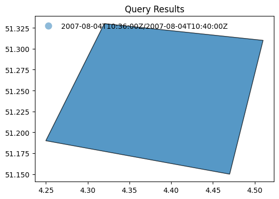
display_map(results)
Search by temporal extent#
Example: 3.5
Search granules by date range (
datetime).
results = w.collection_items(
'datasets',
limit=50,
parentIdentifier=COLLECTION_ID1,
datetime='2019-01-01T00:00:00Z/2019-12-02T00:00:00Z'
)
curl -X GET -G https://fedeo.ceos.org/collections/datasets/items \
--data-urlencode "limit=50" \
--data-urlencode "parentIdentifier=PROBA.CHRIS.1A" \
--data-urlencode "datetime=2019-01-01T00:00:00Z/2019-12-02T00:00:00Z"
print(f"{results['numberMatched']} items found.")
414 items found.
display_date_distribution(results)
Example: 3.6
Search granules by open-ended date range (datetime).
results = w.collection_items(
'datasets',
limit=50,
parentIdentifier=COLLECTION_ID1,
datetime='2021-12-01T00:00:00Z/'
)
curl -X GET -G https://fedeo.ceos.org/collections/datasets/items \
--data-urlencode "limit=50" \
--data-urlencode "parentIdentifier=PROBA.CHRIS.1A" \
--data-urlencode "datetime=2021-12-01T00:00:00Z/"
print(f"{results['numberMatched']} items found.")
510 items found.
display_date_distribution(results)
Search by identifier#
The geo:uid combined with the collection identifier eo:parentIdentifier (already prefilled in the OSDD template extracted from the collection search response) allows retrieving granule metadata for a specific granule. Use an identifier extracted from the previous search response.
'PR1_OPER_CHR_MO2_1P_20211210T065700_N22-100_E111-030_0001'
Example: 3.7
Search granules by identifier (
uid).
results = w.collection_items(
collection_id = 'datasets',
uid = granule_id,
parentIdentifier = COLLECTION_ID1
)
curl -X GET -G https://fedeo.ceos.org/collections/datasets/items \
--data-urlencode "uid=PR1_OPER_CHR_MO2_1P_20211210T065700_N22-100_E111-030_0001" \
--data-urlencode "parentIdentifier=PROBA.CHRIS.1A"
results
{'features': [{'bbox': [110.95, 22.02, 111.11, 22.18],
'geometry': {'coordinates': [[[111.09, 22.02],
[111.11, 22.16],
[110.97, 22.18],
[110.95, 22.04],
[111.09, 22.02]]],
'type': 'Polygon'},
'links': [{'rel': 'self',
'href': 'https://fedeo.ceos.org/collections/PROBA.CHRIS.1A/items/PR1_OPER_CHR_MO2_1P_20211210T065700_N22-100_E111-030_0001',
'type': 'application/geo+json'},
{'rel': 'enclosure',
'href': 'https://tpm-ds.eo.esa.int/oads/data/PROBA1-CHRIS/PR1_OPER_CHR_MO2_1P_20211210T065700_N22-100_E111-030_0001.SIP.ZIP',
'type': 'application/zip',
'title': 'Download'},
{'rel': 'preview',
'href': 'http://tpm-ds.eo.esa.int/oads/meta/PROBA1-CHRIS/browse/PR1_OPER_CHR_MO2_1P_20211210T065700_N22-100_E111-030_0001.SIP.ZIP_BID.PNG',
'type': 'image/png',
'title': 'QUICKLOOK'},
{'rel': 'icon',
'href': 'http://tpm-ds.eo.esa.int/oads/meta/PROBA1-CHRIS/thumbnail/PR1_OPER_CHR_MO2_1P_20211210T065700_N22-100_E111-030_0001.SIP.ZIP_TIMG.jpg',
'type': 'image/jpeg',
'title': 'THUMBNAIL'},
{'rel': 'collection',
'href': 'https://fedeo.ceos.org/collections/series/items/PROBA.CHRIS.1A?httpAccept=application/json',
'type': 'application/json',
'title': 'PROBA.CHRIS.1A'},
{'rel': 'parent',
'href': 'https://fedeo.ceos.org/collections/series/items/PROBA.CHRIS.1A?httpAccept=application/json',
'type': 'application/json',
'title': 'PROBA.CHRIS.1A'},
{'rel': 'up',
'href': 'https://fedeo.ceos.org/collections/series/items/PROBA.CHRIS.1A',
'type': 'application/geo+json',
'title': 'OGC 17-069r3 metadata'},
{'rel': 'alternate',
'href': 'https://fedeo.ceos.org/collections/PROBA.CHRIS.1A/items/PR1_OPER_CHR_MO2_1P_20211210T065700_N22-100_E111-030_0001?httpAccept=application/atom%2Bxml',
'type': 'application/atom+xml',
'title': 'Atom format'},
{'rel': 'alternate',
'href': 'https://fedeo.ceos.org/collections/PROBA.CHRIS.1A/items/PR1_OPER_CHR_MO2_1P_20211210T065700_N22-100_E111-030_0001?httpAccept=application/gml%2Bxml&recordSchema=om',
'type': 'application/gml+xml;profile="http://www.opengis.net/spec/EOMPOM/1.1"',
'title': 'OGC 10-157r4 metadata'},
{'rel': 'alternate',
'href': 'https://fedeo.ceos.org/collections/PROBA.CHRIS.1A/items/PR1_OPER_CHR_MO2_1P_20211210T065700_N22-100_E111-030_0001?mode=owc',
'type': 'application/geo+json;profile="http://www.opengis.net/spec/eo-geojson/1.0"',
'title': 'OGC 17-003r2 metadata'},
{'rel': 'alternate',
'href': 'https://fedeo.ceos.org/collections/PROBA.CHRIS.1A/items/PR1_OPER_CHR_MO2_1P_20211210T065700_N22-100_E111-030_0001?httpAccept=application/geo%2Bjson;profile=https://stacspec.org',
'type': 'application/geo+json;profile="https://stacspec.org"',
'title': 'STAC metadata'},
{'rel': 'alternate',
'href': 'https://fedeo.ceos.org/collections/PROBA.CHRIS.1A/items/PR1_OPER_CHR_MO2_1P_20211210T065700_N22-100_E111-030_0001?httpAccept=application/vnd.iso.19139%2Bxml',
'type': 'application/vnd.iso.19139+xml',
'title': 'ISO 19139 metadata'},
{'rel': 'alternate',
'href': 'https://fedeo.ceos.org/collections/PROBA.CHRIS.1A/items/PR1_OPER_CHR_MO2_1P_20211210T065700_N22-100_E111-030_0001?httpAccept=application/ld%2Bjson',
'type': 'application/ld+json',
'title': 'JSON-LD metadata'},
{'rel': 'alternate',
'href': 'https://fedeo.ceos.org/collections/PROBA.CHRIS.1A/items/PR1_OPER_CHR_MO2_1P_20211210T065700_N22-100_E111-030_0001?httpAccept=application/ld%2Bjson;profile=https://schema.org',
'type': 'application/ld+json;profile="https://schema.org"',
'title': 'JSON-LD (schema.org) metadata'},
{'rel': 'alternate',
'href': 'https://fedeo.ceos.org/collections/PROBA.CHRIS.1A/items/PR1_OPER_CHR_MO2_1P_20211210T065700_N22-100_E111-030_0001?httpAccept=application/ld%2Bjson;profile=http://data.europa.eu/930/',
'type': 'application/ld+json;profile="http://data.europa.eu/930/"',
'title': 'JSON-LD (GeoDCAT-AP) metadata'},
{'rel': 'alternate',
'href': 'https://fedeo.ceos.org/collections/PROBA.CHRIS.1A/items/PR1_OPER_CHR_MO2_1P_20211210T065700_N22-100_E111-030_0001?httpAccept=application/rdf%2Bxml',
'type': 'application/rdf+xml',
'title': 'RDF/XML metadata'},
{'rel': 'alternate',
'href': 'https://fedeo.ceos.org/collections/PROBA.CHRIS.1A/items/PR1_OPER_CHR_MO2_1P_20211210T065700_N22-100_E111-030_0001?httpAccept=application/rdf%2Bxml;profile=https://schema.org',
'type': 'application/rdf+xml;profile="https://schema.org"',
'title': 'RDF/XML (schema.org) metadata'},
{'rel': 'alternate',
'href': 'https://fedeo.ceos.org/collections/PROBA.CHRIS.1A/items/PR1_OPER_CHR_MO2_1P_20211210T065700_N22-100_E111-030_0001?httpAccept=application/rdf%2Bxml;profile=http://data.europa.eu/930/',
'type': 'application/rdf+xml;profile="http://data.europa.eu/930/"',
'title': 'RDF/XML (GeoDCAT-AP) metadata'},
{'rel': 'alternate',
'href': 'https://fedeo.ceos.org/collections/PROBA.CHRIS.1A/items/PR1_OPER_CHR_MO2_1P_20211210T065700_N22-100_E111-030_0001?httpAccept=text/turtle',
'type': 'text/turtle',
'title': 'Turtle metadata'},
{'rel': 'alternate',
'href': 'https://fedeo.ceos.org/collections/PROBA.CHRIS.1A/items/PR1_OPER_CHR_MO2_1P_20211210T065700_N22-100_E111-030_0001?httpAccept=text/turtle;profile=https://schema.org',
'type': 'text/turtle;profile="https://schema.org"',
'title': 'Turtle (schema.org) metadata'},
{'rel': 'alternate',
'href': 'https://fedeo.ceos.org/collections/PROBA.CHRIS.1A/items/PR1_OPER_CHR_MO2_1P_20211210T065700_N22-100_E111-030_0001?httpAccept=text/turtle;profile=http://data.europa.eu/930/',
'type': 'text/turtle;profile="http://data.europa.eu/930/"',
'title': 'Turtle (GeoDCAT-AP) metadata'},
{'rel': 'alternate',
'href': 'https://fedeo.ceos.org/collections/PROBA.CHRIS.1A/items/PR1_OPER_CHR_MO2_1P_20211210T065700_N22-100_E111-030_0001?httpAccept=text/html',
'type': 'text/html',
'title': 'HTML'}],
'id': 'PR1_OPER_CHR_MO2_1P_20211210T065700_N22-100_E111-030_0001',
'collection': 'PROBA.CHRIS.1A',
'type': 'Feature',
'properties': {'date': '2021-12-10T06:57:00Z/2021-12-10T07:01:00Z',
'kind': 'http://purl.org/dc/dcmitype/Dataset',
'productInformation': {'referenceSystemIdentifier': 'epsg:4326',
'size': 36383714,
'productType': 'CHR_MO2_1P',
'availabilityTime': '2021-12-10T07:01:00Z'},
'title': 'PR1_OPER_CHR_MO2_1P_20211210T065700_N22-100_E111-030_0001',
'updated': '2021-12-17T17:37:25Z',
'acquisitionInformation': [{'acquisitionParameters': {'operationalMode': 'MODE-2',
'acquisitionType': 'NOMINAL',
'beginningDateTime': '2021-12-10T06:57:00Z',
'wrsLongitudeGrid': 'E111',
'wrsLatitudeGrid': 'N22',
'acquisitionAngles': {'illuminationAzimuthAngle': 221.0610428208729,
'illuminationElevationAngle': 57.726},
'endingDateTime': '2021-12-10T07:01:00Z',
'orbitNumber': 0},
'instrument': {'instrumentShortName': 'CHRIS', 'sensorType': 'OPTICAL'},
'platform': {'platformShortName': 'PROBA',
'platformSerialIdentifier': '1'}}],
'status': 'ARCHIVED'}}],
'numberReturned': 10,
'links': [{'rel': 'search',
'href': 'https://fedeo.ceos.org/collections/series/items/PROBA.CHRIS.1A/api',
'type': 'application/opensearchdescription+xml',
'title': 'search'},
{'rel': 'profile',
'href': 'http://www.opengis.net/spec/owc-geojson/1.0/req/core'},
{'rel': 'self',
'href': 'https://fedeo.ceos.org/collections/datasets/items?uid=PR1_OPER_CHR_MO2_1P_20211210T065700_N22-100_E111-030_0001&parentIdentifier=PROBA.CHRIS.1A',
'type': 'application/geo+json',
'title': 'self'},
{'rel': 'alternate',
'href': 'https://fedeo.ceos.org/collections/datasets/items?uid=PR1_OPER_CHR_MO2_1P_20211210T065700_N22-100_E111-030_0001&parentIdentifier=PROBA.CHRIS.1A&httpAccept=application/atom%2Bxml',
'type': 'application/atom+xml'},
{'rel': 'alternate',
'href': 'https://fedeo.ceos.org/collections/datasets/items?uid=PR1_OPER_CHR_MO2_1P_20211210T065700_N22-100_E111-030_0001&parentIdentifier=PROBA.CHRIS.1A&mode=owc',
'type': 'application/geo+json;profile="http://www.opengis.net/spec/os-geojson/1.0"'},
{'rel': 'alternate',
'href': 'https://fedeo.ceos.org/collections/datasets/items?uid=PR1_OPER_CHR_MO2_1P_20211210T065700_N22-100_E111-030_0001&parentIdentifier=PROBA.CHRIS.1A&httpAccept=application/geo%2Bjson;profile=https://stacspec.org',
'type': 'application/geo+json;profile="https://stacspec.org"'}],
'id': 'https://fedeo.ceos.org/collections/datasets/items?uid=PR1_OPER_CHR_MO2_1P_20211210T065700_N22-100_E111-030_0001&parentIdentifier=PROBA.CHRIS.1A',
'type': 'FeatureCollection',
'numberMatched': 1,
'queries': {'request': [{'eo:parentIdentifier': 'PROBA.CHRIS.1A',
'role': 'request',
'geo:uid': 'PR1_OPER_CHR_MO2_1P_20211210T065700_N22-100_E111-030_0001',
'os:count': '10',
'sru:recordSchema': 'server-choice'}]}}
Alternatively, the feature can be accessed directly as shown below. The httpAccept query parameter can be added to request a different representation.
Example: 3.8
Access granule by identifier.
results = w.collection_item(
collection_id = COLLECTION_ID1,
identifier = granule_id
)
curl -X GET -G https://fedeo.ceos.org/collections/PROBA.CHRIS.1A/items/PR1_OPER_CHR_MO2_1P_20211210T065700_N22-100_E111-030_0001
# results['properties']['title']
# results['properties']
results
{'bbox': [110.95, 22.02, 111.11, 22.18],
'geometry': {'coordinates': [[[111.09, 22.02],
[111.11, 22.16],
[110.97, 22.18],
[110.95, 22.04],
[111.09, 22.02]]],
'type': 'Polygon'},
'links': [{'rel': 'self',
'href': 'https://fedeo.ceos.org/collections/PROBA.CHRIS.1A/items/PR1_OPER_CHR_MO2_1P_20211210T065700_N22-100_E111-030_0001',
'type': 'application/geo+json'},
{'rel': 'enclosure',
'href': 'https://tpm-ds.eo.esa.int/oads/data/PROBA1-CHRIS/PR1_OPER_CHR_MO2_1P_20211210T065700_N22-100_E111-030_0001.SIP.ZIP',
'type': 'application/zip',
'title': 'Download'},
{'rel': 'preview',
'href': 'http://tpm-ds.eo.esa.int/oads/meta/PROBA1-CHRIS/browse/PR1_OPER_CHR_MO2_1P_20211210T065700_N22-100_E111-030_0001.SIP.ZIP_BID.PNG',
'type': 'image/png',
'title': 'QUICKLOOK'},
{'rel': 'icon',
'href': 'http://tpm-ds.eo.esa.int/oads/meta/PROBA1-CHRIS/thumbnail/PR1_OPER_CHR_MO2_1P_20211210T065700_N22-100_E111-030_0001.SIP.ZIP_TIMG.jpg',
'type': 'image/jpeg',
'title': 'THUMBNAIL'},
{'rel': 'collection',
'href': 'https://fedeo.ceos.org/collections/PROBA.CHRIS.1A?httpAccept=application/json',
'type': 'application/json',
'title': 'PROBA.CHRIS.1A'},
{'rel': 'parent',
'href': 'https://fedeo.ceos.org/collections/PROBA.CHRIS.1A?httpAccept=application/json',
'type': 'application/json',
'title': 'PROBA.CHRIS.1A'},
{'rel': 'up',
'href': 'https://fedeo.ceos.org/collections/PROBA.CHRIS.1A',
'type': 'application/geo+json',
'title': 'OGC 17-069r3 metadata'},
{'rel': 'alternate',
'href': 'https://fedeo.ceos.org/collections/PROBA.CHRIS.1A/items/PR1_OPER_CHR_MO2_1P_20211210T065700_N22-100_E111-030_0001?httpAccept=application/atom%2Bxml',
'type': 'application/atom+xml',
'title': 'Atom format'},
{'rel': 'alternate',
'href': 'https://fedeo.ceos.org/collections/PROBA.CHRIS.1A/items/PR1_OPER_CHR_MO2_1P_20211210T065700_N22-100_E111-030_0001?httpAccept=application/gml%2Bxml&recordSchema=om',
'type': 'application/gml+xml;profile="http://www.opengis.net/spec/EOMPOM/1.1"',
'title': 'OGC 10-157r4 metadata'},
{'rel': 'alternate',
'href': 'https://fedeo.ceos.org/collections/PROBA.CHRIS.1A/items/PR1_OPER_CHR_MO2_1P_20211210T065700_N22-100_E111-030_0001?mode=owc',
'type': 'application/geo+json;profile="http://www.opengis.net/spec/eo-geojson/1.0"',
'title': 'OGC 17-003r2 metadata'},
{'rel': 'alternate',
'href': 'https://fedeo.ceos.org/collections/PROBA.CHRIS.1A/items/PR1_OPER_CHR_MO2_1P_20211210T065700_N22-100_E111-030_0001?httpAccept=application/geo%2Bjson;profile=https://stacspec.org',
'type': 'application/geo+json;profile="https://stacspec.org"',
'title': 'STAC metadata'},
{'rel': 'alternate',
'href': 'https://fedeo.ceos.org/collections/PROBA.CHRIS.1A/items/PR1_OPER_CHR_MO2_1P_20211210T065700_N22-100_E111-030_0001?httpAccept=application/vnd.iso.19139%2Bxml',
'type': 'application/vnd.iso.19139+xml',
'title': 'ISO 19139 metadata'},
{'rel': 'alternate',
'href': 'https://fedeo.ceos.org/collections/PROBA.CHRIS.1A/items/PR1_OPER_CHR_MO2_1P_20211210T065700_N22-100_E111-030_0001?httpAccept=application/ld%2Bjson',
'type': 'application/ld+json',
'title': 'JSON-LD metadata'},
{'rel': 'alternate',
'href': 'https://fedeo.ceos.org/collections/PROBA.CHRIS.1A/items/PR1_OPER_CHR_MO2_1P_20211210T065700_N22-100_E111-030_0001?httpAccept=application/ld%2Bjson;profile=https://schema.org',
'type': 'application/ld+json;profile="https://schema.org"',
'title': 'JSON-LD (schema.org) metadata'},
{'rel': 'alternate',
'href': 'https://fedeo.ceos.org/collections/PROBA.CHRIS.1A/items/PR1_OPER_CHR_MO2_1P_20211210T065700_N22-100_E111-030_0001?httpAccept=application/ld%2Bjson;profile=http://data.europa.eu/930/',
'type': 'application/ld+json;profile="http://data.europa.eu/930/"',
'title': 'JSON-LD (GeoDCAT-AP) metadata'},
{'rel': 'alternate',
'href': 'https://fedeo.ceos.org/collections/PROBA.CHRIS.1A/items/PR1_OPER_CHR_MO2_1P_20211210T065700_N22-100_E111-030_0001?httpAccept=application/rdf%2Bxml',
'type': 'application/rdf+xml',
'title': 'RDF/XML metadata'},
{'rel': 'alternate',
'href': 'https://fedeo.ceos.org/collections/PROBA.CHRIS.1A/items/PR1_OPER_CHR_MO2_1P_20211210T065700_N22-100_E111-030_0001?httpAccept=application/rdf%2Bxml;profile=https://schema.org',
'type': 'application/rdf+xml;profile="https://schema.org"',
'title': 'RDF/XML (schema.org) metadata'},
{'rel': 'alternate',
'href': 'https://fedeo.ceos.org/collections/PROBA.CHRIS.1A/items/PR1_OPER_CHR_MO2_1P_20211210T065700_N22-100_E111-030_0001?httpAccept=application/rdf%2Bxml;profile=http://data.europa.eu/930/',
'type': 'application/rdf+xml;profile="http://data.europa.eu/930/"',
'title': 'RDF/XML (GeoDCAT-AP) metadata'},
{'rel': 'alternate',
'href': 'https://fedeo.ceos.org/collections/PROBA.CHRIS.1A/items/PR1_OPER_CHR_MO2_1P_20211210T065700_N22-100_E111-030_0001?httpAccept=text/turtle',
'type': 'text/turtle',
'title': 'Turtle metadata'},
{'rel': 'alternate',
'href': 'https://fedeo.ceos.org/collections/PROBA.CHRIS.1A/items/PR1_OPER_CHR_MO2_1P_20211210T065700_N22-100_E111-030_0001?httpAccept=text/turtle;profile=https://schema.org',
'type': 'text/turtle;profile="https://schema.org"',
'title': 'Turtle (schema.org) metadata'},
{'rel': 'alternate',
'href': 'https://fedeo.ceos.org/collections/PROBA.CHRIS.1A/items/PR1_OPER_CHR_MO2_1P_20211210T065700_N22-100_E111-030_0001?httpAccept=text/turtle;profile=http://data.europa.eu/930/',
'type': 'text/turtle;profile="http://data.europa.eu/930/"',
'title': 'Turtle (GeoDCAT-AP) metadata'},
{'rel': 'alternate',
'href': 'https://fedeo.ceos.org/collections/PROBA.CHRIS.1A/items/PR1_OPER_CHR_MO2_1P_20211210T065700_N22-100_E111-030_0001?httpAccept=text/html',
'type': 'text/html',
'title': 'HTML'}],
'id': 'PR1_OPER_CHR_MO2_1P_20211210T065700_N22-100_E111-030_0001',
'collection': 'PROBA.CHRIS.1A',
'type': 'Feature',
'properties': {'date': '2021-12-10T06:57:00Z/2021-12-10T07:01:00Z',
'kind': 'http://purl.org/dc/dcmitype/Dataset',
'productInformation': {'referenceSystemIdentifier': 'epsg:4326',
'size': 36383714,
'productType': 'CHR_MO2_1P',
'availabilityTime': '2021-12-10T07:01:00Z'},
'title': 'PR1_OPER_CHR_MO2_1P_20211210T065700_N22-100_E111-030_0001',
'updated': '2021-12-17T17:37:25Z',
'acquisitionInformation': [{'acquisitionParameters': {'operationalMode': 'MODE-2',
'acquisitionType': 'NOMINAL',
'beginningDateTime': '2021-12-10T06:57:00Z',
'wrsLongitudeGrid': 'E111',
'wrsLatitudeGrid': 'N22',
'acquisitionAngles': {'illuminationAzimuthAngle': 221.0610428208729,
'illuminationElevationAngle': 57.726},
'endingDateTime': '2021-12-10T07:01:00Z',
'orbitNumber': 0},
'instrument': {'instrumentShortName': 'CHRIS', 'sensorType': 'OPTICAL'},
'platform': {'platformShortName': 'PROBA',
'platformSerialIdentifier': '1'}}],
'status': 'ARCHIVED'}}
Search by acquisition parameters#
Example: 3.9
Search granules by illumination angles
illuminationElevationAngle,illuminationAzimuthAngle.
The example shows how a set of values can be provided using square brackets: [value-1,value-2].
The illuminationElevationAngle and illuminationAzimuthAngle search parameters allow filtering results by illumination angles. An interval specifying minimum and maximum allowed values is to be provided, e.g. [48,50]. Only providing the minimum or maximum value can be done by using an open interval, e.g. [48 or 50].
Other acquisition parameters can be advertised as searchable in the collection OSDD, depending on the sensor type e.g.:
orbitNumber
orbitDirection
frame
track etc.
results = w.collection_items(
limit = 3,
collection_id = 'datasets',
parentIdentifier = COLLECTION_ID3_CLOUDS,
illuminationElevationAngle = '[30,40]'
)
curl -X GET -G https://fedeo.ceos.org/collections/datasets/items \
--data-urlencode "limit=3" \
--data-urlencode "parentIdentifier=IKONOS.ESA.archive" \
--data-urlencode "illuminationElevationAngle=[30,40]"
print(f"{results['numberMatched']} items found.")
33 items found.
df = pd.json_normalize(results['features'][0]['properties']['acquisitionInformation'])
df.transpose()
| 0 | |
|---|---|
| acquisitionParameters.operationalMode | IM |
| acquisitionParameters.acquisitionType | NOMINAL |
| acquisitionParameters.beginningDateTime | 2006-10-11T10:30:00Z |
| acquisitionParameters.acquisitionAngles.illuminationAzimuthAngle | 171.2605 |
| acquisitionParameters.acquisitionAngles.alongTrackIncidenceAngle | 315.2859 |
| acquisitionParameters.acquisitionAngles.illuminationElevationAngle | 37.74352 |
| acquisitionParameters.acquisitionAngles.acrossTrackIncidenceAngle | 65.79101 |
| acquisitionParameters.endingDateTime | 2006-10-11T10:30:00Z |
| acquisitionParameters.orbitDirection | DESCENDING |
| acquisitionParameters.orbitNumber | 0 |
| instrument.instrumentShortName | OSA |
| instrument.sensorType | OPTICAL |
| platform.platformShortName | IKONOS |
| platform.platformSerialIdentifier | 2 |
Example: 3.10
Search granules by
orbitDirection.
results = w.collection_items(
limit = 3,
collection_id = 'datasets',
parentIdentifier = COLLECTION_ID2,
orbitDirection = 'DESCENDING'
)
curl -X GET -G https://fedeo.ceos.org/collections/datasets/items \
--data-urlencode "limit=3" \
--data-urlencode "parentIdentifier=SPOT-6.and.7.ESA.archive" \
--data-urlencode "orbitDirection=DESCENDING"
print(f"{results['numberMatched']} items found.")
860 items found.
df = pd.json_normalize(results['features'][0]['properties']['acquisitionInformation'])
df.transpose()
| 0 | |
|---|---|
| acquisitionParameters.operationalMode | PMS |
| acquisitionParameters.acquisitionType | NOMINAL |
| acquisitionParameters.beginningDateTime | 2015-04-28T10:10:00Z |
| acquisitionParameters.wrsLongitudeGrid | E002 |
| acquisitionParameters.wrsLatitudeGrid | N42 |
| acquisitionParameters.acquisitionAngles.illuminationAzimuthAngle | 135.304519 |
| acquisitionParameters.acquisitionAngles.alongTrackIncidenceAngle | 3.118372 |
| acquisitionParameters.acquisitionAngles.illuminationElevationAngle | 54.824626 |
| acquisitionParameters.acquisitionAngles.acrossTrackIncidenceAngle | 16.826628 |
| acquisitionParameters.endingDateTime | 2015-04-28T10:10:36Z |
| acquisitionParameters.orbitDirection | DESCENDING |
| acquisitionParameters.orbitNumber | 0 |
| instrument.instrumentShortName | NAOMI |
| instrument.sensorType | OPTICAL |
| platform.platformShortName | SPOT |
| platform.platformSerialIdentifier | 6 |
Example: 3.11
Search granules by
orbitNumber.
The example shows how a set of values can be provided using curly brackets: {value-1,value-2,…,value-n}
results = w.collection_items(
limit = 3,
collection_id = 'datasets',
parentIdentifier = COLLECTION_ID2_CLOUDS,
orbitNumber = '{1237, 1248}' # 1237 or 1248
)
curl -X GET -G https://fedeo.ceos.org/collections/datasets/items \
--data-urlencode "limit=3" \
--data-urlencode "parentIdentifier=LANDSAT.ETM.GTC" \
--data-urlencode "orbitNumber={1237, 1248}"
print(f"{results['numberMatched']} items found.")
14 items found.
df = pd.json_normalize(results['features'][0]['properties']['acquisitionInformation'])
df.transpose()
| 0 | |
|---|---|
| acquisitionParameters.operationalMode | IM |
| acquisitionParameters.acquisitionType | NOMINAL |
| acquisitionParameters.beginningDateTime | 1999-07-09T13:17:15Z |
| acquisitionParameters.wrsLongitudeGrid | 227 |
| acquisitionParameters.wrsLatitudeGrid | 3 |
| acquisitionParameters.acquisitionAngles.illuminationAzimuthAngle | -159.694 |
| acquisitionParameters.acquisitionAngles.illuminationZenithAngle | 57.3796 |
| acquisitionParameters.acquisitionAngles.illuminationElevationAngle | 32.6204 |
| acquisitionParameters.endingDateTime | 1999-07-09T13:17:44Z |
| acquisitionParameters.orbitDirection | DESCENDING |
| acquisitionParameters.orbitNumber | 1237 |
| instrument.instrumentShortName | ETM |
| instrument.sensorType | OPTICAL |
| platform.platformShortName | Landsat |
| platform.platformSerialIdentifier | 7 |
Advanced topics#
Sorting results#
Sorting of search results is available for collection, services and granule searches. The supported search criteria can be found in the corresponding OpenSearch OSDD document. The sortKeys query parameter is defined in the SRU specification [RD07].
Example: 4.1
Collection search results can be sorted according to various criteria with
sortKeys[RD07], in descending or ascending order which can be discovered in the OSDD. The example sorts collections in descending chronological order according to the {eo:modificationDate} value.
results = w.collection_items(
'series',
limit=10,
# sortKeys='title,dc,1',
sortKeys='modificationDate,eo,0',
organisationName = 'ESA/ESRIN'
)
curl -X GET -G https://fedeo.ceos.org/collections/series/items \
--data-urlencode "limit=10" \
--data-urlencode "sortKeys=modificationDate,eo,0" \
--data-urlencode "organisationName=ESA/ESRIN"
print(f"{results['numberMatched']} items found.")
312 items found.
gdf = gpd.GeoDataFrame.from_features(results)
gdf[['updated','title']]
| updated | title | |
|---|---|---|
| 0 | 2025-01-28T00:00:00.000Z | EarthCARE X-MET L1D Products |
| 1 | 2025-01-01T00:00:00.000Z | CLIMATE APPLICATIONS: Global sea-level budget,... |
| 2 | 2024-09-06T00:00:00.000Z | Landsat 5 TM Europe and North Africa Coverage ... |
| 3 | 2024-09-06T00:00:00.000Z | Landsat 5 TM Europe and North Africa Coverage ... |
| 4 | 2024-09-06T00:00:00.000Z | Landsat 5 TM Europe and North Africa Coverage ... |
| 5 | 2024-07-10T00:00:00.000Z | Fundamental Data Record for Atmospheric Compos... |
| 6 | 2024-07-10T00:00:00.000Z | Envisat SCIAMACHY Level 2 - Limb Ozone [SCI_LI... |
| 7 | 2024-07-10T00:00:00.000Z | Envisat SCIAMACHY Level 2 [SCI_____2P] |
| 8 | 2024-07-10T00:00:00.000Z | Envisat SCIAMACHY Level 1b [SCI_____1P] |
| 9 | 2024-06-21T00:00:00.000Z | Sentinel-2 image Mosaic of Brazilian Amazon Bi... |
Example: 4.2
Granule search results can be sorted according to various criteria with
sortKeys[RD07], in descending or ascending order which can be discovered in the OSDD. The example sorts granules in ascending chronological order according to the {time:start} value.
results = w.collection_items(
'datasets',
limit=10,
parentIdentifier=COLLECTION_ID1,
sortKeys='start,time,1'
)
curl -X GET -G https://fedeo.ceos.org/collections/datasets/items \
--data-urlencode "limit=10" \
--data-urlencode "parentIdentifier=PROBA.CHRIS.1A" \
--data-urlencode "sortKeys=start,time,1"
print(f"{results['numberMatched']} items found.")
8268 items found.
gdf = gpd.GeoDataFrame.from_features(results)
gdf[['date','title']]
| date | title | |
|---|---|---|
| 0 | 2002-05-14T10:09:00Z/2002-05-14T10:13:00Z | PR1_OPER_CHR_MO2_1P_20020514T100900_N45-018_E0... |
| 1 | 2002-05-15T18:29:00Z/2002-05-15T18:33:00Z | PR1_OPER_CHR_MO5_1P_20020515T182900_N38-005_W1... |
| 2 | 2002-05-29T18:33:00Z/2002-05-29T18:37:00Z | PR1_OPER_CHR_MO3_1P_20020529T183300_N38-005_W1... |
| 3 | 2002-06-01T15:59:00Z/2002-06-01T16:03:00Z | PR1_OPER_CHR_MO4_1P_20020601T155900_N45-029_W0... |
| 4 | 2002-06-02T17:47:00Z/2002-06-02T17:51:00Z | PR1_OPER_CHR_MO3_1P_20020602T174700_N55-049_W0... |
| 5 | 2002-06-04T18:17:00Z/2002-06-04T18:21:00Z | PR1_OPER_CHR_MO4_1P_20020604T181700_N50-055_W1... |
| 6 | 2002-06-12T10:25:00Z/2002-06-12T10:29:00Z | PR1_OPER_CHR_MO3_1P_20020612T102500_N48-008_E0... |
| 7 | 2002-06-13T18:45:00Z/2002-06-13T18:49:00Z | PR1_OPER_CHR_MO2_1P_20020613T184500_N43-018_W1... |
| 8 | 2002-06-14T17:29:00Z/2002-06-14T17:33:00Z | PR1_OPER_CHR_MO3_1P_20020614T172900_N19-033_W0... |
| 9 | 2002-06-18T08:40:00Z/2002-06-18T08:44:00Z | PR1_OPER_CHR_MO1_1P_20020618T084000_N30-058_E0... |
Faceted search#
Faceted search results are available for collection, service and granule searches in both GeoJSON and Atom response formats. The GeoJSON encoding is defined in [RD35] at https://docs.ogc.org/per/19-020r1.html#_facetedresults and consistent with the OASIS SRU encoding available for Atom response format defined in [RD07].
The server can supply faceted results for a query: i.e. an analysis of how the search results are distributed over various categories (or “facets”). For example, the analysis may reveal how the results are distributed by organization. The client might then refine the query to one particular organization among those listed.
By default, the search response contains faceted search results under the element facetedResults. In the current implementation, the faceted search information groups the results by a number of predefined facets which may include platform, instrument and organisation etc. The client can also specify which facets it would like to receive as part of the request with the facetLimit search parameter.
The search response does not include the list of all values for the facet. The list is truncated and provides the values with the largest count. Future versions of the software may allow paging through all values, which would require support for the sru:facetStart search parameter.
The faceted Results are consistent with the OASIS searchRetrieve facetedResults XML schema available at http://docs.oasis-open.org/search-ws/searchRetrieve/v1.0/os/schemas/facetedResults.xsd defined in [RD07] and the GeoJSON encoding defined in [RD35].
The facetLimit query parameter is defined in the SRU specification [RD07].
Additional response formats#
Different representations are available for search results (container), and individual items representing a Collection, Service or Granule. They are declared in the OpenAPI definition document (/api). Content negotiation can be used via the Accept header parameter or httpAccept query parameter.
Available formats are listed in the following subsections.
All the search criteria described previously can be combined with any of the available representations.
The OpenAPI definition describing the OGC API Features interface is available at https://fedeo.ceos.org/api.
Search result formats#
The various media types available for search results are listed in the OpenAPI definition. For each of the available media types, an example is provided in the current section.
ref = apidoc['paths']['/collections/datasets/items']['get']['responses']['200']['content']
df = pd.json_normalize(ref, max_level = 0)
sorted(ref.keys())
['application/atom+xml',
'application/geo+json',
'application/geo+json;profile="http://www.opengis.net/spec/ogcapi-features-1/1.0"',
'application/geo+json;profile="http://www.opengis.net/spec/os-geojson/1.0"',
'application/geo+json;profile="https://stacspec.org"',
'application/ld+json',
'application/ld+json;profile="http://data.europa.eu/930/"',
'application/ld+json;profile="http://www.opengis.net/spec/os-geojson/1.0"',
'application/ld+json;profile="https://schema.org"',
'application/rdf+xml',
'application/rdf+xml;profile="http://data.europa.eu/930/"',
'application/rdf+xml;profile="http://www.opengis.net/spec/os-geojson/1.0"',
'application/rdf+xml;profile="https://schema.org"',
'text/html',
'text/turtle',
'text/turtle;profile="http://data.europa.eu/930/"',
'text/turtle;profile="http://www.opengis.net/spec/os-geojson/1.0"',
'text/turtle;profile="https://schema.org"']
| Example | Media type |
|---|---|
| Example 5.1 | application/atom+xml |
| Example 5.2 | application/geo+json |
| Example 5.3 | application/geo+json;profile="http://www.opengis.net/spec/ogcapi-features-1/1.0" |
| Example 5.4 | application/geo+json;profile="http://www.opengis.net/spec/os-geojson/1.0" |
| Example 5.5 | application/geo+json;profile="https://stacspec.org" |
| Example 5.6 | application/ld+json |
| Example 5.7 | application/ld+json;profile="http://data.europa.eu/930/" |
| Example 5.8 | application/ld+json;profile="http://www.opengis.net/spec/os-geojson/1.0" |
| Example 5.9 | application/ld+json;profile="https://schema.org" |
| Example 5.10 | application/rdf+xml |
| Example 5.11 | application/rdf+xml;profile="http://data.europa.eu/930/" |
| Example 5.12 | application/rdf+xml;profile="http://www.opengis.net/spec/os-geojson/1.0" |
| Example 5.13 | application/rdf+xml;profile="https://schema.org" |
| Example 5.14 | text/html |
| Example 5.15 | text/turtle |
| Example 5.16 | text/turtle;profile="http://data.europa.eu/930/" |
| Example 5.17 | text/turtle;profile="http://www.opengis.net/spec/os-geojson/1.0" |
| Example 5.18 | text/turtle;profile="https://schema.org" |
Example: 5.1
Represent search response in
application/atom+xmlmedia format (httpAccept).
curl -X GET -G https://fedeo.ceos.org/collections/series/items \
--data-urlencode "limit=0" \
--data-urlencode "httpAccept=application/atom+xml"
<?xml version="1.0" ?><feed xmlns="http://www.w3.org/2005/Atom" xmlns:dc="http://purl.org/dc/elements/1.1/" xmlns:eo="http://a9.com/-/opensearch/extensions/eo/1.0/" xmlns:geo="http://a9.com/-/opensearch/extensions/geo/1.0/" xmlns:georss="http://www.georss.org/georss" xmlns:os="http://a9.com/-/spec/opensearch/1.1/" xmlns:owc="http://www.opengis.net/owc/1.0" xmlns:referrer="http://a9.com/-/opensearch/extensions/referrer/1.0/" xmlns:semantic="http://a9.com/-/opensearch/extensions/semantic/1.0/" xmlns:sru="http://a9.com/-/opensearch/extensions/sru/2.0/" xmlns:time="http://a9.com/-/opensearch/extensions/time/1.0/">
<author>
<name>FedEO Clearinghouse</name>
<email>eohelp@eo.esa.int</email>
</author>
<generator>FedEO Clearinghouse</generator>
<id>https://fedeo.ceos.org/collections/series/items</id>
<rights>Copyright 2016-2024, European Space Agency</rights>
<title>FedEO Clearinghouse - Search Response</title>
<updated>2025-03-18T10:46:24Z</updated>
<link href="https://fedeo.ceos.org/api?httpAccept=application/opensearchdescription%2Bxml" rel="search" type="application/opensearchdescription+xml"/>
<link href="https://fedeo.ceos.org/collections/series/items?limit=0&httpAccept=application/geo%2Bjson;profile="http://www.opengis.net/spec/ogcapi-features-1/1.0"" rel="alternate" type="application/geo+json;profile="http://www.opengis.net/spec/ogcapi-features-1/1.0""/>
<link href="https://fedeo.ceos.org/collections/series/items?limit=0&httpAccept=application/geo%2Bjson;profile="http://www.opengis.net/spec/os-geojson/1.0"" rel="alternate" type="application/geo+json;profile="http://www.opengis.net/spec/os-geojson/1.0""/>
<link href="https://fedeo.ceos.org/collections/series/items?limit=0&httpAccept=application/geo%2Bjson;profile="https://stacspec.org"" rel="alternate" type="application/geo+json;profile="https://stacspec.org""/>
<link href="https://fedeo.ceos.org/collections/series/items?limit=0&httpAccept=application/atom%2Bxml" hreflang="en" rel="self" type="application/atom+xml"/>
<os:totalResults>2731</os:totalResults>
<os:startIndex>1</os:startIndex>
<os:itemsPerPage>0</os:itemsPerPage>
<os:Query dc:type="collection" os:count="0" os:startIndex="1" role="request"/>
</feed>
Example: 5.2
Represent search response in
application/geo+jsonmedia format (httpAccept).
curl -X GET -G https://fedeo.ceos.org/collections/series/items \
--data-urlencode "limit=0" \
--data-urlencode "httpAccept=application/geo+json"
{
"features": [],
"numberReturned": 0,
"links": [
{
"rel": "self",
"href": "https://fedeo.ceos.org/collections/series/items?limit=0&httpAccept=application/geo%2Bjson",
"type": "application/geo+json"
},
{
"rel": "search",
"href": "https://fedeo.ceos.org/api?httpAccept=application/opensearchdescription%2Bxml",
"type": "application/opensearchdescription+xml",
"title": "OpenSearch Description Document"
},
{
"rel": "alternate",
"href": "https://fedeo.ceos.org/collections/series/items?limit=0&httpAccept=application/atom%2Bxml",
"type": "application/atom+xml"
},
{
"rel": "alternate",
"href": "https://fedeo.ceos.org/collections/series/items?limit=0&mode=owc",
"type": "application/geo+json;profile=\"http://www.opengis.net/spec/os-geojson/1.0\""
},
{
"rel": "alternate",
"href": "https://fedeo.ceos.org/collections/series/items?limit=0&httpAccept=application/geo%2Bjson;profile=https://stacspec.org",
"type": "application/geo+json;profile=\"https://stacspec.org\""
}
],
"id": "https://fedeo.ceos.org/collections/series/items",
"type": "FeatureCollection",
"numberMatched": 2731
}
Example: 5.3
Represent search response in
application/geo+json;profile="http://www.opengis.net/spec/ogcapi-features-1/1.0"media format (httpAccept).
curl -X GET -G https://fedeo.ceos.org/collections/series/items \
--data-urlencode "limit=0" \
--data-urlencode "httpAccept=application/geo+json;profile=\"http://www.opengis.net/spec/ogcapi-features-1/1.0\""
{
"features": [],
"numberReturned": 0,
"links": [
{
"rel": "self",
"href": "https://fedeo.ceos.org/collections/series/items?limit=0&httpAccept=application/geo%2Bjson%3Bprofile%3D%22http%3A//www.opengis.net/spec/ogcapi-features-1/1.0%22",
"type": "application/geo+json"
},
{
"rel": "search",
"href": "https://fedeo.ceos.org/api?httpAccept=application/opensearchdescription%2Bxml",
"type": "application/opensearchdescription+xml",
"title": "OpenSearch Description Document"
},
{
"rel": "alternate",
"href": "https://fedeo.ceos.org/collections/series/items?limit=0&httpAccept=application/atom%2Bxml",
"type": "application/atom+xml"
},
{
"rel": "alternate",
"href": "https://fedeo.ceos.org/collections/series/items?limit=0&mode=owc",
"type": "application/geo+json;profile=\"http://www.opengis.net/spec/os-geojson/1.0\""
},
{
"rel": "alternate",
"href": "https://fedeo.ceos.org/collections/series/items?limit=0&httpAccept=application/geo%2Bjson;profile=https://stacspec.org",
"type": "application/geo+json;profile=\"https://stacspec.org\""
}
],
"id": "https://fedeo.ceos.org/collections/series/items",
"type": "FeatureCollection",
"numberMatched": 2731
}
Example: 5.4
Represent search response in
application/geo+json;profile="http://www.opengis.net/spec/os-geojson/1.0"media format (httpAccept).
curl -X GET -G https://fedeo.ceos.org/collections/series/items \
--data-urlencode "limit=0" \
--data-urlencode "httpAccept=application/geo+json;profile=\"http://www.opengis.net/spec/os-geojson/1.0\""
{
"facetedResults": {
"datasource": [
{
"displayLabel": "FedEO",
"baseURL": "https://fedeo.ceos.org",
"description": "FedEO",
"facets": [
{
"displayLabel": "Platform",
"terms": [
{
"actualTerm": "GCOM-C1",
"count": 544
},
{
"actualTerm": "AQUA",
"count": 211
},
{
"actualTerm": "Metop-A",
"count": 202
},
{
"actualTerm": "Envisat",
"count": 200
},
{
"actualTerm": "ADEOS-II",
"count": 190
},
{
"actualTerm": "NOAA-16",
"count": 138
},
{
"actualTerm": "NOAA-18",
"count": 134
},
{
"actualTerm": "ERS-2",
"count": 132
},
{
"actualTerm": "Metop-B",
"count": 131
},
{
"actualTerm": "NOAA-17",
"count": 131
}
],
"index": "eo:platform",
"relation": "="
},
{
"displayLabel": "Instrument",
"terms": [
{
"actualTerm": "SGLI",
"count": 544
},
{
"actualTerm": "AMSR-E",
"count": 152
},
{
"actualTerm": "SEVIRI",
"count": 134
},
{
"actualTerm": "GLI",
"count": 132
},
{
"actualTerm": "AVHRR-3",
"count": 126
},
{
"actualTerm": "AVHRR-2",
"count": 116
},
{
"actualTerm": "AMSR2",
"count": 100
},
{
"actualTerm": "MSI",
"count": 70
},
{
"actualTerm": "MODIS",
"count": 64
},
{
"actualTerm": "SSM/I",
"count": 59
}
],
"index": "eo:instrument",
"relation": "="
},
{
"displayLabel": "OrganisationName",
"terms": [
{
"actualTerm": "JP/JAXA/SAOC",
"count": 1020
},
{
"actualTerm": "ESA/ESRIN",
"count": 312
},
{
"actualTerm": "CEDA",
"count": 297
},
{
"actualTerm": "CMEMS",
"count": 285
},
{
"actualTerm": "EUMETSAT",
"count": 253
},
{
"actualTerm": "VITO",
"count": 214
},
{
"actualTerm": "BR/INPE",
"count": 63
},
{
"actualTerm": "DOC/NOAA/NESDIS/NCEI",
"count": 57
},
{
"actualTerm": "FR/CNES",
"count": 57
},
{
"actualTerm": "DE/DLR",
"count": 51
}
],
"index": "eo:organisationName",
"relation": "="
},
{
"displayLabel": "ProcessingLevel",
"terms": [
{
"actualTerm": "level 2",
"count": 76
},
{
"actualTerm": "level 1b",
"count": 59
},
{
"actualTerm": "level 1",
"count": 54
},
{
"actualTerm": "multiple",
"count": 47
},
{
"actualTerm": "level 3",
"count": 28
},
{
"actualTerm": "level 1a",
"count": 19
},
{
"actualTerm": "level 1c",
"count": 13
},
{
"actualTerm": "level 0",
"count": 9
},
{
"actualTerm": "level 2a",
"count": 6
},
{
"actualTerm": "level 3a",
"count": 5
}
],
"index": "eo:processingLevel",
"relation": "="
},
{
"displayLabel": "ClassifiedAs",
"terms": [
{
"actualTerm": "https://earth.esa.int/concepts/concept_scheme/instruments",
"count": 2144
},
{
"actualTerm": "https://earth.esa.int/concepts/concept_scheme/platforms",
"count": 2144
},
{
"actualTerm": "https://earth.esa.int/concept/4d6ac52b-97d4-5b1e-bfb8-a19c3b56b83d",
"count": 544
},
{
"actualTerm": "https://earth.esa.int/concept/b25b4cc0-a581-53f3-8c2e-b484e03e42cd",
"count": 544
},
{
"actualTerm": "https://earth.esa.int/concept/bb996f88-8040-5849-9253-6a205afdd57a",
"count": 211
},
{
"actualTerm": "https://earth.esa.int/concepts/concept_scheme/earth-topics",
"count": 207
},
{
"actualTerm": "https://earth.esa.int/concept/e0d6e80e-22a7-5c5b-87d3-3d65d893ddc9",
"count": 202
},
{
"actualTerm": "https://earth.esa.int/concept/11ea961b-1d0b-5d6d-a55a-b58aed01d430",
"count": 200
},
{
"actualTerm": "https://earth.esa.int/concept/3b1bb927-b281-5012-bc6c-3d3288d2af04",
"count": 190
},
{
"actualTerm": "https://earth.esa.int/concept/76a2d32b-2a2e-5559-92dd-0896818a5ed2",
"count": 152
}
],
"index": "semantic:classifiedAs",
"relation": "="
},
{
"displayLabel": "UseLimitation",
"terms": [
{
"actualTerm": "The user is entitled to use G-Portal data free of charge without any restrictions (including commercial use) except for the condition about acknowledgement of data credit as stipulated in G-portal terms of use 7.(2).Click [here](https://gportal.jaxa.jp/gpr/index/eula?lang=en) for detailed G-Portal data usage constrains.",
"count": 1017
},
{
"actualTerm": "See Copernicus Marine Environment Monitoring Service Data commitments and licence at: http://marine.copernicus.eu/web/27-service-commitments-and-licence.php",
"count": 285
},
{
"actualTerm": "EO Sign In Authentication",
"count": 78
},
{
"actualTerm": "https://sentinel.esa.int/documents/247904/690755/Sentinel_Data_Legal_Notice",
"count": 49
},
{
"actualTerm": "https://proba-v.vgt.vito.be/en/data-policy",
"count": 41
},
{
"actualTerm": "Fast Registration with approval",
"count": 34
},
{
"actualTerm": "Fast Registration with immediate access",
"count": 26
},
{
"actualTerm": "Project Proposal (Restrained)",
"count": 23
},
{
"actualTerm": "Nutzungseinschr\u00e4nkungen: Das DLR ist nicht haftbar f\u00fcr Sch\u00e4den, die sich aus der Nutzung ergeben. / Use Limitations: DLR not liable for damage resulting from use.",
"count": 21
},
{
"actualTerm": "-",
"count": 19
}
],
"index": "eo:useLimitation",
"relation": "="
}
]
}
]
},
"features": [],
"totalResults": 2731,
"startIndex": 1,
"itemsPerPage": 0,
"id": "https://fedeo.ceos.org/collections/series/items",
"type": "FeatureCollection",
"queries": {
"request": [
{
"dc:type": "collection",
"os:count": "0",
"os:startIndex": "1"
}
]
},
"properties": {
"creator": "FedEO Clearinghouse",
"rights": "Copyright 2016-2024, European Space Agency",
"links": {
"search": [
{
"href": "https://fedeo.ceos.org/api?httpAccept=application/opensearchdescription%2Bxml",
"type": "application/opensearchdescription+xml",
"title": "OpenSearch Description Document"
}
],
"profiles": [
{
"href": "http://www.opengis.net/spec/owc-geojson/1.0/req/core"
},
{
"href": "http://www.opengis.net/spec/os-geojson/1.0/req/core"
}
],
"alternates": [
{
"rel": "alternate",
"href": "https://fedeo.ceos.org/collections/series/items?limit=0&httpAccept=application/atom%2Bxml",
"type": "application/atom+xml"
},
{
"href": "https://fedeo.ceos.org/collections/series/items?limit=0",
"type": "application/geo+json;profile=\"http://www.opengis.net/spec/ogcapi-features-1/1.0\""
},
{
"href": "https://fedeo.ceos.org/collections/series/items?limit=0&httpAccept=application/geo%2Bjson;profile=https://stacspec.org",
"type": "application/geo+json;profile=\"https://stacspec.org\""
}
]
},
"title": "FedEO Clearinghouse - Search Response",
"lang": "en",
"updated": "2025-03-18T10:46:24Z",
"authors": [
{
"name": "FedEO Clearinghouse",
"type": "Agent",
"email": "eohelp@eo.esa.int"
}
]
}
}
Example: 5.5
Represent search response in
application/geo+json;profile="https://stacspec.org"media format (httpAccept).
curl -X GET -G https://fedeo.ceos.org/collections/series/items \
--data-urlencode "limit=0" \
--data-urlencode "httpAccept=application/geo+json;profile=\"https://stacspec.org\""
{
"collections": [],
"numberReturned": 0,
"links": [
{
"rel": "self",
"href": "https://fedeo.ceos.org/collections/series/items?limit=0&httpAccept=application/geo%2Bjson%3Bprofile%3D%22https%3A//stacspec.org%22",
"type": "application/geo+json"
},
{
"rel": "search",
"href": "https://fedeo.ceos.org/api?httpAccept=application/opensearchdescription%2Bxml",
"type": "application/opensearchdescription+xml",
"title": "OpenSearch Description Document"
}
],
"numberMatched": 2731
}
Example: 5.6
Represent search response in
application/ld+jsonmedia format (httpAccept).
curl -X GET -G https://fedeo.ceos.org/collections/series/items \
--data-urlencode "limit=0" \
--data-urlencode "httpAccept=application/ld+json"
{
"dct:date": "2025-03-18T10:46:24Z",
"@type": [
"ldp:Resource",
"ldp:Page"
],
"os:startIndex": 1,
"os:Query": {
"dc:type": "collection",
"os:count": "0",
"os:startIndex": "1"
},
"dct:creator": [
{
"foaf:name": "FedEO Clearinghouse",
"@type": "foaf:Agent",
"foaf:mbox": "eohelp@eo.esa.int"
}
],
"@id": "https://fedeo.ceos.org/collections/series/items?limit=0",
"os:totalResults": 2731,
"os:itemsPerPage": 0,
"@context": {
"void": "http://rdfs.org/ns/void#",
"adms": "http://www.w3.org/ns/adms#",
"os": "http://a9.com/-/spec/opensearch/1.1/",
"gsp": "http://www.opengis.net/ont/geosparql#",
"owl": "http://www.w3.org/2002/07/owl#",
"xsd": "http://www.w3.org/2001/XMLSchema#",
"skos": "http://www.w3.org/2004/02/skos/core#",
"rdfs": "http://www.w3.org/2000/01/rdf-schema#",
"eo": "http://a9.com/-/opensearch/extensions/eo/1.0/",
"vcard": "http://www.w3.org/2006/vcard/ns#",
"dct": "http://purl.org/dc/terms/",
"ldp": "http://www.w3.org/ns/ldp#",
"iana": "http://www.iana.org/assignments/relation/",
"owc": "http://www.opengis.net/ont/owc/1.0/",
"dcat": "http://www.w3.org/ns/dcat#",
"locn": "http://www.w3.org/ns/locn#",
"prov": "http://www.w3.org/ns/prov#",
"foaf": "http://xmlns.com/foaf/0.1/",
"dc": "http://purl.org/dc/elements/1.1/"
}
}
Example: 5.7
Represent search response in
application/ld+json;profile="http://data.europa.eu/930/"media format (httpAccept).
curl -X GET -G https://fedeo.ceos.org/collections/series/items \
--data-urlencode "limit=0" \
--data-urlencode "httpAccept=application/ld+json;profile=\"http://data.europa.eu/930/\""
{
"dct:date": "2025-03-18T10:46:24Z",
"@type": [
"ldp:Resource",
"ldp:Page"
],
"os:startIndex": 1,
"os:Query": {
"dc:type": "collection",
"os:count": "0",
"os:startIndex": "1"
},
"dct:creator": [
{
"foaf:name": "FedEO Clearinghouse",
"@type": "foaf:Agent",
"foaf:mbox": "eohelp@eo.esa.int"
}
],
"@id": "https://fedeo.ceos.org/collections/series/items?limit=0",
"os:totalResults": 2731,
"os:itemsPerPage": 0,
"@context": {
"void": "http://rdfs.org/ns/void#",
"adms": "http://www.w3.org/ns/adms#",
"os": "http://a9.com/-/spec/opensearch/1.1/",
"gsp": "http://www.opengis.net/ont/geosparql#",
"owl": "http://www.w3.org/2002/07/owl#",
"xsd": "http://www.w3.org/2001/XMLSchema#",
"skos": "http://www.w3.org/2004/02/skos/core#",
"rdfs": "http://www.w3.org/2000/01/rdf-schema#",
"eo": "http://a9.com/-/opensearch/extensions/eo/1.0/",
"vcard": "http://www.w3.org/2006/vcard/ns#",
"dct": "http://purl.org/dc/terms/",
"ldp": "http://www.w3.org/ns/ldp#",
"iana": "http://www.iana.org/assignments/relation/",
"owc": "http://www.opengis.net/ont/owc/1.0/",
"dcat": "http://www.w3.org/ns/dcat#",
"locn": "http://www.w3.org/ns/locn#",
"prov": "http://www.w3.org/ns/prov#",
"foaf": "http://xmlns.com/foaf/0.1/",
"dc": "http://purl.org/dc/elements/1.1/"
}
}
Example: 5.8
Represent search response in
application/ld+json;profile="http://www.opengis.net/spec/os-geojson/1.0"media format (httpAccept).
curl -X GET -G https://fedeo.ceos.org/collections/series/items \
--data-urlencode "limit=0" \
--data-urlencode "httpAccept=application/ld+json;profile=\"http://www.opengis.net/spec/os-geojson/1.0\""
{
"dct:modified": "2025-03-18T10:46:24Z",
"dct:rights": "Copyright 2016-2024, European Space Agency",
"@type": "gj:FeatureCollection",
"owc:links": {
"iana:profiles": [
{
"@id": "http://www.opengis.net/spec/owc-geojson/1.0/req/core"
},
{
"@id": "http://www.opengis.net/spec/os-geojson/1.0/req/core"
}
],
"iana:alternate": [
{
"atom:type": "application/atom+xml",
"@id": "https://fedeo.ceos.org/collections/series/items?limit=0&httpAccept=application/atom%2Bxml"
},
{
"atom:type": "application/geo+json;profile=\"http://www.opengis.net/spec/ogcapi-features-1/1.0\"",
"@id": "https://fedeo.ceos.org/collections/series/items?limit=0"
},
{
"atom:type": "application/geo+json;profile=\"https://stacspec.org\"",
"@id": "https://fedeo.ceos.org/collections/series/items?limit=0&httpAccept=application/geo%2Bjson;profile=https://stacspec.org"
}
]
},
"os:itemsPerPage": {
"@value": 0,
"@type": "xsd:nonNegativeInteger"
},
"@context": {
"gj": "https://purl.org/geojson/vocab#",
"void": "http://rdfs.org/ns/void#",
"adms": "http://www.w3.org/ns/adms#",
"os": "http://a9.com/-/spec/opensearch/1.1/",
"gsp": "http://www.opengis.net/ont/geosparql#",
"owl": "http://www.w3.org/2002/07/owl#",
"eop": "http://www.opengis.net/ont/eo-geojson/1.0/",
"xsd": "http://www.w3.org/2001/XMLSchema#",
"skos": "http://www.w3.org/2004/02/skos/core#",
"eo": "http://a9.com/-/opensearch/extensions/eo/1.0/",
"vcard": "http://www.w3.org/2006/vcard/ns#",
"dct": "http://purl.org/dc/terms/",
"sru": "http://a9.com/-/opensearch/extensions/sru/2.0/",
"iana": "http://www.iana.org/assignments/relation/",
"owc": "http://www.opengis.net/ont/owc/1.0/",
"atom": "http://www.w3.org/2005/Atom/",
"dcat": "http://www.w3.org/ns/dcat#",
"locn": "http://www.w3.org/ns/locn#",
"prov": "http://www.w3.org/ns/prov#",
"foaf": "http://xmlns.com/foaf/0.1/",
"dc": "http://purl.org/dc/elements/1.1/"
},
"dct:language": {
"@id": "http://id.loc.gov/vocabulary/iso639-1/en"
},
"os:queries": {
"os:request": {
"dc:type": "collection",
"os:count": "0",
"os:startIndex": "1"
}
},
"os:startIndex": {
"@value": 1,
"@type": "xsd:nonNegativeInteger"
},
"dct:creator": [
{
"foaf:name": "FedEO Clearinghouse",
"@type": "foaf:Agent",
"foaf:mbox": "eohelp@eo.esa.int"
}
],
"@id": "https://fedeo.ceos.org/collections/series/items?limit=0",
"os:totalResults": {
"@value": 2731,
"@type": "xsd:nonNegativeInteger"
},
"dct:title": "FedEO Clearinghouse - Search Response"
}
Example: 5.9
Represent search response in
application/ld+json;profile="https://schema.org"media format (httpAccept).
curl -X GET -G https://fedeo.ceos.org/collections/series/items \
--data-urlencode "limit=0" \
--data-urlencode "httpAccept=application/ld+json;profile=\"https://schema.org\""
{
"@type": [
"Collection",
"ListItem"
],
"collectionSize": 2731,
"description": "FedEO Clearinghouse - Search Response",
"@id": "https://fedeo.ceos.org/collections/series/items",
"@context": {
"@vocab": "https://schema.org/"
}
}
Example: 5.10
Represent search response in
application/rdf+xmlmedia format (httpAccept).
curl -X GET -G https://fedeo.ceos.org/collections/series/items \
--data-urlencode "limit=0" \
--data-urlencode "httpAccept=application/rdf+xml"
<?xml version="1.0" ?><rdf:RDF xmlns:rdf="http://www.w3.org/1999/02/22-rdf-syntax-ns#" xmlns:eo="http://a9.com/-/opensearch/extensions/eo/1.0/" xmlns:sru="http://a9.com/-/opensearch/extensions/sru/2.0/" xmlns:ldp="http://www.w3.org/ns/ldp#" xmlns:geo="http://a9.com/-/opensearch/extensions/geo/1.0/" xmlns:iana="http://www.iana.org/assignments/relation/" xmlns:locn="http://www.w3.org/ns/locn#" xmlns:rdfs="http://www.w3.org/2000/01/rdf-schema#" xmlns:os="http://a9.com/-/spec/opensearch/1.1/" xmlns:void="http://rdfs.org/ns/void#" xmlns:time="http://a9.com/-/opensearch/extensions/time/1.0/" xmlns:dct="http://purl.org/dc/terms/" xmlns:dc="http://purl.org/dc/elements/1.1/" xmlns:adms="http://www.w3.org/ns/adms#" xmlns:owl="http://www.w3.org/2002/07/owl#" xmlns:prov="http://www.w3.org/ns/prov#" xmlns:vcard="http://www.w3.org/2006/vcard/ns#" xmlns:skos="http://www.w3.org/2004/02/skos/core#" xmlns:gsp="http://www.opengis.net/ont/geosparql#" xmlns:owc="http://www.opengis.net/ont/owc/1.0/" xmlns:dcat="http://www.w3.org/ns/dcat#" xmlns:atom="http://www.w3.org/2005/Atom/" xmlns:foaf="http://xmlns.com/foaf/0.1/" xmlns:xsd="http://www.w3.org/2001/XMLSchema#">
<ldp:Page rdf:about="https://fedeo.ceos.org/collections/series/items?limit=0">
<dct:date>2025-03-18T10:46:25Z</dct:date>
<dct:creator>
<foaf:Agent>
<foaf:name>FedEO Clearinghouse</foaf:name>
<foaf:mbox>eohelp@eo.esa.int</foaf:mbox>
</foaf:Agent>
</dct:creator>
<os:totalResults rdf:datatype="http://www.w3.org/2001/XMLSchema#integer">2731</os:totalResults>
<os:startIndex rdf:datatype="http://www.w3.org/2001/XMLSchema#integer">1</os:startIndex>
<os:itemsPerPage rdf:datatype="http://www.w3.org/2001/XMLSchema#integer">0</os:itemsPerPage>
<os:Query rdf:parseType="Resource">
<dc:type>collection</dc:type>
<os:startIndex>1</os:startIndex>
<os:count>0</os:count>
</os:Query>
<rdf:type rdf:resource="http://www.w3.org/ns/ldp#Resource"/>
</ldp:Page>
</rdf:RDF>
Example: 5.11
Represent search response in
application/rdf+xml;profile="http://data.europa.eu/930/"media format (httpAccept).
curl -X GET -G https://fedeo.ceos.org/collections/series/items \
--data-urlencode "limit=0" \
--data-urlencode "httpAccept=application/rdf+xml;profile=\"http://data.europa.eu/930/\""
<?xml version="1.0" ?><rdf:RDF xmlns:rdf="http://www.w3.org/1999/02/22-rdf-syntax-ns#" xmlns:eo="http://a9.com/-/opensearch/extensions/eo/1.0/" xmlns:sru="http://a9.com/-/opensearch/extensions/sru/2.0/" xmlns:ldp="http://www.w3.org/ns/ldp#" xmlns:geo="http://a9.com/-/opensearch/extensions/geo/1.0/" xmlns:iana="http://www.iana.org/assignments/relation/" xmlns:locn="http://www.w3.org/ns/locn#" xmlns:rdfs="http://www.w3.org/2000/01/rdf-schema#" xmlns:os="http://a9.com/-/spec/opensearch/1.1/" xmlns:void="http://rdfs.org/ns/void#" xmlns:time="http://a9.com/-/opensearch/extensions/time/1.0/" xmlns:dct="http://purl.org/dc/terms/" xmlns:dc="http://purl.org/dc/elements/1.1/" xmlns:adms="http://www.w3.org/ns/adms#" xmlns:owl="http://www.w3.org/2002/07/owl#" xmlns:prov="http://www.w3.org/ns/prov#" xmlns:vcard="http://www.w3.org/2006/vcard/ns#" xmlns:skos="http://www.w3.org/2004/02/skos/core#" xmlns:gsp="http://www.opengis.net/ont/geosparql#" xmlns:owc="http://www.opengis.net/ont/owc/1.0/" xmlns:dcat="http://www.w3.org/ns/dcat#" xmlns:atom="http://www.w3.org/2005/Atom/" xmlns:foaf="http://xmlns.com/foaf/0.1/" xmlns:xsd="http://www.w3.org/2001/XMLSchema#">
<ldp:Page rdf:about="https://fedeo.ceos.org/collections/series/items?limit=0">
<dct:date>2025-03-18T10:46:25Z</dct:date>
<dct:creator>
<foaf:Agent>
<foaf:name>FedEO Clearinghouse</foaf:name>
<foaf:mbox>eohelp@eo.esa.int</foaf:mbox>
</foaf:Agent>
</dct:creator>
<os:totalResults rdf:datatype="http://www.w3.org/2001/XMLSchema#integer">2731</os:totalResults>
<os:startIndex rdf:datatype="http://www.w3.org/2001/XMLSchema#integer">1</os:startIndex>
<os:itemsPerPage rdf:datatype="http://www.w3.org/2001/XMLSchema#integer">0</os:itemsPerPage>
<os:Query rdf:parseType="Resource">
<dc:type>collection</dc:type>
<os:startIndex>1</os:startIndex>
<os:count>0</os:count>
</os:Query>
<rdf:type rdf:resource="http://www.w3.org/ns/ldp#Resource"/>
</ldp:Page>
</rdf:RDF>
Example: 5.12
Represent search response in
application/rdf+xml;profile="http://www.opengis.net/spec/os-geojson/1.0"media format (httpAccept).
curl -X GET -G https://fedeo.ceos.org/collections/series/items \
--data-urlencode "limit=0" \
--data-urlencode "httpAccept=application/rdf+xml;profile=\"http://www.opengis.net/spec/os-geojson/1.0\""
<?xml version="1.0" ?><rdf:RDF xmlns:geo="http://a9.com/-/opensearch/extensions/geo/1.0/" xmlns:locn="http://www.w3.org/ns/locn#" xmlns:dct="http://purl.org/dc/terms/" xmlns:dc="http://purl.org/dc/elements/1.1/" xmlns:adms="http://www.w3.org/ns/adms#" xmlns:prov="http://www.w3.org/ns/prov#" xmlns:skos="http://www.w3.org/2004/02/skos/core#" xmlns:eop="http://www.opengis.net/ont/eo-geojson/1.0/" xmlns:owc="http://www.opengis.net/ont/owc/1.0/" xmlns:xsd="http://www.w3.org/2001/XMLSchema#" xmlns:rdf="http://www.w3.org/1999/02/22-rdf-syntax-ns#" xmlns:eo="http://a9.com/-/opensearch/extensions/eo/1.0/" xmlns:sru="http://a9.com/-/opensearch/extensions/sru/2.0/" xmlns:iana="http://www.iana.org/assignments/relation/" xmlns:rdfs="http://www.w3.org/2000/01/rdf-schema#" xmlns:gj="https://purl.org/geojson/vocab#" xmlns:os="http://a9.com/-/spec/opensearch/1.1/" xmlns:void="http://rdfs.org/ns/void#" xmlns:time="http://a9.com/-/opensearch/extensions/time/1.0/" xmlns:owl="http://www.w3.org/2002/07/owl#" xmlns:vcard="http://www.w3.org/2006/vcard/ns#" xmlns:gsp="http://www.opengis.net/ont/geosparql#" xmlns:dcat="http://www.w3.org/ns/dcat#" xmlns:atom="http://www.w3.org/2005/Atom/" xmlns:foaf="http://xmlns.com/foaf/0.1/">
<gj:FeatureCollection rdf:about="https://fedeo.ceos.org/collections/series/items?limit=0">
<dct:creator>
<foaf:Agent>
<foaf:name>FedEO Clearinghouse</foaf:name>
<foaf:mbox>eohelp@eo.esa.int</foaf:mbox>
</foaf:Agent>
</dct:creator>
<os:totalResults rdf:datatype="http://www.w3.org/2001/XMLSchema#nonNegativeInteger">2731</os:totalResults>
<atom:type>application/geo+json;profile="http://www.opengis.net/spec/ogcapi-features-1/1.0"</atom:type>
<dct:language rdf:resource="http://id.loc.gov/vocabulary/iso639-1/en"/>
<os:queries rdf:parseType="Resource">
<os:request rdf:parseType="Resource">
<dc:type>collection</dc:type>
<os:startIndex>1</os:startIndex>
<os:count>0</os:count>
</os:request>
</os:queries>
<dct:rights>Copyright 2016-2024, European Space Agency</dct:rights>
<os:startIndex rdf:datatype="http://www.w3.org/2001/XMLSchema#nonNegativeInteger">1</os:startIndex>
<os:itemsPerPage rdf:datatype="http://www.w3.org/2001/XMLSchema#nonNegativeInteger">0</os:itemsPerPage>
<dct:title>FedEO Clearinghouse - Search Response</dct:title>
<owc:links rdf:parseType="Resource">
<iana:profiles rdf:resource="http://www.opengis.net/spec/os-geojson/1.0/req/core"/>
<iana:profiles rdf:resource="http://www.opengis.net/spec/owc-geojson/1.0/req/core"/>
<iana:alternate>
<rdf:Description rdf:about="https://fedeo.ceos.org/collections/series/items?limit=0&httpAccept=application/geo%2Bjson;profile=https://stacspec.org">
<atom:type>application/geo+json;profile="https://stacspec.org"</atom:type>
</rdf:Description>
</iana:alternate>
<iana:alternate rdf:resource="https://fedeo.ceos.org/collections/series/items?limit=0"/>
<iana:alternate>
<rdf:Description rdf:about="https://fedeo.ceos.org/collections/series/items?limit=0&httpAccept=application/atom%2Bxml">
<atom:type>application/atom+xml</atom:type>
</rdf:Description>
</iana:alternate>
</owc:links>
<dct:modified>2025-03-18T10:46:25Z</dct:modified>
</gj:FeatureCollection>
</rdf:RDF>
Example: 5.13
Represent search response in
application/rdf+xml;profile="https://schema.org"media format (httpAccept).
curl -X GET -G https://fedeo.ceos.org/collections/series/items \
--data-urlencode "limit=0" \
--data-urlencode "httpAccept=application/rdf+xml;profile=\"https://schema.org\""
<?xml version="1.0" ?><rdf:RDF xmlns:rdf="http://www.w3.org/1999/02/22-rdf-syntax-ns#" xmlns:schema="https://schema.org/" xmlns:wikidata="http://www.wikidata.org/entity/" xmlns:rdfa="http://www.w3.org/ns/rdfa#" xmlns:snomed="http://purl.bioontology.org/ontology/SNOMEDCT/" xmlns:yago="http://yago-knowledge.org/resource/" xmlns:dbpedia="http://dbpedia.org/resource/" xmlns:rdfs="http://www.w3.org/2000/01/rdf-schema#" xmlns:void="http://rdfs.org/ns/void#" xmlns:dcterms="http://purl.org/dc/terms/" xmlns:dc="http://purl.org/dc/elements/1.1/" xmlns:owl="http://www.w3.org/2002/07/owl#" xmlns:dctype="http://purl.org/dc/dcmitype/" xmlns:eli="http://data.europa.eu/eli/ontology#" xmlns:skos="http://www.w3.org/2004/02/skos/core#" xmlns:bibo="http://purl.org/ontology/bibo/" xmlns:dcat="http://www.w3.org/ns/dcat#" xmlns:foaf="http://xmlns.com/foaf/0.1/" xmlns:xsd="http://www.w3.org/2001/XMLSchema#">
<schema:ListItem rdf:about="https://fedeo.ceos.org/collections/series/items">
<schema:description>FedEO Clearinghouse - Search Response</schema:description>
<schema:collectionSize rdf:datatype="http://www.w3.org/2001/XMLSchema#integer">2731</schema:collectionSize>
<rdf:type rdf:resource="https://schema.org/Collection"/>
</schema:ListItem>
</rdf:RDF>
Example: 5.14
Represent search response in
text/htmlmedia format (httpAccept).
curl -X GET -G https://fedeo.ceos.org/collections/series/items \
--data-urlencode "limit=0" \
--data-urlencode "httpAccept=text/html"
<html>
<head>
<title>FedEO - Search Response</title>
<meta name="viewport" content="width=device-width, initial-scale=1.0">
<meta content="text/html; charset=UTF-8" http-equiv="content-type"/>
<link rel="stylesheet" type="text/css" href="https://fedeo.ceos.org/css/ceos.css"/>
</head>
<body>
<table width="100%">
<tr>
<td>
<table class="bannerTable">
<tr>
<td>
<a href="" target="_blank"></a>
</td>
<td></td>
<td class="bannerTable-td-right"></td>
</tr>
</table>
</td>
</tr>
</table>
<div class="container"><div class="title"><h1>Search Response <small><a href='https://fedeo.ceos.org/collections/series/items?limit=0'>View Full Response</a></small></h1></div><div class="table"><div class="row"><div class="label-cell label-align"><label class="label">Number of results:</label></div><div class="cell"><ul><li><div>2731</div></li></ul></div></div><div class="row"><div class="label-cell label-align"><label class="label">Start index:</label></div><div class="cell"><ul><li><div>1</div></li></ul></div></div></div></div>
</body>
</html>
Example: 5.15
Represent search response in
text/turtlemedia format (httpAccept).
curl -X GET -G https://fedeo.ceos.org/collections/series/items \
--data-urlencode "limit=0" \
--data-urlencode "httpAccept=text/turtle"
@prefix void: <http://rdfs.org/ns/void#> .
@prefix os: <http://a9.com/-/spec/opensearch/1.1/> .
@prefix adms: <http://www.w3.org/ns/adms#> .
@prefix owl: <http://www.w3.org/2002/07/owl#> .
@prefix gsp: <http://www.opengis.net/ont/geosparql#> .
@prefix xsd: <http://www.w3.org/2001/XMLSchema#> .
@prefix skos: <http://www.w3.org/2004/02/skos/core#> .
@prefix eo: <http://a9.com/-/opensearch/extensions/eo/1.0/> .
@prefix rdfs: <http://www.w3.org/2000/01/rdf-schema#> .
@prefix vcard: <http://www.w3.org/2006/vcard/ns#> .
@prefix geo: <http://a9.com/-/opensearch/extensions/geo/1.0/> .
@prefix dct: <http://purl.org/dc/terms/> .
@prefix sru: <http://a9.com/-/opensearch/extensions/sru/2.0/> .
@prefix ldp: <http://www.w3.org/ns/ldp#> .
@prefix owc: <http://www.opengis.net/ont/owc/1.0/> .
@prefix iana: <http://www.iana.org/assignments/relation/> .
@prefix time: <http://a9.com/-/opensearch/extensions/time/1.0/> .
@prefix locn: <http://www.w3.org/ns/locn#> .
@prefix atom: <http://www.w3.org/2005/Atom/> .
@prefix dcat: <http://www.w3.org/ns/dcat#> .
@prefix prov: <http://www.w3.org/ns/prov#> .
@prefix foaf: <http://xmlns.com/foaf/0.1/> .
@prefix dc: <http://purl.org/dc/elements/1.1/> .
<https://fedeo.ceos.org/collections/series/items?limit=0>
a ldp:Page , ldp:Resource ;
os:Query [ os:count "0" ;
os:startIndex "1" ;
dc:type "collection"
] ;
os:itemsPerPage 0 ;
os:startIndex 1 ;
os:totalResults 2731 ;
dct:creator [ a foaf:Agent ;
foaf:mbox "eohelp@eo.esa.int" ;
foaf:name "FedEO Clearinghouse"
] ;
dct:date "2025-03-18T10:46:25Z" .
Example: 5.16
Represent search response in
text/turtle;profile="http://data.europa.eu/930/"media format (httpAccept).
curl -X GET -G https://fedeo.ceos.org/collections/series/items \
--data-urlencode "limit=0" \
--data-urlencode "httpAccept=text/turtle;profile=\"http://data.europa.eu/930/\""
@prefix void: <http://rdfs.org/ns/void#> .
@prefix os: <http://a9.com/-/spec/opensearch/1.1/> .
@prefix adms: <http://www.w3.org/ns/adms#> .
@prefix owl: <http://www.w3.org/2002/07/owl#> .
@prefix gsp: <http://www.opengis.net/ont/geosparql#> .
@prefix xsd: <http://www.w3.org/2001/XMLSchema#> .
@prefix skos: <http://www.w3.org/2004/02/skos/core#> .
@prefix eo: <http://a9.com/-/opensearch/extensions/eo/1.0/> .
@prefix rdfs: <http://www.w3.org/2000/01/rdf-schema#> .
@prefix vcard: <http://www.w3.org/2006/vcard/ns#> .
@prefix geo: <http://a9.com/-/opensearch/extensions/geo/1.0/> .
@prefix dct: <http://purl.org/dc/terms/> .
@prefix sru: <http://a9.com/-/opensearch/extensions/sru/2.0/> .
@prefix ldp: <http://www.w3.org/ns/ldp#> .
@prefix owc: <http://www.opengis.net/ont/owc/1.0/> .
@prefix iana: <http://www.iana.org/assignments/relation/> .
@prefix time: <http://a9.com/-/opensearch/extensions/time/1.0/> .
@prefix locn: <http://www.w3.org/ns/locn#> .
@prefix atom: <http://www.w3.org/2005/Atom/> .
@prefix dcat: <http://www.w3.org/ns/dcat#> .
@prefix prov: <http://www.w3.org/ns/prov#> .
@prefix foaf: <http://xmlns.com/foaf/0.1/> .
@prefix dc: <http://purl.org/dc/elements/1.1/> .
<https://fedeo.ceos.org/collections/series/items?limit=0>
a ldp:Page , ldp:Resource ;
os:Query [ os:count "0" ;
os:startIndex "1" ;
dc:type "collection"
] ;
os:itemsPerPage 0 ;
os:startIndex 1 ;
os:totalResults 2731 ;
dct:creator [ a foaf:Agent ;
foaf:mbox "eohelp@eo.esa.int" ;
foaf:name "FedEO Clearinghouse"
] ;
dct:date "2025-03-18T10:46:25Z" .
Example: 5.17
Represent search response in
text/turtle;profile="http://www.opengis.net/spec/os-geojson/1.0"media format (httpAccept).
curl -X GET -G https://fedeo.ceos.org/collections/series/items \
--data-urlencode "limit=0" \
--data-urlencode "httpAccept=text/turtle;profile=\"http://www.opengis.net/spec/os-geojson/1.0\""
@prefix void: <http://rdfs.org/ns/void#> .
@prefix gj: <https://purl.org/geojson/vocab#> .
@prefix os: <http://a9.com/-/spec/opensearch/1.1/> .
@prefix adms: <http://www.w3.org/ns/adms#> .
@prefix owl: <http://www.w3.org/2002/07/owl#> .
@prefix gsp: <http://www.opengis.net/ont/geosparql#> .
@prefix eop: <http://www.opengis.net/ont/eo-geojson/1.0/> .
@prefix xsd: <http://www.w3.org/2001/XMLSchema#> .
@prefix skos: <http://www.w3.org/2004/02/skos/core#> .
@prefix eo: <http://a9.com/-/opensearch/extensions/eo/1.0/> .
@prefix rdfs: <http://www.w3.org/2000/01/rdf-schema#> .
@prefix vcard: <http://www.w3.org/2006/vcard/ns#> .
@prefix geo: <http://a9.com/-/opensearch/extensions/geo/1.0/> .
@prefix dct: <http://purl.org/dc/terms/> .
@prefix sru: <http://a9.com/-/opensearch/extensions/sru/2.0/> .
@prefix owc: <http://www.opengis.net/ont/owc/1.0/> .
@prefix iana: <http://www.iana.org/assignments/relation/> .
@prefix time: <http://a9.com/-/opensearch/extensions/time/1.0/> .
@prefix atom: <http://www.w3.org/2005/Atom/> .
@prefix locn: <http://www.w3.org/ns/locn#> .
@prefix dcat: <http://www.w3.org/ns/dcat#> .
@prefix prov: <http://www.w3.org/ns/prov#> .
@prefix foaf: <http://xmlns.com/foaf/0.1/> .
@prefix dc: <http://purl.org/dc/elements/1.1/> .
<https://fedeo.ceos.org/collections/series/items?limit=0&httpAccept=application/atom%2Bxml>
atom:type "application/atom+xml" .
<https://fedeo.ceos.org/collections/series/items?limit=0&httpAccept=application/geo%2Bjson;profile=https://stacspec.org>
atom:type "application/geo+json;profile=\"https://stacspec.org\"" .
<https://fedeo.ceos.org/collections/series/items?limit=0>
a gj:FeatureCollection ;
os:itemsPerPage "0"^^xsd:nonNegativeInteger ;
os:queries [ os:request [ os:count "0" ;
os:startIndex "1" ;
dc:type "collection"
] ] ;
os:startIndex "1"^^xsd:nonNegativeInteger ;
os:totalResults "2731"^^xsd:nonNegativeInteger ;
dct:creator [ a foaf:Agent ;
foaf:mbox "eohelp@eo.esa.int" ;
foaf:name "FedEO Clearinghouse"
] ;
dct:language <http://id.loc.gov/vocabulary/iso639-1/en> ;
dct:modified "2025-03-18T10:46:26Z" ;
dct:rights "Copyright 2016-2024, European Space Agency" ;
dct:title "FedEO Clearinghouse - Search Response" ;
owc:links [ iana:alternate <https://fedeo.ceos.org/collections/series/items?limit=0&httpAccept=application/geo%2Bjson;profile=https://stacspec.org> , <https://fedeo.ceos.org/collections/series/items?limit=0> , <https://fedeo.ceos.org/collections/series/items?limit=0&httpAccept=application/atom%2Bxml> ;
iana:profiles <http://www.opengis.net/spec/os-geojson/1.0/req/core> , <http://www.opengis.net/spec/owc-geojson/1.0/req/core>
] ;
atom:type "application/geo+json;profile=\"http://www.opengis.net/spec/ogcapi-features-1/1.0\"" .
Example: 5.18
Represent search response in
text/turtle;profile="https://schema.org"media format (httpAccept).
curl -X GET -G https://fedeo.ceos.org/collections/series/items \
--data-urlencode "limit=0" \
--data-urlencode "httpAccept=text/turtle;profile=\"https://schema.org\""
@prefix schema: <https://schema.org/> .
@prefix void: <http://rdfs.org/ns/void#> .
@prefix eli: <http://data.europa.eu/eli/ontology#> .
@prefix owl: <http://www.w3.org/2002/07/owl#> .
@prefix snomed: <http://purl.bioontology.org/ontology/SNOMEDCT/> .
@prefix xsd: <http://www.w3.org/2001/XMLSchema#> .
@prefix yago: <http://yago-knowledge.org/resource/> .
@prefix skos: <http://www.w3.org/2004/02/skos/core#> .
@prefix rdfs: <http://www.w3.org/2000/01/rdf-schema#> .
@prefix dbpedia: <http://dbpedia.org/resource/> .
@prefix dct: <http://purl.org/dc/terms/> .
@prefix rdf: <http://www.w3.org/1999/02/22-rdf-syntax-ns#> .
@prefix dctype: <http://purl.org/dc/dcmitype/> .
@prefix rdfa: <http://www.w3.org/ns/rdfa#> .
@prefix dcterms: <http://purl.org/dc/terms/> .
@prefix bibo: <http://purl.org/ontology/bibo/> .
@prefix dcat: <http://www.w3.org/ns/dcat#> .
@prefix wikidata: <http://www.wikidata.org/entity/> .
@prefix foaf: <http://xmlns.com/foaf/0.1/> .
@prefix dc: <http://purl.org/dc/elements/1.1/> .
<https://fedeo.ceos.org/collections/series/items>
a schema:ListItem , schema:Collection ;
schema:collectionSize 2731 ;
schema:description "FedEO Clearinghouse - Search Response" .
Collection Item formats#
The various media types available for representing a collection are listed in the OpenAPI definition. For each of the available media types, an example is provided in the current section.
ref = apidoc['paths']['/collections/series/items/{seriesId}']['get']['responses']['200']['content']
df = pd.json_normalize(ref, max_level = 0)
sorted(ref.keys())
['application/atom+xml',
'application/dif10+xml',
'application/geo+json',
'application/geo+json;profile="http://www.opengis.net/spec/eoc-geojson/1.0"',
'application/geo+json;profile="http://www.opengis.net/spec/ogcapi-features-1/1.0"',
'application/json',
'application/ld+json',
'application/ld+json;profile="http://data.europa.eu/930/"',
'application/ld+json;profile="https://schema.org"',
'application/rdf+xml',
'application/rdf+xml;profile="http://data.europa.eu/930/"',
'application/rdf+xml;profile="https://schema.org"',
'application/vnd.iso.19115-3+xml',
'application/vnd.iso.19139+xml',
'application/vnd.iso.19139-2+xml',
'application/xml',
'text/html',
'text/turtle',
'text/turtle;profile="http://data.europa.eu/930/"',
'text/turtle;profile="https://schema.org"']
| Example | Media type |
|---|---|
| Example 6.1 | application/atom+xml |
| Example 6.2 | application/dif10+xml |
| Example 6.3 | application/geo+json |
| Example 6.4 | application/geo+json;profile="http://www.opengis.net/spec/eoc-geojson/1.0" |
| Example 6.5 | application/geo+json;profile="http://www.opengis.net/spec/ogcapi-features-1/1.0" |
| Example 6.6 | application/json |
| Example 6.7 | application/ld+json |
| Example 6.8 | application/ld+json;profile="http://data.europa.eu/930/" |
| Example 6.9 | application/ld+json;profile="https://schema.org" |
| Example 6.10 | application/rdf+xml |
| Example 6.11 | application/rdf+xml;profile="http://data.europa.eu/930/" |
| Example 6.12 | application/rdf+xml;profile="https://schema.org" |
| Example 6.13 | application/vnd.iso.19115-3+xml |
| Example 6.14 | application/vnd.iso.19139+xml |
| Example 6.15 | application/vnd.iso.19139-2+xml |
| Example 6.16 | application/xml |
| Example 6.17 | text/html |
| Example 6.18 | text/turtle |
| Example 6.19 | text/turtle;profile="http://data.europa.eu/930/" |
| Example 6.20 | text/turtle;profile="https://schema.org" |
series_id
'PROBA.CHRIS.1A'
Example: 6.1
Represent series in
application/atom+xmlmedia format (httpAccept).
curl -X GET -G https://fedeo.ceos.org/collections/series/items/PROBA.CHRIS.1A \
--data-urlencode "httpAccept=application/atom+xml"
<?xml version="1.0" ?><feed xmlns="http://www.w3.org/2005/Atom" xmlns:dc="http://purl.org/dc/elements/1.1/" xmlns:eo="http://a9.com/-/opensearch/extensions/eo/1.0/" xmlns:geo="http://a9.com/-/opensearch/extensions/geo/1.0/" xmlns:georss="http://www.georss.org/georss" xmlns:os="http://a9.com/-/spec/opensearch/1.1/" xmlns:owc="http://www.opengis.net/owc/1.0" xmlns:referrer="http://a9.com/-/opensearch/extensions/referrer/1.0/" xmlns:semantic="http://a9.com/-/opensearch/extensions/semantic/1.0/" xmlns:sru="http://a9.com/-/opensearch/extensions/sru/2.0/" xmlns:time="http://a9.com/-/opensearch/extensions/time/1.0/">
<author>
<name>FedEO Clearinghouse</name>
<email>eohelp@eo.esa.int</email>
</author>
<generator>FedEO Clearinghouse</generator>
<id>https://fedeo.ceos.org/collections/series/items/PROBA.CHRIS.1A</id>
<rights>Copyright 2016-2024, European Space Agency</rights>
<title>FedEO Clearinghouse - Search Response</title>
<updated>2025-03-18T10:46:26Z</updated>
<link href="https://fedeo.ceos.org/api?httpAccept=application/opensearchdescription%2Bxml" rel="search" type="application/opensearchdescription+xml"/>
<link href="https://fedeo.ceos.org/collections/series/items/PROBA.CHRIS.1A?httpAccept=application/geo%2Bjson;profile="http://www.opengis.net/spec/ogcapi-features-1/1.0"" rel="alternate" type="application/geo+json;profile="http://www.opengis.net/spec/ogcapi-features-1/1.0""/>
<link href="https://fedeo.ceos.org/collections/series/items/PROBA.CHRIS.1A?httpAccept=application/geo%2Bjson;profile="http://www.opengis.net/spec/os-geojson/1.0"" rel="alternate" type="application/geo+json;profile="http://www.opengis.net/spec/os-geojson/1.0""/>
<link href="https://fedeo.ceos.org/collections/series/items/PROBA.CHRIS.1A?httpAccept=application/geo%2Bjson;profile="https://stacspec.org"" rel="alternate" type="application/geo+json;profile="https://stacspec.org""/>
<link href="https://fedeo.ceos.org/collections/series/items/PROBA.CHRIS.1A?httpAccept=application/atom%2Bxml" hreflang="en" rel="self" type="application/atom+xml"/>
<os:totalResults>1</os:totalResults>
<os:startIndex>1</os:startIndex>
<os:itemsPerPage>10</os:itemsPerPage>
<os:Query dc:type="collection" geo:uid="PROBA.CHRIS.1A" os:count="10" os:startIndex="1" role="request"/>
<sru:facetedResults>
<sru:datasource>
<sru:facets>
<sru:facet>
<sru:index>eo:platform</sru:index>
<sru:terms>
<sru:term>
<sru:actualTerm>PROBA-1</sru:actualTerm>
<sru:count>1</sru:count>
</sru:term>
</sru:terms>
</sru:facet>
<sru:facet>
<sru:index>eo:instrument</sru:index>
<sru:terms>
<sru:term>
<sru:actualTerm>CHRIS</sru:actualTerm>
<sru:count>1</sru:count>
</sru:term>
</sru:terms>
</sru:facet>
<sru:facet>
<sru:index>eo:organisationName</sru:index>
<sru:terms>
<sru:term>
<sru:actualTerm>ESA/ESRIN</sru:actualTerm>
<sru:count>1</sru:count>
</sru:term>
</sru:terms>
</sru:facet>
<sru:facet>
<sru:index>eo:processingLevel</sru:index>
<sru:terms>
<sru:term>
<sru:actualTerm>level 1a</sru:actualTerm>
<sru:count>1</sru:count>
</sru:term>
</sru:terms>
</sru:facet>
<sru:facet>
<sru:index>semantic:classifiedAs</sru:index>
<sru:terms>
<sru:term>
<sru:actualTerm>https://earth.esa.int/concept/3bf4cc22-5dad-5652-8575-8347564c4a0c</sru:actualTerm>
<sru:count>1</sru:count>
</sru:term>
<sru:term>
<sru:actualTerm>https://earth.esa.int/concept/66ab957a-0434-5953-8b33-be95150a9ecb</sru:actualTerm>
<sru:count>1</sru:count>
</sru:term>
<sru:term>
<sru:actualTerm>https://earth.esa.int/concept/6b0bdcea-3beb-58ab-80f3-4fc5961d99e1</sru:actualTerm>
<sru:count>1</sru:count>
</sru:term>
<sru:term>
<sru:actualTerm>https://earth.esa.int/concept/80694ace-7a2a-50b0-9c22-4a4b45c985a1</sru:actualTerm>
<sru:count>1</sru:count>
</sru:term>
<sru:term>
<sru:actualTerm>https://earth.esa.int/concept/8dc47b68-6cad-59ce-836f-7328372de417</sru:actualTerm>
<sru:count>1</sru:count>
</sru:term>
<sru:term>
<sru:actualTerm>https://earth.esa.int/concept/b3979ff2-d27d-5f22-9e06-a18c5759d9a5</sru:actualTerm>
<sru:count>1</sru:count>
</sru:term>
<sru:term>
<sru:actualTerm>https://earth.esa.int/concept/c4d9537e-36c9-5366-96eb-a69483dd50e4</sru:actualTerm>
<sru:count>1</sru:count>
</sru:term>
<sru:term>
<sru:actualTerm>https://earth.esa.int/concepts/concept_scheme/earth-topics</sru:actualTerm>
<sru:count>1</sru:count>
</sru:term>
<sru:term>
<sru:actualTerm>https://earth.esa.int/concepts/concept_scheme/instruments</sru:actualTerm>
<sru:count>1</sru:count>
</sru:term>
<sru:term>
<sru:actualTerm>https://earth.esa.int/concepts/concept_scheme/platforms</sru:actualTerm>
<sru:count>1</sru:count>
</sru:term>
</sru:terms>
</sru:facet>
<sru:facet>
<sru:index>eo:useLimitation</sru:index>
<sru:terms>
<sru:term>
<sru:actualTerm>EO Sign In Authentication</sru:actualTerm>
<sru:count>1</sru:count>
</sru:term>
</sru:terms>
</sru:facet>
</sru:facets>
</sru:datasource>
</sru:facetedResults>
<entry>
<category label="EARTH SCIENCE>BIOSPHERE>ECOSYSTEMS>TERRESTRIAL ECOSYSTEMS>FORESTS" term="https://gcmd.earthdata.nasa.gov/kms/concept/46e4aaa4-349c-4049-a910-035391360010"/>
<category label="EARTH SCIENCE>BIOSPHERE>VEGETATION" term="https://gcmd.earthdata.nasa.gov/kms/concept/c7b5c02c-724d-4a19-b824-98180f3900c9"/>
<category label="EARTH SCIENCE>TERRESTRIAL HYDROSPHERE>SURFACE WATER" term="https://gcmd.earthdata.nasa.gov/kms/concept/5debb283-51e4-435e-b2a2-e8e2a977220d"/>
<category label="EARTH SCIENCE>OCEANS" term="https://gcmd.earthdata.nasa.gov/kms/concept/91697b7d-8f2b-4954-850e-61d5f61c867d"/>
<category label="PROBA-1" term="https://gcmd.earthdata.nasa.gov/kms/concept/fe4a4604-029e-4cdc-93f0-6d8799dd25e5"/>
<category label="PROBA.CHRIS" term="https://gcmd.earthdata.nasa.gov/kms/concept/0b9dfb8a-828f-4416-aee1-4fe685fb106b"/>
<category label="Forestry" term="https://earth.esa.int/concept/80694ace-7a2a-50b0-9c22-4a4b45c985a1"/>
<category label="Vegetation" term="https://earth.esa.int/concept/3bf4cc22-5dad-5652-8575-8347564c4a0c"/>
<category label="Surface Water" term="https://earth.esa.int/concept/c4d9537e-36c9-5366-96eb-a69483dd50e4"/>
<category label="Oceans" term="https://earth.esa.int/concept/8dc47b68-6cad-59ce-836f-7328372de417"/>
<category label="VIS (0.40 - 0.75 µm)" term="http://www.opengis.net/eop/2.1/wavelengthInformation"/>
<category label="NIR (0.75 - 1.30 µm)" term="http://www.opengis.net/eop/2.1/wavelengthInformation"/>
<category label="Sun-synchronous" term="http://www.opengis.net/eop/2.1/orbitType"/>
<category label="High Resolution - HR (5 - 20 m)" term="http://www.opengis.net/eop/2.1/resolution"/>
<category label="Medium Resolution - MR (20 - 500 m)" term="http://www.opengis.net/eop/2.1/resolution"/>
<category label="CHR_MO1_1P" term="http://www.opengis.net/eop/2.1/productType"/>
<category label="CHR_MO2_1P" term="http://www.opengis.net/eop/2.1/productType"/>
<category label="CHR_MO3_1P" term="http://www.opengis.net/eop/2.1/productType"/>
<category label="CHR_MO4_1P" term="http://www.opengis.net/eop/2.1/productType"/>
<category label="CHR_MO5_1P" term="http://www.opengis.net/eop/2.1/productType"/>
<category label="615 km" term="https://earth.esa.int/eop-ext/orbitHeight"/>
<category label="14 km" term="https://earth.esa.int/eop-ext/swathWidth"/>
<category label="Imaging Spectrometers/Radiometers" term="https://earth.esa.int/concept/66ab957a-0434-5953-8b33-be95150a9ecb"/>
<category label="PROBA-1" term="https://earth.esa.int/concept/b3979ff2-d27d-5f22-9e06-a18c5759d9a5"/>
<category label="CHRIS" term="https://earth.esa.int/concept/6b0bdcea-3beb-58ab-80f3-4fc5961d99e1"/>
<category label="DIF10" term="DIF10"/>
<category label="ESA/ESRIN" term="ESA/ESRIN"/>
<id>https://fedeo.ceos.org/collections/series/items/PROBA.CHRIS.1A?httpAccept=application/atom%2Bxml</id>
<link href="https://fedeo.ceos.org/collections/series/items/PROBA.CHRIS.1A?httpAccept=application/atom%2Bxml" rel="alternate" title="Atom format" type="application/atom+xml"/>
<link href="https://fedeo.ceos.org/collections/series/items/PROBA.CHRIS.1A" rel="alternate" title="OGC 17-069r3 metadata" type="application/geo+json;profile="http://www.opengis.net/spec/ogcapi-features-1/1.0""/>
<link href="https://fedeo.ceos.org/collections/series/items/PROBA.CHRIS.1A?httpAccept=application/vnd.iso.19139%2Bxml" rel="alternate" title="ISO 19139 metadata" type="application/vnd.iso.19139+xml"/>
<link href="https://fedeo.ceos.org/collections/series/items/PROBA.CHRIS.1A?httpAccept=application/vnd.iso.19139-2%2Bxml" rel="alternate" title="ISO 19139-2 metadata" type="application/vnd.iso.19139-2+xml"/>
<link href="https://fedeo.ceos.org/collections/series/items/PROBA.CHRIS.1A?httpAccept=application/vnd.iso.19115-3%2Bxml" rel="alternate" title="ISO 19115-3 metadata" type="application/vnd.iso.19115-3+xml"/>
<link href="https://fedeo.ceos.org/collections/series/items/PROBA.CHRIS.1A?httpAccept=application/dif10%2Bxml" rel="alternate" title="DIF-10 metadata" type="application/dif10+xml"/>
<link href="https://fedeo.ceos.org/collections/series/items/PROBA.CHRIS.1A?httpAccept=application/xml" rel="alternate" title="Dublin Core metadata" type="application/xml"/>
<link href="https://fedeo.ceos.org/collections/series/items/PROBA.CHRIS.1A?mode=owc" rel="alternate" title="OGC 17-084r1 metadata" type="application/geo+json;profile="http://www.opengis.net/spec/eoc-geojson/1.0""/>
<link href="https://fedeo.ceos.org/collections/series/items/PROBA.CHRIS.1A?httpAccept=application/json" rel="alternate" title="STAC metadata" type="application/json"/>
<link href="https://fedeo.ceos.org/collections/series/items/PROBA.CHRIS.1A?httpAccept=application/ld%2Bjson" rel="alternate" title="JSON-LD metadata" type="application/ld+json"/>
<link href="https://fedeo.ceos.org/collections/series/items/PROBA.CHRIS.1A?httpAccept=application/ld%2Bjson;profile=https://schema.org" rel="alternate" title="JSON-LD (schema.org) metadata" type="application/ld+json;profile="https://schema.org""/>
<link href="https://fedeo.ceos.org/collections/series/items/PROBA.CHRIS.1A?httpAccept=application/ld%2Bjson;profile=http://data.europa.eu/930/" rel="alternate" title="JSON-LD (GeoDCAT-AP) metadata" type="application/ld+json;profile="http://data.europa.eu/930/""/>
<link href="https://fedeo.ceos.org/collections/series/items/PROBA.CHRIS.1A?httpAccept=application/rdf%2Bxml" rel="alternate" title="RDF/XML metadata" type="application/rdf+xml"/>
<link href="https://fedeo.ceos.org/collections/series/items/PROBA.CHRIS.1A?httpAccept=application/rdf%2Bxml;profile=https://schema.org" rel="alternate" title="RDF/XML (schema.org) metadata" type="application/rdf+xml;profile="https://schema.org""/>
<link href="https://fedeo.ceos.org/collections/series/items/PROBA.CHRIS.1A?httpAccept=application/rdf%2Bxml;profile=http://data.europa.eu/930/" rel="alternate" title="RDF/XML (GeoDCAT-AP) metadata" type="application/rdf+xml;profile="http://data.europa.eu/930/""/>
<link href="https://fedeo.ceos.org/collections/series/items/PROBA.CHRIS.1A?httpAccept=text/turtle" rel="alternate" title="Turtle metadata" type="text/turtle"/>
<link href="https://fedeo.ceos.org/collections/series/items/PROBA.CHRIS.1A?httpAccept=text/turtle;profile=https://schema.org" rel="alternate" title="Turtle (schema.org) metadata" type="text/turtle;profile="https://schema.org""/>
<link href="https://fedeo.ceos.org/collections/series/items/PROBA.CHRIS.1A?httpAccept=text/turtle;profile=http://data.europa.eu/930/" rel="alternate" title="Turtle (GeoDCAT-AP) metadata" type="text/turtle;profile="http://data.europa.eu/930/""/>
<link href="https://fedeo.ceos.org/collections/series/items/PROBA.CHRIS.1A?httpAccept=text/html" rel="alternate" title="HTML" type="text/html"/>
<link href="https://fedeo.ceos.org/collections/series/items/PROBA.CHRIS.1A/api" rel="search" type="application/opensearchdescription+xml"/>
<link href="https://earth.esa.int/c/document_library/get_file?folderId=23844&name=DLFE-592.pdf" rel="describedby" title="CHRIS Data Format - Product Specifications" type="application/pdf"/>
<link href="https://earth.esa.int/eogateway/documents/20142/37627/Note%20on%20CHRIS%20Acquisition%20Procedure%20and%20Image%20Geometry" rel="describedby" title="Note on CHRIS Acquisition Procedure and Image Geometry - Technical Note" type="application/pdf"/>
<link href="https://earth.esa.int/eogateway/search?category=tools+and+toolboxes&mission=proba-1&tools_type=analysis%2Cprocessing" rel="describedby" title="PROBA Chris Software Tool - Software Tools" type="text/html"/>
<link href="https://esatellus.service-now.com/csp?id=esa_simple_request&sys_id=f27b38f9dbdffe40e3cedb11ce961958" rel="describedby" title="Get Help? - ESA Earth Observation User Services Portal" type="text/html"/>
<rights type="html">EO Sign In Authentication Open Data EO Sign In Authentication (Open) 1. Go to the _$$Dissemination Service$$ https://tpm-ds.eo.esa.int/oads/access/collection/PROBA1-CHRIS 2. Find the product you want via a map 3. Register or log in to EO Sign In 4. Download In the Optical Online _$$Dissemination Service$$ https://tpm-ds.eo.esa.int/smcat/PROBA1-CHRIS/ and catalogue the data is collection based and allows data browse and download through the treeview as well as via geographical search using a static map. PROBA-1 products can also be discovered through _$$ESA's EO Catalogue (EO CAT)$$ https://eocat.esa.int/sec/#data-services-area/search?osParameters={%22EOCAT-PROBA.CHRIS.1A%22:%22%22,%22commonCriteria%22:%22bbox=-180,-56,180,75%22}, which allows users to discover and download products among the available datasets from ESA and Third Party Missions and instruments, using various criteria (spatial, temporal, specific). For further information about the EO Sign In Service you can visit _$$TellUs$$ https://esatellus.service-now.com/csp?id=esa_faq&kb_category=3e0b38dedb212700ee849785ca96194e ESA internal users can use their ESAAD account. Should you need support to access the data, please contact _$$EOHelp$$ https://esatellus.service-now.com/csp?id=esa_simple_request&sys_id=f27b38f9dbdffe40e3cedb11ce961958 World Wide</rights>
<link href="https://fedeo.ceos.org/images/esa.png" rel="icon" type="image/png"/>
<link href="https://tpm-ds.eo.esa.int/oads/meta/PROBA1-CHRIS/index/" rel="enclosure" title="OADS repository - OADS repository" type="text/html"/>
<content type="html">CHRIS acquires a set of up to five images of each target during each acquisition sequence, these images are acquired when Proba-1 is pointing at distinct angles with respect to the target. CHRIS Level 1A products (supplied in HDF data files, version 4.1r3) include five formal CHRIS imaging modes, classified as modes 1 to 5: • MODE 1: Full swath width, 62 spectral bands, 773nm / 1036nm, nadir ground sampling distance 34m @ 556km • MODE 2 WATER BANDS: Full swath width, 18 spectral bands, nadir ground sampling distance 17m @ 556km • MODE 3 LAND CHANNELS: Full swath width, 18 spectral bands, nadir ground sampling distance 17m @ 556km • MODE 4 CHLOROPHYL BAND SET: Full swath width, 18 spectral bands, nadir ground sampling distance 17m @ 556km • MODE 5 LAND CHANNELS: Half swath width, 37 spectral bands, nadir ground sampling distance 17m @ 556km All Proba-1 passes are systematically acquired according to the current acquisition plan, CHRIS data are processed every day to Level 1A and made available to ESA users. Observation over a new specific area can be performed by submitting the request to add a new site to the acquisition plan. Valuable indication whether the acquisition was successfully, cloudy, failed or programmed is reported in the _$$Proba-CHRIS Actual Acquisitions$$ http://www.rsacl.co.uk/chris/excel/active/</content>
<title>Proba CHRIS Level 1A</title>
<updated>2019-05-22T00:00:00.000Z</updated>
<dc:identifier>PROBA.CHRIS.1A</dc:identifier>
<dc:date>2002-05-14T00:00:00.000Z/2022-12-22T23:59:59.999Z</dc:date>
<georss:polygon>-56.00 -180.00 -56.00 180.00 75.00 180.00 75.00 -180.00 -56.00 -180.00</georss:polygon>
<georss:box>-56.00 -180.00 75.00 180.00</georss:box>
<dqv:hasQualityMeasure xmlns:dqv="http://www.w3.org/ns/dqv#">
<dqv:QualityMeasure>
<dqv:hasMetric>http://www.icinga.org/state</dqv:hasMetric>
<dqv:value>0</dqv:value>
</dqv:QualityMeasure>
<dqv:QualityMeasure>
<dqv:hasMetric>http://www.icinga.org/last_state_change</dqv:hasMetric>
<dqv:value>140.8</dqv:value>
</dqv:QualityMeasure>
</dqv:hasQualityMeasure>
</entry>
</feed>
Example: 6.2
Represent series in
application/dif10+xmlmedia format (httpAccept).
curl -X GET -G https://fedeo.ceos.org/collections/series/items/PROBA.CHRIS.1A \
--data-urlencode "httpAccept=application/dif10+xml"
<?xml version="1.0" ?><DIF xmlns="http://gcmd.gsfc.nasa.gov/Aboutus/xml/dif/" xmlns:xsi="http://www.w3.org/2001/XMLSchema-instance" xsi:schemaLocation="http://gcmd.gsfc.nasa.gov/Aboutus/xml/dif/ https://git.earthdata.nasa.gov/projects/EMFD/repos/dif-schemas/raw/10.x/dif_v10.2.xsd">
<Entry_ID>
<Short_Name>PROBA.CHRIS.1A</Short_Name>
<Version>8.0</Version>
</Entry_ID>
<Entry_Title>Proba CHRIS Level 1A</Entry_Title>
<Science_Keywords>
<Category>EARTH SCIENCE</Category>
<Topic>BIOSPHERE</Topic>
<Term>ECOSYSTEMS</Term>
<Variable_Level_1>TERRESTRIAL ECOSYSTEMS</Variable_Level_1>
<Variable_Level_2>FORESTS</Variable_Level_2>
</Science_Keywords>
<Science_Keywords>
<Category>EARTH SCIENCE</Category>
<Topic>BIOSPHERE</Topic>
<Term>VEGETATION</Term>
</Science_Keywords>
<Science_Keywords>
<Category>EARTH SCIENCE</Category>
<Topic>TERRESTRIAL HYDROSPHERE</Topic>
<Term>SURFACE WATER</Term>
</Science_Keywords>
<ISO_Topic_Category>IMAGERY/BASE MAPS/EARTH COVER</ISO_Topic_Category>
<Platform>
<Type>Earth Observation Satellites</Type>
<Short_Name>PROBA-1</Short_Name>
<Long_Name>Project for On-Board Autonomy, PROBA-1</Long_Name>
<Instrument>
<Short_Name>PROBA.CHRIS</Short_Name>
<Long_Name>PROBA CHRIS</Long_Name>
</Instrument>
</Platform>
<Temporal_Coverage>
<Range_DateTime>
<Beginning_Date_Time>2002-05-14</Beginning_Date_Time>
<Ending_Date_Time>2022-12-22</Ending_Date_Time>
</Range_DateTime>
</Temporal_Coverage>
<Dataset_Progress>COMPLETE</Dataset_Progress>
<Spatial_Coverage>
<Granule_Spatial_Representation>NO_SPATIAL</Granule_Spatial_Representation>
<Geometry>
<Coordinate_System>CARTESIAN</Coordinate_System>
<Bounding_Rectangle>
<Southernmost_Latitude>-56.00</Southernmost_Latitude>
<Northernmost_Latitude>75.00</Northernmost_Latitude>
<Westernmost_Longitude>-180.00</Westernmost_Longitude>
<Easternmost_Longitude>180.00</Easternmost_Longitude>
</Bounding_Rectangle>
</Geometry>
</Spatial_Coverage>
<Project>
<Short_Name>FedEO</Short_Name>
<Long_Name>FedEO: Federated EO Gateway</Long_Name>
</Project>
<Use_Constraints>
<License_URL>
<URL>https://earth.esa.int/eogateway/documents/20142/1560778/ESA-Third-Party-Missions-Terms-and-Conditions.pdf</URL>
<Title>Other Constraints</Title>
<Description>Utilisation of this data is subject to ESA's Earth Observation Terms and Conditions</Description>
</License_URL>
</Use_Constraints>
<Organization>
<Organization_Type>DISTRIBUTOR</Organization_Type>
<Organization_Name>
<Short_Name>ESA/ESRIN</Short_Name>
<Long_Name>ESRIN Earth Observation, European Space Agency</Long_Name>
</Organization_Name>
<Organization_URL>http://www.esa.int</Organization_URL>
<Personnel>
<Role>DATA CENTER CONTACT</Role>
<Contact_Group>
<Name>ESRIN Earth Observation Help Desk</Name>
<Address>
<Street_Address>Largo Galileo Galilei 1</Street_Address>
<City>Frascati (Roma)</City>
<Postal_Code>00044</Postal_Code>
<Country>Italy</Country>
</Address>
<Email>eohelp@esa.int</Email>
</Contact_Group>
</Personnel>
</Organization>
<Organization>
<Organization_Type>ORIGINATOR</Organization_Type>
<Organization_Name>
<Short_Name>ESA/ESRIN</Short_Name>
<Long_Name>ESRIN Earth Observation, European Space Agency</Long_Name>
</Organization_Name>
<Organization_URL>http://www.esa.int</Organization_URL>
<Personnel>
<Role>DATA CENTER CONTACT</Role>
<Contact_Group>
<Name>Earth Observation helpdesk</Name>
<Address>
<Street_Address>Largo Galileo Galilei 1</Street_Address>
<City>Frascati (Roma)</City>
<Postal_Code>00044</Postal_Code>
<Country>Italy</Country>
</Address>
<Email>eohelp@esa.int</Email>
</Contact_Group>
</Personnel>
</Organization>
<Summary>
<Abstract>CHRIS acquires a set of up to five images of each target during each acquisition sequence, these images are acquired when Proba-1 is pointing at distinct angles with respect to the target. CHRIS Level 1A products (supplied in HDF data files, version 4.1r3) include five formal CHRIS imaging modes, classified as modes 1 to 5: • MODE 1: Full swath width, 62 spectral bands, 773nm / 1036nm, nadir ground sampling distance 34m @ 556km • MODE 2 WATER BANDS: Full swath width, 18 spectral bands, nadir ground sampling distance 17m @ 556km • MODE 3 LAND CHANNELS: Full swath width, 18 spectral bands, nadir ground sampling distance 17m @ 556km • MODE 4 CHLOROPHYL BAND SET: Full swath width, 18 spectral bands, nadir ground sampling distance 17m @ 556km • MODE 5 LAND CHANNELS: Half swath width, 37 spectral bands, nadir ground sampling distance 17m @ 556km All Proba-1 passes are systematically acquired according to the current acquisition plan, CHRIS data are processed every day to Level 1A and made available to ESA users. Observation over a new specific area can be performed by submitting the request to add a new site to the acquisition plan. Valuable indication whether the acquisition was successfully, cloudy, failed or programmed is reported in the _$$Proba-CHRIS Actual Acquisitions$$ http://www.rsacl.co.uk/chris/excel/active/</Abstract>
</Summary>
<Related_URL>
<URL_Content_Type>
<Type>GET DATA</Type>
</URL_Content_Type>
<URL>https://fedeo-client.ceos.org?uid=PROBA.CHRIS.1A</URL>
<Description>DescribedBy</Description>
<Mime_Type>text/html</Mime_Type>
</Related_URL>
<Related_URL>
<URL_Content_Type>
<Type>GET DATA</Type>
</URL_Content_Type>
<URL>https://fedeo.ceos.org/collections/series/items/PROBA.CHRIS.1A?httpAccept=application/vnd.iso.19139-2%2Bxml</URL>
<Description>DescribedBy</Description>
<Mime_Type>application/x-vnd.iso.19139-2+xml</Mime_Type>
</Related_URL>
<Related_URL>
<URL_Content_Type>
<Type>GET CAPABILITIES</Type>
<Subtype>OpenSearch</Subtype>
</URL_Content_Type>
<URL>https://fedeo.ceos.org/collections/series/items/PROBA.CHRIS.1A/api</URL>
<Description>tag_key: opensearch.granule.osdd</Description>
<Mime_Type>application/opensearchdescription+xml</Mime_Type>
</Related_URL>
<Metadata_Name>CEOS IDN DIF</Metadata_Name>
<Metadata_Version>VERSION 10.2</Metadata_Version>
<Metadata_Dates>
<Metadata_Creation>unknown</Metadata_Creation>
<Metadata_Last_Revision>2025-02-04T13:52:04</Metadata_Last_Revision>
<Data_Creation>2019-05-22</Data_Creation>
<Data_Last_Revision>unknown</Data_Last_Revision>
</Metadata_Dates>
<Product_Level_Id>NA</Product_Level_Id>
<Extended_Metadata>
<Metadata>
<Group>int.esa.fedeo</Group>
<Name>ESA Thesaurus</Name>
<Value>Forestry</Value>
<Value>Vegetation</Value>
<Value>Surface Water</Value>
<Value>Oceans</Value>
</Metadata>
</Extended_Metadata>
</DIF>
Example: 6.3
Represent series in
application/geo+jsonmedia format (httpAccept).
curl -X GET -G https://fedeo.ceos.org/collections/series/items/PROBA.CHRIS.1A \
--data-urlencode "httpAccept=application/geo+json"
{
"geometry": {
"coordinates": [
[
[
-180,
-56
],
[
180,
-56
],
[
180,
75
],
[
-180,
75
],
[
-180,
-56
]
]
],
"type": "Polygon"
},
"links": [
{
"rel": "self",
"href": "https://fedeo.ceos.org/collections/series/items/PROBA.CHRIS.1A",
"type": "application/geo+json"
},
{
"rel": "collection",
"href": "https://fedeo.ceos.org/collections/series",
"type": "application/json",
"title": "the collection document"
},
{
"rel": "search",
"href": "https://fedeo.ceos.org/collections/series/items/PROBA.CHRIS.1A/api",
"type": "application/opensearchdescription+xml",
"title": "OpenSearch Description Document"
},
{
"rel": "enclosure",
"href": "https://tpm-ds.eo.esa.int/oads/meta/PROBA1-CHRIS/index/",
"type": "text/html",
"title": "OADS repository - OADS repository"
},
{
"rel": "describedby",
"href": "https://earth.esa.int/c/document_library/get_file?folderId=23844&name=DLFE-592.pdf",
"type": "application/pdf",
"title": "CHRIS Data Format - Product Specifications"
},
{
"rel": "describedby",
"href": "https://earth.esa.int/eogateway/documents/20142/37627/Note%20on%20CHRIS%20Acquisition%20Procedure%20and%20Image%20Geometry",
"type": "application/pdf",
"title": "Note on CHRIS Acquisition Procedure and Image Geometry - Technical Note"
},
{
"rel": "describedby",
"href": "https://earth.esa.int/eogateway/search?category=tools+and+toolboxes&mission=proba-1&tools_type=analysis%2Cprocessing",
"type": "text/html",
"title": "PROBA Chris Software Tool - Software Tools"
},
{
"rel": "describedby",
"href": "https://esatellus.service-now.com/csp?id=esa_simple_request&sys_id=f27b38f9dbdffe40e3cedb11ce961958",
"type": "text/html",
"title": "Get Help? - ESA Earth Observation User Services Portal"
},
{
"rel": "alternate",
"href": "https://fedeo.ceos.org/collections/series/items/PROBA.CHRIS.1A?httpAccept=application/atom%2Bxml",
"type": "application/atom+xml",
"title": "Atom format"
},
{
"rel": "alternate",
"href": "https://fedeo.ceos.org/collections/series/items/PROBA.CHRIS.1A?httpAccept=application/vnd.iso.19139%2Bxml",
"type": "application/vnd.iso.19139+xml",
"title": "ISO 19139 metadata"
},
{
"rel": "alternate",
"href": "https://fedeo.ceos.org/collections/series/items/PROBA.CHRIS.1A?httpAccept=application/vnd.iso.19139-2%2Bxml",
"type": "application/vnd.iso.19139-2+xml",
"title": "ISO 19139-2 metadata"
},
{
"rel": "alternate",
"href": "https://fedeo.ceos.org/collections/series/items/PROBA.CHRIS.1A?httpAccept=application/vnd.iso.19115-3%2Bxml",
"type": "application/vnd.iso.19115-3+xml",
"title": "ISO 19115-3 metadata"
},
{
"rel": "alternate",
"href": "https://fedeo.ceos.org/collections/series/items/PROBA.CHRIS.1A?httpAccept=application/dif10%2Bxml",
"type": "application/dif10+xml",
"title": "DIF-10 metadata"
},
{
"rel": "alternate",
"href": "https://fedeo.ceos.org/collections/series/items/PROBA.CHRIS.1A?httpAccept=application/xml",
"type": "application/xml",
"title": "Dublin Core metadata"
},
{
"rel": "alternate",
"href": "https://fedeo.ceos.org/collections/series/items/PROBA.CHRIS.1A?mode=owc",
"type": "application/geo+json;profile=\"http://www.opengis.net/spec/eoc-geojson/1.0\"",
"title": "OGC 17-084r1 metadata"
},
{
"rel": "alternate",
"href": "https://fedeo.ceos.org/collections/series/items/PROBA.CHRIS.1A?httpAccept=application/json",
"type": "application/json",
"title": "STAC metadata"
},
{
"rel": "alternate",
"href": "https://fedeo.ceos.org/collections/series/items/PROBA.CHRIS.1A?httpAccept=application/ld%2Bjson",
"type": "application/ld+json",
"title": "JSON-LD metadata"
},
{
"rel": "alternate",
"href": "https://fedeo.ceos.org/collections/series/items/PROBA.CHRIS.1A?httpAccept=application/ld%2Bjson;profile=https://schema.org",
"type": "application/ld+json;profile=\"https://schema.org\"",
"title": "JSON-LD (schema.org) metadata"
},
{
"rel": "alternate",
"href": "https://fedeo.ceos.org/collections/series/items/PROBA.CHRIS.1A?httpAccept=application/ld%2Bjson;profile=http://data.europa.eu/930/",
"type": "application/ld+json;profile=\"http://data.europa.eu/930/\"",
"title": "JSON-LD (GeoDCAT-AP) metadata"
},
{
"rel": "alternate",
"href": "https://fedeo.ceos.org/collections/series/items/PROBA.CHRIS.1A?httpAccept=application/rdf%2Bxml",
"type": "application/rdf+xml",
"title": "RDF/XML metadata"
},
{
"rel": "alternate",
"href": "https://fedeo.ceos.org/collections/series/items/PROBA.CHRIS.1A?httpAccept=application/rdf%2Bxml;profile=https://schema.org",
"type": "application/rdf+xml;profile=\"https://schema.org\"",
"title": "RDF/XML (schema.org) metadata"
},
{
"rel": "alternate",
"href": "https://fedeo.ceos.org/collections/series/items/PROBA.CHRIS.1A?httpAccept=application/rdf%2Bxml;profile=http://data.europa.eu/930/",
"type": "application/rdf+xml;profile=\"http://data.europa.eu/930/\"",
"title": "RDF/XML (GeoDCAT-AP) metadata"
},
{
"rel": "alternate",
"href": "https://fedeo.ceos.org/collections/series/items/PROBA.CHRIS.1A?httpAccept=text/turtle",
"type": "text/turtle",
"title": "Turtle metadata"
},
{
"rel": "alternate",
"href": "https://fedeo.ceos.org/collections/series/items/PROBA.CHRIS.1A?httpAccept=text/turtle;profile=https://schema.org",
"type": "text/turtle;profile=\"https://schema.org\"",
"title": "Turtle (schema.org) metadata"
},
{
"rel": "alternate",
"href": "https://fedeo.ceos.org/collections/series/items/PROBA.CHRIS.1A?httpAccept=text/turtle;profile=http://data.europa.eu/930/",
"type": "text/turtle;profile=\"http://data.europa.eu/930/\"",
"title": "Turtle (GeoDCAT-AP) metadata"
},
{
"rel": "alternate",
"href": "https://fedeo.ceos.org/collections/series/items/PROBA.CHRIS.1A?httpAccept=text/html",
"type": "text/html",
"title": "HTML"
}
],
"id": "PROBA.CHRIS.1A",
"collection": "series",
"type": "Feature",
"properties": {
"date": "2002-05-14T00:00:00.000Z/2022-12-22T23:59:59.999Z",
"contactPoint": [
{
"hasAddress": {
"postal-code": "00044",
"street-address": "Largo Galileo Galilei 1",
"locality": "Frascati (Roma)",
"country-name": "Italy"
},
"phone": "tel:+3906941801",
"name": "ESA/ESRIN",
"type": "Organization",
"uri": "http://www.esa.int",
"email": "eohelp@esa.int"
}
],
"kind": "http://purl.org/dc/dcmitype/Collection",
"created": "2019-05-22T00:00:00.000Z",
"subject": [
{
"term": "http://inspire.ec.europa.eu/metadata-codelist/TopicCategory/imageryBaseMapsEarthCover",
"label": "Imagery Base Maps Earth Cover"
}
],
"abstract": {
"text/plain": "CHRIS acquires a set of up to five images of each target during each acquisition sequence, these images are acquired when Proba-1 is pointing at distinct angles with respect to the target. CHRIS Level 1A products (supplied in HDF data files, version 4.1r3) include five formal CHRIS imaging modes, classified as modes 1 to 5: \u2022 MODE 1: Full swath width, 62 spectral bands, 773nm / 1036nm, nadir ground sampling distance 34m @ 556km \u2022 MODE 2 WATER BANDS: Full swath width, 18 spectral bands, nadir ground sampling distance 17m @ 556km \u2022 MODE 3 LAND CHANNELS: Full swath width, 18 spectral bands, nadir ground sampling distance 17m @ 556km \u2022 MODE 4 CHLOROPHYL BAND SET: Full swath width, 18 spectral bands, nadir ground sampling distance 17m @ 556km \u2022 MODE 5 LAND CHANNELS: Half swath width, 37 spectral bands, nadir ground sampling distance 17m @ 556km All Proba-1 passes are systematically acquired according to the current acquisition plan, CHRIS data are processed every day to Level 1A and made available to ESA users. Observation over a new specific area can be performed by submitting the request to add a new site to the acquisition plan. Valuable indication whether the acquisition was successfully, cloudy, failed or programmed is reported in the _$$Proba-CHRIS Actual Acquisitions$$ http://www.rsacl.co.uk/chris/excel/active/"
},
"title": "Proba CHRIS Level 1A",
"license": [
{
"label": "Utilisation of this data is subject to ESA's Earth Observation Terms and Conditions https://earth.esa.int/eogateway/documents/20142/1560778/ESA-Third-Party-Missions-Terms-and-Conditions.pdf",
"type": "LicenseDocument"
}
],
"categories": [
{
"scheme": "https://gcmd.earthdata.nasa.gov/kms/concepts/concept_scheme/sciencekeywords",
"term": "https://gcmd.earthdata.nasa.gov/kms/concept/46e4aaa4-349c-4049-a910-035391360010",
"label": "EARTH SCIENCE>BIOSPHERE>ECOSYSTEMS>TERRESTRIAL ECOSYSTEMS>FORESTS"
},
{
"scheme": "https://gcmd.earthdata.nasa.gov/kms/concepts/concept_scheme/sciencekeywords",
"term": "https://gcmd.earthdata.nasa.gov/kms/concept/c7b5c02c-724d-4a19-b824-98180f3900c9",
"label": "EARTH SCIENCE>BIOSPHERE>VEGETATION"
},
{
"scheme": "https://gcmd.earthdata.nasa.gov/kms/concepts/concept_scheme/sciencekeywords",
"term": "https://gcmd.earthdata.nasa.gov/kms/concept/5debb283-51e4-435e-b2a2-e8e2a977220d",
"label": "EARTH SCIENCE>TERRESTRIAL HYDROSPHERE>SURFACE WATER"
},
{
"scheme": "https://gcmd.earthdata.nasa.gov/kms/concepts/concept_scheme/sciencekeywords",
"term": "https://gcmd.earthdata.nasa.gov/kms/concept/91697b7d-8f2b-4954-850e-61d5f61c867d",
"label": "EARTH SCIENCE>OCEANS"
},
{
"scheme": "https://gcmd.earthdata.nasa.gov/kms/concepts/concept_scheme/platforms",
"term": "https://gcmd.earthdata.nasa.gov/kms/concept/fe4a4604-029e-4cdc-93f0-6d8799dd25e5",
"label": "PROBA-1"
},
{
"scheme": "https://gcmd.earthdata.nasa.gov/kms/concepts/concept_scheme/instruments",
"term": "https://gcmd.earthdata.nasa.gov/kms/concept/0b9dfb8a-828f-4416-aee1-4fe685fb106b",
"label": "PROBA.CHRIS"
},
{
"scheme": "https://earth.esa.int/concepts/concept_scheme/earth-topics",
"term": "https://earth.esa.int/concept/80694ace-7a2a-50b0-9c22-4a4b45c985a1",
"label": "Forestry"
},
{
"scheme": "https://earth.esa.int/concepts/concept_scheme/earth-topics",
"term": "https://earth.esa.int/concept/3bf4cc22-5dad-5652-8575-8347564c4a0c",
"label": "Vegetation"
},
{
"scheme": "https://earth.esa.int/concepts/concept_scheme/earth-topics",
"term": "https://earth.esa.int/concept/c4d9537e-36c9-5366-96eb-a69483dd50e4",
"label": "Surface Water"
},
{
"scheme": "https://earth.esa.int/concepts/concept_scheme/earth-topics",
"term": "https://earth.esa.int/concept/8dc47b68-6cad-59ce-836f-7328372de417",
"label": "Oceans"
},
{
"scheme": "http://www.opengis.net/eop/2.1/",
"term": "http://www.opengis.net/eop/2.1/wavelengthInformation",
"label": "VIS (0.40 - 0.75 \u00b5m)"
},
{
"scheme": "http://www.opengis.net/eop/2.1/",
"term": "http://www.opengis.net/eop/2.1/wavelengthInformation",
"label": "NIR (0.75 - 1.30 \u00b5m)"
},
{
"scheme": "http://www.opengis.net/eop/2.1/",
"term": "http://www.opengis.net/eop/2.1/orbitType",
"label": "Sun-synchronous"
},
{
"scheme": "http://www.opengis.net/eop/2.1/",
"term": "http://www.opengis.net/eop/2.1/resolution",
"label": "High Resolution - HR (5 - 20 m)"
},
{
"scheme": "http://www.opengis.net/eop/2.1/",
"term": "http://www.opengis.net/eop/2.1/resolution",
"label": "Medium Resolution - MR (20 - 500 m)"
},
{
"scheme": "http://www.opengis.net/eop/2.1/",
"term": "http://www.opengis.net/eop/2.1/productType",
"label": "CHR_MO1_1P"
},
{
"scheme": "http://www.opengis.net/eop/2.1/",
"term": "http://www.opengis.net/eop/2.1/productType",
"label": "CHR_MO2_1P"
},
{
"scheme": "http://www.opengis.net/eop/2.1/",
"term": "http://www.opengis.net/eop/2.1/productType",
"label": "CHR_MO3_1P"
},
{
"scheme": "http://www.opengis.net/eop/2.1/",
"term": "http://www.opengis.net/eop/2.1/productType",
"label": "CHR_MO4_1P"
},
{
"scheme": "http://www.opengis.net/eop/2.1/",
"term": "http://www.opengis.net/eop/2.1/productType",
"label": "CHR_MO5_1P"
},
{
"scheme": "https://earth.esa.int/eop-ext/",
"term": "https://earth.esa.int/eop-ext/orbitHeight",
"label": "615 km"
},
{
"scheme": "https://earth.esa.int/eop-ext/",
"term": "https://earth.esa.int/eop-ext/swathWidth",
"label": "14 km"
},
{
"scheme": "https://earth.esa.int/concepts/concept_scheme/instruments",
"term": "https://earth.esa.int/concept/66ab957a-0434-5953-8b33-be95150a9ecb",
"label": "Imaging Spectrometers/Radiometers"
},
{
"scheme": "https://earth.esa.int/concepts/concept_scheme/platforms",
"term": "https://earth.esa.int/concept/b3979ff2-d27d-5f22-9e06-a18c5759d9a5",
"label": "PROBA-1"
},
{
"scheme": "https://earth.esa.int/concepts/concept_scheme/instruments",
"term": "https://earth.esa.int/concept/6b0bdcea-3beb-58ab-80f3-4fc5961d99e1",
"label": "CHRIS"
}
],
"accessRights": [
{
"label": "EO Sign In Authentication",
"type": "RightsStatement"
},
{
"label": "Open Data",
"type": "RightsStatement"
},
{
"label": "EO Sign In Authentication (Open) 1. Go to the _$$Dissemination Service$$ https://tpm-ds.eo.esa.int/oads/access/collection/PROBA1-CHRIS 2. Find the product you want via a map 3. Register or log in to EO Sign In 4. Download",
"type": "RightsStatement"
},
{
"label": "In the Optical Online _$$Dissemination Service$$ https://tpm-ds.eo.esa.int/smcat/PROBA1-CHRIS/ and catalogue the data is collection based and allows data browse and download through the treeview as well as via geographical search using a static map. PROBA-1 products can also be discovered through _$$ESA's EO Catalogue (EO CAT)$$ https://eocat.esa.int/sec/#data-services-area/search?osParameters={%22EOCAT-PROBA.CHRIS.1A%22:%22%22,%22commonCriteria%22:%22bbox=-180,-56,180,75%22}, which allows users to discover and download products among the available datasets from ESA and Third Party Missions and instruments, using various criteria (spatial, temporal, specific). For further information about the EO Sign In Service you can visit _$$TellUs$$ https://esatellus.service-now.com/csp?id=esa_faq&kb_category=3e0b38dedb212700ee849785ca96194e ESA internal users can use their ESAAD account. Should you need support to access the data, please contact _$$EOHelp$$ https://esatellus.service-now.com/csp?id=esa_simple_request&sys_id=f27b38f9dbdffe40e3cedb11ce961958",
"type": "RightsStatement"
},
{
"label": "World Wide",
"type": "RightsStatement"
}
],
"isPrimaryTopicOf": {
"created": "2019-05-22T00:00:00.00Z",
"conformsTo": {
"versionInfo": "2005/Cor.1:2006",
"type": "Standard",
"title": "ISO19115"
},
"type": "CatalogRecord",
"lang": "en",
"updated": "2025-02-04T13:52:04Z"
},
"keyword": [
"DIF10"
],
"updated": "2019-05-22T00:00:00.000Z",
"qualifiedAttribution": [
{
"agent": [
{
"hasAddress": {
"postal-code": "00044",
"street-address": "Largo Galileo Galilei 1",
"locality": "Frascati (Roma)",
"country-name": "Italy"
},
"phone": "tel:+3906941801",
"name": "ESA/ESRIN",
"type": "Organization",
"uri": "http://www.esa.int",
"email": "eohelp@esa.int"
}
],
"role": "originator",
"type": "Attribution"
}
],
"acquisitionInformation": [
{
"instrument": {
"instrumentShortName": "CHRIS",
"id": "https://earth.esa.int/concept/6b0bdcea-3beb-58ab-80f3-4fc5961d99e1"
},
"platform": {
"platformShortName": "PROBA-1",
"id": "https://earth.esa.int/concept/b3979ff2-d27d-5f22-9e06-a18c5759d9a5"
}
}
]
}
}
Example: 6.4
Represent series in
application/geo+json;profile="http://www.opengis.net/spec/eoc-geojson/1.0"media format (httpAccept).
curl -X GET -G https://fedeo.ceos.org/collections/series/items/PROBA.CHRIS.1A \
--data-urlencode "httpAccept=application/geo+json;profile=\"http://www.opengis.net/spec/eoc-geojson/1.0\""
{
"geometry": {
"coordinates": [
[
[
-180,
-56
],
[
180,
-56
],
[
180,
75
],
[
-180,
75
],
[
-180,
-56
]
]
],
"type": "Polygon"
},
"id": "https://fedeo.ceos.org/collections/series/items/PROBA.CHRIS.1A?mode=owc",
"type": "Feature",
"properties": {
"date": "2002-05-14T00:00:00.000Z/2022-12-22T23:59:59.999Z",
"identifier": "PROBA.CHRIS.1A",
"contactPoint": [
{
"hasAddress": {
"postal-code": "00044",
"street-address": "Largo Galileo Galilei 1",
"locality": "Frascati (Roma)",
"country-name": "Italy"
},
"phone": "tel:+3906941801",
"name": "ESA/ESRIN",
"type": "Organization",
"uri": "http://www.esa.int",
"email": "eohelp@esa.int"
}
],
"kind": "http://purl.org/dc/dcmitype/Collection",
"created": "2019-05-22T00:00:00.000Z",
"subject": [
{
"term": "http://inspire.ec.europa.eu/metadata-codelist/TopicCategory/imageryBaseMapsEarthCover",
"label": "Imagery Base Maps Earth Cover"
}
],
"abstract": {
"text/plain": "CHRIS acquires a set of up to five images of each target during each acquisition sequence, these images are acquired when Proba-1 is pointing at distinct angles with respect to the target. CHRIS Level 1A products (supplied in HDF data files, version 4.1r3) include five formal CHRIS imaging modes, classified as modes 1 to 5: \u2022 MODE 1: Full swath width, 62 spectral bands, 773nm / 1036nm, nadir ground sampling distance 34m @ 556km \u2022 MODE 2 WATER BANDS: Full swath width, 18 spectral bands, nadir ground sampling distance 17m @ 556km \u2022 MODE 3 LAND CHANNELS: Full swath width, 18 spectral bands, nadir ground sampling distance 17m @ 556km \u2022 MODE 4 CHLOROPHYL BAND SET: Full swath width, 18 spectral bands, nadir ground sampling distance 17m @ 556km \u2022 MODE 5 LAND CHANNELS: Half swath width, 37 spectral bands, nadir ground sampling distance 17m @ 556km All Proba-1 passes are systematically acquired according to the current acquisition plan, CHRIS data are processed every day to Level 1A and made available to ESA users. Observation over a new specific area can be performed by submitting the request to add a new site to the acquisition plan. Valuable indication whether the acquisition was successfully, cloudy, failed or programmed is reported in the _$$Proba-CHRIS Actual Acquisitions$$ http://www.rsacl.co.uk/chris/excel/active/"
},
"title": "Proba CHRIS Level 1A",
"license": [
{
"label": "Utilisation of this data is subject to ESA's Earth Observation Terms and Conditions https://earth.esa.int/eogateway/documents/20142/1560778/ESA-Third-Party-Missions-Terms-and-Conditions.pdf",
"type": "LicenseDocument"
}
],
"links": {
"search": [
{
"href": "https://fedeo.ceos.org/collections/series/items/PROBA.CHRIS.1A/api",
"type": "application/opensearchdescription+xml",
"title": "OpenSearch Description Document"
}
],
"data": [
{
"href": "https://tpm-ds.eo.esa.int/oads/meta/PROBA1-CHRIS/index/",
"title": "OADS repository - OADS repository",
"type": "text/html"
}
],
"describedby": [
{
"href": "https://earth.esa.int/c/document_library/get_file?folderId=23844&name=DLFE-592.pdf",
"title": "CHRIS Data Format - Product Specifications",
"type": "application/pdf"
},
{
"href": "https://earth.esa.int/eogateway/documents/20142/37627/Note%20on%20CHRIS%20Acquisition%20Procedure%20and%20Image%20Geometry",
"title": "Note on CHRIS Acquisition Procedure and Image Geometry - Technical Note",
"type": "application/pdf"
},
{
"href": "https://earth.esa.int/eogateway/search?category=tools+and+toolboxes&mission=proba-1&tools_type=analysis%2Cprocessing",
"title": "PROBA Chris Software Tool - Software Tools",
"type": "text/html"
},
{
"href": "https://esatellus.service-now.com/csp?id=esa_simple_request&sys_id=f27b38f9dbdffe40e3cedb11ce961958",
"title": "Get Help? - ESA Earth Observation User Services Portal",
"type": "text/html"
}
],
"alternates": [
{
"href": "https://fedeo.ceos.org/collections/series/items/PROBA.CHRIS.1A?httpAccept=application/atom%2Bxml",
"type": "application/atom+xml",
"title": "Atom format"
},
{
"href": "https://fedeo.ceos.org/collections/series/items/PROBA.CHRIS.1A",
"type": "application/geo+json;profile=\"http://www.opengis.net/spec/ogcapi-features-1/1.0\"",
"title": "OGC 17-069r3 metadata"
},
{
"href": "https://fedeo.ceos.org/collections/series/items/PROBA.CHRIS.1A?httpAccept=application/vnd.iso.19139%2Bxml",
"type": "application/vnd.iso.19139+xml",
"title": "ISO 19139 metadata"
},
{
"href": "https://fedeo.ceos.org/collections/series/items/PROBA.CHRIS.1A?httpAccept=application/vnd.iso.19139-2%2Bxml",
"type": "application/vnd.iso.19139-2+xml",
"title": "ISO 19139-2 metadata"
},
{
"href": "https://fedeo.ceos.org/collections/series/items/PROBA.CHRIS.1A?httpAccept=application/vnd.iso.19115-3%2Bxml",
"type": "application/vnd.iso.19115-3+xml",
"title": "ISO 19115-3 metadata"
},
{
"href": "https://fedeo.ceos.org/collections/series/items/PROBA.CHRIS.1A?httpAccept=application/dif10%2Bxml",
"type": "application/dif10+xml",
"title": "DIF-10 metadata"
},
{
"href": "https://fedeo.ceos.org/collections/series/items/PROBA.CHRIS.1A?httpAccept=application/xml",
"type": "application/xml",
"title": "Dublin Core metadata"
},
{
"href": "https://fedeo.ceos.org/collections/series/items/PROBA.CHRIS.1A?httpAccept=application/json",
"type": "application/json",
"title": "STAC metadata"
},
{
"href": "https://fedeo.ceos.org/collections/series/items/PROBA.CHRIS.1A?httpAccept=application/ld%2Bjson",
"type": "application/ld+json",
"title": "JSON-LD metadata"
},
{
"href": "https://fedeo.ceos.org/collections/series/items/PROBA.CHRIS.1A?httpAccept=application/ld%2Bjson;profile=https://schema.org",
"type": "application/ld+json;profile=\"https://schema.org\"",
"title": "JSON-LD (schema.org) metadata"
},
{
"href": "https://fedeo.ceos.org/collections/series/items/PROBA.CHRIS.1A?httpAccept=application/ld%2Bjson;profile=http://data.europa.eu/930/",
"type": "application/ld+json;profile=\"http://data.europa.eu/930/\"",
"title": "JSON-LD (GeoDCAT-AP) metadata"
},
{
"href": "https://fedeo.ceos.org/collections/series/items/PROBA.CHRIS.1A?httpAccept=application/rdf%2Bxml",
"type": "application/rdf+xml",
"title": "RDF/XML metadata"
},
{
"href": "https://fedeo.ceos.org/collections/series/items/PROBA.CHRIS.1A?httpAccept=application/rdf%2Bxml;profile=https://schema.org",
"type": "application/rdf+xml;profile=\"https://schema.org\"",
"title": "RDF/XML (schema.org) metadata"
},
{
"href": "https://fedeo.ceos.org/collections/series/items/PROBA.CHRIS.1A?httpAccept=application/rdf%2Bxml;profile=http://data.europa.eu/930/",
"type": "application/rdf+xml;profile=\"http://data.europa.eu/930/\"",
"title": "RDF/XML (GeoDCAT-AP) metadata"
},
{
"href": "https://fedeo.ceos.org/collections/series/items/PROBA.CHRIS.1A?httpAccept=text/turtle",
"type": "text/turtle",
"title": "Turtle metadata"
},
{
"href": "https://fedeo.ceos.org/collections/series/items/PROBA.CHRIS.1A?httpAccept=text/turtle;profile=https://schema.org",
"type": "text/turtle;profile=\"https://schema.org\"",
"title": "Turtle (schema.org) metadata"
},
{
"href": "https://fedeo.ceos.org/collections/series/items/PROBA.CHRIS.1A?httpAccept=text/turtle;profile=http://data.europa.eu/930/",
"type": "text/turtle;profile=\"http://data.europa.eu/930/\"",
"title": "Turtle (GeoDCAT-AP) metadata"
},
{
"href": "https://fedeo.ceos.org/collections/series/items/PROBA.CHRIS.1A?httpAccept=text/html",
"type": "text/html",
"title": "HTML"
}
]
},
"categories": [
{
"scheme": "https://gcmd.earthdata.nasa.gov/kms/concepts/concept_scheme/sciencekeywords",
"term": "https://gcmd.earthdata.nasa.gov/kms/concept/46e4aaa4-349c-4049-a910-035391360010",
"label": "EARTH SCIENCE>BIOSPHERE>ECOSYSTEMS>TERRESTRIAL ECOSYSTEMS>FORESTS"
},
{
"scheme": "https://gcmd.earthdata.nasa.gov/kms/concepts/concept_scheme/sciencekeywords",
"term": "https://gcmd.earthdata.nasa.gov/kms/concept/c7b5c02c-724d-4a19-b824-98180f3900c9",
"label": "EARTH SCIENCE>BIOSPHERE>VEGETATION"
},
{
"scheme": "https://gcmd.earthdata.nasa.gov/kms/concepts/concept_scheme/sciencekeywords",
"term": "https://gcmd.earthdata.nasa.gov/kms/concept/5debb283-51e4-435e-b2a2-e8e2a977220d",
"label": "EARTH SCIENCE>TERRESTRIAL HYDROSPHERE>SURFACE WATER"
},
{
"scheme": "https://gcmd.earthdata.nasa.gov/kms/concepts/concept_scheme/sciencekeywords",
"term": "https://gcmd.earthdata.nasa.gov/kms/concept/91697b7d-8f2b-4954-850e-61d5f61c867d",
"label": "EARTH SCIENCE>OCEANS"
},
{
"scheme": "https://gcmd.earthdata.nasa.gov/kms/concepts/concept_scheme/platforms",
"term": "https://gcmd.earthdata.nasa.gov/kms/concept/fe4a4604-029e-4cdc-93f0-6d8799dd25e5",
"label": "PROBA-1"
},
{
"scheme": "https://gcmd.earthdata.nasa.gov/kms/concepts/concept_scheme/instruments",
"term": "https://gcmd.earthdata.nasa.gov/kms/concept/0b9dfb8a-828f-4416-aee1-4fe685fb106b",
"label": "PROBA.CHRIS"
},
{
"scheme": "https://earth.esa.int/concepts/concept_scheme/earth-topics",
"term": "https://earth.esa.int/concept/80694ace-7a2a-50b0-9c22-4a4b45c985a1",
"label": "Forestry"
},
{
"scheme": "https://earth.esa.int/concepts/concept_scheme/earth-topics",
"term": "https://earth.esa.int/concept/3bf4cc22-5dad-5652-8575-8347564c4a0c",
"label": "Vegetation"
},
{
"scheme": "https://earth.esa.int/concepts/concept_scheme/earth-topics",
"term": "https://earth.esa.int/concept/c4d9537e-36c9-5366-96eb-a69483dd50e4",
"label": "Surface Water"
},
{
"scheme": "https://earth.esa.int/concepts/concept_scheme/earth-topics",
"term": "https://earth.esa.int/concept/8dc47b68-6cad-59ce-836f-7328372de417",
"label": "Oceans"
},
{
"scheme": "http://www.opengis.net/eop/2.1/",
"term": "http://www.opengis.net/eop/2.1/wavelengthInformation",
"label": "VIS (0.40 - 0.75 \u00b5m)"
},
{
"scheme": "http://www.opengis.net/eop/2.1/",
"term": "http://www.opengis.net/eop/2.1/wavelengthInformation",
"label": "NIR (0.75 - 1.30 \u00b5m)"
},
{
"scheme": "http://www.opengis.net/eop/2.1/",
"term": "http://www.opengis.net/eop/2.1/orbitType",
"label": "Sun-synchronous"
},
{
"scheme": "http://www.opengis.net/eop/2.1/",
"term": "http://www.opengis.net/eop/2.1/resolution",
"label": "High Resolution - HR (5 - 20 m)"
},
{
"scheme": "http://www.opengis.net/eop/2.1/",
"term": "http://www.opengis.net/eop/2.1/resolution",
"label": "Medium Resolution - MR (20 - 500 m)"
},
{
"scheme": "http://www.opengis.net/eop/2.1/",
"term": "http://www.opengis.net/eop/2.1/productType",
"label": "CHR_MO1_1P"
},
{
"scheme": "http://www.opengis.net/eop/2.1/",
"term": "http://www.opengis.net/eop/2.1/productType",
"label": "CHR_MO2_1P"
},
{
"scheme": "http://www.opengis.net/eop/2.1/",
"term": "http://www.opengis.net/eop/2.1/productType",
"label": "CHR_MO3_1P"
},
{
"scheme": "http://www.opengis.net/eop/2.1/",
"term": "http://www.opengis.net/eop/2.1/productType",
"label": "CHR_MO4_1P"
},
{
"scheme": "http://www.opengis.net/eop/2.1/",
"term": "http://www.opengis.net/eop/2.1/productType",
"label": "CHR_MO5_1P"
},
{
"scheme": "https://earth.esa.int/eop-ext/",
"term": "https://earth.esa.int/eop-ext/orbitHeight",
"label": "615 km"
},
{
"scheme": "https://earth.esa.int/eop-ext/",
"term": "https://earth.esa.int/eop-ext/swathWidth",
"label": "14 km"
},
{
"scheme": "https://earth.esa.int/concepts/concept_scheme/instruments",
"term": "https://earth.esa.int/concept/66ab957a-0434-5953-8b33-be95150a9ecb",
"label": "Imaging Spectrometers/Radiometers"
},
{
"scheme": "https://earth.esa.int/concepts/concept_scheme/platforms",
"term": "https://earth.esa.int/concept/b3979ff2-d27d-5f22-9e06-a18c5759d9a5",
"label": "PROBA-1"
},
{
"scheme": "https://earth.esa.int/concepts/concept_scheme/instruments",
"term": "https://earth.esa.int/concept/6b0bdcea-3beb-58ab-80f3-4fc5961d99e1",
"label": "CHRIS"
}
],
"accessRights": [
{
"label": "EO Sign In Authentication",
"type": "RightsStatement"
},
{
"label": "Open Data",
"type": "RightsStatement"
},
{
"label": "EO Sign In Authentication (Open) 1. Go to the _$$Dissemination Service$$ https://tpm-ds.eo.esa.int/oads/access/collection/PROBA1-CHRIS 2. Find the product you want via a map 3. Register or log in to EO Sign In 4. Download",
"type": "RightsStatement"
},
{
"label": "In the Optical Online _$$Dissemination Service$$ https://tpm-ds.eo.esa.int/smcat/PROBA1-CHRIS/ and catalogue the data is collection based and allows data browse and download through the treeview as well as via geographical search using a static map. PROBA-1 products can also be discovered through _$$ESA's EO Catalogue (EO CAT)$$ https://eocat.esa.int/sec/#data-services-area/search?osParameters={%22EOCAT-PROBA.CHRIS.1A%22:%22%22,%22commonCriteria%22:%22bbox=-180,-56,180,75%22}, which allows users to discover and download products among the available datasets from ESA and Third Party Missions and instruments, using various criteria (spatial, temporal, specific). For further information about the EO Sign In Service you can visit _$$TellUs$$ https://esatellus.service-now.com/csp?id=esa_faq&kb_category=3e0b38dedb212700ee849785ca96194e ESA internal users can use their ESAAD account. Should you need support to access the data, please contact _$$EOHelp$$ https://esatellus.service-now.com/csp?id=esa_simple_request&sys_id=f27b38f9dbdffe40e3cedb11ce961958",
"type": "RightsStatement"
},
{
"label": "World Wide",
"type": "RightsStatement"
}
],
"isPrimaryTopicOf": {
"created": "2019-05-22T00:00:00.00Z",
"conformsTo": {
"versionInfo": "2005/Cor.1:2006",
"type": "Standard",
"title": "ISO19115"
},
"type": "CatalogRecord",
"lang": "en",
"updated": "2025-02-04T13:52:04Z"
},
"keyword": [
"DIF10"
],
"updated": "2019-05-22T00:00:00.000Z",
"qualifiedAttribution": [
{
"agent": [
{
"hasAddress": {
"postal-code": "00044",
"street-address": "Largo Galileo Galilei 1",
"locality": "Frascati (Roma)",
"country-name": "Italy"
},
"phone": "tel:+3906941801",
"name": "ESA/ESRIN",
"type": "Organization",
"uri": "http://www.esa.int",
"email": "eohelp@esa.int"
}
],
"role": "originator",
"type": "Attribution"
}
],
"acquisitionInformation": [
{
"instrument": {
"instrumentShortName": "CHRIS",
"id": "https://earth.esa.int/concept/6b0bdcea-3beb-58ab-80f3-4fc5961d99e1"
},
"platform": {
"platformShortName": "PROBA-1",
"id": "https://earth.esa.int/concept/b3979ff2-d27d-5f22-9e06-a18c5759d9a5"
}
}
]
}
}
Example: 6.5
Represent series in
application/geo+json;profile="http://www.opengis.net/spec/ogcapi-features-1/1.0"media format (httpAccept).
curl -X GET -G https://fedeo.ceos.org/collections/series/items/PROBA.CHRIS.1A \
--data-urlencode "httpAccept=application/geo+json;profile=\"http://www.opengis.net/spec/ogcapi-features-1/1.0\""
{
"geometry": {
"coordinates": [
[
[
-180,
-56
],
[
180,
-56
],
[
180,
75
],
[
-180,
75
],
[
-180,
-56
]
]
],
"type": "Polygon"
},
"links": [
{
"rel": "self",
"href": "https://fedeo.ceos.org/collections/series/items/PROBA.CHRIS.1A",
"type": "application/geo+json"
},
{
"rel": "collection",
"href": "https://fedeo.ceos.org/collections/series",
"type": "application/json",
"title": "the collection document"
},
{
"rel": "search",
"href": "https://fedeo.ceos.org/collections/series/items/PROBA.CHRIS.1A/api",
"type": "application/opensearchdescription+xml",
"title": "OpenSearch Description Document"
},
{
"rel": "enclosure",
"href": "https://tpm-ds.eo.esa.int/oads/meta/PROBA1-CHRIS/index/",
"type": "text/html",
"title": "OADS repository - OADS repository"
},
{
"rel": "describedby",
"href": "https://earth.esa.int/c/document_library/get_file?folderId=23844&name=DLFE-592.pdf",
"type": "application/pdf",
"title": "CHRIS Data Format - Product Specifications"
},
{
"rel": "describedby",
"href": "https://earth.esa.int/eogateway/documents/20142/37627/Note%20on%20CHRIS%20Acquisition%20Procedure%20and%20Image%20Geometry",
"type": "application/pdf",
"title": "Note on CHRIS Acquisition Procedure and Image Geometry - Technical Note"
},
{
"rel": "describedby",
"href": "https://earth.esa.int/eogateway/search?category=tools+and+toolboxes&mission=proba-1&tools_type=analysis%2Cprocessing",
"type": "text/html",
"title": "PROBA Chris Software Tool - Software Tools"
},
{
"rel": "describedby",
"href": "https://esatellus.service-now.com/csp?id=esa_simple_request&sys_id=f27b38f9dbdffe40e3cedb11ce961958",
"type": "text/html",
"title": "Get Help? - ESA Earth Observation User Services Portal"
},
{
"rel": "alternate",
"href": "https://fedeo.ceos.org/collections/series/items/PROBA.CHRIS.1A?httpAccept=application/atom%2Bxml",
"type": "application/atom+xml",
"title": "Atom format"
},
{
"rel": "alternate",
"href": "https://fedeo.ceos.org/collections/series/items/PROBA.CHRIS.1A?httpAccept=application/vnd.iso.19139%2Bxml",
"type": "application/vnd.iso.19139+xml",
"title": "ISO 19139 metadata"
},
{
"rel": "alternate",
"href": "https://fedeo.ceos.org/collections/series/items/PROBA.CHRIS.1A?httpAccept=application/vnd.iso.19139-2%2Bxml",
"type": "application/vnd.iso.19139-2+xml",
"title": "ISO 19139-2 metadata"
},
{
"rel": "alternate",
"href": "https://fedeo.ceos.org/collections/series/items/PROBA.CHRIS.1A?httpAccept=application/vnd.iso.19115-3%2Bxml",
"type": "application/vnd.iso.19115-3+xml",
"title": "ISO 19115-3 metadata"
},
{
"rel": "alternate",
"href": "https://fedeo.ceos.org/collections/series/items/PROBA.CHRIS.1A?httpAccept=application/dif10%2Bxml",
"type": "application/dif10+xml",
"title": "DIF-10 metadata"
},
{
"rel": "alternate",
"href": "https://fedeo.ceos.org/collections/series/items/PROBA.CHRIS.1A?httpAccept=application/xml",
"type": "application/xml",
"title": "Dublin Core metadata"
},
{
"rel": "alternate",
"href": "https://fedeo.ceos.org/collections/series/items/PROBA.CHRIS.1A?mode=owc",
"type": "application/geo+json;profile=\"http://www.opengis.net/spec/eoc-geojson/1.0\"",
"title": "OGC 17-084r1 metadata"
},
{
"rel": "alternate",
"href": "https://fedeo.ceos.org/collections/series/items/PROBA.CHRIS.1A?httpAccept=application/json",
"type": "application/json",
"title": "STAC metadata"
},
{
"rel": "alternate",
"href": "https://fedeo.ceos.org/collections/series/items/PROBA.CHRIS.1A?httpAccept=application/ld%2Bjson",
"type": "application/ld+json",
"title": "JSON-LD metadata"
},
{
"rel": "alternate",
"href": "https://fedeo.ceos.org/collections/series/items/PROBA.CHRIS.1A?httpAccept=application/ld%2Bjson;profile=https://schema.org",
"type": "application/ld+json;profile=\"https://schema.org\"",
"title": "JSON-LD (schema.org) metadata"
},
{
"rel": "alternate",
"href": "https://fedeo.ceos.org/collections/series/items/PROBA.CHRIS.1A?httpAccept=application/ld%2Bjson;profile=http://data.europa.eu/930/",
"type": "application/ld+json;profile=\"http://data.europa.eu/930/\"",
"title": "JSON-LD (GeoDCAT-AP) metadata"
},
{
"rel": "alternate",
"href": "https://fedeo.ceos.org/collections/series/items/PROBA.CHRIS.1A?httpAccept=application/rdf%2Bxml",
"type": "application/rdf+xml",
"title": "RDF/XML metadata"
},
{
"rel": "alternate",
"href": "https://fedeo.ceos.org/collections/series/items/PROBA.CHRIS.1A?httpAccept=application/rdf%2Bxml;profile=https://schema.org",
"type": "application/rdf+xml;profile=\"https://schema.org\"",
"title": "RDF/XML (schema.org) metadata"
},
{
"rel": "alternate",
"href": "https://fedeo.ceos.org/collections/series/items/PROBA.CHRIS.1A?httpAccept=application/rdf%2Bxml;profile=http://data.europa.eu/930/",
"type": "application/rdf+xml;profile=\"http://data.europa.eu/930/\"",
"title": "RDF/XML (GeoDCAT-AP) metadata"
},
{
"rel": "alternate",
"href": "https://fedeo.ceos.org/collections/series/items/PROBA.CHRIS.1A?httpAccept=text/turtle",
"type": "text/turtle",
"title": "Turtle metadata"
},
{
"rel": "alternate",
"href": "https://fedeo.ceos.org/collections/series/items/PROBA.CHRIS.1A?httpAccept=text/turtle;profile=https://schema.org",
"type": "text/turtle;profile=\"https://schema.org\"",
"title": "Turtle (schema.org) metadata"
},
{
"rel": "alternate",
"href": "https://fedeo.ceos.org/collections/series/items/PROBA.CHRIS.1A?httpAccept=text/turtle;profile=http://data.europa.eu/930/",
"type": "text/turtle;profile=\"http://data.europa.eu/930/\"",
"title": "Turtle (GeoDCAT-AP) metadata"
},
{
"rel": "alternate",
"href": "https://fedeo.ceos.org/collections/series/items/PROBA.CHRIS.1A?httpAccept=text/html",
"type": "text/html",
"title": "HTML"
}
],
"id": "PROBA.CHRIS.1A",
"collection": "series",
"type": "Feature",
"properties": {
"date": "2002-05-14T00:00:00.000Z/2022-12-22T23:59:59.999Z",
"contactPoint": [
{
"hasAddress": {
"postal-code": "00044",
"street-address": "Largo Galileo Galilei 1",
"locality": "Frascati (Roma)",
"country-name": "Italy"
},
"phone": "tel:+3906941801",
"name": "ESA/ESRIN",
"type": "Organization",
"uri": "http://www.esa.int",
"email": "eohelp@esa.int"
}
],
"kind": "http://purl.org/dc/dcmitype/Collection",
"created": "2019-05-22T00:00:00.000Z",
"subject": [
{
"term": "http://inspire.ec.europa.eu/metadata-codelist/TopicCategory/imageryBaseMapsEarthCover",
"label": "Imagery Base Maps Earth Cover"
}
],
"abstract": {
"text/plain": "CHRIS acquires a set of up to five images of each target during each acquisition sequence, these images are acquired when Proba-1 is pointing at distinct angles with respect to the target. CHRIS Level 1A products (supplied in HDF data files, version 4.1r3) include five formal CHRIS imaging modes, classified as modes 1 to 5: \u2022 MODE 1: Full swath width, 62 spectral bands, 773nm / 1036nm, nadir ground sampling distance 34m @ 556km \u2022 MODE 2 WATER BANDS: Full swath width, 18 spectral bands, nadir ground sampling distance 17m @ 556km \u2022 MODE 3 LAND CHANNELS: Full swath width, 18 spectral bands, nadir ground sampling distance 17m @ 556km \u2022 MODE 4 CHLOROPHYL BAND SET: Full swath width, 18 spectral bands, nadir ground sampling distance 17m @ 556km \u2022 MODE 5 LAND CHANNELS: Half swath width, 37 spectral bands, nadir ground sampling distance 17m @ 556km All Proba-1 passes are systematically acquired according to the current acquisition plan, CHRIS data are processed every day to Level 1A and made available to ESA users. Observation over a new specific area can be performed by submitting the request to add a new site to the acquisition plan. Valuable indication whether the acquisition was successfully, cloudy, failed or programmed is reported in the _$$Proba-CHRIS Actual Acquisitions$$ http://www.rsacl.co.uk/chris/excel/active/"
},
"title": "Proba CHRIS Level 1A",
"license": [
{
"label": "Utilisation of this data is subject to ESA's Earth Observation Terms and Conditions https://earth.esa.int/eogateway/documents/20142/1560778/ESA-Third-Party-Missions-Terms-and-Conditions.pdf",
"type": "LicenseDocument"
}
],
"categories": [
{
"scheme": "https://gcmd.earthdata.nasa.gov/kms/concepts/concept_scheme/sciencekeywords",
"term": "https://gcmd.earthdata.nasa.gov/kms/concept/46e4aaa4-349c-4049-a910-035391360010",
"label": "EARTH SCIENCE>BIOSPHERE>ECOSYSTEMS>TERRESTRIAL ECOSYSTEMS>FORESTS"
},
{
"scheme": "https://gcmd.earthdata.nasa.gov/kms/concepts/concept_scheme/sciencekeywords",
"term": "https://gcmd.earthdata.nasa.gov/kms/concept/c7b5c02c-724d-4a19-b824-98180f3900c9",
"label": "EARTH SCIENCE>BIOSPHERE>VEGETATION"
},
{
"scheme": "https://gcmd.earthdata.nasa.gov/kms/concepts/concept_scheme/sciencekeywords",
"term": "https://gcmd.earthdata.nasa.gov/kms/concept/5debb283-51e4-435e-b2a2-e8e2a977220d",
"label": "EARTH SCIENCE>TERRESTRIAL HYDROSPHERE>SURFACE WATER"
},
{
"scheme": "https://gcmd.earthdata.nasa.gov/kms/concepts/concept_scheme/sciencekeywords",
"term": "https://gcmd.earthdata.nasa.gov/kms/concept/91697b7d-8f2b-4954-850e-61d5f61c867d",
"label": "EARTH SCIENCE>OCEANS"
},
{
"scheme": "https://gcmd.earthdata.nasa.gov/kms/concepts/concept_scheme/platforms",
"term": "https://gcmd.earthdata.nasa.gov/kms/concept/fe4a4604-029e-4cdc-93f0-6d8799dd25e5",
"label": "PROBA-1"
},
{
"scheme": "https://gcmd.earthdata.nasa.gov/kms/concepts/concept_scheme/instruments",
"term": "https://gcmd.earthdata.nasa.gov/kms/concept/0b9dfb8a-828f-4416-aee1-4fe685fb106b",
"label": "PROBA.CHRIS"
},
{
"scheme": "https://earth.esa.int/concepts/concept_scheme/earth-topics",
"term": "https://earth.esa.int/concept/80694ace-7a2a-50b0-9c22-4a4b45c985a1",
"label": "Forestry"
},
{
"scheme": "https://earth.esa.int/concepts/concept_scheme/earth-topics",
"term": "https://earth.esa.int/concept/3bf4cc22-5dad-5652-8575-8347564c4a0c",
"label": "Vegetation"
},
{
"scheme": "https://earth.esa.int/concepts/concept_scheme/earth-topics",
"term": "https://earth.esa.int/concept/c4d9537e-36c9-5366-96eb-a69483dd50e4",
"label": "Surface Water"
},
{
"scheme": "https://earth.esa.int/concepts/concept_scheme/earth-topics",
"term": "https://earth.esa.int/concept/8dc47b68-6cad-59ce-836f-7328372de417",
"label": "Oceans"
},
{
"scheme": "http://www.opengis.net/eop/2.1/",
"term": "http://www.opengis.net/eop/2.1/wavelengthInformation",
"label": "VIS (0.40 - 0.75 \u00b5m)"
},
{
"scheme": "http://www.opengis.net/eop/2.1/",
"term": "http://www.opengis.net/eop/2.1/wavelengthInformation",
"label": "NIR (0.75 - 1.30 \u00b5m)"
},
{
"scheme": "http://www.opengis.net/eop/2.1/",
"term": "http://www.opengis.net/eop/2.1/orbitType",
"label": "Sun-synchronous"
},
{
"scheme": "http://www.opengis.net/eop/2.1/",
"term": "http://www.opengis.net/eop/2.1/resolution",
"label": "High Resolution - HR (5 - 20 m)"
},
{
"scheme": "http://www.opengis.net/eop/2.1/",
"term": "http://www.opengis.net/eop/2.1/resolution",
"label": "Medium Resolution - MR (20 - 500 m)"
},
{
"scheme": "http://www.opengis.net/eop/2.1/",
"term": "http://www.opengis.net/eop/2.1/productType",
"label": "CHR_MO1_1P"
},
{
"scheme": "http://www.opengis.net/eop/2.1/",
"term": "http://www.opengis.net/eop/2.1/productType",
"label": "CHR_MO2_1P"
},
{
"scheme": "http://www.opengis.net/eop/2.1/",
"term": "http://www.opengis.net/eop/2.1/productType",
"label": "CHR_MO3_1P"
},
{
"scheme": "http://www.opengis.net/eop/2.1/",
"term": "http://www.opengis.net/eop/2.1/productType",
"label": "CHR_MO4_1P"
},
{
"scheme": "http://www.opengis.net/eop/2.1/",
"term": "http://www.opengis.net/eop/2.1/productType",
"label": "CHR_MO5_1P"
},
{
"scheme": "https://earth.esa.int/eop-ext/",
"term": "https://earth.esa.int/eop-ext/orbitHeight",
"label": "615 km"
},
{
"scheme": "https://earth.esa.int/eop-ext/",
"term": "https://earth.esa.int/eop-ext/swathWidth",
"label": "14 km"
},
{
"scheme": "https://earth.esa.int/concepts/concept_scheme/instruments",
"term": "https://earth.esa.int/concept/66ab957a-0434-5953-8b33-be95150a9ecb",
"label": "Imaging Spectrometers/Radiometers"
},
{
"scheme": "https://earth.esa.int/concepts/concept_scheme/platforms",
"term": "https://earth.esa.int/concept/b3979ff2-d27d-5f22-9e06-a18c5759d9a5",
"label": "PROBA-1"
},
{
"scheme": "https://earth.esa.int/concepts/concept_scheme/instruments",
"term": "https://earth.esa.int/concept/6b0bdcea-3beb-58ab-80f3-4fc5961d99e1",
"label": "CHRIS"
}
],
"accessRights": [
{
"label": "EO Sign In Authentication",
"type": "RightsStatement"
},
{
"label": "Open Data",
"type": "RightsStatement"
},
{
"label": "EO Sign In Authentication (Open) 1. Go to the _$$Dissemination Service$$ https://tpm-ds.eo.esa.int/oads/access/collection/PROBA1-CHRIS 2. Find the product you want via a map 3. Register or log in to EO Sign In 4. Download",
"type": "RightsStatement"
},
{
"label": "In the Optical Online _$$Dissemination Service$$ https://tpm-ds.eo.esa.int/smcat/PROBA1-CHRIS/ and catalogue the data is collection based and allows data browse and download through the treeview as well as via geographical search using a static map. PROBA-1 products can also be discovered through _$$ESA's EO Catalogue (EO CAT)$$ https://eocat.esa.int/sec/#data-services-area/search?osParameters={%22EOCAT-PROBA.CHRIS.1A%22:%22%22,%22commonCriteria%22:%22bbox=-180,-56,180,75%22}, which allows users to discover and download products among the available datasets from ESA and Third Party Missions and instruments, using various criteria (spatial, temporal, specific). For further information about the EO Sign In Service you can visit _$$TellUs$$ https://esatellus.service-now.com/csp?id=esa_faq&kb_category=3e0b38dedb212700ee849785ca96194e ESA internal users can use their ESAAD account. Should you need support to access the data, please contact _$$EOHelp$$ https://esatellus.service-now.com/csp?id=esa_simple_request&sys_id=f27b38f9dbdffe40e3cedb11ce961958",
"type": "RightsStatement"
},
{
"label": "World Wide",
"type": "RightsStatement"
}
],
"isPrimaryTopicOf": {
"created": "2019-05-22T00:00:00.00Z",
"conformsTo": {
"versionInfo": "2005/Cor.1:2006",
"type": "Standard",
"title": "ISO19115"
},
"type": "CatalogRecord",
"lang": "en",
"updated": "2025-02-04T13:52:04Z"
},
"keyword": [
"DIF10"
],
"updated": "2019-05-22T00:00:00.000Z",
"qualifiedAttribution": [
{
"agent": [
{
"hasAddress": {
"postal-code": "00044",
"street-address": "Largo Galileo Galilei 1",
"locality": "Frascati (Roma)",
"country-name": "Italy"
},
"phone": "tel:+3906941801",
"name": "ESA/ESRIN",
"type": "Organization",
"uri": "http://www.esa.int",
"email": "eohelp@esa.int"
}
],
"role": "originator",
"type": "Attribution"
}
],
"acquisitionInformation": [
{
"instrument": {
"instrumentShortName": "CHRIS",
"id": "https://earth.esa.int/concept/6b0bdcea-3beb-58ab-80f3-4fc5961d99e1"
},
"platform": {
"platformShortName": "PROBA-1",
"id": "https://earth.esa.int/concept/b3979ff2-d27d-5f22-9e06-a18c5759d9a5"
}
}
]
}
}
Example: 6.6
Represent series in
application/jsonmedia format (httpAccept).
curl -X GET -G https://fedeo.ceos.org/collections/series/items/PROBA.CHRIS.1A \
--data-urlencode "httpAccept=application/json"
{
"extent": {
"spatial": {
"bbox": [
[
-180,
-56,
180,
75
]
]
},
"temporal": {
"interval": [
[
"2002-05-14T00:00:00.000Z",
"2022-12-22T23:59:59.999Z"
]
]
}
},
"stac_version": "1.0.0",
"keywords": [
"DIF10",
"EARTH SCIENCE>BIOSPHERE>ECOSYSTEMS>TERRESTRIAL ECOSYSTEMS>FORESTS",
"EARTH SCIENCE>BIOSPHERE>VEGETATION",
"EARTH SCIENCE>TERRESTRIAL HYDROSPHERE>SURFACE WATER",
"EARTH SCIENCE>OCEANS",
"PROBA-1",
"PROBA.CHRIS",
"Forestry",
"Vegetation",
"Surface Water",
"Oceans",
"VIS (0.40 - 0.75 \u00b5m)",
"NIR (0.75 - 1.30 \u00b5m)",
"Sun-synchronous",
"High Resolution - HR (5 - 20 m)",
"Medium Resolution - MR (20 - 500 m)",
"CHR_MO1_1P",
"CHR_MO2_1P",
"CHR_MO3_1P",
"CHR_MO4_1P",
"CHR_MO5_1P",
"615 km",
"14 km",
"Imaging Spectrometers/Radiometers",
"CHRIS"
],
"created": "2019-05-22T00:00:00.00Z",
"description": "CHRIS acquires a set of up to five images of each target during each acquisition sequence, these images are acquired when Proba-1 is pointing at distinct angles with respect to the target. CHRIS Level 1A products (supplied in HDF data files, version 4.1r3) include five formal CHRIS imaging modes, classified as modes 1 to 5: \u2022 MODE 1: Full swath width, 62 spectral bands, 773nm / 1036nm, nadir ground sampling distance 34m @ 556km \u2022 MODE 2 WATER BANDS: Full swath width, 18 spectral bands, nadir ground sampling distance 17m @ 556km \u2022 MODE 3 LAND CHANNELS: Full swath width, 18 spectral bands, nadir ground sampling distance 17m @ 556km \u2022 MODE 4 CHLOROPHYL BAND SET: Full swath width, 18 spectral bands, nadir ground sampling distance 17m @ 556km \u2022 MODE 5 LAND CHANNELS: Half swath width, 37 spectral bands, nadir ground sampling distance 17m @ 556km All Proba-1 passes are systematically acquired according to the current acquisition plan, CHRIS data are processed every day to Level 1A and made available to ESA users. Observation over a new specific area can be performed by submitting the request to add a new site to the acquisition plan. Valuable indication whether the acquisition was successfully, cloudy, failed or programmed is reported in the _$$Proba-CHRIS Actual Acquisitions$$ http://www.rsacl.co.uk/chris/excel/active/",
"type": "Collection",
"title": "Proba CHRIS Level 1A",
"license": "various",
"assets": {
"search": {
"roles": [
"search"
],
"href": "https://fedeo-client.ceos.org?url=https://fedeo.ceos.org/api?httpAccept=application/opensearchdescription%252Bxml&uid=PROBA.CHRIS.1A",
"type": "text/html",
"title": "Search client"
},
"enclosure": {
"roles": [
"data"
],
"href": "https://tpm-ds.eo.esa.int/oads/meta/PROBA1-CHRIS/index/",
"type": "text/html",
"title": "OADS repository - OADS repository"
},
"metadata_ogc_17_069r3": {
"roles": [
"metadata"
],
"href": "https://fedeo.ceos.org/collections/",
"title": "OGC 17-069r3 metadata",
"type": "application/geo+json;profile=\"http://www.opengis.net/spec/ogcapi-features-1/1.0\""
},
"metadata_iso_19139": {
"roles": [
"metadata"
],
"href": "https://fedeo.ceos.org/collections/?httpAccept=application/vnd.iso.19139%2Bxml",
"title": "ISO 19139 metadata",
"type": "application/vnd.iso.19139+xml"
},
"metadata_iso_19139_2": {
"roles": [
"metadata"
],
"href": "https://fedeo.ceos.org/collections/?httpAccept=application/vnd.iso.19139-2%2Bxml",
"title": "ISO 19139-2 metadata",
"type": "application/vnd.iso.19139-2+xml"
},
"metadata_dif_10": {
"roles": [
"metadata"
],
"href": "https://fedeo.ceos.org/collections/?httpAccept=application/dif10%2Bxml",
"title": "DIF-10 metadata",
"type": "application/dif10+xml"
},
"metadata_ogc_17_084r1": {
"roles": [
"metadata"
],
"href": "https://fedeo.ceos.org/collections/?mode=owc",
"title": "OGC 17-084r1 metadata",
"type": "application/geo+json;profile=\"http://www.opengis.net/spec/eoc-geojson/1.0\""
},
"metadata_html": {
"roles": [
"metadata"
],
"href": "https://fedeo.ceos.org/collections/?httpAccept=text/html",
"title": "HTML",
"type": "text/html"
},
"metadata_iso_191115_3": {
"roles": [
"metadata"
],
"href": "https://fedeo.ceos.org/collections/?httpAccept=application/vnd.iso.19115-3%2Bxml",
"title": "ISO 19115-3 metadata",
"type": "application/vnd.iso.19115-3+xml"
}
},
"links": [
{
"rel": "self",
"href": "https://fedeo.ceos.org/collections/series/items/PROBA.CHRIS.1A?httpAccept=application/json",
"type": "application/json"
},
{
"rel": "parent",
"href": "https://fedeo.ceos.org/collections/series",
"title": "EO Series",
"type": "application/json"
},
{
"rel": "collection",
"href": "https://fedeo.ceos.org/collections/series",
"title": "EO Series",
"type": "application/json"
},
{
"rel": "search",
"href": "https://fedeo.ceos.org/collections/series/items/PROBA.CHRIS.1A/api",
"type": "application/opensearchdescription+xml",
"title": "OpenSearch Description Document"
},
{
"rel": "describedby",
"href": "https://earth.esa.int/c/document_library/get_file?folderId=23844&name=DLFE-592.pdf",
"type": "application/pdf",
"title": "CHRIS Data Format - Product Specifications"
},
{
"rel": "describedby",
"href": "https://earth.esa.int/eogateway/documents/20142/37627/Note%20on%20CHRIS%20Acquisition%20Procedure%20and%20Image%20Geometry",
"type": "application/pdf",
"title": "Note on CHRIS Acquisition Procedure and Image Geometry - Technical Note"
},
{
"rel": "describedby",
"href": "https://earth.esa.int/eogateway/search?category=tools+and+toolboxes&mission=proba-1&tools_type=analysis%2Cprocessing",
"type": "text/html",
"title": "PROBA Chris Software Tool - Software Tools"
},
{
"rel": "describedby",
"href": "https://esatellus.service-now.com/csp?id=esa_simple_request&sys_id=f27b38f9dbdffe40e3cedb11ce961958",
"type": "text/html",
"title": "Get Help? - ESA Earth Observation User Services Portal"
},
{
"rel": "alternate",
"href": "https://fedeo.ceos.org/collections/PROBA.CHRIS.1A?parentIdentifier=EOP:ESA:EARTH-ONLINE&httpAccept=application/atom%2Bxml",
"type": "application/atom+xml",
"title": "Atom format"
},
{
"rel": "alternate",
"href": "https://fedeo.ceos.org/collections/PROBA.CHRIS.1A?parentIdentifier=EOP:ESA:EARTH-ONLINE&httpAccept=application/xml",
"type": "application/xml",
"title": "Dublin Core metadata"
},
{
"rel": "alternate",
"href": "https://fedeo.ceos.org/collections/PROBA.CHRIS.1A?parentIdentifier=EOP:ESA:EARTH-ONLINE&httpAccept=application/ld%2Bjson",
"type": "application/ld+json",
"title": "JSON-LD metadata"
},
{
"rel": "alternate",
"href": "https://fedeo.ceos.org/collections/PROBA.CHRIS.1A?parentIdentifier=EOP:ESA:EARTH-ONLINE&httpAccept=application/ld%2Bjson;profile=https://schema.org",
"type": "application/ld+json;profile=\"https://schema.org\"",
"title": "JSON-LD (schema.org) metadata"
},
{
"rel": "alternate",
"href": "https://fedeo.ceos.org/collections/PROBA.CHRIS.1A?parentIdentifier=EOP:ESA:EARTH-ONLINE&httpAccept=application/ld%2Bjson;profile=http://data.europa.eu/930/",
"type": "application/ld+json;profile=\"http://data.europa.eu/930/\"",
"title": "JSON-LD (GeoDCAT-AP) metadata"
},
{
"rel": "alternate",
"href": "https://fedeo.ceos.org/collections/PROBA.CHRIS.1A?parentIdentifier=EOP:ESA:EARTH-ONLINE&httpAccept=application/rdf%2Bxml",
"type": "application/rdf+xml",
"title": "RDF/XML metadata"
},
{
"rel": "alternate",
"href": "https://fedeo.ceos.org/collections/PROBA.CHRIS.1A?parentIdentifier=EOP:ESA:EARTH-ONLINE&httpAccept=application/rdf%2Bxml;profile=https://schema.org",
"type": "application/rdf+xml;profile=\"https://schema.org\"",
"title": "RDF/XML (schema.org) metadata"
},
{
"rel": "alternate",
"href": "https://fedeo.ceos.org/collections/PROBA.CHRIS.1A?parentIdentifier=EOP:ESA:EARTH-ONLINE&httpAccept=application/rdf%2Bxml;profile=http://data.europa.eu/930/",
"type": "application/rdf+xml;profile=\"http://data.europa.eu/930/\"",
"title": "RDF/XML (GeoDCAT-AP) metadata"
},
{
"rel": "alternate",
"href": "https://fedeo.ceos.org/collections/PROBA.CHRIS.1A?parentIdentifier=EOP:ESA:EARTH-ONLINE&httpAccept=text/turtle",
"type": "text/turtle",
"title": "Turtle metadata"
},
{
"rel": "alternate",
"href": "https://fedeo.ceos.org/collections/PROBA.CHRIS.1A?parentIdentifier=EOP:ESA:EARTH-ONLINE&httpAccept=text/turtle;profile=https://schema.org",
"type": "text/turtle;profile=\"https://schema.org\"",
"title": "Turtle (schema.org) metadata"
},
{
"rel": "alternate",
"href": "https://fedeo.ceos.org/collections/PROBA.CHRIS.1A?parentIdentifier=EOP:ESA:EARTH-ONLINE&httpAccept=text/turtle;profile=http://data.europa.eu/930/",
"type": "text/turtle;profile=\"http://data.europa.eu/930/\"",
"title": "Turtle (GeoDCAT-AP) metadata"
},
{
"rel": "related",
"href": "https://fedeo.ceos.org/series/eo:organisationName/ESA@ESRIN",
"title": "More collections for ESA/ESRIN"
},
{
"rel": "related",
"href": "https://fedeo.ceos.org/series/eo:platform/PROBA-1",
"title": "More collections for PROBA-1 platform"
},
{
"rel": "related",
"href": "https://fedeo.ceos.org/concepts/instruments/6b0bdcea-3beb-58ab-80f3-4fc5961d99e1",
"title": "More collections for CHRIS instrument"
}
],
"id": "PROBA.CHRIS.1A",
"updated": "2025-02-04T13:52:04Z",
"providers": [
{
"roles": [
"producer"
],
"name": "ESA/ESRIN",
"url": "http://www.esa.int"
},
{
"roles": [
"host"
],
"name": "FedEO",
"url": "https://fedeo.ceos.org/readme.html"
}
],
"summaries": {
"instruments": [
"CHRIS"
],
"platform": [
"PROBA-1"
]
}
}
Example: 6.7
Represent series in
application/ld+jsonmedia format (httpAccept).
curl -X GET -G https://fedeo.ceos.org/collections/series/items/PROBA.CHRIS.1A \
--data-urlencode "httpAccept=application/ld+json"
{
"dct:modified": "2019-05-22T00:00:00.000Z",
"dcat:keyword": [
"DIF10"
],
"dct:spatial": {
"@type": "dct:Location",
"locn:geometry": [
{
"@value": "{\"type\":\"Polygon\",\"coordinates\":[[[-180,-56],[180,-56],[180,75],[-180,75],[-180,-56]]] }",
"@type": "gsp:geoJSONLiteral"
},
{
"@value": "POLYGON((-180.0 -56.0,180.0 -56.0,180.0 75.0,-180.0 75.0,-180.0 -56.0))",
"@type": "gsp:wktLiteral"
},
{
"@value": "<gml:Envelope srsName=\"http://www.opengis.net/def/crs/OGC/1.3/CRS84\"><gml:lowerCorner>-180.0 -56.0</gml:lowerCorner><gml:upperCorner>180.0 75.0</gml:upperCorner></gml:Envelope>",
"@type": "gsp:gmlLiteral"
}
]
},
"prov:wasGeneratedBy": [
{
"prov:used": [
{
"@type": "prov:Entity",
"@id": "https://earth.esa.int/concept/6b0bdcea-3beb-58ab-80f3-4fc5961d99e1",
"dct:title": "CHRIS"
},
{
"@type": "prov:Entity",
"@id": "https://earth.esa.int/concept/b3979ff2-d27d-5f22-9e06-a18c5759d9a5",
"dct:title": "PROBA-1"
}
],
"@type": "prov:Activity",
"prov:endedAtTime": "2022-12-22T23:59:59.999Z",
"prov:startedAtTime": "2002-05-14T00:00:00.000Z"
}
],
"dct:accessRights": [
{
"rdfs:label": "EO Sign In Authentication",
"@type": "dct:RightsStatement"
},
{
"rdfs:label": "Open Data",
"@type": "dct:RightsStatement"
},
{
"rdfs:label": "EO Sign In Authentication (Open) 1. Go to the _$$Dissemination Service$$ https://tpm-ds.eo.esa.int/oads/access/collection/PROBA1-CHRIS 2. Find the product you want via a map 3. Register or log in to EO Sign In 4. Download",
"@type": "dct:RightsStatement"
},
{
"rdfs:label": "In the Optical Online _$$Dissemination Service$$ https://tpm-ds.eo.esa.int/smcat/PROBA1-CHRIS/ and catalogue the data is collection based and allows data browse and download through the treeview as well as via geographical search using a static map. PROBA-1 products can also be discovered through _$$ESA's EO Catalogue (EO CAT)$$ https://eocat.esa.int/sec/#data-services-area/search?osParameters={%22EOCAT-PROBA.CHRIS.1A%22:%22%22,%22commonCriteria%22:%22bbox=-180,-56,180,75%22}, which allows users to discover and download products among the available datasets from ESA and Third Party Missions and instruments, using various criteria (spatial, temporal, specific). For further information about the EO Sign In Service you can visit _$$TellUs$$ https://esatellus.service-now.com/csp?id=esa_faq&kb_category=3e0b38dedb212700ee849785ca96194e ESA internal users can use their ESAAD account. Should you need support to access the data, please contact _$$EOHelp$$ https://esatellus.service-now.com/csp?id=esa_simple_request&sys_id=f27b38f9dbdffe40e3cedb11ce961958",
"@type": "dct:RightsStatement"
},
{
"rdfs:label": "World Wide",
"@type": "dct:RightsStatement"
}
],
"foaf:isPrimaryTopicOf": {
"dct:modified": "2025-02-04T13:52:04Z",
"@type": "dcat:CatalogRecord",
"dct:identifier": "https://fedeo.ceos.org/collections/series/items/PROBA.CHRIS.1A",
"dct:source": {
"@type": "dcat:CatalogRecord",
"@id": "https://fedeo.ceos.org/collections/series/items/PROBA.CHRIS.1A?httpAccept=application/vnd.iso.19139-2%2Bxml",
"dct:conformsTo": {
"@type": "dct:Standard",
"dct:title": "ISO19139-2"
}
},
"dct:conformsTo": "https://joinup.ec.europa.eu/release/geodcat-ap/20"
},
"@type": "dcat:Dataset",
"dct:type": "http://inspire.ec.europa.eu/metadata-codelist/ResourceType/series",
"dct:identifier": "PROBA.CHRIS.1A",
"dct:subject": [
{
"@id": "http://inspire.ec.europa.eu/metadata-codelist/TopicCategory/imageryBaseMapsEarthCover"
}
],
"prov:qualifiedAttribution": {
"@type": "prov:Attribution",
"prov:agent": {
"vcard:hasTelephone": {
"@id": "tel:+3906941801"
},
"vcard:hasEmail": {
"@id": "eohelp@esa.int"
},
"@type": "vcard:Organization",
"vcard:hasAddress": {
"vcard:country-name": "Italy",
"@type": "vcard:Address",
"vcard:street-address": "Largo Galileo Galilei 1",
"vcard:postal-code": "00044",
"vcard:locality": "Frascati (Roma)"
},
"vcard:hasName": {
"@value": "ESA/ESRIN",
"@language": "en"
},
"vcard:hasURL": {
"@id": "http://www.esa.int"
}
},
"dcat:hadRole": {
"@id": "http://inspire.ec.europa.eu/metadata-codelist/ResponsiblePartyRole/originator"
}
},
"foaf:page": [
{
"@type": "foaf:Document",
"dct:description": {
"@value": "Product Specifications",
"@language": "en"
},
"@id": "https://earth.esa.int/c/document_library/get_file?folderId=23844&name=DLFE-592.pdf",
"dct:title": {
"@value": "CHRIS Data Format",
"@language": "en"
}
},
{
"@type": "foaf:Document",
"dct:description": {
"@value": "Technical Note",
"@language": "en"
},
"@id": "https://earth.esa.int/eogateway/documents/20142/37627/Note%20on%20CHRIS%20Acquisition%20Procedure%20and%20Image%20Geometry",
"dct:title": {
"@value": "Note on CHRIS Acquisition Procedure and Image Geometry",
"@language": "en"
}
},
{
"@type": "foaf:Document",
"dct:description": {
"@value": "Software Tools",
"@language": "en"
},
"@id": "https://earth.esa.int/eogateway/search?category=tools+and+toolboxes&mission=proba-1&tools_type=analysis%2Cprocessing",
"dct:title": {
"@value": "PROBA Chris Software Tool",
"@language": "en"
}
},
{
"@type": "foaf:Document",
"dct:description": {
"@value": "ESA Earth Observation User Services Portal",
"@language": "en"
},
"@id": "https://esatellus.service-now.com/csp?id=esa_simple_request&sys_id=f27b38f9dbdffe40e3cedb11ce961958",
"dct:title": {
"@value": "Get Help?",
"@language": "en"
}
}
],
"@context": {
"void": "http://rdfs.org/ns/void#",
"adms": "http://www.w3.org/ns/adms#",
"gsp": "http://www.opengis.net/ont/geosparql#",
"owl": "http://www.w3.org/2002/07/owl#",
"xsd": "http://www.w3.org/2001/XMLSchema#",
"skos": "http://www.w3.org/2004/02/skos/core#",
"rdfs": "http://www.w3.org/2000/01/rdf-schema#",
"vcard": "http://www.w3.org/2006/vcard/ns#",
"dct": "http://purl.org/dc/terms/",
"iana": "http://www.iana.org/assignments/relation/",
"owc": "http://www.opengis.net/ont/owc/1.0/",
"dcat": "http://www.w3.org/ns/dcat#",
"locn": "http://www.w3.org/ns/locn#",
"prov": "http://www.w3.org/ns/prov#",
"foaf": "http://xmlns.com/foaf/0.1/"
},
"dct:language": {
"@id": "http://publications.europa.eu/resource/authority/language/EN"
},
"dct:license": [
{
"rdfs:label": "Utilisation of this data is subject to ESA's Earth Observation Terms and Conditions https://earth.esa.int/eogateway/documents/20142/1560778/ESA-Third-Party-Missions-Terms-and-Conditions.pdf",
"@type": "dct:LicenseDocument"
}
],
"dcat:accessURL": "https://tpm-ds.eo.esa.int/oads/meta/PROBA1-CHRIS/index/",
"dcat:contactPoint": {
"vcard:hasTelephone": {
"@id": "tel:+3906941801"
},
"vcard:hasEmail": {
"@id": "eohelp@esa.int"
},
"@type": "vcard:Organization",
"vcard:hasAddress": {
"vcard:country-name": "Italy",
"@type": "vcard:Address",
"vcard:street-address": "Largo Galileo Galilei 1",
"vcard:postal-code": "00044",
"vcard:locality": "Frascati (Roma)"
},
"vcard:hasName": {
"@value": "ESA/ESRIN",
"@language": "en"
},
"vcard:hasURL": {
"@id": "http://www.esa.int"
}
},
"dcat:endpointDescription": "https://fedeo.ceos.org/collections/series/items/PROBA.CHRIS.1A/api",
"dcat:qualifiedRelation": [
{
"dct:relation": "https://fedeo.ceos.org/collections/series/items/PROBA.CHRIS.1A?httpAccept=application/atom%2Bxml",
"dct:format": {
"rdfs:label": "application/atom+xml",
"@type": "dct:MediaType"
},
"@type": "dcat:Relationship",
"dct:title": "Atom format",
"dcat:hadRole": "http://www.iana.org/assignments/relation/alternate"
},
{
"dct:relation": "https://fedeo.ceos.org/collections/series/items/PROBA.CHRIS.1A",
"dct:format": {
"rdfs:label": "application/geo+json;profile=\"http://www.opengis.net/spec/ogcapi-features-1/1.0\"",
"@type": "dct:MediaType"
},
"@type": "dcat:Relationship",
"dct:title": "OGC 17-069r3 metadata",
"dcat:hadRole": "http://www.iana.org/assignments/relation/alternate"
},
{
"dct:relation": "https://fedeo.ceos.org/collections/series/items/PROBA.CHRIS.1A?httpAccept=application/vnd.iso.19139%2Bxml",
"dct:format": {
"rdfs:label": "application/vnd.iso.19139+xml",
"@type": "dct:MediaType"
},
"@type": "dcat:Relationship",
"dct:title": "ISO 19139 metadata",
"dcat:hadRole": "http://www.iana.org/assignments/relation/alternate"
},
{
"dct:relation": "https://fedeo.ceos.org/collections/series/items/PROBA.CHRIS.1A?httpAccept=application/vnd.iso.19139-2%2Bxml",
"dct:format": {
"rdfs:label": "application/vnd.iso.19139-2+xml",
"@type": "dct:MediaType"
},
"@type": "dcat:Relationship",
"dct:title": "ISO 19139-2 metadata",
"dcat:hadRole": "http://www.iana.org/assignments/relation/alternate"
},
{
"dct:relation": "https://fedeo.ceos.org/collections/series/items/PROBA.CHRIS.1A?httpAccept=application/vnd.iso.19115-3%2Bxml",
"dct:format": {
"rdfs:label": "application/vnd.iso.19115-3+xml",
"@type": "dct:MediaType"
},
"@type": "dcat:Relationship",
"dct:title": "ISO 19115-3 metadata",
"dcat:hadRole": "http://www.iana.org/assignments/relation/alternate"
},
{
"dct:relation": "https://fedeo.ceos.org/collections/series/items/PROBA.CHRIS.1A?httpAccept=application/dif10%2Bxml",
"dct:format": {
"rdfs:label": "application/dif10+xml",
"@type": "dct:MediaType"
},
"@type": "dcat:Relationship",
"dct:title": "DIF-10 metadata",
"dcat:hadRole": "http://www.iana.org/assignments/relation/alternate"
},
{
"dct:relation": "https://fedeo.ceos.org/collections/series/items/PROBA.CHRIS.1A?httpAccept=application/xml",
"dct:format": {
"rdfs:label": "application/xml",
"@type": "dct:MediaType"
},
"@type": "dcat:Relationship",
"dct:title": "Dublin Core metadata",
"dcat:hadRole": "http://www.iana.org/assignments/relation/alternate"
},
{
"dct:relation": "https://fedeo.ceos.org/collections/series/items/PROBA.CHRIS.1A?mode=owc",
"dct:format": {
"rdfs:label": "application/geo+json;profile=\"http://www.opengis.net/spec/eoc-geojson/1.0\"",
"@type": "dct:MediaType"
},
"@type": "dcat:Relationship",
"dct:title": "OGC 17-084r1 metadata",
"dcat:hadRole": "http://www.iana.org/assignments/relation/alternate"
},
{
"dct:relation": "https://fedeo.ceos.org/collections/series/items/PROBA.CHRIS.1A?httpAccept=application/json",
"dct:format": {
"rdfs:label": "application/json",
"@type": "dct:MediaType"
},
"@type": "dcat:Relationship",
"dct:title": "STAC metadata",
"dcat:hadRole": "http://www.iana.org/assignments/relation/alternate"
},
{
"dct:relation": "https://fedeo.ceos.org/collections/series/items/PROBA.CHRIS.1A?httpAccept=application/ld%2Bjson;profile=https://schema.org",
"dct:format": {
"rdfs:label": "application/ld+json;profile=\"https://schema.org\"",
"@type": "dct:MediaType"
},
"@type": "dcat:Relationship",
"dct:title": "JSON-LD (schema.org) metadata",
"dcat:hadRole": "http://www.iana.org/assignments/relation/alternate"
},
{
"dct:relation": "https://fedeo.ceos.org/collections/series/items/PROBA.CHRIS.1A?httpAccept=application/ld%2Bjson;profile=http://data.europa.eu/930/",
"dct:format": {
"rdfs:label": "application/ld+json;profile=\"http://data.europa.eu/930/\"",
"@type": "dct:MediaType"
},
"@type": "dcat:Relationship",
"dct:title": "JSON-LD (GeoDCAT-AP) metadata",
"dcat:hadRole": "http://www.iana.org/assignments/relation/alternate"
},
{
"dct:relation": "https://fedeo.ceos.org/collections/series/items/PROBA.CHRIS.1A?httpAccept=application/rdf%2Bxml",
"dct:format": {
"rdfs:label": "application/rdf+xml",
"@type": "dct:MediaType"
},
"@type": "dcat:Relationship",
"dct:title": "RDF/XML metadata",
"dcat:hadRole": "http://www.iana.org/assignments/relation/alternate"
},
{
"dct:relation": "https://fedeo.ceos.org/collections/series/items/PROBA.CHRIS.1A?httpAccept=application/rdf%2Bxml;profile=https://schema.org",
"dct:format": {
"rdfs:label": "application/rdf+xml;profile=\"https://schema.org\"",
"@type": "dct:MediaType"
},
"@type": "dcat:Relationship",
"dct:title": "RDF/XML (schema.org) metadata",
"dcat:hadRole": "http://www.iana.org/assignments/relation/alternate"
},
{
"dct:relation": "https://fedeo.ceos.org/collections/series/items/PROBA.CHRIS.1A?httpAccept=application/rdf%2Bxml;profile=http://data.europa.eu/930/",
"dct:format": {
"rdfs:label": "application/rdf+xml;profile=\"http://data.europa.eu/930/\"",
"@type": "dct:MediaType"
},
"@type": "dcat:Relationship",
"dct:title": "RDF/XML (GeoDCAT-AP) metadata",
"dcat:hadRole": "http://www.iana.org/assignments/relation/alternate"
},
{
"dct:relation": "https://fedeo.ceos.org/collections/series/items/PROBA.CHRIS.1A?httpAccept=text/turtle",
"dct:format": {
"rdfs:label": "text/turtle",
"@type": "dct:MediaType"
},
"@type": "dcat:Relationship",
"dct:title": "Turtle metadata",
"dcat:hadRole": "http://www.iana.org/assignments/relation/alternate"
},
{
"dct:relation": "https://fedeo.ceos.org/collections/series/items/PROBA.CHRIS.1A?httpAccept=text/turtle;profile=https://schema.org",
"dct:format": {
"rdfs:label": "text/turtle;profile=\"https://schema.org\"",
"@type": "dct:MediaType"
},
"@type": "dcat:Relationship",
"dct:title": "Turtle (schema.org) metadata",
"dcat:hadRole": "http://www.iana.org/assignments/relation/alternate"
},
{
"dct:relation": "https://fedeo.ceos.org/collections/series/items/PROBA.CHRIS.1A?httpAccept=text/turtle;profile=http://data.europa.eu/930/",
"dct:format": {
"rdfs:label": "text/turtle;profile=\"http://data.europa.eu/930/\"",
"@type": "dct:MediaType"
},
"@type": "dcat:Relationship",
"dct:title": "Turtle (GeoDCAT-AP) metadata",
"dcat:hadRole": "http://www.iana.org/assignments/relation/alternate"
},
{
"dct:relation": "https://fedeo.ceos.org/collections/series/items/PROBA.CHRIS.1A?httpAccept=text/html",
"dct:format": {
"rdfs:label": "text/html",
"@type": "dct:MediaType"
},
"@type": "dcat:Relationship",
"dct:title": "HTML",
"dcat:hadRole": "http://www.iana.org/assignments/relation/alternate"
}
],
"dct:description": "CHRIS acquires a set of up to five images of each target during each acquisition sequence, these images are acquired when Proba-1 is pointing at distinct angles with respect to the target. CHRIS Level 1A products (supplied in HDF data files, version 4.1r3) include five formal CHRIS imaging modes, classified as modes 1 to 5: \u2022 MODE 1: Full swath width, 62 spectral bands, 773nm / 1036nm, nadir ground sampling distance 34m @ 556km \u2022 MODE 2 WATER BANDS: Full swath width, 18 spectral bands, nadir ground sampling distance 17m @ 556km \u2022 MODE 3 LAND CHANNELS: Full swath width, 18 spectral bands, nadir ground sampling distance 17m @ 556km \u2022 MODE 4 CHLOROPHYL BAND SET: Full swath width, 18 spectral bands, nadir ground sampling distance 17m @ 556km \u2022 MODE 5 LAND CHANNELS: Half swath width, 37 spectral bands, nadir ground sampling distance 17m @ 556km All Proba-1 passes are systematically acquired according to the current acquisition plan, CHRIS data are processed every day to Level 1A and made available to ESA users. Observation over a new specific area can be performed by submitting the request to add a new site to the acquisition plan. Valuable indication whether the acquisition was successfully, cloudy, failed or programmed is reported in the _$$Proba-CHRIS Actual Acquisitions$$ http://www.rsacl.co.uk/chris/excel/active/",
"dcat:theme": [
{
"skos:prefLabel": "EARTH SCIENCE>BIOSPHERE>ECOSYSTEMS>TERRESTRIAL ECOSYSTEMS>FORESTS",
"@type": "skos:Concept",
"@id": "https://gcmd.earthdata.nasa.gov/kms/concept/46e4aaa4-349c-4049-a910-035391360010",
"skos:inScheme": "https://gcmd.earthdata.nasa.gov/kms/concepts/concept_scheme/sciencekeywords"
},
{
"skos:prefLabel": "EARTH SCIENCE>BIOSPHERE>VEGETATION",
"@type": "skos:Concept",
"@id": "https://gcmd.earthdata.nasa.gov/kms/concept/c7b5c02c-724d-4a19-b824-98180f3900c9",
"skos:inScheme": "https://gcmd.earthdata.nasa.gov/kms/concepts/concept_scheme/sciencekeywords"
},
{
"skos:prefLabel": "EARTH SCIENCE>TERRESTRIAL HYDROSPHERE>SURFACE WATER",
"@type": "skos:Concept",
"@id": "https://gcmd.earthdata.nasa.gov/kms/concept/5debb283-51e4-435e-b2a2-e8e2a977220d",
"skos:inScheme": "https://gcmd.earthdata.nasa.gov/kms/concepts/concept_scheme/sciencekeywords"
},
{
"skos:prefLabel": "EARTH SCIENCE>OCEANS",
"@type": "skos:Concept",
"@id": "https://gcmd.earthdata.nasa.gov/kms/concept/91697b7d-8f2b-4954-850e-61d5f61c867d",
"skos:inScheme": "https://gcmd.earthdata.nasa.gov/kms/concepts/concept_scheme/sciencekeywords"
},
{
"skos:prefLabel": "PROBA-1",
"@type": "skos:Concept",
"@id": "https://gcmd.earthdata.nasa.gov/kms/concept/fe4a4604-029e-4cdc-93f0-6d8799dd25e5",
"skos:inScheme": "https://gcmd.earthdata.nasa.gov/kms/concepts/concept_scheme/platforms"
},
{
"skos:prefLabel": "PROBA.CHRIS",
"@type": "skos:Concept",
"@id": "https://gcmd.earthdata.nasa.gov/kms/concept/0b9dfb8a-828f-4416-aee1-4fe685fb106b",
"skos:inScheme": "https://gcmd.earthdata.nasa.gov/kms/concepts/concept_scheme/instruments"
},
{
"skos:prefLabel": "Forestry",
"@type": "skos:Concept",
"@id": "https://earth.esa.int/concept/80694ace-7a2a-50b0-9c22-4a4b45c985a1",
"skos:inScheme": "https://earth.esa.int/concepts/concept_scheme/earth-topics"
},
{
"skos:prefLabel": "Vegetation",
"@type": "skos:Concept",
"@id": "https://earth.esa.int/concept/3bf4cc22-5dad-5652-8575-8347564c4a0c",
"skos:inScheme": "https://earth.esa.int/concepts/concept_scheme/earth-topics"
},
{
"skos:prefLabel": "Surface Water",
"@type": "skos:Concept",
"@id": "https://earth.esa.int/concept/c4d9537e-36c9-5366-96eb-a69483dd50e4",
"skos:inScheme": "https://earth.esa.int/concepts/concept_scheme/earth-topics"
},
{
"skos:prefLabel": "Oceans",
"@type": "skos:Concept",
"@id": "https://earth.esa.int/concept/8dc47b68-6cad-59ce-836f-7328372de417",
"skos:inScheme": "https://earth.esa.int/concepts/concept_scheme/earth-topics"
},
{
"skos:prefLabel": "Imaging Spectrometers/Radiometers",
"@type": "skos:Concept",
"@id": "https://earth.esa.int/concept/66ab957a-0434-5953-8b33-be95150a9ecb",
"skos:inScheme": "https://earth.esa.int/concepts/concept_scheme/instruments"
},
{
"skos:prefLabel": "PROBA-1",
"@type": "skos:Concept",
"@id": "https://earth.esa.int/concept/b3979ff2-d27d-5f22-9e06-a18c5759d9a5",
"skos:inScheme": "https://earth.esa.int/concepts/concept_scheme/platforms"
},
{
"skos:prefLabel": "CHRIS",
"@type": "skos:Concept",
"@id": "https://earth.esa.int/concept/6b0bdcea-3beb-58ab-80f3-4fc5961d99e1",
"skos:inScheme": "https://earth.esa.int/concepts/concept_scheme/instruments"
}
],
"@id": "https://fedeo.ceos.org/collections/series/items/PROBA.CHRIS.1A",
"dct:title": "Proba CHRIS Level 1A",
"dct:temporal": {
"@type": "dct:PeriodOfTime",
"dcat:startDate": {
"@value": "2002-05-14T00:00:00.000Z",
"@type": "xsd:date"
},
"dcat:endDate": {
"@value": "2022-12-22T23:59:59.999Z",
"@type": "xsd:date"
}
}
}
Example: 6.8
Represent series in
application/ld+json;profile="http://data.europa.eu/930/"media format (httpAccept).
curl -X GET -G https://fedeo.ceos.org/collections/series/items/PROBA.CHRIS.1A \
--data-urlencode "httpAccept=application/ld+json;profile=\"http://data.europa.eu/930/\""
{
"dct:modified": "2019-05-22T00:00:00.000Z",
"dcat:keyword": [
"DIF10"
],
"dct:spatial": {
"@type": "dct:Location",
"locn:geometry": [
{
"@value": "{\"type\":\"Polygon\",\"coordinates\":[[[-180,-56],[180,-56],[180,75],[-180,75],[-180,-56]]] }",
"@type": "gsp:geoJSONLiteral"
},
{
"@value": "POLYGON((-180.0 -56.0,180.0 -56.0,180.0 75.0,-180.0 75.0,-180.0 -56.0))",
"@type": "gsp:wktLiteral"
},
{
"@value": "<gml:Envelope srsName=\"http://www.opengis.net/def/crs/OGC/1.3/CRS84\"><gml:lowerCorner>-180.0 -56.0</gml:lowerCorner><gml:upperCorner>180.0 75.0</gml:upperCorner></gml:Envelope>",
"@type": "gsp:gmlLiteral"
}
]
},
"prov:wasGeneratedBy": [
{
"prov:used": [
{
"@type": "prov:Entity",
"@id": "https://earth.esa.int/concept/6b0bdcea-3beb-58ab-80f3-4fc5961d99e1",
"dct:title": "CHRIS"
},
{
"@type": "prov:Entity",
"@id": "https://earth.esa.int/concept/b3979ff2-d27d-5f22-9e06-a18c5759d9a5",
"dct:title": "PROBA-1"
}
],
"@type": "prov:Activity",
"prov:endedAtTime": "2022-12-22T23:59:59.999Z",
"prov:startedAtTime": "2002-05-14T00:00:00.000Z"
}
],
"dct:accessRights": [
{
"rdfs:label": "EO Sign In Authentication",
"@type": "dct:RightsStatement"
},
{
"rdfs:label": "Open Data",
"@type": "dct:RightsStatement"
},
{
"rdfs:label": "EO Sign In Authentication (Open) 1. Go to the _$$Dissemination Service$$ https://tpm-ds.eo.esa.int/oads/access/collection/PROBA1-CHRIS 2. Find the product you want via a map 3. Register or log in to EO Sign In 4. Download",
"@type": "dct:RightsStatement"
},
{
"rdfs:label": "In the Optical Online _$$Dissemination Service$$ https://tpm-ds.eo.esa.int/smcat/PROBA1-CHRIS/ and catalogue the data is collection based and allows data browse and download through the treeview as well as via geographical search using a static map. PROBA-1 products can also be discovered through _$$ESA's EO Catalogue (EO CAT)$$ https://eocat.esa.int/sec/#data-services-area/search?osParameters={%22EOCAT-PROBA.CHRIS.1A%22:%22%22,%22commonCriteria%22:%22bbox=-180,-56,180,75%22}, which allows users to discover and download products among the available datasets from ESA and Third Party Missions and instruments, using various criteria (spatial, temporal, specific). For further information about the EO Sign In Service you can visit _$$TellUs$$ https://esatellus.service-now.com/csp?id=esa_faq&kb_category=3e0b38dedb212700ee849785ca96194e ESA internal users can use their ESAAD account. Should you need support to access the data, please contact _$$EOHelp$$ https://esatellus.service-now.com/csp?id=esa_simple_request&sys_id=f27b38f9dbdffe40e3cedb11ce961958",
"@type": "dct:RightsStatement"
},
{
"rdfs:label": "World Wide",
"@type": "dct:RightsStatement"
}
],
"foaf:isPrimaryTopicOf": {
"dct:modified": "2025-02-04T13:52:04Z",
"@type": "dcat:CatalogRecord",
"dct:identifier": "https://fedeo.ceos.org/collections/series/items/PROBA.CHRIS.1A",
"dct:source": {
"@type": "dcat:CatalogRecord",
"@id": "https://fedeo.ceos.org/collections/series/items/PROBA.CHRIS.1A?httpAccept=application/vnd.iso.19139-2%2Bxml",
"dct:conformsTo": {
"@type": "dct:Standard",
"dct:title": "ISO19139-2"
}
},
"dct:conformsTo": "https://joinup.ec.europa.eu/release/geodcat-ap/20"
},
"@type": "dcat:Dataset",
"dct:type": "http://inspire.ec.europa.eu/metadata-codelist/ResourceType/series",
"dct:identifier": "PROBA.CHRIS.1A",
"dct:subject": [
{
"@id": "http://inspire.ec.europa.eu/metadata-codelist/TopicCategory/imageryBaseMapsEarthCover"
}
],
"prov:qualifiedAttribution": {
"@type": "prov:Attribution",
"prov:agent": {
"vcard:hasTelephone": {
"@id": "tel:+3906941801"
},
"vcard:hasEmail": {
"@id": "eohelp@esa.int"
},
"@type": "vcard:Organization",
"vcard:hasAddress": {
"vcard:country-name": "Italy",
"@type": "vcard:Address",
"vcard:street-address": "Largo Galileo Galilei 1",
"vcard:postal-code": "00044",
"vcard:locality": "Frascati (Roma)"
},
"vcard:hasName": {
"@value": "ESA/ESRIN",
"@language": "en"
},
"vcard:hasURL": {
"@id": "http://www.esa.int"
}
},
"dcat:hadRole": {
"@id": "http://inspire.ec.europa.eu/metadata-codelist/ResponsiblePartyRole/originator"
}
},
"foaf:page": [
{
"@type": "foaf:Document",
"dct:description": {
"@value": "Product Specifications",
"@language": "en"
},
"@id": "https://earth.esa.int/c/document_library/get_file?folderId=23844&name=DLFE-592.pdf",
"dct:title": {
"@value": "CHRIS Data Format",
"@language": "en"
}
},
{
"@type": "foaf:Document",
"dct:description": {
"@value": "Technical Note",
"@language": "en"
},
"@id": "https://earth.esa.int/eogateway/documents/20142/37627/Note%20on%20CHRIS%20Acquisition%20Procedure%20and%20Image%20Geometry",
"dct:title": {
"@value": "Note on CHRIS Acquisition Procedure and Image Geometry",
"@language": "en"
}
},
{
"@type": "foaf:Document",
"dct:description": {
"@value": "Software Tools",
"@language": "en"
},
"@id": "https://earth.esa.int/eogateway/search?category=tools+and+toolboxes&mission=proba-1&tools_type=analysis%2Cprocessing",
"dct:title": {
"@value": "PROBA Chris Software Tool",
"@language": "en"
}
},
{
"@type": "foaf:Document",
"dct:description": {
"@value": "ESA Earth Observation User Services Portal",
"@language": "en"
},
"@id": "https://esatellus.service-now.com/csp?id=esa_simple_request&sys_id=f27b38f9dbdffe40e3cedb11ce961958",
"dct:title": {
"@value": "Get Help?",
"@language": "en"
}
}
],
"@context": {
"void": "http://rdfs.org/ns/void#",
"adms": "http://www.w3.org/ns/adms#",
"gsp": "http://www.opengis.net/ont/geosparql#",
"owl": "http://www.w3.org/2002/07/owl#",
"xsd": "http://www.w3.org/2001/XMLSchema#",
"skos": "http://www.w3.org/2004/02/skos/core#",
"rdfs": "http://www.w3.org/2000/01/rdf-schema#",
"vcard": "http://www.w3.org/2006/vcard/ns#",
"dct": "http://purl.org/dc/terms/",
"iana": "http://www.iana.org/assignments/relation/",
"owc": "http://www.opengis.net/ont/owc/1.0/",
"dcat": "http://www.w3.org/ns/dcat#",
"locn": "http://www.w3.org/ns/locn#",
"prov": "http://www.w3.org/ns/prov#",
"foaf": "http://xmlns.com/foaf/0.1/"
},
"dct:language": {
"@id": "http://publications.europa.eu/resource/authority/language/EN"
},
"dct:license": [
{
"rdfs:label": "Utilisation of this data is subject to ESA's Earth Observation Terms and Conditions https://earth.esa.int/eogateway/documents/20142/1560778/ESA-Third-Party-Missions-Terms-and-Conditions.pdf",
"@type": "dct:LicenseDocument"
}
],
"dcat:accessURL": "https://tpm-ds.eo.esa.int/oads/meta/PROBA1-CHRIS/index/",
"dcat:contactPoint": {
"vcard:hasTelephone": {
"@id": "tel:+3906941801"
},
"vcard:hasEmail": {
"@id": "eohelp@esa.int"
},
"@type": "vcard:Organization",
"vcard:hasAddress": {
"vcard:country-name": "Italy",
"@type": "vcard:Address",
"vcard:street-address": "Largo Galileo Galilei 1",
"vcard:postal-code": "00044",
"vcard:locality": "Frascati (Roma)"
},
"vcard:hasName": {
"@value": "ESA/ESRIN",
"@language": "en"
},
"vcard:hasURL": {
"@id": "http://www.esa.int"
}
},
"dcat:endpointDescription": "https://fedeo.ceos.org/collections/series/items/PROBA.CHRIS.1A/api",
"dcat:qualifiedRelation": [
{
"dct:relation": "https://fedeo.ceos.org/collections/series/items/PROBA.CHRIS.1A?httpAccept=application/atom%2Bxml",
"dct:format": {
"rdfs:label": "application/atom+xml",
"@type": "dct:MediaType"
},
"@type": "dcat:Relationship",
"dct:title": "Atom format",
"dcat:hadRole": "http://www.iana.org/assignments/relation/alternate"
},
{
"dct:relation": "https://fedeo.ceos.org/collections/series/items/PROBA.CHRIS.1A",
"dct:format": {
"rdfs:label": "application/geo+json;profile=\"http://www.opengis.net/spec/ogcapi-features-1/1.0\"",
"@type": "dct:MediaType"
},
"@type": "dcat:Relationship",
"dct:title": "OGC 17-069r3 metadata",
"dcat:hadRole": "http://www.iana.org/assignments/relation/alternate"
},
{
"dct:relation": "https://fedeo.ceos.org/collections/series/items/PROBA.CHRIS.1A?httpAccept=application/vnd.iso.19139%2Bxml",
"dct:format": {
"rdfs:label": "application/vnd.iso.19139+xml",
"@type": "dct:MediaType"
},
"@type": "dcat:Relationship",
"dct:title": "ISO 19139 metadata",
"dcat:hadRole": "http://www.iana.org/assignments/relation/alternate"
},
{
"dct:relation": "https://fedeo.ceos.org/collections/series/items/PROBA.CHRIS.1A?httpAccept=application/vnd.iso.19139-2%2Bxml",
"dct:format": {
"rdfs:label": "application/vnd.iso.19139-2+xml",
"@type": "dct:MediaType"
},
"@type": "dcat:Relationship",
"dct:title": "ISO 19139-2 metadata",
"dcat:hadRole": "http://www.iana.org/assignments/relation/alternate"
},
{
"dct:relation": "https://fedeo.ceos.org/collections/series/items/PROBA.CHRIS.1A?httpAccept=application/vnd.iso.19115-3%2Bxml",
"dct:format": {
"rdfs:label": "application/vnd.iso.19115-3+xml",
"@type": "dct:MediaType"
},
"@type": "dcat:Relationship",
"dct:title": "ISO 19115-3 metadata",
"dcat:hadRole": "http://www.iana.org/assignments/relation/alternate"
},
{
"dct:relation": "https://fedeo.ceos.org/collections/series/items/PROBA.CHRIS.1A?httpAccept=application/dif10%2Bxml",
"dct:format": {
"rdfs:label": "application/dif10+xml",
"@type": "dct:MediaType"
},
"@type": "dcat:Relationship",
"dct:title": "DIF-10 metadata",
"dcat:hadRole": "http://www.iana.org/assignments/relation/alternate"
},
{
"dct:relation": "https://fedeo.ceos.org/collections/series/items/PROBA.CHRIS.1A?httpAccept=application/xml",
"dct:format": {
"rdfs:label": "application/xml",
"@type": "dct:MediaType"
},
"@type": "dcat:Relationship",
"dct:title": "Dublin Core metadata",
"dcat:hadRole": "http://www.iana.org/assignments/relation/alternate"
},
{
"dct:relation": "https://fedeo.ceos.org/collections/series/items/PROBA.CHRIS.1A?mode=owc",
"dct:format": {
"rdfs:label": "application/geo+json;profile=\"http://www.opengis.net/spec/eoc-geojson/1.0\"",
"@type": "dct:MediaType"
},
"@type": "dcat:Relationship",
"dct:title": "OGC 17-084r1 metadata",
"dcat:hadRole": "http://www.iana.org/assignments/relation/alternate"
},
{
"dct:relation": "https://fedeo.ceos.org/collections/series/items/PROBA.CHRIS.1A?httpAccept=application/json",
"dct:format": {
"rdfs:label": "application/json",
"@type": "dct:MediaType"
},
"@type": "dcat:Relationship",
"dct:title": "STAC metadata",
"dcat:hadRole": "http://www.iana.org/assignments/relation/alternate"
},
{
"dct:relation": "https://fedeo.ceos.org/collections/series/items/PROBA.CHRIS.1A?httpAccept=application/ld%2Bjson",
"dct:format": {
"rdfs:label": "application/ld+json",
"@type": "dct:MediaType"
},
"@type": "dcat:Relationship",
"dct:title": "JSON-LD metadata",
"dcat:hadRole": "http://www.iana.org/assignments/relation/alternate"
},
{
"dct:relation": "https://fedeo.ceos.org/collections/series/items/PROBA.CHRIS.1A?httpAccept=application/ld%2Bjson;profile=https://schema.org",
"dct:format": {
"rdfs:label": "application/ld+json;profile=\"https://schema.org\"",
"@type": "dct:MediaType"
},
"@type": "dcat:Relationship",
"dct:title": "JSON-LD (schema.org) metadata",
"dcat:hadRole": "http://www.iana.org/assignments/relation/alternate"
},
{
"dct:relation": "https://fedeo.ceos.org/collections/series/items/PROBA.CHRIS.1A?httpAccept=application/rdf%2Bxml",
"dct:format": {
"rdfs:label": "application/rdf+xml",
"@type": "dct:MediaType"
},
"@type": "dcat:Relationship",
"dct:title": "RDF/XML metadata",
"dcat:hadRole": "http://www.iana.org/assignments/relation/alternate"
},
{
"dct:relation": "https://fedeo.ceos.org/collections/series/items/PROBA.CHRIS.1A?httpAccept=application/rdf%2Bxml;profile=https://schema.org",
"dct:format": {
"rdfs:label": "application/rdf+xml;profile=\"https://schema.org\"",
"@type": "dct:MediaType"
},
"@type": "dcat:Relationship",
"dct:title": "RDF/XML (schema.org) metadata",
"dcat:hadRole": "http://www.iana.org/assignments/relation/alternate"
},
{
"dct:relation": "https://fedeo.ceos.org/collections/series/items/PROBA.CHRIS.1A?httpAccept=application/rdf%2Bxml;profile=http://data.europa.eu/930/",
"dct:format": {
"rdfs:label": "application/rdf+xml;profile=\"http://data.europa.eu/930/\"",
"@type": "dct:MediaType"
},
"@type": "dcat:Relationship",
"dct:title": "RDF/XML (GeoDCAT-AP) metadata",
"dcat:hadRole": "http://www.iana.org/assignments/relation/alternate"
},
{
"dct:relation": "https://fedeo.ceos.org/collections/series/items/PROBA.CHRIS.1A?httpAccept=text/turtle",
"dct:format": {
"rdfs:label": "text/turtle",
"@type": "dct:MediaType"
},
"@type": "dcat:Relationship",
"dct:title": "Turtle metadata",
"dcat:hadRole": "http://www.iana.org/assignments/relation/alternate"
},
{
"dct:relation": "https://fedeo.ceos.org/collections/series/items/PROBA.CHRIS.1A?httpAccept=text/turtle;profile=https://schema.org",
"dct:format": {
"rdfs:label": "text/turtle;profile=\"https://schema.org\"",
"@type": "dct:MediaType"
},
"@type": "dcat:Relationship",
"dct:title": "Turtle (schema.org) metadata",
"dcat:hadRole": "http://www.iana.org/assignments/relation/alternate"
},
{
"dct:relation": "https://fedeo.ceos.org/collections/series/items/PROBA.CHRIS.1A?httpAccept=text/turtle;profile=http://data.europa.eu/930/",
"dct:format": {
"rdfs:label": "text/turtle;profile=\"http://data.europa.eu/930/\"",
"@type": "dct:MediaType"
},
"@type": "dcat:Relationship",
"dct:title": "Turtle (GeoDCAT-AP) metadata",
"dcat:hadRole": "http://www.iana.org/assignments/relation/alternate"
},
{
"dct:relation": "https://fedeo.ceos.org/collections/series/items/PROBA.CHRIS.1A?httpAccept=text/html",
"dct:format": {
"rdfs:label": "text/html",
"@type": "dct:MediaType"
},
"@type": "dcat:Relationship",
"dct:title": "HTML",
"dcat:hadRole": "http://www.iana.org/assignments/relation/alternate"
}
],
"dct:description": "CHRIS acquires a set of up to five images of each target during each acquisition sequence, these images are acquired when Proba-1 is pointing at distinct angles with respect to the target. CHRIS Level 1A products (supplied in HDF data files, version 4.1r3) include five formal CHRIS imaging modes, classified as modes 1 to 5: \u2022 MODE 1: Full swath width, 62 spectral bands, 773nm / 1036nm, nadir ground sampling distance 34m @ 556km \u2022 MODE 2 WATER BANDS: Full swath width, 18 spectral bands, nadir ground sampling distance 17m @ 556km \u2022 MODE 3 LAND CHANNELS: Full swath width, 18 spectral bands, nadir ground sampling distance 17m @ 556km \u2022 MODE 4 CHLOROPHYL BAND SET: Full swath width, 18 spectral bands, nadir ground sampling distance 17m @ 556km \u2022 MODE 5 LAND CHANNELS: Half swath width, 37 spectral bands, nadir ground sampling distance 17m @ 556km All Proba-1 passes are systematically acquired according to the current acquisition plan, CHRIS data are processed every day to Level 1A and made available to ESA users. Observation over a new specific area can be performed by submitting the request to add a new site to the acquisition plan. Valuable indication whether the acquisition was successfully, cloudy, failed or programmed is reported in the _$$Proba-CHRIS Actual Acquisitions$$ http://www.rsacl.co.uk/chris/excel/active/",
"dcat:theme": [
{
"skos:prefLabel": "EARTH SCIENCE>BIOSPHERE>ECOSYSTEMS>TERRESTRIAL ECOSYSTEMS>FORESTS",
"@type": "skos:Concept",
"@id": "https://gcmd.earthdata.nasa.gov/kms/concept/46e4aaa4-349c-4049-a910-035391360010",
"skos:inScheme": "https://gcmd.earthdata.nasa.gov/kms/concepts/concept_scheme/sciencekeywords"
},
{
"skos:prefLabel": "EARTH SCIENCE>BIOSPHERE>VEGETATION",
"@type": "skos:Concept",
"@id": "https://gcmd.earthdata.nasa.gov/kms/concept/c7b5c02c-724d-4a19-b824-98180f3900c9",
"skos:inScheme": "https://gcmd.earthdata.nasa.gov/kms/concepts/concept_scheme/sciencekeywords"
},
{
"skos:prefLabel": "EARTH SCIENCE>TERRESTRIAL HYDROSPHERE>SURFACE WATER",
"@type": "skos:Concept",
"@id": "https://gcmd.earthdata.nasa.gov/kms/concept/5debb283-51e4-435e-b2a2-e8e2a977220d",
"skos:inScheme": "https://gcmd.earthdata.nasa.gov/kms/concepts/concept_scheme/sciencekeywords"
},
{
"skos:prefLabel": "EARTH SCIENCE>OCEANS",
"@type": "skos:Concept",
"@id": "https://gcmd.earthdata.nasa.gov/kms/concept/91697b7d-8f2b-4954-850e-61d5f61c867d",
"skos:inScheme": "https://gcmd.earthdata.nasa.gov/kms/concepts/concept_scheme/sciencekeywords"
},
{
"skos:prefLabel": "PROBA-1",
"@type": "skos:Concept",
"@id": "https://gcmd.earthdata.nasa.gov/kms/concept/fe4a4604-029e-4cdc-93f0-6d8799dd25e5",
"skos:inScheme": "https://gcmd.earthdata.nasa.gov/kms/concepts/concept_scheme/platforms"
},
{
"skos:prefLabel": "PROBA.CHRIS",
"@type": "skos:Concept",
"@id": "https://gcmd.earthdata.nasa.gov/kms/concept/0b9dfb8a-828f-4416-aee1-4fe685fb106b",
"skos:inScheme": "https://gcmd.earthdata.nasa.gov/kms/concepts/concept_scheme/instruments"
},
{
"skos:prefLabel": "Forestry",
"@type": "skos:Concept",
"@id": "https://earth.esa.int/concept/80694ace-7a2a-50b0-9c22-4a4b45c985a1",
"skos:inScheme": "https://earth.esa.int/concepts/concept_scheme/earth-topics"
},
{
"skos:prefLabel": "Vegetation",
"@type": "skos:Concept",
"@id": "https://earth.esa.int/concept/3bf4cc22-5dad-5652-8575-8347564c4a0c",
"skos:inScheme": "https://earth.esa.int/concepts/concept_scheme/earth-topics"
},
{
"skos:prefLabel": "Surface Water",
"@type": "skos:Concept",
"@id": "https://earth.esa.int/concept/c4d9537e-36c9-5366-96eb-a69483dd50e4",
"skos:inScheme": "https://earth.esa.int/concepts/concept_scheme/earth-topics"
},
{
"skos:prefLabel": "Oceans",
"@type": "skos:Concept",
"@id": "https://earth.esa.int/concept/8dc47b68-6cad-59ce-836f-7328372de417",
"skos:inScheme": "https://earth.esa.int/concepts/concept_scheme/earth-topics"
},
{
"skos:prefLabel": "Imaging Spectrometers/Radiometers",
"@type": "skos:Concept",
"@id": "https://earth.esa.int/concept/66ab957a-0434-5953-8b33-be95150a9ecb",
"skos:inScheme": "https://earth.esa.int/concepts/concept_scheme/instruments"
},
{
"skos:prefLabel": "PROBA-1",
"@type": "skos:Concept",
"@id": "https://earth.esa.int/concept/b3979ff2-d27d-5f22-9e06-a18c5759d9a5",
"skos:inScheme": "https://earth.esa.int/concepts/concept_scheme/platforms"
},
{
"skos:prefLabel": "CHRIS",
"@type": "skos:Concept",
"@id": "https://earth.esa.int/concept/6b0bdcea-3beb-58ab-80f3-4fc5961d99e1",
"skos:inScheme": "https://earth.esa.int/concepts/concept_scheme/instruments"
}
],
"@id": "https://fedeo.ceos.org/collections/series/items/PROBA.CHRIS.1A",
"dct:title": "Proba CHRIS Level 1A",
"dct:temporal": {
"@type": "dct:PeriodOfTime",
"dcat:startDate": {
"@value": "2002-05-14T00:00:00.000Z",
"@type": "xsd:date"
},
"dcat:endDate": {
"@value": "2022-12-22T23:59:59.999Z",
"@type": "xsd:date"
}
}
}
Example: 6.9
Represent series in
application/ld+json;profile="https://schema.org"media format (httpAccept).
curl -X GET -G https://fedeo.ceos.org/collections/series/items/PROBA.CHRIS.1A \
--data-urlencode "httpAccept=application/ld+json;profile=\"https://schema.org\""
{
"identifier": [
"PROBA.CHRIS.1A"
],
"creator": [
{
"address": {
"addressCountry": "Italy",
"streetAddress": "Largo Galileo Galilei 1",
"@type": "PostalAddress",
"postalCode": "00044",
"addressLocality": "Frascati (Roma)"
},
"@type": "Organization",
"name": "ESA/ESRIN",
"telephone": "tel:+3906941801",
"url": "http://www.esa.int",
"email": "eohelp@esa.int",
"sameAs": [
"https://gcmd.earthdata.nasa.gov/kms/concept/c56b4a86-82f8-4f15-98ba-c5f7abe8ee5a",
"https://yago-knowledge.org/resource/European_Space_Agency",
"https://dbpedia.org/resource/European_Space_Agency",
"https://ror.org/03wd9za21"
]
}
],
"additionalProperty": {
"@type": "PropertyValue",
"propertyID": "http://dbpedia.org/resource/Spatial_reference_system",
"value": "http://www.opengis.net/def/crs/EPSG/0/4326"
},
"keywords": [
{
"@type": "DefinedTerm",
"name": "Forestry",
"@id": "https://earth.esa.int/concept/80694ace-7a2a-50b0-9c22-4a4b45c985a1",
"inDefinedTermSet": "https://earth.esa.int/concepts/concept_scheme/earth-topics"
},
{
"@type": "DefinedTerm",
"name": "Vegetation",
"@id": "https://earth.esa.int/concept/3bf4cc22-5dad-5652-8575-8347564c4a0c",
"inDefinedTermSet": "https://earth.esa.int/concepts/concept_scheme/earth-topics"
},
{
"@type": "DefinedTerm",
"name": "Oceans",
"@id": "https://earth.esa.int/concept/8dc47b68-6cad-59ce-836f-7328372de417",
"inDefinedTermSet": "https://earth.esa.int/concepts/concept_scheme/earth-topics"
},
{
"@type": "DefinedTerm",
"name": "Surface Water",
"@id": "https://earth.esa.int/concept/c4d9537e-36c9-5366-96eb-a69483dd50e4",
"inDefinedTermSet": "https://earth.esa.int/concepts/concept_scheme/earth-topics"
},
{
"@type": "DefinedTerm",
"name": "Imaging Spectrometers/Radiometers",
"@id": "https://earth.esa.int/concept/66ab957a-0434-5953-8b33-be95150a9ecb",
"inDefinedTermSet": "https://earth.esa.int/concepts/concept_scheme/instruments"
},
{
"@type": "DefinedTerm",
"name": "CHRIS",
"@id": "https://earth.esa.int/concept/6b0bdcea-3beb-58ab-80f3-4fc5961d99e1",
"inDefinedTermSet": "https://earth.esa.int/concepts/concept_scheme/instruments"
},
{
"@type": "DefinedTerm",
"name": "PROBA-1",
"@id": "https://earth.esa.int/concept/b3979ff2-d27d-5f22-9e06-a18c5759d9a5",
"inDefinedTermSet": "https://earth.esa.int/concepts/concept_scheme/platforms"
},
{
"@type": "DefinedTerm",
"name": "EARTH SCIENCE>BIOSPHERE>ECOSYSTEMS>TERRESTRIAL ECOSYSTEMS>FORESTS",
"@id": "https://gcmd.earthdata.nasa.gov/kms/concept/46e4aaa4-349c-4049-a910-035391360010",
"inDefinedTermSet": "https://gcmd.earthdata.nasa.gov/kms/concepts/concept_scheme/sciencekeywords"
},
{
"@type": "DefinedTerm",
"name": "EARTH SCIENCE>BIOSPHERE>VEGETATION",
"@id": "https://gcmd.earthdata.nasa.gov/kms/concept/c7b5c02c-724d-4a19-b824-98180f3900c9",
"inDefinedTermSet": "https://gcmd.earthdata.nasa.gov/kms/concepts/concept_scheme/sciencekeywords"
},
{
"@type": "DefinedTerm",
"name": "EARTH SCIENCE>TERRESTRIAL HYDROSPHERE>SURFACE WATER",
"@id": "https://gcmd.earthdata.nasa.gov/kms/concept/5debb283-51e4-435e-b2a2-e8e2a977220d",
"inDefinedTermSet": "https://gcmd.earthdata.nasa.gov/kms/concepts/concept_scheme/sciencekeywords"
},
{
"@type": "DefinedTerm",
"name": "EARTH SCIENCE>OCEANS",
"@id": "https://gcmd.earthdata.nasa.gov/kms/concept/91697b7d-8f2b-4954-850e-61d5f61c867d",
"inDefinedTermSet": "https://gcmd.earthdata.nasa.gov/kms/concepts/concept_scheme/sciencekeywords"
},
{
"@type": "DefinedTerm",
"name": "PROBA-1",
"@id": "https://gcmd.earthdata.nasa.gov/kms/concept/fe4a4604-029e-4cdc-93f0-6d8799dd25e5",
"inDefinedTermSet": "https://gcmd.earthdata.nasa.gov/kms/concepts/concept_scheme/platforms"
},
{
"@type": "DefinedTerm",
"name": "PROBA.CHRIS",
"@id": "https://gcmd.earthdata.nasa.gov/kms/concept/0b9dfb8a-828f-4416-aee1-4fe685fb106b",
"inDefinedTermSet": "https://gcmd.earthdata.nasa.gov/kms/concepts/concept_scheme/instruments"
},
{
"@type": "DefinedTerm",
"name": "PROBA-1",
"@id": "https://gcmd.earthdata.nasa.gov/kms/concept/fe4a4604-029e-4cdc-93f0-6d8799dd25e5"
},
{
"@type": "DefinedTerm",
"@id": "http://dbpedia.org/resource/PROBA",
"inDefinedTermSet": "http://dbpedia.org/resource/Satellite"
},
{
"@type": "DefinedTerm",
"@id": "http://www.wikidata.org/entity/Q1479854",
"inDefinedTermSet": "http://www.wikidata.org/entity/Q854845"
},
{
"@type": "DefinedTerm",
"@id": "http://yago-knowledge.org/resource/PROBA",
"inDefinedTermSet": "http://yago-knowledge.org/resource/Earth_observation_satellite"
},
{
"@type": "DefinedTerm",
"@id": "https://gcmd.earthdata.nasa.gov/kms/concept/944b7691-af37-4fb4-9393-c114e7997829"
},
{
"@type": "DefinedTerm",
"@id": "https://gcmd.earthdata.nasa.gov/kms/concept/5debb283-51e4-435e-b2a2-e8e2a977220d",
"inDefinedTermSet": "https://gcmd.earthdata.nasa.gov/kms/concepts/concept_scheme/sciencekeywords"
},
{
"@type": "DefinedTerm",
"@id": "https://gcmd.earthdata.nasa.gov/kms/concept/91697b7d-8f2b-4954-850e-61d5f61c867d",
"inDefinedTermSet": "https://gcmd.earthdata.nasa.gov/kms/concepts/concept_scheme/sciencekeywords"
},
{
"@type": "DefinedTerm",
"@id": "https://gcmd.earthdata.nasa.gov/kms/concept/c7b5c02c-724d-4a19-b824-98180f3900c9",
"inDefinedTermSet": "https://gcmd.earthdata.nasa.gov/kms/concepts/concept_scheme/sciencekeywords"
},
{
"@type": "DefinedTerm",
"name": "PROBA.CHRIS",
"@id": "https://gcmd.earthdata.nasa.gov/kms/concept/0b9dfb8a-828f-4416-aee1-4fe685fb106b"
},
{
"@type": "DefinedTerm",
"@id": "https://www.eionet.europa.eu/gemet/en/concept/8922",
"inDefinedTermSet": "http://www.eionet.europa.eu/gemet"
},
{
"@type": "DefinedTerm",
"@id": "https://www.eionet.europa.eu/gemet/en/concept/8229",
"inDefinedTermSet": "http://www.eionet.europa.eu/gemet"
},
{
"@type": "DefinedTerm",
"@id": "https://gcmd.earthdata.nasa.gov/kms/concept/46e4aaa4-349c-4049-a910-035391360010",
"inDefinedTermSet": "https://gcmd.earthdata.nasa.gov/kms/concepts/concept_scheme/sciencekeywords"
},
{
"@type": "DefinedTerm",
"@id": "https://www.eionet.europa.eu/gemet/en/concept/5789",
"inDefinedTermSet": "http://www.eionet.europa.eu/gemet"
},
{
"@type": "DefinedTerm",
"@id": "https://www.eionet.europa.eu/gemet/en/concept/3439",
"inDefinedTermSet": "http://www.eionet.europa.eu/gemet"
},
"DIF10"
],
"@type": "Dataset",
"description": "CHRIS acquires a set of up to five images of each target during each acquisition sequence, these images are acquired when Proba-1 is pointing at distinct angles with respect to the target. CHRIS Level 1A products (supplied in HDF data files, version 4.1r3) include five formal CHRIS imaging modes, classified as modes 1 to 5: \u2022 MODE 1: Full swath width, 62 spectral bands, 773nm / 1036nm, nadir ground sampling distance 34m @ 556km \u2022 MODE 2 WATER BANDS: Full swath width, 18 spectral bands, nadir ground sampling distance 17m @ 556km \u2022 MODE 3 LAND CHANNELS: Full swath width, 18 spectral bands, nadir ground sampling distance 17m @ 556km \u2022 MODE 4 CHLOROPHYL BAND SET: Full swath width, 18 spectral bands, nadir ground sampling distance 17m @ 556km \u2022 MODE 5 LAND CHANNELS: Half swath width, 37 spectral bands, nadir ground sampling distance 17m @ 556km All Proba-1 passes are systematically acquired according to the current acquisition plan, CHRIS data are processed every day to Level 1A and made available to ESA users. Observation over a new specific area can be performed by submitting the request to add a new site to the acquisition plan. Valuable indication whether the acquisition was successfully, cloudy, failed or programmed is reported in the _$$Proba-CHRIS Actual Acquisitions$$ http://www.rsacl.co.uk/chris/excel/active/",
"alternateName": "PROBA.CHRIS.1A",
"dateModified": "2019-05-22T00:00:00.000Z",
"subjectOf": [
{
"dateCreated": "2019-05-22T00:00:00.00Z",
"@type": "ListItem",
"inLanguage": {
"@type": "Language",
"name": "en",
"@id": "http://id.loc.gov/vocabulary/iso639-1/en"
},
"encodingFormat": "application/vnd.iso.19139+xml",
"dateModified": "2025-02-04T13:52:04Z"
},
{
"contentUrl": "https://fedeo.ceos.org/collections/series/items/PROBA.CHRIS.1A?httpAccept=application/atom%2Bxml",
"additionalType": "http://www.iana.org/assignments/relation/alternate",
"@type": "MediaObject",
"name": "Atom format",
"encodingFormat": "application/atom+xml"
},
{
"contentUrl": "https://fedeo.ceos.org/collections/series/items/PROBA.CHRIS.1A",
"additionalType": "http://www.iana.org/assignments/relation/alternate",
"@type": "MediaObject",
"name": "OGC 17-069r3 metadata",
"encodingFormat": "application/geo+json;profile=\"http://www.opengis.net/spec/ogcapi-features-1/1.0\""
},
{
"contentUrl": "https://fedeo.ceos.org/collections/series/items/PROBA.CHRIS.1A?httpAccept=application/vnd.iso.19139%2Bxml",
"additionalType": "http://www.iana.org/assignments/relation/alternate",
"@type": "MediaObject",
"name": "ISO 19139 metadata",
"encodingFormat": "application/vnd.iso.19139+xml"
},
{
"contentUrl": "https://fedeo.ceos.org/collections/series/items/PROBA.CHRIS.1A?httpAccept=application/vnd.iso.19139-2%2Bxml",
"additionalType": "http://www.iana.org/assignments/relation/alternate",
"@type": "MediaObject",
"name": "ISO 19139-2 metadata",
"encodingFormat": "application/vnd.iso.19139-2+xml"
},
{
"contentUrl": "https://fedeo.ceos.org/collections/series/items/PROBA.CHRIS.1A?httpAccept=application/vnd.iso.19115-3%2Bxml",
"additionalType": "http://www.iana.org/assignments/relation/alternate",
"@type": "MediaObject",
"name": "ISO 19115-3 metadata",
"encodingFormat": "application/vnd.iso.19115-3+xml"
},
{
"contentUrl": "https://fedeo.ceos.org/collections/series/items/PROBA.CHRIS.1A?httpAccept=application/dif10%2Bxml",
"additionalType": "http://www.iana.org/assignments/relation/alternate",
"@type": "MediaObject",
"name": "DIF-10 metadata",
"encodingFormat": "application/dif10+xml"
},
{
"contentUrl": "https://fedeo.ceos.org/collections/series/items/PROBA.CHRIS.1A?httpAccept=application/xml",
"additionalType": "http://www.iana.org/assignments/relation/alternate",
"@type": "MediaObject",
"name": "Dublin Core metadata",
"encodingFormat": "application/xml"
},
{
"contentUrl": "https://fedeo.ceos.org/collections/series/items/PROBA.CHRIS.1A?httpAccept=application/json",
"additionalType": "http://www.iana.org/assignments/relation/alternate",
"@type": "MediaObject",
"name": "STAC metadata",
"encodingFormat": "application/json"
},
{
"contentUrl": "https://fedeo.ceos.org/collections/series/items/PROBA.CHRIS.1A?httpAccept=application/ld%2Bjson",
"additionalType": "http://www.iana.org/assignments/relation/alternate",
"@type": "MediaObject",
"name": "JSON-LD metadata",
"encodingFormat": "application/ld+json"
},
{
"contentUrl": "https://fedeo.ceos.org/collections/series/items/PROBA.CHRIS.1A?httpAccept=application/ld%2Bjson;profile=https://schema.org",
"additionalType": "http://www.iana.org/assignments/relation/alternate",
"@type": "MediaObject",
"name": "JSON-LD (schema.org) metadata",
"encodingFormat": "application/ld+json;profile=\"https://schema.org\""
},
{
"contentUrl": "https://fedeo.ceos.org/collections/series/items/PROBA.CHRIS.1A?httpAccept=application/ld%2Bjson;profile=http://data.europa.eu/930/",
"additionalType": "http://www.iana.org/assignments/relation/alternate",
"@type": "MediaObject",
"name": "JSON-LD (GeoDCAT-AP) metadata",
"encodingFormat": "application/ld+json;profile=\"http://data.europa.eu/930/\""
},
{
"contentUrl": "https://fedeo.ceos.org/collections/series/items/PROBA.CHRIS.1A?httpAccept=application/rdf%2Bxml",
"additionalType": "http://www.iana.org/assignments/relation/alternate",
"@type": "MediaObject",
"name": "RDF/XML metadata",
"encodingFormat": "application/rdf+xml"
},
{
"contentUrl": "https://fedeo.ceos.org/collections/series/items/PROBA.CHRIS.1A?httpAccept=application/rdf%2Bxml;profile=https://schema.org",
"additionalType": "http://www.iana.org/assignments/relation/alternate",
"@type": "MediaObject",
"name": "RDF/XML (schema.org) metadata",
"encodingFormat": "application/rdf+xml;profile=\"https://schema.org\""
},
{
"contentUrl": "https://fedeo.ceos.org/collections/series/items/PROBA.CHRIS.1A?httpAccept=application/rdf%2Bxml;profile=http://data.europa.eu/930/",
"additionalType": "http://www.iana.org/assignments/relation/alternate",
"@type": "MediaObject",
"name": "RDF/XML (GeoDCAT-AP) metadata",
"encodingFormat": "application/rdf+xml;profile=\"http://data.europa.eu/930/\""
},
{
"contentUrl": "https://fedeo.ceos.org/collections/series/items/PROBA.CHRIS.1A?httpAccept=text/turtle",
"additionalType": "http://www.iana.org/assignments/relation/alternate",
"@type": "MediaObject",
"name": "Turtle metadata",
"encodingFormat": "text/turtle"
},
{
"contentUrl": "https://fedeo.ceos.org/collections/series/items/PROBA.CHRIS.1A?httpAccept=text/turtle;profile=https://schema.org",
"additionalType": "http://www.iana.org/assignments/relation/alternate",
"@type": "MediaObject",
"name": "Turtle (schema.org) metadata",
"encodingFormat": "text/turtle;profile=\"https://schema.org\""
},
{
"contentUrl": "https://fedeo.ceos.org/collections/series/items/PROBA.CHRIS.1A?httpAccept=text/turtle;profile=http://data.europa.eu/930/",
"additionalType": "http://www.iana.org/assignments/relation/alternate",
"@type": "MediaObject",
"name": "Turtle (GeoDCAT-AP) metadata",
"encodingFormat": "text/turtle;profile=\"http://data.europa.eu/930/\""
},
{
"contentUrl": "https://fedeo.ceos.org/collections/series/items/PROBA.CHRIS.1A?httpAccept=text/html",
"additionalType": "http://www.iana.org/assignments/relation/alternate",
"@type": "MediaObject",
"name": "HTML",
"encodingFormat": "text/html"
},
{
"contentUrl": "https://fedeo.ceos.org/collections/series/items/PROBA.CHRIS.1A?mode=owc",
"additionalType": "http://www.iana.org/assignments/relation/alternate",
"@type": "MediaObject",
"name": "OGC 17-084r1 metadata",
"encodingFormat": "application/geo+json;profile=\"http://www.opengis.net/spec/eoc-geojson/1.0\""
},
{
"contentUrl": "https://earth.esa.int/c/document_library/get_file?folderId=23844&name=DLFE-592.pdf",
"additionalType": "http://www.iana.org/assignments/relation/describedby",
"@type": "MediaObject",
"name": "CHRIS Data Format - Product Specifications",
"encodingFormat": "application/pdf"
},
{
"contentUrl": "https://earth.esa.int/eogateway/documents/20142/37627/Note%20on%20CHRIS%20Acquisition%20Procedure%20and%20Image%20Geometry",
"additionalType": "http://www.iana.org/assignments/relation/describedby",
"@type": "MediaObject",
"name": "Note on CHRIS Acquisition Procedure and Image Geometry - Technical Note",
"encodingFormat": "application/pdf"
},
{
"contentUrl": "https://earth.esa.int/eogateway/search?category=tools+and+toolboxes&mission=proba-1&tools_type=analysis%2Cprocessing",
"additionalType": "http://www.iana.org/assignments/relation/describedby",
"@type": "MediaObject",
"name": "PROBA Chris Software Tool - Software Tools",
"encodingFormat": "text/html"
},
{
"contentUrl": "https://esatellus.service-now.com/csp?id=esa_simple_request&sys_id=f27b38f9dbdffe40e3cedb11ce961958",
"additionalType": "http://www.iana.org/assignments/relation/describedby",
"@type": "MediaObject",
"name": "Get Help? - ESA Earth Observation User Services Portal",
"encodingFormat": "text/html"
}
],
"spatialCoverage": {
"geo": {
"polygon": "-56.0 -180.0 -56.0 180.0 75.0 180.0 75.0 -180.0 -56.0 -180.0",
"@type": "GeoShape"
},
"@type": "Place"
},
"distribution": [
{
"contentUrl": "https://tpm-ds.eo.esa.int/oads/meta/PROBA1-CHRIS/index/",
"@type": "DataDownload",
"name": "OADS repository - OADS repository",
"encodingFormat": "text/html"
}
],
"@context": {
"@vocab": "https://schema.org/"
},
"conditionsOfAccess": [
"EO Sign In Authentication",
"Open Data",
"EO Sign In Authentication (Open) 1. Go to the _$$Dissemination Service$$ https://tpm-ds.eo.esa.int/oads/access/collection/PROBA1-CHRIS 2. Find the product you want via a map 3. Register or log in to EO Sign In 4. Download",
"In the Optical Online _$$Dissemination Service$$ https://tpm-ds.eo.esa.int/smcat/PROBA1-CHRIS/ and catalogue the data is collection based and allows data browse and download through the treeview as well as via geographical search using a static map. PROBA-1 products can also be discovered through _$$ESA's EO Catalogue (EO CAT)$$ https://eocat.esa.int/sec/#data-services-area/search?osParameters={%22EOCAT-PROBA.CHRIS.1A%22:%22%22,%22commonCriteria%22:%22bbox=-180,-56,180,75%22}, which allows users to discover and download products among the available datasets from ESA and Third Party Missions and instruments, using various criteria (spatial, temporal, specific). For further information about the EO Sign In Service you can visit _$$TellUs$$ https://esatellus.service-now.com/csp?id=esa_faq&kb_category=3e0b38dedb212700ee849785ca96194e ESA internal users can use their ESAAD account. Should you need support to access the data, please contact _$$EOHelp$$ https://esatellus.service-now.com/csp?id=esa_simple_request&sys_id=f27b38f9dbdffe40e3cedb11ce961958",
"World Wide"
],
"license": [
{
"@type": "CreativeWork",
"description": "Utilisation of this data is subject to ESA's Earth Observation Terms and Conditions",
"url": "https://earth.esa.int/eogateway/documents/20142/1560778/ESA-Third-Party-Missions-Terms-and-Conditions.pdf"
}
],
"additionalType": [
"http://purl.org/dc/dcmitype/Collection"
],
"dateCreated": "2019-05-22T00:00:00.000Z",
"temporalCoverage": "2002-05-14T00:00:00.000Z/2022-12-22T23:59:59.999Z",
"provider": [
{
"address": {
"addressCountry": "Italy",
"streetAddress": "Largo Galileo Galilei 1",
"@type": "PostalAddress",
"postalCode": "00044",
"addressLocality": "Frascati (Roma)"
},
"@type": "Organization",
"name": "ESA/ESRIN",
"telephone": "tel:+3906941801",
"url": "http://www.esa.int",
"email": "eohelp@esa.int",
"sameAs": [
"https://gcmd.earthdata.nasa.gov/kms/concept/c56b4a86-82f8-4f15-98ba-c5f7abe8ee5a",
"https://yago-knowledge.org/resource/European_Space_Agency",
"https://dbpedia.org/resource/European_Space_Agency",
"https://ror.org/03wd9za21"
]
}
],
"includedInDataCatalog": {
"@type": "DataCatalog",
"name": "FedEO"
},
"potentialAction": [
{
"@type": "CreateAction",
"instrument": [
{
"name": "Imaging Spectrometers/Radiometers",
"@id": "https://earth.esa.int/concept/66ab957a-0434-5953-8b33-be95150a9ecb",
"inDefinedTermSet": "https://earth.esa.int/concepts/concept_scheme/instruments",
"sameAs": [
"https://gcmd.earthdata.nasa.gov/kms/concept/944b7691-af37-4fb4-9393-c114e7997829"
]
},
{
"name": "CHRIS",
"@id": "https://earth.esa.int/concept/6b0bdcea-3beb-58ab-80f3-4fc5961d99e1",
"inDefinedTermSet": "https://earth.esa.int/concepts/concept_scheme/instruments",
"sameAs": [
"https://gcmd.earthdata.nasa.gov/kms/concept/0b9dfb8a-828f-4416-aee1-4fe685fb106b"
]
},
{
"@type": [
"DefinedTerm",
"http://dbpedia.org/resource/Satellite",
"http://www.wikidata.org/entity/Q854845",
"http://yago-knowledge.org/resource/Earth_observation_satellite"
],
"name": "PROBA-1",
"@id": "https://earth.esa.int/concept/b3979ff2-d27d-5f22-9e06-a18c5759d9a5",
"inDefinedTermSet": "https://earth.esa.int/concepts/concept_scheme/platforms",
"url": [
"https://earth.esa.int/web/guest/missions/esa-operational-eo-missions/proba",
"https://directory.eoportal.org/web/eoportal/satellite-missions/p/proba-1"
],
"sameAs": [
"https://gcmd.earthdata.nasa.gov/kms/concept/fe4a4604-029e-4cdc-93f0-6d8799dd25e5",
"http://dbpedia.org/resource/PROBA",
"http://www.wikidata.org/entity/Q1479854",
"http://yago-knowledge.org/resource/PROBA"
]
}
]
},
{
"@type": "SearchAction",
"target": "https://fedeo.ceos.org/collections/series/items/PROBA.CHRIS.1A/api"
}
],
"name": "Proba CHRIS Level 1A",
"measurementTechnique": [
"Imaging Spectrometers/Radiometers"
],
"@id": "https://fedeo.ceos.org/collections/series/items/PROBA.CHRIS.1A"
}
Example: 6.10
Represent series in
application/rdf+xmlmedia format (httpAccept).
curl -X GET -G https://fedeo.ceos.org/collections/series/items/PROBA.CHRIS.1A \
--data-urlencode "httpAccept=application/rdf+xml"
<?xml version="1.0" ?><rdf:RDF xmlns:rdf="http://www.w3.org/1999/02/22-rdf-syntax-ns#" xmlns:eo="http://a9.com/-/opensearch/extensions/eo/1.0/" xmlns:sru="http://a9.com/-/opensearch/extensions/sru/2.0/" xmlns:ldp="http://www.w3.org/ns/ldp#" xmlns:geo="http://a9.com/-/opensearch/extensions/geo/1.0/" xmlns:iana="http://www.iana.org/assignments/relation/" xmlns:locn="http://www.w3.org/ns/locn#" xmlns:rdfs="http://www.w3.org/2000/01/rdf-schema#" xmlns:os="http://a9.com/-/spec/opensearch/1.1/" xmlns:void="http://rdfs.org/ns/void#" xmlns:time="http://a9.com/-/opensearch/extensions/time/1.0/" xmlns:dct="http://purl.org/dc/terms/" xmlns:dc="http://purl.org/dc/elements/1.1/" xmlns:adms="http://www.w3.org/ns/adms#" xmlns:owl="http://www.w3.org/2002/07/owl#" xmlns:prov="http://www.w3.org/ns/prov#" xmlns:vcard="http://www.w3.org/2006/vcard/ns#" xmlns:skos="http://www.w3.org/2004/02/skos/core#" xmlns:gsp="http://www.opengis.net/ont/geosparql#" xmlns:owc="http://www.opengis.net/ont/owc/1.0/" xmlns:dcat="http://www.w3.org/ns/dcat#" xmlns:atom="http://www.w3.org/2005/Atom/" xmlns:foaf="http://xmlns.com/foaf/0.1/" xmlns:xsd="http://www.w3.org/2001/XMLSchema#">
<dcat:Dataset rdf:about="https://fedeo.ceos.org/collections/series/items/PROBA.CHRIS.1A">
<dcat:qualifiedRelation>
<dcat:Relationship>
<dcat:hadRole>http://www.iana.org/assignments/relation/alternate</dcat:hadRole>
<dct:title>DIF-10 metadata</dct:title>
<dct:relation>https://fedeo.ceos.org/collections/series/items/PROBA.CHRIS.1A?httpAccept=application/dif10%2Bxml</dct:relation>
<dct:format>
<dct:MediaType>
<rdfs:label>application/dif10+xml</rdfs:label>
</dct:MediaType>
</dct:format>
</dcat:Relationship>
</dcat:qualifiedRelation>
<prov:qualifiedAttribution>
<prov:Attribution>
<prov:agent>
<vcard:Organization>
<vcard:hasURL rdf:resource="http://www.esa.int"/>
<vcard:hasTelephone rdf:resource="tel:+3906941801"/>
<vcard:hasName xml:lang="en">ESA/ESRIN</vcard:hasName>
<vcard:hasAddress>
<vcard:Address>
<vcard:street-address>Largo Galileo Galilei 1</vcard:street-address>
<vcard:postal-code>00044</vcard:postal-code>
<vcard:locality>Frascati (Roma)</vcard:locality>
<vcard:country-name>Italy</vcard:country-name>
</vcard:Address>
</vcard:hasAddress>
</vcard:Organization>
</prov:agent>
<dcat:hadRole rdf:resource="http://inspire.ec.europa.eu/metadata-codelist/ResponsiblePartyRole/originator"/>
</prov:Attribution>
</prov:qualifiedAttribution>
<dcat:theme>
<prov:Entity rdf:about="https://earth.esa.int/concept/6b0bdcea-3beb-58ab-80f3-4fc5961d99e1">
<skos:prefLabel>CHRIS</skos:prefLabel>
<skos:inScheme>https://earth.esa.int/concepts/concept_scheme/instruments</skos:inScheme>
<dct:title>CHRIS</dct:title>
<rdf:type rdf:resource="http://www.w3.org/2004/02/skos/core#Concept"/>
</prov:Entity>
</dcat:theme>
<foaf:page>
<foaf:Document rdf:about="https://earth.esa.int/eogateway/search?category=tools+and+toolboxes&mission=proba-1&tools_type=analysis%2Cprocessing">
<dct:title xml:lang="en">PROBA Chris Software Tool</dct:title>
<dct:description xml:lang="en">Software Tools</dct:description>
</foaf:Document>
</foaf:page>
<dcat:endpointDescription>https://fedeo.ceos.org/collections/series/items/PROBA.CHRIS.1A/api</dcat:endpointDescription>
<dcat:theme>
<prov:Entity rdf:about="https://earth.esa.int/concept/b3979ff2-d27d-5f22-9e06-a18c5759d9a5">
<skos:prefLabel>PROBA-1</skos:prefLabel>
<skos:inScheme>https://earth.esa.int/concepts/concept_scheme/platforms</skos:inScheme>
<dct:title>PROBA-1</dct:title>
<rdf:type rdf:resource="http://www.w3.org/2004/02/skos/core#Concept"/>
</prov:Entity>
</dcat:theme>
<dcat:theme>
<skos:Concept rdf:about="https://earth.esa.int/concept/66ab957a-0434-5953-8b33-be95150a9ecb">
<skos:prefLabel>Imaging Spectrometers/Radiometers</skos:prefLabel>
<skos:inScheme>https://earth.esa.int/concepts/concept_scheme/instruments</skos:inScheme>
</skos:Concept>
</dcat:theme>
<dcat:qualifiedRelation>
<dcat:Relationship>
<dcat:hadRole>http://www.iana.org/assignments/relation/alternate</dcat:hadRole>
<dct:title>OGC 17-084r1 metadata</dct:title>
<dct:relation>https://fedeo.ceos.org/collections/series/items/PROBA.CHRIS.1A?mode=owc</dct:relation>
<dct:format>
<dct:MediaType>
<rdfs:label>application/geo+json;profile="http://www.opengis.net/spec/eoc-geojson/1.0"</rdfs:label>
</dct:MediaType>
</dct:format>
</dcat:Relationship>
</dcat:qualifiedRelation>
<dcat:accessURL>https://tpm-ds.eo.esa.int/oads/meta/PROBA1-CHRIS/index/</dcat:accessURL>
<dcat:qualifiedRelation>
<dcat:Relationship>
<dcat:hadRole>http://www.iana.org/assignments/relation/alternate</dcat:hadRole>
<dct:title>ISO 19139-2 metadata</dct:title>
<dct:relation>https://fedeo.ceos.org/collections/series/items/PROBA.CHRIS.1A?httpAccept=application/vnd.iso.19139-2%2Bxml</dct:relation>
<dct:format>
<dct:MediaType>
<rdfs:label>application/vnd.iso.19139-2+xml</rdfs:label>
</dct:MediaType>
</dct:format>
</dcat:Relationship>
</dcat:qualifiedRelation>
<dcat:theme>
<skos:Concept rdf:about="https://gcmd.earthdata.nasa.gov/kms/concept/91697b7d-8f2b-4954-850e-61d5f61c867d">
<skos:prefLabel>EARTH SCIENCE>OCEANS</skos:prefLabel>
<skos:inScheme>https://gcmd.earthdata.nasa.gov/kms/concepts/concept_scheme/sciencekeywords</skos:inScheme>
</skos:Concept>
</dcat:theme>
<dcat:theme>
<skos:Concept rdf:about="https://gcmd.earthdata.nasa.gov/kms/concept/46e4aaa4-349c-4049-a910-035391360010">
<skos:prefLabel>EARTH SCIENCE>BIOSPHERE>ECOSYSTEMS>TERRESTRIAL ECOSYSTEMS>FORESTS</skos:prefLabel>
<skos:inScheme>https://gcmd.earthdata.nasa.gov/kms/concepts/concept_scheme/sciencekeywords</skos:inScheme>
</skos:Concept>
</dcat:theme>
<dct:type>http://inspire.ec.europa.eu/metadata-codelist/ResourceType/series</dct:type>
<dcat:theme>
<skos:Concept rdf:about="https://earth.esa.int/concept/8dc47b68-6cad-59ce-836f-7328372de417">
<skos:prefLabel>Oceans</skos:prefLabel>
<skos:inScheme>https://earth.esa.int/concepts/concept_scheme/earth-topics</skos:inScheme>
</skos:Concept>
</dcat:theme>
<dct:description>CHRIS acquires a set of up to five images of each target during each acquisition sequence, these images are acquired when Proba-1 is pointing at distinct angles with respect to the target. CHRIS Level 1A products (supplied in HDF data files, version 4.1r3) include five formal CHRIS imaging modes, classified as modes 1 to 5: • MODE 1: Full swath width, 62 spectral bands, 773nm / 1036nm, nadir ground sampling distance 34m @ 556km • MODE 2 WATER BANDS: Full swath width, 18 spectral bands, nadir ground sampling distance 17m @ 556km • MODE 3 LAND CHANNELS: Full swath width, 18 spectral bands, nadir ground sampling distance 17m @ 556km • MODE 4 CHLOROPHYL BAND SET: Full swath width, 18 spectral bands, nadir ground sampling distance 17m @ 556km • MODE 5 LAND CHANNELS: Half swath width, 37 spectral bands, nadir ground sampling distance 17m @ 556km All Proba-1 passes are systematically acquired according to the current acquisition plan, CHRIS data are processed every day to Level 1A and made available to ESA users. Observation over a new specific area can be performed by submitting the request to add a new site to the acquisition plan. Valuable indication whether the acquisition was successfully, cloudy, failed or programmed is reported in the _$$Proba-CHRIS Actual Acquisitions$$ http://www.rsacl.co.uk/chris/excel/active/</dct:description>
<dct:accessRights>
<dct:RightsStatement>
<rdfs:label>In the Optical Online _$$Dissemination Service$$ https://tpm-ds.eo.esa.int/smcat/PROBA1-CHRIS/ and catalogue the data is collection based and allows data browse and download through the treeview as well as via geographical search using a static map. PROBA-1 products can also be discovered through _$$ESA's EO Catalogue (EO CAT)$$ https://eocat.esa.int/sec/#data-services-area/search?osParameters={%22EOCAT-PROBA.CHRIS.1A%22:%22%22,%22commonCriteria%22:%22bbox=-180,-56,180,75%22}, which allows users to discover and download products among the available datasets from ESA and Third Party Missions and instruments, using various criteria (spatial, temporal, specific). For further information about the EO Sign In Service you can visit _$$TellUs$$ https://esatellus.service-now.com/csp?id=esa_faq&kb_category=3e0b38dedb212700ee849785ca96194e ESA internal users can use their ESAAD account. Should you need support to access the data, please contact _$$EOHelp$$ https://esatellus.service-now.com/csp?id=esa_simple_request&sys_id=f27b38f9dbdffe40e3cedb11ce961958</rdfs:label>
</dct:RightsStatement>
</dct:accessRights>
<dcat:theme>
<skos:Concept rdf:about="https://gcmd.earthdata.nasa.gov/kms/concept/0b9dfb8a-828f-4416-aee1-4fe685fb106b">
<skos:prefLabel>PROBA.CHRIS</skos:prefLabel>
<skos:inScheme>https://gcmd.earthdata.nasa.gov/kms/concepts/concept_scheme/instruments</skos:inScheme>
</skos:Concept>
</dcat:theme>
<dcat:theme>
<skos:Concept rdf:about="https://gcmd.earthdata.nasa.gov/kms/concept/fe4a4604-029e-4cdc-93f0-6d8799dd25e5">
<skos:prefLabel>PROBA-1</skos:prefLabel>
<skos:inScheme>https://gcmd.earthdata.nasa.gov/kms/concepts/concept_scheme/platforms</skos:inScheme>
</skos:Concept>
</dcat:theme>
<dcat:qualifiedRelation>
<dcat:Relationship>
<dcat:hadRole>http://www.iana.org/assignments/relation/alternate</dcat:hadRole>
<dct:title>STAC metadata</dct:title>
<dct:relation>https://fedeo.ceos.org/collections/series/items/PROBA.CHRIS.1A?httpAccept=application/json</dct:relation>
<dct:format>
<dct:MediaType>
<rdfs:label>application/json</rdfs:label>
</dct:MediaType>
</dct:format>
</dcat:Relationship>
</dcat:qualifiedRelation>
<foaf:page>
<foaf:Document rdf:about="https://earth.esa.int/c/document_library/get_file?folderId=23844&name=DLFE-592.pdf">
<dct:title xml:lang="en">CHRIS Data Format</dct:title>
<dct:description xml:lang="en">Product Specifications</dct:description>
</foaf:Document>
</foaf:page>
<dcat:qualifiedRelation>
<dcat:Relationship>
<dcat:hadRole>http://www.iana.org/assignments/relation/alternate</dcat:hadRole>
<dct:title>ISO 19139 metadata</dct:title>
<dct:relation>https://fedeo.ceos.org/collections/series/items/PROBA.CHRIS.1A?httpAccept=application/vnd.iso.19139%2Bxml</dct:relation>
<dct:format>
<dct:MediaType>
<rdfs:label>application/vnd.iso.19139+xml</rdfs:label>
</dct:MediaType>
</dct:format>
</dcat:Relationship>
</dcat:qualifiedRelation>
<dct:subject rdf:resource="http://inspire.ec.europa.eu/metadata-codelist/TopicCategory/imageryBaseMapsEarthCover"/>
<dct:spatial>
<dct:Location>
<locn:geometry rdf:datatype="http://www.opengis.net/ont/geosparql#gmlLiteral"><gml:Envelope srsName="http://www.opengis.net/def/crs/OGC/1.3/CRS84"><gml:lowerCorner>-180.0 -56.0</gml:lowerCorner><gml:upperCorner>180.0 75.0</gml:upperCorner></gml:Envelope></locn:geometry>
<locn:geometry rdf:datatype="http://www.opengis.net/ont/geosparql#wktLiteral">POLYGON((-180.0 -56.0,180.0 -56.0,180.0 75.0,-180.0 75.0,-180.0 -56.0))</locn:geometry>
<locn:geometry rdf:datatype="http://www.opengis.net/ont/geosparql#geoJSONLiteral">{"type":"Polygon","coordinates":[[[-180,-56],[180,-56],[180,75],[-180,75],[-180,-56]]] }</locn:geometry>
</dct:Location>
</dct:spatial>
<dcat:qualifiedRelation>
<dcat:Relationship>
<dcat:hadRole>http://www.iana.org/assignments/relation/alternate</dcat:hadRole>
<dct:title>ISO 19115-3 metadata</dct:title>
<dct:relation>https://fedeo.ceos.org/collections/series/items/PROBA.CHRIS.1A?httpAccept=application/vnd.iso.19115-3%2Bxml</dct:relation>
<dct:format>
<dct:MediaType>
<rdfs:label>application/vnd.iso.19115-3+xml</rdfs:label>
</dct:MediaType>
</dct:format>
</dcat:Relationship>
</dcat:qualifiedRelation>
<dcat:qualifiedRelation>
<dcat:Relationship>
<dcat:hadRole>http://www.iana.org/assignments/relation/alternate</dcat:hadRole>
<dct:title>Dublin Core metadata</dct:title>
<dct:relation>https://fedeo.ceos.org/collections/series/items/PROBA.CHRIS.1A?httpAccept=application/xml</dct:relation>
<dct:format>
<dct:MediaType>
<rdfs:label>application/xml</rdfs:label>
</dct:MediaType>
</dct:format>
</dcat:Relationship>
</dcat:qualifiedRelation>
<dct:language rdf:resource="http://publications.europa.eu/resource/authority/language/EN"/>
<foaf:isPrimaryTopicOf>
<dcat:CatalogRecord>
<dct:source>
<dcat:CatalogRecord rdf:about="https://fedeo.ceos.org/collections/series/items/PROBA.CHRIS.1A?httpAccept=application/vnd.iso.19139-2%2Bxml">
<dct:conformsTo>
<dct:Standard>
<dct:title>ISO19139-2</dct:title>
</dct:Standard>
</dct:conformsTo>
</dcat:CatalogRecord>
</dct:source>
<dct:modified>2025-02-04T13:52:04Z</dct:modified>
<dct:identifier>https://fedeo.ceos.org/collections/series/items/PROBA.CHRIS.1A</dct:identifier>
<dct:conformsTo>https://joinup.ec.europa.eu/release/geodcat-ap/20</dct:conformsTo>
</dcat:CatalogRecord>
</foaf:isPrimaryTopicOf>
<dcat:qualifiedRelation>
<dcat:Relationship>
<dcat:hadRole>http://www.iana.org/assignments/relation/alternate</dcat:hadRole>
<dct:title>RDF/XML (GeoDCAT-AP) metadata</dct:title>
<dct:relation>https://fedeo.ceos.org/collections/series/items/PROBA.CHRIS.1A?httpAccept=application/rdf%2Bxml;profile=http://data.europa.eu/930/</dct:relation>
<dct:format>
<dct:MediaType>
<rdfs:label>application/rdf+xml;profile="http://data.europa.eu/930/"</rdfs:label>
</dct:MediaType>
</dct:format>
</dcat:Relationship>
</dcat:qualifiedRelation>
<dct:accessRights>
<dct:RightsStatement>
<rdfs:label>World Wide</rdfs:label>
</dct:RightsStatement>
</dct:accessRights>
<dcat:theme>
<skos:Concept rdf:about="https://earth.esa.int/concept/3bf4cc22-5dad-5652-8575-8347564c4a0c">
<skos:prefLabel>Vegetation</skos:prefLabel>
<skos:inScheme>https://earth.esa.int/concepts/concept_scheme/earth-topics</skos:inScheme>
</skos:Concept>
</dcat:theme>
<dct:title>Proba CHRIS Level 1A</dct:title>
<dcat:qualifiedRelation>
<dcat:Relationship>
<dcat:hadRole>http://www.iana.org/assignments/relation/alternate</dcat:hadRole>
<dct:title>Turtle (schema.org) metadata</dct:title>
<dct:relation>https://fedeo.ceos.org/collections/series/items/PROBA.CHRIS.1A?httpAccept=text/turtle;profile=https://schema.org</dct:relation>
<dct:format>
<dct:MediaType>
<rdfs:label>text/turtle;profile="https://schema.org"</rdfs:label>
</dct:MediaType>
</dct:format>
</dcat:Relationship>
</dcat:qualifiedRelation>
<dcat:qualifiedRelation>
<dcat:Relationship>
<dcat:hadRole>http://www.iana.org/assignments/relation/alternate</dcat:hadRole>
<dct:title>RDF/XML (schema.org) metadata</dct:title>
<dct:relation>https://fedeo.ceos.org/collections/series/items/PROBA.CHRIS.1A?httpAccept=application/rdf%2Bxml;profile=https://schema.org</dct:relation>
<dct:format>
<dct:MediaType>
<rdfs:label>application/rdf+xml;profile="https://schema.org"</rdfs:label>
</dct:MediaType>
</dct:format>
</dcat:Relationship>
</dcat:qualifiedRelation>
<dcat:qualifiedRelation>
<dcat:Relationship>
<dcat:hadRole>http://www.iana.org/assignments/relation/alternate</dcat:hadRole>
<dct:title>Turtle (GeoDCAT-AP) metadata</dct:title>
<dct:relation>https://fedeo.ceos.org/collections/series/items/PROBA.CHRIS.1A?httpAccept=text/turtle;profile=http://data.europa.eu/930/</dct:relation>
<dct:format>
<dct:MediaType>
<rdfs:label>text/turtle;profile="http://data.europa.eu/930/"</rdfs:label>
</dct:MediaType>
</dct:format>
</dcat:Relationship>
</dcat:qualifiedRelation>
<dct:accessRights>
<dct:RightsStatement>
<rdfs:label>EO Sign In Authentication</rdfs:label>
</dct:RightsStatement>
</dct:accessRights>
<dct:license>
<dct:LicenseDocument>
<rdfs:label>Utilisation of this data is subject to ESA's Earth Observation Terms and Conditions https://earth.esa.int/eogateway/documents/20142/1560778/ESA-Third-Party-Missions-Terms-and-Conditions.pdf</rdfs:label>
</dct:LicenseDocument>
</dct:license>
<dcat:theme>
<skos:Concept rdf:about="https://gcmd.earthdata.nasa.gov/kms/concept/c7b5c02c-724d-4a19-b824-98180f3900c9">
<skos:prefLabel>EARTH SCIENCE>BIOSPHERE>VEGETATION</skos:prefLabel>
<skos:inScheme>https://gcmd.earthdata.nasa.gov/kms/concepts/concept_scheme/sciencekeywords</skos:inScheme>
</skos:Concept>
</dcat:theme>
<dcat:keyword>DIF10</dcat:keyword>
<dcat:contactPoint>
<vcard:Organization>
<vcard:hasURL rdf:resource="http://www.esa.int"/>
<vcard:hasTelephone rdf:resource="tel:+3906941801"/>
<vcard:hasName xml:lang="en">ESA/ESRIN</vcard:hasName>
<vcard:hasAddress>
<vcard:Address>
<vcard:street-address>Largo Galileo Galilei 1</vcard:street-address>
<vcard:postal-code>00044</vcard:postal-code>
<vcard:locality>Frascati (Roma)</vcard:locality>
<vcard:country-name>Italy</vcard:country-name>
</vcard:Address>
</vcard:hasAddress>
</vcard:Organization>
</dcat:contactPoint>
<dcat:qualifiedRelation>
<dcat:Relationship>
<dcat:hadRole>http://www.iana.org/assignments/relation/alternate</dcat:hadRole>
<dct:title>HTML</dct:title>
<dct:relation>https://fedeo.ceos.org/collections/series/items/PROBA.CHRIS.1A?httpAccept=text/html</dct:relation>
<dct:format>
<dct:MediaType>
<rdfs:label>text/html</rdfs:label>
</dct:MediaType>
</dct:format>
</dcat:Relationship>
</dcat:qualifiedRelation>
<dcat:theme>
<skos:Concept rdf:about="https://earth.esa.int/concept/80694ace-7a2a-50b0-9c22-4a4b45c985a1">
<skos:prefLabel>Forestry</skos:prefLabel>
<skos:inScheme>https://earth.esa.int/concepts/concept_scheme/earth-topics</skos:inScheme>
</skos:Concept>
</dcat:theme>
<dct:modified>2019-05-22T00:00:00.000Z</dct:modified>
<dcat:theme>
<skos:Concept rdf:about="https://earth.esa.int/concept/c4d9537e-36c9-5366-96eb-a69483dd50e4">
<skos:prefLabel>Surface Water</skos:prefLabel>
<skos:inScheme>https://earth.esa.int/concepts/concept_scheme/earth-topics</skos:inScheme>
</skos:Concept>
</dcat:theme>
<dct:accessRights>
<dct:RightsStatement>
<rdfs:label>EO Sign In Authentication (Open) 1. Go to the _$$Dissemination Service$$ https://tpm-ds.eo.esa.int/oads/access/collection/PROBA1-CHRIS 2. Find the product you want via a map 3. Register or log in to EO Sign In 4. Download</rdfs:label>
</dct:RightsStatement>
</dct:accessRights>
<foaf:page>
<foaf:Document rdf:about="https://earth.esa.int/eogateway/documents/20142/37627/Note%20on%20CHRIS%20Acquisition%20Procedure%20and%20Image%20Geometry">
<dct:title xml:lang="en">Note on CHRIS Acquisition Procedure and Image Geometry</dct:title>
<dct:description xml:lang="en">Technical Note</dct:description>
</foaf:Document>
</foaf:page>
<dcat:qualifiedRelation>
<dcat:Relationship>
<dcat:hadRole>http://www.iana.org/assignments/relation/alternate</dcat:hadRole>
<dct:title>OGC 17-069r3 metadata</dct:title>
<dct:relation>https://fedeo.ceos.org/collections/series/items/PROBA.CHRIS.1A</dct:relation>
<dct:format>
<dct:MediaType>
<rdfs:label>application/geo+json;profile="http://www.opengis.net/spec/ogcapi-features-1/1.0"</rdfs:label>
</dct:MediaType>
</dct:format>
</dcat:Relationship>
</dcat:qualifiedRelation>
<dcat:qualifiedRelation>
<dcat:Relationship>
<dcat:hadRole>http://www.iana.org/assignments/relation/alternate</dcat:hadRole>
<dct:title>Turtle metadata</dct:title>
<dct:relation>https://fedeo.ceos.org/collections/series/items/PROBA.CHRIS.1A?httpAccept=text/turtle</dct:relation>
<dct:format>
<dct:MediaType>
<rdfs:label>text/turtle</rdfs:label>
</dct:MediaType>
</dct:format>
</dcat:Relationship>
</dcat:qualifiedRelation>
<dcat:theme>
<skos:Concept rdf:about="https://gcmd.earthdata.nasa.gov/kms/concept/5debb283-51e4-435e-b2a2-e8e2a977220d">
<skos:prefLabel>EARTH SCIENCE>TERRESTRIAL HYDROSPHERE>SURFACE WATER</skos:prefLabel>
<skos:inScheme>https://gcmd.earthdata.nasa.gov/kms/concepts/concept_scheme/sciencekeywords</skos:inScheme>
</skos:Concept>
</dcat:theme>
<dcat:qualifiedRelation>
<dcat:Relationship>
<dcat:hadRole>http://www.iana.org/assignments/relation/alternate</dcat:hadRole>
<dct:title>JSON-LD metadata</dct:title>
<dct:relation>https://fedeo.ceos.org/collections/series/items/PROBA.CHRIS.1A?httpAccept=application/ld%2Bjson</dct:relation>
<dct:format>
<dct:MediaType>
<rdfs:label>application/ld+json</rdfs:label>
</dct:MediaType>
</dct:format>
</dcat:Relationship>
</dcat:qualifiedRelation>
<prov:wasGeneratedBy>
<prov:Activity>
<prov:used rdf:resource="https://earth.esa.int/concept/b3979ff2-d27d-5f22-9e06-a18c5759d9a5"/>
<prov:used rdf:resource="https://earth.esa.int/concept/6b0bdcea-3beb-58ab-80f3-4fc5961d99e1"/>
<prov:startedAtTime>2002-05-14T00:00:00.000Z</prov:startedAtTime>
<prov:endedAtTime>2022-12-22T23:59:59.999Z</prov:endedAtTime>
</prov:Activity>
</prov:wasGeneratedBy>
<dct:accessRights>
<dct:RightsStatement>
<rdfs:label>Open Data</rdfs:label>
</dct:RightsStatement>
</dct:accessRights>
<dcat:qualifiedRelation>
<dcat:Relationship>
<dcat:hadRole>http://www.iana.org/assignments/relation/alternate</dcat:hadRole>
<dct:title>JSON-LD (GeoDCAT-AP) metadata</dct:title>
<dct:relation>https://fedeo.ceos.org/collections/series/items/PROBA.CHRIS.1A?httpAccept=application/ld%2Bjson;profile=http://data.europa.eu/930/</dct:relation>
<dct:format>
<dct:MediaType>
<rdfs:label>application/ld+json;profile="http://data.europa.eu/930/"</rdfs:label>
</dct:MediaType>
</dct:format>
</dcat:Relationship>
</dcat:qualifiedRelation>
<dct:identifier>PROBA.CHRIS.1A</dct:identifier>
<dct:temporal>
<dct:PeriodOfTime>
<dcat:startDate rdf:datatype="http://www.w3.org/2001/XMLSchema#date">2002-05-14T00:00:00.000Z</dcat:startDate>
<dcat:endDate rdf:datatype="http://www.w3.org/2001/XMLSchema#date">2022-12-22T23:59:59.999Z</dcat:endDate>
</dct:PeriodOfTime>
</dct:temporal>
<dcat:qualifiedRelation>
<dcat:Relationship>
<dcat:hadRole>http://www.iana.org/assignments/relation/alternate</dcat:hadRole>
<dct:title>JSON-LD (schema.org) metadata</dct:title>
<dct:relation>https://fedeo.ceos.org/collections/series/items/PROBA.CHRIS.1A?httpAccept=application/ld%2Bjson;profile=https://schema.org</dct:relation>
<dct:format>
<dct:MediaType>
<rdfs:label>application/ld+json;profile="https://schema.org"</rdfs:label>
</dct:MediaType>
</dct:format>
</dcat:Relationship>
</dcat:qualifiedRelation>
<dcat:qualifiedRelation>
<dcat:Relationship>
<dcat:hadRole>http://www.iana.org/assignments/relation/alternate</dcat:hadRole>
<dct:title>Atom format</dct:title>
<dct:relation>https://fedeo.ceos.org/collections/series/items/PROBA.CHRIS.1A?httpAccept=application/atom%2Bxml</dct:relation>
<dct:format>
<dct:MediaType>
<rdfs:label>application/atom+xml</rdfs:label>
</dct:MediaType>
</dct:format>
</dcat:Relationship>
</dcat:qualifiedRelation>
<foaf:page>
<foaf:Document rdf:about="https://esatellus.service-now.com/csp?id=esa_simple_request&sys_id=f27b38f9dbdffe40e3cedb11ce961958">
<dct:title xml:lang="en">Get Help?</dct:title>
<dct:description xml:lang="en">ESA Earth Observation User Services Portal</dct:description>
</foaf:Document>
</foaf:page>
</dcat:Dataset>
</rdf:RDF>
Example: 6.11
Represent series in
application/rdf+xml;profile="http://data.europa.eu/930/"media format (httpAccept).
curl -X GET -G https://fedeo.ceos.org/collections/series/items/PROBA.CHRIS.1A \
--data-urlencode "httpAccept=application/rdf+xml;profile=\"http://data.europa.eu/930/\""
<?xml version="1.0" ?><rdf:RDF xmlns:rdf="http://www.w3.org/1999/02/22-rdf-syntax-ns#" xmlns:eo="http://a9.com/-/opensearch/extensions/eo/1.0/" xmlns:sru="http://a9.com/-/opensearch/extensions/sru/2.0/" xmlns:ldp="http://www.w3.org/ns/ldp#" xmlns:geo="http://a9.com/-/opensearch/extensions/geo/1.0/" xmlns:iana="http://www.iana.org/assignments/relation/" xmlns:locn="http://www.w3.org/ns/locn#" xmlns:rdfs="http://www.w3.org/2000/01/rdf-schema#" xmlns:os="http://a9.com/-/spec/opensearch/1.1/" xmlns:void="http://rdfs.org/ns/void#" xmlns:time="http://a9.com/-/opensearch/extensions/time/1.0/" xmlns:dct="http://purl.org/dc/terms/" xmlns:dc="http://purl.org/dc/elements/1.1/" xmlns:adms="http://www.w3.org/ns/adms#" xmlns:owl="http://www.w3.org/2002/07/owl#" xmlns:prov="http://www.w3.org/ns/prov#" xmlns:vcard="http://www.w3.org/2006/vcard/ns#" xmlns:skos="http://www.w3.org/2004/02/skos/core#" xmlns:gsp="http://www.opengis.net/ont/geosparql#" xmlns:owc="http://www.opengis.net/ont/owc/1.0/" xmlns:dcat="http://www.w3.org/ns/dcat#" xmlns:atom="http://www.w3.org/2005/Atom/" xmlns:foaf="http://xmlns.com/foaf/0.1/" xmlns:xsd="http://www.w3.org/2001/XMLSchema#">
<dcat:Dataset rdf:about="https://fedeo.ceos.org/collections/series/items/PROBA.CHRIS.1A">
<dct:accessRights>
<dct:RightsStatement>
<rdfs:label>World Wide</rdfs:label>
</dct:RightsStatement>
</dct:accessRights>
<dcat:qualifiedRelation>
<dcat:Relationship>
<dcat:hadRole>http://www.iana.org/assignments/relation/alternate</dcat:hadRole>
<dct:title>Turtle (GeoDCAT-AP) metadata</dct:title>
<dct:relation>https://fedeo.ceos.org/collections/series/items/PROBA.CHRIS.1A?httpAccept=text/turtle;profile=http://data.europa.eu/930/</dct:relation>
<dct:format>
<dct:MediaType>
<rdfs:label>text/turtle;profile="http://data.europa.eu/930/"</rdfs:label>
</dct:MediaType>
</dct:format>
</dcat:Relationship>
</dcat:qualifiedRelation>
<dcat:qualifiedRelation>
<dcat:Relationship>
<dcat:hadRole>http://www.iana.org/assignments/relation/alternate</dcat:hadRole>
<dct:title>OGC 17-069r3 metadata</dct:title>
<dct:relation>https://fedeo.ceos.org/collections/series/items/PROBA.CHRIS.1A</dct:relation>
<dct:format>
<dct:MediaType>
<rdfs:label>application/geo+json;profile="http://www.opengis.net/spec/ogcapi-features-1/1.0"</rdfs:label>
</dct:MediaType>
</dct:format>
</dcat:Relationship>
</dcat:qualifiedRelation>
<dcat:theme>
<prov:Entity rdf:about="https://earth.esa.int/concept/6b0bdcea-3beb-58ab-80f3-4fc5961d99e1">
<skos:prefLabel>CHRIS</skos:prefLabel>
<skos:inScheme>https://earth.esa.int/concepts/concept_scheme/instruments</skos:inScheme>
<dct:title>CHRIS</dct:title>
<rdf:type rdf:resource="http://www.w3.org/2004/02/skos/core#Concept"/>
</prov:Entity>
</dcat:theme>
<foaf:page>
<foaf:Document rdf:about="https://earth.esa.int/eogateway/search?category=tools+and+toolboxes&mission=proba-1&tools_type=analysis%2Cprocessing">
<dct:title xml:lang="en">PROBA Chris Software Tool</dct:title>
<dct:description xml:lang="en">Software Tools</dct:description>
</foaf:Document>
</foaf:page>
<dcat:endpointDescription>https://fedeo.ceos.org/collections/series/items/PROBA.CHRIS.1A/api</dcat:endpointDescription>
<dcat:theme>
<prov:Entity rdf:about="https://earth.esa.int/concept/b3979ff2-d27d-5f22-9e06-a18c5759d9a5">
<skos:prefLabel>PROBA-1</skos:prefLabel>
<skos:inScheme>https://earth.esa.int/concepts/concept_scheme/platforms</skos:inScheme>
<dct:title>PROBA-1</dct:title>
<rdf:type rdf:resource="http://www.w3.org/2004/02/skos/core#Concept"/>
</prov:Entity>
</dcat:theme>
<dcat:theme>
<skos:Concept rdf:about="https://earth.esa.int/concept/66ab957a-0434-5953-8b33-be95150a9ecb">
<skos:prefLabel>Imaging Spectrometers/Radiometers</skos:prefLabel>
<skos:inScheme>https://earth.esa.int/concepts/concept_scheme/instruments</skos:inScheme>
</skos:Concept>
</dcat:theme>
<dcat:accessURL>https://tpm-ds.eo.esa.int/oads/meta/PROBA1-CHRIS/index/</dcat:accessURL>
<dcat:theme>
<skos:Concept rdf:about="https://gcmd.earthdata.nasa.gov/kms/concept/91697b7d-8f2b-4954-850e-61d5f61c867d">
<skos:prefLabel>EARTH SCIENCE>OCEANS</skos:prefLabel>
<skos:inScheme>https://gcmd.earthdata.nasa.gov/kms/concepts/concept_scheme/sciencekeywords</skos:inScheme>
</skos:Concept>
</dcat:theme>
<dcat:theme>
<skos:Concept rdf:about="https://gcmd.earthdata.nasa.gov/kms/concept/46e4aaa4-349c-4049-a910-035391360010">
<skos:prefLabel>EARTH SCIENCE>BIOSPHERE>ECOSYSTEMS>TERRESTRIAL ECOSYSTEMS>FORESTS</skos:prefLabel>
<skos:inScheme>https://gcmd.earthdata.nasa.gov/kms/concepts/concept_scheme/sciencekeywords</skos:inScheme>
</skos:Concept>
</dcat:theme>
<dct:type>http://inspire.ec.europa.eu/metadata-codelist/ResourceType/series</dct:type>
<dcat:theme>
<skos:Concept rdf:about="https://earth.esa.int/concept/8dc47b68-6cad-59ce-836f-7328372de417">
<skos:prefLabel>Oceans</skos:prefLabel>
<skos:inScheme>https://earth.esa.int/concepts/concept_scheme/earth-topics</skos:inScheme>
</skos:Concept>
</dcat:theme>
<dcat:qualifiedRelation>
<dcat:Relationship>
<dcat:hadRole>http://www.iana.org/assignments/relation/alternate</dcat:hadRole>
<dct:title>ISO 19139-2 metadata</dct:title>
<dct:relation>https://fedeo.ceos.org/collections/series/items/PROBA.CHRIS.1A?httpAccept=application/vnd.iso.19139-2%2Bxml</dct:relation>
<dct:format>
<dct:MediaType>
<rdfs:label>application/vnd.iso.19139-2+xml</rdfs:label>
</dct:MediaType>
</dct:format>
</dcat:Relationship>
</dcat:qualifiedRelation>
<dct:license>
<dct:LicenseDocument>
<rdfs:label>Utilisation of this data is subject to ESA's Earth Observation Terms and Conditions https://earth.esa.int/eogateway/documents/20142/1560778/ESA-Third-Party-Missions-Terms-and-Conditions.pdf</rdfs:label>
</dct:LicenseDocument>
</dct:license>
<dct:temporal>
<dct:PeriodOfTime>
<dcat:startDate rdf:datatype="http://www.w3.org/2001/XMLSchema#date">2002-05-14T00:00:00.000Z</dcat:startDate>
<dcat:endDate rdf:datatype="http://www.w3.org/2001/XMLSchema#date">2022-12-22T23:59:59.999Z</dcat:endDate>
</dct:PeriodOfTime>
</dct:temporal>
<dct:accessRights>
<dct:RightsStatement>
<rdfs:label>In the Optical Online _$$Dissemination Service$$ https://tpm-ds.eo.esa.int/smcat/PROBA1-CHRIS/ and catalogue the data is collection based and allows data browse and download through the treeview as well as via geographical search using a static map. PROBA-1 products can also be discovered through _$$ESA's EO Catalogue (EO CAT)$$ https://eocat.esa.int/sec/#data-services-area/search?osParameters={%22EOCAT-PROBA.CHRIS.1A%22:%22%22,%22commonCriteria%22:%22bbox=-180,-56,180,75%22}, which allows users to discover and download products among the available datasets from ESA and Third Party Missions and instruments, using various criteria (spatial, temporal, specific). For further information about the EO Sign In Service you can visit _$$TellUs$$ https://esatellus.service-now.com/csp?id=esa_faq&kb_category=3e0b38dedb212700ee849785ca96194e ESA internal users can use their ESAAD account. Should you need support to access the data, please contact _$$EOHelp$$ https://esatellus.service-now.com/csp?id=esa_simple_request&sys_id=f27b38f9dbdffe40e3cedb11ce961958</rdfs:label>
</dct:RightsStatement>
</dct:accessRights>
<dcat:qualifiedRelation>
<dcat:Relationship>
<dcat:hadRole>http://www.iana.org/assignments/relation/alternate</dcat:hadRole>
<dct:title>Turtle (schema.org) metadata</dct:title>
<dct:relation>https://fedeo.ceos.org/collections/series/items/PROBA.CHRIS.1A?httpAccept=text/turtle;profile=https://schema.org</dct:relation>
<dct:format>
<dct:MediaType>
<rdfs:label>text/turtle;profile="https://schema.org"</rdfs:label>
</dct:MediaType>
</dct:format>
</dcat:Relationship>
</dcat:qualifiedRelation>
<dct:description>CHRIS acquires a set of up to five images of each target during each acquisition sequence, these images are acquired when Proba-1 is pointing at distinct angles with respect to the target. CHRIS Level 1A products (supplied in HDF data files, version 4.1r3) include five formal CHRIS imaging modes, classified as modes 1 to 5: • MODE 1: Full swath width, 62 spectral bands, 773nm / 1036nm, nadir ground sampling distance 34m @ 556km • MODE 2 WATER BANDS: Full swath width, 18 spectral bands, nadir ground sampling distance 17m @ 556km • MODE 3 LAND CHANNELS: Full swath width, 18 spectral bands, nadir ground sampling distance 17m @ 556km • MODE 4 CHLOROPHYL BAND SET: Full swath width, 18 spectral bands, nadir ground sampling distance 17m @ 556km • MODE 5 LAND CHANNELS: Half swath width, 37 spectral bands, nadir ground sampling distance 17m @ 556km All Proba-1 passes are systematically acquired according to the current acquisition plan, CHRIS data are processed every day to Level 1A and made available to ESA users. Observation over a new specific area can be performed by submitting the request to add a new site to the acquisition plan. Valuable indication whether the acquisition was successfully, cloudy, failed or programmed is reported in the _$$Proba-CHRIS Actual Acquisitions$$ http://www.rsacl.co.uk/chris/excel/active/</dct:description>
<dcat:qualifiedRelation>
<dcat:Relationship>
<dcat:hadRole>http://www.iana.org/assignments/relation/alternate</dcat:hadRole>
<dct:title>Dublin Core metadata</dct:title>
<dct:relation>https://fedeo.ceos.org/collections/series/items/PROBA.CHRIS.1A?httpAccept=application/xml</dct:relation>
<dct:format>
<dct:MediaType>
<rdfs:label>application/xml</rdfs:label>
</dct:MediaType>
</dct:format>
</dcat:Relationship>
</dcat:qualifiedRelation>
<dct:accessRights>
<dct:RightsStatement>
<rdfs:label>EO Sign In Authentication (Open) 1. Go to the _$$Dissemination Service$$ https://tpm-ds.eo.esa.int/oads/access/collection/PROBA1-CHRIS 2. Find the product you want via a map 3. Register or log in to EO Sign In 4. Download</rdfs:label>
</dct:RightsStatement>
</dct:accessRights>
<dcat:theme>
<skos:Concept rdf:about="https://gcmd.earthdata.nasa.gov/kms/concept/0b9dfb8a-828f-4416-aee1-4fe685fb106b">
<skos:prefLabel>PROBA.CHRIS</skos:prefLabel>
<skos:inScheme>https://gcmd.earthdata.nasa.gov/kms/concepts/concept_scheme/instruments</skos:inScheme>
</skos:Concept>
</dcat:theme>
<dcat:theme>
<skos:Concept rdf:about="https://gcmd.earthdata.nasa.gov/kms/concept/fe4a4604-029e-4cdc-93f0-6d8799dd25e5">
<skos:prefLabel>PROBA-1</skos:prefLabel>
<skos:inScheme>https://gcmd.earthdata.nasa.gov/kms/concepts/concept_scheme/platforms</skos:inScheme>
</skos:Concept>
</dcat:theme>
<prov:qualifiedAttribution>
<prov:Attribution>
<prov:agent>
<vcard:Organization>
<vcard:hasURL rdf:resource="http://www.esa.int"/>
<vcard:hasTelephone rdf:resource="tel:+3906941801"/>
<vcard:hasName xml:lang="en">ESA/ESRIN</vcard:hasName>
<vcard:hasAddress>
<vcard:Address>
<vcard:street-address>Largo Galileo Galilei 1</vcard:street-address>
<vcard:postal-code>00044</vcard:postal-code>
<vcard:locality>Frascati (Roma)</vcard:locality>
<vcard:country-name>Italy</vcard:country-name>
</vcard:Address>
</vcard:hasAddress>
</vcard:Organization>
</prov:agent>
<dcat:hadRole rdf:resource="http://inspire.ec.europa.eu/metadata-codelist/ResponsiblePartyRole/originator"/>
</prov:Attribution>
</prov:qualifiedAttribution>
<dcat:qualifiedRelation>
<dcat:Relationship>
<dcat:hadRole>http://www.iana.org/assignments/relation/alternate</dcat:hadRole>
<dct:title>RDF/XML metadata</dct:title>
<dct:relation>https://fedeo.ceos.org/collections/series/items/PROBA.CHRIS.1A?httpAccept=application/rdf%2Bxml</dct:relation>
<dct:format>
<dct:MediaType>
<rdfs:label>application/rdf+xml</rdfs:label>
</dct:MediaType>
</dct:format>
</dcat:Relationship>
</dcat:qualifiedRelation>
<foaf:page>
<foaf:Document rdf:about="https://earth.esa.int/c/document_library/get_file?folderId=23844&name=DLFE-592.pdf">
<dct:title xml:lang="en">CHRIS Data Format</dct:title>
<dct:description xml:lang="en">Product Specifications</dct:description>
</foaf:Document>
</foaf:page>
<dcat:qualifiedRelation>
<dcat:Relationship>
<dcat:hadRole>http://www.iana.org/assignments/relation/alternate</dcat:hadRole>
<dct:title>OGC 17-084r1 metadata</dct:title>
<dct:relation>https://fedeo.ceos.org/collections/series/items/PROBA.CHRIS.1A?mode=owc</dct:relation>
<dct:format>
<dct:MediaType>
<rdfs:label>application/geo+json;profile="http://www.opengis.net/spec/eoc-geojson/1.0"</rdfs:label>
</dct:MediaType>
</dct:format>
</dcat:Relationship>
</dcat:qualifiedRelation>
<dct:subject rdf:resource="http://inspire.ec.europa.eu/metadata-codelist/TopicCategory/imageryBaseMapsEarthCover"/>
<dct:language rdf:resource="http://publications.europa.eu/resource/authority/language/EN"/>
<dcat:theme>
<skos:Concept rdf:about="https://earth.esa.int/concept/3bf4cc22-5dad-5652-8575-8347564c4a0c">
<skos:prefLabel>Vegetation</skos:prefLabel>
<skos:inScheme>https://earth.esa.int/concepts/concept_scheme/earth-topics</skos:inScheme>
</skos:Concept>
</dcat:theme>
<dct:title>Proba CHRIS Level 1A</dct:title>
<dcat:qualifiedRelation>
<dcat:Relationship>
<dcat:hadRole>http://www.iana.org/assignments/relation/alternate</dcat:hadRole>
<dct:title>Turtle metadata</dct:title>
<dct:relation>https://fedeo.ceos.org/collections/series/items/PROBA.CHRIS.1A?httpAccept=text/turtle</dct:relation>
<dct:format>
<dct:MediaType>
<rdfs:label>text/turtle</rdfs:label>
</dct:MediaType>
</dct:format>
</dcat:Relationship>
</dcat:qualifiedRelation>
<dcat:qualifiedRelation>
<dcat:Relationship>
<dcat:hadRole>http://www.iana.org/assignments/relation/alternate</dcat:hadRole>
<dct:title>ISO 19139 metadata</dct:title>
<dct:relation>https://fedeo.ceos.org/collections/series/items/PROBA.CHRIS.1A?httpAccept=application/vnd.iso.19139%2Bxml</dct:relation>
<dct:format>
<dct:MediaType>
<rdfs:label>application/vnd.iso.19139+xml</rdfs:label>
</dct:MediaType>
</dct:format>
</dcat:Relationship>
</dcat:qualifiedRelation>
<dcat:qualifiedRelation>
<dcat:Relationship>
<dcat:hadRole>http://www.iana.org/assignments/relation/alternate</dcat:hadRole>
<dct:title>JSON-LD metadata</dct:title>
<dct:relation>https://fedeo.ceos.org/collections/series/items/PROBA.CHRIS.1A?httpAccept=application/ld%2Bjson</dct:relation>
<dct:format>
<dct:MediaType>
<rdfs:label>application/ld+json</rdfs:label>
</dct:MediaType>
</dct:format>
</dcat:Relationship>
</dcat:qualifiedRelation>
<dcat:contactPoint>
<vcard:Organization>
<vcard:hasURL rdf:resource="http://www.esa.int"/>
<vcard:hasTelephone rdf:resource="tel:+3906941801"/>
<vcard:hasName xml:lang="en">ESA/ESRIN</vcard:hasName>
<vcard:hasAddress>
<vcard:Address>
<vcard:street-address>Largo Galileo Galilei 1</vcard:street-address>
<vcard:postal-code>00044</vcard:postal-code>
<vcard:locality>Frascati (Roma)</vcard:locality>
<vcard:country-name>Italy</vcard:country-name>
</vcard:Address>
</vcard:hasAddress>
</vcard:Organization>
</dcat:contactPoint>
<dcat:qualifiedRelation>
<dcat:Relationship>
<dcat:hadRole>http://www.iana.org/assignments/relation/alternate</dcat:hadRole>
<dct:title>Atom format</dct:title>
<dct:relation>https://fedeo.ceos.org/collections/series/items/PROBA.CHRIS.1A?httpAccept=application/atom%2Bxml</dct:relation>
<dct:format>
<dct:MediaType>
<rdfs:label>application/atom+xml</rdfs:label>
</dct:MediaType>
</dct:format>
</dcat:Relationship>
</dcat:qualifiedRelation>
<dcat:qualifiedRelation>
<dcat:Relationship>
<dcat:hadRole>http://www.iana.org/assignments/relation/alternate</dcat:hadRole>
<dct:title>JSON-LD (schema.org) metadata</dct:title>
<dct:relation>https://fedeo.ceos.org/collections/series/items/PROBA.CHRIS.1A?httpAccept=application/ld%2Bjson;profile=https://schema.org</dct:relation>
<dct:format>
<dct:MediaType>
<rdfs:label>application/ld+json;profile="https://schema.org"</rdfs:label>
</dct:MediaType>
</dct:format>
</dcat:Relationship>
</dcat:qualifiedRelation>
<dcat:theme>
<skos:Concept rdf:about="https://gcmd.earthdata.nasa.gov/kms/concept/c7b5c02c-724d-4a19-b824-98180f3900c9">
<skos:prefLabel>EARTH SCIENCE>BIOSPHERE>VEGETATION</skos:prefLabel>
<skos:inScheme>https://gcmd.earthdata.nasa.gov/kms/concepts/concept_scheme/sciencekeywords</skos:inScheme>
</skos:Concept>
</dcat:theme>
<foaf:isPrimaryTopicOf>
<dcat:CatalogRecord>
<dct:source>
<dcat:CatalogRecord rdf:about="https://fedeo.ceos.org/collections/series/items/PROBA.CHRIS.1A?httpAccept=application/vnd.iso.19139-2%2Bxml">
<dct:conformsTo>
<dct:Standard>
<dct:title>ISO19139-2</dct:title>
</dct:Standard>
</dct:conformsTo>
</dcat:CatalogRecord>
</dct:source>
<dct:modified>2025-02-04T13:52:04Z</dct:modified>
<dct:identifier>https://fedeo.ceos.org/collections/series/items/PROBA.CHRIS.1A</dct:identifier>
<dct:conformsTo>https://joinup.ec.europa.eu/release/geodcat-ap/20</dct:conformsTo>
</dcat:CatalogRecord>
</foaf:isPrimaryTopicOf>
<dcat:keyword>DIF10</dcat:keyword>
<dct:accessRights>
<dct:RightsStatement>
<rdfs:label>Open Data</rdfs:label>
</dct:RightsStatement>
</dct:accessRights>
<dcat:qualifiedRelation>
<dcat:Relationship>
<dcat:hadRole>http://www.iana.org/assignments/relation/alternate</dcat:hadRole>
<dct:title>ISO 19115-3 metadata</dct:title>
<dct:relation>https://fedeo.ceos.org/collections/series/items/PROBA.CHRIS.1A?httpAccept=application/vnd.iso.19115-3%2Bxml</dct:relation>
<dct:format>
<dct:MediaType>
<rdfs:label>application/vnd.iso.19115-3+xml</rdfs:label>
</dct:MediaType>
</dct:format>
</dcat:Relationship>
</dcat:qualifiedRelation>
<dcat:theme>
<skos:Concept rdf:about="https://earth.esa.int/concept/80694ace-7a2a-50b0-9c22-4a4b45c985a1">
<skos:prefLabel>Forestry</skos:prefLabel>
<skos:inScheme>https://earth.esa.int/concepts/concept_scheme/earth-topics</skos:inScheme>
</skos:Concept>
</dcat:theme>
<dct:modified>2019-05-22T00:00:00.000Z</dct:modified>
<dcat:qualifiedRelation>
<dcat:Relationship>
<dcat:hadRole>http://www.iana.org/assignments/relation/alternate</dcat:hadRole>
<dct:title>DIF-10 metadata</dct:title>
<dct:relation>https://fedeo.ceos.org/collections/series/items/PROBA.CHRIS.1A?httpAccept=application/dif10%2Bxml</dct:relation>
<dct:format>
<dct:MediaType>
<rdfs:label>application/dif10+xml</rdfs:label>
</dct:MediaType>
</dct:format>
</dcat:Relationship>
</dcat:qualifiedRelation>
<prov:wasGeneratedBy>
<prov:Activity>
<prov:used rdf:resource="https://earth.esa.int/concept/b3979ff2-d27d-5f22-9e06-a18c5759d9a5"/>
<prov:used rdf:resource="https://earth.esa.int/concept/6b0bdcea-3beb-58ab-80f3-4fc5961d99e1"/>
<prov:startedAtTime>2002-05-14T00:00:00.000Z</prov:startedAtTime>
<prov:endedAtTime>2022-12-22T23:59:59.999Z</prov:endedAtTime>
</prov:Activity>
</prov:wasGeneratedBy>
<dcat:theme>
<skos:Concept rdf:about="https://earth.esa.int/concept/c4d9537e-36c9-5366-96eb-a69483dd50e4">
<skos:prefLabel>Surface Water</skos:prefLabel>
<skos:inScheme>https://earth.esa.int/concepts/concept_scheme/earth-topics</skos:inScheme>
</skos:Concept>
</dcat:theme>
<dcat:qualifiedRelation>
<dcat:Relationship>
<dcat:hadRole>http://www.iana.org/assignments/relation/alternate</dcat:hadRole>
<dct:title>STAC metadata</dct:title>
<dct:relation>https://fedeo.ceos.org/collections/series/items/PROBA.CHRIS.1A?httpAccept=application/json</dct:relation>
<dct:format>
<dct:MediaType>
<rdfs:label>application/json</rdfs:label>
</dct:MediaType>
</dct:format>
</dcat:Relationship>
</dcat:qualifiedRelation>
<foaf:page>
<foaf:Document rdf:about="https://earth.esa.int/eogateway/documents/20142/37627/Note%20on%20CHRIS%20Acquisition%20Procedure%20and%20Image%20Geometry">
<dct:title xml:lang="en">Note on CHRIS Acquisition Procedure and Image Geometry</dct:title>
<dct:description xml:lang="en">Technical Note</dct:description>
</foaf:Document>
</foaf:page>
<dcat:qualifiedRelation>
<dcat:Relationship>
<dcat:hadRole>http://www.iana.org/assignments/relation/alternate</dcat:hadRole>
<dct:title>HTML</dct:title>
<dct:relation>https://fedeo.ceos.org/collections/series/items/PROBA.CHRIS.1A?httpAccept=text/html</dct:relation>
<dct:format>
<dct:MediaType>
<rdfs:label>text/html</rdfs:label>
</dct:MediaType>
</dct:format>
</dcat:Relationship>
</dcat:qualifiedRelation>
<dcat:qualifiedRelation>
<dcat:Relationship>
<dcat:hadRole>http://www.iana.org/assignments/relation/alternate</dcat:hadRole>
<dct:title>RDF/XML (schema.org) metadata</dct:title>
<dct:relation>https://fedeo.ceos.org/collections/series/items/PROBA.CHRIS.1A?httpAccept=application/rdf%2Bxml;profile=https://schema.org</dct:relation>
<dct:format>
<dct:MediaType>
<rdfs:label>application/rdf+xml;profile="https://schema.org"</rdfs:label>
</dct:MediaType>
</dct:format>
</dcat:Relationship>
</dcat:qualifiedRelation>
<dcat:qualifiedRelation>
<dcat:Relationship>
<dcat:hadRole>http://www.iana.org/assignments/relation/alternate</dcat:hadRole>
<dct:title>JSON-LD (GeoDCAT-AP) metadata</dct:title>
<dct:relation>https://fedeo.ceos.org/collections/series/items/PROBA.CHRIS.1A?httpAccept=application/ld%2Bjson;profile=http://data.europa.eu/930/</dct:relation>
<dct:format>
<dct:MediaType>
<rdfs:label>application/ld+json;profile="http://data.europa.eu/930/"</rdfs:label>
</dct:MediaType>
</dct:format>
</dcat:Relationship>
</dcat:qualifiedRelation>
<dct:accessRights>
<dct:RightsStatement>
<rdfs:label>EO Sign In Authentication</rdfs:label>
</dct:RightsStatement>
</dct:accessRights>
<dcat:theme>
<skos:Concept rdf:about="https://gcmd.earthdata.nasa.gov/kms/concept/5debb283-51e4-435e-b2a2-e8e2a977220d">
<skos:prefLabel>EARTH SCIENCE>TERRESTRIAL HYDROSPHERE>SURFACE WATER</skos:prefLabel>
<skos:inScheme>https://gcmd.earthdata.nasa.gov/kms/concepts/concept_scheme/sciencekeywords</skos:inScheme>
</skos:Concept>
</dcat:theme>
<dct:spatial>
<dct:Location>
<locn:geometry rdf:datatype="http://www.opengis.net/ont/geosparql#gmlLiteral"><gml:Envelope srsName="http://www.opengis.net/def/crs/OGC/1.3/CRS84"><gml:lowerCorner>-180.0 -56.0</gml:lowerCorner><gml:upperCorner>180.0 75.0</gml:upperCorner></gml:Envelope></locn:geometry>
<locn:geometry rdf:datatype="http://www.opengis.net/ont/geosparql#wktLiteral">POLYGON((-180.0 -56.0,180.0 -56.0,180.0 75.0,-180.0 75.0,-180.0 -56.0))</locn:geometry>
<locn:geometry rdf:datatype="http://www.opengis.net/ont/geosparql#geoJSONLiteral">{"type":"Polygon","coordinates":[[[-180,-56],[180,-56],[180,75],[-180,75],[-180,-56]]] }</locn:geometry>
</dct:Location>
</dct:spatial>
<dct:identifier>PROBA.CHRIS.1A</dct:identifier>
<foaf:page>
<foaf:Document rdf:about="https://esatellus.service-now.com/csp?id=esa_simple_request&sys_id=f27b38f9dbdffe40e3cedb11ce961958">
<dct:title xml:lang="en">Get Help?</dct:title>
<dct:description xml:lang="en">ESA Earth Observation User Services Portal</dct:description>
</foaf:Document>
</foaf:page>
</dcat:Dataset>
</rdf:RDF>
Example: 6.12
Represent series in
application/rdf+xml;profile="https://schema.org"media format (httpAccept).
curl -X GET -G https://fedeo.ceos.org/collections/series/items/PROBA.CHRIS.1A \
--data-urlencode "httpAccept=application/rdf+xml;profile=\"https://schema.org\""
<?xml version="1.0" ?><rdf:RDF xmlns:rdf="http://www.w3.org/1999/02/22-rdf-syntax-ns#" xmlns:schema="https://schema.org/" xmlns:wikidata="http://www.wikidata.org/entity/" xmlns:rdfa="http://www.w3.org/ns/rdfa#" xmlns:snomed="http://purl.bioontology.org/ontology/SNOMEDCT/" xmlns:yago="http://yago-knowledge.org/resource/" xmlns:dbpedia="http://dbpedia.org/resource/" xmlns:rdfs="http://www.w3.org/2000/01/rdf-schema#" xmlns:void="http://rdfs.org/ns/void#" xmlns:dcterms="http://purl.org/dc/terms/" xmlns:dc="http://purl.org/dc/elements/1.1/" xmlns:owl="http://www.w3.org/2002/07/owl#" xmlns:dctype="http://purl.org/dc/dcmitype/" xmlns:eli="http://data.europa.eu/eli/ontology#" xmlns:skos="http://www.w3.org/2004/02/skos/core#" xmlns:bibo="http://purl.org/ontology/bibo/" xmlns:dcat="http://www.w3.org/ns/dcat#" xmlns:foaf="http://xmlns.com/foaf/0.1/" xmlns:xsd="http://www.w3.org/2001/XMLSchema#">
<schema:Dataset rdf:about="https://fedeo.ceos.org/collections/series/items/PROBA.CHRIS.1A">
<schema:subjectOf>
<schema:MediaObject>
<schema:name>DIF-10 metadata</schema:name>
<schema:encodingFormat>application/dif10+xml</schema:encodingFormat>
<schema:contentUrl rdf:resource="https://fedeo.ceos.org/collections/series/items/PROBA.CHRIS.1A?httpAccept=application/dif10%2Bxml"/>
<schema:additionalType rdf:resource="http://www.iana.org/assignments/relation/alternate"/>
</schema:MediaObject>
</schema:subjectOf>
<schema:license>
<schema:CreativeWork>
<schema:url rdf:resource="https://earth.esa.int/eogateway/documents/20142/1560778/ESA-Third-Party-Missions-Terms-and-Conditions.pdf"/>
<schema:description>Utilisation of this data is subject to ESA's Earth Observation Terms and Conditions</schema:description>
</schema:CreativeWork>
</schema:license>
<schema:keywords>
<schema:DefinedTerm rdf:about="https://earth.esa.int/concept/3bf4cc22-5dad-5652-8575-8347564c4a0c">
<schema:name>Vegetation</schema:name>
<schema:inDefinedTermSet rdf:resource="https://earth.esa.int/concepts/concept_scheme/earth-topics"/>
</schema:DefinedTerm>
</schema:keywords>
<schema:keywords>
<schema:DefinedTerm rdf:about="https://earth.esa.int/concept/b3979ff2-d27d-5f22-9e06-a18c5759d9a5">
<schema:inDefinedTermSet rdf:resource="https://earth.esa.int/concepts/concept_scheme/platforms"/>
<schema:url rdf:resource="https://directory.eoportal.org/web/eoportal/satellite-missions/p/proba-1"/>
<rdf:type rdf:resource="http://dbpedia.org/resource/Satellite"/>
<schema:sameAs>
<schema:DefinedTerm rdf:about="https://gcmd.earthdata.nasa.gov/kms/concept/fe4a4604-029e-4cdc-93f0-6d8799dd25e5">
<schema:name>PROBA-1</schema:name>
<schema:inDefinedTermSet rdf:resource="https://gcmd.earthdata.nasa.gov/kms/concepts/concept_scheme/platforms"/>
</schema:DefinedTerm>
</schema:sameAs>
<schema:sameAs>
<schema:DefinedTerm rdf:about="http://yago-knowledge.org/resource/PROBA">
<schema:inDefinedTermSet rdf:resource="http://yago-knowledge.org/resource/Earth_observation_satellite"/>
</schema:DefinedTerm>
</schema:sameAs>
<rdf:type rdf:resource="http://www.wikidata.org/entity/Q854845"/>
<schema:url rdf:resource="https://earth.esa.int/web/guest/missions/esa-operational-eo-missions/proba"/>
<schema:name>PROBA-1</schema:name>
<schema:sameAs>
<schema:DefinedTerm rdf:about="http://dbpedia.org/resource/PROBA">
<schema:inDefinedTermSet rdf:resource="http://dbpedia.org/resource/Satellite"/>
</schema:DefinedTerm>
</schema:sameAs>
<rdf:type rdf:resource="http://yago-knowledge.org/resource/Earth_observation_satellite"/>
<schema:sameAs>
<schema:DefinedTerm rdf:about="http://www.wikidata.org/entity/Q1479854">
<schema:inDefinedTermSet rdf:resource="http://www.wikidata.org/entity/Q854845"/>
</schema:DefinedTerm>
</schema:sameAs>
</schema:DefinedTerm>
</schema:keywords>
<schema:alternateName>PROBA.CHRIS.1A</schema:alternateName>
<schema:subjectOf>
<schema:MediaObject>
<schema:name>Turtle (schema.org) metadata</schema:name>
<schema:encodingFormat>text/turtle;profile="https://schema.org"</schema:encodingFormat>
<schema:contentUrl rdf:resource="https://fedeo.ceos.org/collections/series/items/PROBA.CHRIS.1A?httpAccept=text/turtle;profile=https://schema.org"/>
<schema:additionalType rdf:resource="http://www.iana.org/assignments/relation/alternate"/>
</schema:MediaObject>
</schema:subjectOf>
<schema:keywords>
<schema:DefinedTerm rdf:about="https://www.eionet.europa.eu/gemet/en/concept/8229">
<schema:inDefinedTermSet rdf:resource="http://www.eionet.europa.eu/gemet"/>
</schema:DefinedTerm>
</schema:keywords>
<schema:description>CHRIS acquires a set of up to five images of each target during each acquisition sequence, these images are acquired when Proba-1 is pointing at distinct angles with respect to the target. CHRIS Level 1A products (supplied in HDF data files, version 4.1r3) include five formal CHRIS imaging modes, classified as modes 1 to 5: • MODE 1: Full swath width, 62 spectral bands, 773nm / 1036nm, nadir ground sampling distance 34m @ 556km • MODE 2 WATER BANDS: Full swath width, 18 spectral bands, nadir ground sampling distance 17m @ 556km • MODE 3 LAND CHANNELS: Full swath width, 18 spectral bands, nadir ground sampling distance 17m @ 556km • MODE 4 CHLOROPHYL BAND SET: Full swath width, 18 spectral bands, nadir ground sampling distance 17m @ 556km • MODE 5 LAND CHANNELS: Half swath width, 37 spectral bands, nadir ground sampling distance 17m @ 556km All Proba-1 passes are systematically acquired according to the current acquisition plan, CHRIS data are processed every day to Level 1A and made available to ESA users. Observation over a new specific area can be performed by submitting the request to add a new site to the acquisition plan. Valuable indication whether the acquisition was successfully, cloudy, failed or programmed is reported in the _$$Proba-CHRIS Actual Acquisitions$$ http://www.rsacl.co.uk/chris/excel/active/</schema:description>
<schema:conditionsOfAccess>World Wide</schema:conditionsOfAccess>
<schema:keywords>
<schema:DefinedTerm rdf:about="https://gcmd.earthdata.nasa.gov/kms/concept/944b7691-af37-4fb4-9393-c114e7997829"/>
</schema:keywords>
<schema:subjectOf>
<schema:MediaObject>
<schema:name>Turtle (GeoDCAT-AP) metadata</schema:name>
<schema:encodingFormat>text/turtle;profile="http://data.europa.eu/930/"</schema:encodingFormat>
<schema:contentUrl rdf:resource="https://fedeo.ceos.org/collections/series/items/PROBA.CHRIS.1A?httpAccept=text/turtle;profile=http://data.europa.eu/930/"/>
<schema:additionalType rdf:resource="http://www.iana.org/assignments/relation/alternate"/>
</schema:MediaObject>
</schema:subjectOf>
<schema:subjectOf>
<schema:MediaObject>
<schema:name>HTML</schema:name>
<schema:encodingFormat>text/html</schema:encodingFormat>
<schema:contentUrl rdf:resource="https://fedeo.ceos.org/collections/series/items/PROBA.CHRIS.1A?httpAccept=text/html"/>
<schema:additionalType rdf:resource="http://www.iana.org/assignments/relation/alternate"/>
</schema:MediaObject>
</schema:subjectOf>
<schema:potentialAction>
<schema:SearchAction>
<schema:target>https://fedeo.ceos.org/collections/series/items/PROBA.CHRIS.1A/api</schema:target>
</schema:SearchAction>
</schema:potentialAction>
<schema:keywords rdf:resource="https://gcmd.earthdata.nasa.gov/kms/concept/fe4a4604-029e-4cdc-93f0-6d8799dd25e5"/>
<schema:subjectOf>
<schema:MediaObject>
<schema:name>OGC 17-069r3 metadata</schema:name>
<schema:encodingFormat>application/geo+json;profile="http://www.opengis.net/spec/ogcapi-features-1/1.0"</schema:encodingFormat>
<schema:contentUrl rdf:resource="https://fedeo.ceos.org/collections/series/items/PROBA.CHRIS.1A"/>
<schema:additionalType rdf:resource="http://www.iana.org/assignments/relation/alternate"/>
</schema:MediaObject>
</schema:subjectOf>
<schema:spatialCoverage>
<schema:Place>
<schema:geo>
<schema:GeoShape>
<schema:polygon>-56.0 -180.0 -56.0 180.0 75.0 180.0 75.0 -180.0 -56.0 -180.0</schema:polygon>
</schema:GeoShape>
</schema:geo>
</schema:Place>
</schema:spatialCoverage>
<schema:potentialAction>
<schema:CreateAction>
<schema:instrument rdf:resource="https://earth.esa.int/concept/b3979ff2-d27d-5f22-9e06-a18c5759d9a5"/>
<schema:instrument>
<schema:DefinedTerm rdf:about="https://earth.esa.int/concept/6b0bdcea-3beb-58ab-80f3-4fc5961d99e1">
<schema:sameAs>
<schema:DefinedTerm rdf:about="https://gcmd.earthdata.nasa.gov/kms/concept/0b9dfb8a-828f-4416-aee1-4fe685fb106b">
<schema:name>PROBA.CHRIS</schema:name>
<schema:inDefinedTermSet rdf:resource="https://gcmd.earthdata.nasa.gov/kms/concepts/concept_scheme/instruments"/>
</schema:DefinedTerm>
</schema:sameAs>
<schema:name>CHRIS</schema:name>
<schema:inDefinedTermSet rdf:resource="https://earth.esa.int/concepts/concept_scheme/instruments"/>
</schema:DefinedTerm>
</schema:instrument>
<schema:instrument>
<schema:DefinedTerm rdf:about="https://earth.esa.int/concept/66ab957a-0434-5953-8b33-be95150a9ecb">
<schema:sameAs rdf:resource="https://gcmd.earthdata.nasa.gov/kms/concept/944b7691-af37-4fb4-9393-c114e7997829"/>
<schema:name>Imaging Spectrometers/Radiometers</schema:name>
<schema:inDefinedTermSet rdf:resource="https://earth.esa.int/concepts/concept_scheme/instruments"/>
</schema:DefinedTerm>
</schema:instrument>
</schema:CreateAction>
</schema:potentialAction>
<schema:keywords>DIF10</schema:keywords>
<schema:keywords>
<schema:DefinedTerm rdf:about="https://earth.esa.int/concept/8dc47b68-6cad-59ce-836f-7328372de417">
<schema:name>Oceans</schema:name>
<schema:inDefinedTermSet rdf:resource="https://earth.esa.int/concepts/concept_scheme/earth-topics"/>
</schema:DefinedTerm>
</schema:keywords>
<schema:keywords rdf:resource="http://www.wikidata.org/entity/Q1479854"/>
<schema:subjectOf>
<schema:MediaObject>
<schema:name>JSON-LD metadata</schema:name>
<schema:encodingFormat>application/ld+json</schema:encodingFormat>
<schema:contentUrl rdf:resource="https://fedeo.ceos.org/collections/series/items/PROBA.CHRIS.1A?httpAccept=application/ld%2Bjson"/>
<schema:additionalType rdf:resource="http://www.iana.org/assignments/relation/alternate"/>
</schema:MediaObject>
</schema:subjectOf>
<schema:keywords rdf:resource="https://earth.esa.int/concept/66ab957a-0434-5953-8b33-be95150a9ecb"/>
<schema:distribution>
<schema:DataDownload>
<schema:name>OADS repository - OADS repository</schema:name>
<schema:encodingFormat>text/html</schema:encodingFormat>
<schema:contentUrl rdf:resource="https://tpm-ds.eo.esa.int/oads/meta/PROBA1-CHRIS/index/"/>
</schema:DataDownload>
</schema:distribution>
<schema:dateCreated rdf:datatype="https://schema.org/Date">2019-05-22T00:00:00.000Z</schema:dateCreated>
<schema:additionalType rdf:resource="http://purl.org/dc/dcmitype/Collection"/>
<schema:temporalCoverage>2002-05-14T00:00:00.000Z/2022-12-22T23:59:59.999Z</schema:temporalCoverage>
<schema:conditionsOfAccess>EO Sign In Authentication</schema:conditionsOfAccess>
<schema:keywords rdf:resource="http://yago-knowledge.org/resource/PROBA"/>
<schema:identifier>PROBA.CHRIS.1A</schema:identifier>
<schema:subjectOf>
<schema:MediaObject>
<schema:name>RDF/XML metadata</schema:name>
<schema:encodingFormat>application/rdf+xml</schema:encodingFormat>
<schema:contentUrl rdf:resource="https://fedeo.ceos.org/collections/series/items/PROBA.CHRIS.1A?httpAccept=application/rdf%2Bxml"/>
<schema:additionalType rdf:resource="http://www.iana.org/assignments/relation/alternate"/>
</schema:MediaObject>
</schema:subjectOf>
<schema:subjectOf>
<schema:MediaObject>
<schema:name>Dublin Core metadata</schema:name>
<schema:encodingFormat>application/xml</schema:encodingFormat>
<schema:contentUrl rdf:resource="https://fedeo.ceos.org/collections/series/items/PROBA.CHRIS.1A?httpAccept=application/xml"/>
<schema:additionalType rdf:resource="http://www.iana.org/assignments/relation/alternate"/>
</schema:MediaObject>
</schema:subjectOf>
<schema:conditionsOfAccess>In the Optical Online _$$Dissemination Service$$ https://tpm-ds.eo.esa.int/smcat/PROBA1-CHRIS/ and catalogue the data is collection based and allows data browse and download through the treeview as well as via geographical search using a static map. PROBA-1 products can also be discovered through _$$ESA's EO Catalogue (EO CAT)$$ https://eocat.esa.int/sec/#data-services-area/search?osParameters={%22EOCAT-PROBA.CHRIS.1A%22:%22%22,%22commonCriteria%22:%22bbox=-180,-56,180,75%22}, which allows users to discover and download products among the available datasets from ESA and Third Party Missions and instruments, using various criteria (spatial, temporal, specific). For further information about the EO Sign In Service you can visit _$$TellUs$$ https://esatellus.service-now.com/csp?id=esa_faq&kb_category=3e0b38dedb212700ee849785ca96194e ESA internal users can use their ESAAD account. Should you need support to access the data, please contact _$$EOHelp$$ https://esatellus.service-now.com/csp?id=esa_simple_request&sys_id=f27b38f9dbdffe40e3cedb11ce961958</schema:conditionsOfAccess>
<schema:subjectOf>
<schema:MediaObject>
<schema:name>Get Help? - ESA Earth Observation User Services Portal</schema:name>
<schema:encodingFormat>text/html</schema:encodingFormat>
<schema:contentUrl rdf:resource="https://esatellus.service-now.com/csp?id=esa_simple_request&sys_id=f27b38f9dbdffe40e3cedb11ce961958"/>
<schema:additionalType rdf:resource="http://www.iana.org/assignments/relation/describedby"/>
</schema:MediaObject>
</schema:subjectOf>
<schema:subjectOf>
<schema:MediaObject>
<schema:name>RDF/XML (GeoDCAT-AP) metadata</schema:name>
<schema:encodingFormat>application/rdf+xml;profile="http://data.europa.eu/930/"</schema:encodingFormat>
<schema:contentUrl rdf:resource="https://fedeo.ceos.org/collections/series/items/PROBA.CHRIS.1A?httpAccept=application/rdf%2Bxml;profile=http://data.europa.eu/930/"/>
<schema:additionalType rdf:resource="http://www.iana.org/assignments/relation/alternate"/>
</schema:MediaObject>
</schema:subjectOf>
<schema:keywords rdf:resource="http://dbpedia.org/resource/PROBA"/>
<schema:keywords>
<schema:DefinedTerm rdf:about="https://www.eionet.europa.eu/gemet/en/concept/3439">
<schema:inDefinedTermSet rdf:resource="http://www.eionet.europa.eu/gemet"/>
</schema:DefinedTerm>
</schema:keywords>
<schema:subjectOf>
<schema:MediaObject>
<schema:name>OGC 17-084r1 metadata</schema:name>
<schema:encodingFormat>application/geo+json;profile="http://www.opengis.net/spec/eoc-geojson/1.0"</schema:encodingFormat>
<schema:contentUrl rdf:resource="https://fedeo.ceos.org/collections/series/items/PROBA.CHRIS.1A?mode=owc"/>
<schema:additionalType rdf:resource="http://www.iana.org/assignments/relation/alternate"/>
</schema:MediaObject>
</schema:subjectOf>
<schema:dateModified rdf:datatype="https://schema.org/Date">2019-05-22T00:00:00.000Z</schema:dateModified>
<schema:subjectOf>
<schema:MediaObject>
<schema:name>CHRIS Data Format - Product Specifications</schema:name>
<schema:encodingFormat>application/pdf</schema:encodingFormat>
<schema:contentUrl rdf:resource="https://earth.esa.int/c/document_library/get_file?folderId=23844&name=DLFE-592.pdf"/>
<schema:additionalType rdf:resource="http://www.iana.org/assignments/relation/describedby"/>
</schema:MediaObject>
</schema:subjectOf>
<schema:provider>
<schema:Organization>
<schema:name>ESA/ESRIN</schema:name>
<schema:sameAs rdf:resource="https://yago-knowledge.org/resource/European_Space_Agency"/>
<schema:telephone>tel:+3906941801</schema:telephone>
<schema:sameAs rdf:resource="https://ror.org/03wd9za21"/>
<schema:sameAs rdf:resource="https://dbpedia.org/resource/European_Space_Agency"/>
<schema:email>eohelp@esa.int</schema:email>
<schema:url rdf:resource="http://www.esa.int"/>
<schema:sameAs rdf:resource="https://gcmd.earthdata.nasa.gov/kms/concept/c56b4a86-82f8-4f15-98ba-c5f7abe8ee5a"/>
<schema:address>
<schema:PostalAddress>
<schema:streetAddress>Largo Galileo Galilei 1</schema:streetAddress>
<schema:postalCode>00044</schema:postalCode>
<schema:addressLocality>Frascati (Roma)</schema:addressLocality>
<schema:addressCountry>Italy</schema:addressCountry>
</schema:PostalAddress>
</schema:address>
</schema:Organization>
</schema:provider>
<schema:subjectOf>
<schema:MediaObject>
<schema:name>RDF/XML (schema.org) metadata</schema:name>
<schema:encodingFormat>application/rdf+xml;profile="https://schema.org"</schema:encodingFormat>
<schema:contentUrl rdf:resource="https://fedeo.ceos.org/collections/series/items/PROBA.CHRIS.1A?httpAccept=application/rdf%2Bxml;profile=https://schema.org"/>
<schema:additionalType rdf:resource="http://www.iana.org/assignments/relation/alternate"/>
</schema:MediaObject>
</schema:subjectOf>
<schema:keywords>
<schema:DefinedTerm rdf:about="https://gcmd.earthdata.nasa.gov/kms/concept/91697b7d-8f2b-4954-850e-61d5f61c867d">
<schema:name>EARTH SCIENCE>OCEANS</schema:name>
<schema:inDefinedTermSet rdf:resource="https://gcmd.earthdata.nasa.gov/kms/concepts/concept_scheme/sciencekeywords"/>
</schema:DefinedTerm>
</schema:keywords>
<schema:keywords>
<schema:DefinedTerm rdf:about="https://www.eionet.europa.eu/gemet/en/concept/8922">
<schema:inDefinedTermSet rdf:resource="http://www.eionet.europa.eu/gemet"/>
</schema:DefinedTerm>
</schema:keywords>
<schema:name>Proba CHRIS Level 1A</schema:name>
<schema:subjectOf>
<schema:ListItem>
<schema:inLanguage>
<schema:Language rdf:about="http://id.loc.gov/vocabulary/iso639-1/en">
<schema:name>en</schema:name>
</schema:Language>
</schema:inLanguage>
<schema:encodingFormat>application/vnd.iso.19139+xml</schema:encodingFormat>
<schema:dateModified rdf:datatype="https://schema.org/Date">2025-02-04T13:52:04Z</schema:dateModified>
<schema:dateCreated rdf:datatype="https://schema.org/Date">2019-05-22T00:00:00.00Z</schema:dateCreated>
</schema:ListItem>
</schema:subjectOf>
<schema:keywords>
<schema:DefinedTerm rdf:about="https://earth.esa.int/concept/80694ace-7a2a-50b0-9c22-4a4b45c985a1">
<schema:name>Forestry</schema:name>
<schema:inDefinedTermSet rdf:resource="https://earth.esa.int/concepts/concept_scheme/earth-topics"/>
</schema:DefinedTerm>
</schema:keywords>
<schema:subjectOf>
<schema:MediaObject>
<schema:name>JSON-LD (GeoDCAT-AP) metadata</schema:name>
<schema:encodingFormat>application/ld+json;profile="http://data.europa.eu/930/"</schema:encodingFormat>
<schema:contentUrl rdf:resource="https://fedeo.ceos.org/collections/series/items/PROBA.CHRIS.1A?httpAccept=application/ld%2Bjson;profile=http://data.europa.eu/930/"/>
<schema:additionalType rdf:resource="http://www.iana.org/assignments/relation/alternate"/>
</schema:MediaObject>
</schema:subjectOf>
<schema:subjectOf>
<schema:MediaObject>
<schema:name>ISO 19115-3 metadata</schema:name>
<schema:encodingFormat>application/vnd.iso.19115-3+xml</schema:encodingFormat>
<schema:contentUrl rdf:resource="https://fedeo.ceos.org/collections/series/items/PROBA.CHRIS.1A?httpAccept=application/vnd.iso.19115-3%2Bxml"/>
<schema:additionalType rdf:resource="http://www.iana.org/assignments/relation/alternate"/>
</schema:MediaObject>
</schema:subjectOf>
<schema:keywords>
<schema:DefinedTerm rdf:about="https://gcmd.earthdata.nasa.gov/kms/concept/5debb283-51e4-435e-b2a2-e8e2a977220d">
<schema:name>EARTH SCIENCE>TERRESTRIAL HYDROSPHERE>SURFACE WATER</schema:name>
<schema:inDefinedTermSet rdf:resource="https://gcmd.earthdata.nasa.gov/kms/concepts/concept_scheme/sciencekeywords"/>
</schema:DefinedTerm>
</schema:keywords>
<schema:keywords>
<schema:DefinedTerm rdf:about="https://gcmd.earthdata.nasa.gov/kms/concept/c7b5c02c-724d-4a19-b824-98180f3900c9">
<schema:name>EARTH SCIENCE>BIOSPHERE>VEGETATION</schema:name>
<schema:inDefinedTermSet rdf:resource="https://gcmd.earthdata.nasa.gov/kms/concepts/concept_scheme/sciencekeywords"/>
</schema:DefinedTerm>
</schema:keywords>
<schema:conditionsOfAccess>Open Data</schema:conditionsOfAccess>
<schema:keywords>
<schema:DefinedTerm rdf:about="https://earth.esa.int/concept/c4d9537e-36c9-5366-96eb-a69483dd50e4">
<schema:name>Surface Water</schema:name>
<schema:inDefinedTermSet rdf:resource="https://earth.esa.int/concepts/concept_scheme/earth-topics"/>
</schema:DefinedTerm>
</schema:keywords>
<schema:subjectOf>
<schema:MediaObject>
<schema:name>Note on CHRIS Acquisition Procedure and Image Geometry - Technical Note</schema:name>
<schema:encodingFormat>application/pdf</schema:encodingFormat>
<schema:contentUrl rdf:resource="https://earth.esa.int/eogateway/documents/20142/37627/Note%20on%20CHRIS%20Acquisition%20Procedure%20and%20Image%20Geometry"/>
<schema:additionalType rdf:resource="http://www.iana.org/assignments/relation/describedby"/>
</schema:MediaObject>
</schema:subjectOf>
<schema:keywords>
<schema:DefinedTerm rdf:about="https://gcmd.earthdata.nasa.gov/kms/concept/46e4aaa4-349c-4049-a910-035391360010">
<schema:name>EARTH SCIENCE>BIOSPHERE>ECOSYSTEMS>TERRESTRIAL ECOSYSTEMS>FORESTS</schema:name>
<schema:inDefinedTermSet rdf:resource="https://gcmd.earthdata.nasa.gov/kms/concepts/concept_scheme/sciencekeywords"/>
</schema:DefinedTerm>
</schema:keywords>
<schema:includedInDataCatalog>
<schema:DataCatalog>
<schema:name>FedEO</schema:name>
</schema:DataCatalog>
</schema:includedInDataCatalog>
<schema:subjectOf>
<schema:MediaObject>
<schema:name>JSON-LD (schema.org) metadata</schema:name>
<schema:encodingFormat>application/ld+json;profile="https://schema.org"</schema:encodingFormat>
<schema:contentUrl rdf:resource="https://fedeo.ceos.org/collections/series/items/PROBA.CHRIS.1A?httpAccept=application/ld%2Bjson;profile=https://schema.org"/>
<schema:additionalType rdf:resource="http://www.iana.org/assignments/relation/alternate"/>
</schema:MediaObject>
</schema:subjectOf>
<schema:keywords>
<schema:DefinedTerm rdf:about="https://www.eionet.europa.eu/gemet/en/concept/5789">
<schema:inDefinedTermSet rdf:resource="http://www.eionet.europa.eu/gemet"/>
</schema:DefinedTerm>
</schema:keywords>
<schema:subjectOf>
<schema:MediaObject>
<schema:name>ISO 19139-2 metadata</schema:name>
<schema:encodingFormat>application/vnd.iso.19139-2+xml</schema:encodingFormat>
<schema:contentUrl rdf:resource="https://fedeo.ceos.org/collections/series/items/PROBA.CHRIS.1A?httpAccept=application/vnd.iso.19139-2%2Bxml"/>
<schema:additionalType rdf:resource="http://www.iana.org/assignments/relation/alternate"/>
</schema:MediaObject>
</schema:subjectOf>
<schema:subjectOf>
<schema:MediaObject>
<schema:name>ISO 19139 metadata</schema:name>
<schema:encodingFormat>application/vnd.iso.19139+xml</schema:encodingFormat>
<schema:contentUrl rdf:resource="https://fedeo.ceos.org/collections/series/items/PROBA.CHRIS.1A?httpAccept=application/vnd.iso.19139%2Bxml"/>
<schema:additionalType rdf:resource="http://www.iana.org/assignments/relation/alternate"/>
</schema:MediaObject>
</schema:subjectOf>
<schema:subjectOf>
<schema:MediaObject>
<schema:name>PROBA Chris Software Tool - Software Tools</schema:name>
<schema:encodingFormat>text/html</schema:encodingFormat>
<schema:contentUrl rdf:resource="https://earth.esa.int/eogateway/search?category=tools+and+toolboxes&mission=proba-1&tools_type=analysis%2Cprocessing"/>
<schema:additionalType rdf:resource="http://www.iana.org/assignments/relation/describedby"/>
</schema:MediaObject>
</schema:subjectOf>
<schema:keywords rdf:resource="https://earth.esa.int/concept/6b0bdcea-3beb-58ab-80f3-4fc5961d99e1"/>
<schema:creator>
<schema:Organization>
<schema:sameAs rdf:resource="https://dbpedia.org/resource/European_Space_Agency"/>
<schema:sameAs rdf:resource="https://yago-knowledge.org/resource/European_Space_Agency"/>
<schema:url rdf:resource="http://www.esa.int"/>
<schema:address>
<schema:PostalAddress>
<schema:streetAddress>Largo Galileo Galilei 1</schema:streetAddress>
<schema:postalCode>00044</schema:postalCode>
<schema:addressLocality>Frascati (Roma)</schema:addressLocality>
<schema:addressCountry>Italy</schema:addressCountry>
</schema:PostalAddress>
</schema:address>
<schema:sameAs rdf:resource="https://ror.org/03wd9za21"/>
<schema:name>ESA/ESRIN</schema:name>
<schema:email>eohelp@esa.int</schema:email>
<schema:sameAs rdf:resource="https://gcmd.earthdata.nasa.gov/kms/concept/c56b4a86-82f8-4f15-98ba-c5f7abe8ee5a"/>
<schema:telephone>tel:+3906941801</schema:telephone>
</schema:Organization>
</schema:creator>
<schema:subjectOf>
<schema:MediaObject>
<schema:name>Atom format</schema:name>
<schema:encodingFormat>application/atom+xml</schema:encodingFormat>
<schema:contentUrl rdf:resource="https://fedeo.ceos.org/collections/series/items/PROBA.CHRIS.1A?httpAccept=application/atom%2Bxml"/>
<schema:additionalType rdf:resource="http://www.iana.org/assignments/relation/alternate"/>
</schema:MediaObject>
</schema:subjectOf>
<schema:conditionsOfAccess>EO Sign In Authentication (Open) 1. Go to the _$$Dissemination Service$$ https://tpm-ds.eo.esa.int/oads/access/collection/PROBA1-CHRIS 2. Find the product you want via a map 3. Register or log in to EO Sign In 4. Download</schema:conditionsOfAccess>
<schema:keywords rdf:resource="https://gcmd.earthdata.nasa.gov/kms/concept/0b9dfb8a-828f-4416-aee1-4fe685fb106b"/>
<schema:measurementTechnique>Imaging Spectrometers/Radiometers</schema:measurementTechnique>
<schema:additionalProperty>
<schema:PropertyValue>
<schema:value>http://www.opengis.net/def/crs/EPSG/0/4326</schema:value>
<schema:propertyID>http://dbpedia.org/resource/Spatial_reference_system</schema:propertyID>
</schema:PropertyValue>
</schema:additionalProperty>
<schema:subjectOf>
<schema:MediaObject>
<schema:name>STAC metadata</schema:name>
<schema:encodingFormat>application/json</schema:encodingFormat>
<schema:contentUrl rdf:resource="https://fedeo.ceos.org/collections/series/items/PROBA.CHRIS.1A?httpAccept=application/json"/>
<schema:additionalType rdf:resource="http://www.iana.org/assignments/relation/alternate"/>
</schema:MediaObject>
</schema:subjectOf>
<schema:subjectOf>
<schema:MediaObject>
<schema:name>Turtle metadata</schema:name>
<schema:encodingFormat>text/turtle</schema:encodingFormat>
<schema:contentUrl rdf:resource="https://fedeo.ceos.org/collections/series/items/PROBA.CHRIS.1A?httpAccept=text/turtle"/>
<schema:additionalType rdf:resource="http://www.iana.org/assignments/relation/alternate"/>
</schema:MediaObject>
</schema:subjectOf>
</schema:Dataset>
</rdf:RDF>
Example: 6.13
Represent series in
application/vnd.iso.19115-3+xmlmedia format (httpAccept).
curl -X GET -G https://fedeo.ceos.org/collections/series/items/PROBA.CHRIS.1A \
--data-urlencode "httpAccept=application/vnd.iso.19115-3+xml"
<?xml version="1.0" ?><mdb:MD_Metadata xmlns:mdb="http://standards.iso.org/iso/19115/-3/mdb/1.0" xmlns:cat="http://standards.iso.org/iso/19115/-3/cat/1.0" xmlns:cit="http://standards.iso.org/iso/19115/-3/cit/1.0" xmlns:gco="http://standards.iso.org/iso/19115/-3/gco/1.0" xmlns:gcx="http://standards.iso.org/iso/19115/-3/gcx/1.0" xmlns:gex="http://standards.iso.org/iso/19115/-3/gex/1.0" xmlns:gml="http://www.opengis.net/gml" xmlns:lan="http://standards.iso.org/iso/19115/-3/lan/1.0" xmlns:mac="http://standards.iso.org/iso/19115/-3/mac/1.0" xmlns:mas="http://standards.iso.org/iso/19115/-3/mas/1.0" xmlns:mcc="http://standards.iso.org/iso/19115/-3/mcc/1.0" xmlns:mco="http://standards.iso.org/iso/19115/-3/mco/1.0" xmlns:mda="http://standards.iso.org/iso/19115/-3/mda/1.0" xmlns:mdq="http://standards.iso.org/iso/19157/-2/mdq/1.0" xmlns:mds="http://standards.iso.org/iso/19115/-3/mds/1.0" xmlns:mdt="http://standards.iso.org/iso/19115/-3/mdt/1.0" xmlns:mex="http://standards.iso.org/iso/19115/-3/mex/1.0" xmlns:mmi="http://standards.iso.org/iso/19115/-3/mmi/1.0" xmlns:mpc="http://standards.iso.org/iso/19115/-3/mpc/1.0" xmlns:mrc="http://standards.iso.org/iso/19115/-3/mrc/1.0" xmlns:mrd="http://standards.iso.org/iso/19115/-3/mrd/1.0" xmlns:mri="http://standards.iso.org/iso/19115/-3/mri/1.0" xmlns:mrl="http://standards.iso.org/iso/19115/-3/mrl/1.0" xmlns:mrs="http://standards.iso.org/iso/19115/-3/mrs/1.0" xmlns:msr="http://standards.iso.org/iso/19115/-3/msr/1.0" xmlns:srv="http://standards.iso.org/iso/19115/-3/srv/2.0" xmlns:xlink="http://www.w3.org/1999/xlink" xmlns:xsi="http://www.w3.org/2001/XMLSchema-instance">
<mdb:metadataIdentifier>
<mcc:MD_Identifier>
<mcc:code>
<gco:CharacterString>PROBA.CHRIS.1A</gco:CharacterString>
</mcc:code>
</mcc:MD_Identifier>
</mdb:metadataIdentifier>
<mdb:defaultLocale>
<lan:PT_Locale>
<lan:language>
<lan:LanguageCode codeList="codeListLocation#LanguageCode" codeListValue="eng">eng</lan:LanguageCode>
</lan:language>
<lan:characterEncoding gco:nilReason="unknown"/>
</lan:PT_Locale>
</mdb:defaultLocale>
<mdb:metadataScope>
<mdb:MD_MetadataScope>
<mdb:resourceScope>
<mcc:MD_ScopeCode codeList="codeListLocation#MD_ScopeCode" codeListValue="series">series</mcc:MD_ScopeCode>
</mdb:resourceScope>
</mdb:MD_MetadataScope>
</mdb:metadataScope>
<mdb:contact>
<cit:CI_Responsibility>
<cit:role>
<cit:CI_RoleCode codeList="codeListLocation#CI_RoleCode" codeListValue="pointOfContact">pointOfContact</cit:CI_RoleCode>
</cit:role>
<cit:party>
<cit:CI_Organisation>
<cit:name>
<gco:CharacterString>ESA/ESRIN</gco:CharacterString>
</cit:name>
<cit:contactInfo>
<cit:CI_Contact>
<cit:phone>
<cit:CI_Telephone>
<cit:number>
<gco:CharacterString>+3906941801</gco:CharacterString>
</cit:number>
<cit:numberType>
<cit:CI_TelephoneTypeCode codeList="codeListLocation#CI_TelephoneTypeCode" codeListValue="voice">voice</cit:CI_TelephoneTypeCode>
</cit:numberType>
</cit:CI_Telephone>
</cit:phone>
<cit:phone>
<cit:CI_Telephone>
<cit:number>
<gco:CharacterString>+390694180280</gco:CharacterString>
</cit:number>
<cit:numberType>
<cit:CI_TelephoneTypeCode codeList="codeListLocation#CI_TelephoneTypeCode" codeListValue="facsimile">facsimile</cit:CI_TelephoneTypeCode>
</cit:numberType>
</cit:CI_Telephone>
</cit:phone>
<cit:address>
<cit:CI_Address>
<cit:deliveryPoint>
<gco:CharacterString>Largo Galileo Galilei 1</gco:CharacterString>
</cit:deliveryPoint>
<cit:city>
<gco:CharacterString>Frascati (Roma)</gco:CharacterString>
</cit:city>
<cit:postalCode>
<gco:CharacterString>00044</gco:CharacterString>
</cit:postalCode>
<cit:country>
<gco:CharacterString>Italy</gco:CharacterString>
</cit:country>
<cit:electronicMailAddress>
<gco:CharacterString>eohelp@esa.int</gco:CharacterString>
</cit:electronicMailAddress>
</cit:CI_Address>
</cit:address>
<cit:onlineResource>
<cit:CI_OnlineResource>
<cit:linkage>
<gco:CharacterString>http://www.esa.int</gco:CharacterString>
</cit:linkage>
</cit:CI_OnlineResource>
</cit:onlineResource>
</cit:CI_Contact>
</cit:contactInfo>
<cit:individual>
<cit:CI_Individual>
<cit:positionName>
<gco:CharacterString>ESRIN Earth Observation Help Desk</gco:CharacterString>
</cit:positionName>
</cit:CI_Individual>
</cit:individual>
</cit:CI_Organisation>
</cit:party>
</cit:CI_Responsibility>
</mdb:contact>
<mdb:dateInfo>
<cit:CI_Date>
<cit:date>
<gco:DateTime>2025-02-04T13:52:04</gco:DateTime>
</cit:date>
<cit:dateType>
<cit:CI_DateTypeCode codeList="codeListLocation#CI_DateTypeCode" codeListValue="creation">creation</cit:CI_DateTypeCode>
</cit:dateType>
</cit:CI_Date>
</mdb:dateInfo>
<mdb:metadataStandard>
<cit:CI_Citation>
<cit:title>
<gco:CharacterString>ISO19115</gco:CharacterString>
</cit:title>
<cit:edition>
<gco:CharacterString>2005/Cor.1:2006</gco:CharacterString>
</cit:edition>
</cit:CI_Citation>
</mdb:metadataStandard>
<mdb:identificationInfo>
<mri:MD_DataIdentification>
<mri:citation>
<cit:CI_Citation>
<cit:title>
<gco:CharacterString>Proba CHRIS Level 1A</gco:CharacterString>
</cit:title>
<cit:alternateTitle>
<gco:CharacterString/>
</cit:alternateTitle>
<cit:date>
<cit:CI_Date>
<cit:date>
<gco:DateTime>2019-05-22T00:00:00</gco:DateTime>
</cit:date>
<cit:dateType>
<cit:CI_DateTypeCode codeList="codeListLocation#CI_DateTypeCode" codeListValue="creation">creation</cit:CI_DateTypeCode>
</cit:dateType>
</cit:CI_Date>
</cit:date>
<cit:edition>
<gco:CharacterString>8.0</gco:CharacterString>
</cit:edition>
<cit:identifier/>
</cit:CI_Citation>
</mri:citation>
<mri:abstract>
<gco:CharacterString>CHRIS acquires a set of up to five images of each target during each acquisition sequence, these images are acquired when Proba-1 is pointing at distinct angles with respect to the target. CHRIS Level 1A products (supplied in HDF data files, version 4.1r3) include five formal CHRIS imaging modes, classified as modes 1 to 5: • MODE 1: Full swath width, 62 spectral bands, 773nm / 1036nm, nadir ground sampling distance 34m @ 556km • MODE 2 WATER BANDS: Full swath width, 18 spectral bands, nadir ground sampling distance 17m @ 556km • MODE 3 LAND CHANNELS: Full swath width, 18 spectral bands, nadir ground sampling distance 17m @ 556km • MODE 4 CHLOROPHYL BAND SET: Full swath width, 18 spectral bands, nadir ground sampling distance 17m @ 556km • MODE 5 LAND CHANNELS: Half swath width, 37 spectral bands, nadir ground sampling distance 17m @ 556km All Proba-1 passes are systematically acquired according to the current acquisition plan, CHRIS data are processed every day to Level 1A and made available to ESA users. Observation over a new specific area can be performed by submitting the request to add a new site to the acquisition plan. Valuable indication whether the acquisition was successfully, cloudy, failed or programmed is reported in the _$$Proba-CHRIS Actual Acquisitions$$ http://www.rsacl.co.uk/chris/excel/active/</gco:CharacterString>
</mri:abstract>
<mri:pointOfContact>
<cit:CI_Responsibility>
<cit:role>
<cit:CI_RoleCode codeList="codeListLocation#CI_RoleCode" codeListValue="originator">originator</cit:CI_RoleCode>
</cit:role>
<cit:party>
<cit:CI_Organisation>
<cit:name>
<gco:CharacterString>ESA/ESRIN</gco:CharacterString>
</cit:name>
<cit:contactInfo>
<cit:CI_Contact>
<cit:phone>
<cit:CI_Telephone>
<cit:number>
<gco:CharacterString>+3906941801</gco:CharacterString>
</cit:number>
<cit:numberType>
<cit:CI_TelephoneTypeCode codeList="codeListLocation#CI_TelephoneTypeCode" codeListValue="voice">voice</cit:CI_TelephoneTypeCode>
</cit:numberType>
</cit:CI_Telephone>
</cit:phone>
<cit:phone>
<cit:CI_Telephone>
<cit:number>
<gco:CharacterString>+390694180280</gco:CharacterString>
</cit:number>
<cit:numberType>
<cit:CI_TelephoneTypeCode codeList="codeListLocation#CI_TelephoneTypeCode" codeListValue="facsimile">facsimile</cit:CI_TelephoneTypeCode>
</cit:numberType>
</cit:CI_Telephone>
</cit:phone>
<cit:address>
<cit:CI_Address>
<cit:deliveryPoint>
<gco:CharacterString>Largo Galileo Galilei 1</gco:CharacterString>
</cit:deliveryPoint>
<cit:city>
<gco:CharacterString>Frascati (Roma)</gco:CharacterString>
</cit:city>
<cit:postalCode>
<gco:CharacterString>00044</gco:CharacterString>
</cit:postalCode>
<cit:country>
<gco:CharacterString>Italy</gco:CharacterString>
</cit:country>
<cit:electronicMailAddress>
<gco:CharacterString>eohelp@esa.int</gco:CharacterString>
</cit:electronicMailAddress>
</cit:CI_Address>
</cit:address>
<cit:onlineResource>
<cit:CI_OnlineResource>
<cit:linkage>
<gco:CharacterString>http://www.esa.int</gco:CharacterString>
</cit:linkage>
</cit:CI_OnlineResource>
</cit:onlineResource>
</cit:CI_Contact>
</cit:contactInfo>
<cit:individual>
<cit:CI_Individual>
<cit:positionName>
<gco:CharacterString>Earth Observation helpdesk</gco:CharacterString>
</cit:positionName>
</cit:CI_Individual>
</cit:individual>
</cit:CI_Organisation>
</cit:party>
</cit:CI_Responsibility>
</mri:pointOfContact>
<mri:topicCategory>
<mri:MD_TopicCategoryCode>imageryBaseMapsEarthCover</mri:MD_TopicCategoryCode>
</mri:topicCategory>
<mri:extent>
<gex:EX_Extent>
<gex:temporalElement>
<gex:EX_TemporalExtent>
<gex:extent>
<gml:TimePeriod gml:id="timeperiod1">
<gml:beginPosition>2002-05-14</gml:beginPosition>
<gml:endPosition>2022-12-22</gml:endPosition>
</gml:TimePeriod>
</gex:extent>
</gex:EX_TemporalExtent>
</gex:temporalElement>
</gex:EX_Extent>
</mri:extent>
<mri:extent>
<gex:EX_Extent>
<gex:geographicElement>
<gex:EX_GeographicBoundingBox>
<gex:westBoundLongitude>
<gco:Decimal>-180.00</gco:Decimal>
</gex:westBoundLongitude>
<gex:eastBoundLongitude>
<gco:Decimal>180.00</gco:Decimal>
</gex:eastBoundLongitude>
<gex:southBoundLatitude>
<gco:Decimal>-56.00</gco:Decimal>
</gex:southBoundLatitude>
<gex:northBoundLatitude>
<gco:Decimal>75.00</gco:Decimal>
</gex:northBoundLatitude>
</gex:EX_GeographicBoundingBox>
</gex:geographicElement>
</gex:EX_Extent>
</mri:extent>
<mri:descriptiveKeywords>
<mri:MD_Keywords>
<mri:keyword>
<gcx:Anchor xlink:href="https://gcmd.earthdata.nasa.gov/kms/concept/46e4aaa4-349c-4049-a910-035391360010">EARTH SCIENCE>BIOSPHERE>ECOSYSTEMS>TERRESTRIAL ECOSYSTEMS>FORESTS</gcx:Anchor>
</mri:keyword>
<mri:keyword>
<gcx:Anchor xlink:href="https://gcmd.earthdata.nasa.gov/kms/concept/c7b5c02c-724d-4a19-b824-98180f3900c9">EARTH SCIENCE>BIOSPHERE>VEGETATION</gcx:Anchor>
</mri:keyword>
<mri:keyword>
<gcx:Anchor xlink:href="https://gcmd.earthdata.nasa.gov/kms/concept/5debb283-51e4-435e-b2a2-e8e2a977220d">EARTH SCIENCE>TERRESTRIAL HYDROSPHERE>SURFACE WATER</gcx:Anchor>
</mri:keyword>
<mri:keyword>
<gcx:Anchor xlink:href="https://gcmd.earthdata.nasa.gov/kms/concept/91697b7d-8f2b-4954-850e-61d5f61c867d">EARTH SCIENCE>OCEANS</gcx:Anchor>
</mri:keyword>
<mri:thesaurusName>
<cit:CI_Citation>
<cit:title>
<gcx:Anchor>Global Change Master Directory (GCMD), GCMD Keywords, Version 10.7</gcx:Anchor>
</cit:title>
<cit:date>
<cit:CI_Date>
<cit:date>
<gco:DateTime>2021-08-06T00:00:00</gco:DateTime>
</cit:date>
<cit:dateType>
<cit:CI_DateTypeCode codeList="codeListLocation#CI_DateTypeCode" codeListValue="publication">publication</cit:CI_DateTypeCode>
</cit:dateType>
</cit:CI_Date>
</cit:date>
</cit:CI_Citation>
</mri:thesaurusName>
</mri:MD_Keywords>
</mri:descriptiveKeywords>
<mri:descriptiveKeywords>
<mri:MD_Keywords>
<mri:keyword>
<gco:CharacterString>DIF10</gco:CharacterString>
</mri:keyword>
</mri:MD_Keywords>
</mri:descriptiveKeywords>
<mri:descriptiveKeywords>
<mri:MD_Keywords>
<mri:keyword>
<gcx:Anchor xlink:href="https://gcmd.earthdata.nasa.gov/kms/concept/fe4a4604-029e-4cdc-93f0-6d8799dd25e5">PROBA-1</gcx:Anchor>
</mri:keyword>
<mri:type>
<mri:MD_KeywordTypeCode codeList="https://gcmd.earthdata.nasa.gov/kms/concepts/concept_scheme/platforms" codeListValue="3466eed1-2fbb-49bf-ab0b-dc08731d502b">Earth Observation Satellites</mri:MD_KeywordTypeCode>
</mri:type>
<mri:thesaurusName>
<cit:CI_Citation>
<cit:title>
<gcx:Anchor>Global Change Master Directory (GCMD), GCMD Keywords, Version 10.7</gcx:Anchor>
</cit:title>
<cit:alternateTitle>
<gco:CharacterString>Platforms</gco:CharacterString>
</cit:alternateTitle>
<cit:date>
<cit:CI_Date>
<cit:date>
<gco:DateTime>2021-08-06T00:00:00</gco:DateTime>
</cit:date>
<cit:dateType>
<cit:CI_DateTypeCode codeList="codeListLocation#CI_DateTypeCode" codeListValue="publication">publication</cit:CI_DateTypeCode>
</cit:dateType>
</cit:CI_Date>
</cit:date>
</cit:CI_Citation>
</mri:thesaurusName>
</mri:MD_Keywords>
</mri:descriptiveKeywords>
<mri:descriptiveKeywords>
<mri:MD_Keywords>
<mri:keyword>
<gcx:Anchor xlink:href="https://gcmd.earthdata.nasa.gov/kms/concept/0b9dfb8a-828f-4416-aee1-4fe685fb106b">PROBA.CHRIS</gcx:Anchor>
</mri:keyword>
<mri:thesaurusName>
<cit:CI_Citation>
<cit:title>
<gcx:Anchor>Global Change Master Directory (GCMD), GCMD Keywords, Version 10.7</gcx:Anchor>
</cit:title>
<cit:alternateTitle>
<gco:CharacterString>Instruments</gco:CharacterString>
</cit:alternateTitle>
<cit:date>
<cit:CI_Date>
<cit:date>
<gco:DateTime>2021-08-06T00:00:00</gco:DateTime>
</cit:date>
<cit:dateType>
<cit:CI_DateTypeCode codeList="codeListLocation#CI_DateTypeCode" codeListValue="publication">publication</cit:CI_DateTypeCode>
</cit:dateType>
</cit:CI_Date>
</cit:date>
</cit:CI_Citation>
</mri:thesaurusName>
</mri:MD_Keywords>
</mri:descriptiveKeywords>
<mri:descriptiveKeywords>
<mri:MD_Keywords>
<mri:keyword>
<gcx:Anchor xlink:href="https://earth.esa.int/concept/80694ace-7a2a-50b0-9c22-4a4b45c985a1">Forestry</gcx:Anchor>
</mri:keyword>
<mri:keyword>
<gcx:Anchor xlink:href="https://earth.esa.int/concept/3bf4cc22-5dad-5652-8575-8347564c4a0c">Vegetation</gcx:Anchor>
</mri:keyword>
<mri:keyword>
<gcx:Anchor xlink:href="https://earth.esa.int/concept/c4d9537e-36c9-5366-96eb-a69483dd50e4">Surface Water</gcx:Anchor>
</mri:keyword>
<mri:keyword>
<gcx:Anchor xlink:href="https://earth.esa.int/concept/8dc47b68-6cad-59ce-836f-7328372de417">Oceans</gcx:Anchor>
</mri:keyword>
<mri:thesaurusName>
<cit:CI_Citation>
<cit:title>
<gcx:Anchor>ESA Thesaurus</gcx:Anchor>
</cit:title>
<cit:date>
<cit:CI_Date>
<cit:date>
<gco:DateTime>2022-07-11T00:00:00</gco:DateTime>
</cit:date>
<cit:dateType>
<cit:CI_DateTypeCode codeList="codeListLocation#CI_DateTypeCode" codeListValue="publication">publication</cit:CI_DateTypeCode>
</cit:dateType>
</cit:CI_Date>
</cit:date>
</cit:CI_Citation>
</mri:thesaurusName>
</mri:MD_Keywords>
</mri:descriptiveKeywords>
<mri:descriptiveKeywords>
<mri:MD_Keywords>
<mri:keyword>
<gcx:Anchor xlink:href="http://www.opengis.net/eop/2.1/wavelengthInformation">VIS (0.40 - 0.75 µm)</gcx:Anchor>
</mri:keyword>
<mri:keyword>
<gcx:Anchor xlink:href="http://www.opengis.net/eop/2.1/wavelengthInformation">NIR (0.75 - 1.30 µm)</gcx:Anchor>
</mri:keyword>
<mri:type>
<mri:MD_KeywordTypeCode codeList="https://earth.esa.int/2017/resources/codeList.xml#MD_KeywordTypeCode" codeListValue="wavelengthInformation"/>
</mri:type>
<mri:thesaurusName>
<cit:CI_Citation>
<cit:title>
<gcx:Anchor>Observations and Measurements Version 1.1</gcx:Anchor>
</cit:title>
<cit:date>
<cit:CI_Date>
<cit:date>
<gco:DateTime>2016-06-09T00:00:00</gco:DateTime>
</cit:date>
<cit:dateType>
<cit:CI_DateTypeCode codeList="codeListLocation#CI_DateTypeCode" codeListValue="publication">publication</cit:CI_DateTypeCode>
</cit:dateType>
</cit:CI_Date>
</cit:date>
</cit:CI_Citation>
</mri:thesaurusName>
</mri:MD_Keywords>
</mri:descriptiveKeywords>
<mri:descriptiveKeywords>
<mri:MD_Keywords>
<mri:keyword>
<gcx:Anchor xlink:href="http://www.opengis.net/eop/2.1/orbitType">Sun-synchronous</gcx:Anchor>
</mri:keyword>
<mri:type>
<mri:MD_KeywordTypeCode codeList="https://earth.esa.int/2017/resources/codeList.xml#MD_KeywordTypeCode" codeListValue="orbitType"/>
</mri:type>
<mri:thesaurusName>
<cit:CI_Citation>
<cit:title>
<gcx:Anchor>Observations and Measurements Version 1.1</gcx:Anchor>
</cit:title>
<cit:date>
<cit:CI_Date>
<cit:date>
<gco:DateTime>2016-06-09T00:00:00</gco:DateTime>
</cit:date>
<cit:dateType>
<cit:CI_DateTypeCode codeList="codeListLocation#CI_DateTypeCode" codeListValue="publication">publication</cit:CI_DateTypeCode>
</cit:dateType>
</cit:CI_Date>
</cit:date>
</cit:CI_Citation>
</mri:thesaurusName>
</mri:MD_Keywords>
</mri:descriptiveKeywords>
<mri:descriptiveKeywords>
<mri:MD_Keywords>
<mri:keyword>
<gcx:Anchor xlink:href="http://www.opengis.net/eop/2.1/resolution">High Resolution - HR (5 - 20 m)</gcx:Anchor>
</mri:keyword>
<mri:keyword>
<gcx:Anchor xlink:href="http://www.opengis.net/eop/2.1/resolution">Medium Resolution - MR (20 - 500 m)</gcx:Anchor>
</mri:keyword>
<mri:type>
<mri:MD_KeywordTypeCode codeList="https://earth.esa.int/2017/resources/codeList.xml#MD_KeywordTypeCode" codeListValue="resolution"/>
</mri:type>
<mri:thesaurusName>
<cit:CI_Citation>
<cit:title>
<gcx:Anchor>Observations and Measurements Version 1.1</gcx:Anchor>
</cit:title>
<cit:date>
<cit:CI_Date>
<cit:date>
<gco:DateTime>2016-06-09T00:00:00</gco:DateTime>
</cit:date>
<cit:dateType>
<cit:CI_DateTypeCode codeList="codeListLocation#CI_DateTypeCode" codeListValue="publication">publication</cit:CI_DateTypeCode>
</cit:dateType>
</cit:CI_Date>
</cit:date>
</cit:CI_Citation>
</mri:thesaurusName>
</mri:MD_Keywords>
</mri:descriptiveKeywords>
<mri:descriptiveKeywords>
<mri:MD_Keywords>
<mri:keyword>
<gcx:Anchor xlink:href="http://www.opengis.net/eop/2.1/productType">CHR_MO1_1P</gcx:Anchor>
</mri:keyword>
<mri:keyword>
<gcx:Anchor xlink:href="http://www.opengis.net/eop/2.1/productType">CHR_MO2_1P</gcx:Anchor>
</mri:keyword>
<mri:keyword>
<gcx:Anchor xlink:href="http://www.opengis.net/eop/2.1/productType">CHR_MO3_1P</gcx:Anchor>
</mri:keyword>
<mri:keyword>
<gcx:Anchor xlink:href="http://www.opengis.net/eop/2.1/productType">CHR_MO4_1P</gcx:Anchor>
</mri:keyword>
<mri:keyword>
<gcx:Anchor xlink:href="http://www.opengis.net/eop/2.1/productType">CHR_MO5_1P</gcx:Anchor>
</mri:keyword>
<mri:type>
<mri:MD_KeywordTypeCode codeList="https://earth.esa.int/2017/resources/codeList.xml#MD_KeywordTypeCode" codeListValue="productType"/>
</mri:type>
<mri:thesaurusName>
<cit:CI_Citation>
<cit:title>
<gcx:Anchor>Observations and Measurements Version 1.1</gcx:Anchor>
</cit:title>
<cit:date>
<cit:CI_Date>
<cit:date>
<gco:DateTime>2016-06-09T00:00:00</gco:DateTime>
</cit:date>
<cit:dateType>
<cit:CI_DateTypeCode codeList="codeListLocation#CI_DateTypeCode" codeListValue="publication">publication</cit:CI_DateTypeCode>
</cit:dateType>
</cit:CI_Date>
</cit:date>
</cit:CI_Citation>
</mri:thesaurusName>
</mri:MD_Keywords>
</mri:descriptiveKeywords>
<mri:descriptiveKeywords>
<mri:MD_Keywords>
<mri:keyword>
<gcx:Anchor xlink:href="https://earth.esa.int/eop-ext/orbitHeight">615 km</gcx:Anchor>
</mri:keyword>
<mri:type>
<mri:MD_KeywordTypeCode codeList="https://earth.esa.int/2017/resources/codeList.xml#MD_KeywordTypeCode" codeListValue="orbitHeight"/>
</mri:type>
<mri:thesaurusName>
<cit:CI_Citation>
<cit:title>
<gcx:Anchor>Observations and Measurements Extension</gcx:Anchor>
</cit:title>
<cit:date>
<cit:CI_Date>
<cit:date>
<gco:DateTime>2017-01-01T00:00:00</gco:DateTime>
</cit:date>
<cit:dateType>
<cit:CI_DateTypeCode codeList="codeListLocation#CI_DateTypeCode" codeListValue="publication">publication</cit:CI_DateTypeCode>
</cit:dateType>
</cit:CI_Date>
</cit:date>
</cit:CI_Citation>
</mri:thesaurusName>
</mri:MD_Keywords>
</mri:descriptiveKeywords>
<mri:descriptiveKeywords>
<mri:MD_Keywords>
<mri:keyword>
<gcx:Anchor xlink:href="https://earth.esa.int/eop-ext/swathWidth">14 km</gcx:Anchor>
</mri:keyword>
<mri:type>
<mri:MD_KeywordTypeCode codeList="https://earth.esa.int/2017/resources/codeList.xml#MD_KeywordTypeCode" codeListValue="swathWidth"/>
</mri:type>
<mri:thesaurusName>
<cit:CI_Citation>
<cit:title>
<gcx:Anchor>Observations and Measurements Extension</gcx:Anchor>
</cit:title>
<cit:date>
<cit:CI_Date>
<cit:date>
<gco:DateTime>2017-01-01T00:00:00</gco:DateTime>
</cit:date>
<cit:dateType>
<cit:CI_DateTypeCode codeList="codeListLocation#CI_DateTypeCode" codeListValue="publication">publication</cit:CI_DateTypeCode>
</cit:dateType>
</cit:CI_Date>
</cit:date>
</cit:CI_Citation>
</mri:thesaurusName>
</mri:MD_Keywords>
</mri:descriptiveKeywords>
<mri:descriptiveKeywords>
<mri:MD_Keywords>
<mri:keyword>
<gcx:Anchor xlink:href="https://earth.esa.int/concept/66ab957a-0434-5953-8b33-be95150a9ecb">Imaging Spectrometers/Radiometers</gcx:Anchor>
</mri:keyword>
<mri:type>
<mri:MD_KeywordTypeCode codeList="http://www.isotc211.org/2005/resources/codeList.xml#MD_KeywordTypeCode" codeListValue="theme"/>
</mri:type>
<mri:thesaurusName>
<cit:CI_Citation>
<cit:title>
<gcx:Anchor>ESA Thesaurus</gcx:Anchor>
</cit:title>
<cit:date>
<cit:CI_Date>
<cit:date>
<gco:DateTime>2024-01-11T00:00:00</gco:DateTime>
</cit:date>
<cit:dateType>
<cit:CI_DateTypeCode codeList="codeListLocation#CI_DateTypeCode" codeListValue="publication">publication</cit:CI_DateTypeCode>
</cit:dateType>
</cit:CI_Date>
</cit:date>
</cit:CI_Citation>
</mri:thesaurusName>
</mri:MD_Keywords>
</mri:descriptiveKeywords>
<mri:resourceConstraints>
<mco:MD_LegalConstraints>
<mco:useLimitation>
<gco:CharacterString>EO Sign In Authentication</gco:CharacterString>
</mco:useLimitation>
<mco:useLimitation>
<gco:CharacterString>Open Data</gco:CharacterString>
</mco:useLimitation>
<mco:useLimitation>
<gco:CharacterString>EO Sign In Authentication (Open) 1. Go to the _$$Dissemination Service$$ https://tpm-ds.eo.esa.int/oads/access/collection/PROBA1-CHRIS 2. Find the product you want via a map 3. Register or log in to EO Sign In 4. Download</gco:CharacterString>
</mco:useLimitation>
<mco:useLimitation>
<gco:CharacterString>In the Optical Online _$$Dissemination Service$$ https://tpm-ds.eo.esa.int/smcat/PROBA1-CHRIS/ and catalogue the data is collection based and allows data browse and download through the treeview as well as via geographical search using a static map. PROBA-1 products can also be discovered through _$$ESA's EO Catalogue (EO CAT)$$ https://eocat.esa.int/sec/#data-services-area/search?osParameters={%22EOCAT-PROBA.CHRIS.1A%22:%22%22,%22commonCriteria%22:%22bbox=-180,-56,180,75%22}, which allows users to discover and download products among the available datasets from ESA and Third Party Missions and instruments, using various criteria (spatial, temporal, specific). For further information about the EO Sign In Service you can visit _$$TellUs$$ https://esatellus.service-now.com/csp?id=esa_faq&kb_category=3e0b38dedb212700ee849785ca96194e ESA internal users can use their ESAAD account. Should you need support to access the data, please contact _$$EOHelp$$ https://esatellus.service-now.com/csp?id=esa_simple_request&sys_id=f27b38f9dbdffe40e3cedb11ce961958</gco:CharacterString>
</mco:useLimitation>
<mco:useLimitation>
<gco:CharacterString>World Wide</gco:CharacterString>
</mco:useLimitation>
<mco:accessConstraints>
<mco:MD_RestrictionCode codeList="http://standards.iso.org/iso/19139/resources/gmxCodelists.xml#MD_RestrictionCode" codeListValue="otherRestrictions"/>
</mco:accessConstraints>
<mco:otherConstraints>
<gcx:Anchor xlink:href="https://earth.esa.int/eogateway/documents/20142/1560778/ESA-Third-Party-Missions-Terms-and-Conditions.pdf">Utilisation of this data is subject to ESA's Earth Observation Terms and Conditions</gcx:Anchor>
</mco:otherConstraints>
</mco:MD_LegalConstraints>
</mri:resourceConstraints>
<mri:defaultLocale>
<lan:PT_Locale>
<lan:language>
<lan:LanguageCode codeList="codeListLocation#LanguageCode" codeListValue="eng">eng</lan:LanguageCode>
</lan:language>
<lan:characterEncoding gco:nilReason="unknown"/>
</lan:PT_Locale>
</mri:defaultLocale>
</mri:MD_DataIdentification>
</mdb:identificationInfo>
<mdb:contentInfo>
<mrc:MD_CoverageDescription>
<mrc:attributeDescription>
<gco:RecordType/>
</mrc:attributeDescription>
</mrc:MD_CoverageDescription>
</mdb:contentInfo>
<mdb:distributionInfo>
<mrd:MD_Distribution>
<mrd:transferOptions>
<mrd:MD_DigitalTransferOptions>
<mrd:onLine>
<cit:CI_OnlineResource>
<cit:linkage>
<gco:CharacterString>https://earth.esa.int/c/document_library/get_file?folderId=23844&name=DLFE-592.pdf</gco:CharacterString>
</cit:linkage>
<cit:protocol>
<gco:CharacterString>Download</gco:CharacterString>
</cit:protocol>
<cit:applicationProfile>
<gco:CharacterString>PDF</gco:CharacterString>
</cit:applicationProfile>
<cit:name>
<gco:CharacterString>CHRIS Data Format</gco:CharacterString>
</cit:name>
<cit:description>
<gco:CharacterString>Product Specifications</gco:CharacterString>
</cit:description>
<cit:function>
<cit:CI_OnLineFunctionCode codeList="http://standards.iso.org/ittf/PubliclyAvailableStandards/ISO_19139_Schemas/resources/codelist/ML_gmxCodelists.xml#CI_OnLineFunctionCode" codeListValue="information"/>
</cit:function>
</cit:CI_OnlineResource>
</mrd:onLine>
<mrd:onLine>
<cit:CI_OnlineResource>
<cit:linkage>
<gco:CharacterString>https://earth.esa.int/eogateway/documents/20142/37627/Note%20on%20CHRIS%20Acquisition%20Procedure%20and%20Image%20Geometry</gco:CharacterString>
</cit:linkage>
<cit:protocol>
<gco:CharacterString>Download</gco:CharacterString>
</cit:protocol>
<cit:applicationProfile>
<gco:CharacterString>PDF</gco:CharacterString>
</cit:applicationProfile>
<cit:name>
<gco:CharacterString>Note on CHRIS Acquisition Procedure and Image Geometry</gco:CharacterString>
</cit:name>
<cit:description>
<gco:CharacterString>Technical Note</gco:CharacterString>
</cit:description>
<cit:function>
<cit:CI_OnLineFunctionCode codeList="http://standards.iso.org/ittf/PubliclyAvailableStandards/ISO_19139_Schemas/resources/codelist/ML_gmxCodelists.xml#CI_OnLineFunctionCode" codeListValue="information"/>
</cit:function>
</cit:CI_OnlineResource>
</mrd:onLine>
<mrd:onLine>
<cit:CI_OnlineResource>
<cit:linkage>
<gco:CharacterString>https://earth.esa.int/eogateway/search?category=tools+and+toolboxes&mission=proba-1&tools_type=analysis%2Cprocessing</gco:CharacterString>
</cit:linkage>
<cit:protocol>
<gco:CharacterString>Visit page</gco:CharacterString>
</cit:protocol>
<cit:applicationProfile>
<gco:CharacterString>HTML</gco:CharacterString>
</cit:applicationProfile>
<cit:name>
<gco:CharacterString>PROBA Chris Software Tool</gco:CharacterString>
</cit:name>
<cit:description>
<gco:CharacterString>Software Tools</gco:CharacterString>
</cit:description>
<cit:function>
<cit:CI_OnLineFunctionCode codeList="http://standards.iso.org/ittf/PubliclyAvailableStandards/ISO_19139_Schemas/resources/codelist/ML_gmxCodelists.xml#CI_OnLineFunctionCode" codeListValue="information"/>
</cit:function>
</cit:CI_OnlineResource>
</mrd:onLine>
<mrd:onLine>
<cit:CI_OnlineResource>
<cit:linkage>
<gco:CharacterString>https://esatellus.service-now.com/csp?id=esa_simple_request&sys_id=f27b38f9dbdffe40e3cedb11ce961958</gco:CharacterString>
</cit:linkage>
<cit:protocol>
<gco:CharacterString>Visit page</gco:CharacterString>
</cit:protocol>
<cit:applicationProfile>
<gco:CharacterString>HTML</gco:CharacterString>
</cit:applicationProfile>
<cit:name>
<gco:CharacterString>Get Help?</gco:CharacterString>
</cit:name>
<cit:description>
<gco:CharacterString>ESA Earth Observation User Services Portal</gco:CharacterString>
</cit:description>
<cit:function>
<cit:CI_OnLineFunctionCode codeList="http://standards.iso.org/ittf/PubliclyAvailableStandards/ISO_19139_Schemas/resources/codelist/ML_gmxCodelists.xml#CI_OnLineFunctionCode" codeListValue="information"/>
</cit:function>
</cit:CI_OnlineResource>
</mrd:onLine>
<mrd:onLine>
<cit:CI_OnlineResource>
<cit:linkage>
<gco:CharacterString>https://tpm-ds.eo.esa.int/oads/meta/PROBA1-CHRIS/index/</gco:CharacterString>
</cit:linkage>
<cit:protocol>
<gcx:Anchor xlink:href="https://earth.esa.int/oads">ESA OADS</gcx:Anchor>
</cit:protocol>
<cit:applicationProfile>
<gco:CharacterString>HTML</gco:CharacterString>
</cit:applicationProfile>
<cit:name>
<gco:CharacterString>OADS repository</gco:CharacterString>
</cit:name>
<cit:description>
<gco:CharacterString>OADS repository</gco:CharacterString>
</cit:description>
<cit:function>
<cit:CI_OnLineFunctionCode codeList="http://standards.iso.org/ittf/PubliclyAvailableStandards/ISO_19139_Schemas/resources/codelist/ML_gmxCodelists.xml#CI_OnLineFunctionCode" codeListValue="download"/>
</cit:function>
</cit:CI_OnlineResource>
</mrd:onLine>
<mrd:onLine>
<cit:CI_OnlineResource>
<cit:linkage>
<gco:CharacterString>https://eocat.esa.int/wmts08/1.0.0/WMTSCapabilities.xml</gco:CharacterString>
</cit:linkage>
<cit:protocol>
<gco:CharacterString>OGC:WMTS:GetCapabilities</gco:CharacterString>
</cit:protocol>
<cit:name>
<gco:CharacterString>GetCapabilities</gco:CharacterString>
</cit:name>
</cit:CI_OnlineResource>
</mrd:onLine>
<mrd:onLine>
<cit:CI_OnlineResource>
<cit:linkage>
<gco:CharacterString>https://eocat.esa.int/wmts08/1.0.0/{platformShortName}{platformSerialIdentifier}-{instrumentShortName}/default/{beginningDateTime}--{endingDateTime}/WGS84/{TileMatrix}/{TileRow}/{TileCol}.jpgpng</gco:CharacterString>
</cit:linkage>
<cit:protocol>
<gco:CharacterString>OGC:WMTS:GetTile</gco:CharacterString>
</cit:protocol>
<cit:name>
<gco:CharacterString>GetTile</gco:CharacterString>
</cit:name>
</cit:CI_OnlineResource>
</mrd:onLine>
<mrd:onLine>
<cit:CI_OnlineResource>
<cit:linkage>
<gco:CharacterString>https://eocat.esa.int/wms08/ows?service=WMS&version=1.1.1&request=GetCapabilities</gco:CharacterString>
</cit:linkage>
<cit:protocol>
<gco:CharacterString>OGC:WMS:GetCapabilities</gco:CharacterString>
</cit:protocol>
<cit:name>
<gco:CharacterString>GetCapabilities</gco:CharacterString>
</cit:name>
</cit:CI_OnlineResource>
</mrd:onLine>
<mrd:onLine>
<cit:CI_OnlineResource>
<cit:linkage>
<gco:CharacterString>https://eocat.esa.int/wms08/ows?service=WMS&version=1.1.1&request=GetMap&layers=PROBA1-CHRIS____heatmap&format=image/png&TRANSPARENT=true&TIME={StartTime}/{EndTime}&width={Width}&height={Height}&SRS=EPSG:4326&styles={Styles}&bbox={BoundingBox}&dim_range={DimRange}</gco:CharacterString>
</cit:linkage>
<cit:protocol>
<gco:CharacterString>OGC:WMS:GetMap</gco:CharacterString>
</cit:protocol>
<cit:name>
<gco:CharacterString>GetMap</gco:CharacterString>
</cit:name>
</cit:CI_OnlineResource>
</mrd:onLine>
</mrd:MD_DigitalTransferOptions>
</mrd:transferOptions>
</mrd:MD_Distribution>
</mdb:distributionInfo>
<mdb:acquisitionInformation>
<mac:MI_AcquisitionInformation>
<mac:operation>
<mac:MI_Operation>
<mac:citation/>
<mac:status>
<mcc:MD_ProgressCode codeList="http://standards.iso.org/ittf/PubliclyAvailableStandards/ISO_19139_Schemas/resources/Codelist/gmxCodelists.xml#MD_ProgressCode" codeListValue="completed"/>
</mac:status>
<mac:parentOperation/>
</mac:MI_Operation>
</mac:operation>
<mac:platform>
<mac:MI_Platform>
<mac:citation>
<cit:CI_Citation>
<cit:title>
<gcx:Anchor>PROBA-1</gcx:Anchor>
</cit:title>
<cit:alternateTitle>
<gcx:Anchor xlink:href="https://gcmd.earthdata.nasa.gov/kms/concept/fe4a4604-029e-4cdc-93f0-6d8799dd25e5">PROBA-1</gcx:Anchor>
</cit:alternateTitle>
<cit:date gco:nilReason="unknown"/>
</cit:CI_Citation>
</mac:citation>
<mac:identifier>
<mcc:MD_Identifier>
<mcc:code>
<gcx:Anchor xlink:href="https://earth.esa.int/concept/b3979ff2-d27d-5f22-9e06-a18c5759d9a5">PROBA-1</gcx:Anchor>
</mcc:code>
</mcc:MD_Identifier>
</mac:identifier>
<mac:description>
<gco:CharacterString>Project for On-Board Autonomy, PROBA-1</gco:CharacterString>
</mac:description>
<mac:instrument>
<mac:MI_Instrument>
<mac:citation>
<cit:CI_Citation>
<cit:title>
<gcx:Anchor>CHRIS</gcx:Anchor>
</cit:title>
<cit:alternateTitle>
<gcx:Anchor xlink:href="https://gcmd.earthdata.nasa.gov/kms/concept/0b9dfb8a-828f-4416-aee1-4fe685fb106b">PROBA.CHRIS</gcx:Anchor>
</cit:alternateTitle>
<cit:date gco:nilReason="unknown"/>
</cit:CI_Citation>
</mac:citation>
<mac:type>
<mac:MI_SensorTypeCode/>
</mac:type>
<mac:description>
<gco:CharacterString>PROBA CHRIS</gco:CharacterString>
</mac:description>
</mac:MI_Instrument>
</mac:instrument>
</mac:MI_Platform>
</mac:platform>
</mac:MI_AcquisitionInformation>
</mdb:acquisitionInformation>
</mdb:MD_Metadata>
Example: 6.14
Represent series in
application/vnd.iso.19139+xmlmedia format (httpAccept).
curl -X GET -G https://fedeo.ceos.org/collections/series/items/PROBA.CHRIS.1A \
--data-urlencode "httpAccept=application/vnd.iso.19139+xml"
<?xml version="1.0" ?><gmd:MD_Metadata xmlns:gmd="http://www.isotc211.org/2005/gmd" xmlns:gco="http://www.isotc211.org/2005/gco" xmlns:gmi="http://www.isotc211.org/2005/gmi" xmlns:gml="http://www.opengis.net/gml/3.2" xmlns:gmx="http://www.isotc211.org/2005/gmx" xmlns:srv="http://www.isotc211.org/2005/srv" xmlns:xlink="http://www.w3.org/1999/xlink" xmlns:xsi="http://www.w3.org/2001/XMLSchema-instance">
<gmd:fileIdentifier> <gco:CharacterString>PROBA.CHRIS.1A</gco:CharacterString> </gmd:fileIdentifier>
<gmd:language> <gmd:LanguageCode codeList="https://www.loc.gov/standards/iso639-2/" codeListValue="eng">eng</gmd:LanguageCode> </gmd:language>
<gmd:hierarchyLevel> <gmd:MD_ScopeCode codeList="http://standards.iso.org/ittf/PubliclyAvailableStandards/ISO_19139_Schemas/resources/codelist/gmxCodelists.xml#MD_ScopeCode" codeListValue="series">series</gmd:MD_ScopeCode> </gmd:hierarchyLevel>
<gmd:contact> <gmd:CI_ResponsibleParty> <gmd:organisationName> <gco:CharacterString>ESA/ESRIN</gco:CharacterString> </gmd:organisationName> <gmd:positionName> <gco:CharacterString>ESRIN Earth Observation Help Desk</gco:CharacterString> </gmd:positionName> <gmd:contactInfo> <gmd:CI_Contact> <gmd:phone> <gmd:CI_Telephone> <gmd:voice> <gco:CharacterString>+3906941801</gco:CharacterString> </gmd:voice> <gmd:facsimile> <gco:CharacterString>+390694180280</gco:CharacterString> </gmd:facsimile> </gmd:CI_Telephone> </gmd:phone> <gmd:address> <gmd:CI_Address> <gmd:deliveryPoint> <gco:CharacterString>Largo Galileo Galilei 1</gco:CharacterString> </gmd:deliveryPoint> <gmd:city> <gco:CharacterString>Frascati (Roma)</gco:CharacterString> </gmd:city> <gmd:postalCode> <gco:CharacterString>00044</gco:CharacterString> </gmd:postalCode> <gmd:country> <gco:CharacterString>Italy</gco:CharacterString> </gmd:country> <gmd:electronicMailAddress> <gco:CharacterString>eohelp@esa.int</gco:CharacterString> </gmd:electronicMailAddress> </gmd:CI_Address> </gmd:address> <gmd:onlineResource> <gmd:CI_OnlineResource> <gmd:linkage> <gmd:URL>http://www.esa.int</gmd:URL> </gmd:linkage> </gmd:CI_OnlineResource> </gmd:onlineResource> </gmd:CI_Contact> </gmd:contactInfo> <role xmlns="http://www.isotc211.org/2005/gmd"> <gmd:CI_RoleCode codeList="http://standards.iso.org/ittf/PubliclyAvailableStandards/ISO_19139_Schemas/resources/codelist/gmxCodelists.xml#CI_RoleCode" codeListValue="pointOfContact">pointOfContact</gmd:CI_RoleCode> </role> </gmd:CI_ResponsibleParty> </gmd:contact>
<gmd:dateStamp> <gco:DateTime>2025-02-04T13:52:04</gco:DateTime> </gmd:dateStamp>
<gmd:metadataStandardName>
<gco:CharacterString>ISO19115</gco:CharacterString>
</gmd:metadataStandardName>
<gmd:metadataStandardVersion> <gco:CharacterString>2005/Cor.1:2006</gco:CharacterString> </gmd:metadataStandardVersion>
<gmd:identificationInfo>
<gmd:MD_DataIdentification>
<gmd:citation> <gmd:CI_Citation> <gmd:title> <gco:CharacterString>Proba CHRIS Level 1A</gco:CharacterString> </gmd:title> <gmd:alternateTitle> <gco:CharacterString/> </gmd:alternateTitle> <gmd:date> <gmd:CI_Date> <gmd:date> <gco:Date>2019-05-22</gco:Date> </gmd:date> <gmd:dateType> <gmd:CI_DateTypeCode codeList="http://www.isotc211.org/2005/resources/Codelist/gmxCodelists.xml#CI_DateTypeCode" codeListValue="creation"/> </gmd:dateType> </gmd:CI_Date> </gmd:date> <gmd:edition> <gco:CharacterString>8.0</gco:CharacterString> </gmd:edition> <gmd:identifier/> </gmd:CI_Citation> </gmd:citation>
<gmd:abstract> <gco:CharacterString>CHRIS acquires a set of up to five images of each target during each acquisition sequence, these images are acquired when Proba-1 is pointing at distinct angles with respect to the target. CHRIS Level 1A products (supplied in HDF data files, version 4.1r3) include five formal CHRIS imaging modes, classified as modes 1 to 5: • MODE 1: Full swath width, 62 spectral bands, 773nm / 1036nm, nadir ground sampling distance 34m @ 556km • MODE 2 WATER BANDS: Full swath width, 18 spectral bands, nadir ground sampling distance 17m @ 556km • MODE 3 LAND CHANNELS: Full swath width, 18 spectral bands, nadir ground sampling distance 17m @ 556km • MODE 4 CHLOROPHYL BAND SET: Full swath width, 18 spectral bands, nadir ground sampling distance 17m @ 556km • MODE 5 LAND CHANNELS: Half swath width, 37 spectral bands, nadir ground sampling distance 17m @ 556km All Proba-1 passes are systematically acquired according to the current acquisition plan, CHRIS data are processed every day to Level 1A and made available to ESA users. Observation over a new specific area can be performed by submitting the request to add a new site to the acquisition plan. Valuable indication whether the acquisition was successfully, cloudy, failed or programmed is reported in the _$$Proba-CHRIS Actual Acquisitions$$ http://www.rsacl.co.uk/chris/excel/active/</gco:CharacterString> </gmd:abstract>
<gmd:pointOfContact> <gmd:CI_ResponsibleParty> <gmd:organisationName> <gco:CharacterString>ESA/ESRIN</gco:CharacterString> </gmd:organisationName> <gmd:positionName> <gco:CharacterString>Earth Observation helpdesk</gco:CharacterString> </gmd:positionName> <gmd:contactInfo> <gmd:CI_Contact> <gmd:phone> <gmd:CI_Telephone> <gmd:voice> <gco:CharacterString>+3906941801</gco:CharacterString> </gmd:voice> <gmd:facsimile> <gco:CharacterString>+390694180280</gco:CharacterString> </gmd:facsimile> </gmd:CI_Telephone> </gmd:phone> <gmd:address> <gmd:CI_Address> <gmd:deliveryPoint> <gco:CharacterString>Largo Galileo Galilei 1</gco:CharacterString> </gmd:deliveryPoint> <gmd:city> <gco:CharacterString>Frascati (Roma)</gco:CharacterString> </gmd:city> <gmd:postalCode> <gco:CharacterString>00044</gco:CharacterString> </gmd:postalCode> <gmd:country> <gco:CharacterString>Italy</gco:CharacterString> </gmd:country> <gmd:electronicMailAddress> <gco:CharacterString>eohelp@esa.int</gco:CharacterString> </gmd:electronicMailAddress> </gmd:CI_Address> </gmd:address> <gmd:onlineResource> <gmd:CI_OnlineResource> <gmd:linkage> <gmd:URL>http://www.esa.int</gmd:URL> </gmd:linkage> </gmd:CI_OnlineResource> </gmd:onlineResource> </gmd:CI_Contact> </gmd:contactInfo> <gmd:role> <gmd:CI_RoleCode codeList="http://standards.iso.org/ittf/PubliclyAvailableStandards/ISO_19139_Schemas/resources/codelist/gmxCodelists.xml#CI_RoleCode" codeListValue="originator">originator</gmd:CI_RoleCode> </gmd:role> </gmd:CI_ResponsibleParty> </gmd:pointOfContact>
<gmd:descriptiveKeywords>
<gmd:MD_Keywords>
<gmd:keyword>
<gco:CharacterString>EARTH SCIENCE>BIOSPHERE>ECOSYSTEMS>TERRESTRIAL ECOSYSTEMS>FORESTS</gco:CharacterString>
</gmd:keyword>
<gmd:keyword>
<gco:CharacterString>EARTH SCIENCE>BIOSPHERE>VEGETATION</gco:CharacterString>
</gmd:keyword>
<gmd:keyword>
<gco:CharacterString>EARTH SCIENCE>TERRESTRIAL HYDROSPHERE>SURFACE WATER</gco:CharacterString>
</gmd:keyword>
<gmd:keyword>
<gco:CharacterString>EARTH SCIENCE>OCEANS</gco:CharacterString>
</gmd:keyword>
<gmd:thesaurusName>
<gmd:CI_Citation>
<gmd:title>
<gco:CharacterString>Global Change Master Directory (GCMD), GCMD Keywords, Version 10.7</gco:CharacterString>
</gmd:title>
<gmd:date>
<gmd:CI_Date>
<gmd:date>
<gco:Date>2021-08-06</gco:Date>
</gmd:date>
<gmd:dateType>
<gmd:CI_DateTypeCode codeList="http://standards.iso.org/ittf/PubliclyAvailableStandards/ISO_19139_Schemas/resources/codelist/ML_gmxCodelists.xml#CI_DateTypeCode" codeListValue="publication">publication</gmd:CI_DateTypeCode>
</gmd:dateType>
</gmd:CI_Date>
</gmd:date>
</gmd:CI_Citation>
</gmd:thesaurusName>
</gmd:MD_Keywords>
</gmd:descriptiveKeywords>
<gmd:descriptiveKeywords>
<gmd:MD_Keywords>
<gmd:keyword>
<gco:CharacterString>DIF10</gco:CharacterString>
</gmd:keyword>
</gmd:MD_Keywords>
</gmd:descriptiveKeywords>
<gmd:descriptiveKeywords>
<gmd:MD_Keywords>
<gmd:keyword>
<gco:CharacterString>PROBA-1</gco:CharacterString>
</gmd:keyword>
<gmd:type>
<gmd:MD_KeywordTypeCode codeList="https://gcmd.earthdata.nasa.gov/kms/concepts/concept_scheme/platforms" codeListValue="3466eed1-2fbb-49bf-ab0b-dc08731d502b">Earth Observation Satellites</gmd:MD_KeywordTypeCode>
</gmd:type>
<gmd:thesaurusName>
<gmd:CI_Citation>
<gmd:title>
<gco:CharacterString>Global Change Master Directory (GCMD), GCMD Keywords, Version 10.7</gco:CharacterString>
</gmd:title>
<gmd:date>
<gmd:CI_Date>
<gmd:date>
<gco:Date>2021-08-06</gco:Date>
</gmd:date>
<gmd:dateType>
<gmd:CI_DateTypeCode codeList="http://standards.iso.org/ittf/PubliclyAvailableStandards/ISO_19139_Schemas/resources/codelist/ML_gmxCodelists.xml#CI_DateTypeCode" codeListValue="publication">publication</gmd:CI_DateTypeCode>
</gmd:dateType>
</gmd:CI_Date>
</gmd:date>
</gmd:CI_Citation>
</gmd:thesaurusName>
</gmd:MD_Keywords>
</gmd:descriptiveKeywords>
<gmd:descriptiveKeywords>
<gmd:MD_Keywords>
<gmd:keyword>
<gco:CharacterString>PROBA.CHRIS</gco:CharacterString>
</gmd:keyword>
<gmd:thesaurusName>
<gmd:CI_Citation>
<gmd:title>
<gco:CharacterString>Global Change Master Directory (GCMD), GCMD Keywords, Version 10.7</gco:CharacterString>
</gmd:title>
<gmd:date>
<gmd:CI_Date>
<gmd:date>
<gco:Date>2021-08-06</gco:Date>
</gmd:date>
<gmd:dateType>
<gmd:CI_DateTypeCode codeList="http://standards.iso.org/ittf/PubliclyAvailableStandards/ISO_19139_Schemas/resources/codelist/ML_gmxCodelists.xml#CI_DateTypeCode" codeListValue="publication">publication</gmd:CI_DateTypeCode>
</gmd:dateType>
</gmd:CI_Date>
</gmd:date>
</gmd:CI_Citation>
</gmd:thesaurusName>
</gmd:MD_Keywords>
</gmd:descriptiveKeywords>
<gmd:descriptiveKeywords>
<gmd:MD_Keywords>
<gmd:keyword>
<gco:CharacterString>Forestry</gco:CharacterString>
</gmd:keyword>
<gmd:keyword>
<gco:CharacterString>Vegetation</gco:CharacterString>
</gmd:keyword>
<gmd:keyword>
<gco:CharacterString>Surface Water</gco:CharacterString>
</gmd:keyword>
<gmd:keyword>
<gco:CharacterString>Oceans</gco:CharacterString>
</gmd:keyword>
<gmd:thesaurusName>
<gmd:CI_Citation>
<gmd:title>
<gco:CharacterString>ESA Thesaurus</gco:CharacterString>
</gmd:title>
<gmd:date> <gmd:CI_Date> <gmd:date> <gco:Date>2022-07-11</gco:Date> </gmd:date> <gmd:dateType> <gmd:CI_DateTypeCode codeList="http://standards.iso.org/ittf/PubliclyAvailableStandards/ISO_19139_Schemas/resources/codelist/ML_gmxCodelists.xml#CI_DateTypeCode" codeListValue="publication">publication</gmd:CI_DateTypeCode> </gmd:dateType> </gmd:CI_Date> </gmd:date>
</gmd:CI_Citation>
</gmd:thesaurusName>
</gmd:MD_Keywords>
</gmd:descriptiveKeywords>
<gmd:descriptiveKeywords>
<gmd:MD_Keywords>
<gmd:keyword>
<gco:CharacterString>VIS (0.40 - 0.75 µm)</gco:CharacterString>
</gmd:keyword>
<gmd:keyword>
<gco:CharacterString>NIR (0.75 - 1.30 µm)</gco:CharacterString>
</gmd:keyword>
<gmd:type> <gmd:MD_KeywordTypeCode codeList="https://earth.esa.int/2017/resources/codeList.xml#MD_KeywordTypeCode" codeListValue="wavelengthInformation"/> </gmd:type>
<gmd:thesaurusName>
<gmd:CI_Citation>
<gmd:title>
<gco:CharacterString>Observations and Measurements Version 1.1</gco:CharacterString>
</gmd:title>
<gmd:date> <gmd:CI_Date> <gmd:date> <gco:Date>2016-06-09</gco:Date> </gmd:date> <gmd:dateType> <gmd:CI_DateTypeCode codeList="http://standards.iso.org/ittf/PubliclyAvailableStandards/ISO_19139_Schemas/resources/codelist/ML_gmxCodelists.xml#CI_DateTypeCode" codeListValue="publication">publication</gmd:CI_DateTypeCode> </gmd:dateType> </gmd:CI_Date> </gmd:date>
</gmd:CI_Citation>
</gmd:thesaurusName>
</gmd:MD_Keywords>
</gmd:descriptiveKeywords>
<gmd:descriptiveKeywords>
<gmd:MD_Keywords>
<gmd:keyword>
<gco:CharacterString>Sun-synchronous</gco:CharacterString>
</gmd:keyword>
<gmd:type> <gmd:MD_KeywordTypeCode codeList="https://earth.esa.int/2017/resources/codeList.xml#MD_KeywordTypeCode" codeListValue="orbitType"/> </gmd:type>
<gmd:thesaurusName>
<gmd:CI_Citation>
<gmd:title>
<gco:CharacterString>Observations and Measurements Version 1.1</gco:CharacterString>
</gmd:title>
<gmd:date> <gmd:CI_Date> <gmd:date> <gco:Date>2016-06-09</gco:Date> </gmd:date> <gmd:dateType> <gmd:CI_DateTypeCode codeList="http://standards.iso.org/ittf/PubliclyAvailableStandards/ISO_19139_Schemas/resources/codelist/ML_gmxCodelists.xml#CI_DateTypeCode" codeListValue="publication">publication</gmd:CI_DateTypeCode> </gmd:dateType> </gmd:CI_Date> </gmd:date>
</gmd:CI_Citation>
</gmd:thesaurusName>
</gmd:MD_Keywords>
</gmd:descriptiveKeywords>
<gmd:descriptiveKeywords>
<gmd:MD_Keywords>
<gmd:keyword>
<gco:CharacterString>High Resolution - HR (5 - 20 m)</gco:CharacterString>
</gmd:keyword>
<gmd:keyword>
<gco:CharacterString>Medium Resolution - MR (20 - 500 m)</gco:CharacterString>
</gmd:keyword>
<gmd:type> <gmd:MD_KeywordTypeCode codeList="https://earth.esa.int/2017/resources/codeList.xml#MD_KeywordTypeCode" codeListValue="resolution"/> </gmd:type>
<gmd:thesaurusName>
<gmd:CI_Citation>
<gmd:title>
<gco:CharacterString>Observations and Measurements Version 1.1</gco:CharacterString>
</gmd:title>
<gmd:date> <gmd:CI_Date> <gmd:date> <gco:Date>2016-06-09</gco:Date> </gmd:date> <gmd:dateType> <gmd:CI_DateTypeCode codeList="http://standards.iso.org/ittf/PubliclyAvailableStandards/ISO_19139_Schemas/resources/codelist/ML_gmxCodelists.xml#CI_DateTypeCode" codeListValue="publication">publication</gmd:CI_DateTypeCode> </gmd:dateType> </gmd:CI_Date> </gmd:date>
</gmd:CI_Citation>
</gmd:thesaurusName>
</gmd:MD_Keywords>
</gmd:descriptiveKeywords>
<gmd:descriptiveKeywords>
<gmd:MD_Keywords>
<gmd:keyword>
<gco:CharacterString>CHR_MO1_1P</gco:CharacterString>
</gmd:keyword>
<gmd:keyword>
<gco:CharacterString>CHR_MO2_1P</gco:CharacterString>
</gmd:keyword>
<gmd:keyword>
<gco:CharacterString>CHR_MO3_1P</gco:CharacterString>
</gmd:keyword>
<gmd:keyword>
<gco:CharacterString>CHR_MO4_1P</gco:CharacterString>
</gmd:keyword>
<gmd:keyword>
<gco:CharacterString>CHR_MO5_1P</gco:CharacterString>
</gmd:keyword>
<gmd:type> <gmd:MD_KeywordTypeCode codeList="https://earth.esa.int/2017/resources/codeList.xml#MD_KeywordTypeCode" codeListValue="productType"/> </gmd:type>
<gmd:thesaurusName>
<gmd:CI_Citation>
<gmd:title>
<gco:CharacterString>Observations and Measurements Version 1.1</gco:CharacterString>
</gmd:title>
<gmd:date> <gmd:CI_Date> <gmd:date> <gco:Date>2016-06-09</gco:Date> </gmd:date> <gmd:dateType> <gmd:CI_DateTypeCode codeList="http://standards.iso.org/ittf/PubliclyAvailableStandards/ISO_19139_Schemas/resources/codelist/ML_gmxCodelists.xml#CI_DateTypeCode" codeListValue="publication">publication</gmd:CI_DateTypeCode> </gmd:dateType> </gmd:CI_Date> </gmd:date>
</gmd:CI_Citation>
</gmd:thesaurusName>
</gmd:MD_Keywords>
</gmd:descriptiveKeywords>
<gmd:descriptiveKeywords>
<gmd:MD_Keywords>
<gmd:keyword>
<gco:CharacterString>615 km</gco:CharacterString>
</gmd:keyword>
<gmd:type> <gmd:MD_KeywordTypeCode codeList="https://earth.esa.int/2017/resources/codeList.xml#MD_KeywordTypeCode" codeListValue="orbitHeight"/> </gmd:type>
<gmd:thesaurusName>
<gmd:CI_Citation>
<gmd:title>
<gco:CharacterString>Observations and Measurements Extension</gco:CharacterString>
</gmd:title>
<gmd:date> <gmd:CI_Date> <gmd:date> <gco:Date>2017</gco:Date> </gmd:date> <gmd:dateType> <gmd:CI_DateTypeCode codeList="http://standards.iso.org/ittf/PubliclyAvailableStandards/ISO_19139_Schemas/resources/codelist/ML_gmxCodelists.xml#CI_DateTypeCode" codeListValue="publication">publication</gmd:CI_DateTypeCode> </gmd:dateType> </gmd:CI_Date> </gmd:date>
</gmd:CI_Citation>
</gmd:thesaurusName>
</gmd:MD_Keywords>
</gmd:descriptiveKeywords>
<gmd:descriptiveKeywords>
<gmd:MD_Keywords>
<gmd:keyword>
<gco:CharacterString>14 km</gco:CharacterString>
</gmd:keyword>
<gmd:type> <gmd:MD_KeywordTypeCode codeList="https://earth.esa.int/2017/resources/codeList.xml#MD_KeywordTypeCode" codeListValue="swathWidth"/> </gmd:type>
<gmd:thesaurusName>
<gmd:CI_Citation>
<gmd:title>
<gco:CharacterString>Observations and Measurements Extension</gco:CharacterString>
</gmd:title>
<gmd:date> <gmd:CI_Date> <gmd:date> <gco:Date>2017</gco:Date> </gmd:date> <gmd:dateType> <gmd:CI_DateTypeCode codeList="http://standards.iso.org/ittf/PubliclyAvailableStandards/ISO_19139_Schemas/resources/codelist/ML_gmxCodelists.xml#CI_DateTypeCode" codeListValue="publication">publication</gmd:CI_DateTypeCode> </gmd:dateType> </gmd:CI_Date> </gmd:date>
</gmd:CI_Citation>
</gmd:thesaurusName>
</gmd:MD_Keywords>
</gmd:descriptiveKeywords>
<gmd:descriptiveKeywords>
<gmd:MD_Keywords>
<gmd:keyword>
<gco:CharacterString>Imaging Spectrometers/Radiometers</gco:CharacterString>
</gmd:keyword>
<gmd:type> <gmd:MD_KeywordTypeCode codeList="http://www.isotc211.org/2005/resources/codeList.xml#MD_KeywordTypeCode" codeListValue="theme"/> </gmd:type>
<gmd:thesaurusName>
<gmd:CI_Citation>
<gmd:title>
<gco:CharacterString>ESA Thesaurus</gco:CharacterString>
</gmd:title>
<gmd:date> <gmd:CI_Date> <gmd:date> <gco:Date>2024-01-11</gco:Date> </gmd:date> <gmd:dateType> <gmd:CI_DateTypeCode codeList="http://standards.iso.org/ittf/PubliclyAvailableStandards/ISO_19139_Schemas/resources/codelist/ML_gmxCodelists.xml#CI_DateTypeCode" codeListValue="publication">publication</gmd:CI_DateTypeCode> </gmd:dateType> </gmd:CI_Date> </gmd:date>
</gmd:CI_Citation>
</gmd:thesaurusName>
</gmd:MD_Keywords>
</gmd:descriptiveKeywords>
<gmd:resourceConstraints> <gmd:MD_LegalConstraints> <gmd:useLimitation> <gco:CharacterString>EO Sign In Authentication</gco:CharacterString> </gmd:useLimitation> <gmd:useLimitation> <gco:CharacterString>Open Data</gco:CharacterString> </gmd:useLimitation> <gmd:useLimitation> <gco:CharacterString>EO Sign In Authentication (Open) 1. Go to the _$$Dissemination Service$$ https://tpm-ds.eo.esa.int/oads/access/collection/PROBA1-CHRIS 2. Find the product you want via a map 3. Register or log in to EO Sign In 4. Download</gco:CharacterString> </gmd:useLimitation> <gmd:useLimitation> <gco:CharacterString>In the Optical Online _$$Dissemination Service$$ https://tpm-ds.eo.esa.int/smcat/PROBA1-CHRIS/ and catalogue the data is collection based and allows data browse and download through the treeview as well as via geographical search using a static map. PROBA-1 products can also be discovered through _$$ESA's EO Catalogue (EO CAT)$$ https://eocat.esa.int/sec/#data-services-area/search?osParameters={%22EOCAT-PROBA.CHRIS.1A%22:%22%22,%22commonCriteria%22:%22bbox=-180,-56,180,75%22}, which allows users to discover and download products among the available datasets from ESA and Third Party Missions and instruments, using various criteria (spatial, temporal, specific). For further information about the EO Sign In Service you can visit _$$TellUs$$ https://esatellus.service-now.com/csp?id=esa_faq&kb_category=3e0b38dedb212700ee849785ca96194e ESA internal users can use their ESAAD account. Should you need support to access the data, please contact _$$EOHelp$$ https://esatellus.service-now.com/csp?id=esa_simple_request&sys_id=f27b38f9dbdffe40e3cedb11ce961958</gco:CharacterString> </gmd:useLimitation> <gmd:useLimitation> <gco:CharacterString>World Wide</gco:CharacterString> </gmd:useLimitation> <gmd:accessConstraints> <gmd:MD_RestrictionCode codeList="http://standards.iso.org/iso/19139/resources/gmxCodelists.xml#MD_RestrictionCode" codeListValue="otherRestrictions"/> </gmd:accessConstraints> <gmd:otherConstraints> <gmx:Anchor xlink:href="https://earth.esa.int/eogateway/documents/20142/1560778/ESA-Third-Party-Missions-Terms-and-Conditions.pdf">Utilisation of this data is subject to ESA's Earth Observation Terms and Conditions</gmx:Anchor> </gmd:otherConstraints> </gmd:MD_LegalConstraints> </gmd:resourceConstraints>
<gmd:language> <gmd:LanguageCode codeList="https://www.loc.gov/standards/iso639-2/" codeListValue="eng">eng</gmd:LanguageCode> </gmd:language>
<gmd:topicCategory> <gmd:MD_TopicCategoryCode>imageryBaseMapsEarthCover</gmd:MD_TopicCategoryCode> </gmd:topicCategory>
<gmd:extent>
<gmd:EX_Extent>
<gmd:temporalElement> <gmd:EX_TemporalExtent> <gmd:extent> <gml:TimePeriod gml:id="timeperiod1"> <gml:beginPosition>2002-05-14</gml:beginPosition> <gml:endPosition>2022-12-22</gml:endPosition> </gml:TimePeriod> </gmd:extent> </gmd:EX_TemporalExtent> </gmd:temporalElement>
</gmd:EX_Extent>
</gmd:extent>
<gmd:extent>
<gmd:EX_Extent>
<gmd:geographicElement> <gmd:EX_GeographicBoundingBox> <gmd:westBoundLongitude> <gco:Decimal>-180.00</gco:Decimal> </gmd:westBoundLongitude> <gmd:eastBoundLongitude> <gco:Decimal>180.00</gco:Decimal> </gmd:eastBoundLongitude> <gmd:southBoundLatitude> <gco:Decimal>-56.00</gco:Decimal> </gmd:southBoundLatitude> <gmd:northBoundLatitude> <gco:Decimal>75.00</gco:Decimal> </gmd:northBoundLatitude> </gmd:EX_GeographicBoundingBox> </gmd:geographicElement>
</gmd:EX_Extent>
</gmd:extent>
</gmd:MD_DataIdentification>
</gmd:identificationInfo>
<gmd:distributionInfo> <gmd:MD_Distribution> <gmd:transferOptions> <gmd:MD_DigitalTransferOptions> <gmd:onLine> <gmd:CI_OnlineResource> <gmd:linkage> <gmd:URL>https://earth.esa.int/c/document_library/get_file?folderId=23844&name=DLFE-592.pdf</gmd:URL> </gmd:linkage> <gmd:protocol> <gco:CharacterString>Download</gco:CharacterString> </gmd:protocol> <gmd:applicationProfile> <gco:CharacterString>PDF</gco:CharacterString> </gmd:applicationProfile> <gmd:name> <gco:CharacterString>CHRIS Data Format</gco:CharacterString> </gmd:name> <gmd:description> <gco:CharacterString>Product Specifications</gco:CharacterString> </gmd:description> <gmd:function> <gmd:CI_OnLineFunctionCode codeList="http://standards.iso.org/ittf/PubliclyAvailableStandards/ISO_19139_Schemas/resources/codelist/ML_gmxCodelists.xml#CI_OnLineFunctionCode" codeListValue="information"/> </gmd:function> </gmd:CI_OnlineResource> </gmd:onLine> <gmd:onLine> <gmd:CI_OnlineResource> <gmd:linkage> <gmd:URL>https://earth.esa.int/eogateway/documents/20142/37627/Note%20on%20CHRIS%20Acquisition%20Procedure%20and%20Image%20Geometry</gmd:URL> </gmd:linkage> <gmd:protocol> <gco:CharacterString>Download</gco:CharacterString> </gmd:protocol> <gmd:applicationProfile> <gco:CharacterString>PDF</gco:CharacterString> </gmd:applicationProfile> <gmd:name> <gco:CharacterString>Note on CHRIS Acquisition Procedure and Image Geometry</gco:CharacterString> </gmd:name> <gmd:description> <gco:CharacterString>Technical Note</gco:CharacterString> </gmd:description> <gmd:function> <gmd:CI_OnLineFunctionCode codeList="http://standards.iso.org/ittf/PubliclyAvailableStandards/ISO_19139_Schemas/resources/codelist/ML_gmxCodelists.xml#CI_OnLineFunctionCode" codeListValue="information"/> </gmd:function> </gmd:CI_OnlineResource> </gmd:onLine> <gmd:onLine> <gmd:CI_OnlineResource> <gmd:linkage> <gmd:URL>https://earth.esa.int/eogateway/search?category=tools+and+toolboxes&mission=proba-1&tools_type=analysis%2Cprocessing</gmd:URL> </gmd:linkage> <gmd:protocol> <gco:CharacterString>Visit page</gco:CharacterString> </gmd:protocol> <gmd:applicationProfile> <gco:CharacterString>HTML</gco:CharacterString> </gmd:applicationProfile> <gmd:name> <gco:CharacterString>PROBA Chris Software Tool</gco:CharacterString> </gmd:name> <gmd:description> <gco:CharacterString>Software Tools</gco:CharacterString> </gmd:description> <gmd:function> <gmd:CI_OnLineFunctionCode codeList="http://standards.iso.org/ittf/PubliclyAvailableStandards/ISO_19139_Schemas/resources/codelist/ML_gmxCodelists.xml#CI_OnLineFunctionCode" codeListValue="information"/> </gmd:function> </gmd:CI_OnlineResource> </gmd:onLine> <gmd:onLine> <gmd:CI_OnlineResource> <gmd:linkage> <gmd:URL>https://esatellus.service-now.com/csp?id=esa_simple_request&sys_id=f27b38f9dbdffe40e3cedb11ce961958</gmd:URL> </gmd:linkage> <gmd:protocol> <gco:CharacterString>Visit page</gco:CharacterString> </gmd:protocol> <gmd:applicationProfile> <gco:CharacterString>HTML</gco:CharacterString> </gmd:applicationProfile> <gmd:name> <gco:CharacterString>Get Help?</gco:CharacterString> </gmd:name> <gmd:description> <gco:CharacterString>ESA Earth Observation User Services Portal</gco:CharacterString> </gmd:description> <gmd:function> <gmd:CI_OnLineFunctionCode codeList="http://standards.iso.org/ittf/PubliclyAvailableStandards/ISO_19139_Schemas/resources/codelist/ML_gmxCodelists.xml#CI_OnLineFunctionCode" codeListValue="information"/> </gmd:function> </gmd:CI_OnlineResource> </gmd:onLine> <gmd:onLine> <gmd:CI_OnlineResource> <gmd:linkage> <gmd:URL>https://tpm-ds.eo.esa.int/oads/meta/PROBA1-CHRIS/index/</gmd:URL> </gmd:linkage> <gmd:protocol> <gmx:Anchor xlink:href="https://earth.esa.int/oads">ESA OADS</gmx:Anchor> </gmd:protocol> <gmd:applicationProfile> <gco:CharacterString>HTML</gco:CharacterString> </gmd:applicationProfile> <gmd:name> <gco:CharacterString>OADS repository</gco:CharacterString> </gmd:name> <gmd:description> <gco:CharacterString>OADS repository</gco:CharacterString> </gmd:description> <gmd:function> <gmd:CI_OnLineFunctionCode codeList="http://standards.iso.org/ittf/PubliclyAvailableStandards/ISO_19139_Schemas/resources/codelist/ML_gmxCodelists.xml#CI_OnLineFunctionCode" codeListValue="download"/> </gmd:function> </gmd:CI_OnlineResource> </gmd:onLine> <gmd:onLine> <gmd:CI_OnlineResource> <gmd:linkage> <gmd:URL>https://eocat.esa.int/wmts08/1.0.0/WMTSCapabilities.xml</gmd:URL> </gmd:linkage> <gmd:protocol> <gco:CharacterString>OGC:WMTS:GetCapabilities</gco:CharacterString> </gmd:protocol> <gmd:name> <gco:CharacterString>GetCapabilities</gco:CharacterString> </gmd:name> </gmd:CI_OnlineResource> </gmd:onLine> <gmd:onLine> <gmd:CI_OnlineResource> <gmd:linkage> <gmd:URL>https://eocat.esa.int/wmts08/1.0.0/{platformShortName}{platformSerialIdentifier}-{instrumentShortName}/default/{beginningDateTime}--{endingDateTime}/WGS84/{TileMatrix}/{TileRow}/{TileCol}.jpgpng</gmd:URL> </gmd:linkage> <gmd:protocol> <gco:CharacterString>OGC:WMTS:GetTile</gco:CharacterString> </gmd:protocol> <gmd:name> <gco:CharacterString>GetTile</gco:CharacterString> </gmd:name> </gmd:CI_OnlineResource> </gmd:onLine> <gmd:onLine> <gmd:CI_OnlineResource> <gmd:linkage> <gmd:URL>https://eocat.esa.int/wms08/ows?service=WMS&version=1.1.1&request=GetCapabilities</gmd:URL> </gmd:linkage> <gmd:protocol> <gco:CharacterString>OGC:WMS:GetCapabilities</gco:CharacterString> </gmd:protocol> <gmd:name> <gco:CharacterString>GetCapabilities</gco:CharacterString> </gmd:name> </gmd:CI_OnlineResource> </gmd:onLine> <gmd:onLine> <gmd:CI_OnlineResource> <gmd:linkage> <gmd:URL>https://eocat.esa.int/wms08/ows?service=WMS&version=1.1.1&request=GetMap&layers=PROBA1-CHRIS____heatmap&format=image/png&TRANSPARENT=true&TIME={StartTime}/{EndTime}&width={Width}&height={Height}&SRS=EPSG:4326&styles={Styles}&bbox={BoundingBox}&dim_range={DimRange}</gmd:URL> </gmd:linkage> <gmd:protocol> <gco:CharacterString>OGC:WMS:GetMap</gco:CharacterString> </gmd:protocol> <gmd:name> <gco:CharacterString>GetMap</gco:CharacterString> </gmd:name> </gmd:CI_OnlineResource> </gmd:onLine> </gmd:MD_DigitalTransferOptions> </gmd:transferOptions> </gmd:MD_Distribution> </gmd:distributionInfo>
</gmd:MD_Metadata>
Example: 6.15
Represent series in
application/vnd.iso.19139-2+xmlmedia format (httpAccept).
curl -X GET -G https://fedeo.ceos.org/collections/series/items/PROBA.CHRIS.1A \
--data-urlencode "httpAccept=application/vnd.iso.19139-2+xml"
<?xml version="1.0" ?><gmi:MI_Metadata xmlns:gmi="http://www.isotc211.org/2005/gmi" xmlns:gco="http://www.isotc211.org/2005/gco" xmlns:gmx="http://www.isotc211.org/2005/gmx" xmlns:xlink="http://www.w3.org/1999/xlink"> <gmd:fileIdentifier xmlns:gmd="http://www.isotc211.org/2005/gmd"> <gco:CharacterString>PROBA.CHRIS.1A</gco:CharacterString> </gmd:fileIdentifier> <gmd:language xmlns:gmd="http://www.isotc211.org/2005/gmd"> <gmd:LanguageCode codeList="https://www.loc.gov/standards/iso639-2/" codeListValue="eng">eng</gmd:LanguageCode> </gmd:language> <gmd:hierarchyLevel xmlns:gmd="http://www.isotc211.org/2005/gmd"> <gmd:MD_ScopeCode codeList="http://standards.iso.org/ittf/PubliclyAvailableStandards/ISO_19139_Schemas/resources/codelist/gmxCodelists.xml#MD_ScopeCode" codeListValue="series">series</gmd:MD_ScopeCode> </gmd:hierarchyLevel> <gmd:contact xmlns:gmd="http://www.isotc211.org/2005/gmd"> <gmd:CI_ResponsibleParty> <gmd:organisationName> <gco:CharacterString>ESA/ESRIN</gco:CharacterString> </gmd:organisationName> <gmd:positionName> <gco:CharacterString>ESRIN Earth Observation Help Desk</gco:CharacterString> </gmd:positionName> <gmd:contactInfo> <gmd:CI_Contact> <gmd:phone> <gmd:CI_Telephone> <gmd:voice> <gco:CharacterString>+3906941801</gco:CharacterString> </gmd:voice> <gmd:facsimile> <gco:CharacterString>+390694180280</gco:CharacterString> </gmd:facsimile> </gmd:CI_Telephone> </gmd:phone> <gmd:address> <gmd:CI_Address> <gmd:deliveryPoint> <gco:CharacterString>Largo Galileo Galilei 1</gco:CharacterString> </gmd:deliveryPoint> <gmd:city> <gco:CharacterString>Frascati (Roma)</gco:CharacterString> </gmd:city> <gmd:postalCode> <gco:CharacterString>00044</gco:CharacterString> </gmd:postalCode> <gmd:country> <gco:CharacterString>Italy</gco:CharacterString> </gmd:country> <gmd:electronicMailAddress> <gco:CharacterString>eohelp@esa.int</gco:CharacterString> </gmd:electronicMailAddress> </gmd:CI_Address> </gmd:address> <gmd:onlineResource> <gmd:CI_OnlineResource> <gmd:linkage> <gmd:URL>http://www.esa.int</gmd:URL> </gmd:linkage> </gmd:CI_OnlineResource> </gmd:onlineResource> </gmd:CI_Contact> </gmd:contactInfo> <role xmlns="http://www.isotc211.org/2005/gmd"> <gmd:CI_RoleCode codeList="http://standards.iso.org/ittf/PubliclyAvailableStandards/ISO_19139_Schemas/resources/codelist/gmxCodelists.xml#CI_RoleCode" codeListValue="pointOfContact">pointOfContact</gmd:CI_RoleCode> </role> </gmd:CI_ResponsibleParty> </gmd:contact> <gmd:dateStamp xmlns:gmd="http://www.isotc211.org/2005/gmd"> <gco:DateTime>2025-02-04T13:52:04</gco:DateTime> </gmd:dateStamp> <gmd:metadataStandardName xmlns:gmd="http://www.isotc211.org/2005/gmd"> <gco:CharacterString>ISO19115</gco:CharacterString> </gmd:metadataStandardName> <gmd:metadataStandardVersion xmlns:gmd="http://www.isotc211.org/2005/gmd"> <gco:CharacterString>2005/Cor.1:2006</gco:CharacterString> </gmd:metadataStandardVersion> <gmd:identificationInfo xmlns:gmd="http://www.isotc211.org/2005/gmd"> <gmd:MD_DataIdentification> <gmd:citation> <gmd:CI_Citation> <gmd:title> <gco:CharacterString>Proba CHRIS Level 1A</gco:CharacterString> </gmd:title> <gmd:alternateTitle> <gco:CharacterString/> </gmd:alternateTitle> <gmd:date> <gmd:CI_Date> <gmd:date> <gco:Date>2019-05-22</gco:Date> </gmd:date> <gmd:dateType> <gmd:CI_DateTypeCode codeList="http://www.isotc211.org/2005/resources/Codelist/gmxCodelists.xml#CI_DateTypeCode" codeListValue="creation"/> </gmd:dateType> </gmd:CI_Date> </gmd:date> <gmd:edition> <gco:CharacterString>8.0</gco:CharacterString> </gmd:edition> <gmd:identifier/> </gmd:CI_Citation> </gmd:citation> <gmd:abstract> <gco:CharacterString>CHRIS acquires a set of up to five images of each target during each acquisition sequence, these images are acquired when Proba-1 is pointing at distinct angles with respect to the target. CHRIS Level 1A products (supplied in HDF data files, version 4.1r3) include five formal CHRIS imaging modes, classified as modes 1 to 5: • MODE 1: Full swath width, 62 spectral bands, 773nm / 1036nm, nadir ground sampling distance 34m @ 556km • MODE 2 WATER BANDS: Full swath width, 18 spectral bands, nadir ground sampling distance 17m @ 556km • MODE 3 LAND CHANNELS: Full swath width, 18 spectral bands, nadir ground sampling distance 17m @ 556km • MODE 4 CHLOROPHYL BAND SET: Full swath width, 18 spectral bands, nadir ground sampling distance 17m @ 556km • MODE 5 LAND CHANNELS: Half swath width, 37 spectral bands, nadir ground sampling distance 17m @ 556km All Proba-1 passes are systematically acquired according to the current acquisition plan, CHRIS data are processed every day to Level 1A and made available to ESA users. Observation over a new specific area can be performed by submitting the request to add a new site to the acquisition plan. Valuable indication whether the acquisition was successfully, cloudy, failed or programmed is reported in the _$$Proba-CHRIS Actual Acquisitions$$ http://www.rsacl.co.uk/chris/excel/active/</gco:CharacterString> </gmd:abstract> <gmd:pointOfContact> <gmd:CI_ResponsibleParty> <gmd:organisationName> <gco:CharacterString>ESA/ESRIN</gco:CharacterString> </gmd:organisationName> <gmd:positionName> <gco:CharacterString>Earth Observation helpdesk</gco:CharacterString> </gmd:positionName> <gmd:contactInfo> <gmd:CI_Contact> <gmd:phone> <gmd:CI_Telephone> <gmd:voice> <gco:CharacterString>+3906941801</gco:CharacterString> </gmd:voice> <gmd:facsimile> <gco:CharacterString>+390694180280</gco:CharacterString> </gmd:facsimile> </gmd:CI_Telephone> </gmd:phone> <gmd:address> <gmd:CI_Address> <gmd:deliveryPoint> <gco:CharacterString>Largo Galileo Galilei 1</gco:CharacterString> </gmd:deliveryPoint> <gmd:city> <gco:CharacterString>Frascati (Roma)</gco:CharacterString> </gmd:city> <gmd:postalCode> <gco:CharacterString>00044</gco:CharacterString> </gmd:postalCode> <gmd:country> <gco:CharacterString>Italy</gco:CharacterString> </gmd:country> <gmd:electronicMailAddress> <gco:CharacterString>eohelp@esa.int</gco:CharacterString> </gmd:electronicMailAddress> </gmd:CI_Address> </gmd:address> <gmd:onlineResource> <gmd:CI_OnlineResource> <gmd:linkage> <gmd:URL>http://www.esa.int</gmd:URL> </gmd:linkage> </gmd:CI_OnlineResource> </gmd:onlineResource> </gmd:CI_Contact> </gmd:contactInfo> <gmd:role> <gmd:CI_RoleCode codeList="http://standards.iso.org/ittf/PubliclyAvailableStandards/ISO_19139_Schemas/resources/codelist/gmxCodelists.xml#CI_RoleCode" codeListValue="originator">originator</gmd:CI_RoleCode> </gmd:role> </gmd:CI_ResponsibleParty> </gmd:pointOfContact> <gmd:descriptiveKeywords>
<gmd:MD_Keywords>
<gmd:keyword>
<gmx:Anchor xlink:href="https://gcmd.earthdata.nasa.gov/kms/concept/46e4aaa4-349c-4049-a910-035391360010">EARTH SCIENCE>BIOSPHERE>ECOSYSTEMS>TERRESTRIAL ECOSYSTEMS>FORESTS</gmx:Anchor>
</gmd:keyword>
<gmd:keyword>
<gmx:Anchor xlink:href="https://gcmd.earthdata.nasa.gov/kms/concept/c7b5c02c-724d-4a19-b824-98180f3900c9">EARTH SCIENCE>BIOSPHERE>VEGETATION</gmx:Anchor>
</gmd:keyword>
<gmd:keyword>
<gmx:Anchor xlink:href="https://gcmd.earthdata.nasa.gov/kms/concept/5debb283-51e4-435e-b2a2-e8e2a977220d">EARTH SCIENCE>TERRESTRIAL HYDROSPHERE>SURFACE WATER</gmx:Anchor>
</gmd:keyword>
<gmd:keyword>
<gmx:Anchor xlink:href="https://gcmd.earthdata.nasa.gov/kms/concept/91697b7d-8f2b-4954-850e-61d5f61c867d">EARTH SCIENCE>OCEANS</gmx:Anchor>
</gmd:keyword>
<gmd:thesaurusName>
<gmd:CI_Citation>
<gmd:title>
<gmx:Anchor xlink:href="https://gcmd.earthdata.nasa.gov/kms/concepts/concept_scheme/sciencekeywords">Global Change Master Directory (GCMD), GCMD Keywords, Version 10.7</gmx:Anchor> </gmd:title>
<gmd:date>
<gmd:CI_Date>
<gmd:date>
<gco:Date>2021-08-06</gco:Date>
</gmd:date>
<gmd:dateType>
<gmd:CI_DateTypeCode codeList="http://standards.iso.org/ittf/PubliclyAvailableStandards/ISO_19139_Schemas/resources/codelist/ML_gmxCodelists.xml#CI_DateTypeCode" codeListValue="publication">publication</gmd:CI_DateTypeCode>
</gmd:dateType>
</gmd:CI_Date>
</gmd:date>
</gmd:CI_Citation>
</gmd:thesaurusName>
</gmd:MD_Keywords>
</gmd:descriptiveKeywords>
<gmd:descriptiveKeywords>
<gmd:MD_Keywords>
<gmd:keyword>
<gco:CharacterString>DIF10</gco:CharacterString>
</gmd:keyword>
</gmd:MD_Keywords>
</gmd:descriptiveKeywords>
<gmd:descriptiveKeywords>
<gmd:MD_Keywords>
<gmd:keyword>
<gmx:Anchor xlink:href="https://gcmd.earthdata.nasa.gov/kms/concept/fe4a4604-029e-4cdc-93f0-6d8799dd25e5">PROBA-1</gmx:Anchor>
</gmd:keyword>
<gmd:type>
<gmd:MD_KeywordTypeCode codeList="https://gcmd.earthdata.nasa.gov/kms/concepts/concept_scheme/platforms" codeListValue="3466eed1-2fbb-49bf-ab0b-dc08731d502b">Earth Observation Satellites</gmd:MD_KeywordTypeCode>
</gmd:type>
<gmd:thesaurusName>
<gmd:CI_Citation>
<gmd:title>
<gmx:Anchor xlink:href="https://gcmd.earthdata.nasa.gov/kms/concepts/concept_scheme/platforms">Global Change Master Directory (GCMD), GCMD Keywords, Version 10.7</gmx:Anchor> </gmd:title>
<gmd:alternateTitle>
<gco:CharacterString>Platforms</gco:CharacterString>
</gmd:alternateTitle>
<gmd:date>
<gmd:CI_Date>
<gmd:date>
<gco:Date>2021-08-06</gco:Date>
</gmd:date>
<gmd:dateType>
<gmd:CI_DateTypeCode codeList="http://standards.iso.org/ittf/PubliclyAvailableStandards/ISO_19139_Schemas/resources/codelist/ML_gmxCodelists.xml#CI_DateTypeCode" codeListValue="publication">publication</gmd:CI_DateTypeCode>
</gmd:dateType>
</gmd:CI_Date>
</gmd:date>
</gmd:CI_Citation>
</gmd:thesaurusName>
</gmd:MD_Keywords>
</gmd:descriptiveKeywords>
<gmd:descriptiveKeywords>
<gmd:MD_Keywords>
<gmd:keyword>
<gmx:Anchor xlink:href="https://gcmd.earthdata.nasa.gov/kms/concept/0b9dfb8a-828f-4416-aee1-4fe685fb106b">PROBA.CHRIS</gmx:Anchor>
</gmd:keyword>
<gmd:thesaurusName>
<gmd:CI_Citation>
<gmd:title>
<gmx:Anchor xlink:href="https://gcmd.earthdata.nasa.gov/kms/concepts/concept_scheme/instruments">Global Change Master Directory (GCMD), GCMD Keywords, Version 10.7</gmx:Anchor> </gmd:title>
<gmd:alternateTitle>
<gco:CharacterString>Instruments</gco:CharacterString>
</gmd:alternateTitle>
<gmd:date>
<gmd:CI_Date>
<gmd:date>
<gco:Date>2021-08-06</gco:Date>
</gmd:date>
<gmd:dateType>
<gmd:CI_DateTypeCode codeList="http://standards.iso.org/ittf/PubliclyAvailableStandards/ISO_19139_Schemas/resources/codelist/ML_gmxCodelists.xml#CI_DateTypeCode" codeListValue="publication">publication</gmd:CI_DateTypeCode>
</gmd:dateType>
</gmd:CI_Date>
</gmd:date>
</gmd:CI_Citation>
</gmd:thesaurusName>
</gmd:MD_Keywords>
</gmd:descriptiveKeywords>
<gmd:descriptiveKeywords> <gmd:MD_Keywords> <gmd:keyword> <gmx:Anchor xlink:href="https://earth.esa.int/concept/80694ace-7a2a-50b0-9c22-4a4b45c985a1">Forestry</gmx:Anchor> </gmd:keyword> <gmd:keyword> <gmx:Anchor xlink:href="https://earth.esa.int/concept/3bf4cc22-5dad-5652-8575-8347564c4a0c">Vegetation</gmx:Anchor> </gmd:keyword> <gmd:keyword> <gmx:Anchor xlink:href="https://earth.esa.int/concept/c4d9537e-36c9-5366-96eb-a69483dd50e4">Surface Water</gmx:Anchor> </gmd:keyword> <gmd:keyword> <gmx:Anchor xlink:href="https://earth.esa.int/concept/8dc47b68-6cad-59ce-836f-7328372de417">Oceans</gmx:Anchor> </gmd:keyword> <gmd:thesaurusName> <gmd:CI_Citation> <gmd:title> <gmx:Anchor xlink:href="https://earth.esa.int/concepts/concept_scheme/earth-topics">ESA Thesaurus</gmx:Anchor> </gmd:title> <gmd:date> <gmd:CI_Date> <gmd:date> <gco:Date>2022-07-11</gco:Date> </gmd:date> <gmd:dateType> <gmd:CI_DateTypeCode codeList="http://standards.iso.org/ittf/PubliclyAvailableStandards/ISO_19139_Schemas/resources/codelist/ML_gmxCodelists.xml#CI_DateTypeCode" codeListValue="publication">publication</gmd:CI_DateTypeCode> </gmd:dateType> </gmd:CI_Date> </gmd:date> </gmd:CI_Citation> </gmd:thesaurusName> </gmd:MD_Keywords> </gmd:descriptiveKeywords> <gmd:descriptiveKeywords> <gmd:MD_Keywords> <gmd:keyword> <gmx:Anchor xlink:href="http://www.opengis.net/eop/2.1/wavelengthInformation">VIS (0.40 - 0.75 µm)</gmx:Anchor> </gmd:keyword> <gmd:keyword> <gmx:Anchor xlink:href="http://www.opengis.net/eop/2.1/wavelengthInformation">NIR (0.75 - 1.30 µm)</gmx:Anchor> </gmd:keyword> <gmd:type> <gmd:MD_KeywordTypeCode codeList="https://earth.esa.int/2017/resources/codeList.xml#MD_KeywordTypeCode" codeListValue="wavelengthInformation"/> </gmd:type> <gmd:thesaurusName> <gmd:CI_Citation> <gmd:title> <gmx:Anchor xlink:href="http://www.opengis.net/eop/2.1/">Observations and Measurements Version 1.1</gmx:Anchor> </gmd:title> <gmd:date> <gmd:CI_Date> <gmd:date> <gco:Date>2016-06-09</gco:Date> </gmd:date> <gmd:dateType> <gmd:CI_DateTypeCode codeList="http://standards.iso.org/ittf/PubliclyAvailableStandards/ISO_19139_Schemas/resources/codelist/ML_gmxCodelists.xml#CI_DateTypeCode" codeListValue="publication">publication</gmd:CI_DateTypeCode> </gmd:dateType> </gmd:CI_Date> </gmd:date> </gmd:CI_Citation> </gmd:thesaurusName> </gmd:MD_Keywords> </gmd:descriptiveKeywords> <gmd:descriptiveKeywords> <gmd:MD_Keywords> <gmd:keyword> <gmx:Anchor xlink:href="http://www.opengis.net/eop/2.1/orbitType">Sun-synchronous</gmx:Anchor> </gmd:keyword> <gmd:type> <gmd:MD_KeywordTypeCode codeList="https://earth.esa.int/2017/resources/codeList.xml#MD_KeywordTypeCode" codeListValue="orbitType"/> </gmd:type> <gmd:thesaurusName> <gmd:CI_Citation> <gmd:title> <gmx:Anchor xlink:href="http://www.opengis.net/eop/2.1/">Observations and Measurements Version 1.1</gmx:Anchor> </gmd:title> <gmd:date> <gmd:CI_Date> <gmd:date> <gco:Date>2016-06-09</gco:Date> </gmd:date> <gmd:dateType> <gmd:CI_DateTypeCode codeList="http://standards.iso.org/ittf/PubliclyAvailableStandards/ISO_19139_Schemas/resources/codelist/ML_gmxCodelists.xml#CI_DateTypeCode" codeListValue="publication">publication</gmd:CI_DateTypeCode> </gmd:dateType> </gmd:CI_Date> </gmd:date> </gmd:CI_Citation> </gmd:thesaurusName> </gmd:MD_Keywords> </gmd:descriptiveKeywords> <gmd:descriptiveKeywords> <gmd:MD_Keywords> <gmd:keyword> <gmx:Anchor xlink:href="http://www.opengis.net/eop/2.1/resolution">High Resolution - HR (5 - 20 m)</gmx:Anchor> </gmd:keyword> <gmd:keyword> <gmx:Anchor xlink:href="http://www.opengis.net/eop/2.1/resolution">Medium Resolution - MR (20 - 500 m)</gmx:Anchor> </gmd:keyword> <gmd:type> <gmd:MD_KeywordTypeCode codeList="https://earth.esa.int/2017/resources/codeList.xml#MD_KeywordTypeCode" codeListValue="resolution"/> </gmd:type> <gmd:thesaurusName> <gmd:CI_Citation> <gmd:title> <gmx:Anchor xlink:href="http://www.opengis.net/eop/2.1/">Observations and Measurements Version 1.1</gmx:Anchor> </gmd:title> <gmd:date> <gmd:CI_Date> <gmd:date> <gco:Date>2016-06-09</gco:Date> </gmd:date> <gmd:dateType> <gmd:CI_DateTypeCode codeList="http://standards.iso.org/ittf/PubliclyAvailableStandards/ISO_19139_Schemas/resources/codelist/ML_gmxCodelists.xml#CI_DateTypeCode" codeListValue="publication">publication</gmd:CI_DateTypeCode> </gmd:dateType> </gmd:CI_Date> </gmd:date> </gmd:CI_Citation> </gmd:thesaurusName> </gmd:MD_Keywords> </gmd:descriptiveKeywords> <gmd:descriptiveKeywords> <gmd:MD_Keywords> <gmd:keyword> <gmx:Anchor xlink:href="http://www.opengis.net/eop/2.1/productType">CHR_MO1_1P</gmx:Anchor> </gmd:keyword> <gmd:keyword> <gmx:Anchor xlink:href="http://www.opengis.net/eop/2.1/productType">CHR_MO2_1P</gmx:Anchor> </gmd:keyword> <gmd:keyword> <gmx:Anchor xlink:href="http://www.opengis.net/eop/2.1/productType">CHR_MO3_1P</gmx:Anchor> </gmd:keyword> <gmd:keyword> <gmx:Anchor xlink:href="http://www.opengis.net/eop/2.1/productType">CHR_MO4_1P</gmx:Anchor> </gmd:keyword> <gmd:keyword> <gmx:Anchor xlink:href="http://www.opengis.net/eop/2.1/productType">CHR_MO5_1P</gmx:Anchor> </gmd:keyword> <gmd:type> <gmd:MD_KeywordTypeCode codeList="https://earth.esa.int/2017/resources/codeList.xml#MD_KeywordTypeCode" codeListValue="productType"/> </gmd:type> <gmd:thesaurusName> <gmd:CI_Citation> <gmd:title> <gmx:Anchor xlink:href="http://www.opengis.net/eop/2.1/">Observations and Measurements Version 1.1</gmx:Anchor> </gmd:title> <gmd:date> <gmd:CI_Date> <gmd:date> <gco:Date>2016-06-09</gco:Date> </gmd:date> <gmd:dateType> <gmd:CI_DateTypeCode codeList="http://standards.iso.org/ittf/PubliclyAvailableStandards/ISO_19139_Schemas/resources/codelist/ML_gmxCodelists.xml#CI_DateTypeCode" codeListValue="publication">publication</gmd:CI_DateTypeCode> </gmd:dateType> </gmd:CI_Date> </gmd:date> </gmd:CI_Citation> </gmd:thesaurusName> </gmd:MD_Keywords> </gmd:descriptiveKeywords> <gmd:descriptiveKeywords> <gmd:MD_Keywords> <gmd:keyword> <gmx:Anchor xlink:href="https://earth.esa.int/eop-ext/orbitHeight">615 km</gmx:Anchor> </gmd:keyword> <gmd:type> <gmd:MD_KeywordTypeCode codeList="https://earth.esa.int/2017/resources/codeList.xml#MD_KeywordTypeCode" codeListValue="orbitHeight"/> </gmd:type> <gmd:thesaurusName> <gmd:CI_Citation> <gmd:title> <gmx:Anchor xlink:href="https://earth.esa.int/eop-ext/">Observations and Measurements Extension</gmx:Anchor> </gmd:title> <gmd:date> <gmd:CI_Date> <gmd:date> <gco:Date>2017</gco:Date> </gmd:date> <gmd:dateType> <gmd:CI_DateTypeCode codeList="http://standards.iso.org/ittf/PubliclyAvailableStandards/ISO_19139_Schemas/resources/codelist/ML_gmxCodelists.xml#CI_DateTypeCode" codeListValue="publication">publication</gmd:CI_DateTypeCode> </gmd:dateType> </gmd:CI_Date> </gmd:date> </gmd:CI_Citation> </gmd:thesaurusName> </gmd:MD_Keywords> </gmd:descriptiveKeywords> <gmd:descriptiveKeywords> <gmd:MD_Keywords> <gmd:keyword> <gmx:Anchor xlink:href="https://earth.esa.int/eop-ext/swathWidth">14 km</gmx:Anchor> </gmd:keyword> <gmd:type> <gmd:MD_KeywordTypeCode codeList="https://earth.esa.int/2017/resources/codeList.xml#MD_KeywordTypeCode" codeListValue="swathWidth"/> </gmd:type> <gmd:thesaurusName> <gmd:CI_Citation> <gmd:title> <gmx:Anchor xlink:href="https://earth.esa.int/eop-ext/">Observations and Measurements Extension</gmx:Anchor> </gmd:title> <gmd:date> <gmd:CI_Date> <gmd:date> <gco:Date>2017</gco:Date> </gmd:date> <gmd:dateType> <gmd:CI_DateTypeCode codeList="http://standards.iso.org/ittf/PubliclyAvailableStandards/ISO_19139_Schemas/resources/codelist/ML_gmxCodelists.xml#CI_DateTypeCode" codeListValue="publication">publication</gmd:CI_DateTypeCode> </gmd:dateType> </gmd:CI_Date> </gmd:date> </gmd:CI_Citation> </gmd:thesaurusName> </gmd:MD_Keywords> </gmd:descriptiveKeywords> <gmd:descriptiveKeywords> <gmd:MD_Keywords> <gmd:keyword> <gmx:Anchor xlink:href="https://earth.esa.int/concept/66ab957a-0434-5953-8b33-be95150a9ecb">Imaging Spectrometers/Radiometers</gmx:Anchor> </gmd:keyword> <gmd:type> <gmd:MD_KeywordTypeCode codeList="http://www.isotc211.org/2005/resources/codeList.xml#MD_KeywordTypeCode" codeListValue="theme"/> </gmd:type> <gmd:thesaurusName> <gmd:CI_Citation> <gmd:title> <gmx:Anchor xlink:href="https://earth.esa.int/concepts/concept_scheme/instruments">ESA Thesaurus</gmx:Anchor> </gmd:title> <gmd:date> <gmd:CI_Date> <gmd:date> <gco:Date>2024-01-11</gco:Date> </gmd:date> <gmd:dateType> <gmd:CI_DateTypeCode codeList="http://standards.iso.org/ittf/PubliclyAvailableStandards/ISO_19139_Schemas/resources/codelist/ML_gmxCodelists.xml#CI_DateTypeCode" codeListValue="publication">publication</gmd:CI_DateTypeCode> </gmd:dateType> </gmd:CI_Date> </gmd:date> </gmd:CI_Citation> </gmd:thesaurusName> </gmd:MD_Keywords> </gmd:descriptiveKeywords> <gmd:resourceConstraints> <gmd:MD_LegalConstraints> <gmd:useLimitation> <gco:CharacterString>EO Sign In Authentication</gco:CharacterString> </gmd:useLimitation> <gmd:useLimitation> <gco:CharacterString>Open Data</gco:CharacterString> </gmd:useLimitation> <gmd:useLimitation> <gco:CharacterString>EO Sign In Authentication (Open) 1. Go to the _$$Dissemination Service$$ https://tpm-ds.eo.esa.int/oads/access/collection/PROBA1-CHRIS 2. Find the product you want via a map 3. Register or log in to EO Sign In 4. Download</gco:CharacterString> </gmd:useLimitation> <gmd:useLimitation> <gco:CharacterString>In the Optical Online _$$Dissemination Service$$ https://tpm-ds.eo.esa.int/smcat/PROBA1-CHRIS/ and catalogue the data is collection based and allows data browse and download through the treeview as well as via geographical search using a static map. PROBA-1 products can also be discovered through _$$ESA's EO Catalogue (EO CAT)$$ https://eocat.esa.int/sec/#data-services-area/search?osParameters={%22EOCAT-PROBA.CHRIS.1A%22:%22%22,%22commonCriteria%22:%22bbox=-180,-56,180,75%22}, which allows users to discover and download products among the available datasets from ESA and Third Party Missions and instruments, using various criteria (spatial, temporal, specific). For further information about the EO Sign In Service you can visit _$$TellUs$$ https://esatellus.service-now.com/csp?id=esa_faq&kb_category=3e0b38dedb212700ee849785ca96194e ESA internal users can use their ESAAD account. Should you need support to access the data, please contact _$$EOHelp$$ https://esatellus.service-now.com/csp?id=esa_simple_request&sys_id=f27b38f9dbdffe40e3cedb11ce961958</gco:CharacterString> </gmd:useLimitation> <gmd:useLimitation> <gco:CharacterString>World Wide</gco:CharacterString> </gmd:useLimitation> <gmd:accessConstraints> <gmd:MD_RestrictionCode codeList="http://standards.iso.org/iso/19139/resources/gmxCodelists.xml#MD_RestrictionCode" codeListValue="otherRestrictions"/> </gmd:accessConstraints> <gmd:otherConstraints> <gmx:Anchor xlink:href="https://earth.esa.int/eogateway/documents/20142/1560778/ESA-Third-Party-Missions-Terms-and-Conditions.pdf">Utilisation of this data is subject to ESA's Earth Observation Terms and Conditions</gmx:Anchor> </gmd:otherConstraints> </gmd:MD_LegalConstraints> </gmd:resourceConstraints> <gmd:language> <gmd:LanguageCode codeList="https://www.loc.gov/standards/iso639-2/" codeListValue="eng">eng</gmd:LanguageCode> </gmd:language> <gmd:topicCategory> <gmd:MD_TopicCategoryCode>imageryBaseMapsEarthCover</gmd:MD_TopicCategoryCode> </gmd:topicCategory> <gmd:extent> <gmd:EX_Extent> <gmd:temporalElement> <gmd:EX_TemporalExtent> <gmd:extent> <gml:TimePeriod xmlns:gml="http://www.opengis.net/gml/3.2" gml:id="timeperiod1"> <gml:beginPosition>2002-05-14</gml:beginPosition> <gml:endPosition>2022-12-22</gml:endPosition> </gml:TimePeriod> </gmd:extent> </gmd:EX_TemporalExtent> </gmd:temporalElement> </gmd:EX_Extent> </gmd:extent> <gmd:extent> <gmd:EX_Extent> <gmd:geographicElement> <gmd:EX_GeographicBoundingBox> <gmd:westBoundLongitude> <gco:Decimal>-180.00</gco:Decimal> </gmd:westBoundLongitude> <gmd:eastBoundLongitude> <gco:Decimal>180.00</gco:Decimal> </gmd:eastBoundLongitude> <gmd:southBoundLatitude> <gco:Decimal>-56.00</gco:Decimal> </gmd:southBoundLatitude> <gmd:northBoundLatitude> <gco:Decimal>75.00</gco:Decimal> </gmd:northBoundLatitude> </gmd:EX_GeographicBoundingBox> </gmd:geographicElement> </gmd:EX_Extent> </gmd:extent> </gmd:MD_DataIdentification> </gmd:identificationInfo> <gmd:contentInfo xmlns:gmd="http://www.isotc211.org/2005/gmd"> <gmi:MI_ImageDescription> <gmd:attributeDescription/> <gmd:contentType/> <gmd:processingLevelCode> <gmd:RS_Identifier> <gmd:code> <gco:CharacterString>level 1a</gco:CharacterString> </gmd:code> <gmd:codeSpace/> </gmd:RS_Identifier> </gmd:processingLevelCode> </gmi:MI_ImageDescription> </gmd:contentInfo> <gmd:distributionInfo xmlns:gmd="http://www.isotc211.org/2005/gmd"> <gmd:MD_Distribution> <gmd:transferOptions> <gmd:MD_DigitalTransferOptions> <gmd:onLine> <gmd:CI_OnlineResource> <gmd:linkage> <gmd:URL>https://earth.esa.int/c/document_library/get_file?folderId=23844&name=DLFE-592.pdf</gmd:URL> </gmd:linkage> <gmd:protocol> <gco:CharacterString>Download</gco:CharacterString> </gmd:protocol> <gmd:applicationProfile> <gco:CharacterString>PDF</gco:CharacterString> </gmd:applicationProfile> <gmd:name> <gco:CharacterString>CHRIS Data Format</gco:CharacterString> </gmd:name> <gmd:description> <gco:CharacterString>Product Specifications</gco:CharacterString> </gmd:description> <gmd:function> <gmd:CI_OnLineFunctionCode codeList="http://standards.iso.org/ittf/PubliclyAvailableStandards/ISO_19139_Schemas/resources/codelist/ML_gmxCodelists.xml#CI_OnLineFunctionCode" codeListValue="information"/> </gmd:function> </gmd:CI_OnlineResource> </gmd:onLine> <gmd:onLine> <gmd:CI_OnlineResource> <gmd:linkage> <gmd:URL>https://earth.esa.int/eogateway/documents/20142/37627/Note%20on%20CHRIS%20Acquisition%20Procedure%20and%20Image%20Geometry</gmd:URL> </gmd:linkage> <gmd:protocol> <gco:CharacterString>Download</gco:CharacterString> </gmd:protocol> <gmd:applicationProfile> <gco:CharacterString>PDF</gco:CharacterString> </gmd:applicationProfile> <gmd:name> <gco:CharacterString>Note on CHRIS Acquisition Procedure and Image Geometry</gco:CharacterString> </gmd:name> <gmd:description> <gco:CharacterString>Technical Note</gco:CharacterString> </gmd:description> <gmd:function> <gmd:CI_OnLineFunctionCode codeList="http://standards.iso.org/ittf/PubliclyAvailableStandards/ISO_19139_Schemas/resources/codelist/ML_gmxCodelists.xml#CI_OnLineFunctionCode" codeListValue="information"/> </gmd:function> </gmd:CI_OnlineResource> </gmd:onLine> <gmd:onLine> <gmd:CI_OnlineResource> <gmd:linkage> <gmd:URL>https://earth.esa.int/eogateway/search?category=tools+and+toolboxes&mission=proba-1&tools_type=analysis%2Cprocessing</gmd:URL> </gmd:linkage> <gmd:protocol> <gco:CharacterString>Visit page</gco:CharacterString> </gmd:protocol> <gmd:applicationProfile> <gco:CharacterString>HTML</gco:CharacterString> </gmd:applicationProfile> <gmd:name> <gco:CharacterString>PROBA Chris Software Tool</gco:CharacterString> </gmd:name> <gmd:description> <gco:CharacterString>Software Tools</gco:CharacterString> </gmd:description> <gmd:function> <gmd:CI_OnLineFunctionCode codeList="http://standards.iso.org/ittf/PubliclyAvailableStandards/ISO_19139_Schemas/resources/codelist/ML_gmxCodelists.xml#CI_OnLineFunctionCode" codeListValue="information"/> </gmd:function> </gmd:CI_OnlineResource> </gmd:onLine> <gmd:onLine> <gmd:CI_OnlineResource> <gmd:linkage> <gmd:URL>https://esatellus.service-now.com/csp?id=esa_simple_request&sys_id=f27b38f9dbdffe40e3cedb11ce961958</gmd:URL> </gmd:linkage> <gmd:protocol> <gco:CharacterString>Visit page</gco:CharacterString> </gmd:protocol> <gmd:applicationProfile> <gco:CharacterString>HTML</gco:CharacterString> </gmd:applicationProfile> <gmd:name> <gco:CharacterString>Get Help?</gco:CharacterString> </gmd:name> <gmd:description> <gco:CharacterString>ESA Earth Observation User Services Portal</gco:CharacterString> </gmd:description> <gmd:function> <gmd:CI_OnLineFunctionCode codeList="http://standards.iso.org/ittf/PubliclyAvailableStandards/ISO_19139_Schemas/resources/codelist/ML_gmxCodelists.xml#CI_OnLineFunctionCode" codeListValue="information"/> </gmd:function> </gmd:CI_OnlineResource> </gmd:onLine> <gmd:onLine> <gmd:CI_OnlineResource> <gmd:linkage> <gmd:URL>https://tpm-ds.eo.esa.int/oads/meta/PROBA1-CHRIS/index/</gmd:URL> </gmd:linkage> <gmd:protocol> <gmx:Anchor xlink:href="https://earth.esa.int/oads">ESA OADS</gmx:Anchor> </gmd:protocol> <gmd:applicationProfile> <gco:CharacterString>HTML</gco:CharacterString> </gmd:applicationProfile> <gmd:name> <gco:CharacterString>OADS repository</gco:CharacterString> </gmd:name> <gmd:description> <gco:CharacterString>OADS repository</gco:CharacterString> </gmd:description> <gmd:function> <gmd:CI_OnLineFunctionCode codeList="http://standards.iso.org/ittf/PubliclyAvailableStandards/ISO_19139_Schemas/resources/codelist/ML_gmxCodelists.xml#CI_OnLineFunctionCode" codeListValue="download"/> </gmd:function> </gmd:CI_OnlineResource> </gmd:onLine> <gmd:onLine> <gmd:CI_OnlineResource> <gmd:linkage> <gmd:URL>https://eocat.esa.int/wmts08/1.0.0/WMTSCapabilities.xml</gmd:URL> </gmd:linkage> <gmd:protocol> <gco:CharacterString>OGC:WMTS:GetCapabilities</gco:CharacterString> </gmd:protocol> <gmd:name> <gco:CharacterString>GetCapabilities</gco:CharacterString> </gmd:name> </gmd:CI_OnlineResource> </gmd:onLine> <gmd:onLine> <gmd:CI_OnlineResource> <gmd:linkage> <gmd:URL>https://eocat.esa.int/wmts08/1.0.0/{platformShortName}{platformSerialIdentifier}-{instrumentShortName}/default/{beginningDateTime}--{endingDateTime}/WGS84/{TileMatrix}/{TileRow}/{TileCol}.jpgpng</gmd:URL> </gmd:linkage> <gmd:protocol> <gco:CharacterString>OGC:WMTS:GetTile</gco:CharacterString> </gmd:protocol> <gmd:name> <gco:CharacterString>GetTile</gco:CharacterString> </gmd:name> </gmd:CI_OnlineResource> </gmd:onLine> <gmd:onLine> <gmd:CI_OnlineResource> <gmd:linkage> <gmd:URL>https://eocat.esa.int/wms08/ows?service=WMS&version=1.1.1&request=GetCapabilities</gmd:URL> </gmd:linkage> <gmd:protocol> <gco:CharacterString>OGC:WMS:GetCapabilities</gco:CharacterString> </gmd:protocol> <gmd:name> <gco:CharacterString>GetCapabilities</gco:CharacterString> </gmd:name> </gmd:CI_OnlineResource> </gmd:onLine> <gmd:onLine> <gmd:CI_OnlineResource> <gmd:linkage> <gmd:URL>https://eocat.esa.int/wms08/ows?service=WMS&version=1.1.1&request=GetMap&layers=PROBA1-CHRIS____heatmap&format=image/png&TRANSPARENT=true&TIME={StartTime}/{EndTime}&width={Width}&height={Height}&SRS=EPSG:4326&styles={Styles}&bbox={BoundingBox}&dim_range={DimRange}</gmd:URL> </gmd:linkage> <gmd:protocol> <gco:CharacterString>OGC:WMS:GetMap</gco:CharacterString> </gmd:protocol> <gmd:name> <gco:CharacterString>GetMap</gco:CharacterString> </gmd:name> </gmd:CI_OnlineResource> </gmd:onLine> </gmd:MD_DigitalTransferOptions> </gmd:transferOptions> </gmd:MD_Distribution> </gmd:distributionInfo> <gmi:acquisitionInformation> <gmi:MI_AcquisitionInformation> <gmi:operation> <gmi:MI_Operation> <gmi:citation/> <gmi:status> <gmd:MD_ProgressCode xmlns:gmd="http://www.isotc211.org/2005/gmd" codeList="http://standards.iso.org/ittf/PubliclyAvailableStandards/ISO_19139_Schemas/resources/Codelist/gmxCodelists.xml#MD_ProgressCode" codeListValue="completed"/> </gmi:status> <gmi:parentOperation/> </gmi:MI_Operation> </gmi:operation> <gmi:platform xmlns:gmd="http://www.isotc211.org/2005/gmd">
<gmi:MI_Platform>
<gmi:citation>
<gmd:CI_Citation>
<gmd:title>
<gmx:Anchor xlink:href="https://earth.esa.int/concept/b3979ff2-d27d-5f22-9e06-a18c5759d9a5">PROBA-1</gmx:Anchor>
</gmd:title>
<gmd:alternateTitle>
<gmx:Anchor xlink:href="https://gcmd.earthdata.nasa.gov/kms/concept/fe4a4604-029e-4cdc-93f0-6d8799dd25e5">PROBA-1</gmx:Anchor>
</gmd:alternateTitle>
<gmd:date gco:nilReason="unknown"/>
</gmd:CI_Citation>
</gmi:citation>
<gmi:identifier>
<gmd:MD_Identifier>
<gmd:code>
<gmx:Anchor xlink:href="https://earth.esa.int/concept/b3979ff2-d27d-5f22-9e06-a18c5759d9a5">PROBA-1</gmx:Anchor>
</gmd:code>
</gmd:MD_Identifier>
</gmi:identifier>
<gmi:description>
<gco:CharacterString>Project for On-Board Autonomy, PROBA-1</gco:CharacterString>
</gmi:description>
<gmi:instrument>
<gmi:MI_Instrument>
<gmi:citation>
<gmd:CI_Citation>
<gmd:title>
<gmx:Anchor xlink:href="https://earth.esa.int/concept/6b0bdcea-3beb-58ab-80f3-4fc5961d99e1">CHRIS</gmx:Anchor>
</gmd:title>
<gmd:alternateTitle>
<gmx:Anchor xlink:href="https://gcmd.earthdata.nasa.gov/kms/concept/0b9dfb8a-828f-4416-aee1-4fe685fb106b">PROBA.CHRIS</gmx:Anchor>
</gmd:alternateTitle>
<gmd:date gco:nilReason="unknown"/>
</gmd:CI_Citation>
</gmi:citation>
<gmi:type>
<gmi:MI_SensorTypeCode/>
</gmi:type>
<gmi:description>
<gco:CharacterString>PROBA CHRIS</gco:CharacterString>
</gmi:description>
</gmi:MI_Instrument>
</gmi:instrument>
</gmi:MI_Platform>
</gmi:platform>
</gmi:MI_AcquisitionInformation> </gmi:acquisitionInformation>
</gmi:MI_Metadata>
Example: 6.16
Represent series in
application/xmlmedia format (httpAccept).
curl -X GET -G https://fedeo.ceos.org/collections/series/items/PROBA.CHRIS.1A \
--data-urlencode "httpAccept=application/xml"
<?xml version="1.0" ?><srw_dc:dc xmlns:srw_dc="info:srw/schema/1/dc-schema" xmlns:dc="http://purl.org/dc/elements/1.1/" xmlns:xsi="http://www.w3.org/2001/XMLSchema-instance" xsi:schemaLocation="info:srw/schema/1/dc-schema http://www.loc.gov/standards/sru/recordSchemas/dc-schema.xsd">
<dc:title>Proba CHRIS Level 1A</dc:title>
<dc:creator>ESA/ESRIN</dc:creator>
<dc:subject>EARTH SCIENCE>BIOSPHERE>ECOSYSTEMS>TERRESTRIAL ECOSYSTEMS>FORESTS</dc:subject>
<dc:subject>EARTH SCIENCE>BIOSPHERE>VEGETATION</dc:subject>
<dc:subject>EARTH SCIENCE>TERRESTRIAL HYDROSPHERE>SURFACE WATER</dc:subject>
<dc:subject>EARTH SCIENCE>OCEANS</dc:subject>
<dc:subject>PROBA-1</dc:subject>
<dc:subject>PROBA.CHRIS</dc:subject>
<dc:subject>Forestry</dc:subject>
<dc:subject>Vegetation</dc:subject>
<dc:subject>Surface Water</dc:subject>
<dc:subject>Oceans</dc:subject>
<dc:subject>VIS (0.40 - 0.75 µm)</dc:subject>
<dc:subject>NIR (0.75 - 1.30 µm)</dc:subject>
<dc:subject>Sun-synchronous</dc:subject>
<dc:subject>High Resolution - HR (5 - 20 m)</dc:subject>
<dc:subject>Medium Resolution - MR (20 - 500 m)</dc:subject>
<dc:subject>CHR_MO1_1P</dc:subject>
<dc:subject>CHR_MO2_1P</dc:subject>
<dc:subject>CHR_MO3_1P</dc:subject>
<dc:subject>CHR_MO4_1P</dc:subject>
<dc:subject>CHR_MO5_1P</dc:subject>
<dc:subject>615 km</dc:subject>
<dc:subject>14 km</dc:subject>
<dc:subject>Imaging Spectrometers/Radiometers</dc:subject>
<dc:subject>PROBA-1</dc:subject>
<dc:subject>CHRIS</dc:subject>
<dc:subject>DIF10</dc:subject>
<dc:description>CHRIS acquires a set of up to five images of each target during each acquisition sequence, these images are acquired when Proba-1 is pointing at distinct angles with respect to the target. CHRIS Level 1A products (supplied in HDF data files, version 4.1r3) include five formal CHRIS imaging modes, classified as modes 1 to 5: • MODE 1: Full swath width, 62 spectral bands, 773nm / 1036nm, nadir ground sampling distance 34m @ 556km • MODE 2 WATER BANDS: Full swath width, 18 spectral bands, nadir ground sampling distance 17m @ 556km • MODE 3 LAND CHANNELS: Full swath width, 18 spectral bands, nadir ground sampling distance 17m @ 556km • MODE 4 CHLOROPHYL BAND SET: Full swath width, 18 spectral bands, nadir ground sampling distance 17m @ 556km • MODE 5 LAND CHANNELS: Half swath width, 37 spectral bands, nadir ground sampling distance 17m @ 556km All Proba-1 passes are systematically acquired according to the current acquisition plan, CHRIS data are processed every day to Level 1A and made available to ESA users. Observation over a new specific area can be performed by submitting the request to add a new site to the acquisition plan. Valuable indication whether the acquisition was successfully, cloudy, failed or programmed is reported in the _$$Proba-CHRIS Actual Acquisitions$$ http://www.rsacl.co.uk/chris/excel/active/</dc:description>
<dc:date>2019-05-22T00:00:00.00Z</dc:date>
<dc:type>series</dc:type>
<dc:identifier>PROBA.CHRIS.1A</dc:identifier>
<dc:language>eng</dc:language>
<dc:coverage>-56.0 -180.0 75.0 -180.0 75.0 180.0 -56.0 180.0 -56.0 -180.0</dc:coverage>
<dc:rights>EO Sign In Authentication</dc:rights>
</srw_dc:dc>
Example: 6.17
Represent series in
text/htmlmedia format (httpAccept).
curl -X GET -G https://fedeo.ceos.org/collections/series/items/PROBA.CHRIS.1A \
--data-urlencode "httpAccept=text/html"
<html>
<head>
<title>FedEO - PROBA.CHRIS.1A</title>
<meta name="viewport" content="width=device-width, initial-scale=1.0">
<meta content="text/html; charset=UTF-8" http-equiv="content-type"/>
<link rel="stylesheet" type="text/css" href="https://fedeo.ceos.org/css/ceos.css"/>
<script type="application/ld+json">
{
"identifier": ["PROBA.CHRIS.1A"],
"creator": [{
"address": {
"addressCountry": "Italy",
"streetAddress": "Largo Galileo Galilei 1",
"@type": "PostalAddress",
"postalCode": "00044",
"addressLocality": "Frascati (Roma)"
},
"@type": "Organization",
"name": "ESA/ESRIN",
"telephone": "tel:+3906941801",
"url": "http://www.esa.int",
"email": "eohelp@esa.int",
"sameAs": [
"https://gcmd.earthdata.nasa.gov/kms/concept/c56b4a86-82f8-4f15-98ba-c5f7abe8ee5a",
"https://yago-knowledge.org/resource/European_Space_Agency",
"https://dbpedia.org/resource/European_Space_Agency",
"https://ror.org/03wd9za21"
]
}],
"additionalProperty": {
"@type": "PropertyValue",
"propertyID": "http://dbpedia.org/resource/Spatial_reference_system",
"value": "http://www.opengis.net/def/crs/EPSG/0/4326"
},
"keywords": [
{
"@type": "DefinedTerm",
"name": "Forestry",
"@id": "https://earth.esa.int/concept/80694ace-7a2a-50b0-9c22-4a4b45c985a1",
"inDefinedTermSet": "https://earth.esa.int/concepts/concept_scheme/earth-topics"
},
{
"@type": "DefinedTerm",
"name": "Vegetation",
"@id": "https://earth.esa.int/concept/3bf4cc22-5dad-5652-8575-8347564c4a0c",
"inDefinedTermSet": "https://earth.esa.int/concepts/concept_scheme/earth-topics"
},
{
"@type": "DefinedTerm",
"name": "Oceans",
"@id": "https://earth.esa.int/concept/8dc47b68-6cad-59ce-836f-7328372de417",
"inDefinedTermSet": "https://earth.esa.int/concepts/concept_scheme/earth-topics"
},
{
"@type": "DefinedTerm",
"name": "Surface Water",
"@id": "https://earth.esa.int/concept/c4d9537e-36c9-5366-96eb-a69483dd50e4",
"inDefinedTermSet": "https://earth.esa.int/concepts/concept_scheme/earth-topics"
},
{
"@type": "DefinedTerm",
"name": "Imaging Spectrometers/Radiometers",
"@id": "https://earth.esa.int/concept/66ab957a-0434-5953-8b33-be95150a9ecb",
"inDefinedTermSet": "https://earth.esa.int/concepts/concept_scheme/instruments"
},
{
"@type": "DefinedTerm",
"name": "CHRIS",
"@id": "https://earth.esa.int/concept/6b0bdcea-3beb-58ab-80f3-4fc5961d99e1",
"inDefinedTermSet": "https://earth.esa.int/concepts/concept_scheme/instruments"
},
{
"@type": "DefinedTerm",
"name": "PROBA-1",
"@id": "https://earth.esa.int/concept/b3979ff2-d27d-5f22-9e06-a18c5759d9a5",
"inDefinedTermSet": "https://earth.esa.int/concepts/concept_scheme/platforms"
},
{
"@type": "DefinedTerm",
"name": "EARTH SCIENCE>BIOSPHERE>ECOSYSTEMS>TERRESTRIAL ECOSYSTEMS>FORESTS",
"@id": "https://gcmd.earthdata.nasa.gov/kms/concept/46e4aaa4-349c-4049-a910-035391360010",
"inDefinedTermSet": "https://gcmd.earthdata.nasa.gov/kms/concepts/concept_scheme/sciencekeywords"
},
{
"@type": "DefinedTerm",
"name": "EARTH SCIENCE>BIOSPHERE>VEGETATION",
"@id": "https://gcmd.earthdata.nasa.gov/kms/concept/c7b5c02c-724d-4a19-b824-98180f3900c9",
"inDefinedTermSet": "https://gcmd.earthdata.nasa.gov/kms/concepts/concept_scheme/sciencekeywords"
},
{
"@type": "DefinedTerm",
"name": "EARTH SCIENCE>TERRESTRIAL HYDROSPHERE>SURFACE WATER",
"@id": "https://gcmd.earthdata.nasa.gov/kms/concept/5debb283-51e4-435e-b2a2-e8e2a977220d",
"inDefinedTermSet": "https://gcmd.earthdata.nasa.gov/kms/concepts/concept_scheme/sciencekeywords"
},
{
"@type": "DefinedTerm",
"name": "EARTH SCIENCE>OCEANS",
"@id": "https://gcmd.earthdata.nasa.gov/kms/concept/91697b7d-8f2b-4954-850e-61d5f61c867d",
"inDefinedTermSet": "https://gcmd.earthdata.nasa.gov/kms/concepts/concept_scheme/sciencekeywords"
},
{
"@type": "DefinedTerm",
"name": "PROBA-1",
"@id": "https://gcmd.earthdata.nasa.gov/kms/concept/fe4a4604-029e-4cdc-93f0-6d8799dd25e5",
"inDefinedTermSet": "https://gcmd.earthdata.nasa.gov/kms/concepts/concept_scheme/platforms"
},
{
"@type": "DefinedTerm",
"name": "PROBA.CHRIS",
"@id": "https://gcmd.earthdata.nasa.gov/kms/concept/0b9dfb8a-828f-4416-aee1-4fe685fb106b",
"inDefinedTermSet": "https://gcmd.earthdata.nasa.gov/kms/concepts/concept_scheme/instruments"
},
{
"@type": "DefinedTerm",
"name": "PROBA-1",
"@id": "https://gcmd.earthdata.nasa.gov/kms/concept/fe4a4604-029e-4cdc-93f0-6d8799dd25e5"
},
{
"@type": "DefinedTerm",
"@id": "http://dbpedia.org/resource/PROBA",
"inDefinedTermSet": "http://dbpedia.org/resource/Satellite"
},
{
"@type": "DefinedTerm",
"@id": "http://www.wikidata.org/entity/Q1479854",
"inDefinedTermSet": "http://www.wikidata.org/entity/Q854845"
},
{
"@type": "DefinedTerm",
"@id": "http://yago-knowledge.org/resource/PROBA",
"inDefinedTermSet": "http://yago-knowledge.org/resource/Earth_observation_satellite"
},
{
"@type": "DefinedTerm",
"@id": "https://gcmd.earthdata.nasa.gov/kms/concept/944b7691-af37-4fb4-9393-c114e7997829"
},
{
"@type": "DefinedTerm",
"@id": "https://gcmd.earthdata.nasa.gov/kms/concept/5debb283-51e4-435e-b2a2-e8e2a977220d",
"inDefinedTermSet": "https://gcmd.earthdata.nasa.gov/kms/concepts/concept_scheme/sciencekeywords"
},
{
"@type": "DefinedTerm",
"@id": "https://gcmd.earthdata.nasa.gov/kms/concept/91697b7d-8f2b-4954-850e-61d5f61c867d",
"inDefinedTermSet": "https://gcmd.earthdata.nasa.gov/kms/concepts/concept_scheme/sciencekeywords"
},
{
"@type": "DefinedTerm",
"@id": "https://gcmd.earthdata.nasa.gov/kms/concept/c7b5c02c-724d-4a19-b824-98180f3900c9",
"inDefinedTermSet": "https://gcmd.earthdata.nasa.gov/kms/concepts/concept_scheme/sciencekeywords"
},
{
"@type": "DefinedTerm",
"name": "PROBA.CHRIS",
"@id": "https://gcmd.earthdata.nasa.gov/kms/concept/0b9dfb8a-828f-4416-aee1-4fe685fb106b"
},
{
"@type": "DefinedTerm",
"@id": "https://www.eionet.europa.eu/gemet/en/concept/8922",
"inDefinedTermSet": "http://www.eionet.europa.eu/gemet"
},
{
"@type": "DefinedTerm",
"@id": "https://www.eionet.europa.eu/gemet/en/concept/8229",
"inDefinedTermSet": "http://www.eionet.europa.eu/gemet"
},
{
"@type": "DefinedTerm",
"@id": "https://gcmd.earthdata.nasa.gov/kms/concept/46e4aaa4-349c-4049-a910-035391360010",
"inDefinedTermSet": "https://gcmd.earthdata.nasa.gov/kms/concepts/concept_scheme/sciencekeywords"
},
{
"@type": "DefinedTerm",
"@id": "https://www.eionet.europa.eu/gemet/en/concept/5789",
"inDefinedTermSet": "http://www.eionet.europa.eu/gemet"
},
{
"@type": "DefinedTerm",
"@id": "https://www.eionet.europa.eu/gemet/en/concept/3439",
"inDefinedTermSet": "http://www.eionet.europa.eu/gemet"
},
"DIF10"
],
"@type": "Dataset",
"description": "CHRIS acquires a set of up to five images of each target during each acquisition sequence, these images are acquired when Proba-1 is pointing at distinct angles with respect to the target. CHRIS Level 1A products (supplied in HDF data files, version 4.1r3) include five formal CHRIS imaging modes, classified as modes 1 to 5: \u2022 MODE 1: Full swath width, 62 spectral bands, 773nm / 1036nm, nadir ground sampling distance 34m @ 556km \u2022 MODE 2 WATER BANDS: Full swath width, 18 spectral bands, nadir ground sampling distance 17m @ 556km \u2022 MODE 3 LAND CHANNELS: Full swath width, 18 spectral bands, nadir ground sampling distance 17m @ 556km \u2022 MODE 4 CHLOROPHYL BAND SET: Full swath width, 18 spectral bands, nadir ground sampling distance 17m @ 556km \u2022 MODE 5 LAND CHANNELS: Half swath width, 37 spectral bands, nadir ground sampling distance 17m @ 556km All Proba-1 passes are systematically acquired according to the current acquisition plan, CHRIS data are processed every day to Level 1A and made available to ESA users. Observation over a new specific area can be performed by submitting the request to add a new site to the acquisition plan. Valuable indication whether the acquisition was successfully, cloudy, failed or programmed is reported in the _$$Proba-CHRIS Actual Acquisitions$$ http://www.rsacl.co.uk/chris/excel/active/",
"alternateName": "PROBA.CHRIS.1A",
"dateModified": "2019-05-22T00:00:00.000Z",
"subjectOf": [
{
"dateCreated": "2019-05-22T00:00:00.00Z",
"@type": "ListItem",
"inLanguage": {
"@type": "Language",
"name": "en",
"@id": "http://id.loc.gov/vocabulary/iso639-1/en"
},
"encodingFormat": "application/vnd.iso.19139+xml",
"dateModified": "2025-02-04T13:52:04Z"
},
{
"contentUrl": "https://fedeo.ceos.org/collections/series/items/PROBA.CHRIS.1A?httpAccept=application/atom%2Bxml",
"additionalType": "http://www.iana.org/assignments/relation/alternate",
"@type": "MediaObject",
"name": "Atom format",
"encodingFormat": "application/atom+xml"
},
{
"contentUrl": "https://fedeo.ceos.org/collections/series/items/PROBA.CHRIS.1A",
"additionalType": "http://www.iana.org/assignments/relation/alternate",
"@type": "MediaObject",
"name": "OGC 17-069r3 metadata",
"encodingFormat": "application/geo+json;profile=\"http://www.opengis.net/spec/ogcapi-features-1/1.0\""
},
{
"contentUrl": "https://fedeo.ceos.org/collections/series/items/PROBA.CHRIS.1A?httpAccept=application/vnd.iso.19139%2Bxml",
"additionalType": "http://www.iana.org/assignments/relation/alternate",
"@type": "MediaObject",
"name": "ISO 19139 metadata",
"encodingFormat": "application/vnd.iso.19139+xml"
},
{
"contentUrl": "https://fedeo.ceos.org/collections/series/items/PROBA.CHRIS.1A?httpAccept=application/vnd.iso.19139-2%2Bxml",
"additionalType": "http://www.iana.org/assignments/relation/alternate",
"@type": "MediaObject",
"name": "ISO 19139-2 metadata",
"encodingFormat": "application/vnd.iso.19139-2+xml"
},
{
"contentUrl": "https://fedeo.ceos.org/collections/series/items/PROBA.CHRIS.1A?httpAccept=application/vnd.iso.19115-3%2Bxml",
"additionalType": "http://www.iana.org/assignments/relation/alternate",
"@type": "MediaObject",
"name": "ISO 19115-3 metadata",
"encodingFormat": "application/vnd.iso.19115-3+xml"
},
{
"contentUrl": "https://fedeo.ceos.org/collections/series/items/PROBA.CHRIS.1A?httpAccept=application/dif10%2Bxml",
"additionalType": "http://www.iana.org/assignments/relation/alternate",
"@type": "MediaObject",
"name": "DIF-10 metadata",
"encodingFormat": "application/dif10+xml"
},
{
"contentUrl": "https://fedeo.ceos.org/collections/series/items/PROBA.CHRIS.1A?httpAccept=application/xml",
"additionalType": "http://www.iana.org/assignments/relation/alternate",
"@type": "MediaObject",
"name": "Dublin Core metadata",
"encodingFormat": "application/xml"
},
{
"contentUrl": "https://fedeo.ceos.org/collections/series/items/PROBA.CHRIS.1A?httpAccept=application/json",
"additionalType": "http://www.iana.org/assignments/relation/alternate",
"@type": "MediaObject",
"name": "STAC metadata",
"encodingFormat": "application/json"
},
{
"contentUrl": "https://fedeo.ceos.org/collections/series/items/PROBA.CHRIS.1A?httpAccept=application/ld%2Bjson",
"additionalType": "http://www.iana.org/assignments/relation/alternate",
"@type": "MediaObject",
"name": "JSON-LD metadata",
"encodingFormat": "application/ld+json"
},
{
"contentUrl": "https://fedeo.ceos.org/collections/series/items/PROBA.CHRIS.1A?httpAccept=application/ld%2Bjson;profile=https://schema.org",
"additionalType": "http://www.iana.org/assignments/relation/alternate",
"@type": "MediaObject",
"name": "JSON-LD (schema.org) metadata",
"encodingFormat": "application/ld+json;profile=\"https://schema.org\""
},
{
"contentUrl": "https://fedeo.ceos.org/collections/series/items/PROBA.CHRIS.1A?httpAccept=application/ld%2Bjson;profile=http://data.europa.eu/930/",
"additionalType": "http://www.iana.org/assignments/relation/alternate",
"@type": "MediaObject",
"name": "JSON-LD (GeoDCAT-AP) metadata",
"encodingFormat": "application/ld+json;profile=\"http://data.europa.eu/930/\""
},
{
"contentUrl": "https://fedeo.ceos.org/collections/series/items/PROBA.CHRIS.1A?httpAccept=application/rdf%2Bxml",
"additionalType": "http://www.iana.org/assignments/relation/alternate",
"@type": "MediaObject",
"name": "RDF/XML metadata",
"encodingFormat": "application/rdf+xml"
},
{
"contentUrl": "https://fedeo.ceos.org/collections/series/items/PROBA.CHRIS.1A?httpAccept=application/rdf%2Bxml;profile=https://schema.org",
"additionalType": "http://www.iana.org/assignments/relation/alternate",
"@type": "MediaObject",
"name": "RDF/XML (schema.org) metadata",
"encodingFormat": "application/rdf+xml;profile=\"https://schema.org\""
},
{
"contentUrl": "https://fedeo.ceos.org/collections/series/items/PROBA.CHRIS.1A?httpAccept=application/rdf%2Bxml;profile=http://data.europa.eu/930/",
"additionalType": "http://www.iana.org/assignments/relation/alternate",
"@type": "MediaObject",
"name": "RDF/XML (GeoDCAT-AP) metadata",
"encodingFormat": "application/rdf+xml;profile=\"http://data.europa.eu/930/\""
},
{
"contentUrl": "https://fedeo.ceos.org/collections/series/items/PROBA.CHRIS.1A?httpAccept=text/turtle",
"additionalType": "http://www.iana.org/assignments/relation/alternate",
"@type": "MediaObject",
"name": "Turtle metadata",
"encodingFormat": "text/turtle"
},
{
"contentUrl": "https://fedeo.ceos.org/collections/series/items/PROBA.CHRIS.1A?httpAccept=text/turtle;profile=https://schema.org",
"additionalType": "http://www.iana.org/assignments/relation/alternate",
"@type": "MediaObject",
"name": "Turtle (schema.org) metadata",
"encodingFormat": "text/turtle;profile=\"https://schema.org\""
},
{
"contentUrl": "https://fedeo.ceos.org/collections/series/items/PROBA.CHRIS.1A?httpAccept=text/turtle;profile=http://data.europa.eu/930/",
"additionalType": "http://www.iana.org/assignments/relation/alternate",
"@type": "MediaObject",
"name": "Turtle (GeoDCAT-AP) metadata",
"encodingFormat": "text/turtle;profile=\"http://data.europa.eu/930/\""
},
{
"contentUrl": "https://fedeo.ceos.org/collections/series/items/PROBA.CHRIS.1A?httpAccept=text/html",
"additionalType": "http://www.iana.org/assignments/relation/alternate",
"@type": "MediaObject",
"name": "HTML",
"encodingFormat": "text/html"
},
{
"contentUrl": "https://fedeo.ceos.org/collections/series/items/PROBA.CHRIS.1A?mode=owc",
"additionalType": "http://www.iana.org/assignments/relation/alternate",
"@type": "MediaObject",
"name": "OGC 17-084r1 metadata",
"encodingFormat": "application/geo+json;profile=\"http://www.opengis.net/spec/eoc-geojson/1.0\""
},
{
"contentUrl": "https://earth.esa.int/c/document_library/get_file?folderId=23844&name=DLFE-592.pdf",
"additionalType": "http://www.iana.org/assignments/relation/describedby",
"@type": "MediaObject",
"name": "CHRIS Data Format - Product Specifications",
"encodingFormat": "application/pdf"
},
{
"contentUrl": "https://earth.esa.int/eogateway/documents/20142/37627/Note%20on%20CHRIS%20Acquisition%20Procedure%20and%20Image%20Geometry",
"additionalType": "http://www.iana.org/assignments/relation/describedby",
"@type": "MediaObject",
"name": "Note on CHRIS Acquisition Procedure and Image Geometry - Technical Note",
"encodingFormat": "application/pdf"
},
{
"contentUrl": "https://earth.esa.int/eogateway/search?category=tools+and+toolboxes&mission=proba-1&tools_type=analysis%2Cprocessing",
"additionalType": "http://www.iana.org/assignments/relation/describedby",
"@type": "MediaObject",
"name": "PROBA Chris Software Tool - Software Tools",
"encodingFormat": "text/html"
},
{
"contentUrl": "https://esatellus.service-now.com/csp?id=esa_simple_request&sys_id=f27b38f9dbdffe40e3cedb11ce961958",
"additionalType": "http://www.iana.org/assignments/relation/describedby",
"@type": "MediaObject",
"name": "Get Help? - ESA Earth Observation User Services Portal",
"encodingFormat": "text/html"
}
],
"spatialCoverage": {
"geo": {
"polygon": "-56.0 -180.0 -56.0 180.0 75.0 180.0 75.0 -180.0 -56.0 -180.0",
"@type": "GeoShape"
},
"@type": "Place"
},
"distribution": [{
"contentUrl": "https://tpm-ds.eo.esa.int/oads/meta/PROBA1-CHRIS/index/",
"@type": "DataDownload",
"name": "OADS repository - OADS repository",
"encodingFormat": "text/html"
}],
"@context": {"@vocab": "https://schema.org/"},
"conditionsOfAccess": [
"EO Sign In Authentication",
"Open Data",
"EO Sign In Authentication (Open) 1. Go to the _$$Dissemination Service$$ https://tpm-ds.eo.esa.int/oads/access/collection/PROBA1-CHRIS 2. Find the product you want via a map 3. Register or log in to EO Sign In 4. Download",
"In the Optical Online _$$Dissemination Service$$ https://tpm-ds.eo.esa.int/smcat/PROBA1-CHRIS/ and catalogue the data is collection based and allows data browse and download through the treeview as well as via geographical search using a static map. PROBA-1 products can also be discovered through _$$ESA's EO Catalogue (EO CAT)$$ https://eocat.esa.int/sec/#data-services-area/search?osParameters={%22EOCAT-PROBA.CHRIS.1A%22:%22%22,%22commonCriteria%22:%22bbox=-180,-56,180,75%22}, which allows users to discover and download products among the available datasets from ESA and Third Party Missions and instruments, using various criteria (spatial, temporal, specific). For further information about the EO Sign In Service you can visit _$$TellUs$$ https://esatellus.service-now.com/csp?id=esa_faq&kb_category=3e0b38dedb212700ee849785ca96194e ESA internal users can use their ESAAD account. Should you need support to access the data, please contact _$$EOHelp$$ https://esatellus.service-now.com/csp?id=esa_simple_request&sys_id=f27b38f9dbdffe40e3cedb11ce961958",
"World Wide"
],
"license": [{
"@type": "CreativeWork",
"description": "Utilisation of this data is subject to ESA's Earth Observation Terms and Conditions",
"url": "https://earth.esa.int/eogateway/documents/20142/1560778/ESA-Third-Party-Missions-Terms-and-Conditions.pdf"
}],
"additionalType": ["http://purl.org/dc/dcmitype/Collection"],
"dateCreated": "2019-05-22T00:00:00.000Z",
"temporalCoverage": "2002-05-14T00:00:00.000Z/2022-12-22T23:59:59.999Z",
"provider": [{
"address": {
"addressCountry": "Italy",
"streetAddress": "Largo Galileo Galilei 1",
"@type": "PostalAddress",
"postalCode": "00044",
"addressLocality": "Frascati (Roma)"
},
"@type": "Organization",
"name": "ESA/ESRIN",
"telephone": "tel:+3906941801",
"url": "http://www.esa.int",
"email": "eohelp@esa.int",
"sameAs": [
"https://gcmd.earthdata.nasa.gov/kms/concept/c56b4a86-82f8-4f15-98ba-c5f7abe8ee5a",
"https://yago-knowledge.org/resource/European_Space_Agency",
"https://dbpedia.org/resource/European_Space_Agency",
"https://ror.org/03wd9za21"
]
}],
"includedInDataCatalog": {
"@type": "DataCatalog",
"name": "FedEO"
},
"potentialAction": [
{
"@type": "CreateAction",
"instrument": [
{
"name": "Imaging Spectrometers/Radiometers",
"@id": "https://earth.esa.int/concept/66ab957a-0434-5953-8b33-be95150a9ecb",
"inDefinedTermSet": "https://earth.esa.int/concepts/concept_scheme/instruments",
"sameAs": ["https://gcmd.earthdata.nasa.gov/kms/concept/944b7691-af37-4fb4-9393-c114e7997829"]
},
{
"name": "CHRIS",
"@id": "https://earth.esa.int/concept/6b0bdcea-3beb-58ab-80f3-4fc5961d99e1",
"inDefinedTermSet": "https://earth.esa.int/concepts/concept_scheme/instruments",
"sameAs": ["https://gcmd.earthdata.nasa.gov/kms/concept/0b9dfb8a-828f-4416-aee1-4fe685fb106b"]
},
{
"@type": [
"DefinedTerm",
"http://dbpedia.org/resource/Satellite",
"http://www.wikidata.org/entity/Q854845",
"http://yago-knowledge.org/resource/Earth_observation_satellite"
],
"name": "PROBA-1",
"@id": "https://earth.esa.int/concept/b3979ff2-d27d-5f22-9e06-a18c5759d9a5",
"inDefinedTermSet": "https://earth.esa.int/concepts/concept_scheme/platforms",
"url": [
"https://earth.esa.int/web/guest/missions/esa-operational-eo-missions/proba",
"https://directory.eoportal.org/web/eoportal/satellite-missions/p/proba-1"
],
"sameAs": [
"https://gcmd.earthdata.nasa.gov/kms/concept/fe4a4604-029e-4cdc-93f0-6d8799dd25e5",
"http://dbpedia.org/resource/PROBA",
"http://www.wikidata.org/entity/Q1479854",
"http://yago-knowledge.org/resource/PROBA"
]
}
]
},
{
"@type": "SearchAction",
"target": "https://fedeo.ceos.org/collections/series/items/PROBA.CHRIS.1A/api"
}
],
"name": "Proba CHRIS Level 1A",
"measurementTechnique": ["Imaging Spectrometers/Radiometers"],
"@id": "https://fedeo.ceos.org/collections/series/items/PROBA.CHRIS.1A"
}
</script>
</head>
<body>
<table width="100%">
<tr>
<td>
<table class="bannerTable">
<tr>
<td>
<a href="" target="_blank"></a>
</td>
<td></td>
<td class="bannerTable-td-right"></td>
</tr>
</table>
</td>
</tr>
</table>
<div class="container"><div class="title"><h1>Metadata Summary <small><a href='https://fedeo.ceos.org/collections/series/items/PROBA.CHRIS.1A?mode=owc'>View Full Metadata</a></small></h1></div><div class="table"><div class="row"><div class="label-cell label-align"><label class="label">Identifier:</label></div><div class="cell"><ul><li><div>PROBA.CHRIS.1A</div></li></ul></div></div><div class="row"><div class="label-cell label-align"><label class="label">Title:</label></div><div class="cell"><ul><li><div>Proba CHRIS Level 1A</div></li></ul></div></div><div class="row"><div class="label-cell label-align"><label class="label">Last Update:</label></div><div class="cell"><ul><li><div>2025-02-04 13:52:04</div></li></ul></div></div><div class="row"><div class="label-cell label-align"><label class="label">Abstract:</label></div><div class="cell"><ul><li><div>CHRIS acquires a set of up to five images of each target during each acquisition sequence, these images are acquired when Proba-1 is pointing at distinct angles with respect to the target. CHRIS Level 1A products (supplied in HDF data files, version 4.1r3) include five formal CHRIS imaging modes, classified as modes 1 to 5: • MODE 1: Full swath width, 62 spectral bands, 773nm / 1036nm, nadir ground sampling distance 34m @ 556km • MODE 2 WATER BANDS: Full swath width, 18 spectral bands, nadir ground sampling distance 17m @ 556km • MODE 3 LAND CHANNELS: Full swath width, 18 spectral bands, nadir ground sampling distance 17m @ 556km • MODE 4 CHLOROPHYL BAND SET: Full swath width, 18 spectral bands, nadir ground sampling distance 17m @ 556km • MODE 5 LAND CHANNELS: Half swath width, 37 spectral bands, nadir ground sampling distance 17m @ 556km All Proba-1 passes are systematically acquired according to the current acquisition plan, CHRIS data are processed every day to Level 1A and made available to ESA users. Observation over a new specific area can be performed by submitting the request to add a new site to the acquisition plan. Valuable indication whether the acquisition was successfully, cloudy, failed or programmed is reported in the _$$Proba-CHRIS Actual Acquisitions$$ http://www.rsacl.co.uk/chris/excel/active/</div></li></ul></div></div><div class="row"><div class="label-cell label-align"><label class="label">Type:</label></div><div class="cell"><ul><li><div>Collection</div></li></ul></div></div><div class="row"><div class="label-cell label-align"><label class="label">Originator:</label></div><div class="cell"><ul><li><div>ESA/ESRIN<br/>Largo Galileo Galilei 1<br/>00044 Frascati (Roma)<br/>Italy<br/>tel:+3906941801<br/>eohelp@esa.int<br/><a href="http://www.esa.int" target="_blank">http://www.esa.int</a></div></li></ul></div></div><div class="row"><div class="label-cell label-align"><label class="label">Point of contact:</label></div><div class="cell"><ul><li><div>ESA/ESRIN<br/>Largo Galileo Galilei 1<br/>00044 Frascati (Roma)<br/>Italy<br/>tel:+3906941801<br/>eohelp@esa.int<br/><a href="http://www.esa.int" target="_blank">http://www.esa.int</a></div></li></ul></div></div><div class="row"><div class="label-cell label-align"><label class="label">Spatial Coverage:</label></div><div class="cell"><ul><li><div>-56.0 -180.0 -56.0 180.0 75.0 180.0 75.0 -180.0 -56.0 -180.0</div></li></ul></div></div><div class="row"><div class="label-cell label-align"><label class="label">Temporal Extent:</label></div><div class="cell"><ul><li><div>2002-05-14 00:00:00 / 2022-12-22 23:59:59</div></li></ul></div></div><div class="row"><div class="label-cell label-align"><label class="label">Mission:</label></div><div class="cell"><ul><li class="keyword">PROBA-1</li></ul></div></div><div class="row"><div class="label-cell label-align"><label class="label">Instrument:</label></div><div class="cell"><ul><li class="keyword">Imaging Spectrometers/Radiometers</li><li class="keyword">CHRIS</li></ul></div></div><div class="row"><div class="label-cell label-align"><label class="label">Keywords:</label></div><div class="cell"><ul><li class="keyword">Forestry</li><li class="keyword">Vegetation</li><li class="keyword">Surface Water</li><li class="keyword">Oceans</li><li class="keyword">DIF10</li></ul></div></div><div class="row"><div class="label-cell label-align"><label class="label">Resources:</label></div><div class="cell"><ul><li>Search<ol><li><a href='https://fedeo.ceos.org/collections/series/items/PROBA.CHRIS.1A/api' target="_blank">OpenSearch Description Document</a></li></ol></li><li>Alternates<ol><li><a href='https://fedeo.ceos.org/collections/series/items/PROBA.CHRIS.1A?httpAccept=application/atom%2Bxml' target="_blank">Atom format</a></li><li><a href='https://fedeo.ceos.org/collections/series/items/PROBA.CHRIS.1A' target="_blank">OGC 17-069r3 metadata</a></li><li><a href='https://fedeo.ceos.org/collections/series/items/PROBA.CHRIS.1A?httpAccept=application/vnd.iso.19139%2Bxml' target="_blank">ISO 19139 metadata</a></li><li><a href='https://fedeo.ceos.org/collections/series/items/PROBA.CHRIS.1A?httpAccept=application/vnd.iso.19139-2%2Bxml' target="_blank">ISO 19139-2 metadata</a></li><li><a href='https://fedeo.ceos.org/collections/series/items/PROBA.CHRIS.1A?httpAccept=application/vnd.iso.19115-3%2Bxml' target="_blank">ISO 19115-3 metadata</a></li><li><a href='https://fedeo.ceos.org/collections/series/items/PROBA.CHRIS.1A?httpAccept=application/dif10%2Bxml' target="_blank">DIF-10 metadata</a></li><li><a href='https://fedeo.ceos.org/collections/series/items/PROBA.CHRIS.1A?httpAccept=application/xml' target="_blank">Dublin Core metadata</a></li><li><a href='https://fedeo.ceos.org/collections/series/items/PROBA.CHRIS.1A?httpAccept=application/json' target="_blank">STAC metadata</a></li><li><a href='https://fedeo.ceos.org/collections/series/items/PROBA.CHRIS.1A?httpAccept=application/ld%2Bjson' target="_blank">JSON-LD metadata</a></li><li><a href='https://fedeo.ceos.org/collections/series/items/PROBA.CHRIS.1A?httpAccept=application/ld%2Bjson;profile=https://schema.org' target="_blank">JSON-LD (schema.org) metadata</a></li><li><a href='https://fedeo.ceos.org/collections/series/items/PROBA.CHRIS.1A?httpAccept=application/ld%2Bjson;profile=http://data.europa.eu/930/' target="_blank">JSON-LD (GeoDCAT-AP) metadata</a></li><li><a href='https://fedeo.ceos.org/collections/series/items/PROBA.CHRIS.1A?httpAccept=application/rdf%2Bxml' target="_blank">RDF/XML metadata</a></li><li><a href='https://fedeo.ceos.org/collections/series/items/PROBA.CHRIS.1A?httpAccept=application/rdf%2Bxml;profile=https://schema.org' target="_blank">RDF/XML (schema.org) metadata</a></li><li><a href='https://fedeo.ceos.org/collections/series/items/PROBA.CHRIS.1A?httpAccept=application/rdf%2Bxml;profile=http://data.europa.eu/930/' target="_blank">RDF/XML (GeoDCAT-AP) metadata</a></li><li><a href='https://fedeo.ceos.org/collections/series/items/PROBA.CHRIS.1A?httpAccept=text/turtle' target="_blank">Turtle metadata</a></li><li><a href='https://fedeo.ceos.org/collections/series/items/PROBA.CHRIS.1A?httpAccept=text/turtle;profile=https://schema.org' target="_blank">Turtle (schema.org) metadata</a></li><li><a href='https://fedeo.ceos.org/collections/series/items/PROBA.CHRIS.1A?httpAccept=text/turtle;profile=http://data.europa.eu/930/' target="_blank">Turtle (GeoDCAT-AP) metadata</a></li><li><a href='https://fedeo.ceos.org/collections/series/items/PROBA.CHRIS.1A?httpAccept=text/html' target="_blank">HTML</a></li><li><a href='https://fedeo.ceos.org/collections/series/items/PROBA.CHRIS.1A?mode=owc' target="_blank">OGC 17-084r1 metadata</a></li></ol></li><li>Described by<ol><li><a href='https://earth.esa.int/c/document_library/get_file?folderId=23844&name=DLFE-592.pdf' target="_blank">CHRIS Data Format - Product Specifications</a></li><li><a href='https://earth.esa.int/eogateway/documents/20142/37627/Note%20on%20CHRIS%20Acquisition%20Procedure%20and%20Image%20Geometry' target="_blank">Note on CHRIS Acquisition Procedure and Image Geometry - Technical Note</a></li><li><a href='https://earth.esa.int/eogateway/search?category=tools+and+toolboxes&mission=proba-1&tools_type=analysis%2Cprocessing' target="_blank">PROBA Chris Software Tool - Software Tools</a></li><li><a href='https://esatellus.service-now.com/csp?id=esa_simple_request&sys_id=f27b38f9dbdffe40e3cedb11ce961958' target="_blank">Get Help? - ESA Earth Observation User Services Portal</a></li></ol></li><li>Data<ol><li><a href='https://tpm-ds.eo.esa.int/oads/meta/PROBA1-CHRIS/index/' target="_blank">OADS repository - OADS repository</a></li></ol></li></ul></div></div></div></div>
</body>
</html>
Example: 6.18
Represent series in
text/turtlemedia format (httpAccept).
curl -X GET -G https://fedeo.ceos.org/collections/series/items/PROBA.CHRIS.1A \
--data-urlencode "httpAccept=text/turtle"
@prefix void: <http://rdfs.org/ns/void#> .
@prefix os: <http://a9.com/-/spec/opensearch/1.1/> .
@prefix adms: <http://www.w3.org/ns/adms#> .
@prefix owl: <http://www.w3.org/2002/07/owl#> .
@prefix gsp: <http://www.opengis.net/ont/geosparql#> .
@prefix xsd: <http://www.w3.org/2001/XMLSchema#> .
@prefix skos: <http://www.w3.org/2004/02/skos/core#> .
@prefix eo: <http://a9.com/-/opensearch/extensions/eo/1.0/> .
@prefix rdfs: <http://www.w3.org/2000/01/rdf-schema#> .
@prefix vcard: <http://www.w3.org/2006/vcard/ns#> .
@prefix geo: <http://a9.com/-/opensearch/extensions/geo/1.0/> .
@prefix dct: <http://purl.org/dc/terms/> .
@prefix sru: <http://a9.com/-/opensearch/extensions/sru/2.0/> .
@prefix ldp: <http://www.w3.org/ns/ldp#> .
@prefix owc: <http://www.opengis.net/ont/owc/1.0/> .
@prefix iana: <http://www.iana.org/assignments/relation/> .
@prefix time: <http://a9.com/-/opensearch/extensions/time/1.0/> .
@prefix locn: <http://www.w3.org/ns/locn#> .
@prefix atom: <http://www.w3.org/2005/Atom/> .
@prefix dcat: <http://www.w3.org/ns/dcat#> .
@prefix prov: <http://www.w3.org/ns/prov#> .
@prefix foaf: <http://xmlns.com/foaf/0.1/> .
@prefix dc: <http://purl.org/dc/elements/1.1/> .
<https://gcmd.earthdata.nasa.gov/kms/concept/91697b7d-8f2b-4954-850e-61d5f61c867d>
a skos:Concept ;
skos:inScheme "https://gcmd.earthdata.nasa.gov/kms/concepts/concept_scheme/sciencekeywords" ;
skos:prefLabel "EARTH SCIENCE>OCEANS" .
<https://fedeo.ceos.org/collections/series/items/PROBA.CHRIS.1A?httpAccept=application/vnd.iso.19139-2%2Bxml>
a dcat:CatalogRecord ;
dct:conformsTo [ a dct:Standard ;
dct:title "ISO19139-2"
] .
<https://earth.esa.int/eogateway/documents/20142/37627/Note%20on%20CHRIS%20Acquisition%20Procedure%20and%20Image%20Geometry>
a foaf:Document ;
dct:description "Technical Note"@en ;
dct:title "Note on CHRIS Acquisition Procedure and Image Geometry"@en .
<https://gcmd.earthdata.nasa.gov/kms/concept/5debb283-51e4-435e-b2a2-e8e2a977220d>
a skos:Concept ;
skos:inScheme "https://gcmd.earthdata.nasa.gov/kms/concepts/concept_scheme/sciencekeywords" ;
skos:prefLabel "EARTH SCIENCE>TERRESTRIAL HYDROSPHERE>SURFACE WATER" .
<https://earth.esa.int/concept/c4d9537e-36c9-5366-96eb-a69483dd50e4>
a skos:Concept ;
skos:inScheme "https://earth.esa.int/concepts/concept_scheme/earth-topics" ;
skos:prefLabel "Surface Water" .
<https://earth.esa.int/c/document_library/get_file?folderId=23844&name=DLFE-592.pdf>
a foaf:Document ;
dct:description "Product Specifications"@en ;
dct:title "CHRIS Data Format"@en .
<https://earth.esa.int/concept/80694ace-7a2a-50b0-9c22-4a4b45c985a1>
a skos:Concept ;
skos:inScheme "https://earth.esa.int/concepts/concept_scheme/earth-topics" ;
skos:prefLabel "Forestry" .
<https://earth.esa.int/concept/3bf4cc22-5dad-5652-8575-8347564c4a0c>
a skos:Concept ;
skos:inScheme "https://earth.esa.int/concepts/concept_scheme/earth-topics" ;
skos:prefLabel "Vegetation" .
<https://earth.esa.int/eogateway/search?category=tools+and+toolboxes&mission=proba-1&tools_type=analysis%2Cprocessing>
a foaf:Document ;
dct:description "Software Tools"@en ;
dct:title "PROBA Chris Software Tool"@en .
<https://fedeo.ceos.org/collections/series/items/PROBA.CHRIS.1A>
a dcat:Dataset ;
dct:accessRights [ a dct:RightsStatement ;
rdfs:label "Open Data"
] ;
dct:accessRights [ a dct:RightsStatement ;
rdfs:label "EO Sign In Authentication"
] ;
dct:accessRights [ a dct:RightsStatement ;
rdfs:label "World Wide"
] ;
dct:accessRights [ a dct:RightsStatement ;
rdfs:label "In the Optical Online _$$Dissemination Service$$ https://tpm-ds.eo.esa.int/smcat/PROBA1-CHRIS/ and catalogue the data is collection based and allows data browse and download through the treeview as well as via geographical search using a static map. PROBA-1 products can also be discovered through _$$ESA's EO Catalogue (EO CAT)$$ https://eocat.esa.int/sec/#data-services-area/search?osParameters={%22EOCAT-PROBA.CHRIS.1A%22:%22%22,%22commonCriteria%22:%22bbox=-180,-56,180,75%22}, which allows users to discover and download products among the available datasets from ESA and Third Party Missions and instruments, using various criteria (spatial, temporal, specific). For further information about the EO Sign In Service you can visit _$$TellUs$$ https://esatellus.service-now.com/csp?id=esa_faq&kb_category=3e0b38dedb212700ee849785ca96194e ESA internal users can use their ESAAD account. Should you need support to access the data, please contact _$$EOHelp$$ https://esatellus.service-now.com/csp?id=esa_simple_request&sys_id=f27b38f9dbdffe40e3cedb11ce961958"
] ;
dct:accessRights [ a dct:RightsStatement ;
rdfs:label "EO Sign In Authentication (Open) 1. Go to the _$$Dissemination Service$$ https://tpm-ds.eo.esa.int/oads/access/collection/PROBA1-CHRIS 2. Find the product you want via a map 3. Register or log in to EO Sign In 4. Download"
] ;
dct:description "CHRIS acquires a set of up to five images of each target during each acquisition sequence, these images are acquired when Proba-1 is pointing at distinct angles with respect to the target. CHRIS Level 1A products (supplied in HDF data files, version 4.1r3) include five formal CHRIS imaging modes, classified as modes 1 to 5: • MODE 1: Full swath width, 62 spectral bands, 773nm / 1036nm, nadir ground sampling distance 34m @ 556km • MODE 2 WATER BANDS: Full swath width, 18 spectral bands, nadir ground sampling distance 17m @ 556km • MODE 3 LAND CHANNELS: Full swath width, 18 spectral bands, nadir ground sampling distance 17m @ 556km • MODE 4 CHLOROPHYL BAND SET: Full swath width, 18 spectral bands, nadir ground sampling distance 17m @ 556km • MODE 5 LAND CHANNELS: Half swath width, 37 spectral bands, nadir ground sampling distance 17m @ 556km All Proba-1 passes are systematically acquired according to the current acquisition plan, CHRIS data are processed every day to Level 1A and made available to ESA users. Observation over a new specific area can be performed by submitting the request to add a new site to the acquisition plan. Valuable indication whether the acquisition was successfully, cloudy, failed or programmed is reported in the _$$Proba-CHRIS Actual Acquisitions$$ http://www.rsacl.co.uk/chris/excel/active/" ;
dct:identifier "PROBA.CHRIS.1A" ;
dct:language <http://publications.europa.eu/resource/authority/language/EN> ;
dct:license [ a dct:LicenseDocument ;
rdfs:label "Utilisation of this data is subject to ESA's Earth Observation Terms and Conditions https://earth.esa.int/eogateway/documents/20142/1560778/ESA-Third-Party-Missions-Terms-and-Conditions.pdf"
] ;
dct:modified "2019-05-22T00:00:00.000Z" ;
dct:spatial [ a dct:Location ;
locn:geometry "<gml:Envelope srsName=\"http://www.opengis.net/def/crs/OGC/1.3/CRS84\"><gml:lowerCorner>-180.0 -56.0</gml:lowerCorner><gml:upperCorner>180.0 75.0</gml:upperCorner></gml:Envelope>"^^gsp:gmlLiteral , "POLYGON((-180.0 -56.0,180.0 -56.0,180.0 75.0,-180.0 75.0,-180.0 -56.0))"^^gsp:wktLiteral , "{\"type\":\"Polygon\",\"coordinates\":[[[-180,-56],[180,-56],[180,75],[-180,75],[-180,-56]]] }"^^gsp:geoJSONLiteral
] ;
dct:subject <http://inspire.ec.europa.eu/metadata-codelist/TopicCategory/imageryBaseMapsEarthCover> ;
dct:temporal [ a dct:PeriodOfTime ;
dcat:endDate "2022-12-22T23:59:59.999Z"^^xsd:date ;
dcat:startDate "2002-05-14T00:00:00.000Z"^^xsd:date
] ;
dct:title "Proba CHRIS Level 1A" ;
dct:type "http://inspire.ec.europa.eu/metadata-codelist/ResourceType/series" ;
dcat:accessURL "https://tpm-ds.eo.esa.int/oads/meta/PROBA1-CHRIS/index/" ;
dcat:contactPoint [ a vcard:Organization ;
vcard:hasAddress [ a vcard:Address ;
vcard:country-name "Italy" ;
vcard:locality "Frascati (Roma)" ;
vcard:postal-code "00044" ;
vcard:street-address "Largo Galileo Galilei 1"
] ;
vcard:hasName "ESA/ESRIN"@en ;
vcard:hasTelephone <tel:+3906941801> ;
vcard:hasURL <http://www.esa.int>
] ;
dcat:endpointDescription "https://fedeo.ceos.org/collections/series/items/PROBA.CHRIS.1A/api" ;
dcat:keyword "DIF10" ;
dcat:qualifiedRelation [ a dcat:Relationship ;
dct:format [ a dct:MediaType ;
rdfs:label "application/atom+xml"
] ;
dct:relation "https://fedeo.ceos.org/collections/series/items/PROBA.CHRIS.1A?httpAccept=application/atom%2Bxml" ;
dct:title "Atom format" ;
dcat:hadRole "http://www.iana.org/assignments/relation/alternate"
] ;
dcat:qualifiedRelation [ a dcat:Relationship ;
dct:format [ a dct:MediaType ;
rdfs:label "application/dif10+xml"
] ;
dct:relation "https://fedeo.ceos.org/collections/series/items/PROBA.CHRIS.1A?httpAccept=application/dif10%2Bxml" ;
dct:title "DIF-10 metadata" ;
dcat:hadRole "http://www.iana.org/assignments/relation/alternate"
] ;
dcat:qualifiedRelation [ a dcat:Relationship ;
dct:format [ a dct:MediaType ;
rdfs:label "application/ld+json"
] ;
dct:relation "https://fedeo.ceos.org/collections/series/items/PROBA.CHRIS.1A?httpAccept=application/ld%2Bjson" ;
dct:title "JSON-LD metadata" ;
dcat:hadRole "http://www.iana.org/assignments/relation/alternate"
] ;
dcat:qualifiedRelation [ a dcat:Relationship ;
dct:format [ a dct:MediaType ;
rdfs:label "application/rdf+xml"
] ;
dct:relation "https://fedeo.ceos.org/collections/series/items/PROBA.CHRIS.1A?httpAccept=application/rdf%2Bxml" ;
dct:title "RDF/XML metadata" ;
dcat:hadRole "http://www.iana.org/assignments/relation/alternate"
] ;
dcat:qualifiedRelation [ a dcat:Relationship ;
dct:format [ a dct:MediaType ;
rdfs:label "application/vnd.iso.19139-2+xml"
] ;
dct:relation "https://fedeo.ceos.org/collections/series/items/PROBA.CHRIS.1A?httpAccept=application/vnd.iso.19139-2%2Bxml" ;
dct:title "ISO 19139-2 metadata" ;
dcat:hadRole "http://www.iana.org/assignments/relation/alternate"
] ;
dcat:qualifiedRelation [ a dcat:Relationship ;
dct:format [ a dct:MediaType ;
rdfs:label "text/turtle;profile=\"http://data.europa.eu/930/\""
] ;
dct:relation "https://fedeo.ceos.org/collections/series/items/PROBA.CHRIS.1A?httpAccept=text/turtle;profile=http://data.europa.eu/930/" ;
dct:title "Turtle (GeoDCAT-AP) metadata" ;
dcat:hadRole "http://www.iana.org/assignments/relation/alternate"
] ;
dcat:qualifiedRelation [ a dcat:Relationship ;
dct:format [ a dct:MediaType ;
rdfs:label "application/geo+json;profile=\"http://www.opengis.net/spec/eoc-geojson/1.0\""
] ;
dct:relation "https://fedeo.ceos.org/collections/series/items/PROBA.CHRIS.1A?mode=owc" ;
dct:title "OGC 17-084r1 metadata" ;
dcat:hadRole "http://www.iana.org/assignments/relation/alternate"
] ;
dcat:qualifiedRelation [ a dcat:Relationship ;
dct:format [ a dct:MediaType ;
rdfs:label "application/geo+json;profile=\"http://www.opengis.net/spec/ogcapi-features-1/1.0\""
] ;
dct:relation "https://fedeo.ceos.org/collections/series/items/PROBA.CHRIS.1A" ;
dct:title "OGC 17-069r3 metadata" ;
dcat:hadRole "http://www.iana.org/assignments/relation/alternate"
] ;
dcat:qualifiedRelation [ a dcat:Relationship ;
dct:format [ a dct:MediaType ;
rdfs:label "application/json"
] ;
dct:relation "https://fedeo.ceos.org/collections/series/items/PROBA.CHRIS.1A?httpAccept=application/json" ;
dct:title "STAC metadata" ;
dcat:hadRole "http://www.iana.org/assignments/relation/alternate"
] ;
dcat:qualifiedRelation [ a dcat:Relationship ;
dct:format [ a dct:MediaType ;
rdfs:label "application/rdf+xml;profile=\"http://data.europa.eu/930/\""
] ;
dct:relation "https://fedeo.ceos.org/collections/series/items/PROBA.CHRIS.1A?httpAccept=application/rdf%2Bxml;profile=http://data.europa.eu/930/" ;
dct:title "RDF/XML (GeoDCAT-AP) metadata" ;
dcat:hadRole "http://www.iana.org/assignments/relation/alternate"
] ;
dcat:qualifiedRelation [ a dcat:Relationship ;
dct:format [ a dct:MediaType ;
rdfs:label "text/turtle;profile=\"https://schema.org\""
] ;
dct:relation "https://fedeo.ceos.org/collections/series/items/PROBA.CHRIS.1A?httpAccept=text/turtle;profile=https://schema.org" ;
dct:title "Turtle (schema.org) metadata" ;
dcat:hadRole "http://www.iana.org/assignments/relation/alternate"
] ;
dcat:qualifiedRelation [ a dcat:Relationship ;
dct:format [ a dct:MediaType ;
rdfs:label "application/ld+json;profile=\"http://data.europa.eu/930/\""
] ;
dct:relation "https://fedeo.ceos.org/collections/series/items/PROBA.CHRIS.1A?httpAccept=application/ld%2Bjson;profile=http://data.europa.eu/930/" ;
dct:title "JSON-LD (GeoDCAT-AP) metadata" ;
dcat:hadRole "http://www.iana.org/assignments/relation/alternate"
] ;
dcat:qualifiedRelation [ a dcat:Relationship ;
dct:format [ a dct:MediaType ;
rdfs:label "text/html"
] ;
dct:relation "https://fedeo.ceos.org/collections/series/items/PROBA.CHRIS.1A?httpAccept=text/html" ;
dct:title "HTML" ;
dcat:hadRole "http://www.iana.org/assignments/relation/alternate"
] ;
dcat:qualifiedRelation [ a dcat:Relationship ;
dct:format [ a dct:MediaType ;
rdfs:label "application/ld+json;profile=\"https://schema.org\""
] ;
dct:relation "https://fedeo.ceos.org/collections/series/items/PROBA.CHRIS.1A?httpAccept=application/ld%2Bjson;profile=https://schema.org" ;
dct:title "JSON-LD (schema.org) metadata" ;
dcat:hadRole "http://www.iana.org/assignments/relation/alternate"
] ;
dcat:qualifiedRelation [ a dcat:Relationship ;
dct:format [ a dct:MediaType ;
rdfs:label "application/xml"
] ;
dct:relation "https://fedeo.ceos.org/collections/series/items/PROBA.CHRIS.1A?httpAccept=application/xml" ;
dct:title "Dublin Core metadata" ;
dcat:hadRole "http://www.iana.org/assignments/relation/alternate"
] ;
dcat:qualifiedRelation [ a dcat:Relationship ;
dct:format [ a dct:MediaType ;
rdfs:label "application/vnd.iso.19115-3+xml"
] ;
dct:relation "https://fedeo.ceos.org/collections/series/items/PROBA.CHRIS.1A?httpAccept=application/vnd.iso.19115-3%2Bxml" ;
dct:title "ISO 19115-3 metadata" ;
dcat:hadRole "http://www.iana.org/assignments/relation/alternate"
] ;
dcat:qualifiedRelation [ a dcat:Relationship ;
dct:format [ a dct:MediaType ;
rdfs:label "application/rdf+xml;profile=\"https://schema.org\""
] ;
dct:relation "https://fedeo.ceos.org/collections/series/items/PROBA.CHRIS.1A?httpAccept=application/rdf%2Bxml;profile=https://schema.org" ;
dct:title "RDF/XML (schema.org) metadata" ;
dcat:hadRole "http://www.iana.org/assignments/relation/alternate"
] ;
dcat:qualifiedRelation [ a dcat:Relationship ;
dct:format [ a dct:MediaType ;
rdfs:label "application/vnd.iso.19139+xml"
] ;
dct:relation "https://fedeo.ceos.org/collections/series/items/PROBA.CHRIS.1A?httpAccept=application/vnd.iso.19139%2Bxml" ;
dct:title "ISO 19139 metadata" ;
dcat:hadRole "http://www.iana.org/assignments/relation/alternate"
] ;
dcat:theme <https://earth.esa.int/concept/6b0bdcea-3beb-58ab-80f3-4fc5961d99e1> , <https://earth.esa.int/concept/b3979ff2-d27d-5f22-9e06-a18c5759d9a5> , <https://earth.esa.int/concept/66ab957a-0434-5953-8b33-be95150a9ecb> , <https://gcmd.earthdata.nasa.gov/kms/concept/91697b7d-8f2b-4954-850e-61d5f61c867d> , <https://gcmd.earthdata.nasa.gov/kms/concept/46e4aaa4-349c-4049-a910-035391360010> , <https://earth.esa.int/concept/8dc47b68-6cad-59ce-836f-7328372de417> , <https://gcmd.earthdata.nasa.gov/kms/concept/0b9dfb8a-828f-4416-aee1-4fe685fb106b> , <https://gcmd.earthdata.nasa.gov/kms/concept/fe4a4604-029e-4cdc-93f0-6d8799dd25e5> , <https://earth.esa.int/concept/3bf4cc22-5dad-5652-8575-8347564c4a0c> , <https://gcmd.earthdata.nasa.gov/kms/concept/c7b5c02c-724d-4a19-b824-98180f3900c9> , <https://earth.esa.int/concept/80694ace-7a2a-50b0-9c22-4a4b45c985a1> , <https://earth.esa.int/concept/c4d9537e-36c9-5366-96eb-a69483dd50e4> , <https://gcmd.earthdata.nasa.gov/kms/concept/5debb283-51e4-435e-b2a2-e8e2a977220d> ;
prov:qualifiedAttribution [ a prov:Attribution ;
dcat:hadRole <http://inspire.ec.europa.eu/metadata-codelist/ResponsiblePartyRole/originator> ;
prov:agent [ a vcard:Organization ;
vcard:hasAddress [ a vcard:Address ;
vcard:country-name "Italy" ;
vcard:locality "Frascati (Roma)" ;
vcard:postal-code "00044" ;
vcard:street-address "Largo Galileo Galilei 1"
] ;
vcard:hasName "ESA/ESRIN"@en ;
vcard:hasTelephone <tel:+3906941801> ;
vcard:hasURL <http://www.esa.int>
]
] ;
prov:wasGeneratedBy [ a prov:Activity ;
prov:endedAtTime "2022-12-22T23:59:59.999Z" ;
prov:startedAtTime "2002-05-14T00:00:00.000Z" ;
prov:used <https://earth.esa.int/concept/b3979ff2-d27d-5f22-9e06-a18c5759d9a5> , <https://earth.esa.int/concept/6b0bdcea-3beb-58ab-80f3-4fc5961d99e1>
] ;
foaf:isPrimaryTopicOf [ a dcat:CatalogRecord ;
dct:conformsTo "https://joinup.ec.europa.eu/release/geodcat-ap/20" ;
dct:identifier "https://fedeo.ceos.org/collections/series/items/PROBA.CHRIS.1A" ;
dct:modified "2025-02-04T13:52:04Z" ;
dct:source <https://fedeo.ceos.org/collections/series/items/PROBA.CHRIS.1A?httpAccept=application/vnd.iso.19139-2%2Bxml>
] ;
foaf:page <https://earth.esa.int/eogateway/search?category=tools+and+toolboxes&mission=proba-1&tools_type=analysis%2Cprocessing> , <https://earth.esa.int/c/document_library/get_file?folderId=23844&name=DLFE-592.pdf> , <https://earth.esa.int/eogateway/documents/20142/37627/Note%20on%20CHRIS%20Acquisition%20Procedure%20and%20Image%20Geometry> , <https://esatellus.service-now.com/csp?id=esa_simple_request&sys_id=f27b38f9dbdffe40e3cedb11ce961958> .
<https://earth.esa.int/concept/b3979ff2-d27d-5f22-9e06-a18c5759d9a5>
a prov:Entity , skos:Concept ;
dct:title "PROBA-1" ;
skos:inScheme "https://earth.esa.int/concepts/concept_scheme/platforms" ;
skos:prefLabel "PROBA-1" .
<https://gcmd.earthdata.nasa.gov/kms/concept/0b9dfb8a-828f-4416-aee1-4fe685fb106b>
a skos:Concept ;
skos:inScheme "https://gcmd.earthdata.nasa.gov/kms/concepts/concept_scheme/instruments" ;
skos:prefLabel "PROBA.CHRIS" .
<https://earth.esa.int/concept/66ab957a-0434-5953-8b33-be95150a9ecb>
a skos:Concept ;
skos:inScheme "https://earth.esa.int/concepts/concept_scheme/instruments" ;
skos:prefLabel "Imaging Spectrometers/Radiometers" .
<https://earth.esa.int/concept/6b0bdcea-3beb-58ab-80f3-4fc5961d99e1>
a prov:Entity , skos:Concept ;
dct:title "CHRIS" ;
skos:inScheme "https://earth.esa.int/concepts/concept_scheme/instruments" ;
skos:prefLabel "CHRIS" .
<https://gcmd.earthdata.nasa.gov/kms/concept/fe4a4604-029e-4cdc-93f0-6d8799dd25e5>
a skos:Concept ;
skos:inScheme "https://gcmd.earthdata.nasa.gov/kms/concepts/concept_scheme/platforms" ;
skos:prefLabel "PROBA-1" .
<https://gcmd.earthdata.nasa.gov/kms/concept/46e4aaa4-349c-4049-a910-035391360010>
a skos:Concept ;
skos:inScheme "https://gcmd.earthdata.nasa.gov/kms/concepts/concept_scheme/sciencekeywords" ;
skos:prefLabel "EARTH SCIENCE>BIOSPHERE>ECOSYSTEMS>TERRESTRIAL ECOSYSTEMS>FORESTS" .
<https://esatellus.service-now.com/csp?id=esa_simple_request&sys_id=f27b38f9dbdffe40e3cedb11ce961958>
a foaf:Document ;
dct:description "ESA Earth Observation User Services Portal"@en ;
dct:title "Get Help?"@en .
<https://gcmd.earthdata.nasa.gov/kms/concept/c7b5c02c-724d-4a19-b824-98180f3900c9>
a skos:Concept ;
skos:inScheme "https://gcmd.earthdata.nasa.gov/kms/concepts/concept_scheme/sciencekeywords" ;
skos:prefLabel "EARTH SCIENCE>BIOSPHERE>VEGETATION" .
<https://earth.esa.int/concept/8dc47b68-6cad-59ce-836f-7328372de417>
a skos:Concept ;
skos:inScheme "https://earth.esa.int/concepts/concept_scheme/earth-topics" ;
skos:prefLabel "Oceans" .
Example: 6.19
Represent series in
text/turtle;profile="http://data.europa.eu/930/"media format (httpAccept).
curl -X GET -G https://fedeo.ceos.org/collections/series/items/PROBA.CHRIS.1A \
--data-urlencode "httpAccept=text/turtle;profile=\"http://data.europa.eu/930/\""
@prefix void: <http://rdfs.org/ns/void#> .
@prefix os: <http://a9.com/-/spec/opensearch/1.1/> .
@prefix adms: <http://www.w3.org/ns/adms#> .
@prefix owl: <http://www.w3.org/2002/07/owl#> .
@prefix gsp: <http://www.opengis.net/ont/geosparql#> .
@prefix xsd: <http://www.w3.org/2001/XMLSchema#> .
@prefix skos: <http://www.w3.org/2004/02/skos/core#> .
@prefix eo: <http://a9.com/-/opensearch/extensions/eo/1.0/> .
@prefix rdfs: <http://www.w3.org/2000/01/rdf-schema#> .
@prefix vcard: <http://www.w3.org/2006/vcard/ns#> .
@prefix geo: <http://a9.com/-/opensearch/extensions/geo/1.0/> .
@prefix dct: <http://purl.org/dc/terms/> .
@prefix sru: <http://a9.com/-/opensearch/extensions/sru/2.0/> .
@prefix ldp: <http://www.w3.org/ns/ldp#> .
@prefix owc: <http://www.opengis.net/ont/owc/1.0/> .
@prefix iana: <http://www.iana.org/assignments/relation/> .
@prefix time: <http://a9.com/-/opensearch/extensions/time/1.0/> .
@prefix locn: <http://www.w3.org/ns/locn#> .
@prefix atom: <http://www.w3.org/2005/Atom/> .
@prefix dcat: <http://www.w3.org/ns/dcat#> .
@prefix prov: <http://www.w3.org/ns/prov#> .
@prefix foaf: <http://xmlns.com/foaf/0.1/> .
@prefix dc: <http://purl.org/dc/elements/1.1/> .
<https://gcmd.earthdata.nasa.gov/kms/concept/91697b7d-8f2b-4954-850e-61d5f61c867d>
a skos:Concept ;
skos:inScheme "https://gcmd.earthdata.nasa.gov/kms/concepts/concept_scheme/sciencekeywords" ;
skos:prefLabel "EARTH SCIENCE>OCEANS" .
<https://fedeo.ceos.org/collections/series/items/PROBA.CHRIS.1A?httpAccept=application/vnd.iso.19139-2%2Bxml>
a dcat:CatalogRecord ;
dct:conformsTo [ a dct:Standard ;
dct:title "ISO19139-2"
] .
<https://earth.esa.int/eogateway/documents/20142/37627/Note%20on%20CHRIS%20Acquisition%20Procedure%20and%20Image%20Geometry>
a foaf:Document ;
dct:description "Technical Note"@en ;
dct:title "Note on CHRIS Acquisition Procedure and Image Geometry"@en .
<https://gcmd.earthdata.nasa.gov/kms/concept/5debb283-51e4-435e-b2a2-e8e2a977220d>
a skos:Concept ;
skos:inScheme "https://gcmd.earthdata.nasa.gov/kms/concepts/concept_scheme/sciencekeywords" ;
skos:prefLabel "EARTH SCIENCE>TERRESTRIAL HYDROSPHERE>SURFACE WATER" .
<https://earth.esa.int/concept/c4d9537e-36c9-5366-96eb-a69483dd50e4>
a skos:Concept ;
skos:inScheme "https://earth.esa.int/concepts/concept_scheme/earth-topics" ;
skos:prefLabel "Surface Water" .
<https://earth.esa.int/c/document_library/get_file?folderId=23844&name=DLFE-592.pdf>
a foaf:Document ;
dct:description "Product Specifications"@en ;
dct:title "CHRIS Data Format"@en .
<https://earth.esa.int/concept/80694ace-7a2a-50b0-9c22-4a4b45c985a1>
a skos:Concept ;
skos:inScheme "https://earth.esa.int/concepts/concept_scheme/earth-topics" ;
skos:prefLabel "Forestry" .
<https://earth.esa.int/concept/3bf4cc22-5dad-5652-8575-8347564c4a0c>
a skos:Concept ;
skos:inScheme "https://earth.esa.int/concepts/concept_scheme/earth-topics" ;
skos:prefLabel "Vegetation" .
<https://earth.esa.int/eogateway/search?category=tools+and+toolboxes&mission=proba-1&tools_type=analysis%2Cprocessing>
a foaf:Document ;
dct:description "Software Tools"@en ;
dct:title "PROBA Chris Software Tool"@en .
<https://fedeo.ceos.org/collections/series/items/PROBA.CHRIS.1A>
a dcat:Dataset ;
dct:accessRights [ a dct:RightsStatement ;
rdfs:label "EO Sign In Authentication"
] ;
dct:accessRights [ a dct:RightsStatement ;
rdfs:label "EO Sign In Authentication (Open) 1. Go to the _$$Dissemination Service$$ https://tpm-ds.eo.esa.int/oads/access/collection/PROBA1-CHRIS 2. Find the product you want via a map 3. Register or log in to EO Sign In 4. Download"
] ;
dct:accessRights [ a dct:RightsStatement ;
rdfs:label "Open Data"
] ;
dct:accessRights [ a dct:RightsStatement ;
rdfs:label "In the Optical Online _$$Dissemination Service$$ https://tpm-ds.eo.esa.int/smcat/PROBA1-CHRIS/ and catalogue the data is collection based and allows data browse and download through the treeview as well as via geographical search using a static map. PROBA-1 products can also be discovered through _$$ESA's EO Catalogue (EO CAT)$$ https://eocat.esa.int/sec/#data-services-area/search?osParameters={%22EOCAT-PROBA.CHRIS.1A%22:%22%22,%22commonCriteria%22:%22bbox=-180,-56,180,75%22}, which allows users to discover and download products among the available datasets from ESA and Third Party Missions and instruments, using various criteria (spatial, temporal, specific). For further information about the EO Sign In Service you can visit _$$TellUs$$ https://esatellus.service-now.com/csp?id=esa_faq&kb_category=3e0b38dedb212700ee849785ca96194e ESA internal users can use their ESAAD account. Should you need support to access the data, please contact _$$EOHelp$$ https://esatellus.service-now.com/csp?id=esa_simple_request&sys_id=f27b38f9dbdffe40e3cedb11ce961958"
] ;
dct:accessRights [ a dct:RightsStatement ;
rdfs:label "World Wide"
] ;
dct:description "CHRIS acquires a set of up to five images of each target during each acquisition sequence, these images are acquired when Proba-1 is pointing at distinct angles with respect to the target. CHRIS Level 1A products (supplied in HDF data files, version 4.1r3) include five formal CHRIS imaging modes, classified as modes 1 to 5: • MODE 1: Full swath width, 62 spectral bands, 773nm / 1036nm, nadir ground sampling distance 34m @ 556km • MODE 2 WATER BANDS: Full swath width, 18 spectral bands, nadir ground sampling distance 17m @ 556km • MODE 3 LAND CHANNELS: Full swath width, 18 spectral bands, nadir ground sampling distance 17m @ 556km • MODE 4 CHLOROPHYL BAND SET: Full swath width, 18 spectral bands, nadir ground sampling distance 17m @ 556km • MODE 5 LAND CHANNELS: Half swath width, 37 spectral bands, nadir ground sampling distance 17m @ 556km All Proba-1 passes are systematically acquired according to the current acquisition plan, CHRIS data are processed every day to Level 1A and made available to ESA users. Observation over a new specific area can be performed by submitting the request to add a new site to the acquisition plan. Valuable indication whether the acquisition was successfully, cloudy, failed or programmed is reported in the _$$Proba-CHRIS Actual Acquisitions$$ http://www.rsacl.co.uk/chris/excel/active/" ;
dct:identifier "PROBA.CHRIS.1A" ;
dct:language <http://publications.europa.eu/resource/authority/language/EN> ;
dct:license [ a dct:LicenseDocument ;
rdfs:label "Utilisation of this data is subject to ESA's Earth Observation Terms and Conditions https://earth.esa.int/eogateway/documents/20142/1560778/ESA-Third-Party-Missions-Terms-and-Conditions.pdf"
] ;
dct:modified "2019-05-22T00:00:00.000Z" ;
dct:spatial [ a dct:Location ;
locn:geometry "<gml:Envelope srsName=\"http://www.opengis.net/def/crs/OGC/1.3/CRS84\"><gml:lowerCorner>-180.0 -56.0</gml:lowerCorner><gml:upperCorner>180.0 75.0</gml:upperCorner></gml:Envelope>"^^gsp:gmlLiteral , "POLYGON((-180.0 -56.0,180.0 -56.0,180.0 75.0,-180.0 75.0,-180.0 -56.0))"^^gsp:wktLiteral , "{\"type\":\"Polygon\",\"coordinates\":[[[-180,-56],[180,-56],[180,75],[-180,75],[-180,-56]]] }"^^gsp:geoJSONLiteral
] ;
dct:subject <http://inspire.ec.europa.eu/metadata-codelist/TopicCategory/imageryBaseMapsEarthCover> ;
dct:temporal [ a dct:PeriodOfTime ;
dcat:endDate "2022-12-22T23:59:59.999Z"^^xsd:date ;
dcat:startDate "2002-05-14T00:00:00.000Z"^^xsd:date
] ;
dct:title "Proba CHRIS Level 1A" ;
dct:type "http://inspire.ec.europa.eu/metadata-codelist/ResourceType/series" ;
dcat:accessURL "https://tpm-ds.eo.esa.int/oads/meta/PROBA1-CHRIS/index/" ;
dcat:contactPoint [ a vcard:Organization ;
vcard:hasAddress [ a vcard:Address ;
vcard:country-name "Italy" ;
vcard:locality "Frascati (Roma)" ;
vcard:postal-code "00044" ;
vcard:street-address "Largo Galileo Galilei 1"
] ;
vcard:hasName "ESA/ESRIN"@en ;
vcard:hasTelephone <tel:+3906941801> ;
vcard:hasURL <http://www.esa.int>
] ;
dcat:endpointDescription "https://fedeo.ceos.org/collections/series/items/PROBA.CHRIS.1A/api" ;
dcat:keyword "DIF10" ;
dcat:qualifiedRelation [ a dcat:Relationship ;
dct:format [ a dct:MediaType ;
rdfs:label "application/rdf+xml;profile=\"https://schema.org\""
] ;
dct:relation "https://fedeo.ceos.org/collections/series/items/PROBA.CHRIS.1A?httpAccept=application/rdf%2Bxml;profile=https://schema.org" ;
dct:title "RDF/XML (schema.org) metadata" ;
dcat:hadRole "http://www.iana.org/assignments/relation/alternate"
] ;
dcat:qualifiedRelation [ a dcat:Relationship ;
dct:format [ a dct:MediaType ;
rdfs:label "application/ld+json"
] ;
dct:relation "https://fedeo.ceos.org/collections/series/items/PROBA.CHRIS.1A?httpAccept=application/ld%2Bjson" ;
dct:title "JSON-LD metadata" ;
dcat:hadRole "http://www.iana.org/assignments/relation/alternate"
] ;
dcat:qualifiedRelation [ a dcat:Relationship ;
dct:format [ a dct:MediaType ;
rdfs:label "application/vnd.iso.19115-3+xml"
] ;
dct:relation "https://fedeo.ceos.org/collections/series/items/PROBA.CHRIS.1A?httpAccept=application/vnd.iso.19115-3%2Bxml" ;
dct:title "ISO 19115-3 metadata" ;
dcat:hadRole "http://www.iana.org/assignments/relation/alternate"
] ;
dcat:qualifiedRelation [ a dcat:Relationship ;
dct:format [ a dct:MediaType ;
rdfs:label "application/rdf+xml"
] ;
dct:relation "https://fedeo.ceos.org/collections/series/items/PROBA.CHRIS.1A?httpAccept=application/rdf%2Bxml" ;
dct:title "RDF/XML metadata" ;
dcat:hadRole "http://www.iana.org/assignments/relation/alternate"
] ;
dcat:qualifiedRelation [ a dcat:Relationship ;
dct:format [ a dct:MediaType ;
rdfs:label "application/dif10+xml"
] ;
dct:relation "https://fedeo.ceos.org/collections/series/items/PROBA.CHRIS.1A?httpAccept=application/dif10%2Bxml" ;
dct:title "DIF-10 metadata" ;
dcat:hadRole "http://www.iana.org/assignments/relation/alternate"
] ;
dcat:qualifiedRelation [ a dcat:Relationship ;
dct:format [ a dct:MediaType ;
rdfs:label "application/ld+json;profile=\"https://schema.org\""
] ;
dct:relation "https://fedeo.ceos.org/collections/series/items/PROBA.CHRIS.1A?httpAccept=application/ld%2Bjson;profile=https://schema.org" ;
dct:title "JSON-LD (schema.org) metadata" ;
dcat:hadRole "http://www.iana.org/assignments/relation/alternate"
] ;
dcat:qualifiedRelation [ a dcat:Relationship ;
dct:format [ a dct:MediaType ;
rdfs:label "application/xml"
] ;
dct:relation "https://fedeo.ceos.org/collections/series/items/PROBA.CHRIS.1A?httpAccept=application/xml" ;
dct:title "Dublin Core metadata" ;
dcat:hadRole "http://www.iana.org/assignments/relation/alternate"
] ;
dcat:qualifiedRelation [ a dcat:Relationship ;
dct:format [ a dct:MediaType ;
rdfs:label "application/json"
] ;
dct:relation "https://fedeo.ceos.org/collections/series/items/PROBA.CHRIS.1A?httpAccept=application/json" ;
dct:title "STAC metadata" ;
dcat:hadRole "http://www.iana.org/assignments/relation/alternate"
] ;
dcat:qualifiedRelation [ a dcat:Relationship ;
dct:format [ a dct:MediaType ;
rdfs:label "application/vnd.iso.19139+xml"
] ;
dct:relation "https://fedeo.ceos.org/collections/series/items/PROBA.CHRIS.1A?httpAccept=application/vnd.iso.19139%2Bxml" ;
dct:title "ISO 19139 metadata" ;
dcat:hadRole "http://www.iana.org/assignments/relation/alternate"
] ;
dcat:qualifiedRelation [ a dcat:Relationship ;
dct:format [ a dct:MediaType ;
rdfs:label "application/atom+xml"
] ;
dct:relation "https://fedeo.ceos.org/collections/series/items/PROBA.CHRIS.1A?httpAccept=application/atom%2Bxml" ;
dct:title "Atom format" ;
dcat:hadRole "http://www.iana.org/assignments/relation/alternate"
] ;
dcat:qualifiedRelation [ a dcat:Relationship ;
dct:format [ a dct:MediaType ;
rdfs:label "application/geo+json;profile=\"http://www.opengis.net/spec/eoc-geojson/1.0\""
] ;
dct:relation "https://fedeo.ceos.org/collections/series/items/PROBA.CHRIS.1A?mode=owc" ;
dct:title "OGC 17-084r1 metadata" ;
dcat:hadRole "http://www.iana.org/assignments/relation/alternate"
] ;
dcat:qualifiedRelation [ a dcat:Relationship ;
dct:format [ a dct:MediaType ;
rdfs:label "application/ld+json;profile=\"http://data.europa.eu/930/\""
] ;
dct:relation "https://fedeo.ceos.org/collections/series/items/PROBA.CHRIS.1A?httpAccept=application/ld%2Bjson;profile=http://data.europa.eu/930/" ;
dct:title "JSON-LD (GeoDCAT-AP) metadata" ;
dcat:hadRole "http://www.iana.org/assignments/relation/alternate"
] ;
dcat:qualifiedRelation [ a dcat:Relationship ;
dct:format [ a dct:MediaType ;
rdfs:label "application/vnd.iso.19139-2+xml"
] ;
dct:relation "https://fedeo.ceos.org/collections/series/items/PROBA.CHRIS.1A?httpAccept=application/vnd.iso.19139-2%2Bxml" ;
dct:title "ISO 19139-2 metadata" ;
dcat:hadRole "http://www.iana.org/assignments/relation/alternate"
] ;
dcat:qualifiedRelation [ a dcat:Relationship ;
dct:format [ a dct:MediaType ;
rdfs:label "text/turtle;profile=\"https://schema.org\""
] ;
dct:relation "https://fedeo.ceos.org/collections/series/items/PROBA.CHRIS.1A?httpAccept=text/turtle;profile=https://schema.org" ;
dct:title "Turtle (schema.org) metadata" ;
dcat:hadRole "http://www.iana.org/assignments/relation/alternate"
] ;
dcat:qualifiedRelation [ a dcat:Relationship ;
dct:format [ a dct:MediaType ;
rdfs:label "text/turtle"
] ;
dct:relation "https://fedeo.ceos.org/collections/series/items/PROBA.CHRIS.1A?httpAccept=text/turtle" ;
dct:title "Turtle metadata" ;
dcat:hadRole "http://www.iana.org/assignments/relation/alternate"
] ;
dcat:qualifiedRelation [ a dcat:Relationship ;
dct:format [ a dct:MediaType ;
rdfs:label "application/rdf+xml;profile=\"http://data.europa.eu/930/\""
] ;
dct:relation "https://fedeo.ceos.org/collections/series/items/PROBA.CHRIS.1A?httpAccept=application/rdf%2Bxml;profile=http://data.europa.eu/930/" ;
dct:title "RDF/XML (GeoDCAT-AP) metadata" ;
dcat:hadRole "http://www.iana.org/assignments/relation/alternate"
] ;
dcat:qualifiedRelation [ a dcat:Relationship ;
dct:format [ a dct:MediaType ;
rdfs:label "text/html"
] ;
dct:relation "https://fedeo.ceos.org/collections/series/items/PROBA.CHRIS.1A?httpAccept=text/html" ;
dct:title "HTML" ;
dcat:hadRole "http://www.iana.org/assignments/relation/alternate"
] ;
dcat:qualifiedRelation [ a dcat:Relationship ;
dct:format [ a dct:MediaType ;
rdfs:label "application/geo+json;profile=\"http://www.opengis.net/spec/ogcapi-features-1/1.0\""
] ;
dct:relation "https://fedeo.ceos.org/collections/series/items/PROBA.CHRIS.1A" ;
dct:title "OGC 17-069r3 metadata" ;
dcat:hadRole "http://www.iana.org/assignments/relation/alternate"
] ;
dcat:theme <https://earth.esa.int/concept/6b0bdcea-3beb-58ab-80f3-4fc5961d99e1> , <https://earth.esa.int/concept/b3979ff2-d27d-5f22-9e06-a18c5759d9a5> , <https://earth.esa.int/concept/66ab957a-0434-5953-8b33-be95150a9ecb> , <https://gcmd.earthdata.nasa.gov/kms/concept/91697b7d-8f2b-4954-850e-61d5f61c867d> , <https://gcmd.earthdata.nasa.gov/kms/concept/46e4aaa4-349c-4049-a910-035391360010> , <https://earth.esa.int/concept/8dc47b68-6cad-59ce-836f-7328372de417> , <https://gcmd.earthdata.nasa.gov/kms/concept/0b9dfb8a-828f-4416-aee1-4fe685fb106b> , <https://gcmd.earthdata.nasa.gov/kms/concept/fe4a4604-029e-4cdc-93f0-6d8799dd25e5> , <https://earth.esa.int/concept/3bf4cc22-5dad-5652-8575-8347564c4a0c> , <https://gcmd.earthdata.nasa.gov/kms/concept/c7b5c02c-724d-4a19-b824-98180f3900c9> , <https://earth.esa.int/concept/80694ace-7a2a-50b0-9c22-4a4b45c985a1> , <https://earth.esa.int/concept/c4d9537e-36c9-5366-96eb-a69483dd50e4> , <https://gcmd.earthdata.nasa.gov/kms/concept/5debb283-51e4-435e-b2a2-e8e2a977220d> ;
prov:qualifiedAttribution [ a prov:Attribution ;
dcat:hadRole <http://inspire.ec.europa.eu/metadata-codelist/ResponsiblePartyRole/originator> ;
prov:agent [ a vcard:Organization ;
vcard:hasAddress [ a vcard:Address ;
vcard:country-name "Italy" ;
vcard:locality "Frascati (Roma)" ;
vcard:postal-code "00044" ;
vcard:street-address "Largo Galileo Galilei 1"
] ;
vcard:hasName "ESA/ESRIN"@en ;
vcard:hasTelephone <tel:+3906941801> ;
vcard:hasURL <http://www.esa.int>
]
] ;
prov:wasGeneratedBy [ a prov:Activity ;
prov:endedAtTime "2022-12-22T23:59:59.999Z" ;
prov:startedAtTime "2002-05-14T00:00:00.000Z" ;
prov:used <https://earth.esa.int/concept/b3979ff2-d27d-5f22-9e06-a18c5759d9a5> , <https://earth.esa.int/concept/6b0bdcea-3beb-58ab-80f3-4fc5961d99e1>
] ;
foaf:isPrimaryTopicOf [ a dcat:CatalogRecord ;
dct:conformsTo "https://joinup.ec.europa.eu/release/geodcat-ap/20" ;
dct:identifier "https://fedeo.ceos.org/collections/series/items/PROBA.CHRIS.1A" ;
dct:modified "2025-02-04T13:52:04Z" ;
dct:source <https://fedeo.ceos.org/collections/series/items/PROBA.CHRIS.1A?httpAccept=application/vnd.iso.19139-2%2Bxml>
] ;
foaf:page <https://earth.esa.int/eogateway/search?category=tools+and+toolboxes&mission=proba-1&tools_type=analysis%2Cprocessing> , <https://earth.esa.int/c/document_library/get_file?folderId=23844&name=DLFE-592.pdf> , <https://earth.esa.int/eogateway/documents/20142/37627/Note%20on%20CHRIS%20Acquisition%20Procedure%20and%20Image%20Geometry> , <https://esatellus.service-now.com/csp?id=esa_simple_request&sys_id=f27b38f9dbdffe40e3cedb11ce961958> .
<https://earth.esa.int/concept/b3979ff2-d27d-5f22-9e06-a18c5759d9a5>
a prov:Entity , skos:Concept ;
dct:title "PROBA-1" ;
skos:inScheme "https://earth.esa.int/concepts/concept_scheme/platforms" ;
skos:prefLabel "PROBA-1" .
<https://gcmd.earthdata.nasa.gov/kms/concept/0b9dfb8a-828f-4416-aee1-4fe685fb106b>
a skos:Concept ;
skos:inScheme "https://gcmd.earthdata.nasa.gov/kms/concepts/concept_scheme/instruments" ;
skos:prefLabel "PROBA.CHRIS" .
<https://earth.esa.int/concept/66ab957a-0434-5953-8b33-be95150a9ecb>
a skos:Concept ;
skos:inScheme "https://earth.esa.int/concepts/concept_scheme/instruments" ;
skos:prefLabel "Imaging Spectrometers/Radiometers" .
<https://earth.esa.int/concept/6b0bdcea-3beb-58ab-80f3-4fc5961d99e1>
a prov:Entity , skos:Concept ;
dct:title "CHRIS" ;
skos:inScheme "https://earth.esa.int/concepts/concept_scheme/instruments" ;
skos:prefLabel "CHRIS" .
<https://gcmd.earthdata.nasa.gov/kms/concept/fe4a4604-029e-4cdc-93f0-6d8799dd25e5>
a skos:Concept ;
skos:inScheme "https://gcmd.earthdata.nasa.gov/kms/concepts/concept_scheme/platforms" ;
skos:prefLabel "PROBA-1" .
<https://gcmd.earthdata.nasa.gov/kms/concept/46e4aaa4-349c-4049-a910-035391360010>
a skos:Concept ;
skos:inScheme "https://gcmd.earthdata.nasa.gov/kms/concepts/concept_scheme/sciencekeywords" ;
skos:prefLabel "EARTH SCIENCE>BIOSPHERE>ECOSYSTEMS>TERRESTRIAL ECOSYSTEMS>FORESTS" .
<https://esatellus.service-now.com/csp?id=esa_simple_request&sys_id=f27b38f9dbdffe40e3cedb11ce961958>
a foaf:Document ;
dct:description "ESA Earth Observation User Services Portal"@en ;
dct:title "Get Help?"@en .
<https://gcmd.earthdata.nasa.gov/kms/concept/c7b5c02c-724d-4a19-b824-98180f3900c9>
a skos:Concept ;
skos:inScheme "https://gcmd.earthdata.nasa.gov/kms/concepts/concept_scheme/sciencekeywords" ;
skos:prefLabel "EARTH SCIENCE>BIOSPHERE>VEGETATION" .
<https://earth.esa.int/concept/8dc47b68-6cad-59ce-836f-7328372de417>
a skos:Concept ;
skos:inScheme "https://earth.esa.int/concepts/concept_scheme/earth-topics" ;
skos:prefLabel "Oceans" .
Example: 6.20
Represent series in
text/turtle;profile="https://schema.org"media format (httpAccept).
curl -X GET -G https://fedeo.ceos.org/collections/series/items/PROBA.CHRIS.1A \
--data-urlencode "httpAccept=text/turtle;profile=\"https://schema.org\""
@prefix schema: <https://schema.org/> .
@prefix void: <http://rdfs.org/ns/void#> .
@prefix eli: <http://data.europa.eu/eli/ontology#> .
@prefix owl: <http://www.w3.org/2002/07/owl#> .
@prefix snomed: <http://purl.bioontology.org/ontology/SNOMEDCT/> .
@prefix xsd: <http://www.w3.org/2001/XMLSchema#> .
@prefix yago: <http://yago-knowledge.org/resource/> .
@prefix skos: <http://www.w3.org/2004/02/skos/core#> .
@prefix rdfs: <http://www.w3.org/2000/01/rdf-schema#> .
@prefix dbpedia: <http://dbpedia.org/resource/> .
@prefix dct: <http://purl.org/dc/terms/> .
@prefix rdf: <http://www.w3.org/1999/02/22-rdf-syntax-ns#> .
@prefix dctype: <http://purl.org/dc/dcmitype/> .
@prefix rdfa: <http://www.w3.org/ns/rdfa#> .
@prefix dcterms: <http://purl.org/dc/terms/> .
@prefix bibo: <http://purl.org/ontology/bibo/> .
@prefix dcat: <http://www.w3.org/ns/dcat#> .
@prefix wikidata: <http://www.wikidata.org/entity/> .
@prefix foaf: <http://xmlns.com/foaf/0.1/> .
@prefix dc: <http://purl.org/dc/elements/1.1/> .
<https://gcmd.earthdata.nasa.gov/kms/concept/91697b7d-8f2b-4954-850e-61d5f61c867d>
a schema:DefinedTerm ;
schema:inDefinedTermSet <https://gcmd.earthdata.nasa.gov/kms/concepts/concept_scheme/sciencekeywords> ;
schema:name "EARTH SCIENCE>OCEANS" .
<https://gcmd.earthdata.nasa.gov/kms/concept/5debb283-51e4-435e-b2a2-e8e2a977220d>
a schema:DefinedTerm ;
schema:inDefinedTermSet <https://gcmd.earthdata.nasa.gov/kms/concepts/concept_scheme/sciencekeywords> ;
schema:name "EARTH SCIENCE>TERRESTRIAL HYDROSPHERE>SURFACE WATER" .
<https://www.eionet.europa.eu/gemet/en/concept/8922>
a schema:DefinedTerm ;
schema:inDefinedTermSet <http://www.eionet.europa.eu/gemet> .
<https://www.eionet.europa.eu/gemet/en/concept/8229>
a schema:DefinedTerm ;
schema:inDefinedTermSet <http://www.eionet.europa.eu/gemet> .
<https://earth.esa.int/concept/c4d9537e-36c9-5366-96eb-a69483dd50e4>
a schema:DefinedTerm ;
schema:inDefinedTermSet <https://earth.esa.int/concepts/concept_scheme/earth-topics> ;
schema:name "Surface Water" .
<https://earth.esa.int/concept/80694ace-7a2a-50b0-9c22-4a4b45c985a1>
a schema:DefinedTerm ;
schema:inDefinedTermSet <https://earth.esa.int/concepts/concept_scheme/earth-topics> ;
schema:name "Forestry" .
<https://earth.esa.int/concept/3bf4cc22-5dad-5652-8575-8347564c4a0c>
a schema:DefinedTerm ;
schema:inDefinedTermSet <https://earth.esa.int/concepts/concept_scheme/earth-topics> ;
schema:name "Vegetation" .
<https://www.eionet.europa.eu/gemet/en/concept/5789>
a schema:DefinedTerm ;
schema:inDefinedTermSet <http://www.eionet.europa.eu/gemet> .
<https://fedeo.ceos.org/collections/series/items/PROBA.CHRIS.1A>
a schema:Dataset ;
schema:additionalProperty [ a schema:PropertyValue ;
schema:propertyID "http://dbpedia.org/resource/Spatial_reference_system" ;
schema:value "http://www.opengis.net/def/crs/EPSG/0/4326"
] ;
schema:additionalType dctype:Collection ;
schema:alternateName "PROBA.CHRIS.1A" ;
schema:conditionsOfAccess "World Wide" , "EO Sign In Authentication" , "In the Optical Online _$$Dissemination Service$$ https://tpm-ds.eo.esa.int/smcat/PROBA1-CHRIS/ and catalogue the data is collection based and allows data browse and download through the treeview as well as via geographical search using a static map. PROBA-1 products can also be discovered through _$$ESA's EO Catalogue (EO CAT)$$ https://eocat.esa.int/sec/#data-services-area/search?osParameters={%22EOCAT-PROBA.CHRIS.1A%22:%22%22,%22commonCriteria%22:%22bbox=-180,-56,180,75%22}, which allows users to discover and download products among the available datasets from ESA and Third Party Missions and instruments, using various criteria (spatial, temporal, specific). For further information about the EO Sign In Service you can visit _$$TellUs$$ https://esatellus.service-now.com/csp?id=esa_faq&kb_category=3e0b38dedb212700ee849785ca96194e ESA internal users can use their ESAAD account. Should you need support to access the data, please contact _$$EOHelp$$ https://esatellus.service-now.com/csp?id=esa_simple_request&sys_id=f27b38f9dbdffe40e3cedb11ce961958" , "Open Data" , "EO Sign In Authentication (Open) 1. Go to the _$$Dissemination Service$$ https://tpm-ds.eo.esa.int/oads/access/collection/PROBA1-CHRIS 2. Find the product you want via a map 3. Register or log in to EO Sign In 4. Download" ;
schema:creator [ a schema:Organization ;
schema:address [ a schema:PostalAddress ;
schema:addressCountry "Italy" ;
schema:addressLocality "Frascati (Roma)" ;
schema:postalCode "00044" ;
schema:streetAddress "Largo Galileo Galilei 1"
] ;
schema:email "eohelp@esa.int" ;
schema:name "ESA/ESRIN" ;
schema:sameAs <https://ror.org/03wd9za21> , <https://yago-knowledge.org/resource/European_Space_Agency> , <https://dbpedia.org/resource/European_Space_Agency> , <https://gcmd.earthdata.nasa.gov/kms/concept/c56b4a86-82f8-4f15-98ba-c5f7abe8ee5a> ;
schema:telephone "tel:+3906941801" ;
schema:url <http://www.esa.int>
] ;
schema:dateCreated "2019-05-22T00:00:00.000Z"^^schema:Date ;
schema:dateModified "2019-05-22T00:00:00.000Z"^^schema:Date ;
schema:description "CHRIS acquires a set of up to five images of each target during each acquisition sequence, these images are acquired when Proba-1 is pointing at distinct angles with respect to the target. CHRIS Level 1A products (supplied in HDF data files, version 4.1r3) include five formal CHRIS imaging modes, classified as modes 1 to 5: • MODE 1: Full swath width, 62 spectral bands, 773nm / 1036nm, nadir ground sampling distance 34m @ 556km • MODE 2 WATER BANDS: Full swath width, 18 spectral bands, nadir ground sampling distance 17m @ 556km • MODE 3 LAND CHANNELS: Full swath width, 18 spectral bands, nadir ground sampling distance 17m @ 556km • MODE 4 CHLOROPHYL BAND SET: Full swath width, 18 spectral bands, nadir ground sampling distance 17m @ 556km • MODE 5 LAND CHANNELS: Half swath width, 37 spectral bands, nadir ground sampling distance 17m @ 556km All Proba-1 passes are systematically acquired according to the current acquisition plan, CHRIS data are processed every day to Level 1A and made available to ESA users. Observation over a new specific area can be performed by submitting the request to add a new site to the acquisition plan. Valuable indication whether the acquisition was successfully, cloudy, failed or programmed is reported in the _$$Proba-CHRIS Actual Acquisitions$$ http://www.rsacl.co.uk/chris/excel/active/" ;
schema:distribution [ a schema:DataDownload ;
schema:contentUrl <https://tpm-ds.eo.esa.int/oads/meta/PROBA1-CHRIS/index/> ;
schema:encodingFormat "text/html" ;
schema:name "OADS repository - OADS repository"
] ;
schema:identifier "PROBA.CHRIS.1A" ;
schema:includedInDataCatalog [ a schema:DataCatalog ;
schema:name "FedEO"
] ;
schema:keywords "DIF10" ;
schema:keywords <https://earth.esa.int/concept/3bf4cc22-5dad-5652-8575-8347564c4a0c> , <https://earth.esa.int/concept/b3979ff2-d27d-5f22-9e06-a18c5759d9a5> , <https://www.eionet.europa.eu/gemet/en/concept/8229> , <https://gcmd.earthdata.nasa.gov/kms/concept/944b7691-af37-4fb4-9393-c114e7997829> , <https://gcmd.earthdata.nasa.gov/kms/concept/fe4a4604-029e-4cdc-93f0-6d8799dd25e5> , <https://earth.esa.int/concept/8dc47b68-6cad-59ce-836f-7328372de417> , wikidata:Q1479854 , <https://earth.esa.int/concept/66ab957a-0434-5953-8b33-be95150a9ecb> , yago:PROBA , dbpedia:PROBA , <https://www.eionet.europa.eu/gemet/en/concept/3439> , <https://gcmd.earthdata.nasa.gov/kms/concept/91697b7d-8f2b-4954-850e-61d5f61c867d> , <https://www.eionet.europa.eu/gemet/en/concept/8922> , <https://earth.esa.int/concept/80694ace-7a2a-50b0-9c22-4a4b45c985a1> , <https://gcmd.earthdata.nasa.gov/kms/concept/5debb283-51e4-435e-b2a2-e8e2a977220d> , <https://gcmd.earthdata.nasa.gov/kms/concept/c7b5c02c-724d-4a19-b824-98180f3900c9> , <https://earth.esa.int/concept/c4d9537e-36c9-5366-96eb-a69483dd50e4> , <https://gcmd.earthdata.nasa.gov/kms/concept/46e4aaa4-349c-4049-a910-035391360010> , <https://www.eionet.europa.eu/gemet/en/concept/5789> , <https://earth.esa.int/concept/6b0bdcea-3beb-58ab-80f3-4fc5961d99e1> , <https://gcmd.earthdata.nasa.gov/kms/concept/0b9dfb8a-828f-4416-aee1-4fe685fb106b> ;
schema:license [ a schema:CreativeWork ;
schema:description "Utilisation of this data is subject to ESA's Earth Observation Terms and Conditions" ;
schema:url <https://earth.esa.int/eogateway/documents/20142/1560778/ESA-Third-Party-Missions-Terms-and-Conditions.pdf>
] ;
schema:measurementTechnique "Imaging Spectrometers/Radiometers" ;
schema:name "Proba CHRIS Level 1A" ;
schema:potentialAction [ a schema:SearchAction ;
schema:target "https://fedeo.ceos.org/collections/series/items/PROBA.CHRIS.1A/api"
] ;
schema:potentialAction [ a schema:CreateAction ;
schema:instrument <https://earth.esa.int/concept/b3979ff2-d27d-5f22-9e06-a18c5759d9a5> , <https://earth.esa.int/concept/6b0bdcea-3beb-58ab-80f3-4fc5961d99e1> , <https://earth.esa.int/concept/66ab957a-0434-5953-8b33-be95150a9ecb>
] ;
schema:provider [ a schema:Organization ;
schema:address [ a schema:PostalAddress ;
schema:addressCountry "Italy" ;
schema:addressLocality "Frascati (Roma)" ;
schema:postalCode "00044" ;
schema:streetAddress "Largo Galileo Galilei 1"
] ;
schema:email "eohelp@esa.int" ;
schema:name "ESA/ESRIN" ;
schema:sameAs <https://gcmd.earthdata.nasa.gov/kms/concept/c56b4a86-82f8-4f15-98ba-c5f7abe8ee5a> , <https://dbpedia.org/resource/European_Space_Agency> , <https://ror.org/03wd9za21> , <https://yago-knowledge.org/resource/European_Space_Agency> ;
schema:telephone "tel:+3906941801" ;
schema:url <http://www.esa.int>
] ;
schema:spatialCoverage [ a schema:Place ;
schema:geo [ a schema:GeoShape ;
schema:polygon "-56.0 -180.0 -56.0 180.0 75.0 180.0 75.0 -180.0 -56.0 -180.0"
]
] ;
schema:subjectOf [ a schema:MediaObject ;
schema:additionalType <http://www.iana.org/assignments/relation/alternate> ;
schema:contentUrl <https://fedeo.ceos.org/collections/series/items/PROBA.CHRIS.1A?httpAccept=application/ld%2Bjson> ;
schema:encodingFormat "application/ld+json" ;
schema:name "JSON-LD metadata"
] ;
schema:subjectOf [ a schema:MediaObject ;
schema:additionalType <http://www.iana.org/assignments/relation/alternate> ;
schema:contentUrl <https://fedeo.ceos.org/collections/series/items/PROBA.CHRIS.1A?httpAccept=application/json> ;
schema:encodingFormat "application/json" ;
schema:name "STAC metadata"
] ;
schema:subjectOf [ a schema:MediaObject ;
schema:additionalType <http://www.iana.org/assignments/relation/alternate> ;
schema:contentUrl <https://fedeo.ceos.org/collections/series/items/PROBA.CHRIS.1A?httpAccept=application/rdf%2Bxml;profile=http://data.europa.eu/930/> ;
schema:encodingFormat "application/rdf+xml;profile=\"http://data.europa.eu/930/\"" ;
schema:name "RDF/XML (GeoDCAT-AP) metadata"
] ;
schema:subjectOf [ a schema:MediaObject ;
schema:additionalType <http://www.iana.org/assignments/relation/alternate> ;
schema:contentUrl <https://fedeo.ceos.org/collections/series/items/PROBA.CHRIS.1A?httpAccept=application/ld%2Bjson;profile=http://data.europa.eu/930/> ;
schema:encodingFormat "application/ld+json;profile=\"http://data.europa.eu/930/\"" ;
schema:name "JSON-LD (GeoDCAT-AP) metadata"
] ;
schema:subjectOf [ a schema:MediaObject ;
schema:additionalType <http://www.iana.org/assignments/relation/alternate> ;
schema:contentUrl <https://fedeo.ceos.org/collections/series/items/PROBA.CHRIS.1A?httpAccept=text/turtle> ;
schema:encodingFormat "text/turtle" ;
schema:name "Turtle metadata"
] ;
schema:subjectOf [ a schema:MediaObject ;
schema:additionalType <http://www.iana.org/assignments/relation/alternate> ;
schema:contentUrl <https://fedeo.ceos.org/collections/series/items/PROBA.CHRIS.1A?httpAccept=application/vnd.iso.19139-2%2Bxml> ;
schema:encodingFormat "application/vnd.iso.19139-2+xml" ;
schema:name "ISO 19139-2 metadata"
] ;
schema:subjectOf [ a schema:MediaObject ;
schema:additionalType <http://www.iana.org/assignments/relation/describedby> ;
schema:contentUrl <https://esatellus.service-now.com/csp?id=esa_simple_request&sys_id=f27b38f9dbdffe40e3cedb11ce961958> ;
schema:encodingFormat "text/html" ;
schema:name "Get Help? - ESA Earth Observation User Services Portal"
] ;
schema:subjectOf [ a schema:MediaObject ;
schema:additionalType <http://www.iana.org/assignments/relation/alternate> ;
schema:contentUrl <https://fedeo.ceos.org/collections/series/items/PROBA.CHRIS.1A?httpAccept=text/turtle;profile=http://data.europa.eu/930/> ;
schema:encodingFormat "text/turtle;profile=\"http://data.europa.eu/930/\"" ;
schema:name "Turtle (GeoDCAT-AP) metadata"
] ;
schema:subjectOf [ a schema:MediaObject ;
schema:additionalType <http://www.iana.org/assignments/relation/describedby> ;
schema:contentUrl <https://earth.esa.int/c/document_library/get_file?folderId=23844&name=DLFE-592.pdf> ;
schema:encodingFormat "application/pdf" ;
schema:name "CHRIS Data Format - Product Specifications"
] ;
schema:subjectOf [ a schema:MediaObject ;
schema:additionalType <http://www.iana.org/assignments/relation/alternate> ;
schema:contentUrl <https://fedeo.ceos.org/collections/series/items/PROBA.CHRIS.1A?httpAccept=application/rdf%2Bxml> ;
schema:encodingFormat "application/rdf+xml" ;
schema:name "RDF/XML metadata"
] ;
schema:subjectOf [ a schema:MediaObject ;
schema:additionalType <http://www.iana.org/assignments/relation/alternate> ;
schema:contentUrl <https://fedeo.ceos.org/collections/series/items/PROBA.CHRIS.1A?httpAccept=application/ld%2Bjson;profile=https://schema.org> ;
schema:encodingFormat "application/ld+json;profile=\"https://schema.org\"" ;
schema:name "JSON-LD (schema.org) metadata"
] ;
schema:subjectOf [ a schema:MediaObject ;
schema:additionalType <http://www.iana.org/assignments/relation/alternate> ;
schema:contentUrl <https://fedeo.ceos.org/collections/series/items/PROBA.CHRIS.1A?httpAccept=text/turtle;profile=https://schema.org> ;
schema:encodingFormat "text/turtle;profile=\"https://schema.org\"" ;
schema:name "Turtle (schema.org) metadata"
] ;
schema:subjectOf [ a schema:MediaObject ;
schema:additionalType <http://www.iana.org/assignments/relation/alternate> ;
schema:contentUrl <https://fedeo.ceos.org/collections/series/items/PROBA.CHRIS.1A?httpAccept=application/dif10%2Bxml> ;
schema:encodingFormat "application/dif10+xml" ;
schema:name "DIF-10 metadata"
] ;
schema:subjectOf [ a schema:MediaObject ;
schema:additionalType <http://www.iana.org/assignments/relation/alternate> ;
schema:contentUrl <https://fedeo.ceos.org/collections/series/items/PROBA.CHRIS.1A?httpAccept=application/vnd.iso.19139%2Bxml> ;
schema:encodingFormat "application/vnd.iso.19139+xml" ;
schema:name "ISO 19139 metadata"
] ;
schema:subjectOf [ a schema:MediaObject ;
schema:additionalType <http://www.iana.org/assignments/relation/alternate> ;
schema:contentUrl <https://fedeo.ceos.org/collections/series/items/PROBA.CHRIS.1A?httpAccept=text/html> ;
schema:encodingFormat "text/html" ;
schema:name "HTML"
] ;
schema:subjectOf [ a schema:MediaObject ;
schema:additionalType <http://www.iana.org/assignments/relation/alternate> ;
schema:contentUrl <https://fedeo.ceos.org/collections/series/items/PROBA.CHRIS.1A> ;
schema:encodingFormat "application/geo+json;profile=\"http://www.opengis.net/spec/ogcapi-features-1/1.0\"" ;
schema:name "OGC 17-069r3 metadata"
] ;
schema:subjectOf [ a schema:MediaObject ;
schema:additionalType <http://www.iana.org/assignments/relation/alternate> ;
schema:contentUrl <https://fedeo.ceos.org/collections/series/items/PROBA.CHRIS.1A?httpAccept=application/atom%2Bxml> ;
schema:encodingFormat "application/atom+xml" ;
schema:name "Atom format"
] ;
schema:subjectOf [ a schema:MediaObject ;
schema:additionalType <http://www.iana.org/assignments/relation/alternate> ;
schema:contentUrl <https://fedeo.ceos.org/collections/series/items/PROBA.CHRIS.1A?mode=owc> ;
schema:encodingFormat "application/geo+json;profile=\"http://www.opengis.net/spec/eoc-geojson/1.0\"" ;
schema:name "OGC 17-084r1 metadata"
] ;
schema:subjectOf [ a schema:ListItem ;
schema:dateCreated "2019-05-22T00:00:00.00Z"^^schema:Date ;
schema:dateModified "2025-02-04T13:52:04Z"^^schema:Date ;
schema:encodingFormat "application/vnd.iso.19139+xml" ;
schema:inLanguage <http://id.loc.gov/vocabulary/iso639-1/en>
] ;
schema:subjectOf [ a schema:MediaObject ;
schema:additionalType <http://www.iana.org/assignments/relation/describedby> ;
schema:contentUrl <https://earth.esa.int/eogateway/documents/20142/37627/Note%20on%20CHRIS%20Acquisition%20Procedure%20and%20Image%20Geometry> ;
schema:encodingFormat "application/pdf" ;
schema:name "Note on CHRIS Acquisition Procedure and Image Geometry - Technical Note"
] ;
schema:subjectOf [ a schema:MediaObject ;
schema:additionalType <http://www.iana.org/assignments/relation/alternate> ;
schema:contentUrl <https://fedeo.ceos.org/collections/series/items/PROBA.CHRIS.1A?httpAccept=application/xml> ;
schema:encodingFormat "application/xml" ;
schema:name "Dublin Core metadata"
] ;
schema:subjectOf [ a schema:MediaObject ;
schema:additionalType <http://www.iana.org/assignments/relation/alternate> ;
schema:contentUrl <https://fedeo.ceos.org/collections/series/items/PROBA.CHRIS.1A?httpAccept=application/rdf%2Bxml;profile=https://schema.org> ;
schema:encodingFormat "application/rdf+xml;profile=\"https://schema.org\"" ;
schema:name "RDF/XML (schema.org) metadata"
] ;
schema:subjectOf [ a schema:MediaObject ;
schema:additionalType <http://www.iana.org/assignments/relation/alternate> ;
schema:contentUrl <https://fedeo.ceos.org/collections/series/items/PROBA.CHRIS.1A?httpAccept=application/vnd.iso.19115-3%2Bxml> ;
schema:encodingFormat "application/vnd.iso.19115-3+xml" ;
schema:name "ISO 19115-3 metadata"
] ;
schema:subjectOf [ a schema:MediaObject ;
schema:additionalType <http://www.iana.org/assignments/relation/describedby> ;
schema:contentUrl <https://earth.esa.int/eogateway/search?category=tools+and+toolboxes&mission=proba-1&tools_type=analysis%2Cprocessing> ;
schema:encodingFormat "text/html" ;
schema:name "PROBA Chris Software Tool - Software Tools"
] ;
schema:temporalCoverage "2002-05-14T00:00:00.000Z/2022-12-22T23:59:59.999Z" .
dbpedia:PROBA a schema:DefinedTerm ;
schema:inDefinedTermSet dbpedia:Satellite .
wikidata:Q1479854 a schema:DefinedTerm ;
schema:inDefinedTermSet wikidata:Q854845 .
<https://gcmd.earthdata.nasa.gov/kms/concept/944b7691-af37-4fb4-9393-c114e7997829>
a schema:DefinedTerm .
<https://earth.esa.int/concept/b3979ff2-d27d-5f22-9e06-a18c5759d9a5>
a schema:DefinedTerm , dbpedia:Satellite , wikidata:Q854845 , yago:Earth_observation_satellite ;
schema:inDefinedTermSet <https://earth.esa.int/concepts/concept_scheme/platforms> ;
schema:name "PROBA-1" ;
schema:sameAs <https://gcmd.earthdata.nasa.gov/kms/concept/fe4a4604-029e-4cdc-93f0-6d8799dd25e5> , yago:PROBA , dbpedia:PROBA , wikidata:Q1479854 ;
schema:url <https://directory.eoportal.org/web/eoportal/satellite-missions/p/proba-1> , <https://earth.esa.int/web/guest/missions/esa-operational-eo-missions/proba> .
<https://gcmd.earthdata.nasa.gov/kms/concept/0b9dfb8a-828f-4416-aee1-4fe685fb106b>
a schema:DefinedTerm ;
schema:inDefinedTermSet <https://gcmd.earthdata.nasa.gov/kms/concepts/concept_scheme/instruments> ;
schema:name "PROBA.CHRIS" .
<https://earth.esa.int/concept/66ab957a-0434-5953-8b33-be95150a9ecb>
a schema:DefinedTerm ;
schema:inDefinedTermSet <https://earth.esa.int/concepts/concept_scheme/instruments> ;
schema:name "Imaging Spectrometers/Radiometers" ;
schema:sameAs <https://gcmd.earthdata.nasa.gov/kms/concept/944b7691-af37-4fb4-9393-c114e7997829> .
<https://earth.esa.int/concept/6b0bdcea-3beb-58ab-80f3-4fc5961d99e1>
a schema:DefinedTerm ;
schema:inDefinedTermSet <https://earth.esa.int/concepts/concept_scheme/instruments> ;
schema:name "CHRIS" ;
schema:sameAs <https://gcmd.earthdata.nasa.gov/kms/concept/0b9dfb8a-828f-4416-aee1-4fe685fb106b> .
<https://gcmd.earthdata.nasa.gov/kms/concept/fe4a4604-029e-4cdc-93f0-6d8799dd25e5>
a schema:DefinedTerm ;
schema:inDefinedTermSet <https://gcmd.earthdata.nasa.gov/kms/concepts/concept_scheme/platforms> ;
schema:name "PROBA-1" .
<https://gcmd.earthdata.nasa.gov/kms/concept/46e4aaa4-349c-4049-a910-035391360010>
a schema:DefinedTerm ;
schema:inDefinedTermSet <https://gcmd.earthdata.nasa.gov/kms/concepts/concept_scheme/sciencekeywords> ;
schema:name "EARTH SCIENCE>BIOSPHERE>ECOSYSTEMS>TERRESTRIAL ECOSYSTEMS>FORESTS" .
yago:PROBA a schema:DefinedTerm ;
schema:inDefinedTermSet yago:Earth_observation_satellite .
<https://gcmd.earthdata.nasa.gov/kms/concept/c7b5c02c-724d-4a19-b824-98180f3900c9>
a schema:DefinedTerm ;
schema:inDefinedTermSet <https://gcmd.earthdata.nasa.gov/kms/concepts/concept_scheme/sciencekeywords> ;
schema:name "EARTH SCIENCE>BIOSPHERE>VEGETATION" .
<https://www.eionet.europa.eu/gemet/en/concept/3439>
a schema:DefinedTerm ;
schema:inDefinedTermSet <http://www.eionet.europa.eu/gemet> .
<https://earth.esa.int/concept/8dc47b68-6cad-59ce-836f-7328372de417>
a schema:DefinedTerm ;
schema:inDefinedTermSet <https://earth.esa.int/concepts/concept_scheme/earth-topics> ;
schema:name "Oceans" .
<http://id.loc.gov/vocabulary/iso639-1/en>
a schema:Language ;
schema:name "en" .
Service Item formats#
The various media types available for representing a service (or application) are listed in the OpenAPI definition. For each of the available media types, an example is provided in the current section.
ref = apidoc['paths']['/collections/services/items/{serviceId}']['get']['responses']['200']['content']
df = pd.json_normalize(ref, max_level = 0)
sorted(ref.keys())
['application/atom+xml',
'application/geo+json',
'application/geo+json;profile="http://www.opengis.net/spec/eopad-geojson/1.0"',
'application/geo+json;profile="http://www.opengis.net/spec/ogcapi-features-1/1.0"',
'application/ld+json',
'application/ld+json;profile="http://data.europa.eu/930/"',
'application/ld+json;profile="https://schema.org"',
'application/rdf+xml',
'application/rdf+xml;profile="http://data.europa.eu/930/"',
'application/rdf+xml;profile="https://schema.org"',
'application/vnd.iso.19139+xml',
'text/html',
'text/turtle',
'text/turtle;profile="http://data.europa.eu/930/"',
'text/turtle;profile="https://schema.org"']
| Example | Media type |
|---|---|
| Example 7.1 | application/atom+xml |
| Example 7.2 | application/geo+json |
| Example 7.3 | application/geo+json;profile="http://www.opengis.net/spec/eopad-geojson/1.0" |
| Example 7.4 | application/geo+json;profile="http://www.opengis.net/spec/ogcapi-features-1/1.0" |
| Example 7.5 | application/ld+json |
| Example 7.6 | application/ld+json;profile="http://data.europa.eu/930/" |
| Example 7.7 | application/ld+json;profile="https://schema.org" |
| Example 7.8 | application/rdf+xml |
| Example 7.9 | application/rdf+xml;profile="http://data.europa.eu/930/" |
| Example 7.10 | application/rdf+xml;profile="https://schema.org" |
| Example 7.11 | application/vnd.iso.19139+xml |
| Example 7.12 | text/html |
| Example 7.13 | text/turtle |
| Example 7.14 | text/turtle;profile="http://data.europa.eu/930/" |
| Example 7.15 | text/turtle;profile="https://schema.org" |
# service_id = 'rasdaman'
service_id = 'geonetwork'
Example: 7.1
Represent service in
application/atom+xmlmedia format (httpAccept).
curl -X GET -G https://fedeo.ceos.org/collections/services/items/geonetwork \
--data-urlencode "httpAccept=application/atom+xml"
<?xml version="1.0" ?><feed xmlns="http://www.w3.org/2005/Atom" xmlns:dc="http://purl.org/dc/elements/1.1/" xmlns:eo="http://a9.com/-/opensearch/extensions/eo/1.0/" xmlns:geo="http://a9.com/-/opensearch/extensions/geo/1.0/" xmlns:georss="http://www.georss.org/georss" xmlns:os="http://a9.com/-/spec/opensearch/1.1/" xmlns:owc="http://www.opengis.net/owc/1.0" xmlns:referrer="http://a9.com/-/opensearch/extensions/referrer/1.0/" xmlns:semantic="http://a9.com/-/opensearch/extensions/semantic/1.0/" xmlns:sru="http://a9.com/-/opensearch/extensions/sru/2.0/" xmlns:time="http://a9.com/-/opensearch/extensions/time/1.0/">
<author>
<name>FedEO Clearinghouse</name>
<email>eohelp@eo.esa.int</email>
</author>
<generator>FedEO Clearinghouse</generator>
<id>https://fedeo.ceos.org/collections/services/items/geonetwork</id>
<rights>Copyright 2016-2024, European Space Agency</rights>
<title>FedEO Clearinghouse - Search Response</title>
<updated>2025-03-18T10:46:29Z</updated>
<link href="https://fedeo.ceos.org/api?httpAccept=application/opensearchdescription%2Bxml" rel="search" type="application/opensearchdescription+xml"/>
<link href="https://fedeo.ceos.org/collections/services/items/geonetwork?httpAccept=application/geo%2Bjson;profile="http://www.opengis.net/spec/ogcapi-features-1/1.0"" rel="alternate" type="application/geo+json;profile="http://www.opengis.net/spec/ogcapi-features-1/1.0""/>
<link href="https://fedeo.ceos.org/collections/services/items/geonetwork?httpAccept=application/geo%2Bjson;profile="http://www.opengis.net/spec/os-geojson/1.0"" rel="alternate" type="application/geo+json;profile="http://www.opengis.net/spec/os-geojson/1.0""/>
<link href="https://fedeo.ceos.org/collections/services/items/geonetwork?httpAccept=application/geo%2Bjson;profile="https://stacspec.org"" rel="alternate" type="application/geo+json;profile="https://stacspec.org""/>
<link href="https://fedeo.ceos.org/collections/services/items/geonetwork?httpAccept=application/atom%2Bxml" hreflang="en" rel="self" type="application/atom+xml"/>
<os:totalResults>1</os:totalResults>
<os:startIndex>1</os:startIndex>
<os:itemsPerPage>10</os:itemsPerPage>
<os:Query dc:type="service" geo:uid="geonetwork" os:count="10" os:startIndex="1" role="request"/>
<sru:facetedResults>
<sru:datasource>
<sru:facets>
<sru:facet>
<sru:index>eo:organisationName</sru:index>
<sru:terms>
<sru:term>
<sru:actualTerm>OSGeo</sru:actualTerm>
<sru:count>1</sru:count>
</sru:term>
</sru:terms>
</sru:facet>
<sru:facet>
<sru:index>semantic:classifiedAs</sru:index>
<sru:terms>
<sru:term>
<sru:actualTerm>https://earth.esa.int/concept/5cf82b7b-3e83-5ff2-8d73-1c21ad294a8f</sru:actualTerm>
<sru:count>1</sru:count>
</sru:term>
<sru:term>
<sru:actualTerm>https://earth.esa.int/concept/6cf86de5-a6c9-54e1-be4f-b31706a8291b</sru:actualTerm>
<sru:count>1</sru:count>
</sru:term>
<sru:term>
<sru:actualTerm>https://earth.esa.int/concept/d3f9adbc-82b8-5c3c-b609-0c033c5daeeb</sru:actualTerm>
<sru:count>1</sru:count>
</sru:term>
</sru:terms>
</sru:facet>
</sru:facets>
</sru:datasource>
</sru:facetedResults>
<entry>
<category label="Metadata Handling" term="https://earth.esa.int/concept/5cf82b7b-3e83-5ff2-8d73-1c21ad294a8f"/>
<category label="Data Discovery" term="https://earth.esa.int/concept/d3f9adbc-82b8-5c3c-b609-0c033c5daeeb"/>
<category label="Catalog Service for the Web" term="https://earth.esa.int/concept/6cf86de5-a6c9-54e1-be4f-b31706a8291b"/>
<category label="CEOS" term="CEOS"/>
<category label="CSW" term="CSW"/>
<category label="OpenSearch" term="OpenSearch"/>
<category label="OAI-PMH" term="OAI-PMH"/>
<category label="Z39" term="Z39"/>
<category label="OSGeo" term="OSGeo"/>
<id>https://fedeo.ceos.org/collections/services/items/geonetwork?httpAccept=application/atom%2Bxml</id>
<link href="https://fedeo.ceos.org/collections/services/items/geonetwork?httpAccept=application/atom%2Bxml" rel="alternate" title="Atom format" type="application/atom+xml"/>
<link href="https://fedeo.ceos.org/collections/services/items/geonetwork" rel="alternate" title="OGC 17-069r3 metadata" type="application/geo+json;profile="http://www.opengis.net/spec/ogcapi-features-1/1.0""/>
<link href="https://fedeo.ceos.org/collections/services/items/geonetwork?httpAccept=application/vnd.iso.19139%2Bxml" rel="alternate" title="ISO 19139 metadata" type="application/vnd.iso.19139+xml"/>
<link href="https://fedeo.ceos.org/collections/services/items/geonetwork?mode=owc" rel="alternate" title="OGC 19-020r1 metadata" type="application/geo+json;profile="http://www.opengis.net/spec/eopad-geojson/1.0""/>
<link href="https://fedeo.ceos.org/collections/services/items/geonetwork?httpAccept=application/ld%2Bjson" rel="alternate" title="JSON-LD metadata" type="application/ld+json"/>
<link href="https://fedeo.ceos.org/collections/services/items/geonetwork?httpAccept=application/ld%2Bjson;profile=https://schema.org" rel="alternate" title="JSON-LD (schema.org) metadata" type="application/ld+json;profile="https://schema.org""/>
<link href="https://fedeo.ceos.org/collections/services/items/geonetwork?httpAccept=application/ld%2Bjson;profile=http://data.europa.eu/930/" rel="alternate" title="JSON-LD (GeoDCAT-AP) metadata" type="application/ld+json;profile="http://data.europa.eu/930/""/>
<link href="https://fedeo.ceos.org/collections/services/items/geonetwork?httpAccept=application/rdf%2Bxml" rel="alternate" title="RDF/XML metadata" type="application/rdf+xml"/>
<link href="https://fedeo.ceos.org/collections/services/items/geonetwork?httpAccept=application/rdf%2Bxml;profile=https://schema.org" rel="alternate" title="RDF/XML (schema.org) metadata" type="application/rdf+xml;profile="https://schema.org""/>
<link href="https://fedeo.ceos.org/collections/services/items/geonetwork?httpAccept=application/rdf%2Bxml;profile=http://data.europa.eu/930/" rel="alternate" title="RDF/XML (GeoDCAT-AP) metadata" type="application/rdf+xml;profile="http://data.europa.eu/930/""/>
<link href="https://fedeo.ceos.org/collections/services/items/geonetwork?httpAccept=text/turtle" rel="alternate" title="Turtle metadata" type="text/turtle"/>
<link href="https://fedeo.ceos.org/collections/services/items/geonetwork?httpAccept=text/turtle;profile=https://schema.org" rel="alternate" title="Turtle (schema.org) metadata" type="text/turtle;profile="https://schema.org""/>
<link href="https://fedeo.ceos.org/collections/services/items/geonetwork?httpAccept=text/turtle;profile=http://data.europa.eu/930/" rel="alternate" title="Turtle (GeoDCAT-AP) metadata" type="text/turtle;profile="http://data.europa.eu/930/""/>
<link href="https://fedeo.ceos.org/collections/services/items/geonetwork?httpAccept=text/html" rel="alternate" title="HTML" type="text/html"/>
<link href="https://geonetwork-opensource.org/" rel="describedby" title="GeoNetwork opensource" type="text/html"/>
<link href="https://github.com/geonetwork/" rel="enclosure" title="Download"/>
<content type="html">GeoNetwork is a catalog application to manage spatially referenced resources. It provides powerful metadata editing and search functions as well as an interactive web map viewer. It is currently used in numerous Spatial Data Infrastructure initiatives across the world.</content>
<title>GeoNetwork opensource</title>
<updated>2023-12-15T16:08:55.511Z</updated>
<dc:identifier>geonetwork</dc:identifier>
</entry>
</feed>
Example: 7.2
Represent service in
application/geo+jsonmedia format (httpAccept).
curl -X GET -G https://fedeo.ceos.org/collections/services/items/geonetwork \
--data-urlencode "httpAccept=application/geo+json"
{
"geometry": null,
"links": [
{
"rel": "self",
"href": "https://fedeo.ceos.org/collections/services/items/geonetwork",
"type": "application/geo+json"
},
{
"rel": "collection",
"href": "https://fedeo.ceos.org/collections/services",
"type": "application/json",
"title": "the collection document"
},
{
"rel": "enclosure",
"href": "https://github.com/geonetwork/",
"type": "text/html",
"title": "Download"
},
{
"rel": "profile",
"href": "http://www.opengis.net/spec/owc-geojson/1.0/req/core"
},
{
"rel": "profile",
"href": "http://www.opengis.net/spec/eopad-geojson/1.0/req/core"
},
{
"rel": "icon",
"href": "https://www.osgeo.org/wp-content/themes/roots/assets/img/logo-osgeo.svg",
"type": "image/svg+xml",
"title": "OSGeo"
},
{
"rel": "describedby",
"href": "https://geonetwork-opensource.org/",
"type": "text/html",
"title": "GeoNetwork opensource"
},
{
"rel": "alternate",
"href": "https://fedeo.ceos.org/collections/services/items/geonetwork?httpAccept=application/atom%2Bxml",
"type": "application/atom+xml",
"title": "Atom format"
},
{
"rel": "alternate",
"href": "https://fedeo.ceos.org/collections/services/items/geonetwork?httpAccept=application/vnd.iso.19139%2Bxml",
"type": "application/vnd.iso.19139+xml",
"title": "ISO 19139 metadata"
},
{
"rel": "alternate",
"href": "https://fedeo.ceos.org/collections/services/items/geonetwork?mode=owc",
"type": "application/geo+json;profile=\"http://www.opengis.net/spec/eopad-geojson/1.0\"",
"title": "OGC 19-020r1 metadata"
},
{
"rel": "alternate",
"href": "https://fedeo.ceos.org/collections/services/items/geonetwork?httpAccept=application/ld%2Bjson",
"type": "application/ld+json",
"title": "JSON-LD metadata"
},
{
"rel": "alternate",
"href": "https://fedeo.ceos.org/collections/services/items/geonetwork?httpAccept=application/ld%2Bjson;profile=https://schema.org",
"type": "application/ld+json;profile=\"https://schema.org\"",
"title": "JSON-LD (schema.org) metadata"
},
{
"rel": "alternate",
"href": "https://fedeo.ceos.org/collections/services/items/geonetwork?httpAccept=application/ld%2Bjson;profile=http://data.europa.eu/930/",
"type": "application/ld+json;profile=\"http://data.europa.eu/930/\"",
"title": "JSON-LD (GeoDCAT-AP) metadata"
},
{
"rel": "alternate",
"href": "https://fedeo.ceos.org/collections/services/items/geonetwork?httpAccept=application/rdf%2Bxml",
"type": "application/rdf+xml",
"title": "RDF/XML metadata"
},
{
"rel": "alternate",
"href": "https://fedeo.ceos.org/collections/services/items/geonetwork?httpAccept=application/rdf%2Bxml;profile=https://schema.org",
"type": "application/rdf+xml;profile=\"https://schema.org\"",
"title": "RDF/XML (schema.org) metadata"
},
{
"rel": "alternate",
"href": "https://fedeo.ceos.org/collections/services/items/geonetwork?httpAccept=application/rdf%2Bxml;profile=http://data.europa.eu/930/",
"type": "application/rdf+xml;profile=\"http://data.europa.eu/930/\"",
"title": "RDF/XML (GeoDCAT-AP) metadata"
},
{
"rel": "alternate",
"href": "https://fedeo.ceos.org/collections/services/items/geonetwork?httpAccept=text/turtle",
"type": "text/turtle",
"title": "Turtle metadata"
},
{
"rel": "alternate",
"href": "https://fedeo.ceos.org/collections/services/items/geonetwork?httpAccept=text/turtle;profile=https://schema.org",
"type": "text/turtle;profile=\"https://schema.org\"",
"title": "Turtle (schema.org) metadata"
},
{
"rel": "alternate",
"href": "https://fedeo.ceos.org/collections/services/items/geonetwork?httpAccept=text/turtle;profile=http://data.europa.eu/930/",
"type": "text/turtle;profile=\"http://data.europa.eu/930/\"",
"title": "Turtle (GeoDCAT-AP) metadata"
},
{
"rel": "alternate",
"href": "https://fedeo.ceos.org/collections/services/items/geonetwork?httpAccept=text/html",
"type": "text/html",
"title": "HTML"
}
],
"id": "geonetwork",
"collection": "services",
"type": "Feature",
"properties": {
"contactPoint": [
{
"name": "OSGeo",
"type": "Organization",
"uri": "https://www.osgeo.org/about/contact/"
}
],
"kind": "http://purl.org/dc/dcmitype/Service",
"abstract": "GeoNetwork is a catalog application to manage spatially referenced resources. It provides powerful metadata editing and search functions as well as an interactive web map viewer. It is currently used in numerous Spatial Data Infrastructure initiatives across the world.",
"title": "GeoNetwork opensource",
"license": [
"https://spdx.org/licenses/GPL-2.0-only"
],
"isPrimaryTopicOf": {
"contactPoint": [
{
"name": "Committee on Earth Observation Satellites",
"type": "Organization",
"uri": "https://ceos.org"
}
],
"created": "2023-12-15T16:08:55.511Z",
"type": "CatalogRecord",
"lang": "en",
"updated": "2023-12-15T16:08:55.511Z"
},
"categories": [
{
"scheme": "https://earth.esa.int/concepts/concept_scheme/tools",
"term": "https://earth.esa.int/concept/5cf82b7b-3e83-5ff2-8d73-1c21ad294a8f",
"label": "Metadata Handling"
},
{
"scheme": "https://earth.esa.int/concepts/concept_scheme/tools",
"term": "https://earth.esa.int/concept/d3f9adbc-82b8-5c3c-b609-0c033c5daeeb",
"label": "Data Discovery"
},
{
"scheme": "https://earth.esa.int/concepts/concept_scheme/tools",
"term": "https://earth.esa.int/concept/6cf86de5-a6c9-54e1-be4f-b31706a8291b",
"label": "Catalog Service for the Web"
}
],
"lang": "en",
"keyword": [
"CEOS",
"CSW",
"OpenSearch",
"OAI-PMH",
"Z39"
],
"offerings": [
{
"code": "http://www.opengis.net/spec/eopad-geojson/1.0/req/docker/image",
"contents": [
{
"type": "text/plain",
"content": "docker://docker.io/geonetwork:latest"
}
],
"type": "Offering"
},
{
"code": "http://www.opengis.net/spec/owc-geojson/1.0/req/csw",
"type": "Offering"
}
],
"updated": "2013-12-15T16:09:55.511Z"
}
}
Example: 7.3
Represent service in
application/geo+json;profile="http://www.opengis.net/spec/eopad-geojson/1.0"media format (httpAccept).
curl -X GET -G https://fedeo.ceos.org/collections/services/items/geonetwork \
--data-urlencode "httpAccept=application/geo+json;profile=\"http://www.opengis.net/spec/eopad-geojson/1.0\""
{
"geometry": null,
"id": "https://fedeo.ceos.org/collections/services/items/geonetwork?mode=owc",
"type": "Feature",
"properties": {
"identifier": "geonetwork",
"contactPoint": [
{
"name": "OSGeo",
"type": "Organization",
"uri": "https://www.osgeo.org/about/contact/"
}
],
"kind": "http://purl.org/dc/dcmitype/Service",
"abstract": "GeoNetwork is a catalog application to manage spatially referenced resources. It provides powerful metadata editing and search functions as well as an interactive web map viewer. It is currently used in numerous Spatial Data Infrastructure initiatives across the world.",
"title": "GeoNetwork opensource",
"license": [
"https://spdx.org/licenses/GPL-2.0-only"
],
"links": {
"data": [
{
"href": "https://github.com/geonetwork/",
"type": "text/html",
"title": "Download"
}
],
"profiles": [
{
"href": "http://www.opengis.net/spec/owc-geojson/1.0/req/core"
},
{
"href": "http://www.opengis.net/spec/eopad-geojson/1.0/req/core"
}
],
"previews": [
{
"href": "https://www.osgeo.org/wp-content/themes/roots/assets/img/logo-osgeo.svg",
"title": "OSGeo",
"type": "image/svg+xml"
}
],
"describedby": [
{
"href": "https://geonetwork-opensource.org/",
"title": "GeoNetwork opensource",
"type": "text/html"
}
],
"alternates": [
{
"href": "https://fedeo.ceos.org/collections/services/items/geonetwork?httpAccept=application/atom%2Bxml",
"type": "application/atom+xml",
"title": "Atom format"
},
{
"href": "https://fedeo.ceos.org/collections/services/items/geonetwork",
"type": "application/geo+json;profile=\"http://www.opengis.net/spec/ogcapi-features-1/1.0\"",
"title": "OGC 17-069r3 metadata"
},
{
"href": "https://fedeo.ceos.org/collections/services/items/geonetwork?httpAccept=application/vnd.iso.19139%2Bxml",
"type": "application/vnd.iso.19139+xml",
"title": "ISO 19139 metadata"
},
{
"href": "https://fedeo.ceos.org/collections/services/items/geonetwork?httpAccept=application/ld%2Bjson",
"type": "application/ld+json",
"title": "JSON-LD metadata"
},
{
"href": "https://fedeo.ceos.org/collections/services/items/geonetwork?httpAccept=application/ld%2Bjson;profile=https://schema.org",
"type": "application/ld+json;profile=\"https://schema.org\"",
"title": "JSON-LD (schema.org) metadata"
},
{
"href": "https://fedeo.ceos.org/collections/services/items/geonetwork?httpAccept=application/ld%2Bjson;profile=http://data.europa.eu/930/",
"type": "application/ld+json;profile=\"http://data.europa.eu/930/\"",
"title": "JSON-LD (GeoDCAT-AP) metadata"
},
{
"href": "https://fedeo.ceos.org/collections/services/items/geonetwork?httpAccept=application/rdf%2Bxml",
"type": "application/rdf+xml",
"title": "RDF/XML metadata"
},
{
"href": "https://fedeo.ceos.org/collections/services/items/geonetwork?httpAccept=application/rdf%2Bxml;profile=https://schema.org",
"type": "application/rdf+xml;profile=\"https://schema.org\"",
"title": "RDF/XML (schema.org) metadata"
},
{
"href": "https://fedeo.ceos.org/collections/services/items/geonetwork?httpAccept=application/rdf%2Bxml;profile=http://data.europa.eu/930/",
"type": "application/rdf+xml;profile=\"http://data.europa.eu/930/\"",
"title": "RDF/XML (GeoDCAT-AP) metadata"
},
{
"href": "https://fedeo.ceos.org/collections/services/items/geonetwork?httpAccept=text/turtle",
"type": "text/turtle",
"title": "Turtle metadata"
},
{
"href": "https://fedeo.ceos.org/collections/services/items/geonetwork?httpAccept=text/turtle;profile=https://schema.org",
"type": "text/turtle;profile=\"https://schema.org\"",
"title": "Turtle (schema.org) metadata"
},
{
"href": "https://fedeo.ceos.org/collections/services/items/geonetwork?httpAccept=text/turtle;profile=http://data.europa.eu/930/",
"type": "text/turtle;profile=\"http://data.europa.eu/930/\"",
"title": "Turtle (GeoDCAT-AP) metadata"
},
{
"href": "https://fedeo.ceos.org/collections/services/items/geonetwork?httpAccept=text/html",
"type": "text/html",
"title": "HTML"
}
]
},
"isPrimaryTopicOf": {
"contactPoint": [
{
"name": "Committee on Earth Observation Satellites",
"type": "Organization",
"uri": "https://ceos.org"
}
],
"created": "2023-12-15T16:08:55.511Z",
"type": "CatalogRecord",
"lang": "en",
"updated": "2023-12-15T16:08:55.511Z"
},
"categories": [
{
"scheme": "https://earth.esa.int/concepts/concept_scheme/tools",
"term": "https://earth.esa.int/concept/5cf82b7b-3e83-5ff2-8d73-1c21ad294a8f",
"label": "Metadata Handling"
},
{
"scheme": "https://earth.esa.int/concepts/concept_scheme/tools",
"term": "https://earth.esa.int/concept/d3f9adbc-82b8-5c3c-b609-0c033c5daeeb",
"label": "Data Discovery"
},
{
"scheme": "https://earth.esa.int/concepts/concept_scheme/tools",
"term": "https://earth.esa.int/concept/6cf86de5-a6c9-54e1-be4f-b31706a8291b",
"label": "Catalog Service for the Web"
}
],
"lang": "en",
"keyword": [
"CEOS",
"CSW",
"OpenSearch",
"OAI-PMH",
"Z39"
],
"offerings": [
{
"code": "http://www.opengis.net/spec/eopad-geojson/1.0/req/docker/image",
"contents": [
{
"type": "text/plain",
"content": "docker://docker.io/geonetwork:latest"
}
],
"type": "Offering"
},
{
"code": "http://www.opengis.net/spec/owc-geojson/1.0/req/csw",
"type": "Offering"
}
],
"updated": "2013-12-15T16:09:55.511Z"
}
}
Example: 7.4
Represent service in
application/geo+json;profile="http://www.opengis.net/spec/ogcapi-features-1/1.0"media format (httpAccept).
curl -X GET -G https://fedeo.ceos.org/collections/services/items/geonetwork \
--data-urlencode "httpAccept=application/geo+json;profile=\"http://www.opengis.net/spec/ogcapi-features-1/1.0\""
{
"geometry": null,
"links": [
{
"rel": "self",
"href": "https://fedeo.ceos.org/collections/services/items/geonetwork",
"type": "application/geo+json"
},
{
"rel": "collection",
"href": "https://fedeo.ceos.org/collections/services",
"type": "application/json",
"title": "the collection document"
},
{
"rel": "enclosure",
"href": "https://github.com/geonetwork/",
"type": "text/html",
"title": "Download"
},
{
"rel": "profile",
"href": "http://www.opengis.net/spec/owc-geojson/1.0/req/core"
},
{
"rel": "profile",
"href": "http://www.opengis.net/spec/eopad-geojson/1.0/req/core"
},
{
"rel": "icon",
"href": "https://www.osgeo.org/wp-content/themes/roots/assets/img/logo-osgeo.svg",
"type": "image/svg+xml",
"title": "OSGeo"
},
{
"rel": "describedby",
"href": "https://geonetwork-opensource.org/",
"type": "text/html",
"title": "GeoNetwork opensource"
},
{
"rel": "alternate",
"href": "https://fedeo.ceos.org/collections/services/items/geonetwork?httpAccept=application/atom%2Bxml",
"type": "application/atom+xml",
"title": "Atom format"
},
{
"rel": "alternate",
"href": "https://fedeo.ceos.org/collections/services/items/geonetwork?httpAccept=application/vnd.iso.19139%2Bxml",
"type": "application/vnd.iso.19139+xml",
"title": "ISO 19139 metadata"
},
{
"rel": "alternate",
"href": "https://fedeo.ceos.org/collections/services/items/geonetwork?mode=owc",
"type": "application/geo+json;profile=\"http://www.opengis.net/spec/eopad-geojson/1.0\"",
"title": "OGC 19-020r1 metadata"
},
{
"rel": "alternate",
"href": "https://fedeo.ceos.org/collections/services/items/geonetwork?httpAccept=application/ld%2Bjson",
"type": "application/ld+json",
"title": "JSON-LD metadata"
},
{
"rel": "alternate",
"href": "https://fedeo.ceos.org/collections/services/items/geonetwork?httpAccept=application/ld%2Bjson;profile=https://schema.org",
"type": "application/ld+json;profile=\"https://schema.org\"",
"title": "JSON-LD (schema.org) metadata"
},
{
"rel": "alternate",
"href": "https://fedeo.ceos.org/collections/services/items/geonetwork?httpAccept=application/ld%2Bjson;profile=http://data.europa.eu/930/",
"type": "application/ld+json;profile=\"http://data.europa.eu/930/\"",
"title": "JSON-LD (GeoDCAT-AP) metadata"
},
{
"rel": "alternate",
"href": "https://fedeo.ceos.org/collections/services/items/geonetwork?httpAccept=application/rdf%2Bxml",
"type": "application/rdf+xml",
"title": "RDF/XML metadata"
},
{
"rel": "alternate",
"href": "https://fedeo.ceos.org/collections/services/items/geonetwork?httpAccept=application/rdf%2Bxml;profile=https://schema.org",
"type": "application/rdf+xml;profile=\"https://schema.org\"",
"title": "RDF/XML (schema.org) metadata"
},
{
"rel": "alternate",
"href": "https://fedeo.ceos.org/collections/services/items/geonetwork?httpAccept=application/rdf%2Bxml;profile=http://data.europa.eu/930/",
"type": "application/rdf+xml;profile=\"http://data.europa.eu/930/\"",
"title": "RDF/XML (GeoDCAT-AP) metadata"
},
{
"rel": "alternate",
"href": "https://fedeo.ceos.org/collections/services/items/geonetwork?httpAccept=text/turtle",
"type": "text/turtle",
"title": "Turtle metadata"
},
{
"rel": "alternate",
"href": "https://fedeo.ceos.org/collections/services/items/geonetwork?httpAccept=text/turtle;profile=https://schema.org",
"type": "text/turtle;profile=\"https://schema.org\"",
"title": "Turtle (schema.org) metadata"
},
{
"rel": "alternate",
"href": "https://fedeo.ceos.org/collections/services/items/geonetwork?httpAccept=text/turtle;profile=http://data.europa.eu/930/",
"type": "text/turtle;profile=\"http://data.europa.eu/930/\"",
"title": "Turtle (GeoDCAT-AP) metadata"
},
{
"rel": "alternate",
"href": "https://fedeo.ceos.org/collections/services/items/geonetwork?httpAccept=text/html",
"type": "text/html",
"title": "HTML"
}
],
"id": "geonetwork",
"collection": "services",
"type": "Feature",
"properties": {
"contactPoint": [
{
"name": "OSGeo",
"type": "Organization",
"uri": "https://www.osgeo.org/about/contact/"
}
],
"kind": "http://purl.org/dc/dcmitype/Service",
"abstract": "GeoNetwork is a catalog application to manage spatially referenced resources. It provides powerful metadata editing and search functions as well as an interactive web map viewer. It is currently used in numerous Spatial Data Infrastructure initiatives across the world.",
"title": "GeoNetwork opensource",
"license": [
"https://spdx.org/licenses/GPL-2.0-only"
],
"isPrimaryTopicOf": {
"contactPoint": [
{
"name": "Committee on Earth Observation Satellites",
"type": "Organization",
"uri": "https://ceos.org"
}
],
"created": "2023-12-15T16:08:55.511Z",
"type": "CatalogRecord",
"lang": "en",
"updated": "2023-12-15T16:08:55.511Z"
},
"categories": [
{
"scheme": "https://earth.esa.int/concepts/concept_scheme/tools",
"term": "https://earth.esa.int/concept/5cf82b7b-3e83-5ff2-8d73-1c21ad294a8f",
"label": "Metadata Handling"
},
{
"scheme": "https://earth.esa.int/concepts/concept_scheme/tools",
"term": "https://earth.esa.int/concept/d3f9adbc-82b8-5c3c-b609-0c033c5daeeb",
"label": "Data Discovery"
},
{
"scheme": "https://earth.esa.int/concepts/concept_scheme/tools",
"term": "https://earth.esa.int/concept/6cf86de5-a6c9-54e1-be4f-b31706a8291b",
"label": "Catalog Service for the Web"
}
],
"lang": "en",
"keyword": [
"CEOS",
"CSW",
"OpenSearch",
"OAI-PMH",
"Z39"
],
"offerings": [
{
"code": "http://www.opengis.net/spec/eopad-geojson/1.0/req/docker/image",
"contents": [
{
"type": "text/plain",
"content": "docker://docker.io/geonetwork:latest"
}
],
"type": "Offering"
},
{
"code": "http://www.opengis.net/spec/owc-geojson/1.0/req/csw",
"type": "Offering"
}
],
"updated": "2013-12-15T16:09:55.511Z"
}
}
Example: 7.5
Represent service in
application/ld+jsonmedia format (httpAccept).
curl -X GET -G https://fedeo.ceos.org/collections/services/items/geonetwork \
--data-urlencode "httpAccept=application/ld+json"
{
"dct:modified": "2013-12-15T16:09:55.511Z",
"dcat:keyword": [
"CEOS",
"CSW",
"OpenSearch",
"OAI-PMH",
"Z39"
],
"foaf:isPrimaryTopicOf": {
"dct:modified": "2023-12-15T16:08:55.511Z",
"@type": "dcat:CatalogRecord",
"dct:identifier": "https://fedeo.ceos.org/collections/services/items/geonetwork",
"dct:source": {
"@type": "dcat:CatalogRecord",
"@id": "https://fedeo.ceos.org/collections/services/items/geonetwork?httpAccept=application/vnd.iso.19139-2%2Bxml",
"dct:conformsTo": {
"@type": "dct:Standard",
"dct:title": "ISO19139"
}
},
"dct:conformsTo": "https://joinup.ec.europa.eu/release/geodcat-ap/20"
},
"@type": "dcat:DataService",
"dct:type": "http://inspire.ec.europa.eu/metadata-codelist/ResourceType/service",
"dct:identifier": "geonetwork",
"foaf:page": [
{
"@type": "foaf:Document",
"@id": "https://geonetwork-opensource.org/",
"dct:title": {
"@value": "GeoNetwork opensource",
"@language": "en"
}
}
],
"@context": {
"void": "http://rdfs.org/ns/void#",
"adms": "http://www.w3.org/ns/adms#",
"gsp": "http://www.opengis.net/ont/geosparql#",
"owl": "http://www.w3.org/2002/07/owl#",
"xsd": "http://www.w3.org/2001/XMLSchema#",
"skos": "http://www.w3.org/2004/02/skos/core#",
"rdfs": "http://www.w3.org/2000/01/rdf-schema#",
"vcard": "http://www.w3.org/2006/vcard/ns#",
"dct": "http://purl.org/dc/terms/",
"iana": "http://www.iana.org/assignments/relation/",
"owc": "http://www.opengis.net/ont/owc/1.0/",
"dcat": "http://www.w3.org/ns/dcat#",
"locn": "http://www.w3.org/ns/locn#",
"prov": "http://www.w3.org/ns/prov#",
"foaf": "http://xmlns.com/foaf/0.1/"
},
"dct:language": {
"@id": "http://publications.europa.eu/resource/authority/language/EN"
},
"dct:license": [
{
"@id": "https://spdx.org/licenses/GPL-2.0-only"
}
],
"dcat:accessURL": "https://github.com/geonetwork/",
"dcat:contactPoint": {
"@type": "vcard:Organization",
"vcard:hasName": {
"@value": "OSGeo",
"@language": "en"
},
"vcard:hasURL": {
"@id": "https://www.osgeo.org/about/contact/"
}
},
"dcat:endpointDescription": [
{
"owc:contents": [
{
"owc:content": "docker://docker.io/geonetwork:latest",
"owc:type": "text/plain"
}
],
"@type": "owc:Offering",
"owc:code": {
"@id": "http://www.opengis.net/spec/eopad-geojson/1.0/req/docker/image"
}
},
{
"@type": "owc:Offering",
"owc:code": {
"@id": "http://www.opengis.net/spec/owc-geojson/1.0/req/csw"
}
}
],
"dcat:qualifiedRelation": [
{
"dct:relation": "https://fedeo.ceos.org/collections/services/items/geonetwork?httpAccept=application/atom%2Bxml",
"dct:format": {
"rdfs:label": "application/atom+xml",
"@type": "dct:MediaType"
},
"@type": "dcat:Relationship",
"dct:title": "Atom format",
"dcat:hadRole": "http://www.iana.org/assignments/relation/alternate"
},
{
"dct:relation": "https://fedeo.ceos.org/collections/services/items/geonetwork",
"dct:format": {
"rdfs:label": "application/geo+json;profile=\"http://www.opengis.net/spec/ogcapi-features-1/1.0\"",
"@type": "dct:MediaType"
},
"@type": "dcat:Relationship",
"dct:title": "OGC 17-069r3 metadata",
"dcat:hadRole": "http://www.iana.org/assignments/relation/alternate"
},
{
"dct:relation": "https://fedeo.ceos.org/collections/services/items/geonetwork?httpAccept=application/vnd.iso.19139%2Bxml",
"dct:format": {
"rdfs:label": "application/vnd.iso.19139+xml",
"@type": "dct:MediaType"
},
"@type": "dcat:Relationship",
"dct:title": "ISO 19139 metadata",
"dcat:hadRole": "http://www.iana.org/assignments/relation/alternate"
},
{
"dct:relation": "https://fedeo.ceos.org/collections/services/items/geonetwork?mode=owc",
"dct:format": {
"rdfs:label": "application/geo+json;profile=\"http://www.opengis.net/spec/eopad-geojson/1.0\"",
"@type": "dct:MediaType"
},
"@type": "dcat:Relationship",
"dct:title": "OGC 19-020r1 metadata",
"dcat:hadRole": "http://www.iana.org/assignments/relation/alternate"
},
{
"dct:relation": "https://fedeo.ceos.org/collections/services/items/geonetwork?httpAccept=application/ld%2Bjson;profile=https://schema.org",
"dct:format": {
"rdfs:label": "application/ld+json;profile=\"https://schema.org\"",
"@type": "dct:MediaType"
},
"@type": "dcat:Relationship",
"dct:title": "JSON-LD (schema.org) metadata",
"dcat:hadRole": "http://www.iana.org/assignments/relation/alternate"
},
{
"dct:relation": "https://fedeo.ceos.org/collections/services/items/geonetwork?httpAccept=application/ld%2Bjson;profile=http://data.europa.eu/930/",
"dct:format": {
"rdfs:label": "application/ld+json;profile=\"http://data.europa.eu/930/\"",
"@type": "dct:MediaType"
},
"@type": "dcat:Relationship",
"dct:title": "JSON-LD (GeoDCAT-AP) metadata",
"dcat:hadRole": "http://www.iana.org/assignments/relation/alternate"
},
{
"dct:relation": "https://fedeo.ceos.org/collections/services/items/geonetwork?httpAccept=application/rdf%2Bxml",
"dct:format": {
"rdfs:label": "application/rdf+xml",
"@type": "dct:MediaType"
},
"@type": "dcat:Relationship",
"dct:title": "RDF/XML metadata",
"dcat:hadRole": "http://www.iana.org/assignments/relation/alternate"
},
{
"dct:relation": "https://fedeo.ceos.org/collections/services/items/geonetwork?httpAccept=application/rdf%2Bxml;profile=https://schema.org",
"dct:format": {
"rdfs:label": "application/rdf+xml;profile=\"https://schema.org\"",
"@type": "dct:MediaType"
},
"@type": "dcat:Relationship",
"dct:title": "RDF/XML (schema.org) metadata",
"dcat:hadRole": "http://www.iana.org/assignments/relation/alternate"
},
{
"dct:relation": "https://fedeo.ceos.org/collections/services/items/geonetwork?httpAccept=application/rdf%2Bxml;profile=http://data.europa.eu/930/",
"dct:format": {
"rdfs:label": "application/rdf+xml;profile=\"http://data.europa.eu/930/\"",
"@type": "dct:MediaType"
},
"@type": "dcat:Relationship",
"dct:title": "RDF/XML (GeoDCAT-AP) metadata",
"dcat:hadRole": "http://www.iana.org/assignments/relation/alternate"
},
{
"dct:relation": "https://fedeo.ceos.org/collections/services/items/geonetwork?httpAccept=text/turtle",
"dct:format": {
"rdfs:label": "text/turtle",
"@type": "dct:MediaType"
},
"@type": "dcat:Relationship",
"dct:title": "Turtle metadata",
"dcat:hadRole": "http://www.iana.org/assignments/relation/alternate"
},
{
"dct:relation": "https://fedeo.ceos.org/collections/services/items/geonetwork?httpAccept=text/turtle;profile=https://schema.org",
"dct:format": {
"rdfs:label": "text/turtle;profile=\"https://schema.org\"",
"@type": "dct:MediaType"
},
"@type": "dcat:Relationship",
"dct:title": "Turtle (schema.org) metadata",
"dcat:hadRole": "http://www.iana.org/assignments/relation/alternate"
},
{
"dct:relation": "https://fedeo.ceos.org/collections/services/items/geonetwork?httpAccept=text/turtle;profile=http://data.europa.eu/930/",
"dct:format": {
"rdfs:label": "text/turtle;profile=\"http://data.europa.eu/930/\"",
"@type": "dct:MediaType"
},
"@type": "dcat:Relationship",
"dct:title": "Turtle (GeoDCAT-AP) metadata",
"dcat:hadRole": "http://www.iana.org/assignments/relation/alternate"
},
{
"dct:relation": "https://fedeo.ceos.org/collections/services/items/geonetwork?httpAccept=text/html",
"dct:format": {
"rdfs:label": "text/html",
"@type": "dct:MediaType"
},
"@type": "dcat:Relationship",
"dct:title": "HTML",
"dcat:hadRole": "http://www.iana.org/assignments/relation/alternate"
}
],
"dct:description": "GeoNetwork is a catalog application to manage spatially referenced resources. It provides powerful metadata editing and search functions as well as an interactive web map viewer. It is currently used in numerous Spatial Data Infrastructure initiatives across the world.",
"dcat:theme": [
{
"skos:prefLabel": "Metadata Handling",
"@type": "skos:Concept",
"@id": "https://earth.esa.int/concept/5cf82b7b-3e83-5ff2-8d73-1c21ad294a8f",
"skos:inScheme": "https://earth.esa.int/concepts/concept_scheme/tools"
},
{
"skos:prefLabel": "Data Discovery",
"@type": "skos:Concept",
"@id": "https://earth.esa.int/concept/d3f9adbc-82b8-5c3c-b609-0c033c5daeeb",
"skos:inScheme": "https://earth.esa.int/concepts/concept_scheme/tools"
},
{
"skos:prefLabel": "Catalog Service for the Web",
"@type": "skos:Concept",
"@id": "https://earth.esa.int/concept/6cf86de5-a6c9-54e1-be4f-b31706a8291b",
"skos:inScheme": "https://earth.esa.int/concepts/concept_scheme/tools"
}
],
"@id": "https://fedeo.ceos.org/collections/services/items/geonetwork",
"dct:title": "GeoNetwork opensource",
"dct:conformsTo": [
{
"@id": "http://www.opengis.net/null"
},
{
"@id": "http://www.opengis.net/null"
}
]
}
Example: 7.6
Represent service in
application/ld+json;profile="http://data.europa.eu/930/"media format (httpAccept).
curl -X GET -G https://fedeo.ceos.org/collections/services/items/geonetwork \
--data-urlencode "httpAccept=application/ld+json;profile=\"http://data.europa.eu/930/\""
{
"dct:modified": "2013-12-15T16:09:55.511Z",
"dcat:keyword": [
"CEOS",
"CSW",
"OpenSearch",
"OAI-PMH",
"Z39"
],
"foaf:isPrimaryTopicOf": {
"dct:modified": "2023-12-15T16:08:55.511Z",
"@type": "dcat:CatalogRecord",
"dct:identifier": "https://fedeo.ceos.org/collections/services/items/geonetwork",
"dct:source": {
"@type": "dcat:CatalogRecord",
"@id": "https://fedeo.ceos.org/collections/services/items/geonetwork?httpAccept=application/vnd.iso.19139-2%2Bxml",
"dct:conformsTo": {
"@type": "dct:Standard",
"dct:title": "ISO19139"
}
},
"dct:conformsTo": "https://joinup.ec.europa.eu/release/geodcat-ap/20"
},
"@type": "dcat:DataService",
"dct:type": "http://inspire.ec.europa.eu/metadata-codelist/ResourceType/service",
"dct:identifier": "geonetwork",
"foaf:page": [
{
"@type": "foaf:Document",
"@id": "https://geonetwork-opensource.org/",
"dct:title": {
"@value": "GeoNetwork opensource",
"@language": "en"
}
}
],
"@context": {
"void": "http://rdfs.org/ns/void#",
"adms": "http://www.w3.org/ns/adms#",
"gsp": "http://www.opengis.net/ont/geosparql#",
"owl": "http://www.w3.org/2002/07/owl#",
"xsd": "http://www.w3.org/2001/XMLSchema#",
"skos": "http://www.w3.org/2004/02/skos/core#",
"rdfs": "http://www.w3.org/2000/01/rdf-schema#",
"vcard": "http://www.w3.org/2006/vcard/ns#",
"dct": "http://purl.org/dc/terms/",
"iana": "http://www.iana.org/assignments/relation/",
"owc": "http://www.opengis.net/ont/owc/1.0/",
"dcat": "http://www.w3.org/ns/dcat#",
"locn": "http://www.w3.org/ns/locn#",
"prov": "http://www.w3.org/ns/prov#",
"foaf": "http://xmlns.com/foaf/0.1/"
},
"dct:language": {
"@id": "http://publications.europa.eu/resource/authority/language/EN"
},
"dct:license": [
{
"@id": "https://spdx.org/licenses/GPL-2.0-only"
}
],
"dcat:accessURL": "https://github.com/geonetwork/",
"dcat:contactPoint": {
"@type": "vcard:Organization",
"vcard:hasName": {
"@value": "OSGeo",
"@language": "en"
},
"vcard:hasURL": {
"@id": "https://www.osgeo.org/about/contact/"
}
},
"dcat:endpointDescription": [
{
"owc:contents": [
{
"owc:content": "docker://docker.io/geonetwork:latest",
"owc:type": "text/plain"
}
],
"@type": "owc:Offering",
"owc:code": {
"@id": "http://www.opengis.net/spec/eopad-geojson/1.0/req/docker/image"
}
},
{
"@type": "owc:Offering",
"owc:code": {
"@id": "http://www.opengis.net/spec/owc-geojson/1.0/req/csw"
}
}
],
"dcat:qualifiedRelation": [
{
"dct:relation": "https://fedeo.ceos.org/collections/services/items/geonetwork?httpAccept=application/atom%2Bxml",
"dct:format": {
"rdfs:label": "application/atom+xml",
"@type": "dct:MediaType"
},
"@type": "dcat:Relationship",
"dct:title": "Atom format",
"dcat:hadRole": "http://www.iana.org/assignments/relation/alternate"
},
{
"dct:relation": "https://fedeo.ceos.org/collections/services/items/geonetwork",
"dct:format": {
"rdfs:label": "application/geo+json;profile=\"http://www.opengis.net/spec/ogcapi-features-1/1.0\"",
"@type": "dct:MediaType"
},
"@type": "dcat:Relationship",
"dct:title": "OGC 17-069r3 metadata",
"dcat:hadRole": "http://www.iana.org/assignments/relation/alternate"
},
{
"dct:relation": "https://fedeo.ceos.org/collections/services/items/geonetwork?httpAccept=application/vnd.iso.19139%2Bxml",
"dct:format": {
"rdfs:label": "application/vnd.iso.19139+xml",
"@type": "dct:MediaType"
},
"@type": "dcat:Relationship",
"dct:title": "ISO 19139 metadata",
"dcat:hadRole": "http://www.iana.org/assignments/relation/alternate"
},
{
"dct:relation": "https://fedeo.ceos.org/collections/services/items/geonetwork?mode=owc",
"dct:format": {
"rdfs:label": "application/geo+json;profile=\"http://www.opengis.net/spec/eopad-geojson/1.0\"",
"@type": "dct:MediaType"
},
"@type": "dcat:Relationship",
"dct:title": "OGC 19-020r1 metadata",
"dcat:hadRole": "http://www.iana.org/assignments/relation/alternate"
},
{
"dct:relation": "https://fedeo.ceos.org/collections/services/items/geonetwork?httpAccept=application/ld%2Bjson",
"dct:format": {
"rdfs:label": "application/ld+json",
"@type": "dct:MediaType"
},
"@type": "dcat:Relationship",
"dct:title": "JSON-LD metadata",
"dcat:hadRole": "http://www.iana.org/assignments/relation/alternate"
},
{
"dct:relation": "https://fedeo.ceos.org/collections/services/items/geonetwork?httpAccept=application/ld%2Bjson;profile=https://schema.org",
"dct:format": {
"rdfs:label": "application/ld+json;profile=\"https://schema.org\"",
"@type": "dct:MediaType"
},
"@type": "dcat:Relationship",
"dct:title": "JSON-LD (schema.org) metadata",
"dcat:hadRole": "http://www.iana.org/assignments/relation/alternate"
},
{
"dct:relation": "https://fedeo.ceos.org/collections/services/items/geonetwork?httpAccept=application/rdf%2Bxml",
"dct:format": {
"rdfs:label": "application/rdf+xml",
"@type": "dct:MediaType"
},
"@type": "dcat:Relationship",
"dct:title": "RDF/XML metadata",
"dcat:hadRole": "http://www.iana.org/assignments/relation/alternate"
},
{
"dct:relation": "https://fedeo.ceos.org/collections/services/items/geonetwork?httpAccept=application/rdf%2Bxml;profile=https://schema.org",
"dct:format": {
"rdfs:label": "application/rdf+xml;profile=\"https://schema.org\"",
"@type": "dct:MediaType"
},
"@type": "dcat:Relationship",
"dct:title": "RDF/XML (schema.org) metadata",
"dcat:hadRole": "http://www.iana.org/assignments/relation/alternate"
},
{
"dct:relation": "https://fedeo.ceos.org/collections/services/items/geonetwork?httpAccept=application/rdf%2Bxml;profile=http://data.europa.eu/930/",
"dct:format": {
"rdfs:label": "application/rdf+xml;profile=\"http://data.europa.eu/930/\"",
"@type": "dct:MediaType"
},
"@type": "dcat:Relationship",
"dct:title": "RDF/XML (GeoDCAT-AP) metadata",
"dcat:hadRole": "http://www.iana.org/assignments/relation/alternate"
},
{
"dct:relation": "https://fedeo.ceos.org/collections/services/items/geonetwork?httpAccept=text/turtle",
"dct:format": {
"rdfs:label": "text/turtle",
"@type": "dct:MediaType"
},
"@type": "dcat:Relationship",
"dct:title": "Turtle metadata",
"dcat:hadRole": "http://www.iana.org/assignments/relation/alternate"
},
{
"dct:relation": "https://fedeo.ceos.org/collections/services/items/geonetwork?httpAccept=text/turtle;profile=https://schema.org",
"dct:format": {
"rdfs:label": "text/turtle;profile=\"https://schema.org\"",
"@type": "dct:MediaType"
},
"@type": "dcat:Relationship",
"dct:title": "Turtle (schema.org) metadata",
"dcat:hadRole": "http://www.iana.org/assignments/relation/alternate"
},
{
"dct:relation": "https://fedeo.ceos.org/collections/services/items/geonetwork?httpAccept=text/turtle;profile=http://data.europa.eu/930/",
"dct:format": {
"rdfs:label": "text/turtle;profile=\"http://data.europa.eu/930/\"",
"@type": "dct:MediaType"
},
"@type": "dcat:Relationship",
"dct:title": "Turtle (GeoDCAT-AP) metadata",
"dcat:hadRole": "http://www.iana.org/assignments/relation/alternate"
},
{
"dct:relation": "https://fedeo.ceos.org/collections/services/items/geonetwork?httpAccept=text/html",
"dct:format": {
"rdfs:label": "text/html",
"@type": "dct:MediaType"
},
"@type": "dcat:Relationship",
"dct:title": "HTML",
"dcat:hadRole": "http://www.iana.org/assignments/relation/alternate"
}
],
"dct:description": "GeoNetwork is a catalog application to manage spatially referenced resources. It provides powerful metadata editing and search functions as well as an interactive web map viewer. It is currently used in numerous Spatial Data Infrastructure initiatives across the world.",
"dcat:theme": [
{
"skos:prefLabel": "Metadata Handling",
"@type": "skos:Concept",
"@id": "https://earth.esa.int/concept/5cf82b7b-3e83-5ff2-8d73-1c21ad294a8f",
"skos:inScheme": "https://earth.esa.int/concepts/concept_scheme/tools"
},
{
"skos:prefLabel": "Data Discovery",
"@type": "skos:Concept",
"@id": "https://earth.esa.int/concept/d3f9adbc-82b8-5c3c-b609-0c033c5daeeb",
"skos:inScheme": "https://earth.esa.int/concepts/concept_scheme/tools"
},
{
"skos:prefLabel": "Catalog Service for the Web",
"@type": "skos:Concept",
"@id": "https://earth.esa.int/concept/6cf86de5-a6c9-54e1-be4f-b31706a8291b",
"skos:inScheme": "https://earth.esa.int/concepts/concept_scheme/tools"
}
],
"@id": "https://fedeo.ceos.org/collections/services/items/geonetwork",
"dct:title": "GeoNetwork opensource",
"dct:conformsTo": [
{
"@id": "http://www.opengis.net/null"
},
{
"@id": "http://www.opengis.net/null"
}
]
}
Example: 7.7
Represent service in
application/ld+json;profile="https://schema.org"media format (httpAccept).
curl -X GET -G https://fedeo.ceos.org/collections/services/items/geonetwork \
--data-urlencode "httpAccept=application/ld+json;profile=\"https://schema.org\""
{
"identifier": [
"geonetwork"
],
"additionalProperty": {
"@type": "PropertyValue",
"propertyID": "http://dbpedia.org/resource/Spatial_reference_system",
"value": "http://www.opengis.net/def/crs/EPSG/0/4326"
},
"keywords": [
{
"@type": "DefinedTerm",
"name": "Metadata Handling",
"@id": "https://earth.esa.int/concept/5cf82b7b-3e83-5ff2-8d73-1c21ad294a8f",
"inDefinedTermSet": "https://earth.esa.int/concepts/concept_scheme/tools"
},
{
"@type": "DefinedTerm",
"name": "Data Discovery",
"@id": "https://earth.esa.int/concept/d3f9adbc-82b8-5c3c-b609-0c033c5daeeb",
"inDefinedTermSet": "https://earth.esa.int/concepts/concept_scheme/tools"
},
{
"@type": "DefinedTerm",
"name": "Catalog Service for the Web",
"@id": "https://earth.esa.int/concept/6cf86de5-a6c9-54e1-be4f-b31706a8291b",
"inDefinedTermSet": "https://earth.esa.int/concepts/concept_scheme/tools"
},
"CEOS",
"CSW",
"OpenSearch",
"OAI-PMH",
"Z39"
],
"@type": "CreativeWork",
"description": "GeoNetwork is a catalog application to manage spatially referenced resources. It provides powerful metadata editing and search functions as well as an interactive web map viewer. It is currently used in numerous Spatial Data Infrastructure initiatives across the world.",
"alternateName": "geonetwork",
"dateModified": "2013-12-15T16:09:55.511Z",
"subjectOf": [
{
"dateCreated": "2023-12-15T16:08:55.511Z",
"@type": "ListItem",
"inLanguage": {
"@type": "Language",
"name": "en",
"@id": "http://id.loc.gov/vocabulary/iso639-1/en"
},
"encodingFormat": "application/vnd.iso.19139+xml",
"dateModified": "2023-12-15T16:08:55.511Z"
},
{
"contentUrl": "https://www.osgeo.org/wp-content/themes/roots/assets/img/logo-osgeo.svg",
"additionalType": "http://www.iana.org/assignments/relation/icon",
"@type": "MediaObject",
"name": "OSGeo",
"encodingFormat": "image/svg+xml"
},
{
"contentUrl": "https://fedeo.ceos.org/collections/services/items/geonetwork?httpAccept=application/atom%2Bxml",
"additionalType": "http://www.iana.org/assignments/relation/alternate",
"@type": "MediaObject",
"name": "Atom format",
"encodingFormat": "application/atom+xml"
},
{
"contentUrl": "https://fedeo.ceos.org/collections/services/items/geonetwork",
"additionalType": "http://www.iana.org/assignments/relation/alternate",
"@type": "MediaObject",
"name": "OGC 17-069r3 metadata",
"encodingFormat": "application/geo+json;profile=\"http://www.opengis.net/spec/ogcapi-features-1/1.0\""
},
{
"contentUrl": "https://fedeo.ceos.org/collections/services/items/geonetwork?httpAccept=application/vnd.iso.19139%2Bxml",
"additionalType": "http://www.iana.org/assignments/relation/alternate",
"@type": "MediaObject",
"name": "ISO 19139 metadata",
"encodingFormat": "application/vnd.iso.19139+xml"
},
{
"contentUrl": "https://fedeo.ceos.org/collections/services/items/geonetwork?httpAccept=application/ld%2Bjson",
"additionalType": "http://www.iana.org/assignments/relation/alternate",
"@type": "MediaObject",
"name": "JSON-LD metadata",
"encodingFormat": "application/ld+json"
},
{
"contentUrl": "https://fedeo.ceos.org/collections/services/items/geonetwork?httpAccept=application/ld%2Bjson;profile=https://schema.org",
"additionalType": "http://www.iana.org/assignments/relation/alternate",
"@type": "MediaObject",
"name": "JSON-LD (schema.org) metadata",
"encodingFormat": "application/ld+json;profile=\"https://schema.org\""
},
{
"contentUrl": "https://fedeo.ceos.org/collections/services/items/geonetwork?httpAccept=application/ld%2Bjson;profile=http://data.europa.eu/930/",
"additionalType": "http://www.iana.org/assignments/relation/alternate",
"@type": "MediaObject",
"name": "JSON-LD (GeoDCAT-AP) metadata",
"encodingFormat": "application/ld+json;profile=\"http://data.europa.eu/930/\""
},
{
"contentUrl": "https://fedeo.ceos.org/collections/services/items/geonetwork?httpAccept=application/rdf%2Bxml",
"additionalType": "http://www.iana.org/assignments/relation/alternate",
"@type": "MediaObject",
"name": "RDF/XML metadata",
"encodingFormat": "application/rdf+xml"
},
{
"contentUrl": "https://fedeo.ceos.org/collections/services/items/geonetwork?httpAccept=application/rdf%2Bxml;profile=https://schema.org",
"additionalType": "http://www.iana.org/assignments/relation/alternate",
"@type": "MediaObject",
"name": "RDF/XML (schema.org) metadata",
"encodingFormat": "application/rdf+xml;profile=\"https://schema.org\""
},
{
"contentUrl": "https://fedeo.ceos.org/collections/services/items/geonetwork?httpAccept=application/rdf%2Bxml;profile=http://data.europa.eu/930/",
"additionalType": "http://www.iana.org/assignments/relation/alternate",
"@type": "MediaObject",
"name": "RDF/XML (GeoDCAT-AP) metadata",
"encodingFormat": "application/rdf+xml;profile=\"http://data.europa.eu/930/\""
},
{
"contentUrl": "https://fedeo.ceos.org/collections/services/items/geonetwork?httpAccept=text/turtle",
"additionalType": "http://www.iana.org/assignments/relation/alternate",
"@type": "MediaObject",
"name": "Turtle metadata",
"encodingFormat": "text/turtle"
},
{
"contentUrl": "https://fedeo.ceos.org/collections/services/items/geonetwork?httpAccept=text/turtle;profile=https://schema.org",
"additionalType": "http://www.iana.org/assignments/relation/alternate",
"@type": "MediaObject",
"name": "Turtle (schema.org) metadata",
"encodingFormat": "text/turtle;profile=\"https://schema.org\""
},
{
"contentUrl": "https://fedeo.ceos.org/collections/services/items/geonetwork?httpAccept=text/turtle;profile=http://data.europa.eu/930/",
"additionalType": "http://www.iana.org/assignments/relation/alternate",
"@type": "MediaObject",
"name": "Turtle (GeoDCAT-AP) metadata",
"encodingFormat": "text/turtle;profile=\"http://data.europa.eu/930/\""
},
{
"contentUrl": "https://fedeo.ceos.org/collections/services/items/geonetwork?httpAccept=text/html",
"additionalType": "http://www.iana.org/assignments/relation/alternate",
"@type": "MediaObject",
"name": "HTML",
"encodingFormat": "text/html"
},
{
"contentUrl": "https://fedeo.ceos.org/collections/services/items/geonetwork?mode=owc",
"additionalType": "http://www.iana.org/assignments/relation/alternate",
"@type": "MediaObject",
"name": "OGC 19-020r1 metadata",
"encodingFormat": "application/geo+json;profile=\"http://www.opengis.net/spec/eopad-geojson/1.0\""
},
{
"contentUrl": "https://geonetwork-opensource.org/",
"additionalType": "http://www.iana.org/assignments/relation/describedby",
"@type": "MediaObject",
"name": "GeoNetwork opensource",
"encodingFormat": "text/html"
},
{
"contentUrl": "https://github.com/geonetwork/",
"@type": "DataDownload",
"name": "Download",
"encodingFormat": "text/html"
},
{
"contentUrl": "https://www.osgeo.org/wp-content/themes/roots/assets/img/logo-osgeo.svg",
"@type": "DataDownload",
"name": "OSGeo",
"encodingFormat": "image/svg+xml"
}
],
"spatialCoverage": {
"geo": {
"@type": "GeoShape"
},
"@type": "Place"
},
"@context": {
"@vocab": "https://schema.org/"
},
"license": [
{
"@type": "CreativeWork",
"description": "",
"url": "https://spdx.org/licenses/GPL-2.0-only"
}
],
"additionalType": [
"http://purl.org/dc/dcmitype/Service"
],
"temporalCoverage": "",
"provider": [
{
"@type": "Organization",
"name": "OSGeo",
"url": "https://www.osgeo.org/about/contact/"
}
],
"name": "GeoNetwork opensource",
"@id": "https://fedeo.ceos.org/collections/services/items/geonetwork",
"thumbnailUrl": "https://www.osgeo.org/wp-content/themes/roots/assets/img/logo-osgeo.svg"
}
Example: 7.8
Represent service in
application/rdf+xmlmedia format (httpAccept).
curl -X GET -G https://fedeo.ceos.org/collections/services/items/geonetwork \
--data-urlencode "httpAccept=application/rdf+xml"
<?xml version="1.0" ?><rdf:RDF xmlns:rdf="http://www.w3.org/1999/02/22-rdf-syntax-ns#" xmlns:eo="http://a9.com/-/opensearch/extensions/eo/1.0/" xmlns:sru="http://a9.com/-/opensearch/extensions/sru/2.0/" xmlns:ldp="http://www.w3.org/ns/ldp#" xmlns:geo="http://a9.com/-/opensearch/extensions/geo/1.0/" xmlns:iana="http://www.iana.org/assignments/relation/" xmlns:locn="http://www.w3.org/ns/locn#" xmlns:rdfs="http://www.w3.org/2000/01/rdf-schema#" xmlns:os="http://a9.com/-/spec/opensearch/1.1/" xmlns:void="http://rdfs.org/ns/void#" xmlns:time="http://a9.com/-/opensearch/extensions/time/1.0/" xmlns:dct="http://purl.org/dc/terms/" xmlns:dc="http://purl.org/dc/elements/1.1/" xmlns:adms="http://www.w3.org/ns/adms#" xmlns:owl="http://www.w3.org/2002/07/owl#" xmlns:prov="http://www.w3.org/ns/prov#" xmlns:vcard="http://www.w3.org/2006/vcard/ns#" xmlns:skos="http://www.w3.org/2004/02/skos/core#" xmlns:gsp="http://www.opengis.net/ont/geosparql#" xmlns:owc="http://www.opengis.net/ont/owc/1.0/" xmlns:dcat="http://www.w3.org/ns/dcat#" xmlns:atom="http://www.w3.org/2005/Atom/" xmlns:foaf="http://xmlns.com/foaf/0.1/" xmlns:xsd="http://www.w3.org/2001/XMLSchema#">
<dcat:DataService rdf:about="https://fedeo.ceos.org/collections/services/items/geonetwork">
<dcat:qualifiedRelation>
<dcat:Relationship>
<dcat:hadRole>http://www.iana.org/assignments/relation/alternate</dcat:hadRole>
<dct:title>HTML</dct:title>
<dct:relation>https://fedeo.ceos.org/collections/services/items/geonetwork?httpAccept=text/html</dct:relation>
<dct:format>
<dct:MediaType>
<rdfs:label>text/html</rdfs:label>
</dct:MediaType>
</dct:format>
</dcat:Relationship>
</dcat:qualifiedRelation>
<dcat:qualifiedRelation>
<dcat:Relationship>
<dcat:hadRole>http://www.iana.org/assignments/relation/alternate</dcat:hadRole>
<dct:title>Turtle (schema.org) metadata</dct:title>
<dct:relation>https://fedeo.ceos.org/collections/services/items/geonetwork?httpAccept=text/turtle;profile=https://schema.org</dct:relation>
<dct:format>
<dct:MediaType>
<rdfs:label>text/turtle;profile="https://schema.org"</rdfs:label>
</dct:MediaType>
</dct:format>
</dcat:Relationship>
</dcat:qualifiedRelation>
<dct:conformsTo rdf:resource="http://www.opengis.net/null"/>
<dcat:qualifiedRelation>
<dcat:Relationship>
<dcat:hadRole>http://www.iana.org/assignments/relation/alternate</dcat:hadRole>
<dct:title>JSON-LD metadata</dct:title>
<dct:relation>https://fedeo.ceos.org/collections/services/items/geonetwork?httpAccept=application/ld%2Bjson</dct:relation>
<dct:format>
<dct:MediaType>
<rdfs:label>application/ld+json</rdfs:label>
</dct:MediaType>
</dct:format>
</dcat:Relationship>
</dcat:qualifiedRelation>
<dcat:qualifiedRelation>
<dcat:Relationship>
<dcat:hadRole>http://www.iana.org/assignments/relation/alternate</dcat:hadRole>
<dct:title>Atom format</dct:title>
<dct:relation>https://fedeo.ceos.org/collections/services/items/geonetwork?httpAccept=application/atom%2Bxml</dct:relation>
<dct:format>
<dct:MediaType>
<rdfs:label>application/atom+xml</rdfs:label>
</dct:MediaType>
</dct:format>
</dcat:Relationship>
</dcat:qualifiedRelation>
<dcat:endpointDescription>
<owc:Offering>
<owc:code rdf:resource="http://www.opengis.net/spec/owc-geojson/1.0/req/csw"/>
</owc:Offering>
</dcat:endpointDescription>
<dcat:theme>
<skos:Concept rdf:about="https://earth.esa.int/concept/5cf82b7b-3e83-5ff2-8d73-1c21ad294a8f">
<skos:prefLabel>Metadata Handling</skos:prefLabel>
<skos:inScheme>https://earth.esa.int/concepts/concept_scheme/tools</skos:inScheme>
</skos:Concept>
</dcat:theme>
<dct:type>http://inspire.ec.europa.eu/metadata-codelist/ResourceType/service</dct:type>
<dcat:qualifiedRelation>
<dcat:Relationship>
<dcat:hadRole>http://www.iana.org/assignments/relation/alternate</dcat:hadRole>
<dct:title>OGC 19-020r1 metadata</dct:title>
<dct:relation>https://fedeo.ceos.org/collections/services/items/geonetwork?mode=owc</dct:relation>
<dct:format>
<dct:MediaType>
<rdfs:label>application/geo+json;profile="http://www.opengis.net/spec/eopad-geojson/1.0"</rdfs:label>
</dct:MediaType>
</dct:format>
</dcat:Relationship>
</dcat:qualifiedRelation>
<dcat:qualifiedRelation>
<dcat:Relationship>
<dcat:hadRole>http://www.iana.org/assignments/relation/alternate</dcat:hadRole>
<dct:title>ISO 19139 metadata</dct:title>
<dct:relation>https://fedeo.ceos.org/collections/services/items/geonetwork?httpAccept=application/vnd.iso.19139%2Bxml</dct:relation>
<dct:format>
<dct:MediaType>
<rdfs:label>application/vnd.iso.19139+xml</rdfs:label>
</dct:MediaType>
</dct:format>
</dcat:Relationship>
</dcat:qualifiedRelation>
<dcat:contactPoint>
<vcard:Organization>
<vcard:hasURL rdf:resource="https://www.osgeo.org/about/contact/"/>
<vcard:hasName xml:lang="en">OSGeo</vcard:hasName>
</vcard:Organization>
</dcat:contactPoint>
<dcat:qualifiedRelation>
<dcat:Relationship>
<dcat:hadRole>http://www.iana.org/assignments/relation/alternate</dcat:hadRole>
<dct:title>OGC 17-069r3 metadata</dct:title>
<dct:relation>https://fedeo.ceos.org/collections/services/items/geonetwork</dct:relation>
<dct:format>
<dct:MediaType>
<rdfs:label>application/geo+json;profile="http://www.opengis.net/spec/ogcapi-features-1/1.0"</rdfs:label>
</dct:MediaType>
</dct:format>
</dcat:Relationship>
</dcat:qualifiedRelation>
<dcat:qualifiedRelation>
<dcat:Relationship>
<dcat:hadRole>http://www.iana.org/assignments/relation/alternate</dcat:hadRole>
<dct:title>JSON-LD (schema.org) metadata</dct:title>
<dct:relation>https://fedeo.ceos.org/collections/services/items/geonetwork?httpAccept=application/ld%2Bjson;profile=https://schema.org</dct:relation>
<dct:format>
<dct:MediaType>
<rdfs:label>application/ld+json;profile="https://schema.org"</rdfs:label>
</dct:MediaType>
</dct:format>
</dcat:Relationship>
</dcat:qualifiedRelation>
<dcat:qualifiedRelation>
<dcat:Relationship>
<dcat:hadRole>http://www.iana.org/assignments/relation/alternate</dcat:hadRole>
<dct:title>Turtle metadata</dct:title>
<dct:relation>https://fedeo.ceos.org/collections/services/items/geonetwork?httpAccept=text/turtle</dct:relation>
<dct:format>
<dct:MediaType>
<rdfs:label>text/turtle</rdfs:label>
</dct:MediaType>
</dct:format>
</dcat:Relationship>
</dcat:qualifiedRelation>
<dct:title>GeoNetwork opensource</dct:title>
<foaf:page>
<foaf:Document rdf:about="https://geonetwork-opensource.org/">
<dct:title xml:lang="en">GeoNetwork opensource</dct:title>
</foaf:Document>
</foaf:page>
<dcat:qualifiedRelation>
<dcat:Relationship>
<dcat:hadRole>http://www.iana.org/assignments/relation/alternate</dcat:hadRole>
<dct:title>JSON-LD (GeoDCAT-AP) metadata</dct:title>
<dct:relation>https://fedeo.ceos.org/collections/services/items/geonetwork?httpAccept=application/ld%2Bjson;profile=http://data.europa.eu/930/</dct:relation>
<dct:format>
<dct:MediaType>
<rdfs:label>application/ld+json;profile="http://data.europa.eu/930/"</rdfs:label>
</dct:MediaType>
</dct:format>
</dcat:Relationship>
</dcat:qualifiedRelation>
<dcat:endpointDescription>
<owc:Offering>
<owc:contents rdf:parseType="Resource">
<owc:type>text/plain</owc:type>
<owc:content>docker://docker.io/geonetwork:latest</owc:content>
</owc:contents>
<owc:code rdf:resource="http://www.opengis.net/spec/eopad-geojson/1.0/req/docker/image"/>
</owc:Offering>
</dcat:endpointDescription>
<dct:modified>2013-12-15T16:09:55.511Z</dct:modified>
<dcat:keyword>CEOS</dcat:keyword>
<dcat:accessURL>https://github.com/geonetwork/</dcat:accessURL>
<foaf:isPrimaryTopicOf>
<dcat:CatalogRecord>
<dct:source>
<dcat:CatalogRecord rdf:about="https://fedeo.ceos.org/collections/services/items/geonetwork?httpAccept=application/vnd.iso.19139-2%2Bxml">
<dct:conformsTo>
<dct:Standard>
<dct:title>ISO19139</dct:title>
</dct:Standard>
</dct:conformsTo>
</dcat:CatalogRecord>
</dct:source>
<dct:modified>2023-12-15T16:08:55.511Z</dct:modified>
<dct:identifier>https://fedeo.ceos.org/collections/services/items/geonetwork</dct:identifier>
<dct:conformsTo>https://joinup.ec.europa.eu/release/geodcat-ap/20</dct:conformsTo>
</dcat:CatalogRecord>
</foaf:isPrimaryTopicOf>
<dcat:qualifiedRelation>
<dcat:Relationship>
<dcat:hadRole>http://www.iana.org/assignments/relation/alternate</dcat:hadRole>
<dct:title>RDF/XML (schema.org) metadata</dct:title>
<dct:relation>https://fedeo.ceos.org/collections/services/items/geonetwork?httpAccept=application/rdf%2Bxml;profile=https://schema.org</dct:relation>
<dct:format>
<dct:MediaType>
<rdfs:label>application/rdf+xml;profile="https://schema.org"</rdfs:label>
</dct:MediaType>
</dct:format>
</dcat:Relationship>
</dcat:qualifiedRelation>
<dct:license rdf:resource="https://spdx.org/licenses/GPL-2.0-only"/>
<dct:language rdf:resource="http://publications.europa.eu/resource/authority/language/EN"/>
<dct:identifier>geonetwork</dct:identifier>
<dcat:keyword>Z39</dcat:keyword>
<dcat:theme>
<skos:Concept rdf:about="https://earth.esa.int/concept/d3f9adbc-82b8-5c3c-b609-0c033c5daeeb">
<skos:prefLabel>Data Discovery</skos:prefLabel>
<skos:inScheme>https://earth.esa.int/concepts/concept_scheme/tools</skos:inScheme>
</skos:Concept>
</dcat:theme>
<dcat:keyword>CSW</dcat:keyword>
<dcat:qualifiedRelation>
<dcat:Relationship>
<dcat:hadRole>http://www.iana.org/assignments/relation/alternate</dcat:hadRole>
<dct:title>RDF/XML (GeoDCAT-AP) metadata</dct:title>
<dct:relation>https://fedeo.ceos.org/collections/services/items/geonetwork?httpAccept=application/rdf%2Bxml;profile=http://data.europa.eu/930/</dct:relation>
<dct:format>
<dct:MediaType>
<rdfs:label>application/rdf+xml;profile="http://data.europa.eu/930/"</rdfs:label>
</dct:MediaType>
</dct:format>
</dcat:Relationship>
</dcat:qualifiedRelation>
<dcat:keyword>OAI-PMH</dcat:keyword>
<dcat:theme>
<skos:Concept rdf:about="https://earth.esa.int/concept/6cf86de5-a6c9-54e1-be4f-b31706a8291b">
<skos:prefLabel>Catalog Service for the Web</skos:prefLabel>
<skos:inScheme>https://earth.esa.int/concepts/concept_scheme/tools</skos:inScheme>
</skos:Concept>
</dcat:theme>
<dcat:keyword>OpenSearch</dcat:keyword>
<dcat:qualifiedRelation>
<dcat:Relationship>
<dcat:hadRole>http://www.iana.org/assignments/relation/alternate</dcat:hadRole>
<dct:title>Turtle (GeoDCAT-AP) metadata</dct:title>
<dct:relation>https://fedeo.ceos.org/collections/services/items/geonetwork?httpAccept=text/turtle;profile=http://data.europa.eu/930/</dct:relation>
<dct:format>
<dct:MediaType>
<rdfs:label>text/turtle;profile="http://data.europa.eu/930/"</rdfs:label>
</dct:MediaType>
</dct:format>
</dcat:Relationship>
</dcat:qualifiedRelation>
<dct:description>GeoNetwork is a catalog application to manage spatially referenced resources. It provides powerful metadata editing and search functions as well as an interactive web map viewer. It is currently used in numerous Spatial Data Infrastructure initiatives across the world.</dct:description>
</dcat:DataService>
</rdf:RDF>
Example: 7.9
Represent service in
application/rdf+xml;profile="http://data.europa.eu/930/"media format (httpAccept).
curl -X GET -G https://fedeo.ceos.org/collections/services/items/geonetwork \
--data-urlencode "httpAccept=application/rdf+xml;profile=\"http://data.europa.eu/930/\""
<?xml version="1.0" ?><rdf:RDF xmlns:rdf="http://www.w3.org/1999/02/22-rdf-syntax-ns#" xmlns:eo="http://a9.com/-/opensearch/extensions/eo/1.0/" xmlns:sru="http://a9.com/-/opensearch/extensions/sru/2.0/" xmlns:ldp="http://www.w3.org/ns/ldp#" xmlns:geo="http://a9.com/-/opensearch/extensions/geo/1.0/" xmlns:iana="http://www.iana.org/assignments/relation/" xmlns:locn="http://www.w3.org/ns/locn#" xmlns:rdfs="http://www.w3.org/2000/01/rdf-schema#" xmlns:os="http://a9.com/-/spec/opensearch/1.1/" xmlns:void="http://rdfs.org/ns/void#" xmlns:time="http://a9.com/-/opensearch/extensions/time/1.0/" xmlns:dct="http://purl.org/dc/terms/" xmlns:dc="http://purl.org/dc/elements/1.1/" xmlns:adms="http://www.w3.org/ns/adms#" xmlns:owl="http://www.w3.org/2002/07/owl#" xmlns:prov="http://www.w3.org/ns/prov#" xmlns:vcard="http://www.w3.org/2006/vcard/ns#" xmlns:skos="http://www.w3.org/2004/02/skos/core#" xmlns:gsp="http://www.opengis.net/ont/geosparql#" xmlns:owc="http://www.opengis.net/ont/owc/1.0/" xmlns:dcat="http://www.w3.org/ns/dcat#" xmlns:atom="http://www.w3.org/2005/Atom/" xmlns:foaf="http://xmlns.com/foaf/0.1/" xmlns:xsd="http://www.w3.org/2001/XMLSchema#">
<dcat:DataService rdf:about="https://fedeo.ceos.org/collections/services/items/geonetwork">
<foaf:isPrimaryTopicOf>
<dcat:CatalogRecord>
<dct:source>
<dcat:CatalogRecord rdf:about="https://fedeo.ceos.org/collections/services/items/geonetwork?httpAccept=application/vnd.iso.19139-2%2Bxml">
<dct:conformsTo>
<dct:Standard>
<dct:title>ISO19139</dct:title>
</dct:Standard>
</dct:conformsTo>
</dcat:CatalogRecord>
</dct:source>
<dct:modified>2023-12-15T16:08:55.511Z</dct:modified>
<dct:identifier>https://fedeo.ceos.org/collections/services/items/geonetwork</dct:identifier>
<dct:conformsTo>https://joinup.ec.europa.eu/release/geodcat-ap/20</dct:conformsTo>
</dcat:CatalogRecord>
</foaf:isPrimaryTopicOf>
<dct:conformsTo rdf:resource="http://www.opengis.net/null"/>
<dcat:qualifiedRelation>
<dcat:Relationship>
<dcat:hadRole>http://www.iana.org/assignments/relation/alternate</dcat:hadRole>
<dct:title>JSON-LD metadata</dct:title>
<dct:relation>https://fedeo.ceos.org/collections/services/items/geonetwork?httpAccept=application/ld%2Bjson</dct:relation>
<dct:format>
<dct:MediaType>
<rdfs:label>application/ld+json</rdfs:label>
</dct:MediaType>
</dct:format>
</dcat:Relationship>
</dcat:qualifiedRelation>
<dcat:theme>
<skos:Concept rdf:about="https://earth.esa.int/concept/5cf82b7b-3e83-5ff2-8d73-1c21ad294a8f">
<skos:prefLabel>Metadata Handling</skos:prefLabel>
<skos:inScheme>https://earth.esa.int/concepts/concept_scheme/tools</skos:inScheme>
</skos:Concept>
</dcat:theme>
<dcat:qualifiedRelation>
<dcat:Relationship>
<dcat:hadRole>http://www.iana.org/assignments/relation/alternate</dcat:hadRole>
<dct:title>RDF/XML metadata</dct:title>
<dct:relation>https://fedeo.ceos.org/collections/services/items/geonetwork?httpAccept=application/rdf%2Bxml</dct:relation>
<dct:format>
<dct:MediaType>
<rdfs:label>application/rdf+xml</rdfs:label>
</dct:MediaType>
</dct:format>
</dcat:Relationship>
</dcat:qualifiedRelation>
<dct:type>http://inspire.ec.europa.eu/metadata-codelist/ResourceType/service</dct:type>
<dcat:qualifiedRelation>
<dcat:Relationship>
<dcat:hadRole>http://www.iana.org/assignments/relation/alternate</dcat:hadRole>
<dct:title>Turtle metadata</dct:title>
<dct:relation>https://fedeo.ceos.org/collections/services/items/geonetwork?httpAccept=text/turtle</dct:relation>
<dct:format>
<dct:MediaType>
<rdfs:label>text/turtle</rdfs:label>
</dct:MediaType>
</dct:format>
</dcat:Relationship>
</dcat:qualifiedRelation>
<dcat:qualifiedRelation>
<dcat:Relationship>
<dcat:hadRole>http://www.iana.org/assignments/relation/alternate</dcat:hadRole>
<dct:title>OGC 19-020r1 metadata</dct:title>
<dct:relation>https://fedeo.ceos.org/collections/services/items/geonetwork?mode=owc</dct:relation>
<dct:format>
<dct:MediaType>
<rdfs:label>application/geo+json;profile="http://www.opengis.net/spec/eopad-geojson/1.0"</rdfs:label>
</dct:MediaType>
</dct:format>
</dcat:Relationship>
</dcat:qualifiedRelation>
<dcat:qualifiedRelation>
<dcat:Relationship>
<dcat:hadRole>http://www.iana.org/assignments/relation/alternate</dcat:hadRole>
<dct:title>Atom format</dct:title>
<dct:relation>https://fedeo.ceos.org/collections/services/items/geonetwork?httpAccept=application/atom%2Bxml</dct:relation>
<dct:format>
<dct:MediaType>
<rdfs:label>application/atom+xml</rdfs:label>
</dct:MediaType>
</dct:format>
</dcat:Relationship>
</dcat:qualifiedRelation>
<dcat:qualifiedRelation>
<dcat:Relationship>
<dcat:hadRole>http://www.iana.org/assignments/relation/alternate</dcat:hadRole>
<dct:title>ISO 19139 metadata</dct:title>
<dct:relation>https://fedeo.ceos.org/collections/services/items/geonetwork?httpAccept=application/vnd.iso.19139%2Bxml</dct:relation>
<dct:format>
<dct:MediaType>
<rdfs:label>application/vnd.iso.19139+xml</rdfs:label>
</dct:MediaType>
</dct:format>
</dcat:Relationship>
</dcat:qualifiedRelation>
<dcat:endpointDescription>
<owc:Offering>
<owc:code rdf:resource="http://www.opengis.net/spec/owc-geojson/1.0/req/csw"/>
</owc:Offering>
</dcat:endpointDescription>
<dct:title>GeoNetwork opensource</dct:title>
<foaf:page>
<foaf:Document rdf:about="https://geonetwork-opensource.org/">
<dct:title xml:lang="en">GeoNetwork opensource</dct:title>
</foaf:Document>
</foaf:page>
<dcat:qualifiedRelation>
<dcat:Relationship>
<dcat:hadRole>http://www.iana.org/assignments/relation/alternate</dcat:hadRole>
<dct:title>Turtle (schema.org) metadata</dct:title>
<dct:relation>https://fedeo.ceos.org/collections/services/items/geonetwork?httpAccept=text/turtle;profile=https://schema.org</dct:relation>
<dct:format>
<dct:MediaType>
<rdfs:label>text/turtle;profile="https://schema.org"</rdfs:label>
</dct:MediaType>
</dct:format>
</dcat:Relationship>
</dcat:qualifiedRelation>
<dcat:qualifiedRelation>
<dcat:Relationship>
<dcat:hadRole>http://www.iana.org/assignments/relation/alternate</dcat:hadRole>
<dct:title>Turtle (GeoDCAT-AP) metadata</dct:title>
<dct:relation>https://fedeo.ceos.org/collections/services/items/geonetwork?httpAccept=text/turtle;profile=http://data.europa.eu/930/</dct:relation>
<dct:format>
<dct:MediaType>
<rdfs:label>text/turtle;profile="http://data.europa.eu/930/"</rdfs:label>
</dct:MediaType>
</dct:format>
</dcat:Relationship>
</dcat:qualifiedRelation>
<dct:modified>2013-12-15T16:09:55.511Z</dct:modified>
<dcat:qualifiedRelation>
<dcat:Relationship>
<dcat:hadRole>http://www.iana.org/assignments/relation/alternate</dcat:hadRole>
<dct:title>HTML</dct:title>
<dct:relation>https://fedeo.ceos.org/collections/services/items/geonetwork?httpAccept=text/html</dct:relation>
<dct:format>
<dct:MediaType>
<rdfs:label>text/html</rdfs:label>
</dct:MediaType>
</dct:format>
</dcat:Relationship>
</dcat:qualifiedRelation>
<dcat:keyword>CEOS</dcat:keyword>
<dcat:accessURL>https://github.com/geonetwork/</dcat:accessURL>
<dcat:qualifiedRelation>
<dcat:Relationship>
<dcat:hadRole>http://www.iana.org/assignments/relation/alternate</dcat:hadRole>
<dct:title>OGC 17-069r3 metadata</dct:title>
<dct:relation>https://fedeo.ceos.org/collections/services/items/geonetwork</dct:relation>
<dct:format>
<dct:MediaType>
<rdfs:label>application/geo+json;profile="http://www.opengis.net/spec/ogcapi-features-1/1.0"</rdfs:label>
</dct:MediaType>
</dct:format>
</dcat:Relationship>
</dcat:qualifiedRelation>
<dct:license rdf:resource="https://spdx.org/licenses/GPL-2.0-only"/>
<dct:language rdf:resource="http://publications.europa.eu/resource/authority/language/EN"/>
<dct:identifier>geonetwork</dct:identifier>
<dcat:keyword>Z39</dcat:keyword>
<dcat:theme>
<skos:Concept rdf:about="https://earth.esa.int/concept/d3f9adbc-82b8-5c3c-b609-0c033c5daeeb">
<skos:prefLabel>Data Discovery</skos:prefLabel>
<skos:inScheme>https://earth.esa.int/concepts/concept_scheme/tools</skos:inScheme>
</skos:Concept>
</dcat:theme>
<dcat:qualifiedRelation>
<dcat:Relationship>
<dcat:hadRole>http://www.iana.org/assignments/relation/alternate</dcat:hadRole>
<dct:title>RDF/XML (schema.org) metadata</dct:title>
<dct:relation>https://fedeo.ceos.org/collections/services/items/geonetwork?httpAccept=application/rdf%2Bxml;profile=https://schema.org</dct:relation>
<dct:format>
<dct:MediaType>
<rdfs:label>application/rdf+xml;profile="https://schema.org"</rdfs:label>
</dct:MediaType>
</dct:format>
</dcat:Relationship>
</dcat:qualifiedRelation>
<dcat:contactPoint>
<vcard:Organization>
<vcard:hasURL rdf:resource="https://www.osgeo.org/about/contact/"/>
<vcard:hasName xml:lang="en">OSGeo</vcard:hasName>
</vcard:Organization>
</dcat:contactPoint>
<dcat:keyword>CSW</dcat:keyword>
<dcat:endpointDescription>
<owc:Offering>
<owc:contents rdf:parseType="Resource">
<owc:type>text/plain</owc:type>
<owc:content>docker://docker.io/geonetwork:latest</owc:content>
</owc:contents>
<owc:code rdf:resource="http://www.opengis.net/spec/eopad-geojson/1.0/req/docker/image"/>
</owc:Offering>
</dcat:endpointDescription>
<dcat:keyword>OAI-PMH</dcat:keyword>
<dcat:theme>
<skos:Concept rdf:about="https://earth.esa.int/concept/6cf86de5-a6c9-54e1-be4f-b31706a8291b">
<skos:prefLabel>Catalog Service for the Web</skos:prefLabel>
<skos:inScheme>https://earth.esa.int/concepts/concept_scheme/tools</skos:inScheme>
</skos:Concept>
</dcat:theme>
<dcat:qualifiedRelation>
<dcat:Relationship>
<dcat:hadRole>http://www.iana.org/assignments/relation/alternate</dcat:hadRole>
<dct:title>JSON-LD (GeoDCAT-AP) metadata</dct:title>
<dct:relation>https://fedeo.ceos.org/collections/services/items/geonetwork?httpAccept=application/ld%2Bjson;profile=http://data.europa.eu/930/</dct:relation>
<dct:format>
<dct:MediaType>
<rdfs:label>application/ld+json;profile="http://data.europa.eu/930/"</rdfs:label>
</dct:MediaType>
</dct:format>
</dcat:Relationship>
</dcat:qualifiedRelation>
<dcat:qualifiedRelation>
<dcat:Relationship>
<dcat:hadRole>http://www.iana.org/assignments/relation/alternate</dcat:hadRole>
<dct:title>JSON-LD (schema.org) metadata</dct:title>
<dct:relation>https://fedeo.ceos.org/collections/services/items/geonetwork?httpAccept=application/ld%2Bjson;profile=https://schema.org</dct:relation>
<dct:format>
<dct:MediaType>
<rdfs:label>application/ld+json;profile="https://schema.org"</rdfs:label>
</dct:MediaType>
</dct:format>
</dcat:Relationship>
</dcat:qualifiedRelation>
<dcat:keyword>OpenSearch</dcat:keyword>
<dct:description>GeoNetwork is a catalog application to manage spatially referenced resources. It provides powerful metadata editing and search functions as well as an interactive web map viewer. It is currently used in numerous Spatial Data Infrastructure initiatives across the world.</dct:description>
</dcat:DataService>
</rdf:RDF>
Example: 7.10
Represent service in
application/rdf+xml;profile="https://schema.org"media format (httpAccept).
curl -X GET -G https://fedeo.ceos.org/collections/services/items/geonetwork \
--data-urlencode "httpAccept=application/rdf+xml;profile=\"https://schema.org\""
<?xml version="1.0" ?><rdf:RDF xmlns:rdf="http://www.w3.org/1999/02/22-rdf-syntax-ns#" xmlns:schema="https://schema.org/" xmlns:wikidata="http://www.wikidata.org/entity/" xmlns:rdfa="http://www.w3.org/ns/rdfa#" xmlns:snomed="http://purl.bioontology.org/ontology/SNOMEDCT/" xmlns:yago="http://yago-knowledge.org/resource/" xmlns:dbpedia="http://dbpedia.org/resource/" xmlns:rdfs="http://www.w3.org/2000/01/rdf-schema#" xmlns:void="http://rdfs.org/ns/void#" xmlns:dcterms="http://purl.org/dc/terms/" xmlns:dc="http://purl.org/dc/elements/1.1/" xmlns:owl="http://www.w3.org/2002/07/owl#" xmlns:dctype="http://purl.org/dc/dcmitype/" xmlns:eli="http://data.europa.eu/eli/ontology#" xmlns:skos="http://www.w3.org/2004/02/skos/core#" xmlns:bibo="http://purl.org/ontology/bibo/" xmlns:dcat="http://www.w3.org/ns/dcat#" xmlns:foaf="http://xmlns.com/foaf/0.1/" xmlns:xsd="http://www.w3.org/2001/XMLSchema#">
<schema:CreativeWork rdf:about="https://fedeo.ceos.org/collections/services/items/geonetwork">
<schema:alternateName>geonetwork</schema:alternateName>
<schema:subjectOf>
<schema:ListItem>
<schema:inLanguage>
<schema:Language rdf:about="http://id.loc.gov/vocabulary/iso639-1/en">
<schema:name>en</schema:name>
</schema:Language>
</schema:inLanguage>
<schema:encodingFormat>application/vnd.iso.19139+xml</schema:encodingFormat>
<schema:dateModified rdf:datatype="https://schema.org/Date">2023-12-15T16:08:55.511Z</schema:dateModified>
<schema:dateCreated rdf:datatype="https://schema.org/Date">2023-12-15T16:08:55.511Z</schema:dateCreated>
</schema:ListItem>
</schema:subjectOf>
<schema:subjectOf>
<schema:MediaObject>
<schema:name>OSGeo</schema:name>
<schema:encodingFormat>image/svg+xml</schema:encodingFormat>
<schema:contentUrl rdf:resource="https://www.osgeo.org/wp-content/themes/roots/assets/img/logo-osgeo.svg"/>
<schema:additionalType rdf:resource="http://www.iana.org/assignments/relation/icon"/>
</schema:MediaObject>
</schema:subjectOf>
<schema:subjectOf>
<schema:MediaObject>
<schema:name>Turtle (schema.org) metadata</schema:name>
<schema:encodingFormat>text/turtle;profile="https://schema.org"</schema:encodingFormat>
<schema:contentUrl rdf:resource="https://fedeo.ceos.org/collections/services/items/geonetwork?httpAccept=text/turtle;profile=https://schema.org"/>
<schema:additionalType rdf:resource="http://www.iana.org/assignments/relation/alternate"/>
</schema:MediaObject>
</schema:subjectOf>
<schema:subjectOf>
<schema:MediaObject>
<schema:name>RDF/XML (schema.org) metadata</schema:name>
<schema:encodingFormat>application/rdf+xml;profile="https://schema.org"</schema:encodingFormat>
<schema:contentUrl rdf:resource="https://fedeo.ceos.org/collections/services/items/geonetwork?httpAccept=application/rdf%2Bxml;profile=https://schema.org"/>
<schema:additionalType rdf:resource="http://www.iana.org/assignments/relation/alternate"/>
</schema:MediaObject>
</schema:subjectOf>
<schema:keywords>Z39</schema:keywords>
<schema:subjectOf>
<schema:DataDownload>
<schema:name>Download</schema:name>
<schema:encodingFormat>text/html</schema:encodingFormat>
<schema:contentUrl rdf:resource="https://github.com/geonetwork/"/>
</schema:DataDownload>
</schema:subjectOf>
<schema:temporalCoverage/>
<schema:subjectOf>
<schema:MediaObject>
<schema:name>Turtle metadata</schema:name>
<schema:encodingFormat>text/turtle</schema:encodingFormat>
<schema:contentUrl rdf:resource="https://fedeo.ceos.org/collections/services/items/geonetwork?httpAccept=text/turtle"/>
<schema:additionalType rdf:resource="http://www.iana.org/assignments/relation/alternate"/>
</schema:MediaObject>
</schema:subjectOf>
<schema:additionalProperty>
<schema:PropertyValue>
<schema:value>http://www.opengis.net/def/crs/EPSG/0/4326</schema:value>
<schema:propertyID>http://dbpedia.org/resource/Spatial_reference_system</schema:propertyID>
</schema:PropertyValue>
</schema:additionalProperty>
<schema:keywords>CSW</schema:keywords>
<schema:dateModified rdf:datatype="https://schema.org/Date">2013-12-15T16:09:55.511Z</schema:dateModified>
<schema:license>
<schema:CreativeWork>
<schema:url rdf:resource="https://spdx.org/licenses/GPL-2.0-only"/>
<schema:description/>
</schema:CreativeWork>
</schema:license>
<schema:spatialCoverage>
<schema:Place>
<schema:geo>
<schema:GeoShape/>
</schema:geo>
</schema:Place>
</schema:spatialCoverage>
<schema:provider>
<schema:Organization>
<schema:url rdf:resource="https://www.osgeo.org/about/contact/"/>
<schema:name>OSGeo</schema:name>
</schema:Organization>
</schema:provider>
<schema:subjectOf>
<schema:MediaObject>
<schema:name>JSON-LD (GeoDCAT-AP) metadata</schema:name>
<schema:encodingFormat>application/ld+json;profile="http://data.europa.eu/930/"</schema:encodingFormat>
<schema:contentUrl rdf:resource="https://fedeo.ceos.org/collections/services/items/geonetwork?httpAccept=application/ld%2Bjson;profile=http://data.europa.eu/930/"/>
<schema:additionalType rdf:resource="http://www.iana.org/assignments/relation/alternate"/>
</schema:MediaObject>
</schema:subjectOf>
<schema:thumbnailUrl rdf:resource="https://www.osgeo.org/wp-content/themes/roots/assets/img/logo-osgeo.svg"/>
<schema:subjectOf>
<schema:DataDownload>
<schema:name>OSGeo</schema:name>
<schema:encodingFormat>image/svg+xml</schema:encodingFormat>
<schema:contentUrl rdf:resource="https://www.osgeo.org/wp-content/themes/roots/assets/img/logo-osgeo.svg"/>
</schema:DataDownload>
</schema:subjectOf>
<schema:identifier>geonetwork</schema:identifier>
<schema:subjectOf>
<schema:MediaObject>
<schema:name>RDF/XML (GeoDCAT-AP) metadata</schema:name>
<schema:encodingFormat>application/rdf+xml;profile="http://data.europa.eu/930/"</schema:encodingFormat>
<schema:contentUrl rdf:resource="https://fedeo.ceos.org/collections/services/items/geonetwork?httpAccept=application/rdf%2Bxml;profile=http://data.europa.eu/930/"/>
<schema:additionalType rdf:resource="http://www.iana.org/assignments/relation/alternate"/>
</schema:MediaObject>
</schema:subjectOf>
<schema:subjectOf>
<schema:MediaObject>
<schema:name>ISO 19139 metadata</schema:name>
<schema:encodingFormat>application/vnd.iso.19139+xml</schema:encodingFormat>
<schema:contentUrl rdf:resource="https://fedeo.ceos.org/collections/services/items/geonetwork?httpAccept=application/vnd.iso.19139%2Bxml"/>
<schema:additionalType rdf:resource="http://www.iana.org/assignments/relation/alternate"/>
</schema:MediaObject>
</schema:subjectOf>
<schema:description>GeoNetwork is a catalog application to manage spatially referenced resources. It provides powerful metadata editing and search functions as well as an interactive web map viewer. It is currently used in numerous Spatial Data Infrastructure initiatives across the world.</schema:description>
<schema:subjectOf>
<schema:MediaObject>
<schema:name>JSON-LD (schema.org) metadata</schema:name>
<schema:encodingFormat>application/ld+json;profile="https://schema.org"</schema:encodingFormat>
<schema:contentUrl rdf:resource="https://fedeo.ceos.org/collections/services/items/geonetwork?httpAccept=application/ld%2Bjson;profile=https://schema.org"/>
<schema:additionalType rdf:resource="http://www.iana.org/assignments/relation/alternate"/>
</schema:MediaObject>
</schema:subjectOf>
<schema:subjectOf>
<schema:MediaObject>
<schema:name>HTML</schema:name>
<schema:encodingFormat>text/html</schema:encodingFormat>
<schema:contentUrl rdf:resource="https://fedeo.ceos.org/collections/services/items/geonetwork?httpAccept=text/html"/>
<schema:additionalType rdf:resource="http://www.iana.org/assignments/relation/alternate"/>
</schema:MediaObject>
</schema:subjectOf>
<schema:name>GeoNetwork opensource</schema:name>
<schema:keywords>CEOS</schema:keywords>
<schema:subjectOf>
<schema:MediaObject>
<schema:name>OGC 19-020r1 metadata</schema:name>
<schema:encodingFormat>application/geo+json;profile="http://www.opengis.net/spec/eopad-geojson/1.0"</schema:encodingFormat>
<schema:contentUrl rdf:resource="https://fedeo.ceos.org/collections/services/items/geonetwork?mode=owc"/>
<schema:additionalType rdf:resource="http://www.iana.org/assignments/relation/alternate"/>
</schema:MediaObject>
</schema:subjectOf>
<schema:subjectOf>
<schema:MediaObject>
<schema:name>GeoNetwork opensource</schema:name>
<schema:encodingFormat>text/html</schema:encodingFormat>
<schema:contentUrl rdf:resource="https://geonetwork-opensource.org/"/>
<schema:additionalType rdf:resource="http://www.iana.org/assignments/relation/describedby"/>
</schema:MediaObject>
</schema:subjectOf>
<schema:keywords>OpenSearch</schema:keywords>
<schema:keywords>
<schema:DefinedTerm rdf:about="https://earth.esa.int/concept/d3f9adbc-82b8-5c3c-b609-0c033c5daeeb">
<schema:name>Data Discovery</schema:name>
<schema:inDefinedTermSet rdf:resource="https://earth.esa.int/concepts/concept_scheme/tools"/>
</schema:DefinedTerm>
</schema:keywords>
<schema:subjectOf>
<schema:MediaObject>
<schema:name>Turtle (GeoDCAT-AP) metadata</schema:name>
<schema:encodingFormat>text/turtle;profile="http://data.europa.eu/930/"</schema:encodingFormat>
<schema:contentUrl rdf:resource="https://fedeo.ceos.org/collections/services/items/geonetwork?httpAccept=text/turtle;profile=http://data.europa.eu/930/"/>
<schema:additionalType rdf:resource="http://www.iana.org/assignments/relation/alternate"/>
</schema:MediaObject>
</schema:subjectOf>
<schema:keywords>
<schema:DefinedTerm rdf:about="https://earth.esa.int/concept/5cf82b7b-3e83-5ff2-8d73-1c21ad294a8f">
<schema:name>Metadata Handling</schema:name>
<schema:inDefinedTermSet rdf:resource="https://earth.esa.int/concepts/concept_scheme/tools"/>
</schema:DefinedTerm>
</schema:keywords>
<schema:subjectOf>
<schema:MediaObject>
<schema:name>RDF/XML metadata</schema:name>
<schema:encodingFormat>application/rdf+xml</schema:encodingFormat>
<schema:contentUrl rdf:resource="https://fedeo.ceos.org/collections/services/items/geonetwork?httpAccept=application/rdf%2Bxml"/>
<schema:additionalType rdf:resource="http://www.iana.org/assignments/relation/alternate"/>
</schema:MediaObject>
</schema:subjectOf>
<schema:additionalType rdf:resource="http://purl.org/dc/dcmitype/Service"/>
<schema:keywords>
<schema:DefinedTerm rdf:about="https://earth.esa.int/concept/6cf86de5-a6c9-54e1-be4f-b31706a8291b">
<schema:name>Catalog Service for the Web</schema:name>
<schema:inDefinedTermSet rdf:resource="https://earth.esa.int/concepts/concept_scheme/tools"/>
</schema:DefinedTerm>
</schema:keywords>
<schema:subjectOf>
<schema:MediaObject>
<schema:name>Atom format</schema:name>
<schema:encodingFormat>application/atom+xml</schema:encodingFormat>
<schema:contentUrl rdf:resource="https://fedeo.ceos.org/collections/services/items/geonetwork?httpAccept=application/atom%2Bxml"/>
<schema:additionalType rdf:resource="http://www.iana.org/assignments/relation/alternate"/>
</schema:MediaObject>
</schema:subjectOf>
<schema:keywords>OAI-PMH</schema:keywords>
<schema:subjectOf>
<schema:MediaObject>
<schema:name>OGC 17-069r3 metadata</schema:name>
<schema:encodingFormat>application/geo+json;profile="http://www.opengis.net/spec/ogcapi-features-1/1.0"</schema:encodingFormat>
<schema:contentUrl rdf:resource="https://fedeo.ceos.org/collections/services/items/geonetwork"/>
<schema:additionalType rdf:resource="http://www.iana.org/assignments/relation/alternate"/>
</schema:MediaObject>
</schema:subjectOf>
<schema:subjectOf>
<schema:MediaObject>
<schema:name>JSON-LD metadata</schema:name>
<schema:encodingFormat>application/ld+json</schema:encodingFormat>
<schema:contentUrl rdf:resource="https://fedeo.ceos.org/collections/services/items/geonetwork?httpAccept=application/ld%2Bjson"/>
<schema:additionalType rdf:resource="http://www.iana.org/assignments/relation/alternate"/>
</schema:MediaObject>
</schema:subjectOf>
</schema:CreativeWork>
</rdf:RDF>
Example: 7.11
Represent service in
application/vnd.iso.19139+xmlmedia format (httpAccept).
curl -X GET -G https://fedeo.ceos.org/collections/services/items/geonetwork \
--data-urlencode "httpAccept=application/vnd.iso.19139+xml"
<?xml version="1.0" ?><gmd:MD_Metadata xmlns:gmd="http://www.isotc211.org/2005/gmd" xmlns:gco="http://www.isotc211.org/2005/gco" xmlns:gmi="http://www.isotc211.org/2005/gmi" xmlns:gml="http://www.opengis.net/gml/3.2" xmlns:gmx="http://www.isotc211.org/2005/gmx" xmlns:srv="http://www.isotc211.org/2005/srv" xmlns:xlink="http://www.w3.org/1999/xlink" xmlns:xsi="http://www.w3.org/2001/XMLSchema-instance">
<gmd:fileIdentifier>
<gco:CharacterString>geonetwork</gco:CharacterString>
</gmd:fileIdentifier>
<gmd:language>
<gmd:LanguageCode codeList="http://standards.iso.org/ittf/PubliclyAvailableStandards/ISO_19139_Schemas/resources/codelist/ML_gmxCodelists.xml#LanguageCode" codeListValue="eng">eng</gmd:LanguageCode>
</gmd:language>
<gmd:hierarchyLevel>
<gmd:MD_ScopeCode codeList="http://standards.iso.org/ittf/PubliclyAvailableStandards/ISO_19139_Schemas/resources/codelist/ML_gmxCodelists.xml#MD_ScopeCode" codeListValue="service">service</gmd:MD_ScopeCode>
</gmd:hierarchyLevel>
<gmd:contact>
<gmd:CI_ResponsibleParty>
<gmd:organisationName>
<gco:CharacterString>OSGeo</gco:CharacterString>
</gmd:organisationName>
<gmd:contactInfo>
<gmd:CI_Contact>
<gmd:onlineResource>
<gmd:CI_OnlineResource>
<gmd:linkage>
<gmd:URL>https://www.osgeo.org/about/contact/</gmd:URL>
</gmd:linkage>
</gmd:CI_OnlineResource>
</gmd:onlineResource>
</gmd:CI_Contact>
</gmd:contactInfo>
<gmd:role>
<gmd:CI_RoleCode codeList="http://standards.iso.org/ittf/PubliclyAvailableStandards/ISO_19139_Schemas/resources/codelist/ML_gmxCodelists.xml#CI_RoleCode" codeListValue="pointOfContact">pointOfContact</gmd:CI_RoleCode>
</gmd:role>
</gmd:CI_ResponsibleParty>
</gmd:contact>
<gmd:dateStamp/>
<gmd:metadataStandardName>
<gco:CharacterString>ISO19115</gco:CharacterString>
</gmd:metadataStandardName>
<gmd:metadataStandardVersion>
<gco:CharacterString>2005/Cor.1:2006</gco:CharacterString>
</gmd:metadataStandardVersion>
<gmd:identificationInfo>
<srv:SV_ServiceIdentification>
<gmd:citation>
<gmd:CI_Citation>
<gmd:title>
<gco:CharacterString>GeoNetwork opensource</gco:CharacterString>
</gmd:title>
<gmd:date>
<gmd:CI_Date>
<gmd:date>
<gco:DateTime>2023-12-15T16:08:55.511Z</gco:DateTime>
</gmd:date>
<gmd:dateType>
<gmd:CI_DateTypeCode codeList="http://www.isotc211.org/2005/resources/codeList.xml#CI_DateTypeCode" codeListValue="creation"/>
</gmd:dateType>
</gmd:CI_Date>
</gmd:date>
<gmd:identifier>
<gmd:RS_Identifier>
<gmd:code>
<gco:CharacterString>geonetwork</gco:CharacterString>
</gmd:code>
</gmd:RS_Identifier>
</gmd:identifier>
</gmd:CI_Citation>
</gmd:citation>
<gmd:abstract>
<gco:CharacterString>GeoNetwork is a catalog application to manage spatially referenced resources. It provides powerful metadata editing and search functions as well as an interactive web map viewer. It is currently used in numerous Spatial Data Infrastructure initiatives across the world.</gco:CharacterString>
</gmd:abstract>
<gmd:pointOfContact/>
<gmd:descriptiveKeywords>
<gmd:MD_Keywords>
<gmd:keyword>
<gco:CharacterString>CEOS</gco:CharacterString>
</gmd:keyword>
<gmd:keyword>
<gco:CharacterString>CSW</gco:CharacterString>
</gmd:keyword>
<gmd:keyword>
<gco:CharacterString>OpenSearch</gco:CharacterString>
</gmd:keyword>
<gmd:keyword>
<gco:CharacterString>OAI-PMH</gco:CharacterString>
</gmd:keyword>
<gmd:keyword>
<gco:CharacterString>Z39</gco:CharacterString>
</gmd:keyword>
</gmd:MD_Keywords>
</gmd:descriptiveKeywords>
<gmd:resourceConstraints>
<gmd:MD_LegalConstraints/>
</gmd:resourceConstraints>
<srv:serviceType>
<gco:LocalName codeSpace="http://inspire.ec.europa.eu/metadata-codelist/SpatialDataServiceType"/>
</srv:serviceType>
<srv:couplingType gco:nilReason="missing"/>
<srv:containsOperations gco:nilReason="missing"/>
</srv:SV_ServiceIdentification>
</gmd:identificationInfo>
<gmd:distributionInfo>
<gmd:MD_Distribution>
<gmd:transferOptions>
<gmd:MD_DigitalTransferOptions>
<gmd:onLine>
<gmd:CI_OnlineResource>
<gmd:linkage>
<gmd:URL>https://github.com/geonetwork/</gmd:URL>
</gmd:linkage>
<gmd:name>
<gco:CharacterString>Download</gco:CharacterString>
</gmd:name>
<gmd:function>
<gmd:CI_OnLineFunctionCode codeList="http://standards.iso.org/ittf/PubliclyAvailableStandards/ISO_19139_Schemas/resources/codelist/ML_gmxCodelists.xml#CI_OnLineFunctionCode" codeListValue="download"/>
</gmd:function>
</gmd:CI_OnlineResource>
</gmd:onLine>
<gmd:onLine>
<gmd:CI_OnlineResource>
<gmd:linkage>
<gmd:URL>https://geonetwork-opensource.org/</gmd:URL>
</gmd:linkage>
<gmd:name>
<gco:CharacterString>GeoNetwork opensource</gco:CharacterString>
</gmd:name>
<gmd:function>
<gmd:CI_OnLineFunctionCode codeList="http://standards.iso.org/ittf/PubliclyAvailableStandards/ISO_19139_Schemas/resources/codelist/ML_gmxCodelists.xml#CI_OnLineFunctionCode" codeListValue="information"/>
</gmd:function>
</gmd:CI_OnlineResource>
</gmd:onLine>
</gmd:MD_DigitalTransferOptions>
</gmd:transferOptions>
</gmd:MD_Distribution>
</gmd:distributionInfo>
</gmd:MD_Metadata>
Example: 7.12
Represent service in
text/htmlmedia format (httpAccept).
curl -X GET -G https://fedeo.ceos.org/collections/services/items/geonetwork \
--data-urlencode "httpAccept=text/html"
<html>
<head>
<title>FedEO - geonetwork</title>
<meta name="viewport" content="width=device-width, initial-scale=1.0">
<meta content="text/html; charset=UTF-8" http-equiv="content-type"/>
<link rel="stylesheet" type="text/css" href="https://fedeo.ceos.org/css/ceos.css"/>
<script type="application/ld+json">
{
"identifier": ["geonetwork"],
"additionalProperty": {
"@type": "PropertyValue",
"propertyID": "http://dbpedia.org/resource/Spatial_reference_system",
"value": "http://www.opengis.net/def/crs/EPSG/0/4326"
},
"keywords": [
{
"@type": "DefinedTerm",
"name": "Metadata Handling",
"@id": "https://earth.esa.int/concept/5cf82b7b-3e83-5ff2-8d73-1c21ad294a8f",
"inDefinedTermSet": "https://earth.esa.int/concepts/concept_scheme/tools"
},
{
"@type": "DefinedTerm",
"name": "Data Discovery",
"@id": "https://earth.esa.int/concept/d3f9adbc-82b8-5c3c-b609-0c033c5daeeb",
"inDefinedTermSet": "https://earth.esa.int/concepts/concept_scheme/tools"
},
{
"@type": "DefinedTerm",
"name": "Catalog Service for the Web",
"@id": "https://earth.esa.int/concept/6cf86de5-a6c9-54e1-be4f-b31706a8291b",
"inDefinedTermSet": "https://earth.esa.int/concepts/concept_scheme/tools"
},
"CEOS",
"CSW",
"OpenSearch",
"OAI-PMH",
"Z39"
],
"@type": "CreativeWork",
"description": "GeoNetwork is a catalog application to manage spatially referenced resources. It provides powerful metadata editing and search functions as well as an interactive web map viewer. It is currently used in numerous Spatial Data Infrastructure initiatives across the world.",
"alternateName": "geonetwork",
"dateModified": "2013-12-15T16:09:55.511Z",
"subjectOf": [
{
"dateCreated": "2023-12-15T16:08:55.511Z",
"@type": "ListItem",
"inLanguage": {
"@type": "Language",
"name": "en",
"@id": "http://id.loc.gov/vocabulary/iso639-1/en"
},
"encodingFormat": "application/vnd.iso.19139+xml",
"dateModified": "2023-12-15T16:08:55.511Z"
},
{
"contentUrl": "https://www.osgeo.org/wp-content/themes/roots/assets/img/logo-osgeo.svg",
"additionalType": "http://www.iana.org/assignments/relation/icon",
"@type": "MediaObject",
"name": "OSGeo",
"encodingFormat": "image/svg+xml"
},
{
"contentUrl": "https://fedeo.ceos.org/collections/services/items/geonetwork?httpAccept=application/atom%2Bxml",
"additionalType": "http://www.iana.org/assignments/relation/alternate",
"@type": "MediaObject",
"name": "Atom format",
"encodingFormat": "application/atom+xml"
},
{
"contentUrl": "https://fedeo.ceos.org/collections/services/items/geonetwork",
"additionalType": "http://www.iana.org/assignments/relation/alternate",
"@type": "MediaObject",
"name": "OGC 17-069r3 metadata",
"encodingFormat": "application/geo+json;profile=\"http://www.opengis.net/spec/ogcapi-features-1/1.0\""
},
{
"contentUrl": "https://fedeo.ceos.org/collections/services/items/geonetwork?httpAccept=application/vnd.iso.19139%2Bxml",
"additionalType": "http://www.iana.org/assignments/relation/alternate",
"@type": "MediaObject",
"name": "ISO 19139 metadata",
"encodingFormat": "application/vnd.iso.19139+xml"
},
{
"contentUrl": "https://fedeo.ceos.org/collections/services/items/geonetwork?httpAccept=application/ld%2Bjson",
"additionalType": "http://www.iana.org/assignments/relation/alternate",
"@type": "MediaObject",
"name": "JSON-LD metadata",
"encodingFormat": "application/ld+json"
},
{
"contentUrl": "https://fedeo.ceos.org/collections/services/items/geonetwork?httpAccept=application/ld%2Bjson;profile=https://schema.org",
"additionalType": "http://www.iana.org/assignments/relation/alternate",
"@type": "MediaObject",
"name": "JSON-LD (schema.org) metadata",
"encodingFormat": "application/ld+json;profile=\"https://schema.org\""
},
{
"contentUrl": "https://fedeo.ceos.org/collections/services/items/geonetwork?httpAccept=application/ld%2Bjson;profile=http://data.europa.eu/930/",
"additionalType": "http://www.iana.org/assignments/relation/alternate",
"@type": "MediaObject",
"name": "JSON-LD (GeoDCAT-AP) metadata",
"encodingFormat": "application/ld+json;profile=\"http://data.europa.eu/930/\""
},
{
"contentUrl": "https://fedeo.ceos.org/collections/services/items/geonetwork?httpAccept=application/rdf%2Bxml",
"additionalType": "http://www.iana.org/assignments/relation/alternate",
"@type": "MediaObject",
"name": "RDF/XML metadata",
"encodingFormat": "application/rdf+xml"
},
{
"contentUrl": "https://fedeo.ceos.org/collections/services/items/geonetwork?httpAccept=application/rdf%2Bxml;profile=https://schema.org",
"additionalType": "http://www.iana.org/assignments/relation/alternate",
"@type": "MediaObject",
"name": "RDF/XML (schema.org) metadata",
"encodingFormat": "application/rdf+xml;profile=\"https://schema.org\""
},
{
"contentUrl": "https://fedeo.ceos.org/collections/services/items/geonetwork?httpAccept=application/rdf%2Bxml;profile=http://data.europa.eu/930/",
"additionalType": "http://www.iana.org/assignments/relation/alternate",
"@type": "MediaObject",
"name": "RDF/XML (GeoDCAT-AP) metadata",
"encodingFormat": "application/rdf+xml;profile=\"http://data.europa.eu/930/\""
},
{
"contentUrl": "https://fedeo.ceos.org/collections/services/items/geonetwork?httpAccept=text/turtle",
"additionalType": "http://www.iana.org/assignments/relation/alternate",
"@type": "MediaObject",
"name": "Turtle metadata",
"encodingFormat": "text/turtle"
},
{
"contentUrl": "https://fedeo.ceos.org/collections/services/items/geonetwork?httpAccept=text/turtle;profile=https://schema.org",
"additionalType": "http://www.iana.org/assignments/relation/alternate",
"@type": "MediaObject",
"name": "Turtle (schema.org) metadata",
"encodingFormat": "text/turtle;profile=\"https://schema.org\""
},
{
"contentUrl": "https://fedeo.ceos.org/collections/services/items/geonetwork?httpAccept=text/turtle;profile=http://data.europa.eu/930/",
"additionalType": "http://www.iana.org/assignments/relation/alternate",
"@type": "MediaObject",
"name": "Turtle (GeoDCAT-AP) metadata",
"encodingFormat": "text/turtle;profile=\"http://data.europa.eu/930/\""
},
{
"contentUrl": "https://fedeo.ceos.org/collections/services/items/geonetwork?httpAccept=text/html",
"additionalType": "http://www.iana.org/assignments/relation/alternate",
"@type": "MediaObject",
"name": "HTML",
"encodingFormat": "text/html"
},
{
"contentUrl": "https://fedeo.ceos.org/collections/services/items/geonetwork?mode=owc",
"additionalType": "http://www.iana.org/assignments/relation/alternate",
"@type": "MediaObject",
"name": "OGC 19-020r1 metadata",
"encodingFormat": "application/geo+json;profile=\"http://www.opengis.net/spec/eopad-geojson/1.0\""
},
{
"contentUrl": "https://geonetwork-opensource.org/",
"additionalType": "http://www.iana.org/assignments/relation/describedby",
"@type": "MediaObject",
"name": "GeoNetwork opensource",
"encodingFormat": "text/html"
},
{
"contentUrl": "https://github.com/geonetwork/",
"@type": "DataDownload",
"name": "Download",
"encodingFormat": "text/html"
},
{
"contentUrl": "https://www.osgeo.org/wp-content/themes/roots/assets/img/logo-osgeo.svg",
"@type": "DataDownload",
"name": "OSGeo",
"encodingFormat": "image/svg+xml"
}
],
"spatialCoverage": {
"geo": {"@type": "GeoShape"},
"@type": "Place"
},
"@context": {"@vocab": "https://schema.org/"},
"license": [{
"@type": "CreativeWork",
"description": "",
"url": "https://spdx.org/licenses/GPL-2.0-only"
}],
"additionalType": ["http://purl.org/dc/dcmitype/Service"],
"temporalCoverage": "",
"provider": [{
"@type": "Organization",
"name": "OSGeo",
"url": "https://www.osgeo.org/about/contact/"
}],
"name": "GeoNetwork opensource",
"@id": "https://fedeo.ceos.org/collections/services/items/geonetwork",
"thumbnailUrl": "https://www.osgeo.org/wp-content/themes/roots/assets/img/logo-osgeo.svg"
}
</script>
</head>
<body>
<table width="100%">
<tr>
<td>
<table class="bannerTable">
<tr>
<td>
<a href="" target="_blank"></a>
</td>
<td></td>
<td class="bannerTable-td-right"></td>
</tr>
</table>
</td>
</tr>
</table>
<div class="container"><div class="title"><h1>Metadata Summary <small><a href='https://fedeo.ceos.org/collections/services/items/geonetwork?mode=owc'>View Full Metadata</a></small></h1></div><div class="table"><div class="row"><div class="label-cell label-align"><label class="label">Identifier:</label></div><div class="cell"><ul><li><div>geonetwork</div></li></ul></div></div><div class="row"><div class="label-cell label-align"><label class="label">Title:</label></div><div class="cell"><ul><li><div>GeoNetwork opensource</div></li></ul></div></div><div class="row"><div class="label-cell label-align"><label class="label">Last Update:</label></div><div class="cell"><ul><li><div>2023-12-15 16:08:55</div></li></ul></div></div><div class="row"><div class="label-cell label-align"><label class="label">Abstract:</label></div><div class="cell"><ul><li><div>GeoNetwork is a catalog application to manage spatially referenced resources. It provides powerful metadata editing and search functions as well as an interactive web map viewer. It is currently used in numerous Spatial Data Infrastructure initiatives across the world.</div></li></ul></div></div><div class="row"><div class="label-cell label-align"><label class="label">Type:</label></div><div class="cell"><ul><li><div>Service</div></li></ul></div></div><div class="row"><div class="label-cell label-align"><label class="label">Point of contact:</label></div><div class="cell"><ul><li><div>OSGeo<br/><a href="https://www.osgeo.org/about/contact/" target="_blank">https://www.osgeo.org/about/contact/</a></div></li></ul></div></div><div class="row"><div class="label-cell label-align"><label class="label">Keywords:</label></div><div class="cell"><ul><li class="keyword">CEOS</li><li class="keyword">CSW</li><li class="keyword">OpenSearch</li><li class="keyword">OAI-PMH</li><li class="keyword">Z39</li></ul></div></div><div class="row"><div class="label-cell label-align"><label class="label">Offerings:</label></div><div class="cell"><ul><li>http://www.opengis.net/spec/eopad-geojson/1.0/req/docker/image</li><li>docker://docker.io/geonetwork:latest</li><li>text/plain</li><li>http://www.opengis.net/spec/owc-geojson/1.0/req/csw</li></ul></div></div><div class="row"><div class="label-cell label-align"><label class="label">Resources:</label></div><div class="cell"><ul><li>Alternates<ol><li><a href='https://fedeo.ceos.org/collections/services/items/geonetwork?httpAccept=application/atom%2Bxml' target="_blank">Atom format</a></li><li><a href='https://fedeo.ceos.org/collections/services/items/geonetwork' target="_blank">OGC 17-069r3 metadata</a></li><li><a href='https://fedeo.ceos.org/collections/services/items/geonetwork?httpAccept=application/vnd.iso.19139%2Bxml' target="_blank">ISO 19139 metadata</a></li><li><a href='https://fedeo.ceos.org/collections/services/items/geonetwork?httpAccept=application/ld%2Bjson' target="_blank">JSON-LD metadata</a></li><li><a href='https://fedeo.ceos.org/collections/services/items/geonetwork?httpAccept=application/ld%2Bjson;profile=https://schema.org' target="_blank">JSON-LD (schema.org) metadata</a></li><li><a href='https://fedeo.ceos.org/collections/services/items/geonetwork?httpAccept=application/ld%2Bjson;profile=http://data.europa.eu/930/' target="_blank">JSON-LD (GeoDCAT-AP) metadata</a></li><li><a href='https://fedeo.ceos.org/collections/services/items/geonetwork?httpAccept=application/rdf%2Bxml' target="_blank">RDF/XML metadata</a></li><li><a href='https://fedeo.ceos.org/collections/services/items/geonetwork?httpAccept=application/rdf%2Bxml;profile=https://schema.org' target="_blank">RDF/XML (schema.org) metadata</a></li><li><a href='https://fedeo.ceos.org/collections/services/items/geonetwork?httpAccept=application/rdf%2Bxml;profile=http://data.europa.eu/930/' target="_blank">RDF/XML (GeoDCAT-AP) metadata</a></li><li><a href='https://fedeo.ceos.org/collections/services/items/geonetwork?httpAccept=text/turtle' target="_blank">Turtle metadata</a></li><li><a href='https://fedeo.ceos.org/collections/services/items/geonetwork?httpAccept=text/turtle;profile=https://schema.org' target="_blank">Turtle (schema.org) metadata</a></li><li><a href='https://fedeo.ceos.org/collections/services/items/geonetwork?httpAccept=text/turtle;profile=http://data.europa.eu/930/' target="_blank">Turtle (GeoDCAT-AP) metadata</a></li><li><a href='https://fedeo.ceos.org/collections/services/items/geonetwork?httpAccept=text/html' target="_blank">HTML</a></li><li><a href='https://fedeo.ceos.org/collections/services/items/geonetwork?mode=owc' target="_blank">OGC 19-020r1 metadata</a></li></ol></li><li>Described by<ol><li><a href='https://geonetwork-opensource.org/' target="_blank">GeoNetwork opensource</a></li></ol></li><li>Data<ol><li><a href='https://github.com/geonetwork/' target="_blank">Download</a></li></ol></li><li>Previews<ol><li><a href='https://www.osgeo.org/wp-content/themes/roots/assets/img/logo-osgeo.svg' target="_blank">OSGeo</a></li></ol></li></ul></div></div></div></div>
</body>
</html>
Example: 7.13
Represent service in
text/turtlemedia format (httpAccept).
curl -X GET -G https://fedeo.ceos.org/collections/services/items/geonetwork \
--data-urlencode "httpAccept=text/turtle"
@prefix void: <http://rdfs.org/ns/void#> .
@prefix os: <http://a9.com/-/spec/opensearch/1.1/> .
@prefix adms: <http://www.w3.org/ns/adms#> .
@prefix owl: <http://www.w3.org/2002/07/owl#> .
@prefix gsp: <http://www.opengis.net/ont/geosparql#> .
@prefix xsd: <http://www.w3.org/2001/XMLSchema#> .
@prefix skos: <http://www.w3.org/2004/02/skos/core#> .
@prefix eo: <http://a9.com/-/opensearch/extensions/eo/1.0/> .
@prefix rdfs: <http://www.w3.org/2000/01/rdf-schema#> .
@prefix vcard: <http://www.w3.org/2006/vcard/ns#> .
@prefix geo: <http://a9.com/-/opensearch/extensions/geo/1.0/> .
@prefix dct: <http://purl.org/dc/terms/> .
@prefix sru: <http://a9.com/-/opensearch/extensions/sru/2.0/> .
@prefix ldp: <http://www.w3.org/ns/ldp#> .
@prefix owc: <http://www.opengis.net/ont/owc/1.0/> .
@prefix iana: <http://www.iana.org/assignments/relation/> .
@prefix time: <http://a9.com/-/opensearch/extensions/time/1.0/> .
@prefix locn: <http://www.w3.org/ns/locn#> .
@prefix atom: <http://www.w3.org/2005/Atom/> .
@prefix dcat: <http://www.w3.org/ns/dcat#> .
@prefix prov: <http://www.w3.org/ns/prov#> .
@prefix foaf: <http://xmlns.com/foaf/0.1/> .
@prefix dc: <http://purl.org/dc/elements/1.1/> .
<https://earth.esa.int/concept/5cf82b7b-3e83-5ff2-8d73-1c21ad294a8f>
a skos:Concept ;
skos:inScheme "https://earth.esa.int/concepts/concept_scheme/tools" ;
skos:prefLabel "Metadata Handling" .
<https://fedeo.ceos.org/collections/services/items/geonetwork?httpAccept=application/vnd.iso.19139-2%2Bxml>
a dcat:CatalogRecord ;
dct:conformsTo [ a dct:Standard ;
dct:title "ISO19139"
] .
<https://earth.esa.int/concept/d3f9adbc-82b8-5c3c-b609-0c033c5daeeb>
a skos:Concept ;
skos:inScheme "https://earth.esa.int/concepts/concept_scheme/tools" ;
skos:prefLabel "Data Discovery" .
<https://geonetwork-opensource.org/>
a foaf:Document ;
dct:title "GeoNetwork opensource"@en .
<https://fedeo.ceos.org/collections/services/items/geonetwork>
a dcat:DataService ;
dct:conformsTo <http://www.opengis.net/null> ;
dct:description "GeoNetwork is a catalog application to manage spatially referenced resources. It provides powerful metadata editing and search functions as well as an interactive web map viewer. It is currently used in numerous Spatial Data Infrastructure initiatives across the world." ;
dct:identifier "geonetwork" ;
dct:language <http://publications.europa.eu/resource/authority/language/EN> ;
dct:license <https://spdx.org/licenses/GPL-2.0-only> ;
dct:modified "2013-12-15T16:09:55.511Z" ;
dct:title "GeoNetwork opensource" ;
dct:type "http://inspire.ec.europa.eu/metadata-codelist/ResourceType/service" ;
dcat:accessURL "https://github.com/geonetwork/" ;
dcat:contactPoint [ a vcard:Organization ;
vcard:hasName "OSGeo"@en ;
vcard:hasURL <https://www.osgeo.org/about/contact/>
] ;
dcat:endpointDescription [ a owc:Offering ;
owc:code <http://www.opengis.net/spec/eopad-geojson/1.0/req/docker/image> ;
owc:contents [ owc:content "docker://docker.io/geonetwork:latest" ;
owc:type "text/plain"
]
] ;
dcat:endpointDescription [ a owc:Offering ;
owc:code <http://www.opengis.net/spec/owc-geojson/1.0/req/csw>
] ;
dcat:keyword "CEOS" , "Z39" , "CSW" , "OAI-PMH" , "OpenSearch" ;
dcat:qualifiedRelation [ a dcat:Relationship ;
dct:format [ a dct:MediaType ;
rdfs:label "application/rdf+xml"
] ;
dct:relation "https://fedeo.ceos.org/collections/services/items/geonetwork?httpAccept=application/rdf%2Bxml" ;
dct:title "RDF/XML metadata" ;
dcat:hadRole "http://www.iana.org/assignments/relation/alternate"
] ;
dcat:qualifiedRelation [ a dcat:Relationship ;
dct:format [ a dct:MediaType ;
rdfs:label "application/rdf+xml;profile=\"http://data.europa.eu/930/\""
] ;
dct:relation "https://fedeo.ceos.org/collections/services/items/geonetwork?httpAccept=application/rdf%2Bxml;profile=http://data.europa.eu/930/" ;
dct:title "RDF/XML (GeoDCAT-AP) metadata" ;
dcat:hadRole "http://www.iana.org/assignments/relation/alternate"
] ;
dcat:qualifiedRelation [ a dcat:Relationship ;
dct:format [ a dct:MediaType ;
rdfs:label "text/turtle;profile=\"https://schema.org\""
] ;
dct:relation "https://fedeo.ceos.org/collections/services/items/geonetwork?httpAccept=text/turtle;profile=https://schema.org" ;
dct:title "Turtle (schema.org) metadata" ;
dcat:hadRole "http://www.iana.org/assignments/relation/alternate"
] ;
dcat:qualifiedRelation [ a dcat:Relationship ;
dct:format [ a dct:MediaType ;
rdfs:label "text/turtle;profile=\"http://data.europa.eu/930/\""
] ;
dct:relation "https://fedeo.ceos.org/collections/services/items/geonetwork?httpAccept=text/turtle;profile=http://data.europa.eu/930/" ;
dct:title "Turtle (GeoDCAT-AP) metadata" ;
dcat:hadRole "http://www.iana.org/assignments/relation/alternate"
] ;
dcat:qualifiedRelation [ a dcat:Relationship ;
dct:format [ a dct:MediaType ;
rdfs:label "application/rdf+xml;profile=\"https://schema.org\""
] ;
dct:relation "https://fedeo.ceos.org/collections/services/items/geonetwork?httpAccept=application/rdf%2Bxml;profile=https://schema.org" ;
dct:title "RDF/XML (schema.org) metadata" ;
dcat:hadRole "http://www.iana.org/assignments/relation/alternate"
] ;
dcat:qualifiedRelation [ a dcat:Relationship ;
dct:format [ a dct:MediaType ;
rdfs:label "application/vnd.iso.19139+xml"
] ;
dct:relation "https://fedeo.ceos.org/collections/services/items/geonetwork?httpAccept=application/vnd.iso.19139%2Bxml" ;
dct:title "ISO 19139 metadata" ;
dcat:hadRole "http://www.iana.org/assignments/relation/alternate"
] ;
dcat:qualifiedRelation [ a dcat:Relationship ;
dct:format [ a dct:MediaType ;
rdfs:label "application/geo+json;profile=\"http://www.opengis.net/spec/ogcapi-features-1/1.0\""
] ;
dct:relation "https://fedeo.ceos.org/collections/services/items/geonetwork" ;
dct:title "OGC 17-069r3 metadata" ;
dcat:hadRole "http://www.iana.org/assignments/relation/alternate"
] ;
dcat:qualifiedRelation [ a dcat:Relationship ;
dct:format [ a dct:MediaType ;
rdfs:label "application/geo+json;profile=\"http://www.opengis.net/spec/eopad-geojson/1.0\""
] ;
dct:relation "https://fedeo.ceos.org/collections/services/items/geonetwork?mode=owc" ;
dct:title "OGC 19-020r1 metadata" ;
dcat:hadRole "http://www.iana.org/assignments/relation/alternate"
] ;
dcat:qualifiedRelation [ a dcat:Relationship ;
dct:format [ a dct:MediaType ;
rdfs:label "application/ld+json;profile=\"http://data.europa.eu/930/\""
] ;
dct:relation "https://fedeo.ceos.org/collections/services/items/geonetwork?httpAccept=application/ld%2Bjson;profile=http://data.europa.eu/930/" ;
dct:title "JSON-LD (GeoDCAT-AP) metadata" ;
dcat:hadRole "http://www.iana.org/assignments/relation/alternate"
] ;
dcat:qualifiedRelation [ a dcat:Relationship ;
dct:format [ a dct:MediaType ;
rdfs:label "application/ld+json"
] ;
dct:relation "https://fedeo.ceos.org/collections/services/items/geonetwork?httpAccept=application/ld%2Bjson" ;
dct:title "JSON-LD metadata" ;
dcat:hadRole "http://www.iana.org/assignments/relation/alternate"
] ;
dcat:qualifiedRelation [ a dcat:Relationship ;
dct:format [ a dct:MediaType ;
rdfs:label "application/atom+xml"
] ;
dct:relation "https://fedeo.ceos.org/collections/services/items/geonetwork?httpAccept=application/atom%2Bxml" ;
dct:title "Atom format" ;
dcat:hadRole "http://www.iana.org/assignments/relation/alternate"
] ;
dcat:qualifiedRelation [ a dcat:Relationship ;
dct:format [ a dct:MediaType ;
rdfs:label "application/ld+json;profile=\"https://schema.org\""
] ;
dct:relation "https://fedeo.ceos.org/collections/services/items/geonetwork?httpAccept=application/ld%2Bjson;profile=https://schema.org" ;
dct:title "JSON-LD (schema.org) metadata" ;
dcat:hadRole "http://www.iana.org/assignments/relation/alternate"
] ;
dcat:qualifiedRelation [ a dcat:Relationship ;
dct:format [ a dct:MediaType ;
rdfs:label "text/html"
] ;
dct:relation "https://fedeo.ceos.org/collections/services/items/geonetwork?httpAccept=text/html" ;
dct:title "HTML" ;
dcat:hadRole "http://www.iana.org/assignments/relation/alternate"
] ;
dcat:theme <https://earth.esa.int/concept/5cf82b7b-3e83-5ff2-8d73-1c21ad294a8f> , <https://earth.esa.int/concept/d3f9adbc-82b8-5c3c-b609-0c033c5daeeb> , <https://earth.esa.int/concept/6cf86de5-a6c9-54e1-be4f-b31706a8291b> ;
foaf:isPrimaryTopicOf [ a dcat:CatalogRecord ;
dct:conformsTo "https://joinup.ec.europa.eu/release/geodcat-ap/20" ;
dct:identifier "https://fedeo.ceos.org/collections/services/items/geonetwork" ;
dct:modified "2023-12-15T16:08:55.511Z" ;
dct:source <https://fedeo.ceos.org/collections/services/items/geonetwork?httpAccept=application/vnd.iso.19139-2%2Bxml>
] ;
foaf:page <https://geonetwork-opensource.org/> .
<https://earth.esa.int/concept/6cf86de5-a6c9-54e1-be4f-b31706a8291b>
a skos:Concept ;
skos:inScheme "https://earth.esa.int/concepts/concept_scheme/tools" ;
skos:prefLabel "Catalog Service for the Web" .
Example: 7.14
Represent service in
text/turtle;profile="http://data.europa.eu/930/"media format (httpAccept).
curl -X GET -G https://fedeo.ceos.org/collections/services/items/geonetwork \
--data-urlencode "httpAccept=text/turtle;profile=\"http://data.europa.eu/930/\""
@prefix void: <http://rdfs.org/ns/void#> .
@prefix os: <http://a9.com/-/spec/opensearch/1.1/> .
@prefix adms: <http://www.w3.org/ns/adms#> .
@prefix owl: <http://www.w3.org/2002/07/owl#> .
@prefix gsp: <http://www.opengis.net/ont/geosparql#> .
@prefix xsd: <http://www.w3.org/2001/XMLSchema#> .
@prefix skos: <http://www.w3.org/2004/02/skos/core#> .
@prefix eo: <http://a9.com/-/opensearch/extensions/eo/1.0/> .
@prefix rdfs: <http://www.w3.org/2000/01/rdf-schema#> .
@prefix vcard: <http://www.w3.org/2006/vcard/ns#> .
@prefix geo: <http://a9.com/-/opensearch/extensions/geo/1.0/> .
@prefix dct: <http://purl.org/dc/terms/> .
@prefix sru: <http://a9.com/-/opensearch/extensions/sru/2.0/> .
@prefix ldp: <http://www.w3.org/ns/ldp#> .
@prefix owc: <http://www.opengis.net/ont/owc/1.0/> .
@prefix iana: <http://www.iana.org/assignments/relation/> .
@prefix time: <http://a9.com/-/opensearch/extensions/time/1.0/> .
@prefix locn: <http://www.w3.org/ns/locn#> .
@prefix atom: <http://www.w3.org/2005/Atom/> .
@prefix dcat: <http://www.w3.org/ns/dcat#> .
@prefix prov: <http://www.w3.org/ns/prov#> .
@prefix foaf: <http://xmlns.com/foaf/0.1/> .
@prefix dc: <http://purl.org/dc/elements/1.1/> .
<https://earth.esa.int/concept/5cf82b7b-3e83-5ff2-8d73-1c21ad294a8f>
a skos:Concept ;
skos:inScheme "https://earth.esa.int/concepts/concept_scheme/tools" ;
skos:prefLabel "Metadata Handling" .
<https://fedeo.ceos.org/collections/services/items/geonetwork?httpAccept=application/vnd.iso.19139-2%2Bxml>
a dcat:CatalogRecord ;
dct:conformsTo [ a dct:Standard ;
dct:title "ISO19139"
] .
<https://earth.esa.int/concept/d3f9adbc-82b8-5c3c-b609-0c033c5daeeb>
a skos:Concept ;
skos:inScheme "https://earth.esa.int/concepts/concept_scheme/tools" ;
skos:prefLabel "Data Discovery" .
<https://geonetwork-opensource.org/>
a foaf:Document ;
dct:title "GeoNetwork opensource"@en .
<https://fedeo.ceos.org/collections/services/items/geonetwork>
a dcat:DataService ;
dct:conformsTo <http://www.opengis.net/null> ;
dct:description "GeoNetwork is a catalog application to manage spatially referenced resources. It provides powerful metadata editing and search functions as well as an interactive web map viewer. It is currently used in numerous Spatial Data Infrastructure initiatives across the world." ;
dct:identifier "geonetwork" ;
dct:language <http://publications.europa.eu/resource/authority/language/EN> ;
dct:license <https://spdx.org/licenses/GPL-2.0-only> ;
dct:modified "2013-12-15T16:09:55.511Z" ;
dct:title "GeoNetwork opensource" ;
dct:type "http://inspire.ec.europa.eu/metadata-codelist/ResourceType/service" ;
dcat:accessURL "https://github.com/geonetwork/" ;
dcat:contactPoint [ a vcard:Organization ;
vcard:hasName "OSGeo"@en ;
vcard:hasURL <https://www.osgeo.org/about/contact/>
] ;
dcat:endpointDescription [ a owc:Offering ;
owc:code <http://www.opengis.net/spec/owc-geojson/1.0/req/csw>
] ;
dcat:endpointDescription [ a owc:Offering ;
owc:code <http://www.opengis.net/spec/eopad-geojson/1.0/req/docker/image> ;
owc:contents [ owc:content "docker://docker.io/geonetwork:latest" ;
owc:type "text/plain"
]
] ;
dcat:keyword "CEOS" , "Z39" , "CSW" , "OAI-PMH" , "OpenSearch" ;
dcat:qualifiedRelation [ a dcat:Relationship ;
dct:format [ a dct:MediaType ;
rdfs:label "application/ld+json;profile=\"http://data.europa.eu/930/\""
] ;
dct:relation "https://fedeo.ceos.org/collections/services/items/geonetwork?httpAccept=application/ld%2Bjson;profile=http://data.europa.eu/930/" ;
dct:title "JSON-LD (GeoDCAT-AP) metadata" ;
dcat:hadRole "http://www.iana.org/assignments/relation/alternate"
] ;
dcat:qualifiedRelation [ a dcat:Relationship ;
dct:format [ a dct:MediaType ;
rdfs:label "application/rdf+xml;profile=\"https://schema.org\""
] ;
dct:relation "https://fedeo.ceos.org/collections/services/items/geonetwork?httpAccept=application/rdf%2Bxml;profile=https://schema.org" ;
dct:title "RDF/XML (schema.org) metadata" ;
dcat:hadRole "http://www.iana.org/assignments/relation/alternate"
] ;
dcat:qualifiedRelation [ a dcat:Relationship ;
dct:format [ a dct:MediaType ;
rdfs:label "text/turtle"
] ;
dct:relation "https://fedeo.ceos.org/collections/services/items/geonetwork?httpAccept=text/turtle" ;
dct:title "Turtle metadata" ;
dcat:hadRole "http://www.iana.org/assignments/relation/alternate"
] ;
dcat:qualifiedRelation [ a dcat:Relationship ;
dct:format [ a dct:MediaType ;
rdfs:label "application/rdf+xml"
] ;
dct:relation "https://fedeo.ceos.org/collections/services/items/geonetwork?httpAccept=application/rdf%2Bxml" ;
dct:title "RDF/XML metadata" ;
dcat:hadRole "http://www.iana.org/assignments/relation/alternate"
] ;
dcat:qualifiedRelation [ a dcat:Relationship ;
dct:format [ a dct:MediaType ;
rdfs:label "text/turtle;profile=\"https://schema.org\""
] ;
dct:relation "https://fedeo.ceos.org/collections/services/items/geonetwork?httpAccept=text/turtle;profile=https://schema.org" ;
dct:title "Turtle (schema.org) metadata" ;
dcat:hadRole "http://www.iana.org/assignments/relation/alternate"
] ;
dcat:qualifiedRelation [ a dcat:Relationship ;
dct:format [ a dct:MediaType ;
rdfs:label "application/ld+json;profile=\"https://schema.org\""
] ;
dct:relation "https://fedeo.ceos.org/collections/services/items/geonetwork?httpAccept=application/ld%2Bjson;profile=https://schema.org" ;
dct:title "JSON-LD (schema.org) metadata" ;
dcat:hadRole "http://www.iana.org/assignments/relation/alternate"
] ;
dcat:qualifiedRelation [ a dcat:Relationship ;
dct:format [ a dct:MediaType ;
rdfs:label "application/geo+json;profile=\"http://www.opengis.net/spec/eopad-geojson/1.0\""
] ;
dct:relation "https://fedeo.ceos.org/collections/services/items/geonetwork?mode=owc" ;
dct:title "OGC 19-020r1 metadata" ;
dcat:hadRole "http://www.iana.org/assignments/relation/alternate"
] ;
dcat:qualifiedRelation [ a dcat:Relationship ;
dct:format [ a dct:MediaType ;
rdfs:label "application/geo+json;profile=\"http://www.opengis.net/spec/ogcapi-features-1/1.0\""
] ;
dct:relation "https://fedeo.ceos.org/collections/services/items/geonetwork" ;
dct:title "OGC 17-069r3 metadata" ;
dcat:hadRole "http://www.iana.org/assignments/relation/alternate"
] ;
dcat:qualifiedRelation [ a dcat:Relationship ;
dct:format [ a dct:MediaType ;
rdfs:label "text/html"
] ;
dct:relation "https://fedeo.ceos.org/collections/services/items/geonetwork?httpAccept=text/html" ;
dct:title "HTML" ;
dcat:hadRole "http://www.iana.org/assignments/relation/alternate"
] ;
dcat:qualifiedRelation [ a dcat:Relationship ;
dct:format [ a dct:MediaType ;
rdfs:label "application/rdf+xml;profile=\"http://data.europa.eu/930/\""
] ;
dct:relation "https://fedeo.ceos.org/collections/services/items/geonetwork?httpAccept=application/rdf%2Bxml;profile=http://data.europa.eu/930/" ;
dct:title "RDF/XML (GeoDCAT-AP) metadata" ;
dcat:hadRole "http://www.iana.org/assignments/relation/alternate"
] ;
dcat:qualifiedRelation [ a dcat:Relationship ;
dct:format [ a dct:MediaType ;
rdfs:label "application/atom+xml"
] ;
dct:relation "https://fedeo.ceos.org/collections/services/items/geonetwork?httpAccept=application/atom%2Bxml" ;
dct:title "Atom format" ;
dcat:hadRole "http://www.iana.org/assignments/relation/alternate"
] ;
dcat:qualifiedRelation [ a dcat:Relationship ;
dct:format [ a dct:MediaType ;
rdfs:label "application/vnd.iso.19139+xml"
] ;
dct:relation "https://fedeo.ceos.org/collections/services/items/geonetwork?httpAccept=application/vnd.iso.19139%2Bxml" ;
dct:title "ISO 19139 metadata" ;
dcat:hadRole "http://www.iana.org/assignments/relation/alternate"
] ;
dcat:qualifiedRelation [ a dcat:Relationship ;
dct:format [ a dct:MediaType ;
rdfs:label "application/ld+json"
] ;
dct:relation "https://fedeo.ceos.org/collections/services/items/geonetwork?httpAccept=application/ld%2Bjson" ;
dct:title "JSON-LD metadata" ;
dcat:hadRole "http://www.iana.org/assignments/relation/alternate"
] ;
dcat:theme <https://earth.esa.int/concept/5cf82b7b-3e83-5ff2-8d73-1c21ad294a8f> , <https://earth.esa.int/concept/d3f9adbc-82b8-5c3c-b609-0c033c5daeeb> , <https://earth.esa.int/concept/6cf86de5-a6c9-54e1-be4f-b31706a8291b> ;
foaf:isPrimaryTopicOf [ a dcat:CatalogRecord ;
dct:conformsTo "https://joinup.ec.europa.eu/release/geodcat-ap/20" ;
dct:identifier "https://fedeo.ceos.org/collections/services/items/geonetwork" ;
dct:modified "2023-12-15T16:08:55.511Z" ;
dct:source <https://fedeo.ceos.org/collections/services/items/geonetwork?httpAccept=application/vnd.iso.19139-2%2Bxml>
] ;
foaf:page <https://geonetwork-opensource.org/> .
<https://earth.esa.int/concept/6cf86de5-a6c9-54e1-be4f-b31706a8291b>
a skos:Concept ;
skos:inScheme "https://earth.esa.int/concepts/concept_scheme/tools" ;
skos:prefLabel "Catalog Service for the Web" .
Example: 7.15
Represent service in
text/turtle;profile="https://schema.org"media format (httpAccept).
curl -X GET -G https://fedeo.ceos.org/collections/services/items/geonetwork \
--data-urlencode "httpAccept=text/turtle;profile=\"https://schema.org\""
@prefix schema: <https://schema.org/> .
@prefix void: <http://rdfs.org/ns/void#> .
@prefix eli: <http://data.europa.eu/eli/ontology#> .
@prefix owl: <http://www.w3.org/2002/07/owl#> .
@prefix snomed: <http://purl.bioontology.org/ontology/SNOMEDCT/> .
@prefix xsd: <http://www.w3.org/2001/XMLSchema#> .
@prefix yago: <http://yago-knowledge.org/resource/> .
@prefix skos: <http://www.w3.org/2004/02/skos/core#> .
@prefix rdfs: <http://www.w3.org/2000/01/rdf-schema#> .
@prefix dbpedia: <http://dbpedia.org/resource/> .
@prefix dct: <http://purl.org/dc/terms/> .
@prefix rdf: <http://www.w3.org/1999/02/22-rdf-syntax-ns#> .
@prefix dctype: <http://purl.org/dc/dcmitype/> .
@prefix rdfa: <http://www.w3.org/ns/rdfa#> .
@prefix dcterms: <http://purl.org/dc/terms/> .
@prefix bibo: <http://purl.org/ontology/bibo/> .
@prefix dcat: <http://www.w3.org/ns/dcat#> .
@prefix wikidata: <http://www.wikidata.org/entity/> .
@prefix foaf: <http://xmlns.com/foaf/0.1/> .
@prefix dc: <http://purl.org/dc/elements/1.1/> .
<https://earth.esa.int/concept/5cf82b7b-3e83-5ff2-8d73-1c21ad294a8f>
a schema:DefinedTerm ;
schema:inDefinedTermSet <https://earth.esa.int/concepts/concept_scheme/tools> ;
schema:name "Metadata Handling" .
<http://id.loc.gov/vocabulary/iso639-1/en>
a schema:Language ;
schema:name "en" .
<https://earth.esa.int/concept/d3f9adbc-82b8-5c3c-b609-0c033c5daeeb>
a schema:DefinedTerm ;
schema:inDefinedTermSet <https://earth.esa.int/concepts/concept_scheme/tools> ;
schema:name "Data Discovery" .
<https://fedeo.ceos.org/collections/services/items/geonetwork>
a schema:CreativeWork ;
schema:additionalProperty [ a schema:PropertyValue ;
schema:propertyID "http://dbpedia.org/resource/Spatial_reference_system" ;
schema:value "http://www.opengis.net/def/crs/EPSG/0/4326"
] ;
schema:additionalType dctype:Service ;
schema:alternateName "geonetwork" ;
schema:dateModified "2013-12-15T16:09:55.511Z"^^schema:Date ;
schema:description "GeoNetwork is a catalog application to manage spatially referenced resources. It provides powerful metadata editing and search functions as well as an interactive web map viewer. It is currently used in numerous Spatial Data Infrastructure initiatives across the world." ;
schema:identifier "geonetwork" ;
schema:keywords "Z39" , "CSW" , "CEOS" , "OpenSearch" , "OAI-PMH" ;
schema:keywords <https://earth.esa.int/concept/d3f9adbc-82b8-5c3c-b609-0c033c5daeeb> , <https://earth.esa.int/concept/5cf82b7b-3e83-5ff2-8d73-1c21ad294a8f> , <https://earth.esa.int/concept/6cf86de5-a6c9-54e1-be4f-b31706a8291b> ;
schema:license [ a schema:CreativeWork ;
schema:description "" ;
schema:url <https://spdx.org/licenses/GPL-2.0-only>
] ;
schema:name "GeoNetwork opensource" ;
schema:provider [ a schema:Organization ;
schema:name "OSGeo" ;
schema:url <https://www.osgeo.org/about/contact/>
] ;
schema:spatialCoverage [ a schema:Place ;
schema:geo [ a schema:GeoShape ]
] ;
schema:subjectOf [ a schema:MediaObject ;
schema:additionalType <http://www.iana.org/assignments/relation/alternate> ;
schema:contentUrl <https://fedeo.ceos.org/collections/services/items/geonetwork?httpAccept=application/ld%2Bjson;profile=http://data.europa.eu/930/> ;
schema:encodingFormat "application/ld+json;profile=\"http://data.europa.eu/930/\"" ;
schema:name "JSON-LD (GeoDCAT-AP) metadata"
] ;
schema:subjectOf [ a schema:MediaObject ;
schema:additionalType <http://www.iana.org/assignments/relation/alternate> ;
schema:contentUrl <https://fedeo.ceos.org/collections/services/items/geonetwork?httpAccept=text/turtle;profile=http://data.europa.eu/930/> ;
schema:encodingFormat "text/turtle;profile=\"http://data.europa.eu/930/\"" ;
schema:name "Turtle (GeoDCAT-AP) metadata"
] ;
schema:subjectOf [ a schema:MediaObject ;
schema:additionalType <http://www.iana.org/assignments/relation/alternate> ;
schema:contentUrl <https://fedeo.ceos.org/collections/services/items/geonetwork?httpAccept=application/ld%2Bjson;profile=https://schema.org> ;
schema:encodingFormat "application/ld+json;profile=\"https://schema.org\"" ;
schema:name "JSON-LD (schema.org) metadata"
] ;
schema:subjectOf [ a schema:ListItem ;
schema:dateCreated "2023-12-15T16:08:55.511Z"^^schema:Date ;
schema:dateModified "2023-12-15T16:08:55.511Z"^^schema:Date ;
schema:encodingFormat "application/vnd.iso.19139+xml" ;
schema:inLanguage <http://id.loc.gov/vocabulary/iso639-1/en>
] ;
schema:subjectOf [ a schema:MediaObject ;
schema:additionalType <http://www.iana.org/assignments/relation/alternate> ;
schema:contentUrl <https://fedeo.ceos.org/collections/services/items/geonetwork?httpAccept=text/turtle> ;
schema:encodingFormat "text/turtle" ;
schema:name "Turtle metadata"
] ;
schema:subjectOf [ a schema:MediaObject ;
schema:additionalType <http://www.iana.org/assignments/relation/icon> ;
schema:contentUrl <https://www.osgeo.org/wp-content/themes/roots/assets/img/logo-osgeo.svg> ;
schema:encodingFormat "image/svg+xml" ;
schema:name "OSGeo"
] ;
schema:subjectOf [ a schema:MediaObject ;
schema:additionalType <http://www.iana.org/assignments/relation/describedby> ;
schema:contentUrl <https://geonetwork-opensource.org/> ;
schema:encodingFormat "text/html" ;
schema:name "GeoNetwork opensource"
] ;
schema:subjectOf [ a schema:MediaObject ;
schema:additionalType <http://www.iana.org/assignments/relation/alternate> ;
schema:contentUrl <https://fedeo.ceos.org/collections/services/items/geonetwork?httpAccept=application/vnd.iso.19139%2Bxml> ;
schema:encodingFormat "application/vnd.iso.19139+xml" ;
schema:name "ISO 19139 metadata"
] ;
schema:subjectOf [ a schema:MediaObject ;
schema:additionalType <http://www.iana.org/assignments/relation/alternate> ;
schema:contentUrl <https://fedeo.ceos.org/collections/services/items/geonetwork?httpAccept=text/html> ;
schema:encodingFormat "text/html" ;
schema:name "HTML"
] ;
schema:subjectOf [ a schema:MediaObject ;
schema:additionalType <http://www.iana.org/assignments/relation/alternate> ;
schema:contentUrl <https://fedeo.ceos.org/collections/services/items/geonetwork> ;
schema:encodingFormat "application/geo+json;profile=\"http://www.opengis.net/spec/ogcapi-features-1/1.0\"" ;
schema:name "OGC 17-069r3 metadata"
] ;
schema:subjectOf [ a schema:MediaObject ;
schema:additionalType <http://www.iana.org/assignments/relation/alternate> ;
schema:contentUrl <https://fedeo.ceos.org/collections/services/items/geonetwork?httpAccept=application/atom%2Bxml> ;
schema:encodingFormat "application/atom+xml" ;
schema:name "Atom format"
] ;
schema:subjectOf [ a schema:MediaObject ;
schema:additionalType <http://www.iana.org/assignments/relation/alternate> ;
schema:contentUrl <https://fedeo.ceos.org/collections/services/items/geonetwork?httpAccept=application/rdf%2Bxml> ;
schema:encodingFormat "application/rdf+xml" ;
schema:name "RDF/XML metadata"
] ;
schema:subjectOf [ a schema:MediaObject ;
schema:additionalType <http://www.iana.org/assignments/relation/alternate> ;
schema:contentUrl <https://fedeo.ceos.org/collections/services/items/geonetwork?httpAccept=application/rdf%2Bxml;profile=http://data.europa.eu/930/> ;
schema:encodingFormat "application/rdf+xml;profile=\"http://data.europa.eu/930/\"" ;
schema:name "RDF/XML (GeoDCAT-AP) metadata"
] ;
schema:subjectOf [ a schema:MediaObject ;
schema:additionalType <http://www.iana.org/assignments/relation/alternate> ;
schema:contentUrl <https://fedeo.ceos.org/collections/services/items/geonetwork?mode=owc> ;
schema:encodingFormat "application/geo+json;profile=\"http://www.opengis.net/spec/eopad-geojson/1.0\"" ;
schema:name "OGC 19-020r1 metadata"
] ;
schema:subjectOf [ a schema:MediaObject ;
schema:additionalType <http://www.iana.org/assignments/relation/alternate> ;
schema:contentUrl <https://fedeo.ceos.org/collections/services/items/geonetwork?httpAccept=application/ld%2Bjson> ;
schema:encodingFormat "application/ld+json" ;
schema:name "JSON-LD metadata"
] ;
schema:subjectOf [ a schema:DataDownload ;
schema:contentUrl <https://www.osgeo.org/wp-content/themes/roots/assets/img/logo-osgeo.svg> ;
schema:encodingFormat "image/svg+xml" ;
schema:name "OSGeo"
] ;
schema:subjectOf [ a schema:DataDownload ;
schema:contentUrl <https://github.com/geonetwork/> ;
schema:encodingFormat "text/html" ;
schema:name "Download"
] ;
schema:subjectOf [ a schema:MediaObject ;
schema:additionalType <http://www.iana.org/assignments/relation/alternate> ;
schema:contentUrl <https://fedeo.ceos.org/collections/services/items/geonetwork?httpAccept=text/turtle;profile=https://schema.org> ;
schema:encodingFormat "text/turtle;profile=\"https://schema.org\"" ;
schema:name "Turtle (schema.org) metadata"
] ;
schema:subjectOf [ a schema:MediaObject ;
schema:additionalType <http://www.iana.org/assignments/relation/alternate> ;
schema:contentUrl <https://fedeo.ceos.org/collections/services/items/geonetwork?httpAccept=application/rdf%2Bxml;profile=https://schema.org> ;
schema:encodingFormat "application/rdf+xml;profile=\"https://schema.org\"" ;
schema:name "RDF/XML (schema.org) metadata"
] ;
schema:temporalCoverage "" ;
schema:thumbnailUrl <https://www.osgeo.org/wp-content/themes/roots/assets/img/logo-osgeo.svg> .
<https://earth.esa.int/concept/6cf86de5-a6c9-54e1-be4f-b31706a8291b>
a schema:DefinedTerm ;
schema:inDefinedTermSet <https://earth.esa.int/concepts/concept_scheme/tools> ;
schema:name "Catalog Service for the Web" .
Granule Item formats#
The various media types available for representing a granule are listed in the OpenAPI definition. For each of the available media types, an example is provided in the current section.
ref = apidoc['paths']['/collections/datasets/items/{datasetId}']['get']['responses']['200']['content']
df = pd.json_normalize(ref, max_level = 0)
sorted(ref.keys())
['application/atom+xml',
'application/geo+json',
'application/geo+json;profile="http://www.opengis.net/spec/eo-geojson/1.0"',
'application/geo+json;profile="http://www.opengis.net/spec/ogcapi-features-1/1.0"',
'application/geo+json;profile="https://stacspec.org"',
'application/gml+xml',
'application/gml+xml;profile="http://www.opengis.net/spec/EOMPOM/1.1"',
'application/ld+json',
'application/ld+json;profile="http://data.europa.eu/930/"',
'application/ld+json;profile="https://schema.org"',
'application/rdf+xml',
'application/rdf+xml;profile="http://data.europa.eu/930/"',
'application/rdf+xml;profile="https://schema.org"',
'application/vnd.iso.19139+xml',
'text/html',
'text/turtle',
'text/turtle;profile="http://data.europa.eu/930/"',
'text/turtle;profile="https://schema.org"']
| Example | Media type |
|---|---|
| Example 8.1 | application/atom+xml |
| Example 8.2 | application/geo+json |
| Example 8.3 | application/geo+json;profile="http://www.opengis.net/spec/eo-geojson/1.0" |
| Example 8.4 | application/geo+json;profile="http://www.opengis.net/spec/ogcapi-features-1/1.0" |
| Example 8.5 | application/geo+json;profile="https://stacspec.org" |
| Example 8.6 | application/gml+xml |
| Example 8.7 | application/gml+xml;profile="http://www.opengis.net/spec/EOMPOM/1.1" |
| Example 8.8 | application/ld+json |
| Example 8.9 | application/ld+json;profile="http://data.europa.eu/930/" |
| Example 8.10 | application/ld+json;profile="https://schema.org" |
| Example 8.11 | application/rdf+xml |
| Example 8.12 | application/rdf+xml;profile="http://data.europa.eu/930/" |
| Example 8.13 | application/rdf+xml;profile="https://schema.org" |
| Example 8.14 | application/vnd.iso.19139+xml |
| Example 8.15 | text/html |
| Example 8.16 | text/turtle |
| Example 8.17 | text/turtle;profile="http://data.europa.eu/930/" |
| Example 8.18 | text/turtle;profile="https://schema.org" |
# granule_id1 = 'PR1_OPER_CHR_MO2_1P_20161003T154700_N36-095_W006-036_0001'
# https://fedeo.ceos.org/collections/PROBA.CHRIS.1A/items/PR1_OPER_CHR_MO1_1P_20140628T050600_N37-075_E015-001_0001
granule_id1 = 'PR1_OPER_CHR_MO1_1P_20140628T050600_N37-075_E015-001_0001'
x = URL_LANDING_PAGE + 'collections/' + COLLECTION_ID1 + '/items/' + granule_id1
x
'https://fedeo.ceos.org/collections/PROBA.CHRIS.1A/items/PR1_OPER_CHR_MO1_1P_20140628T050600_N37-075_E015-001_0001'
Example: 8.1
Represent granule in
application/atom+xmlmedia format (httpAccept).
curl -X GET -G https://fedeo.ceos.org/collections/PROBA.CHRIS.1A/items/PR1_OPER_CHR_MO1_1P_20140628T050600_N37-075_E015-001_0001 \
--data-urlencode "httpAccept=application/atom+xml"
<?xml version="1.0" ?><feed xmlns="http://www.w3.org/2005/Atom" xmlns:dc="http://purl.org/dc/elements/1.1/" xmlns:eo="http://a9.com/-/opensearch/extensions/eo/1.0/" xmlns:geo="http://a9.com/-/opensearch/extensions/geo/1.0/" xmlns:georss="http://www.georss.org/georss" xmlns:media="http://search.yahoo.com/mrss/" xmlns:os="http://a9.com/-/spec/opensearch/1.1/">
<author>
<name>FedEO Clearinghouse</name>
<email>eohelp@eo.esa.int</email>
</author>
<generator>FedEO Clearinghouse</generator>
<id>https://fedeo.ceos.org/collections/PROBA.CHRIS.1A/items/PR1_OPER_CHR_MO1_1P_20140628T050600_N37-075_E015-001_0001</id>
<rights>Copyright 2016-2024, European Space Agency</rights>
<title>FedEO Clearinghouse - Search Response</title>
<updated>2025-03-18T10:46:31Z</updated>
<link href="https://fedeo.ceos.org/collections/series/items/PROBA.CHRIS.1A/api" rel="search" type="application/opensearchdescription+xml"/>
<link href="https://fedeo.ceos.org/collections/PROBA.CHRIS.1A/items/PR1_OPER_CHR_MO1_1P_20140628T050600_N37-075_E015-001_0001?httpAccept=application/geo%2Bjson;profile="http://www.opengis.net/spec/ogcapi-features-1/1.0"" rel="alternate" type="application/geo+json;profile="http://www.opengis.net/spec/ogcapi-features-1/1.0""/>
<link href="https://fedeo.ceos.org/collections/PROBA.CHRIS.1A/items/PR1_OPER_CHR_MO1_1P_20140628T050600_N37-075_E015-001_0001?httpAccept=application/geo%2Bjson;profile="http://www.opengis.net/spec/os-geojson/1.0"" rel="alternate" type="application/geo+json;profile="http://www.opengis.net/spec/os-geojson/1.0""/>
<link href="https://fedeo.ceos.org/collections/PROBA.CHRIS.1A/items/PR1_OPER_CHR_MO1_1P_20140628T050600_N37-075_E015-001_0001?httpAccept=application/geo%2Bjson;profile="https://stacspec.org"" rel="alternate" type="application/geo+json;profile="https://stacspec.org""/>
<link href="https://fedeo.ceos.org/collections/PROBA.CHRIS.1A/items/PR1_OPER_CHR_MO1_1P_20140628T050600_N37-075_E015-001_0001?httpAccept=application/metalink%2Bxml" rel="alternate" type="application/metalink+xml"/>
<link href="https://fedeo.ceos.org/collections/PROBA.CHRIS.1A/items/PR1_OPER_CHR_MO1_1P_20140628T050600_N37-075_E015-001_0001?httpAccept=application/metalink4%2Bxml" rel="alternate" type="application/metalink4+xml"/>
<link href="https://fedeo.ceos.org/collections/PROBA.CHRIS.1A/items/PR1_OPER_CHR_MO1_1P_20140628T050600_N37-075_E015-001_0001?httpAccept=application/atom%2Bxml" hreflang="en" rel="self" type="application/atom+xml"/>
<os:totalResults>1</os:totalResults>
<os:startIndex>1</os:startIndex>
<os:itemsPerPage>10</os:itemsPerPage>
<os:Query eo:parentIdentifier="PROBA.CHRIS.1A" geo:uid="PR1_OPER_CHR_MO1_1P_20140628T050600_N37-075_E015-001_0001" os:count="10" role="request"/>
<entry>
<id>https://fedeo.ceos.org/collections/datasets/items/PR1_OPER_CHR_MO1_1P_20140628T050600_N37-075_E015-001_0001?parentIdentifier=PROBA.CHRIS.1A&httpAccept=application/atom%2Bxml</id>
<link href="https://fedeo.ceos.org/collections/datasets/items/PR1_OPER_CHR_MO1_1P_20140628T050600_N37-075_E015-001_0001?parentIdentifier=PROBA.CHRIS.1A&httpAccept=application/atom%2Bxml" rel="alternate" title="Atom format" type="application/atom+xml"/>
<link href="https://fedeo.ceos.org/collections/datasets/items/PR1_OPER_CHR_MO1_1P_20140628T050600_N37-075_E015-001_0001?parentIdentifier=PROBA.CHRIS.1A&httpAccept=application/gml%2Bxml&recordSchema=om" rel="alternate" title="OGC 10-157r4 metadata" type="application/gml+xml;profile="http://www.opengis.net/spec/EOMPOM/1.1""/>
<link href="https://fedeo.ceos.org/collections/datasets/items/PR1_OPER_CHR_MO1_1P_20140628T050600_N37-075_E015-001_0001?parentIdentifier=PROBA.CHRIS.1A&mode=owc" rel="alternate" title="OGC 17-003r2 metadata" type="application/geo+json;profile="http://www.opengis.net/spec/eo-geojson/1.0""/>
<link href="https://fedeo.ceos.org/collections/datasets/items/PR1_OPER_CHR_MO1_1P_20140628T050600_N37-075_E015-001_0001?parentIdentifier=PROBA.CHRIS.1A" rel="alternate" title="OGC 17-069r3 metadata" type="application/geo+json;profile="http://www.opengis.net/spec/ogcapi-features-1/1.0""/>
<link href="https://fedeo.ceos.org/collections/datasets/items/PR1_OPER_CHR_MO1_1P_20140628T050600_N37-075_E015-001_0001?parentIdentifier=PROBA.CHRIS.1A&httpAccept=application/geo%2Bjson;profile="https://stacspec.org"" rel="alternate" title="STAC metadata" type="application/geo+json;profile="https://stacspec.org""/>
<link href="https://fedeo.ceos.org/collections/datasets/items/PR1_OPER_CHR_MO1_1P_20140628T050600_N37-075_E015-001_0001?parentIdentifier=PROBA.CHRIS.1A&httpAccept=application/vnd.iso.19139%2Bxml" rel="alternate" title="ISO 19139 metadata" type="application/vnd.iso.19139+xml"/>
<link href="https://fedeo.ceos.org/collections/datasets/items/PR1_OPER_CHR_MO1_1P_20140628T050600_N37-075_E015-001_0001?parentIdentifier=PROBA.CHRIS.1A&httpAccept=application/ld%2Bjson" rel="alternate" title="JSON-LD metadata" type="application/ld+json"/>
<link href="https://fedeo.ceos.org/collections/datasets/items/PR1_OPER_CHR_MO1_1P_20140628T050600_N37-075_E015-001_0001?parentIdentifier=PROBA.CHRIS.1A&httpAccept=application/ld%2Bjson;profile=https://schema.org" rel="alternate" title="JSON-LD (schema.org) metadata" type="application/ld+json;profile="https://schema.org""/>
<link href="https://fedeo.ceos.org/collections/datasets/items/PR1_OPER_CHR_MO1_1P_20140628T050600_N37-075_E015-001_0001?parentIdentifier=PROBA.CHRIS.1A&httpAccept=application/ld%2Bjson;profile=http://data.europa.eu/930/" rel="alternate" title="JSON-LD (GeoDCAT-AP) metadata" type="application/ld+json;profile="http://data.europa.eu/930/""/>
<link href="https://fedeo.ceos.org/collections/datasets/items/PR1_OPER_CHR_MO1_1P_20140628T050600_N37-075_E015-001_0001?parentIdentifier=PROBA.CHRIS.1A&httpAccept=application/rdf%2Bxml" rel="alternate" title="RDF/XML metadata" type="application/rdf+xml"/>
<link href="https://fedeo.ceos.org/collections/datasets/items/PR1_OPER_CHR_MO1_1P_20140628T050600_N37-075_E015-001_0001?parentIdentifier=PROBA.CHRIS.1A&httpAccept=application/rdf%2Bxml;profile=https://schema.org" rel="alternate" title="RDF/XML (schema.org) metadata" type="application/rdf+xml;profile="https://schema.org""/>
<link href="https://fedeo.ceos.org/collections/datasets/items/PR1_OPER_CHR_MO1_1P_20140628T050600_N37-075_E015-001_0001?parentIdentifier=PROBA.CHRIS.1A&httpAccept=application/rdf%2Bxml;profile=http://data.europa.eu/930/" rel="alternate" title="RDF/XML (GeoDCAT-AP) metadata" type="application/rdf+xml;profile="http://data.europa.eu/930/""/>
<link href="https://fedeo.ceos.org/collections/datasets/items/PR1_OPER_CHR_MO1_1P_20140628T050600_N37-075_E015-001_0001?parentIdentifier=PROBA.CHRIS.1A&httpAccept=text/turtle" rel="alternate" title="Turtle metadata" type="text/turtle"/>
<link href="https://fedeo.ceos.org/collections/datasets/items/PR1_OPER_CHR_MO1_1P_20140628T050600_N37-075_E015-001_0001?parentIdentifier=PROBA.CHRIS.1A&httpAccept=text/turtle;profile=https://schema.org" rel="alternate" title="Turtle (schema.org) metadata" type="text/turtle;profile="https://schema.org""/>
<link href="https://fedeo.ceos.org/collections/datasets/items/PR1_OPER_CHR_MO1_1P_20140628T050600_N37-075_E015-001_0001?parentIdentifier=PROBA.CHRIS.1A&httpAccept=text/turtle;profile=http://data.europa.eu/930/" rel="alternate" title="Turtle (GeoDCAT-AP) metadata" type="text/turtle;profile="http://data.europa.eu/930/""/>
<link href="https://fedeo.ceos.org/collections/datasets/items/PR1_OPER_CHR_MO1_1P_20140628T050600_N37-075_E015-001_0001?parentIdentifier=PROBA.CHRIS.1A&httpAccept=text/html" rel="alternate" title="HTML" type="text/html"/>
<link href="https://fedeo.ceos.org/collections/series/items/PROBA.CHRIS.1A?httpAccept=application/vnd.iso.19139-2%2Bxml" rel="up" title="ISO 19139-2 metadata" type="application/vnd.iso.19139-2+xml"/>
<link href="http://tpm-ds.eo.esa.int/oads/meta/PROBA1-CHRIS/browse/PR1_OPER_CHR_MO1_1P_20140628T050600_N37-075_E015-001_0001.SIP.ZIP_BID.PNG" rel="preview" title="QUICKLOOK" type="image/png"/>
<link href="http://tpm-ds.eo.esa.int/oads/meta/PROBA1-CHRIS/thumbnail/PR1_OPER_CHR_MO1_1P_20140628T050600_N37-075_E015-001_0001.SIP.ZIP_TIMG.jpg" rel="icon" title="THUMBNAIL" type="image/jpeg"/>
<link href="https://tpm-ds.eo.esa.int/oads/data/PROBA1-CHRIS/PR1_OPER_CHR_MO1_1P_20140628T050600_N37-075_E015-001_0001.SIP.ZIP" rel="enclosure" title="Download" type="application/zip"/>
<title>PR1_OPER_CHR_MO1_1P_20140628T050600_N37-075_E015-001_0001</title>
<updated>2018-04-12T08:58:04Z</updated>
<dc:identifier>PR1_OPER_CHR_MO1_1P_20140628T050600_N37-075_E015-001_0001</dc:identifier>
<dc:date>2014-06-28T05:06:00Z/2014-06-28T05:10:00Z</dc:date>
<georss:polygon>37.80 14.93 37.68 14.95 37.70 15.10 37.77 15.11 37.80 14.93</georss:polygon>
<georss:box>37.68 14.93 37.8 15.11</georss:box>
<media:group>
<media:content medium="image" type="image/png" url="http://tpm-ds.eo.esa.int/oads/meta/PROBA1-CHRIS/browse/PR1_OPER_CHR_MO1_1P_20140628T050600_N37-075_E015-001_0001.SIP.ZIP_BID.PNG">
<media:category scheme="http://www.opengis.net/spec/EOMPOM/1.1">QUICKLOOK</media:category>
</media:content>
</media:group>
<media:group>
<media:content medium="image" type="image/jpeg" url="http://tpm-ds.eo.esa.int/oads/meta/PROBA1-CHRIS/thumbnail/PR1_OPER_CHR_MO1_1P_20140628T050600_N37-075_E015-001_0001.SIP.ZIP_TIMG.jpg">
<media:category scheme="http://www.opengis.net/spec/EOMPOM/1.1">THUMBNAIL</media:category>
</media:content>
</media:group>
</entry>
</feed>
Example: 8.2
Represent granule in
application/geo+jsonmedia format (httpAccept).
curl -X GET -G https://fedeo.ceos.org/collections/PROBA.CHRIS.1A/items/PR1_OPER_CHR_MO1_1P_20140628T050600_N37-075_E015-001_0001 \
--data-urlencode "httpAccept=application/geo+json"
{
"bbox": [
14.93,
37.68,
15.11,
37.8
],
"geometry": {
"coordinates": [
[
[
14.93,
37.8
],
[
14.95,
37.68
],
[
15.1,
37.7
],
[
15.11,
37.77
],
[
14.93,
37.8
]
]
],
"type": "Polygon"
},
"links": [
{
"rel": "self",
"href": "https://fedeo.ceos.org/collections/PROBA.CHRIS.1A/items/PR1_OPER_CHR_MO1_1P_20140628T050600_N37-075_E015-001_0001",
"type": "application/geo+json"
},
{
"rel": "enclosure",
"href": "https://tpm-ds.eo.esa.int/oads/data/PROBA1-CHRIS/PR1_OPER_CHR_MO1_1P_20140628T050600_N37-075_E015-001_0001.SIP.ZIP",
"type": "application/zip",
"title": "Download"
},
{
"rel": "preview",
"href": "http://tpm-ds.eo.esa.int/oads/meta/PROBA1-CHRIS/browse/PR1_OPER_CHR_MO1_1P_20140628T050600_N37-075_E015-001_0001.SIP.ZIP_BID.PNG",
"type": "image/png",
"title": "QUICKLOOK"
},
{
"rel": "icon",
"href": "http://tpm-ds.eo.esa.int/oads/meta/PROBA1-CHRIS/thumbnail/PR1_OPER_CHR_MO1_1P_20140628T050600_N37-075_E015-001_0001.SIP.ZIP_TIMG.jpg",
"type": "image/jpeg",
"title": "THUMBNAIL"
},
{
"rel": "collection",
"href": "https://fedeo.ceos.org/collections/PROBA.CHRIS.1A?httpAccept=application/json",
"type": "application/json",
"title": "PROBA.CHRIS.1A"
},
{
"rel": "parent",
"href": "https://fedeo.ceos.org/collections/PROBA.CHRIS.1A?httpAccept=application/json",
"type": "application/json",
"title": "PROBA.CHRIS.1A"
},
{
"rel": "up",
"href": "https://fedeo.ceos.org/collections/PROBA.CHRIS.1A",
"type": "application/geo+json",
"title": "OGC 17-069r3 metadata"
},
{
"rel": "alternate",
"href": "https://fedeo.ceos.org/collections/PROBA.CHRIS.1A/items/PR1_OPER_CHR_MO1_1P_20140628T050600_N37-075_E015-001_0001?httpAccept=application/atom%2Bxml",
"type": "application/atom+xml",
"title": "Atom format"
},
{
"rel": "alternate",
"href": "https://fedeo.ceos.org/collections/PROBA.CHRIS.1A/items/PR1_OPER_CHR_MO1_1P_20140628T050600_N37-075_E015-001_0001?httpAccept=application/gml%2Bxml&recordSchema=om",
"type": "application/gml+xml;profile=\"http://www.opengis.net/spec/EOMPOM/1.1\"",
"title": "OGC 10-157r4 metadata"
},
{
"rel": "alternate",
"href": "https://fedeo.ceos.org/collections/PROBA.CHRIS.1A/items/PR1_OPER_CHR_MO1_1P_20140628T050600_N37-075_E015-001_0001?mode=owc",
"type": "application/geo+json;profile=\"http://www.opengis.net/spec/eo-geojson/1.0\"",
"title": "OGC 17-003r2 metadata"
},
{
"rel": "alternate",
"href": "https://fedeo.ceos.org/collections/PROBA.CHRIS.1A/items/PR1_OPER_CHR_MO1_1P_20140628T050600_N37-075_E015-001_0001?httpAccept=application/geo%2Bjson;profile=https://stacspec.org",
"type": "application/geo+json;profile=\"https://stacspec.org\"",
"title": "STAC metadata"
},
{
"rel": "alternate",
"href": "https://fedeo.ceos.org/collections/PROBA.CHRIS.1A/items/PR1_OPER_CHR_MO1_1P_20140628T050600_N37-075_E015-001_0001?httpAccept=application/vnd.iso.19139%2Bxml",
"type": "application/vnd.iso.19139+xml",
"title": "ISO 19139 metadata"
},
{
"rel": "alternate",
"href": "https://fedeo.ceos.org/collections/PROBA.CHRIS.1A/items/PR1_OPER_CHR_MO1_1P_20140628T050600_N37-075_E015-001_0001?httpAccept=application/ld%2Bjson",
"type": "application/ld+json",
"title": "JSON-LD metadata"
},
{
"rel": "alternate",
"href": "https://fedeo.ceos.org/collections/PROBA.CHRIS.1A/items/PR1_OPER_CHR_MO1_1P_20140628T050600_N37-075_E015-001_0001?httpAccept=application/ld%2Bjson;profile=https://schema.org",
"type": "application/ld+json;profile=\"https://schema.org\"",
"title": "JSON-LD (schema.org) metadata"
},
{
"rel": "alternate",
"href": "https://fedeo.ceos.org/collections/PROBA.CHRIS.1A/items/PR1_OPER_CHR_MO1_1P_20140628T050600_N37-075_E015-001_0001?httpAccept=application/ld%2Bjson;profile=http://data.europa.eu/930/",
"type": "application/ld+json;profile=\"http://data.europa.eu/930/\"",
"title": "JSON-LD (GeoDCAT-AP) metadata"
},
{
"rel": "alternate",
"href": "https://fedeo.ceos.org/collections/PROBA.CHRIS.1A/items/PR1_OPER_CHR_MO1_1P_20140628T050600_N37-075_E015-001_0001?httpAccept=application/rdf%2Bxml",
"type": "application/rdf+xml",
"title": "RDF/XML metadata"
},
{
"rel": "alternate",
"href": "https://fedeo.ceos.org/collections/PROBA.CHRIS.1A/items/PR1_OPER_CHR_MO1_1P_20140628T050600_N37-075_E015-001_0001?httpAccept=application/rdf%2Bxml;profile=https://schema.org",
"type": "application/rdf+xml;profile=\"https://schema.org\"",
"title": "RDF/XML (schema.org) metadata"
},
{
"rel": "alternate",
"href": "https://fedeo.ceos.org/collections/PROBA.CHRIS.1A/items/PR1_OPER_CHR_MO1_1P_20140628T050600_N37-075_E015-001_0001?httpAccept=application/rdf%2Bxml;profile=http://data.europa.eu/930/",
"type": "application/rdf+xml;profile=\"http://data.europa.eu/930/\"",
"title": "RDF/XML (GeoDCAT-AP) metadata"
},
{
"rel": "alternate",
"href": "https://fedeo.ceos.org/collections/PROBA.CHRIS.1A/items/PR1_OPER_CHR_MO1_1P_20140628T050600_N37-075_E015-001_0001?httpAccept=text/turtle",
"type": "text/turtle",
"title": "Turtle metadata"
},
{
"rel": "alternate",
"href": "https://fedeo.ceos.org/collections/PROBA.CHRIS.1A/items/PR1_OPER_CHR_MO1_1P_20140628T050600_N37-075_E015-001_0001?httpAccept=text/turtle;profile=https://schema.org",
"type": "text/turtle;profile=\"https://schema.org\"",
"title": "Turtle (schema.org) metadata"
},
{
"rel": "alternate",
"href": "https://fedeo.ceos.org/collections/PROBA.CHRIS.1A/items/PR1_OPER_CHR_MO1_1P_20140628T050600_N37-075_E015-001_0001?httpAccept=text/turtle;profile=http://data.europa.eu/930/",
"type": "text/turtle;profile=\"http://data.europa.eu/930/\"",
"title": "Turtle (GeoDCAT-AP) metadata"
},
{
"rel": "alternate",
"href": "https://fedeo.ceos.org/collections/PROBA.CHRIS.1A/items/PR1_OPER_CHR_MO1_1P_20140628T050600_N37-075_E015-001_0001?httpAccept=text/html",
"type": "text/html",
"title": "HTML"
}
],
"id": "PR1_OPER_CHR_MO1_1P_20140628T050600_N37-075_E015-001_0001",
"collection": "PROBA.CHRIS.1A",
"type": "Feature",
"properties": {
"date": "2014-06-28T05:06:00Z/2014-06-28T05:10:00Z",
"kind": "http://purl.org/dc/dcmitype/Dataset",
"productInformation": {
"referenceSystemIdentifier": "epsg:4326",
"size": 505498879,
"productType": "CHR_MO1_1P",
"availabilityTime": "2014-06-28T05:10:00Z"
},
"title": "PR1_OPER_CHR_MO1_1P_20140628T050600_N37-075_E015-001_0001",
"updated": "2018-04-12T08:58:04Z",
"acquisitionInformation": [
{
"acquisitionParameters": {
"operationalMode": "MODE-1",
"acquisitionType": "NOMINAL",
"beginningDateTime": "2014-06-28T05:06:00Z",
"wrsLongitudeGrid": "E015",
"wrsLatitudeGrid": "N37",
"acquisitionAngles": {
"illuminationAzimuthAngle": 53.73919812878585,
"illuminationElevationAngle": 75.229
},
"endingDateTime": "2014-06-28T05:10:00Z",
"orbitNumber": 0
},
"instrument": {
"instrumentShortName": "CHRIS",
"sensorType": "OPTICAL"
},
"platform": {
"platformShortName": "PROBA",
"platformSerialIdentifier": "1"
}
}
],
"status": "ARCHIVED"
}
}
Example: 8.3
Represent granule in
application/geo+json;profile="http://www.opengis.net/spec/eo-geojson/1.0"media format (httpAccept).
curl -X GET -G https://fedeo.ceos.org/collections/PROBA.CHRIS.1A/items/PR1_OPER_CHR_MO1_1P_20140628T050600_N37-075_E015-001_0001 \
--data-urlencode "httpAccept=application/geo+json;profile=\"http://www.opengis.net/spec/eo-geojson/1.0\""
{
"geometry": {
"coordinates": [
[
[
37.68,
14.93
],
[
37.8,
14.93
],
[
37.8,
15.11
],
[
37.68,
15.11
],
[
37.68,
14.93
]
]
],
"type": "Polygon"
},
"id": "https://fedeo.ceos.org/collections/datasets/items/PR1_OPER_CHR_MO1_1P_20140628T050600_N37-075_E015-001_0001?parentIdentifier=PROBA.CHRIS.1A&httpAccept=application/geo%2Bjson&mode=owc",
"type": "Feature",
"properties": {
"date": "2014-06-28T05:06:00Z/2014-06-28T05:10:00Z",
"identifier": "PR1_OPER_CHR_MO1_1P_20140628T050600_N37-075_E015-001_0001",
"parentIdentifier": "PROBA.CHRIS.1A",
"links": {
"data": [
{
"href": "https://tpm-ds.eo.esa.int/oads/data/PROBA1-CHRIS/PR1_OPER_CHR_MO1_1P_20140628T050600_N37-075_E015-001_0001.SIP.ZIP",
"type": "application/zip",
"title": "Download"
}
],
"previews": [
{
"href": "http://tpm-ds.eo.esa.int/oads/meta/PROBA1-CHRIS/browse/PR1_OPER_CHR_MO1_1P_20140628T050600_N37-075_E015-001_0001.SIP.ZIP_BID.PNG",
"type": "image/png",
"title": "QUICKLOOK"
}
],
"icon": [
{
"href": "http://tpm-ds.eo.esa.int/oads/meta/PROBA1-CHRIS/thumbnail/PR1_OPER_CHR_MO1_1P_20140628T050600_N37-075_E015-001_0001.SIP.ZIP_TIMG.jpg",
"type": "image/jpeg",
"title": "THUMBNAIL"
}
],
"up": [
{
"href": "https://fedeo.ceos.org/collections/PROBA.CHRIS.1A?mode=owc",
"title": "OGC 17-084r1 metadata",
"type": "application/geo+json"
}
],
"alternates": [
{
"href": "https://fedeo.ceos.org/collections/PROBA.CHRIS.1A/items/PR1_OPER_CHR_MO1_1P_20140628T050600_N37-075_E015-001_0001?httpAccept=application/atom%2Bxml",
"type": "application/atom+xml",
"title": "Atom format"
},
{
"href": "https://fedeo.ceos.org/collections/PROBA.CHRIS.1A/items/PR1_OPER_CHR_MO1_1P_20140628T050600_N37-075_E015-001_0001?httpAccept=application/gml%2Bxml&recordSchema=om",
"type": "application/gml+xml;profile=\"http://www.opengis.net/spec/EOMPOM/1.1\"",
"title": "OGC 10-157r4 metadata"
},
{
"href": "https://fedeo.ceos.org/collections/PROBA.CHRIS.1A/items/PR1_OPER_CHR_MO1_1P_20140628T050600_N37-075_E015-001_0001",
"type": "application/geo+json;profile=\"http://www.opengis.net/spec/ogcapi-features-1/1.0\"",
"title": "OGC 17-069r3 metadata"
},
{
"href": "https://fedeo.ceos.org/collections/PROBA.CHRIS.1A/items/PR1_OPER_CHR_MO1_1P_20140628T050600_N37-075_E015-001_0001?httpAccept=application/geo%2Bjson;profile=https://stacspec.org",
"type": "application/geo+json;profile=\"https://stacspec.org\"",
"title": "STAC metadata"
},
{
"href": "https://fedeo.ceos.org/collections/PROBA.CHRIS.1A/items/PR1_OPER_CHR_MO1_1P_20140628T050600_N37-075_E015-001_0001?httpAccept=application/vnd.iso.19139%2Bxml",
"type": "application/vnd.iso.19139+xml",
"title": "ISO 19139 metadata"
},
{
"href": "https://fedeo.ceos.org/collections/PROBA.CHRIS.1A/items/PR1_OPER_CHR_MO1_1P_20140628T050600_N37-075_E015-001_0001?httpAccept=application/ld%2Bjson",
"type": "application/ld+json",
"title": "JSON-LD metadata"
},
{
"href": "https://fedeo.ceos.org/collections/PROBA.CHRIS.1A/items/PR1_OPER_CHR_MO1_1P_20140628T050600_N37-075_E015-001_0001?httpAccept=application/ld%2Bjson;profile=https://schema.org",
"type": "application/ld+json;profile=\"https://schema.org\"",
"title": "JSON-LD (schema.org) metadata"
},
{
"href": "https://fedeo.ceos.org/collections/PROBA.CHRIS.1A/items/PR1_OPER_CHR_MO1_1P_20140628T050600_N37-075_E015-001_0001?httpAccept=application/ld%2Bjson;profile=http://data.europa.eu/930/",
"type": "application/ld+json;profile=\"http://data.europa.eu/930/\"",
"title": "JSON-LD (GeoDCAT-AP) metadata"
},
{
"href": "https://fedeo.ceos.org/collections/PROBA.CHRIS.1A/items/PR1_OPER_CHR_MO1_1P_20140628T050600_N37-075_E015-001_0001?httpAccept=application/rdf%2Bxml",
"type": "application/rdf+xml",
"title": "RDF/XML metadata"
},
{
"href": "https://fedeo.ceos.org/collections/PROBA.CHRIS.1A/items/PR1_OPER_CHR_MO1_1P_20140628T050600_N37-075_E015-001_0001?httpAccept=application/rdf%2Bxml;profile=https://schema.org",
"type": "application/rdf+xml;profile=\"https://schema.org\"",
"title": "RDF/XML (schema.org) metadata"
},
{
"href": "https://fedeo.ceos.org/collections/PROBA.CHRIS.1A/items/PR1_OPER_CHR_MO1_1P_20140628T050600_N37-075_E015-001_0001?httpAccept=application/rdf%2Bxml;profile=http://data.europa.eu/930/",
"type": "application/rdf+xml;profile=\"http://data.europa.eu/930/\"",
"title": "RDF/XML (GeoDCAT-AP) metadata"
},
{
"href": "https://fedeo.ceos.org/collections/PROBA.CHRIS.1A/items/PR1_OPER_CHR_MO1_1P_20140628T050600_N37-075_E015-001_0001?httpAccept=text/turtle",
"type": "text/turtle",
"title": "Turtle metadata"
},
{
"href": "https://fedeo.ceos.org/collections/PROBA.CHRIS.1A/items/PR1_OPER_CHR_MO1_1P_20140628T050600_N37-075_E015-001_0001?httpAccept=text/turtle;profile=https://schema.org",
"type": "text/turtle;profile=\"https://schema.org\"",
"title": "Turtle (schema.org) metadata"
},
{
"href": "https://fedeo.ceos.org/collections/PROBA.CHRIS.1A/items/PR1_OPER_CHR_MO1_1P_20140628T050600_N37-075_E015-001_0001?httpAccept=text/turtle;profile=http://data.europa.eu/930/",
"type": "text/turtle;profile=\"http://data.europa.eu/930/\"",
"title": "Turtle (GeoDCAT-AP) metadata"
},
{
"href": "https://fedeo.ceos.org/collections/PROBA.CHRIS.1A/items/PR1_OPER_CHR_MO1_1P_20140628T050600_N37-075_E015-001_0001?httpAccept=text/html",
"type": "text/html",
"title": "HTML"
}
]
},
"title": "PR1_OPER_CHR_MO1_1P_20140628T050600_N37-075_E015-001_0001",
"updated": "2018-04-12T08:58:04Z"
}
}
Example: 8.4
Represent granule in
application/geo+json;profile="http://www.opengis.net/spec/ogcapi-features-1/1.0"media format (httpAccept).
curl -X GET -G https://fedeo.ceos.org/collections/PROBA.CHRIS.1A/items/PR1_OPER_CHR_MO1_1P_20140628T050600_N37-075_E015-001_0001 \
--data-urlencode "httpAccept=application/geo+json;profile=\"http://www.opengis.net/spec/ogcapi-features-1/1.0\""
{
"bbox": [
14.93,
37.68,
15.11,
37.8
],
"geometry": {
"coordinates": [
[
[
14.93,
37.8
],
[
14.95,
37.68
],
[
15.1,
37.7
],
[
15.11,
37.77
],
[
14.93,
37.8
]
]
],
"type": "Polygon"
},
"links": [
{
"rel": "self",
"href": "https://fedeo.ceos.org/collections/PROBA.CHRIS.1A/items/PR1_OPER_CHR_MO1_1P_20140628T050600_N37-075_E015-001_0001",
"type": "application/geo+json"
},
{
"rel": "enclosure",
"href": "https://tpm-ds.eo.esa.int/oads/data/PROBA1-CHRIS/PR1_OPER_CHR_MO1_1P_20140628T050600_N37-075_E015-001_0001.SIP.ZIP",
"type": "application/zip",
"title": "Download"
},
{
"rel": "preview",
"href": "http://tpm-ds.eo.esa.int/oads/meta/PROBA1-CHRIS/browse/PR1_OPER_CHR_MO1_1P_20140628T050600_N37-075_E015-001_0001.SIP.ZIP_BID.PNG",
"type": "image/png",
"title": "QUICKLOOK"
},
{
"rel": "icon",
"href": "http://tpm-ds.eo.esa.int/oads/meta/PROBA1-CHRIS/thumbnail/PR1_OPER_CHR_MO1_1P_20140628T050600_N37-075_E015-001_0001.SIP.ZIP_TIMG.jpg",
"type": "image/jpeg",
"title": "THUMBNAIL"
},
{
"rel": "collection",
"href": "https://fedeo.ceos.org/collections/PROBA.CHRIS.1A?httpAccept=application/json",
"type": "application/json",
"title": "PROBA.CHRIS.1A"
},
{
"rel": "parent",
"href": "https://fedeo.ceos.org/collections/PROBA.CHRIS.1A?httpAccept=application/json",
"type": "application/json",
"title": "PROBA.CHRIS.1A"
},
{
"rel": "up",
"href": "https://fedeo.ceos.org/collections/PROBA.CHRIS.1A",
"type": "application/geo+json",
"title": "OGC 17-069r3 metadata"
},
{
"rel": "alternate",
"href": "https://fedeo.ceos.org/collections/PROBA.CHRIS.1A/items/PR1_OPER_CHR_MO1_1P_20140628T050600_N37-075_E015-001_0001?httpAccept=application/atom%2Bxml",
"type": "application/atom+xml",
"title": "Atom format"
},
{
"rel": "alternate",
"href": "https://fedeo.ceos.org/collections/PROBA.CHRIS.1A/items/PR1_OPER_CHR_MO1_1P_20140628T050600_N37-075_E015-001_0001?httpAccept=application/gml%2Bxml&recordSchema=om",
"type": "application/gml+xml;profile=\"http://www.opengis.net/spec/EOMPOM/1.1\"",
"title": "OGC 10-157r4 metadata"
},
{
"rel": "alternate",
"href": "https://fedeo.ceos.org/collections/PROBA.CHRIS.1A/items/PR1_OPER_CHR_MO1_1P_20140628T050600_N37-075_E015-001_0001?mode=owc",
"type": "application/geo+json;profile=\"http://www.opengis.net/spec/eo-geojson/1.0\"",
"title": "OGC 17-003r2 metadata"
},
{
"rel": "alternate",
"href": "https://fedeo.ceos.org/collections/PROBA.CHRIS.1A/items/PR1_OPER_CHR_MO1_1P_20140628T050600_N37-075_E015-001_0001?httpAccept=application/geo%2Bjson;profile=https://stacspec.org",
"type": "application/geo+json;profile=\"https://stacspec.org\"",
"title": "STAC metadata"
},
{
"rel": "alternate",
"href": "https://fedeo.ceos.org/collections/PROBA.CHRIS.1A/items/PR1_OPER_CHR_MO1_1P_20140628T050600_N37-075_E015-001_0001?httpAccept=application/vnd.iso.19139%2Bxml",
"type": "application/vnd.iso.19139+xml",
"title": "ISO 19139 metadata"
},
{
"rel": "alternate",
"href": "https://fedeo.ceos.org/collections/PROBA.CHRIS.1A/items/PR1_OPER_CHR_MO1_1P_20140628T050600_N37-075_E015-001_0001?httpAccept=application/ld%2Bjson",
"type": "application/ld+json",
"title": "JSON-LD metadata"
},
{
"rel": "alternate",
"href": "https://fedeo.ceos.org/collections/PROBA.CHRIS.1A/items/PR1_OPER_CHR_MO1_1P_20140628T050600_N37-075_E015-001_0001?httpAccept=application/ld%2Bjson;profile=https://schema.org",
"type": "application/ld+json;profile=\"https://schema.org\"",
"title": "JSON-LD (schema.org) metadata"
},
{
"rel": "alternate",
"href": "https://fedeo.ceos.org/collections/PROBA.CHRIS.1A/items/PR1_OPER_CHR_MO1_1P_20140628T050600_N37-075_E015-001_0001?httpAccept=application/ld%2Bjson;profile=http://data.europa.eu/930/",
"type": "application/ld+json;profile=\"http://data.europa.eu/930/\"",
"title": "JSON-LD (GeoDCAT-AP) metadata"
},
{
"rel": "alternate",
"href": "https://fedeo.ceos.org/collections/PROBA.CHRIS.1A/items/PR1_OPER_CHR_MO1_1P_20140628T050600_N37-075_E015-001_0001?httpAccept=application/rdf%2Bxml",
"type": "application/rdf+xml",
"title": "RDF/XML metadata"
},
{
"rel": "alternate",
"href": "https://fedeo.ceos.org/collections/PROBA.CHRIS.1A/items/PR1_OPER_CHR_MO1_1P_20140628T050600_N37-075_E015-001_0001?httpAccept=application/rdf%2Bxml;profile=https://schema.org",
"type": "application/rdf+xml;profile=\"https://schema.org\"",
"title": "RDF/XML (schema.org) metadata"
},
{
"rel": "alternate",
"href": "https://fedeo.ceos.org/collections/PROBA.CHRIS.1A/items/PR1_OPER_CHR_MO1_1P_20140628T050600_N37-075_E015-001_0001?httpAccept=application/rdf%2Bxml;profile=http://data.europa.eu/930/",
"type": "application/rdf+xml;profile=\"http://data.europa.eu/930/\"",
"title": "RDF/XML (GeoDCAT-AP) metadata"
},
{
"rel": "alternate",
"href": "https://fedeo.ceos.org/collections/PROBA.CHRIS.1A/items/PR1_OPER_CHR_MO1_1P_20140628T050600_N37-075_E015-001_0001?httpAccept=text/turtle",
"type": "text/turtle",
"title": "Turtle metadata"
},
{
"rel": "alternate",
"href": "https://fedeo.ceos.org/collections/PROBA.CHRIS.1A/items/PR1_OPER_CHR_MO1_1P_20140628T050600_N37-075_E015-001_0001?httpAccept=text/turtle;profile=https://schema.org",
"type": "text/turtle;profile=\"https://schema.org\"",
"title": "Turtle (schema.org) metadata"
},
{
"rel": "alternate",
"href": "https://fedeo.ceos.org/collections/PROBA.CHRIS.1A/items/PR1_OPER_CHR_MO1_1P_20140628T050600_N37-075_E015-001_0001?httpAccept=text/turtle;profile=http://data.europa.eu/930/",
"type": "text/turtle;profile=\"http://data.europa.eu/930/\"",
"title": "Turtle (GeoDCAT-AP) metadata"
},
{
"rel": "alternate",
"href": "https://fedeo.ceos.org/collections/PROBA.CHRIS.1A/items/PR1_OPER_CHR_MO1_1P_20140628T050600_N37-075_E015-001_0001?httpAccept=text/html",
"type": "text/html",
"title": "HTML"
}
],
"id": "PR1_OPER_CHR_MO1_1P_20140628T050600_N37-075_E015-001_0001",
"collection": "PROBA.CHRIS.1A",
"type": "Feature",
"properties": {
"date": "2014-06-28T05:06:00Z/2014-06-28T05:10:00Z",
"kind": "http://purl.org/dc/dcmitype/Dataset",
"productInformation": {
"referenceSystemIdentifier": "epsg:4326",
"size": 505498879,
"productType": "CHR_MO1_1P",
"availabilityTime": "2014-06-28T05:10:00Z"
},
"title": "PR1_OPER_CHR_MO1_1P_20140628T050600_N37-075_E015-001_0001",
"updated": "2018-04-12T08:58:04Z",
"acquisitionInformation": [
{
"acquisitionParameters": {
"operationalMode": "MODE-1",
"acquisitionType": "NOMINAL",
"beginningDateTime": "2014-06-28T05:06:00Z",
"wrsLongitudeGrid": "E015",
"wrsLatitudeGrid": "N37",
"acquisitionAngles": {
"illuminationAzimuthAngle": 53.73919812878585,
"illuminationElevationAngle": 75.229
},
"endingDateTime": "2014-06-28T05:10:00Z",
"orbitNumber": 0
},
"instrument": {
"instrumentShortName": "CHRIS",
"sensorType": "OPTICAL"
},
"platform": {
"platformShortName": "PROBA",
"platformSerialIdentifier": "1"
}
}
],
"status": "ARCHIVED"
}
}
Example: 8.5
Represent granule in
application/geo+json;profile="https://stacspec.org"media format (httpAccept).
curl -X GET -G https://fedeo.ceos.org/collections/PROBA.CHRIS.1A/items/PR1_OPER_CHR_MO1_1P_20140628T050600_N37-075_E015-001_0001 \
--data-urlencode "httpAccept=application/geo+json;profile=\"https://stacspec.org\""
{
"stac_version": "1.0.0",
"assets": {
"thumbnail": {
"roles": [
"thumbnail"
],
"href": "http://tpm-ds.eo.esa.int/oads/meta/PROBA1-CHRIS/thumbnail/PR1_OPER_CHR_MO1_1P_20140628T050600_N37-075_E015-001_0001.SIP.ZIP_TIMG.jpg",
"type": "image/jpeg",
"title": "THUMBNAIL"
},
"enclosure": {
"roles": [
"data"
],
"href": "https://tpm-ds.eo.esa.int/oads/data/PROBA1-CHRIS/PR1_OPER_CHR_MO1_1P_20140628T050600_N37-075_E015-001_0001.SIP.ZIP",
"type": "application/zip",
"title": "Download",
"file:size": 505498879
},
"metadata_ogc_10_157r4": {
"roles": [
"metadata"
],
"href": "https://fedeo.ceos.org/collections/PROBA.CHRIS.1A/items/PR1_OPER_CHR_MO1_1P_20140628T050600_N37-075_E015-001_0001?httpAccept=application/gml%2Bxml&recordSchema=om",
"title": "OGC 10-157r4 metadata",
"type": "application/gml+xml;profile=\"http://www.opengis.net/spec/EOMPOM/1.1\""
},
"metadata_ogc_17_069r3": {
"roles": [
"metadata"
],
"href": "https://fedeo.ceos.org/collections/PROBA.CHRIS.1A/items/PR1_OPER_CHR_MO1_1P_20140628T050600_N37-075_E015-001_0001",
"title": "OGC 17-069r3 metadata",
"type": "application/geo+json;profile=\"http://www.opengis.net/spec/ogcapi-features-1/1.0\""
},
"metadata_ogc_17_003r2": {
"roles": [
"metadata"
],
"href": "https://fedeo.ceos.org/collections/PROBA.CHRIS.1A/items/PR1_OPER_CHR_MO1_1P_20140628T050600_N37-075_E015-001_0001?mode=owc",
"title": "OGC 17-003r2 metadata",
"type": "application/geo+json;profile=\"http://www.opengis.net/spec/eo-geojson/1.0\""
},
"metadata_iso_19139": {
"roles": [
"metadata"
],
"href": "https://fedeo.ceos.org/collections/PROBA.CHRIS.1A/items/PR1_OPER_CHR_MO1_1P_20140628T050600_N37-075_E015-001_0001?httpAccept=application/vnd.iso.19139%2Bxml",
"title": "ISO 19139 metadata",
"type": "application/vnd.iso.19139+xml"
},
"metadata_html": {
"roles": [
"metadata"
],
"href": "https://fedeo.ceos.org/collections/PROBA.CHRIS.1A/items/PR1_OPER_CHR_MO1_1P_20140628T050600_N37-075_E015-001_0001?httpAccept=text/html",
"title": "HTML",
"type": "text/html"
},
"quicklook": {
"roles": [
"overview"
],
"href": "http://tpm-ds.eo.esa.int/oads/meta/PROBA1-CHRIS/browse/PR1_OPER_CHR_MO1_1P_20140628T050600_N37-075_E015-001_0001.SIP.ZIP_BID.PNG",
"type": "image/png",
"title": "QUICKLOOK"
}
},
"bbox": [
14.93,
37.68,
15.11,
37.8
],
"geometry": {
"coordinates": [
[
[
14.93,
37.8
],
[
14.95,
37.68
],
[
15.1,
37.7
],
[
15.11,
37.77
],
[
14.93,
37.8
]
]
],
"type": "Polygon"
},
"links": [
{
"rel": "self",
"href": "https://fedeo.ceos.org/collections/PROBA.CHRIS.1A/items/PR1_OPER_CHR_MO1_1P_20140628T050600_N37-075_E015-001_0001?httpAccept=application/geo%2Bjson;profile=https://stacspec.org",
"type": "application/geo+json;profile=\"https://stacspec.org\""
},
{
"rel": "collection",
"href": "https://fedeo.ceos.org/collections/PROBA.CHRIS.1A?httpAccept=application/json",
"type": "application/json",
"title": "PROBA.CHRIS.1A"
},
{
"rel": "parent",
"href": "https://fedeo.ceos.org/collections/PROBA.CHRIS.1A?httpAccept=application/json",
"type": "application/json",
"title": "PROBA.CHRIS.1A"
},
{
"rel": "up",
"href": "https://fedeo.ceos.org/collections/PROBA.CHRIS.1A?mode=owc",
"type": "application/geo+json",
"title": "OGC 17-084r1 metadata"
},
{
"rel": "alternate",
"href": "https://fedeo.ceos.org/collections/PROBA.CHRIS.1A/items/PR1_OPER_CHR_MO1_1P_20140628T050600_N37-075_E015-001_0001?httpAccept=application/atom%2Bxml",
"type": "application/atom+xml",
"title": "Atom format"
},
{
"rel": "alternate",
"href": "https://fedeo.ceos.org/collections/PROBA.CHRIS.1A/items/PR1_OPER_CHR_MO1_1P_20140628T050600_N37-075_E015-001_0001?httpAccept=application/ld%2Bjson",
"type": "application/ld+json",
"title": "JSON-LD metadata"
},
{
"rel": "alternate",
"href": "https://fedeo.ceos.org/collections/PROBA.CHRIS.1A/items/PR1_OPER_CHR_MO1_1P_20140628T050600_N37-075_E015-001_0001?httpAccept=application/ld%2Bjson;profile=https://schema.org",
"type": "application/ld+json;profile=\"https://schema.org\"",
"title": "JSON-LD (schema.org) metadata"
},
{
"rel": "alternate",
"href": "https://fedeo.ceos.org/collections/PROBA.CHRIS.1A/items/PR1_OPER_CHR_MO1_1P_20140628T050600_N37-075_E015-001_0001?httpAccept=application/ld%2Bjson;profile=http://data.europa.eu/930/",
"type": "application/ld+json;profile=\"http://data.europa.eu/930/\"",
"title": "JSON-LD (GeoDCAT-AP) metadata"
},
{
"rel": "alternate",
"href": "https://fedeo.ceos.org/collections/PROBA.CHRIS.1A/items/PR1_OPER_CHR_MO1_1P_20140628T050600_N37-075_E015-001_0001?httpAccept=application/rdf%2Bxml",
"type": "application/rdf+xml",
"title": "RDF/XML metadata"
},
{
"rel": "alternate",
"href": "https://fedeo.ceos.org/collections/PROBA.CHRIS.1A/items/PR1_OPER_CHR_MO1_1P_20140628T050600_N37-075_E015-001_0001?httpAccept=application/rdf%2Bxml;profile=https://schema.org",
"type": "application/rdf+xml;profile=\"https://schema.org\"",
"title": "RDF/XML (schema.org) metadata"
},
{
"rel": "alternate",
"href": "https://fedeo.ceos.org/collections/PROBA.CHRIS.1A/items/PR1_OPER_CHR_MO1_1P_20140628T050600_N37-075_E015-001_0001?httpAccept=application/rdf%2Bxml;profile=http://data.europa.eu/930/",
"type": "application/rdf+xml;profile=\"http://data.europa.eu/930/\"",
"title": "RDF/XML (GeoDCAT-AP) metadata"
},
{
"rel": "alternate",
"href": "https://fedeo.ceos.org/collections/PROBA.CHRIS.1A/items/PR1_OPER_CHR_MO1_1P_20140628T050600_N37-075_E015-001_0001?httpAccept=text/turtle",
"type": "text/turtle",
"title": "Turtle metadata"
},
{
"rel": "alternate",
"href": "https://fedeo.ceos.org/collections/PROBA.CHRIS.1A/items/PR1_OPER_CHR_MO1_1P_20140628T050600_N37-075_E015-001_0001?httpAccept=text/turtle;profile=https://schema.org",
"type": "text/turtle;profile=\"https://schema.org\"",
"title": "Turtle (schema.org) metadata"
},
{
"rel": "alternate",
"href": "https://fedeo.ceos.org/collections/PROBA.CHRIS.1A/items/PR1_OPER_CHR_MO1_1P_20140628T050600_N37-075_E015-001_0001?httpAccept=text/turtle;profile=http://data.europa.eu/930/",
"type": "text/turtle;profile=\"http://data.europa.eu/930/\"",
"title": "Turtle (GeoDCAT-AP) metadata"
}
],
"id": "PR1_OPER_CHR_MO1_1P_20140628T050600_N37-075_E015-001_0001",
"collection": "PROBA.CHRIS.1A",
"type": "Feature",
"stac_extensions": [
"https://stac-extensions.github.io/file/v2.1.0/schema.json",
"https://stac-extensions.github.io/projection/v1.1.0/schema.json",
"https://stac-extensions.github.io/view/v1.0.0/schema.json",
"https://stac-extensions.github.io/grid/v1.1.0/schema.json",
"https://stac-extensions.github.io/product/v0.1.0/schema.json",
"https://stac-extensions.github.io/timestamps/v1.1.0/schema.json"
],
"properties": {
"grid:code": "WRS-E015-N37",
"proj:code": "EPSG:4326",
"time:published": "2014-06-28T05:10:00Z",
"start_datetime": "2014-06-28T05:06:00Z",
"end_datetime": "2014-06-28T05:10:00Z",
"view:sun_azimuth": 53.73919812878585,
"product:type": "CHR_MO1_1P",
"title": "PR1_OPER_CHR_MO1_1P_20140628T050600_N37-075_E015-001_0001",
"platform": "PROBA-1",
"view:sun_elevation": 75.229,
"datetime": "2014-06-28T05:06:00Z",
"sar:instrument_mode": "MODE-1",
"instruments": [
"CHRIS"
],
"constellation": "PROBA",
"updated": "2018-04-12T08:58:04Z",
"product:acquisition_type": "nominal"
}
}
Example: 8.6
Represent granule in
application/gml+xmlmedia format (httpAccept).
curl -X GET -G https://fedeo.ceos.org/collections/PROBA.CHRIS.1A/items/PR1_OPER_CHR_MO1_1P_20140628T050600_N37-075_E015-001_0001 \
--data-urlencode "httpAccept=application/gml+xml"
<?xml version="1.0" ?><opt:EarthObservation xmlns:opt="http://www.opengis.net/opt/2.1" xmlns:gml="http://www.opengis.net/gml/3.2" xmlns:eop="http://www.opengis.net/eop/2.1" xmlns:om="http://www.opengis.net/om/2.0" xmlns:ows="http://www.opengis.net/ows/2.0" xmlns:xlink="http://www.w3.org/1999/xlink" xmlns:xsi="http://www.w3.org/2001/XMLSchema-instance" gml:id="ID0000" xsi:schemaLocation="http://www.opengis.net/opt/2.1 http://schemas.opengis.net/eompom/1.1/xsd/opt.xsd">
<om:phenomenonTime>
<gml:TimePeriod gml:id="ID0001">
<gml:beginPosition>2014-06-28T05:06:00Z</gml:beginPosition>
<gml:endPosition>2014-06-28T05:10:00Z</gml:endPosition>
</gml:TimePeriod>
</om:phenomenonTime>
<om:resultTime>
<gml:TimeInstant gml:id="ID0002">
<gml:timePosition>2014-06-28T05:10:00Z</gml:timePosition>
</gml:TimeInstant>
</om:resultTime>
<om:procedure>
<eop:EarthObservationEquipment gml:id="ID0003">
<eop:platform>
<eop:Platform>
<eop:shortName>PROBA</eop:shortName>
<eop:serialIdentifier>1</eop:serialIdentifier>
</eop:Platform>
</eop:platform>
<eop:instrument>
<eop:Instrument>
<eop:shortName>CHRIS</eop:shortName>
</eop:Instrument>
</eop:instrument>
<eop:sensor>
<eop:Sensor>
<eop:sensorType>OPTICAL</eop:sensorType>
<eop:operationalMode codeSpace="urn:eop:PHR:sensorMode">MODE-1</eop:operationalMode>
</eop:Sensor>
</eop:sensor>
<eop:acquisitionParameters>
<eop:Acquisition>
<eop:orbitNumber>0</eop:orbitNumber>
<eop:wrsLongitudeGrid codeSpace="EPSG">E015</eop:wrsLongitudeGrid>
<eop:wrsLatitudeGrid codeSpace="EPSG">N37</eop:wrsLatitudeGrid>
<eop:illuminationAzimuthAngle uom="deg">53.73919812878585</eop:illuminationAzimuthAngle>
<eop:illuminationElevationAngle uom="deg">75.229</eop:illuminationElevationAngle>
</eop:Acquisition>
</eop:acquisitionParameters>
</eop:EarthObservationEquipment>
</om:procedure>
<om:observedProperty nilReason="inapplicable"/>
<om:featureOfInterest>
<eop:Footprint gml:id="ID0004">
<eop:multiExtentOf>
<gml:MultiSurface gml:id="ID00051" srsName="EPSG:4326">
<gml:surfaceMembers>
<gml:Polygon gml:id="ID00052">
<gml:exterior>
<gml:LinearRing>
<gml:posList>37.80 14.93 37.68 14.95 37.70 15.10 37.77 15.11 37.80 14.93</gml:posList>
</gml:LinearRing>
</gml:exterior>
</gml:Polygon>
</gml:surfaceMembers>
</gml:MultiSurface>
</eop:multiExtentOf>
</eop:Footprint>
</om:featureOfInterest>
<om:result>
<opt:EarthObservationResult gml:id="ID0005">
<eop:browse>
<eop:BrowseInformation>
<eop:type>QUICKLOOK</eop:type>
<eop:referenceSystemIdentifier codeSpace="EPSG">epsg:4326</eop:referenceSystemIdentifier>
<eop:fileName>
<ows:ServiceReference xlink:href="http://tpm-ds.eo.esa.int/oads/meta/PROBA1-CHRIS/browse/PR1_OPER_CHR_MO1_1P_20140628T050600_N37-075_E015-001_0001.SIP.ZIP_BID.PNG">
<ows:RequestMessage/>
</ows:ServiceReference>
</eop:fileName>
</eop:BrowseInformation>
</eop:browse>
<eop:browse>
<eop:BrowseInformation>
<eop:type>THUMBNAIL</eop:type>
<eop:referenceSystemIdentifier codeSpace="EPSG">epsg:4326</eop:referenceSystemIdentifier>
<eop:fileName>
<ows:ServiceReference xlink:href="http://tpm-ds.eo.esa.int/oads/meta/PROBA1-CHRIS/thumbnail/PR1_OPER_CHR_MO1_1P_20140628T050600_N37-075_E015-001_0001.SIP.ZIP_TIMG.jpg">
<ows:RequestMessage/>
</ows:ServiceReference>
</eop:fileName>
</eop:BrowseInformation>
</eop:browse>
<eop:product>
<eop:ProductInformation>
<eop:referenceSystemIdentifier codeSpace="EPSG">epsg:4326</eop:referenceSystemIdentifier>
<eop:fileName>
<ows:ServiceReference xlink:href="https://tpm-ds.eo.esa.int/oads/data/PROBA1-CHRIS/PR1_OPER_CHR_MO1_1P_20140628T050600_N37-075_E015-001_0001.SIP.ZIP">
<ows:RequestMessage/>
</ows:ServiceReference>
</eop:fileName>
<eop:size uom="byte">505498879</eop:size>
</eop:ProductInformation>
</eop:product>
</opt:EarthObservationResult>
</om:result>
<eop:metaDataProperty>
<eop:EarthObservationMetaData>
<eop:identifier>PR1_OPER_CHR_MO1_1P_20140628T050600_N37-075_E015-001_0001</eop:identifier>
<eop:modificationDate>2018-04-12T08:58:04Z</eop:modificationDate>
<eop:parentIdentifier>PROBA.CHRIS.1A</eop:parentIdentifier>
<eop:acquisitionType>NOMINAL</eop:acquisitionType>
<eop:productType>CHR_MO1_1P</eop:productType>
<eop:status>ARCHIVED</eop:status>
</eop:EarthObservationMetaData>
</eop:metaDataProperty>
</opt:EarthObservation>
Example: 8.7
Represent granule in
application/gml+xml;profile="http://www.opengis.net/spec/EOMPOM/1.1"media format (httpAccept).
curl -X GET -G https://fedeo.ceos.org/collections/PROBA.CHRIS.1A/items/PR1_OPER_CHR_MO1_1P_20140628T050600_N37-075_E015-001_0001 \
--data-urlencode "httpAccept=application/gml+xml;profile=\"http://www.opengis.net/spec/EOMPOM/1.1\""
<?xml version="1.0" ?><opt:EarthObservation xmlns:opt="http://www.opengis.net/opt/2.1" xmlns:gml="http://www.opengis.net/gml/3.2" xmlns:eop="http://www.opengis.net/eop/2.1" xmlns:om="http://www.opengis.net/om/2.0" xmlns:ows="http://www.opengis.net/ows/2.0" xmlns:xlink="http://www.w3.org/1999/xlink" xmlns:xsi="http://www.w3.org/2001/XMLSchema-instance" gml:id="ID0000" xsi:schemaLocation="http://www.opengis.net/opt/2.1 http://schemas.opengis.net/eompom/1.1/xsd/opt.xsd">
<om:phenomenonTime>
<gml:TimePeriod gml:id="ID0001">
<gml:beginPosition>2014-06-28T05:06:00Z</gml:beginPosition>
<gml:endPosition>2014-06-28T05:10:00Z</gml:endPosition>
</gml:TimePeriod>
</om:phenomenonTime>
<om:resultTime>
<gml:TimeInstant gml:id="ID0002">
<gml:timePosition>2014-06-28T05:10:00Z</gml:timePosition>
</gml:TimeInstant>
</om:resultTime>
<om:procedure>
<eop:EarthObservationEquipment gml:id="ID0003">
<eop:platform>
<eop:Platform>
<eop:shortName>PROBA</eop:shortName>
<eop:serialIdentifier>1</eop:serialIdentifier>
</eop:Platform>
</eop:platform>
<eop:instrument>
<eop:Instrument>
<eop:shortName>CHRIS</eop:shortName>
</eop:Instrument>
</eop:instrument>
<eop:sensor>
<eop:Sensor>
<eop:sensorType>OPTICAL</eop:sensorType>
<eop:operationalMode codeSpace="urn:eop:PHR:sensorMode">MODE-1</eop:operationalMode>
</eop:Sensor>
</eop:sensor>
<eop:acquisitionParameters>
<eop:Acquisition>
<eop:orbitNumber>0</eop:orbitNumber>
<eop:wrsLongitudeGrid codeSpace="EPSG">E015</eop:wrsLongitudeGrid>
<eop:wrsLatitudeGrid codeSpace="EPSG">N37</eop:wrsLatitudeGrid>
<eop:illuminationAzimuthAngle uom="deg">53.73919812878585</eop:illuminationAzimuthAngle>
<eop:illuminationElevationAngle uom="deg">75.229</eop:illuminationElevationAngle>
</eop:Acquisition>
</eop:acquisitionParameters>
</eop:EarthObservationEquipment>
</om:procedure>
<om:observedProperty nilReason="inapplicable"/>
<om:featureOfInterest>
<eop:Footprint gml:id="ID0004">
<eop:multiExtentOf>
<gml:MultiSurface gml:id="ID00051" srsName="EPSG:4326">
<gml:surfaceMembers>
<gml:Polygon gml:id="ID00052">
<gml:exterior>
<gml:LinearRing>
<gml:posList>37.80 14.93 37.68 14.95 37.70 15.10 37.77 15.11 37.80 14.93</gml:posList>
</gml:LinearRing>
</gml:exterior>
</gml:Polygon>
</gml:surfaceMembers>
</gml:MultiSurface>
</eop:multiExtentOf>
</eop:Footprint>
</om:featureOfInterest>
<om:result>
<opt:EarthObservationResult gml:id="ID0005">
<eop:browse>
<eop:BrowseInformation>
<eop:type>QUICKLOOK</eop:type>
<eop:referenceSystemIdentifier codeSpace="EPSG">epsg:4326</eop:referenceSystemIdentifier>
<eop:fileName>
<ows:ServiceReference xlink:href="http://tpm-ds.eo.esa.int/oads/meta/PROBA1-CHRIS/browse/PR1_OPER_CHR_MO1_1P_20140628T050600_N37-075_E015-001_0001.SIP.ZIP_BID.PNG">
<ows:RequestMessage/>
</ows:ServiceReference>
</eop:fileName>
</eop:BrowseInformation>
</eop:browse>
<eop:browse>
<eop:BrowseInformation>
<eop:type>THUMBNAIL</eop:type>
<eop:referenceSystemIdentifier codeSpace="EPSG">epsg:4326</eop:referenceSystemIdentifier>
<eop:fileName>
<ows:ServiceReference xlink:href="http://tpm-ds.eo.esa.int/oads/meta/PROBA1-CHRIS/thumbnail/PR1_OPER_CHR_MO1_1P_20140628T050600_N37-075_E015-001_0001.SIP.ZIP_TIMG.jpg">
<ows:RequestMessage/>
</ows:ServiceReference>
</eop:fileName>
</eop:BrowseInformation>
</eop:browse>
<eop:product>
<eop:ProductInformation>
<eop:referenceSystemIdentifier codeSpace="EPSG">epsg:4326</eop:referenceSystemIdentifier>
<eop:fileName>
<ows:ServiceReference xlink:href="https://tpm-ds.eo.esa.int/oads/data/PROBA1-CHRIS/PR1_OPER_CHR_MO1_1P_20140628T050600_N37-075_E015-001_0001.SIP.ZIP">
<ows:RequestMessage/>
</ows:ServiceReference>
</eop:fileName>
<eop:size uom="byte">505498879</eop:size>
</eop:ProductInformation>
</eop:product>
</opt:EarthObservationResult>
</om:result>
<eop:metaDataProperty>
<eop:EarthObservationMetaData>
<eop:identifier>PR1_OPER_CHR_MO1_1P_20140628T050600_N37-075_E015-001_0001</eop:identifier>
<eop:modificationDate>2018-04-12T08:58:04Z</eop:modificationDate>
<eop:parentIdentifier>PROBA.CHRIS.1A</eop:parentIdentifier>
<eop:acquisitionType>NOMINAL</eop:acquisitionType>
<eop:productType>CHR_MO1_1P</eop:productType>
<eop:status>ARCHIVED</eop:status>
</eop:EarthObservationMetaData>
</eop:metaDataProperty>
</opt:EarthObservation>
Example: 8.8
Represent granule in
application/ld+jsonmedia format (httpAccept).
curl -X GET -G https://fedeo.ceos.org/collections/PROBA.CHRIS.1A/items/PR1_OPER_CHR_MO1_1P_20140628T050600_N37-075_E015-001_0001 \
--data-urlencode "httpAccept=application/ld+json"
{
"dct:modified": "2018-04-12T08:58:04Z",
"dct:spatial": {
"@type": "dct:Location",
"locn:geometry": [
{
"@value": "{\"type\":\"Polygon\",\"coordinates\":[[[14.93,37.8],[14.95,37.68],[15.1,37.7],[15.11,37.77],[14.93,37.8]]] }",
"@type": "gsp:geoJSONLiteral"
},
{
"@value": "POLYGON((14.93 37.8,14.95 37.68,15.1 37.7,15.11 37.77,14.93 37.8))",
"@type": "gsp:wktLiteral"
},
{
"@value": "<gml:Envelope srsName=\"http://www.opengis.net/def/crs/OGC/1.3/CRS84\"><gml:lowerCorner>14.93 37.68</gml:lowerCorner><gml:upperCorner>15.11 37.8</gml:upperCorner></gml:Envelope>",
"@type": "gsp:gmlLiteral"
}
]
},
"prov:wasGeneratedBy": [
{
"prov:used": [
{
"@type": "prov:Entity",
"dct:title": "CHRIS"
},
{
"@type": "prov:Entity",
"dct:title": "PROBA"
}
],
"@type": "prov:Activity",
"prov:endedAtTime": "2014-06-28T05:10:00Z",
"prov:startedAtTime": "2014-06-28T05:06:00Z"
}
],
"foaf:isPrimaryTopicOf": {
"dct:modified": "2018-04-12T08:58:04Z",
"@type": "dcat:CatalogRecord",
"dct:identifier": "https://fedeo.ceos.org/collections/PROBA.CHRIS.1A/items/PR1_OPER_CHR_MO1_1P_20140628T050600_N37-075_E015-001_0001",
"dct:source": {
"@type": "dcat:CatalogRecord",
"@id": "https://fedeo.ceos.org/collections/PROBA.CHRIS.1A/items/PR1_OPER_CHR_MO1_1P_20140628T050600_N37-075_E015-001_0001?httpAccept=application/gml%2Bxml&recordSchema=om",
"dct:conformsTo": {
"@type": "dct:Standard",
"dct:title": "OGC10-157r4"
}
},
"dct:conformsTo": "https://joinup.ec.europa.eu/release/geodcat-ap/20"
},
"@type": "dcat:Dataset",
"dct:type": "http://inspire.ec.europa.eu/metadata-codelist/ResourceType/dataset",
"dct:identifier": "PR1_OPER_CHR_MO1_1P_20140628T050600_N37-075_E015-001_0001",
"@context": {
"void": "http://rdfs.org/ns/void#",
"adms": "http://www.w3.org/ns/adms#",
"gsp": "http://www.opengis.net/ont/geosparql#",
"owl": "http://www.w3.org/2002/07/owl#",
"xsd": "http://www.w3.org/2001/XMLSchema#",
"skos": "http://www.w3.org/2004/02/skos/core#",
"rdfs": "http://www.w3.org/2000/01/rdf-schema#",
"vcard": "http://www.w3.org/2006/vcard/ns#",
"dct": "http://purl.org/dc/terms/",
"iana": "http://www.iana.org/assignments/relation/",
"owc": "http://www.opengis.net/ont/owc/1.0/",
"dcat": "http://www.w3.org/ns/dcat#",
"locn": "http://www.w3.org/ns/locn#",
"prov": "http://www.w3.org/ns/prov#",
"foaf": "http://xmlns.com/foaf/0.1/"
},
"dct:language": {
"@id": "http://publications.europa.eu/resource/authority/language/ENG"
},
"dct:isPartOf": {
"@id": "https://fedeo.ceos.org/collections/PROBA.CHRIS.1A"
},
"dcat:distribution": [
{
"dcat:mediaType": "application/zip",
"dcat:downloadURL": "https://tpm-ds.eo.esa.int/oads/data/PROBA1-CHRIS/PR1_OPER_CHR_MO1_1P_20140628T050600_N37-075_E015-001_0001.SIP.ZIP",
"@type": "dcat:Distribution"
},
{
"dcat:mediaType": "image/png",
"dcat:downloadURL": "http://tpm-ds.eo.esa.int/oads/meta/PROBA1-CHRIS/browse/PR1_OPER_CHR_MO1_1P_20140628T050600_N37-075_E015-001_0001.SIP.ZIP_BID.PNG",
"@type": "dcat:Distribution"
}
],
"foaf:depiction": "http://tpm-ds.eo.esa.int/oads/meta/PROBA1-CHRIS/browse/PR1_OPER_CHR_MO1_1P_20140628T050600_N37-075_E015-001_0001.SIP.ZIP_BID.PNG",
"dcat:qualifiedRelation": [
{
"dct:relation": "https://fedeo.ceos.org/collections/PROBA.CHRIS.1A/items/PR1_OPER_CHR_MO1_1P_20140628T050600_N37-075_E015-001_0001?httpAccept=application/atom%2Bxml",
"dct:format": {
"rdfs:label": "application/atom+xml",
"@type": "dct:MediaType"
},
"@type": "dcat:Relationship",
"dct:title": "Atom format",
"dcat:hadRole": "http://www.iana.org/assignments/relation/alternate"
},
{
"dct:relation": "https://fedeo.ceos.org/collections/PROBA.CHRIS.1A/items/PR1_OPER_CHR_MO1_1P_20140628T050600_N37-075_E015-001_0001?httpAccept=application/gml%2Bxml&recordSchema=om",
"dct:format": {
"rdfs:label": "application/gml+xml;profile=\"http://www.opengis.net/spec/EOMPOM/1.1\"",
"@type": "dct:MediaType"
},
"@type": "dcat:Relationship",
"dct:title": "OGC 10-157r4 metadata",
"dcat:hadRole": "http://www.iana.org/assignments/relation/alternate"
},
{
"dct:relation": "https://fedeo.ceos.org/collections/PROBA.CHRIS.1A/items/PR1_OPER_CHR_MO1_1P_20140628T050600_N37-075_E015-001_0001?mode=owc",
"dct:format": {
"rdfs:label": "application/geo+json;profile=\"http://www.opengis.net/spec/eo-geojson/1.0\"",
"@type": "dct:MediaType"
},
"@type": "dcat:Relationship",
"dct:title": "OGC 17-003r2 metadata",
"dcat:hadRole": "http://www.iana.org/assignments/relation/alternate"
},
{
"dct:relation": "https://fedeo.ceos.org/collections/PROBA.CHRIS.1A/items/PR1_OPER_CHR_MO1_1P_20140628T050600_N37-075_E015-001_0001",
"dct:format": {
"rdfs:label": "application/geo+json;profile=\"http://www.opengis.net/spec/ogcapi-features-1/1.0\"",
"@type": "dct:MediaType"
},
"@type": "dcat:Relationship",
"dct:title": "OGC 17-069r3 metadata",
"dcat:hadRole": "http://www.iana.org/assignments/relation/alternate"
},
{
"dct:relation": "https://fedeo.ceos.org/collections/PROBA.CHRIS.1A/items/PR1_OPER_CHR_MO1_1P_20140628T050600_N37-075_E015-001_0001?httpAccept=application/geo%2Bjson;profile=\"https://stacspec.org\"",
"dct:format": {
"rdfs:label": "application/geo+json;profile=\"https://stacspec.org\"",
"@type": "dct:MediaType"
},
"@type": "dcat:Relationship",
"dct:title": "STAC metadata",
"dcat:hadRole": "http://www.iana.org/assignments/relation/alternate"
},
{
"dct:relation": "https://fedeo.ceos.org/collections/PROBA.CHRIS.1A/items/PR1_OPER_CHR_MO1_1P_20140628T050600_N37-075_E015-001_0001?httpAccept=application/vnd.iso.19139%2Bxml",
"dct:format": {
"rdfs:label": "application/vnd.iso.19139+xml",
"@type": "dct:MediaType"
},
"@type": "dcat:Relationship",
"dct:title": "ISO 19139 metadata",
"dcat:hadRole": "http://www.iana.org/assignments/relation/alternate"
},
{
"dct:relation": "https://fedeo.ceos.org/collections/PROBA.CHRIS.1A/items/PR1_OPER_CHR_MO1_1P_20140628T050600_N37-075_E015-001_0001?httpAccept=application/ld%2Bjson;profile=https://schema.org",
"dct:format": {
"rdfs:label": "application/ld+json;profile=\"https://schema.org\"",
"@type": "dct:MediaType"
},
"@type": "dcat:Relationship",
"dct:title": "JSON-LD (schema.org) metadata",
"dcat:hadRole": "http://www.iana.org/assignments/relation/alternate"
},
{
"dct:relation": "https://fedeo.ceos.org/collections/PROBA.CHRIS.1A/items/PR1_OPER_CHR_MO1_1P_20140628T050600_N37-075_E015-001_0001?httpAccept=application/ld%2Bjson;profile=http://data.europa.eu/930/",
"dct:format": {
"rdfs:label": "application/ld+json;profile=\"http://data.europa.eu/930/\"",
"@type": "dct:MediaType"
},
"@type": "dcat:Relationship",
"dct:title": "JSON-LD (GeoDCAT-AP) metadata",
"dcat:hadRole": "http://www.iana.org/assignments/relation/alternate"
},
{
"dct:relation": "https://fedeo.ceos.org/collections/PROBA.CHRIS.1A/items/PR1_OPER_CHR_MO1_1P_20140628T050600_N37-075_E015-001_0001?httpAccept=application/rdf%2Bxml",
"dct:format": {
"rdfs:label": "application/rdf+xml",
"@type": "dct:MediaType"
},
"@type": "dcat:Relationship",
"dct:title": "RDF/XML metadata",
"dcat:hadRole": "http://www.iana.org/assignments/relation/alternate"
},
{
"dct:relation": "https://fedeo.ceos.org/collections/PROBA.CHRIS.1A/items/PR1_OPER_CHR_MO1_1P_20140628T050600_N37-075_E015-001_0001?httpAccept=application/rdf%2Bxml;profile=https://schema.org",
"dct:format": {
"rdfs:label": "application/rdf+xml;profile=\"https://schema.org\"",
"@type": "dct:MediaType"
},
"@type": "dcat:Relationship",
"dct:title": "RDF/XML (schema.org) metadata",
"dcat:hadRole": "http://www.iana.org/assignments/relation/alternate"
},
{
"dct:relation": "https://fedeo.ceos.org/collections/PROBA.CHRIS.1A/items/PR1_OPER_CHR_MO1_1P_20140628T050600_N37-075_E015-001_0001?httpAccept=application/rdf%2Bxml;profile=http://data.europa.eu/930/",
"dct:format": {
"rdfs:label": "application/rdf+xml;profile=\"http://data.europa.eu/930/\"",
"@type": "dct:MediaType"
},
"@type": "dcat:Relationship",
"dct:title": "RDF/XML (GeoDCAT-AP) metadata",
"dcat:hadRole": "http://www.iana.org/assignments/relation/alternate"
},
{
"dct:relation": "https://fedeo.ceos.org/collections/PROBA.CHRIS.1A/items/PR1_OPER_CHR_MO1_1P_20140628T050600_N37-075_E015-001_0001?httpAccept=text/turtle",
"dct:format": {
"rdfs:label": "text/turtle",
"@type": "dct:MediaType"
},
"@type": "dcat:Relationship",
"dct:title": "Turtle metadata",
"dcat:hadRole": "http://www.iana.org/assignments/relation/alternate"
},
{
"dct:relation": "https://fedeo.ceos.org/collections/PROBA.CHRIS.1A/items/PR1_OPER_CHR_MO1_1P_20140628T050600_N37-075_E015-001_0001?httpAccept=text/turtle;profile=https://schema.org",
"dct:format": {
"rdfs:label": "text/turtle;profile=\"https://schema.org\"",
"@type": "dct:MediaType"
},
"@type": "dcat:Relationship",
"dct:title": "Turtle (schema.org) metadata",
"dcat:hadRole": "http://www.iana.org/assignments/relation/alternate"
},
{
"dct:relation": "https://fedeo.ceos.org/collections/PROBA.CHRIS.1A/items/PR1_OPER_CHR_MO1_1P_20140628T050600_N37-075_E015-001_0001?httpAccept=text/turtle;profile=http://data.europa.eu/930/",
"dct:format": {
"rdfs:label": "text/turtle;profile=\"http://data.europa.eu/930/\"",
"@type": "dct:MediaType"
},
"@type": "dcat:Relationship",
"dct:title": "Turtle (GeoDCAT-AP) metadata",
"dcat:hadRole": "http://www.iana.org/assignments/relation/alternate"
},
{
"dct:relation": "https://fedeo.ceos.org/collections/PROBA.CHRIS.1A/items/PR1_OPER_CHR_MO1_1P_20140628T050600_N37-075_E015-001_0001?httpAccept=text/html",
"dct:format": {
"rdfs:label": "text/html",
"@type": "dct:MediaType"
},
"@type": "dcat:Relationship",
"dct:title": "HTML",
"dcat:hadRole": "http://www.iana.org/assignments/relation/alternate"
}
],
"dct:description": "Dataset PR1_OPER_CHR_MO1_1P_20140628T050600_N37-075_E015-001_0001 from PROBA.CHRIS.1A acquired 2014-06-28T05:06:00Z",
"@id": "https://fedeo.ceos.org/collections/PROBA.CHRIS.1A/items/PR1_OPER_CHR_MO1_1P_20140628T050600_N37-075_E015-001_0001?parentIdentifier=PROBA.CHRIS.1A",
"dct:title": "PR1_OPER_CHR_MO1_1P_20140628T050600_N37-075_E015-001_0001",
"dct:conformsTo": "http://www.opengis.net/def/crs/EPSG/0/4326",
"dct:temporal": {
"@type": "dct:PeriodOfTime",
"dcat:startDate": {
"@value": "2014-06-28T05:06:00Z",
"@type": "xsd:date"
},
"dcat:endDate": {
"@value": "2014-06-28T05:10:00Z",
"@type": "xsd:date"
}
}
}
Example: 8.9
Represent granule in
application/ld+json;profile="http://data.europa.eu/930/"media format (httpAccept).
curl -X GET -G https://fedeo.ceos.org/collections/PROBA.CHRIS.1A/items/PR1_OPER_CHR_MO1_1P_20140628T050600_N37-075_E015-001_0001 \
--data-urlencode "httpAccept=application/ld+json;profile=\"http://data.europa.eu/930/\""
{
"dct:modified": "2018-04-12T08:58:04Z",
"dct:spatial": {
"@type": "dct:Location",
"locn:geometry": [
{
"@value": "{\"type\":\"Polygon\",\"coordinates\":[[[14.93,37.8],[14.95,37.68],[15.1,37.7],[15.11,37.77],[14.93,37.8]]] }",
"@type": "gsp:geoJSONLiteral"
},
{
"@value": "POLYGON((14.93 37.8,14.95 37.68,15.1 37.7,15.11 37.77,14.93 37.8))",
"@type": "gsp:wktLiteral"
},
{
"@value": "<gml:Envelope srsName=\"http://www.opengis.net/def/crs/OGC/1.3/CRS84\"><gml:lowerCorner>14.93 37.68</gml:lowerCorner><gml:upperCorner>15.11 37.8</gml:upperCorner></gml:Envelope>",
"@type": "gsp:gmlLiteral"
}
]
},
"prov:wasGeneratedBy": [
{
"prov:used": [
{
"@type": "prov:Entity",
"dct:title": "CHRIS"
},
{
"@type": "prov:Entity",
"dct:title": "PROBA"
}
],
"@type": "prov:Activity",
"prov:endedAtTime": "2014-06-28T05:10:00Z",
"prov:startedAtTime": "2014-06-28T05:06:00Z"
}
],
"foaf:isPrimaryTopicOf": {
"dct:modified": "2018-04-12T08:58:04Z",
"@type": "dcat:CatalogRecord",
"dct:identifier": "https://fedeo.ceos.org/collections/PROBA.CHRIS.1A/items/PR1_OPER_CHR_MO1_1P_20140628T050600_N37-075_E015-001_0001",
"dct:source": {
"@type": "dcat:CatalogRecord",
"@id": "https://fedeo.ceos.org/collections/PROBA.CHRIS.1A/items/PR1_OPER_CHR_MO1_1P_20140628T050600_N37-075_E015-001_0001?httpAccept=application/gml%2Bxml&recordSchema=om",
"dct:conformsTo": {
"@type": "dct:Standard",
"dct:title": "OGC10-157r4"
}
},
"dct:conformsTo": "https://joinup.ec.europa.eu/release/geodcat-ap/20"
},
"@type": "dcat:Dataset",
"dct:type": "http://inspire.ec.europa.eu/metadata-codelist/ResourceType/dataset",
"dct:identifier": "PR1_OPER_CHR_MO1_1P_20140628T050600_N37-075_E015-001_0001",
"@context": {
"void": "http://rdfs.org/ns/void#",
"adms": "http://www.w3.org/ns/adms#",
"gsp": "http://www.opengis.net/ont/geosparql#",
"owl": "http://www.w3.org/2002/07/owl#",
"xsd": "http://www.w3.org/2001/XMLSchema#",
"skos": "http://www.w3.org/2004/02/skos/core#",
"rdfs": "http://www.w3.org/2000/01/rdf-schema#",
"vcard": "http://www.w3.org/2006/vcard/ns#",
"dct": "http://purl.org/dc/terms/",
"iana": "http://www.iana.org/assignments/relation/",
"owc": "http://www.opengis.net/ont/owc/1.0/",
"dcat": "http://www.w3.org/ns/dcat#",
"locn": "http://www.w3.org/ns/locn#",
"prov": "http://www.w3.org/ns/prov#",
"foaf": "http://xmlns.com/foaf/0.1/"
},
"dct:language": {
"@id": "http://publications.europa.eu/resource/authority/language/ENG"
},
"dct:isPartOf": {
"@id": "https://fedeo.ceos.org/collections/PROBA.CHRIS.1A"
},
"dcat:distribution": [
{
"dcat:mediaType": "application/zip",
"dcat:downloadURL": "https://tpm-ds.eo.esa.int/oads/data/PROBA1-CHRIS/PR1_OPER_CHR_MO1_1P_20140628T050600_N37-075_E015-001_0001.SIP.ZIP",
"@type": "dcat:Distribution"
},
{
"dcat:mediaType": "image/png",
"dcat:downloadURL": "http://tpm-ds.eo.esa.int/oads/meta/PROBA1-CHRIS/browse/PR1_OPER_CHR_MO1_1P_20140628T050600_N37-075_E015-001_0001.SIP.ZIP_BID.PNG",
"@type": "dcat:Distribution"
}
],
"foaf:depiction": "http://tpm-ds.eo.esa.int/oads/meta/PROBA1-CHRIS/browse/PR1_OPER_CHR_MO1_1P_20140628T050600_N37-075_E015-001_0001.SIP.ZIP_BID.PNG",
"dcat:qualifiedRelation": [
{
"dct:relation": "https://fedeo.ceos.org/collections/PROBA.CHRIS.1A/items/PR1_OPER_CHR_MO1_1P_20140628T050600_N37-075_E015-001_0001?httpAccept=application/atom%2Bxml",
"dct:format": {
"rdfs:label": "application/atom+xml",
"@type": "dct:MediaType"
},
"@type": "dcat:Relationship",
"dct:title": "Atom format",
"dcat:hadRole": "http://www.iana.org/assignments/relation/alternate"
},
{
"dct:relation": "https://fedeo.ceos.org/collections/PROBA.CHRIS.1A/items/PR1_OPER_CHR_MO1_1P_20140628T050600_N37-075_E015-001_0001?httpAccept=application/gml%2Bxml&recordSchema=om",
"dct:format": {
"rdfs:label": "application/gml+xml;profile=\"http://www.opengis.net/spec/EOMPOM/1.1\"",
"@type": "dct:MediaType"
},
"@type": "dcat:Relationship",
"dct:title": "OGC 10-157r4 metadata",
"dcat:hadRole": "http://www.iana.org/assignments/relation/alternate"
},
{
"dct:relation": "https://fedeo.ceos.org/collections/PROBA.CHRIS.1A/items/PR1_OPER_CHR_MO1_1P_20140628T050600_N37-075_E015-001_0001?mode=owc",
"dct:format": {
"rdfs:label": "application/geo+json;profile=\"http://www.opengis.net/spec/eo-geojson/1.0\"",
"@type": "dct:MediaType"
},
"@type": "dcat:Relationship",
"dct:title": "OGC 17-003r2 metadata",
"dcat:hadRole": "http://www.iana.org/assignments/relation/alternate"
},
{
"dct:relation": "https://fedeo.ceos.org/collections/PROBA.CHRIS.1A/items/PR1_OPER_CHR_MO1_1P_20140628T050600_N37-075_E015-001_0001",
"dct:format": {
"rdfs:label": "application/geo+json;profile=\"http://www.opengis.net/spec/ogcapi-features-1/1.0\"",
"@type": "dct:MediaType"
},
"@type": "dcat:Relationship",
"dct:title": "OGC 17-069r3 metadata",
"dcat:hadRole": "http://www.iana.org/assignments/relation/alternate"
},
{
"dct:relation": "https://fedeo.ceos.org/collections/PROBA.CHRIS.1A/items/PR1_OPER_CHR_MO1_1P_20140628T050600_N37-075_E015-001_0001?httpAccept=application/geo%2Bjson;profile=\"https://stacspec.org\"",
"dct:format": {
"rdfs:label": "application/geo+json;profile=\"https://stacspec.org\"",
"@type": "dct:MediaType"
},
"@type": "dcat:Relationship",
"dct:title": "STAC metadata",
"dcat:hadRole": "http://www.iana.org/assignments/relation/alternate"
},
{
"dct:relation": "https://fedeo.ceos.org/collections/PROBA.CHRIS.1A/items/PR1_OPER_CHR_MO1_1P_20140628T050600_N37-075_E015-001_0001?httpAccept=application/vnd.iso.19139%2Bxml",
"dct:format": {
"rdfs:label": "application/vnd.iso.19139+xml",
"@type": "dct:MediaType"
},
"@type": "dcat:Relationship",
"dct:title": "ISO 19139 metadata",
"dcat:hadRole": "http://www.iana.org/assignments/relation/alternate"
},
{
"dct:relation": "https://fedeo.ceos.org/collections/PROBA.CHRIS.1A/items/PR1_OPER_CHR_MO1_1P_20140628T050600_N37-075_E015-001_0001?httpAccept=application/ld%2Bjson",
"dct:format": {
"rdfs:label": "application/ld+json",
"@type": "dct:MediaType"
},
"@type": "dcat:Relationship",
"dct:title": "JSON-LD metadata",
"dcat:hadRole": "http://www.iana.org/assignments/relation/alternate"
},
{
"dct:relation": "https://fedeo.ceos.org/collections/PROBA.CHRIS.1A/items/PR1_OPER_CHR_MO1_1P_20140628T050600_N37-075_E015-001_0001?httpAccept=application/ld%2Bjson;profile=https://schema.org",
"dct:format": {
"rdfs:label": "application/ld+json;profile=\"https://schema.org\"",
"@type": "dct:MediaType"
},
"@type": "dcat:Relationship",
"dct:title": "JSON-LD (schema.org) metadata",
"dcat:hadRole": "http://www.iana.org/assignments/relation/alternate"
},
{
"dct:relation": "https://fedeo.ceos.org/collections/PROBA.CHRIS.1A/items/PR1_OPER_CHR_MO1_1P_20140628T050600_N37-075_E015-001_0001?httpAccept=application/rdf%2Bxml",
"dct:format": {
"rdfs:label": "application/rdf+xml",
"@type": "dct:MediaType"
},
"@type": "dcat:Relationship",
"dct:title": "RDF/XML metadata",
"dcat:hadRole": "http://www.iana.org/assignments/relation/alternate"
},
{
"dct:relation": "https://fedeo.ceos.org/collections/PROBA.CHRIS.1A/items/PR1_OPER_CHR_MO1_1P_20140628T050600_N37-075_E015-001_0001?httpAccept=application/rdf%2Bxml;profile=https://schema.org",
"dct:format": {
"rdfs:label": "application/rdf+xml;profile=\"https://schema.org\"",
"@type": "dct:MediaType"
},
"@type": "dcat:Relationship",
"dct:title": "RDF/XML (schema.org) metadata",
"dcat:hadRole": "http://www.iana.org/assignments/relation/alternate"
},
{
"dct:relation": "https://fedeo.ceos.org/collections/PROBA.CHRIS.1A/items/PR1_OPER_CHR_MO1_1P_20140628T050600_N37-075_E015-001_0001?httpAccept=application/rdf%2Bxml;profile=http://data.europa.eu/930/",
"dct:format": {
"rdfs:label": "application/rdf+xml;profile=\"http://data.europa.eu/930/\"",
"@type": "dct:MediaType"
},
"@type": "dcat:Relationship",
"dct:title": "RDF/XML (GeoDCAT-AP) metadata",
"dcat:hadRole": "http://www.iana.org/assignments/relation/alternate"
},
{
"dct:relation": "https://fedeo.ceos.org/collections/PROBA.CHRIS.1A/items/PR1_OPER_CHR_MO1_1P_20140628T050600_N37-075_E015-001_0001?httpAccept=text/turtle",
"dct:format": {
"rdfs:label": "text/turtle",
"@type": "dct:MediaType"
},
"@type": "dcat:Relationship",
"dct:title": "Turtle metadata",
"dcat:hadRole": "http://www.iana.org/assignments/relation/alternate"
},
{
"dct:relation": "https://fedeo.ceos.org/collections/PROBA.CHRIS.1A/items/PR1_OPER_CHR_MO1_1P_20140628T050600_N37-075_E015-001_0001?httpAccept=text/turtle;profile=https://schema.org",
"dct:format": {
"rdfs:label": "text/turtle;profile=\"https://schema.org\"",
"@type": "dct:MediaType"
},
"@type": "dcat:Relationship",
"dct:title": "Turtle (schema.org) metadata",
"dcat:hadRole": "http://www.iana.org/assignments/relation/alternate"
},
{
"dct:relation": "https://fedeo.ceos.org/collections/PROBA.CHRIS.1A/items/PR1_OPER_CHR_MO1_1P_20140628T050600_N37-075_E015-001_0001?httpAccept=text/turtle;profile=http://data.europa.eu/930/",
"dct:format": {
"rdfs:label": "text/turtle;profile=\"http://data.europa.eu/930/\"",
"@type": "dct:MediaType"
},
"@type": "dcat:Relationship",
"dct:title": "Turtle (GeoDCAT-AP) metadata",
"dcat:hadRole": "http://www.iana.org/assignments/relation/alternate"
},
{
"dct:relation": "https://fedeo.ceos.org/collections/PROBA.CHRIS.1A/items/PR1_OPER_CHR_MO1_1P_20140628T050600_N37-075_E015-001_0001?httpAccept=text/html",
"dct:format": {
"rdfs:label": "text/html",
"@type": "dct:MediaType"
},
"@type": "dcat:Relationship",
"dct:title": "HTML",
"dcat:hadRole": "http://www.iana.org/assignments/relation/alternate"
}
],
"dct:description": "Dataset PR1_OPER_CHR_MO1_1P_20140628T050600_N37-075_E015-001_0001 from PROBA.CHRIS.1A acquired 2014-06-28T05:06:00Z",
"@id": "https://fedeo.ceos.org/collections/PROBA.CHRIS.1A/items/PR1_OPER_CHR_MO1_1P_20140628T050600_N37-075_E015-001_0001?parentIdentifier=PROBA.CHRIS.1A",
"dct:title": "PR1_OPER_CHR_MO1_1P_20140628T050600_N37-075_E015-001_0001",
"dct:conformsTo": "http://www.opengis.net/def/crs/EPSG/0/4326",
"dct:temporal": {
"@type": "dct:PeriodOfTime",
"dcat:startDate": {
"@value": "2014-06-28T05:06:00Z",
"@type": "xsd:date"
},
"dcat:endDate": {
"@value": "2014-06-28T05:10:00Z",
"@type": "xsd:date"
}
}
}
Example: 8.10
Represent granule in
application/ld+json;profile="https://schema.org"media format (httpAccept).
curl -X GET -G https://fedeo.ceos.org/collections/PROBA.CHRIS.1A/items/PR1_OPER_CHR_MO1_1P_20140628T050600_N37-075_E015-001_0001 \
--data-urlencode "httpAccept=application/ld+json;profile=\"https://schema.org\""
{
"identifier": [
"PR1_OPER_CHR_MO1_1P_20140628T050600_N37-075_E015-001_0001"
],
"additionalProperty": {
"@type": "PropertyValue",
"propertyID": "http://dbpedia.org/resource/Spatial_reference_system",
"value": "http://www.opengis.net/def/crs/EPSG/0/4326"
},
"keywords": [
{
"@type": "DefinedTerm",
"name": "CHRIS",
"@id": "https://earth.esa.int/concept/6b0bdcea-3beb-58ab-80f3-4fc5961d99e1",
"inDefinedTermSet": "https://earth.esa.int/concepts/concept_scheme/instruments"
},
{
"@type": "DefinedTerm",
"name": "PROBA",
"@id": "https://earth.esa.int/concept/b3979ff2-d27d-5f22-9e06-a18c5759d9a5",
"inDefinedTermSet": "https://earth.esa.int/concepts/concept_scheme/platforms"
},
{
"@type": "DefinedTerm",
"@id": "https://gcmd.earthdata.nasa.gov/kms/concept/fe4a4604-029e-4cdc-93f0-6d8799dd25e5"
},
{
"@type": "DefinedTerm",
"@id": "http://dbpedia.org/resource/PROBA",
"inDefinedTermSet": "http://dbpedia.org/resource/Satellite"
},
{
"@type": "DefinedTerm",
"@id": "http://www.wikidata.org/entity/Q1479854",
"inDefinedTermSet": "http://www.wikidata.org/entity/Q854845"
},
{
"@type": "DefinedTerm",
"@id": "http://yago-knowledge.org/resource/PROBA",
"inDefinedTermSet": "http://yago-knowledge.org/resource/Earth_observation_satellite"
},
{
"@type": "DefinedTerm",
"@id": "https://gcmd.earthdata.nasa.gov/kms/concept/0b9dfb8a-828f-4416-aee1-4fe685fb106b"
}
],
"@type": "Dataset",
"description": "Dataset PR1_OPER_CHR_MO1_1P_20140628T050600_N37-075_E015-001_0001 from PROBA.CHRIS.1A acquired 2014-06-28T05:06:00Z",
"alternateName": "PR1_OPER_CHR_MO1_1P_20140628T050600_N37-075_E015-001_0001",
"dateModified": "2018-04-12T08:58:04Z",
"subjectOf": [
{
"@type": "ListItem",
"encodingFormat": "application/gml+xml;profile=\"http://www.opengis.net/spec/EOMPOM/1.1\"",
"dateModified": "2018-04-12T08:58:04Z"
},
{
"contentUrl": "http://tpm-ds.eo.esa.int/oads/meta/PROBA1-CHRIS/browse/PR1_OPER_CHR_MO1_1P_20140628T050600_N37-075_E015-001_0001.SIP.ZIP_BID.PNG",
"additionalType": "http://www.iana.org/assignments/relation/icon",
"@type": "MediaObject",
"name": "QUICKLOOK",
"encodingFormat": "image/png"
},
{
"contentUrl": "https://fedeo.ceos.org/collections/PROBA.CHRIS.1A/items/PR1_OPER_CHR_MO1_1P_20140628T050600_N37-075_E015-001_0001?httpAccept=application/atom%2Bxml",
"additionalType": "http://www.iana.org/assignments/relation/alternate",
"@type": "MediaObject",
"name": "Atom format",
"encodingFormat": "application/atom+xml"
},
{
"contentUrl": "https://fedeo.ceos.org/collections/PROBA.CHRIS.1A/items/PR1_OPER_CHR_MO1_1P_20140628T050600_N37-075_E015-001_0001?httpAccept=application/gml%2Bxml&recordSchema=om",
"additionalType": "http://www.iana.org/assignments/relation/alternate",
"@type": "MediaObject",
"name": "OGC 10-157r4 metadata",
"encodingFormat": "application/gml+xml;profile=\"http://www.opengis.net/spec/EOMPOM/1.1\""
},
{
"contentUrl": "https://fedeo.ceos.org/collections/PROBA.CHRIS.1A/items/PR1_OPER_CHR_MO1_1P_20140628T050600_N37-075_E015-001_0001",
"additionalType": "http://www.iana.org/assignments/relation/alternate",
"@type": "MediaObject",
"name": "OGC 17-069r3 metadata",
"encodingFormat": "application/geo+json;profile=\"http://www.opengis.net/spec/ogcapi-features-1/1.0\""
},
{
"contentUrl": "https://fedeo.ceos.org/collections/PROBA.CHRIS.1A/items/PR1_OPER_CHR_MO1_1P_20140628T050600_N37-075_E015-001_0001?httpAccept=application/geo%2Bjson;profile=https://stacspec.org",
"additionalType": "http://www.iana.org/assignments/relation/alternate",
"@type": "MediaObject",
"name": "STAC metadata",
"encodingFormat": "application/geo+json;profile=\"https://stacspec.org\""
},
{
"contentUrl": "https://fedeo.ceos.org/collections/PROBA.CHRIS.1A/items/PR1_OPER_CHR_MO1_1P_20140628T050600_N37-075_E015-001_0001?httpAccept=application/vnd.iso.19139%2Bxml",
"additionalType": "http://www.iana.org/assignments/relation/alternate",
"@type": "MediaObject",
"name": "ISO 19139 metadata",
"encodingFormat": "application/vnd.iso.19139+xml"
},
{
"contentUrl": "https://fedeo.ceos.org/collections/PROBA.CHRIS.1A/items/PR1_OPER_CHR_MO1_1P_20140628T050600_N37-075_E015-001_0001?httpAccept=application/ld%2Bjson",
"additionalType": "http://www.iana.org/assignments/relation/alternate",
"@type": "MediaObject",
"name": "JSON-LD metadata",
"encodingFormat": "application/ld+json"
},
{
"contentUrl": "https://fedeo.ceos.org/collections/PROBA.CHRIS.1A/items/PR1_OPER_CHR_MO1_1P_20140628T050600_N37-075_E015-001_0001?httpAccept=application/ld%2Bjson;profile=https://schema.org",
"additionalType": "http://www.iana.org/assignments/relation/alternate",
"@type": "MediaObject",
"name": "JSON-LD (schema.org) metadata",
"encodingFormat": "application/ld+json;profile=\"https://schema.org\""
},
{
"contentUrl": "https://fedeo.ceos.org/collections/PROBA.CHRIS.1A/items/PR1_OPER_CHR_MO1_1P_20140628T050600_N37-075_E015-001_0001?httpAccept=application/ld%2Bjson;profile=http://data.europa.eu/930/",
"additionalType": "http://www.iana.org/assignments/relation/alternate",
"@type": "MediaObject",
"name": "JSON-LD (GeoDCAT-AP) metadata",
"encodingFormat": "application/ld+json;profile=\"http://data.europa.eu/930/\""
},
{
"contentUrl": "https://fedeo.ceos.org/collections/PROBA.CHRIS.1A/items/PR1_OPER_CHR_MO1_1P_20140628T050600_N37-075_E015-001_0001?httpAccept=application/rdf%2Bxml",
"additionalType": "http://www.iana.org/assignments/relation/alternate",
"@type": "MediaObject",
"name": "RDF/XML metadata",
"encodingFormat": "application/rdf+xml"
},
{
"contentUrl": "https://fedeo.ceos.org/collections/PROBA.CHRIS.1A/items/PR1_OPER_CHR_MO1_1P_20140628T050600_N37-075_E015-001_0001?httpAccept=application/rdf%2Bxml;profile=https://schema.org",
"additionalType": "http://www.iana.org/assignments/relation/alternate",
"@type": "MediaObject",
"name": "RDF/XML (schema.org) metadata",
"encodingFormat": "application/rdf+xml;profile=\"https://schema.org\""
},
{
"contentUrl": "https://fedeo.ceos.org/collections/PROBA.CHRIS.1A/items/PR1_OPER_CHR_MO1_1P_20140628T050600_N37-075_E015-001_0001?httpAccept=application/rdf%2Bxml;profile=http://data.europa.eu/930/",
"additionalType": "http://www.iana.org/assignments/relation/alternate",
"@type": "MediaObject",
"name": "RDF/XML (GeoDCAT-AP) metadata",
"encodingFormat": "application/rdf+xml;profile=\"http://data.europa.eu/930/\""
},
{
"contentUrl": "https://fedeo.ceos.org/collections/PROBA.CHRIS.1A/items/PR1_OPER_CHR_MO1_1P_20140628T050600_N37-075_E015-001_0001?httpAccept=text/turtle",
"additionalType": "http://www.iana.org/assignments/relation/alternate",
"@type": "MediaObject",
"name": "Turtle metadata",
"encodingFormat": "text/turtle"
},
{
"contentUrl": "https://fedeo.ceos.org/collections/PROBA.CHRIS.1A/items/PR1_OPER_CHR_MO1_1P_20140628T050600_N37-075_E015-001_0001?httpAccept=text/turtle;profile=https://schema.org",
"additionalType": "http://www.iana.org/assignments/relation/alternate",
"@type": "MediaObject",
"name": "Turtle (schema.org) metadata",
"encodingFormat": "text/turtle;profile=\"https://schema.org\""
},
{
"contentUrl": "https://fedeo.ceos.org/collections/PROBA.CHRIS.1A/items/PR1_OPER_CHR_MO1_1P_20140628T050600_N37-075_E015-001_0001?httpAccept=text/turtle;profile=http://data.europa.eu/930/",
"additionalType": "http://www.iana.org/assignments/relation/alternate",
"@type": "MediaObject",
"name": "Turtle (GeoDCAT-AP) metadata",
"encodingFormat": "text/turtle;profile=\"http://data.europa.eu/930/\""
},
{
"contentUrl": "https://fedeo.ceos.org/collections/PROBA.CHRIS.1A/items/PR1_OPER_CHR_MO1_1P_20140628T050600_N37-075_E015-001_0001?httpAccept=text/html",
"additionalType": "http://www.iana.org/assignments/relation/alternate",
"@type": "MediaObject",
"name": "HTML",
"encodingFormat": "text/html"
},
{
"contentUrl": "https://fedeo.ceos.org/collections/PROBA.CHRIS.1A/items/PR1_OPER_CHR_MO1_1P_20140628T050600_N37-075_E015-001_0001?httpAccept=application/geo%2Bjson&mode=owc&parentIdentifier=PROBA.CHRIS.1A",
"additionalType": "http://www.iana.org/assignments/relation/alternate",
"@type": "MediaObject",
"name": "OGC 17-003r2 metadata",
"encodingFormat": "application/geo+json;profile=\"http://www.opengis.net/spec/eo-geojson/1.0\""
}
],
"isPartOf": "https://fedeo.ceos.org/collections/PROBA.CHRIS.1A",
"spatialCoverage": {
"geo": {
"polygon": "37.8 14.93 37.68 14.95 37.7 15.1 37.77 15.11 37.8 14.93",
"@type": "GeoShape",
"box": "37.68 14.93 37.8 15.11"
},
"@type": "Place"
},
"distribution": [
{
"contentUrl": "http://tpm-ds.eo.esa.int/oads/meta/PROBA1-CHRIS/browse/PR1_OPER_CHR_MO1_1P_20140628T050600_N37-075_E015-001_0001.SIP.ZIP_BID.PNG",
"@type": "DataDownload",
"name": "QUICKLOOK",
"encodingFormat": "image/png"
},
{
"contentUrl": "https://tpm-ds.eo.esa.int/oads/data/PROBA1-CHRIS/PR1_OPER_CHR_MO1_1P_20140628T050600_N37-075_E015-001_0001.SIP.ZIP",
"@type": "DataDownload",
"contentSize": "505498879",
"name": "Download",
"encodingFormat": "application/zip"
}
],
"@context": {
"@vocab": "https://schema.org/"
},
"additionalType": [
"http://purl.org/dc/dcmitype/Dataset"
],
"temporalCoverage": "2014-06-28T05:06:00Z/2014-06-28T05:10:00Z",
"includedInDataCatalog": {
"@type": "DataCatalog",
"name": "FedEO"
},
"potentialAction": [
{
"@type": "CreateAction",
"instrument": [
{
"name": "CHRIS",
"@id": "https://earth.esa.int/concept/6b0bdcea-3beb-58ab-80f3-4fc5961d99e1",
"inDefinedTermSet": "https://earth.esa.int/concepts/concept_scheme/instruments",
"sameAs": [
"https://gcmd.earthdata.nasa.gov/kms/concept/0b9dfb8a-828f-4416-aee1-4fe685fb106b"
]
},
{
"@type": [
"DefinedTerm",
"http://dbpedia.org/resource/Satellite",
"http://www.wikidata.org/entity/Q854845",
"http://yago-knowledge.org/resource/Earth_observation_satellite"
],
"name": "PROBA",
"@id": "https://earth.esa.int/concept/b3979ff2-d27d-5f22-9e06-a18c5759d9a5",
"inDefinedTermSet": "https://earth.esa.int/concepts/concept_scheme/platforms",
"url": [
"https://earth.esa.int/web/guest/missions/esa-operational-eo-missions/proba",
"https://directory.eoportal.org/web/eoportal/satellite-missions/p/proba-1"
],
"sameAs": [
"https://gcmd.earthdata.nasa.gov/kms/concept/fe4a4604-029e-4cdc-93f0-6d8799dd25e5",
"http://dbpedia.org/resource/PROBA",
"http://www.wikidata.org/entity/Q1479854",
"http://yago-knowledge.org/resource/PROBA"
]
}
]
}
],
"name": "PR1_OPER_CHR_MO1_1P_20140628T050600_N37-075_E015-001_0001",
"@id": "https://fedeo.ceos.org/collections/PROBA.CHRIS.1A/items/PR1_OPER_CHR_MO1_1P_20140628T050600_N37-075_E015-001_0001",
"thumbnailUrl": "http://tpm-ds.eo.esa.int/oads/meta/PROBA1-CHRIS/browse/PR1_OPER_CHR_MO1_1P_20140628T050600_N37-075_E015-001_0001.SIP.ZIP_BID.PNG"
}
Example: 8.11
Represent granule in
application/rdf+xmlmedia format (httpAccept).
curl -X GET -G https://fedeo.ceos.org/collections/PROBA.CHRIS.1A/items/PR1_OPER_CHR_MO1_1P_20140628T050600_N37-075_E015-001_0001 \
--data-urlencode "httpAccept=application/rdf+xml"
<?xml version="1.0" ?><rdf:RDF xmlns:rdf="http://www.w3.org/1999/02/22-rdf-syntax-ns#" xmlns:eo="http://a9.com/-/opensearch/extensions/eo/1.0/" xmlns:sru="http://a9.com/-/opensearch/extensions/sru/2.0/" xmlns:ldp="http://www.w3.org/ns/ldp#" xmlns:geo="http://a9.com/-/opensearch/extensions/geo/1.0/" xmlns:iana="http://www.iana.org/assignments/relation/" xmlns:locn="http://www.w3.org/ns/locn#" xmlns:rdfs="http://www.w3.org/2000/01/rdf-schema#" xmlns:os="http://a9.com/-/spec/opensearch/1.1/" xmlns:void="http://rdfs.org/ns/void#" xmlns:time="http://a9.com/-/opensearch/extensions/time/1.0/" xmlns:dct="http://purl.org/dc/terms/" xmlns:dc="http://purl.org/dc/elements/1.1/" xmlns:adms="http://www.w3.org/ns/adms#" xmlns:owl="http://www.w3.org/2002/07/owl#" xmlns:prov="http://www.w3.org/ns/prov#" xmlns:vcard="http://www.w3.org/2006/vcard/ns#" xmlns:skos="http://www.w3.org/2004/02/skos/core#" xmlns:gsp="http://www.opengis.net/ont/geosparql#" xmlns:owc="http://www.opengis.net/ont/owc/1.0/" xmlns:dcat="http://www.w3.org/ns/dcat#" xmlns:atom="http://www.w3.org/2005/Atom/" xmlns:foaf="http://xmlns.com/foaf/0.1/" xmlns:xsd="http://www.w3.org/2001/XMLSchema#">
<dcat:Dataset rdf:about="https://fedeo.ceos.org/collections/PROBA.CHRIS.1A/items/PR1_OPER_CHR_MO1_1P_20140628T050600_N37-075_E015-001_0001?parentIdentifier=PROBA.CHRIS.1A">
<dct:conformsTo>http://www.opengis.net/def/crs/EPSG/0/4326</dct:conformsTo>
<dcat:qualifiedRelation>
<dcat:Relationship>
<dcat:hadRole>http://www.iana.org/assignments/relation/alternate</dcat:hadRole>
<dct:title>Turtle (GeoDCAT-AP) metadata</dct:title>
<dct:relation>https://fedeo.ceos.org/collections/PROBA.CHRIS.1A/items/PR1_OPER_CHR_MO1_1P_20140628T050600_N37-075_E015-001_0001?httpAccept=text/turtle;profile=http://data.europa.eu/930/</dct:relation>
<dct:format>
<dct:MediaType>
<rdfs:label>text/turtle;profile="http://data.europa.eu/930/"</rdfs:label>
</dct:MediaType>
</dct:format>
</dcat:Relationship>
</dcat:qualifiedRelation>
<dcat:qualifiedRelation>
<dcat:Relationship>
<dcat:hadRole>http://www.iana.org/assignments/relation/alternate</dcat:hadRole>
<dct:title>ISO 19139 metadata</dct:title>
<dct:relation>https://fedeo.ceos.org/collections/PROBA.CHRIS.1A/items/PR1_OPER_CHR_MO1_1P_20140628T050600_N37-075_E015-001_0001?httpAccept=application/vnd.iso.19139%2Bxml</dct:relation>
<dct:format>
<dct:MediaType>
<rdfs:label>application/vnd.iso.19139+xml</rdfs:label>
</dct:MediaType>
</dct:format>
</dcat:Relationship>
</dcat:qualifiedRelation>
<dcat:qualifiedRelation>
<dcat:Relationship>
<dcat:hadRole>http://www.iana.org/assignments/relation/alternate</dcat:hadRole>
<dct:title>OGC 10-157r4 metadata</dct:title>
<dct:relation>https://fedeo.ceos.org/collections/PROBA.CHRIS.1A/items/PR1_OPER_CHR_MO1_1P_20140628T050600_N37-075_E015-001_0001?httpAccept=application/gml%2Bxml&recordSchema=om</dct:relation>
<dct:format>
<dct:MediaType>
<rdfs:label>application/gml+xml;profile="http://www.opengis.net/spec/EOMPOM/1.1"</rdfs:label>
</dct:MediaType>
</dct:format>
</dcat:Relationship>
</dcat:qualifiedRelation>
<foaf:depiction>http://tpm-ds.eo.esa.int/oads/meta/PROBA1-CHRIS/browse/PR1_OPER_CHR_MO1_1P_20140628T050600_N37-075_E015-001_0001.SIP.ZIP_BID.PNG</foaf:depiction>
<dcat:qualifiedRelation>
<dcat:Relationship>
<dcat:hadRole>http://www.iana.org/assignments/relation/alternate</dcat:hadRole>
<dct:title>RDF/XML (schema.org) metadata</dct:title>
<dct:relation>https://fedeo.ceos.org/collections/PROBA.CHRIS.1A/items/PR1_OPER_CHR_MO1_1P_20140628T050600_N37-075_E015-001_0001?httpAccept=application/rdf%2Bxml;profile=https://schema.org</dct:relation>
<dct:format>
<dct:MediaType>
<rdfs:label>application/rdf+xml;profile="https://schema.org"</rdfs:label>
</dct:MediaType>
</dct:format>
</dcat:Relationship>
</dcat:qualifiedRelation>
<dct:title>PR1_OPER_CHR_MO1_1P_20140628T050600_N37-075_E015-001_0001</dct:title>
<dct:language rdf:resource="http://publications.europa.eu/resource/authority/language/ENG"/>
<dct:temporal>
<dct:PeriodOfTime>
<dcat:startDate rdf:datatype="http://www.w3.org/2001/XMLSchema#date">2014-06-28T05:06:00Z</dcat:startDate>
<dcat:endDate rdf:datatype="http://www.w3.org/2001/XMLSchema#date">2014-06-28T05:10:00Z</dcat:endDate>
</dct:PeriodOfTime>
</dct:temporal>
<dcat:qualifiedRelation>
<dcat:Relationship>
<dcat:hadRole>http://www.iana.org/assignments/relation/alternate</dcat:hadRole>
<dct:title>JSON-LD (schema.org) metadata</dct:title>
<dct:relation>https://fedeo.ceos.org/collections/PROBA.CHRIS.1A/items/PR1_OPER_CHR_MO1_1P_20140628T050600_N37-075_E015-001_0001?httpAccept=application/ld%2Bjson;profile=https://schema.org</dct:relation>
<dct:format>
<dct:MediaType>
<rdfs:label>application/ld+json;profile="https://schema.org"</rdfs:label>
</dct:MediaType>
</dct:format>
</dcat:Relationship>
</dcat:qualifiedRelation>
<dcat:qualifiedRelation>
<dcat:Relationship>
<dcat:hadRole>http://www.iana.org/assignments/relation/alternate</dcat:hadRole>
<dct:title>JSON-LD metadata</dct:title>
<dct:relation>https://fedeo.ceos.org/collections/PROBA.CHRIS.1A/items/PR1_OPER_CHR_MO1_1P_20140628T050600_N37-075_E015-001_0001?httpAccept=application/ld%2Bjson</dct:relation>
<dct:format>
<dct:MediaType>
<rdfs:label>application/ld+json</rdfs:label>
</dct:MediaType>
</dct:format>
</dcat:Relationship>
</dcat:qualifiedRelation>
<dcat:qualifiedRelation>
<dcat:Relationship>
<dcat:hadRole>http://www.iana.org/assignments/relation/alternate</dcat:hadRole>
<dct:title>OGC 17-003r2 metadata</dct:title>
<dct:relation>https://fedeo.ceos.org/collections/PROBA.CHRIS.1A/items/PR1_OPER_CHR_MO1_1P_20140628T050600_N37-075_E015-001_0001?mode=owc</dct:relation>
<dct:format>
<dct:MediaType>
<rdfs:label>application/geo+json;profile="http://www.opengis.net/spec/eo-geojson/1.0"</rdfs:label>
</dct:MediaType>
</dct:format>
</dcat:Relationship>
</dcat:qualifiedRelation>
<dct:spatial>
<dct:Location>
<locn:geometry rdf:datatype="http://www.opengis.net/ont/geosparql#gmlLiteral"><gml:Envelope srsName="http://www.opengis.net/def/crs/OGC/1.3/CRS84"><gml:lowerCorner>14.93 37.68</gml:lowerCorner><gml:upperCorner>15.11 37.8</gml:upperCorner></gml:Envelope></locn:geometry>
<locn:geometry rdf:datatype="http://www.opengis.net/ont/geosparql#wktLiteral">POLYGON((14.93 37.8,14.95 37.68,15.1 37.7,15.11 37.77,14.93 37.8))</locn:geometry>
<locn:geometry rdf:datatype="http://www.opengis.net/ont/geosparql#geoJSONLiteral">{"type":"Polygon","coordinates":[[[14.93,37.8],[14.95,37.68],[15.1,37.7],[15.11,37.77],[14.93,37.8]]] }</locn:geometry>
</dct:Location>
</dct:spatial>
<dcat:qualifiedRelation>
<dcat:Relationship>
<dcat:hadRole>http://www.iana.org/assignments/relation/alternate</dcat:hadRole>
<dct:title>JSON-LD (GeoDCAT-AP) metadata</dct:title>
<dct:relation>https://fedeo.ceos.org/collections/PROBA.CHRIS.1A/items/PR1_OPER_CHR_MO1_1P_20140628T050600_N37-075_E015-001_0001?httpAccept=application/ld%2Bjson;profile=http://data.europa.eu/930/</dct:relation>
<dct:format>
<dct:MediaType>
<rdfs:label>application/ld+json;profile="http://data.europa.eu/930/"</rdfs:label>
</dct:MediaType>
</dct:format>
</dcat:Relationship>
</dcat:qualifiedRelation>
<prov:wasGeneratedBy>
<prov:Activity>
<prov:used>
<prov:Entity>
<dct:title>PROBA</dct:title>
</prov:Entity>
</prov:used>
<prov:used>
<prov:Entity>
<dct:title>CHRIS</dct:title>
</prov:Entity>
</prov:used>
<prov:startedAtTime>2014-06-28T05:06:00Z</prov:startedAtTime>
<prov:endedAtTime>2014-06-28T05:10:00Z</prov:endedAtTime>
</prov:Activity>
</prov:wasGeneratedBy>
<dct:identifier>PR1_OPER_CHR_MO1_1P_20140628T050600_N37-075_E015-001_0001</dct:identifier>
<dct:isPartOf rdf:resource="https://fedeo.ceos.org/collections/PROBA.CHRIS.1A"/>
<dcat:qualifiedRelation>
<dcat:Relationship>
<dcat:hadRole>http://www.iana.org/assignments/relation/alternate</dcat:hadRole>
<dct:title>HTML</dct:title>
<dct:relation>https://fedeo.ceos.org/collections/PROBA.CHRIS.1A/items/PR1_OPER_CHR_MO1_1P_20140628T050600_N37-075_E015-001_0001?httpAccept=text/html</dct:relation>
<dct:format>
<dct:MediaType>
<rdfs:label>text/html</rdfs:label>
</dct:MediaType>
</dct:format>
</dcat:Relationship>
</dcat:qualifiedRelation>
<dcat:qualifiedRelation>
<dcat:Relationship>
<dcat:hadRole>http://www.iana.org/assignments/relation/alternate</dcat:hadRole>
<dct:title>OGC 17-069r3 metadata</dct:title>
<dct:relation>https://fedeo.ceos.org/collections/PROBA.CHRIS.1A/items/PR1_OPER_CHR_MO1_1P_20140628T050600_N37-075_E015-001_0001</dct:relation>
<dct:format>
<dct:MediaType>
<rdfs:label>application/geo+json;profile="http://www.opengis.net/spec/ogcapi-features-1/1.0"</rdfs:label>
</dct:MediaType>
</dct:format>
</dcat:Relationship>
</dcat:qualifiedRelation>
<dcat:distribution>
<dcat:Distribution>
<dcat:mediaType>image/png</dcat:mediaType>
<dcat:downloadURL>http://tpm-ds.eo.esa.int/oads/meta/PROBA1-CHRIS/browse/PR1_OPER_CHR_MO1_1P_20140628T050600_N37-075_E015-001_0001.SIP.ZIP_BID.PNG</dcat:downloadURL>
</dcat:Distribution>
</dcat:distribution>
<dcat:qualifiedRelation>
<dcat:Relationship>
<dcat:hadRole>http://www.iana.org/assignments/relation/alternate</dcat:hadRole>
<dct:title>STAC metadata</dct:title>
<dct:relation>https://fedeo.ceos.org/collections/PROBA.CHRIS.1A/items/PR1_OPER_CHR_MO1_1P_20140628T050600_N37-075_E015-001_0001?httpAccept=application/geo%2Bjson;profile="https://stacspec.org"</dct:relation>
<dct:format>
<dct:MediaType>
<rdfs:label>application/geo+json;profile="https://stacspec.org"</rdfs:label>
</dct:MediaType>
</dct:format>
</dcat:Relationship>
</dcat:qualifiedRelation>
<dct:type>http://inspire.ec.europa.eu/metadata-codelist/ResourceType/dataset</dct:type>
<dcat:qualifiedRelation>
<dcat:Relationship>
<dcat:hadRole>http://www.iana.org/assignments/relation/alternate</dcat:hadRole>
<dct:title>Atom format</dct:title>
<dct:relation>https://fedeo.ceos.org/collections/PROBA.CHRIS.1A/items/PR1_OPER_CHR_MO1_1P_20140628T050600_N37-075_E015-001_0001?httpAccept=application/atom%2Bxml</dct:relation>
<dct:format>
<dct:MediaType>
<rdfs:label>application/atom+xml</rdfs:label>
</dct:MediaType>
</dct:format>
</dcat:Relationship>
</dcat:qualifiedRelation>
<dct:modified>2018-04-12T08:58:04Z</dct:modified>
<dcat:distribution>
<dcat:Distribution>
<dcat:mediaType>application/zip</dcat:mediaType>
<dcat:downloadURL>https://tpm-ds.eo.esa.int/oads/data/PROBA1-CHRIS/PR1_OPER_CHR_MO1_1P_20140628T050600_N37-075_E015-001_0001.SIP.ZIP</dcat:downloadURL>
</dcat:Distribution>
</dcat:distribution>
<dct:description>Dataset PR1_OPER_CHR_MO1_1P_20140628T050600_N37-075_E015-001_0001 from PROBA.CHRIS.1A acquired 2014-06-28T05:06:00Z</dct:description>
<foaf:isPrimaryTopicOf>
<dcat:CatalogRecord>
<dct:source>
<dcat:CatalogRecord rdf:about="https://fedeo.ceos.org/collections/PROBA.CHRIS.1A/items/PR1_OPER_CHR_MO1_1P_20140628T050600_N37-075_E015-001_0001?httpAccept=application/gml%2Bxml&recordSchema=om">
<dct:conformsTo>
<dct:Standard>
<dct:title>OGC10-157r4</dct:title>
</dct:Standard>
</dct:conformsTo>
</dcat:CatalogRecord>
</dct:source>
<dct:modified>2018-04-12T08:58:04Z</dct:modified>
<dct:identifier>https://fedeo.ceos.org/collections/PROBA.CHRIS.1A/items/PR1_OPER_CHR_MO1_1P_20140628T050600_N37-075_E015-001_0001</dct:identifier>
<dct:conformsTo>https://joinup.ec.europa.eu/release/geodcat-ap/20</dct:conformsTo>
</dcat:CatalogRecord>
</foaf:isPrimaryTopicOf>
<dcat:qualifiedRelation>
<dcat:Relationship>
<dcat:hadRole>http://www.iana.org/assignments/relation/alternate</dcat:hadRole>
<dct:title>Turtle (schema.org) metadata</dct:title>
<dct:relation>https://fedeo.ceos.org/collections/PROBA.CHRIS.1A/items/PR1_OPER_CHR_MO1_1P_20140628T050600_N37-075_E015-001_0001?httpAccept=text/turtle;profile=https://schema.org</dct:relation>
<dct:format>
<dct:MediaType>
<rdfs:label>text/turtle;profile="https://schema.org"</rdfs:label>
</dct:MediaType>
</dct:format>
</dcat:Relationship>
</dcat:qualifiedRelation>
<dcat:qualifiedRelation>
<dcat:Relationship>
<dcat:hadRole>http://www.iana.org/assignments/relation/alternate</dcat:hadRole>
<dct:title>RDF/XML (GeoDCAT-AP) metadata</dct:title>
<dct:relation>https://fedeo.ceos.org/collections/PROBA.CHRIS.1A/items/PR1_OPER_CHR_MO1_1P_20140628T050600_N37-075_E015-001_0001?httpAccept=application/rdf%2Bxml;profile=http://data.europa.eu/930/</dct:relation>
<dct:format>
<dct:MediaType>
<rdfs:label>application/rdf+xml;profile="http://data.europa.eu/930/"</rdfs:label>
</dct:MediaType>
</dct:format>
</dcat:Relationship>
</dcat:qualifiedRelation>
<dcat:qualifiedRelation>
<dcat:Relationship>
<dcat:hadRole>http://www.iana.org/assignments/relation/alternate</dcat:hadRole>
<dct:title>Turtle metadata</dct:title>
<dct:relation>https://fedeo.ceos.org/collections/PROBA.CHRIS.1A/items/PR1_OPER_CHR_MO1_1P_20140628T050600_N37-075_E015-001_0001?httpAccept=text/turtle</dct:relation>
<dct:format>
<dct:MediaType>
<rdfs:label>text/turtle</rdfs:label>
</dct:MediaType>
</dct:format>
</dcat:Relationship>
</dcat:qualifiedRelation>
</dcat:Dataset>
</rdf:RDF>
Example: 8.12
Represent granule in
application/rdf+xml;profile="http://data.europa.eu/930/"media format (httpAccept).
curl -X GET -G https://fedeo.ceos.org/collections/PROBA.CHRIS.1A/items/PR1_OPER_CHR_MO1_1P_20140628T050600_N37-075_E015-001_0001 \
--data-urlencode "httpAccept=application/rdf+xml;profile=\"http://data.europa.eu/930/\""
<?xml version="1.0" ?><rdf:RDF xmlns:rdf="http://www.w3.org/1999/02/22-rdf-syntax-ns#" xmlns:eo="http://a9.com/-/opensearch/extensions/eo/1.0/" xmlns:sru="http://a9.com/-/opensearch/extensions/sru/2.0/" xmlns:ldp="http://www.w3.org/ns/ldp#" xmlns:geo="http://a9.com/-/opensearch/extensions/geo/1.0/" xmlns:iana="http://www.iana.org/assignments/relation/" xmlns:locn="http://www.w3.org/ns/locn#" xmlns:rdfs="http://www.w3.org/2000/01/rdf-schema#" xmlns:os="http://a9.com/-/spec/opensearch/1.1/" xmlns:void="http://rdfs.org/ns/void#" xmlns:time="http://a9.com/-/opensearch/extensions/time/1.0/" xmlns:dct="http://purl.org/dc/terms/" xmlns:dc="http://purl.org/dc/elements/1.1/" xmlns:adms="http://www.w3.org/ns/adms#" xmlns:owl="http://www.w3.org/2002/07/owl#" xmlns:prov="http://www.w3.org/ns/prov#" xmlns:vcard="http://www.w3.org/2006/vcard/ns#" xmlns:skos="http://www.w3.org/2004/02/skos/core#" xmlns:gsp="http://www.opengis.net/ont/geosparql#" xmlns:owc="http://www.opengis.net/ont/owc/1.0/" xmlns:dcat="http://www.w3.org/ns/dcat#" xmlns:atom="http://www.w3.org/2005/Atom/" xmlns:foaf="http://xmlns.com/foaf/0.1/" xmlns:xsd="http://www.w3.org/2001/XMLSchema#">
<dcat:Dataset rdf:about="https://fedeo.ceos.org/collections/PROBA.CHRIS.1A/items/PR1_OPER_CHR_MO1_1P_20140628T050600_N37-075_E015-001_0001?parentIdentifier=PROBA.CHRIS.1A">
<dct:conformsTo>http://www.opengis.net/def/crs/EPSG/0/4326</dct:conformsTo>
<dcat:qualifiedRelation>
<dcat:Relationship>
<dcat:hadRole>http://www.iana.org/assignments/relation/alternate</dcat:hadRole>
<dct:title>ISO 19139 metadata</dct:title>
<dct:relation>https://fedeo.ceos.org/collections/PROBA.CHRIS.1A/items/PR1_OPER_CHR_MO1_1P_20140628T050600_N37-075_E015-001_0001?httpAccept=application/vnd.iso.19139%2Bxml</dct:relation>
<dct:format>
<dct:MediaType>
<rdfs:label>application/vnd.iso.19139+xml</rdfs:label>
</dct:MediaType>
</dct:format>
</dcat:Relationship>
</dcat:qualifiedRelation>
<foaf:isPrimaryTopicOf>
<dcat:CatalogRecord>
<dct:source>
<dcat:CatalogRecord rdf:about="https://fedeo.ceos.org/collections/PROBA.CHRIS.1A/items/PR1_OPER_CHR_MO1_1P_20140628T050600_N37-075_E015-001_0001?httpAccept=application/gml%2Bxml&recordSchema=om">
<dct:conformsTo>
<dct:Standard>
<dct:title>OGC10-157r4</dct:title>
</dct:Standard>
</dct:conformsTo>
</dcat:CatalogRecord>
</dct:source>
<dct:modified>2018-04-12T08:58:04Z</dct:modified>
<dct:identifier>https://fedeo.ceos.org/collections/PROBA.CHRIS.1A/items/PR1_OPER_CHR_MO1_1P_20140628T050600_N37-075_E015-001_0001</dct:identifier>
<dct:conformsTo>https://joinup.ec.europa.eu/release/geodcat-ap/20</dct:conformsTo>
</dcat:CatalogRecord>
</foaf:isPrimaryTopicOf>
<dcat:qualifiedRelation>
<dcat:Relationship>
<dcat:hadRole>http://www.iana.org/assignments/relation/alternate</dcat:hadRole>
<dct:title>RDF/XML (schema.org) metadata</dct:title>
<dct:relation>https://fedeo.ceos.org/collections/PROBA.CHRIS.1A/items/PR1_OPER_CHR_MO1_1P_20140628T050600_N37-075_E015-001_0001?httpAccept=application/rdf%2Bxml;profile=https://schema.org</dct:relation>
<dct:format>
<dct:MediaType>
<rdfs:label>application/rdf+xml;profile="https://schema.org"</rdfs:label>
</dct:MediaType>
</dct:format>
</dcat:Relationship>
</dcat:qualifiedRelation>
<dcat:distribution>
<dcat:Distribution>
<dcat:mediaType>image/png</dcat:mediaType>
<dcat:downloadURL>http://tpm-ds.eo.esa.int/oads/meta/PROBA1-CHRIS/browse/PR1_OPER_CHR_MO1_1P_20140628T050600_N37-075_E015-001_0001.SIP.ZIP_BID.PNG</dcat:downloadURL>
</dcat:Distribution>
</dcat:distribution>
<dcat:qualifiedRelation>
<dcat:Relationship>
<dcat:hadRole>http://www.iana.org/assignments/relation/alternate</dcat:hadRole>
<dct:title>OGC 17-069r3 metadata</dct:title>
<dct:relation>https://fedeo.ceos.org/collections/PROBA.CHRIS.1A/items/PR1_OPER_CHR_MO1_1P_20140628T050600_N37-075_E015-001_0001</dct:relation>
<dct:format>
<dct:MediaType>
<rdfs:label>application/geo+json;profile="http://www.opengis.net/spec/ogcapi-features-1/1.0"</rdfs:label>
</dct:MediaType>
</dct:format>
</dcat:Relationship>
</dcat:qualifiedRelation>
<foaf:depiction>http://tpm-ds.eo.esa.int/oads/meta/PROBA1-CHRIS/browse/PR1_OPER_CHR_MO1_1P_20140628T050600_N37-075_E015-001_0001.SIP.ZIP_BID.PNG</foaf:depiction>
<dct:title>PR1_OPER_CHR_MO1_1P_20140628T050600_N37-075_E015-001_0001</dct:title>
<dct:language rdf:resource="http://publications.europa.eu/resource/authority/language/ENG"/>
<dcat:qualifiedRelation>
<dcat:Relationship>
<dcat:hadRole>http://www.iana.org/assignments/relation/alternate</dcat:hadRole>
<dct:title>RDF/XML metadata</dct:title>
<dct:relation>https://fedeo.ceos.org/collections/PROBA.CHRIS.1A/items/PR1_OPER_CHR_MO1_1P_20140628T050600_N37-075_E015-001_0001?httpAccept=application/rdf%2Bxml</dct:relation>
<dct:format>
<dct:MediaType>
<rdfs:label>application/rdf+xml</rdfs:label>
</dct:MediaType>
</dct:format>
</dcat:Relationship>
</dcat:qualifiedRelation>
<dcat:qualifiedRelation>
<dcat:Relationship>
<dcat:hadRole>http://www.iana.org/assignments/relation/alternate</dcat:hadRole>
<dct:title>Turtle (GeoDCAT-AP) metadata</dct:title>
<dct:relation>https://fedeo.ceos.org/collections/PROBA.CHRIS.1A/items/PR1_OPER_CHR_MO1_1P_20140628T050600_N37-075_E015-001_0001?httpAccept=text/turtle;profile=http://data.europa.eu/930/</dct:relation>
<dct:format>
<dct:MediaType>
<rdfs:label>text/turtle;profile="http://data.europa.eu/930/"</rdfs:label>
</dct:MediaType>
</dct:format>
</dcat:Relationship>
</dcat:qualifiedRelation>
<dcat:qualifiedRelation>
<dcat:Relationship>
<dcat:hadRole>http://www.iana.org/assignments/relation/alternate</dcat:hadRole>
<dct:title>OGC 10-157r4 metadata</dct:title>
<dct:relation>https://fedeo.ceos.org/collections/PROBA.CHRIS.1A/items/PR1_OPER_CHR_MO1_1P_20140628T050600_N37-075_E015-001_0001?httpAccept=application/gml%2Bxml&recordSchema=om</dct:relation>
<dct:format>
<dct:MediaType>
<rdfs:label>application/gml+xml;profile="http://www.opengis.net/spec/EOMPOM/1.1"</rdfs:label>
</dct:MediaType>
</dct:format>
</dcat:Relationship>
</dcat:qualifiedRelation>
<dcat:qualifiedRelation>
<dcat:Relationship>
<dcat:hadRole>http://www.iana.org/assignments/relation/alternate</dcat:hadRole>
<dct:title>OGC 17-003r2 metadata</dct:title>
<dct:relation>https://fedeo.ceos.org/collections/PROBA.CHRIS.1A/items/PR1_OPER_CHR_MO1_1P_20140628T050600_N37-075_E015-001_0001?mode=owc</dct:relation>
<dct:format>
<dct:MediaType>
<rdfs:label>application/geo+json;profile="http://www.opengis.net/spec/eo-geojson/1.0"</rdfs:label>
</dct:MediaType>
</dct:format>
</dcat:Relationship>
</dcat:qualifiedRelation>
<dcat:qualifiedRelation>
<dcat:Relationship>
<dcat:hadRole>http://www.iana.org/assignments/relation/alternate</dcat:hadRole>
<dct:title>JSON-LD (schema.org) metadata</dct:title>
<dct:relation>https://fedeo.ceos.org/collections/PROBA.CHRIS.1A/items/PR1_OPER_CHR_MO1_1P_20140628T050600_N37-075_E015-001_0001?httpAccept=application/ld%2Bjson;profile=https://schema.org</dct:relation>
<dct:format>
<dct:MediaType>
<rdfs:label>application/ld+json;profile="https://schema.org"</rdfs:label>
</dct:MediaType>
</dct:format>
</dcat:Relationship>
</dcat:qualifiedRelation>
<dcat:distribution>
<dcat:Distribution>
<dcat:mediaType>application/zip</dcat:mediaType>
<dcat:downloadURL>https://tpm-ds.eo.esa.int/oads/data/PROBA1-CHRIS/PR1_OPER_CHR_MO1_1P_20140628T050600_N37-075_E015-001_0001.SIP.ZIP</dcat:downloadURL>
</dcat:Distribution>
</dcat:distribution>
<dct:identifier>PR1_OPER_CHR_MO1_1P_20140628T050600_N37-075_E015-001_0001</dct:identifier>
<dct:isPartOf rdf:resource="https://fedeo.ceos.org/collections/PROBA.CHRIS.1A"/>
<dct:type>http://inspire.ec.europa.eu/metadata-codelist/ResourceType/dataset</dct:type>
<dcat:qualifiedRelation>
<dcat:Relationship>
<dcat:hadRole>http://www.iana.org/assignments/relation/alternate</dcat:hadRole>
<dct:title>JSON-LD metadata</dct:title>
<dct:relation>https://fedeo.ceos.org/collections/PROBA.CHRIS.1A/items/PR1_OPER_CHR_MO1_1P_20140628T050600_N37-075_E015-001_0001?httpAccept=application/ld%2Bjson</dct:relation>
<dct:format>
<dct:MediaType>
<rdfs:label>application/ld+json</rdfs:label>
</dct:MediaType>
</dct:format>
</dcat:Relationship>
</dcat:qualifiedRelation>
<prov:wasGeneratedBy>
<prov:Activity>
<prov:used>
<prov:Entity>
<dct:title>PROBA</dct:title>
</prov:Entity>
</prov:used>
<prov:used>
<prov:Entity>
<dct:title>CHRIS</dct:title>
</prov:Entity>
</prov:used>
<prov:startedAtTime>2014-06-28T05:06:00Z</prov:startedAtTime>
<prov:endedAtTime>2014-06-28T05:10:00Z</prov:endedAtTime>
</prov:Activity>
</prov:wasGeneratedBy>
<dcat:qualifiedRelation>
<dcat:Relationship>
<dcat:hadRole>http://www.iana.org/assignments/relation/alternate</dcat:hadRole>
<dct:title>Atom format</dct:title>
<dct:relation>https://fedeo.ceos.org/collections/PROBA.CHRIS.1A/items/PR1_OPER_CHR_MO1_1P_20140628T050600_N37-075_E015-001_0001?httpAccept=application/atom%2Bxml</dct:relation>
<dct:format>
<dct:MediaType>
<rdfs:label>application/atom+xml</rdfs:label>
</dct:MediaType>
</dct:format>
</dcat:Relationship>
</dcat:qualifiedRelation>
<dct:modified>2018-04-12T08:58:04Z</dct:modified>
<dcat:qualifiedRelation>
<dcat:Relationship>
<dcat:hadRole>http://www.iana.org/assignments/relation/alternate</dcat:hadRole>
<dct:title>Turtle metadata</dct:title>
<dct:relation>https://fedeo.ceos.org/collections/PROBA.CHRIS.1A/items/PR1_OPER_CHR_MO1_1P_20140628T050600_N37-075_E015-001_0001?httpAccept=text/turtle</dct:relation>
<dct:format>
<dct:MediaType>
<rdfs:label>text/turtle</rdfs:label>
</dct:MediaType>
</dct:format>
</dcat:Relationship>
</dcat:qualifiedRelation>
<dct:temporal>
<dct:PeriodOfTime>
<dcat:startDate rdf:datatype="http://www.w3.org/2001/XMLSchema#date">2014-06-28T05:06:00Z</dcat:startDate>
<dcat:endDate rdf:datatype="http://www.w3.org/2001/XMLSchema#date">2014-06-28T05:10:00Z</dcat:endDate>
</dct:PeriodOfTime>
</dct:temporal>
<dcat:qualifiedRelation>
<dcat:Relationship>
<dcat:hadRole>http://www.iana.org/assignments/relation/alternate</dcat:hadRole>
<dct:title>Turtle (schema.org) metadata</dct:title>
<dct:relation>https://fedeo.ceos.org/collections/PROBA.CHRIS.1A/items/PR1_OPER_CHR_MO1_1P_20140628T050600_N37-075_E015-001_0001?httpAccept=text/turtle;profile=https://schema.org</dct:relation>
<dct:format>
<dct:MediaType>
<rdfs:label>text/turtle;profile="https://schema.org"</rdfs:label>
</dct:MediaType>
</dct:format>
</dcat:Relationship>
</dcat:qualifiedRelation>
<dcat:qualifiedRelation>
<dcat:Relationship>
<dcat:hadRole>http://www.iana.org/assignments/relation/alternate</dcat:hadRole>
<dct:title>STAC metadata</dct:title>
<dct:relation>https://fedeo.ceos.org/collections/PROBA.CHRIS.1A/items/PR1_OPER_CHR_MO1_1P_20140628T050600_N37-075_E015-001_0001?httpAccept=application/geo%2Bjson;profile="https://stacspec.org"</dct:relation>
<dct:format>
<dct:MediaType>
<rdfs:label>application/geo+json;profile="https://stacspec.org"</rdfs:label>
</dct:MediaType>
</dct:format>
</dcat:Relationship>
</dcat:qualifiedRelation>
<dct:description>Dataset PR1_OPER_CHR_MO1_1P_20140628T050600_N37-075_E015-001_0001 from PROBA.CHRIS.1A acquired 2014-06-28T05:06:00Z</dct:description>
<dcat:qualifiedRelation>
<dcat:Relationship>
<dcat:hadRole>http://www.iana.org/assignments/relation/alternate</dcat:hadRole>
<dct:title>JSON-LD (GeoDCAT-AP) metadata</dct:title>
<dct:relation>https://fedeo.ceos.org/collections/PROBA.CHRIS.1A/items/PR1_OPER_CHR_MO1_1P_20140628T050600_N37-075_E015-001_0001?httpAccept=application/ld%2Bjson;profile=http://data.europa.eu/930/</dct:relation>
<dct:format>
<dct:MediaType>
<rdfs:label>application/ld+json;profile="http://data.europa.eu/930/"</rdfs:label>
</dct:MediaType>
</dct:format>
</dcat:Relationship>
</dcat:qualifiedRelation>
<dct:spatial>
<dct:Location>
<locn:geometry rdf:datatype="http://www.opengis.net/ont/geosparql#gmlLiteral"><gml:Envelope srsName="http://www.opengis.net/def/crs/OGC/1.3/CRS84"><gml:lowerCorner>14.93 37.68</gml:lowerCorner><gml:upperCorner>15.11 37.8</gml:upperCorner></gml:Envelope></locn:geometry>
<locn:geometry rdf:datatype="http://www.opengis.net/ont/geosparql#wktLiteral">POLYGON((14.93 37.8,14.95 37.68,15.1 37.7,15.11 37.77,14.93 37.8))</locn:geometry>
<locn:geometry rdf:datatype="http://www.opengis.net/ont/geosparql#geoJSONLiteral">{"type":"Polygon","coordinates":[[[14.93,37.8],[14.95,37.68],[15.1,37.7],[15.11,37.77],[14.93,37.8]]] }</locn:geometry>
</dct:Location>
</dct:spatial>
<dcat:qualifiedRelation>
<dcat:Relationship>
<dcat:hadRole>http://www.iana.org/assignments/relation/alternate</dcat:hadRole>
<dct:title>HTML</dct:title>
<dct:relation>https://fedeo.ceos.org/collections/PROBA.CHRIS.1A/items/PR1_OPER_CHR_MO1_1P_20140628T050600_N37-075_E015-001_0001?httpAccept=text/html</dct:relation>
<dct:format>
<dct:MediaType>
<rdfs:label>text/html</rdfs:label>
</dct:MediaType>
</dct:format>
</dcat:Relationship>
</dcat:qualifiedRelation>
</dcat:Dataset>
</rdf:RDF>
Example: 8.13
Represent granule in
application/rdf+xml;profile="https://schema.org"media format (httpAccept).
curl -X GET -G https://fedeo.ceos.org/collections/PROBA.CHRIS.1A/items/PR1_OPER_CHR_MO1_1P_20140628T050600_N37-075_E015-001_0001 \
--data-urlencode "httpAccept=application/rdf+xml;profile=\"https://schema.org\""
<?xml version="1.0" ?><rdf:RDF xmlns:rdf="http://www.w3.org/1999/02/22-rdf-syntax-ns#" xmlns:schema="https://schema.org/" xmlns:wikidata="http://www.wikidata.org/entity/" xmlns:rdfa="http://www.w3.org/ns/rdfa#" xmlns:snomed="http://purl.bioontology.org/ontology/SNOMEDCT/" xmlns:yago="http://yago-knowledge.org/resource/" xmlns:dbpedia="http://dbpedia.org/resource/" xmlns:rdfs="http://www.w3.org/2000/01/rdf-schema#" xmlns:void="http://rdfs.org/ns/void#" xmlns:dcterms="http://purl.org/dc/terms/" xmlns:dc="http://purl.org/dc/elements/1.1/" xmlns:owl="http://www.w3.org/2002/07/owl#" xmlns:dctype="http://purl.org/dc/dcmitype/" xmlns:eli="http://data.europa.eu/eli/ontology#" xmlns:skos="http://www.w3.org/2004/02/skos/core#" xmlns:bibo="http://purl.org/ontology/bibo/" xmlns:dcat="http://www.w3.org/ns/dcat#" xmlns:foaf="http://xmlns.com/foaf/0.1/" xmlns:xsd="http://www.w3.org/2001/XMLSchema#">
<schema:Dataset rdf:about="https://fedeo.ceos.org/collections/PROBA.CHRIS.1A/items/PR1_OPER_CHR_MO1_1P_20140628T050600_N37-075_E015-001_0001">
<schema:subjectOf>
<schema:MediaObject>
<schema:name>OGC 17-003r2 metadata</schema:name>
<schema:encodingFormat>application/geo+json;profile="http://www.opengis.net/spec/eo-geojson/1.0"</schema:encodingFormat>
<schema:contentUrl rdf:resource="https://fedeo.ceos.org/collections/PROBA.CHRIS.1A/items/PR1_OPER_CHR_MO1_1P_20140628T050600_N37-075_E015-001_0001?httpAccept=application/geo%2Bjson&mode=owc&parentIdentifier=PROBA.CHRIS.1A"/>
<schema:additionalType rdf:resource="http://www.iana.org/assignments/relation/alternate"/>
</schema:MediaObject>
</schema:subjectOf>
<schema:subjectOf>
<schema:MediaObject>
<schema:name>STAC metadata</schema:name>
<schema:encodingFormat>application/geo+json;profile="https://stacspec.org"</schema:encodingFormat>
<schema:contentUrl rdf:resource="https://fedeo.ceos.org/collections/PROBA.CHRIS.1A/items/PR1_OPER_CHR_MO1_1P_20140628T050600_N37-075_E015-001_0001?httpAccept=application/geo%2Bjson;profile=https://stacspec.org"/>
<schema:additionalType rdf:resource="http://www.iana.org/assignments/relation/alternate"/>
</schema:MediaObject>
</schema:subjectOf>
<schema:isPartOf rdf:resource="https://fedeo.ceos.org/collections/PROBA.CHRIS.1A"/>
<schema:name>PR1_OPER_CHR_MO1_1P_20140628T050600_N37-075_E015-001_0001</schema:name>
<schema:subjectOf>
<schema:MediaObject>
<schema:name>ISO 19139 metadata</schema:name>
<schema:encodingFormat>application/vnd.iso.19139+xml</schema:encodingFormat>
<schema:contentUrl rdf:resource="https://fedeo.ceos.org/collections/PROBA.CHRIS.1A/items/PR1_OPER_CHR_MO1_1P_20140628T050600_N37-075_E015-001_0001?httpAccept=application/vnd.iso.19139%2Bxml"/>
<schema:additionalType rdf:resource="http://www.iana.org/assignments/relation/alternate"/>
</schema:MediaObject>
</schema:subjectOf>
<schema:distribution>
<schema:DataDownload>
<schema:name>Download</schema:name>
<schema:encodingFormat>application/zip</schema:encodingFormat>
<schema:contentUrl rdf:resource="https://tpm-ds.eo.esa.int/oads/data/PROBA1-CHRIS/PR1_OPER_CHR_MO1_1P_20140628T050600_N37-075_E015-001_0001.SIP.ZIP"/>
<schema:contentSize>505498879</schema:contentSize>
</schema:DataDownload>
</schema:distribution>
<schema:subjectOf>
<schema:MediaObject>
<schema:name>JSON-LD (GeoDCAT-AP) metadata</schema:name>
<schema:encodingFormat>application/ld+json;profile="http://data.europa.eu/930/"</schema:encodingFormat>
<schema:contentUrl rdf:resource="https://fedeo.ceos.org/collections/PROBA.CHRIS.1A/items/PR1_OPER_CHR_MO1_1P_20140628T050600_N37-075_E015-001_0001?httpAccept=application/ld%2Bjson;profile=http://data.europa.eu/930/"/>
<schema:additionalType rdf:resource="http://www.iana.org/assignments/relation/alternate"/>
</schema:MediaObject>
</schema:subjectOf>
<schema:keywords>
<schema:DefinedTerm rdf:about="https://earth.esa.int/concept/b3979ff2-d27d-5f22-9e06-a18c5759d9a5">
<schema:inDefinedTermSet rdf:resource="https://earth.esa.int/concepts/concept_scheme/platforms"/>
<schema:url rdf:resource="https://directory.eoportal.org/web/eoportal/satellite-missions/p/proba-1"/>
<rdf:type rdf:resource="http://dbpedia.org/resource/Satellite"/>
<schema:sameAs>
<schema:DefinedTerm rdf:about="https://gcmd.earthdata.nasa.gov/kms/concept/fe4a4604-029e-4cdc-93f0-6d8799dd25e5"/>
</schema:sameAs>
<schema:sameAs>
<schema:DefinedTerm rdf:about="http://yago-knowledge.org/resource/PROBA">
<schema:inDefinedTermSet rdf:resource="http://yago-knowledge.org/resource/Earth_observation_satellite"/>
</schema:DefinedTerm>
</schema:sameAs>
<rdf:type rdf:resource="http://www.wikidata.org/entity/Q854845"/>
<schema:url rdf:resource="https://earth.esa.int/web/guest/missions/esa-operational-eo-missions/proba"/>
<schema:sameAs>
<schema:DefinedTerm rdf:about="http://dbpedia.org/resource/PROBA">
<schema:inDefinedTermSet rdf:resource="http://dbpedia.org/resource/Satellite"/>
</schema:DefinedTerm>
</schema:sameAs>
<rdf:type rdf:resource="http://yago-knowledge.org/resource/Earth_observation_satellite"/>
<schema:sameAs>
<schema:DefinedTerm rdf:about="http://www.wikidata.org/entity/Q1479854">
<schema:inDefinedTermSet rdf:resource="http://www.wikidata.org/entity/Q854845"/>
</schema:DefinedTerm>
</schema:sameAs>
<schema:name>PROBA</schema:name>
</schema:DefinedTerm>
</schema:keywords>
<schema:description>Dataset PR1_OPER_CHR_MO1_1P_20140628T050600_N37-075_E015-001_0001 from PROBA.CHRIS.1A acquired 2014-06-28T05:06:00Z</schema:description>
<schema:keywords rdf:resource="http://yago-knowledge.org/resource/PROBA"/>
<schema:subjectOf>
<schema:MediaObject>
<schema:name>RDF/XML (schema.org) metadata</schema:name>
<schema:encodingFormat>application/rdf+xml;profile="https://schema.org"</schema:encodingFormat>
<schema:contentUrl rdf:resource="https://fedeo.ceos.org/collections/PROBA.CHRIS.1A/items/PR1_OPER_CHR_MO1_1P_20140628T050600_N37-075_E015-001_0001?httpAccept=application/rdf%2Bxml;profile=https://schema.org"/>
<schema:additionalType rdf:resource="http://www.iana.org/assignments/relation/alternate"/>
</schema:MediaObject>
</schema:subjectOf>
<schema:subjectOf>
<schema:MediaObject>
<schema:name>JSON-LD (schema.org) metadata</schema:name>
<schema:encodingFormat>application/ld+json;profile="https://schema.org"</schema:encodingFormat>
<schema:contentUrl rdf:resource="https://fedeo.ceos.org/collections/PROBA.CHRIS.1A/items/PR1_OPER_CHR_MO1_1P_20140628T050600_N37-075_E015-001_0001?httpAccept=application/ld%2Bjson;profile=https://schema.org"/>
<schema:additionalType rdf:resource="http://www.iana.org/assignments/relation/alternate"/>
</schema:MediaObject>
</schema:subjectOf>
<schema:keywords rdf:resource="http://dbpedia.org/resource/PROBA"/>
<schema:temporalCoverage>2014-06-28T05:06:00Z/2014-06-28T05:10:00Z</schema:temporalCoverage>
<schema:subjectOf>
<schema:MediaObject>
<schema:name>RDF/XML (GeoDCAT-AP) metadata</schema:name>
<schema:encodingFormat>application/rdf+xml;profile="http://data.europa.eu/930/"</schema:encodingFormat>
<schema:contentUrl rdf:resource="https://fedeo.ceos.org/collections/PROBA.CHRIS.1A/items/PR1_OPER_CHR_MO1_1P_20140628T050600_N37-075_E015-001_0001?httpAccept=application/rdf%2Bxml;profile=http://data.europa.eu/930/"/>
<schema:additionalType rdf:resource="http://www.iana.org/assignments/relation/alternate"/>
</schema:MediaObject>
</schema:subjectOf>
<schema:dateModified rdf:datatype="https://schema.org/Date">2018-04-12T08:58:04Z</schema:dateModified>
<schema:keywords rdf:resource="https://gcmd.earthdata.nasa.gov/kms/concept/fe4a4604-029e-4cdc-93f0-6d8799dd25e5"/>
<schema:spatialCoverage>
<schema:Place>
<schema:geo>
<schema:GeoShape>
<schema:polygon>37.8 14.93 37.68 14.95 37.7 15.1 37.77 15.11 37.8 14.93</schema:polygon>
<schema:box>37.68 14.93 37.8 15.11</schema:box>
</schema:GeoShape>
</schema:geo>
</schema:Place>
</schema:spatialCoverage>
<schema:subjectOf>
<schema:MediaObject>
<schema:name>RDF/XML metadata</schema:name>
<schema:encodingFormat>application/rdf+xml</schema:encodingFormat>
<schema:contentUrl rdf:resource="https://fedeo.ceos.org/collections/PROBA.CHRIS.1A/items/PR1_OPER_CHR_MO1_1P_20140628T050600_N37-075_E015-001_0001?httpAccept=application/rdf%2Bxml"/>
<schema:additionalType rdf:resource="http://www.iana.org/assignments/relation/alternate"/>
</schema:MediaObject>
</schema:subjectOf>
<schema:subjectOf>
<schema:MediaObject>
<schema:name>JSON-LD metadata</schema:name>
<schema:encodingFormat>application/ld+json</schema:encodingFormat>
<schema:contentUrl rdf:resource="https://fedeo.ceos.org/collections/PROBA.CHRIS.1A/items/PR1_OPER_CHR_MO1_1P_20140628T050600_N37-075_E015-001_0001?httpAccept=application/ld%2Bjson"/>
<schema:additionalType rdf:resource="http://www.iana.org/assignments/relation/alternate"/>
</schema:MediaObject>
</schema:subjectOf>
<schema:keywords>
<schema:DefinedTerm rdf:about="https://earth.esa.int/concept/6b0bdcea-3beb-58ab-80f3-4fc5961d99e1">
<schema:sameAs>
<schema:DefinedTerm rdf:about="https://gcmd.earthdata.nasa.gov/kms/concept/0b9dfb8a-828f-4416-aee1-4fe685fb106b"/>
</schema:sameAs>
<schema:name>CHRIS</schema:name>
<schema:inDefinedTermSet rdf:resource="https://earth.esa.int/concepts/concept_scheme/instruments"/>
</schema:DefinedTerm>
</schema:keywords>
<schema:subjectOf>
<schema:MediaObject>
<schema:name>Turtle metadata</schema:name>
<schema:encodingFormat>text/turtle</schema:encodingFormat>
<schema:contentUrl rdf:resource="https://fedeo.ceos.org/collections/PROBA.CHRIS.1A/items/PR1_OPER_CHR_MO1_1P_20140628T050600_N37-075_E015-001_0001?httpAccept=text/turtle"/>
<schema:additionalType rdf:resource="http://www.iana.org/assignments/relation/alternate"/>
</schema:MediaObject>
</schema:subjectOf>
<schema:thumbnailUrl rdf:resource="http://tpm-ds.eo.esa.int/oads/meta/PROBA1-CHRIS/browse/PR1_OPER_CHR_MO1_1P_20140628T050600_N37-075_E015-001_0001.SIP.ZIP_BID.PNG"/>
<schema:additionalProperty>
<schema:PropertyValue>
<schema:value>http://www.opengis.net/def/crs/EPSG/0/4326</schema:value>
<schema:propertyID>http://dbpedia.org/resource/Spatial_reference_system</schema:propertyID>
</schema:PropertyValue>
</schema:additionalProperty>
<schema:potentialAction>
<schema:CreateAction>
<schema:instrument rdf:resource="https://earth.esa.int/concept/b3979ff2-d27d-5f22-9e06-a18c5759d9a5"/>
<schema:instrument rdf:resource="https://earth.esa.int/concept/6b0bdcea-3beb-58ab-80f3-4fc5961d99e1"/>
</schema:CreateAction>
</schema:potentialAction>
<schema:subjectOf>
<schema:MediaObject>
<schema:name>Turtle (schema.org) metadata</schema:name>
<schema:encodingFormat>text/turtle;profile="https://schema.org"</schema:encodingFormat>
<schema:contentUrl rdf:resource="https://fedeo.ceos.org/collections/PROBA.CHRIS.1A/items/PR1_OPER_CHR_MO1_1P_20140628T050600_N37-075_E015-001_0001?httpAccept=text/turtle;profile=https://schema.org"/>
<schema:additionalType rdf:resource="http://www.iana.org/assignments/relation/alternate"/>
</schema:MediaObject>
</schema:subjectOf>
<schema:additionalType rdf:resource="http://purl.org/dc/dcmitype/Dataset"/>
<schema:subjectOf>
<schema:MediaObject>
<schema:name>QUICKLOOK</schema:name>
<schema:encodingFormat>image/png</schema:encodingFormat>
<schema:contentUrl rdf:resource="http://tpm-ds.eo.esa.int/oads/meta/PROBA1-CHRIS/browse/PR1_OPER_CHR_MO1_1P_20140628T050600_N37-075_E015-001_0001.SIP.ZIP_BID.PNG"/>
<schema:additionalType rdf:resource="http://www.iana.org/assignments/relation/icon"/>
</schema:MediaObject>
</schema:subjectOf>
<schema:subjectOf>
<schema:MediaObject>
<schema:name>Turtle (GeoDCAT-AP) metadata</schema:name>
<schema:encodingFormat>text/turtle;profile="http://data.europa.eu/930/"</schema:encodingFormat>
<schema:contentUrl rdf:resource="https://fedeo.ceos.org/collections/PROBA.CHRIS.1A/items/PR1_OPER_CHR_MO1_1P_20140628T050600_N37-075_E015-001_0001?httpAccept=text/turtle;profile=http://data.europa.eu/930/"/>
<schema:additionalType rdf:resource="http://www.iana.org/assignments/relation/alternate"/>
</schema:MediaObject>
</schema:subjectOf>
<schema:subjectOf>
<schema:ListItem>
<schema:encodingFormat>application/gml+xml;profile="http://www.opengis.net/spec/EOMPOM/1.1"</schema:encodingFormat>
<schema:dateModified rdf:datatype="https://schema.org/Date">2018-04-12T08:58:04Z</schema:dateModified>
</schema:ListItem>
</schema:subjectOf>
<schema:identifier>PR1_OPER_CHR_MO1_1P_20140628T050600_N37-075_E015-001_0001</schema:identifier>
<schema:subjectOf>
<schema:MediaObject>
<schema:name>OGC 17-069r3 metadata</schema:name>
<schema:encodingFormat>application/geo+json;profile="http://www.opengis.net/spec/ogcapi-features-1/1.0"</schema:encodingFormat>
<schema:contentUrl rdf:resource="https://fedeo.ceos.org/collections/PROBA.CHRIS.1A/items/PR1_OPER_CHR_MO1_1P_20140628T050600_N37-075_E015-001_0001"/>
<schema:additionalType rdf:resource="http://www.iana.org/assignments/relation/alternate"/>
</schema:MediaObject>
</schema:subjectOf>
<schema:subjectOf>
<schema:MediaObject>
<schema:name>OGC 10-157r4 metadata</schema:name>
<schema:encodingFormat>application/gml+xml;profile="http://www.opengis.net/spec/EOMPOM/1.1"</schema:encodingFormat>
<schema:contentUrl rdf:resource="https://fedeo.ceos.org/collections/PROBA.CHRIS.1A/items/PR1_OPER_CHR_MO1_1P_20140628T050600_N37-075_E015-001_0001?httpAccept=application/gml%2Bxml&recordSchema=om"/>
<schema:additionalType rdf:resource="http://www.iana.org/assignments/relation/alternate"/>
</schema:MediaObject>
</schema:subjectOf>
<schema:includedInDataCatalog>
<schema:DataCatalog>
<schema:name>FedEO</schema:name>
</schema:DataCatalog>
</schema:includedInDataCatalog>
<schema:keywords rdf:resource="http://www.wikidata.org/entity/Q1479854"/>
<schema:alternateName>PR1_OPER_CHR_MO1_1P_20140628T050600_N37-075_E015-001_0001</schema:alternateName>
<schema:distribution>
<schema:DataDownload>
<schema:name>QUICKLOOK</schema:name>
<schema:encodingFormat>image/png</schema:encodingFormat>
<schema:contentUrl rdf:resource="http://tpm-ds.eo.esa.int/oads/meta/PROBA1-CHRIS/browse/PR1_OPER_CHR_MO1_1P_20140628T050600_N37-075_E015-001_0001.SIP.ZIP_BID.PNG"/>
</schema:DataDownload>
</schema:distribution>
<schema:subjectOf>
<schema:MediaObject>
<schema:name>Atom format</schema:name>
<schema:encodingFormat>application/atom+xml</schema:encodingFormat>
<schema:contentUrl rdf:resource="https://fedeo.ceos.org/collections/PROBA.CHRIS.1A/items/PR1_OPER_CHR_MO1_1P_20140628T050600_N37-075_E015-001_0001?httpAccept=application/atom%2Bxml"/>
<schema:additionalType rdf:resource="http://www.iana.org/assignments/relation/alternate"/>
</schema:MediaObject>
</schema:subjectOf>
<schema:subjectOf>
<schema:MediaObject>
<schema:name>HTML</schema:name>
<schema:encodingFormat>text/html</schema:encodingFormat>
<schema:contentUrl rdf:resource="https://fedeo.ceos.org/collections/PROBA.CHRIS.1A/items/PR1_OPER_CHR_MO1_1P_20140628T050600_N37-075_E015-001_0001?httpAccept=text/html"/>
<schema:additionalType rdf:resource="http://www.iana.org/assignments/relation/alternate"/>
</schema:MediaObject>
</schema:subjectOf>
<schema:keywords rdf:resource="https://gcmd.earthdata.nasa.gov/kms/concept/0b9dfb8a-828f-4416-aee1-4fe685fb106b"/>
</schema:Dataset>
</rdf:RDF>
Example: 8.14
Represent granule in
application/vnd.iso.19139+xmlmedia format (httpAccept).
curl -X GET -G https://fedeo.ceos.org/collections/PROBA.CHRIS.1A/items/PR1_OPER_CHR_MO1_1P_20140628T050600_N37-075_E015-001_0001 \
--data-urlencode "httpAccept=application/vnd.iso.19139+xml"
<?xml version="1.0" ?><gmd:MD_Metadata xmlns:gmd="http://www.isotc211.org/2005/gmd" xmlns:gco="http://www.isotc211.org/2005/gco" xmlns:gml="http://www.opengis.net/gml/3.2" xmlns:gmx="http://www.isotc211.org/2005/gmx" xmlns:xlink="http://www.w3.org/1999/xlink" xmlns:xsi="http://www.w3.org/2001/XMLSchema-instance" xsi:schemaLocation="http://www.isotc211.org/2005/gmd ./apiso-inspire.xsd">
<gmd:fileIdentifier>
<gco:CharacterString>PR1_OPER_CHR_MO1_1P_20140628T050600_N37-075_E015-001_0001</gco:CharacterString>
</gmd:fileIdentifier>
<gmd:language>
<gmd:LanguageCode codeList="http://id.loc.gov/vocabulary/iso639-2" codeListValue="eng">eng</gmd:LanguageCode>
</gmd:language>
<gmd:parentIdentifier>
<gmx:Anchor xlink:href="https://fedeo.ceos.org/collections/series/items/PROBA.CHRIS.1A">PROBA.CHRIS.1A</gmx:Anchor>
</gmd:parentIdentifier>
<gmd:hierarchyLevel>
<gmd:MD_ScopeCode codeList="http://standards.iso.org/ittf/PubliclyAvailableStandards/ISO_19139_Schemas/resources/codelist/ML_gmxCodelists.xml#MD_ScopeCode" codeListValue="dataset"/>
</gmd:hierarchyLevel>
<gmd:contact xmlns:gmd="http://www.isotc211.org/2005/gmd"> <gmd:CI_ResponsibleParty> <gmd:organisationName> <gco:CharacterString>ESA/ESRIN</gco:CharacterString> </gmd:organisationName> <gmd:positionName> <gco:CharacterString>ESRIN Earth Observation Help Desk</gco:CharacterString> </gmd:positionName> <gmd:contactInfo> <gmd:CI_Contact> <gmd:phone> <gmd:CI_Telephone> <gmd:voice> <gco:CharacterString>+3906941801</gco:CharacterString> </gmd:voice> <gmd:facsimile> <gco:CharacterString>+390694180280</gco:CharacterString> </gmd:facsimile> </gmd:CI_Telephone> </gmd:phone> <gmd:address> <gmd:CI_Address> <gmd:deliveryPoint> <gco:CharacterString>Largo Galileo Galilei 1</gco:CharacterString> </gmd:deliveryPoint> <gmd:city> <gco:CharacterString>Frascati (Roma)</gco:CharacterString> </gmd:city> <gmd:postalCode> <gco:CharacterString>00044</gco:CharacterString> </gmd:postalCode> <gmd:country> <gco:CharacterString>Italy</gco:CharacterString> </gmd:country> <gmd:electronicMailAddress> <gco:CharacterString>eohelp@esa.int</gco:CharacterString> </gmd:electronicMailAddress> </gmd:CI_Address> </gmd:address> <gmd:onlineResource> <gmd:CI_OnlineResource> <gmd:linkage> <gmd:URL>http://www.esa.int</gmd:URL> </gmd:linkage> </gmd:CI_OnlineResource> </gmd:onlineResource> </gmd:CI_Contact> </gmd:contactInfo> <role xmlns="http://www.isotc211.org/2005/gmd"> <gmd:CI_RoleCode codeList="http://standards.iso.org/ittf/PubliclyAvailableStandards/ISO_19139_Schemas/resources/codelist/gmxCodelists.xml#CI_RoleCode" codeListValue="pointOfContact">pointOfContact</gmd:CI_RoleCode> </role> </gmd:CI_ResponsibleParty> </gmd:contact>
<gmd:dateStamp>
<gco:DateTime>2025-03-18T10:46:34</gco:DateTime>
</gmd:dateStamp>
<gmd:metadataStandardName>
<gco:CharacterString>ISO19115</gco:CharacterString>
</gmd:metadataStandardName>
<gmd:metadataStandardVersion>
<gco:CharacterString>2005/Cor.1:2006</gco:CharacterString>
</gmd:metadataStandardVersion>
<gmd:referenceSystemInfo>
<gmd:MD_ReferenceSystem>
<gmd:referenceSystemIdentifier>
<gmd:RS_Identifier>
<gmd:code>
<gmx:Anchor xlink:href="http://www.opengis.net/def/crs/EPSG/0/4326">EPSG:4326</gmx:Anchor>
</gmd:code>
</gmd:RS_Identifier>
</gmd:referenceSystemIdentifier>
</gmd:MD_ReferenceSystem>
</gmd:referenceSystemInfo>
<gmd:identificationInfo>
<gmd:MD_DataIdentification>
<gmd:citation>
<gmd:CI_Citation>
<gmd:title> <gco:CharacterString>Proba CHRIS Level 1A</gco:CharacterString> </gmd:title>
<gmd:date> <gmd:CI_Date> <gmd:date> <gco:Date>2019-05-22</gco:Date> </gmd:date> <gmd:dateType> <gmd:CI_DateTypeCode codeList="http://www.isotc211.org/2005/resources/Codelist/gmxCodelists.xml#CI_DateTypeCode" codeListValue="creation"/> </gmd:dateType> </gmd:CI_Date> </gmd:date>
<gmd:identifier>
<gmd:MD_Identifier>
<gmd:code>
<gmx:Anchor xlink:href="https://fedeo.ceos.org/collections/datasets/items/PR1_OPER_CHR_MO1_1P_20140628T050600_N37-075_E015-001_0001"/>
</gmd:code>
</gmd:MD_Identifier>
</gmd:identifier>
</gmd:CI_Citation>
</gmd:citation>
<gmd:abstract> <gco:CharacterString>CHRIS acquires a set of up to five images of each target during each acquisition sequence, these images are acquired when Proba-1 is pointing at distinct angles with respect to the target. CHRIS Level 1A products (supplied in HDF data files, version 4.1r3) include five formal CHRIS imaging modes, classified as modes 1 to 5: • MODE 1: Full swath width, 62 spectral bands, 773nm / 1036nm, nadir ground sampling distance 34m @ 556km • MODE 2 WATER BANDS: Full swath width, 18 spectral bands, nadir ground sampling distance 17m @ 556km • MODE 3 LAND CHANNELS: Full swath width, 18 spectral bands, nadir ground sampling distance 17m @ 556km • MODE 4 CHLOROPHYL BAND SET: Full swath width, 18 spectral bands, nadir ground sampling distance 17m @ 556km • MODE 5 LAND CHANNELS: Half swath width, 37 spectral bands, nadir ground sampling distance 17m @ 556km All Proba-1 passes are systematically acquired according to the current acquisition plan, CHRIS data are processed every day to Level 1A and made available to ESA users. Observation over a new specific area can be performed by submitting the request to add a new site to the acquisition plan. Valuable indication whether the acquisition was successfully, cloudy, failed or programmed is reported in the _$$Proba-CHRIS Actual Acquisitions$$ http://www.rsacl.co.uk/chris/excel/active/</gco:CharacterString> </gmd:abstract>
<gmd:pointOfContact> <gmd:CI_ResponsibleParty> <gmd:organisationName> <gco:CharacterString>ESA/ESRIN</gco:CharacterString> </gmd:organisationName> <gmd:positionName> <gco:CharacterString>Earth Observation helpdesk</gco:CharacterString> </gmd:positionName> <gmd:contactInfo> <gmd:CI_Contact> <gmd:phone> <gmd:CI_Telephone> <gmd:voice> <gco:CharacterString>+3906941801</gco:CharacterString> </gmd:voice> <gmd:facsimile> <gco:CharacterString>+390694180280</gco:CharacterString> </gmd:facsimile> </gmd:CI_Telephone> </gmd:phone> <gmd:address> <gmd:CI_Address> <gmd:deliveryPoint> <gco:CharacterString>Largo Galileo Galilei 1</gco:CharacterString> </gmd:deliveryPoint> <gmd:city> <gco:CharacterString>Frascati (Roma)</gco:CharacterString> </gmd:city> <gmd:postalCode> <gco:CharacterString>00044</gco:CharacterString> </gmd:postalCode> <gmd:country> <gco:CharacterString>Italy</gco:CharacterString> </gmd:country> <gmd:electronicMailAddress> <gco:CharacterString>eohelp@esa.int</gco:CharacterString> </gmd:electronicMailAddress> </gmd:CI_Address> </gmd:address> <gmd:onlineResource> <gmd:CI_OnlineResource> <gmd:linkage> <gmd:URL>http://www.esa.int</gmd:URL> </gmd:linkage> </gmd:CI_OnlineResource> </gmd:onlineResource> </gmd:CI_Contact> </gmd:contactInfo> <gmd:role> <gmd:CI_RoleCode codeList="http://standards.iso.org/ittf/PubliclyAvailableStandards/ISO_19139_Schemas/resources/codelist/gmxCodelists.xml#CI_RoleCode" codeListValue="originator">originator</gmd:CI_RoleCode> </gmd:role> </gmd:CI_ResponsibleParty> </gmd:pointOfContact>
<gmd:graphicOverview>
<gmd:MD_BrowseGraphic>
<gmd:fileName>
<gco:CharacterString>http://tpm-ds.eo.esa.int/oads/meta/PROBA1-CHRIS/browse/PR1_OPER_CHR_MO1_1P_20140628T050600_N37-075_E015-001_0001.SIP.ZIP_BID.PNG</gco:CharacterString>
</gmd:fileName>
</gmd:MD_BrowseGraphic>
</gmd:graphicOverview>
<gmd:descriptiveKeywords>
<gmd:MD_Keywords>
<gmd:keyword>
<gmx:Anchor xlink:href="http://inspire.ec.europa.eu/theme/lc">Land cover</gmx:Anchor>
</gmd:keyword>
<gmd:thesaurusName>
<gmd:CI_Citation>
<gmd:title>
<gmx:Anchor xlink:href="http://www.eionet.europa.eu/gemet/inspire_themes">GEMET - INSPIRE themes, version 1.0</gmx:Anchor>
</gmd:title>
<gmd:date>
<gmd:CI_Date>
<gmd:date>
<gco:Date>2008-06-01</gco:Date>
</gmd:date>
<gmd:dateType>
<gmd:CI_DateTypeCode codeList="http://standards.iso.org/ittf/PubliclyAvailableStandards/ISO_19139_Schemas/resources/codelist/ML_gmxCodelists.xml#CI_DateTypeCode" codeListValue="publication">publication</gmd:CI_DateTypeCode>
</gmd:dateType>
</gmd:CI_Date>
</gmd:date>
</gmd:CI_Citation>
</gmd:thesaurusName>
</gmd:MD_Keywords>
</gmd:descriptiveKeywords>
<gmd:descriptiveKeywords>
<gmd:MD_Keywords>
<gmd:keyword>
<gmx:Anchor xlink:href="https://gcmd.earthdata.nasa.gov/kms/concept/46e4aaa4-349c-4049-a910-035391360010">EARTH SCIENCE>BIOSPHERE>ECOSYSTEMS>TERRESTRIAL ECOSYSTEMS>FORESTS</gmx:Anchor>
</gmd:keyword>
<gmd:keyword>
<gmx:Anchor xlink:href="https://gcmd.earthdata.nasa.gov/kms/concept/c7b5c02c-724d-4a19-b824-98180f3900c9">EARTH SCIENCE>BIOSPHERE>VEGETATION</gmx:Anchor>
</gmd:keyword>
<gmd:keyword>
<gmx:Anchor xlink:href="https://gcmd.earthdata.nasa.gov/kms/concept/5debb283-51e4-435e-b2a2-e8e2a977220d">EARTH SCIENCE>TERRESTRIAL HYDROSPHERE>SURFACE WATER</gmx:Anchor>
</gmd:keyword>
<gmd:keyword>
<gmx:Anchor xlink:href="https://gcmd.earthdata.nasa.gov/kms/concept/91697b7d-8f2b-4954-850e-61d5f61c867d">EARTH SCIENCE>OCEANS</gmx:Anchor>
</gmd:keyword>
<gmd:thesaurusName>
<gmd:CI_Citation>
<gmd:title>
<gmx:Anchor xlink:href="https://gcmd.earthdata.nasa.gov/kms/concepts/concept_scheme/sciencekeywords">Global Change Master Directory (GCMD), GCMD Keywords, Version 10.7</gmx:Anchor> </gmd:title>
<gmd:date>
<gmd:CI_Date>
<gmd:date>
<gco:Date>2021-08-06</gco:Date>
</gmd:date>
<gmd:dateType>
<gmd:CI_DateTypeCode codeList="http://standards.iso.org/ittf/PubliclyAvailableStandards/ISO_19139_Schemas/resources/codelist/ML_gmxCodelists.xml#CI_DateTypeCode" codeListValue="publication">publication</gmd:CI_DateTypeCode>
</gmd:dateType>
</gmd:CI_Date>
</gmd:date>
</gmd:CI_Citation>
</gmd:thesaurusName>
</gmd:MD_Keywords>
</gmd:descriptiveKeywords>
<gmd:descriptiveKeywords>
<gmd:MD_Keywords>
<gmd:keyword>
<gmx:Anchor xlink:href="https://gcmd.earthdata.nasa.gov/kms/concept/fe4a4604-029e-4cdc-93f0-6d8799dd25e5">PROBA-1</gmx:Anchor>
</gmd:keyword>
<gmd:type>
<gmd:MD_KeywordTypeCode codeList="https://gcmd.earthdata.nasa.gov/kms/concepts/concept_scheme/platforms" codeListValue="3466eed1-2fbb-49bf-ab0b-dc08731d502b">Earth Observation Satellites</gmd:MD_KeywordTypeCode>
</gmd:type>
<gmd:thesaurusName>
<gmd:CI_Citation>
<gmd:title>
<gmx:Anchor xlink:href="https://gcmd.earthdata.nasa.gov/kms/concepts/concept_scheme/platforms">Global Change Master Directory (GCMD), GCMD Keywords, Version 10.7</gmx:Anchor> </gmd:title>
<gmd:alternateTitle>
<gco:CharacterString>Platforms</gco:CharacterString>
</gmd:alternateTitle>
<gmd:date>
<gmd:CI_Date>
<gmd:date>
<gco:Date>2021-08-06</gco:Date>
</gmd:date>
<gmd:dateType>
<gmd:CI_DateTypeCode codeList="http://standards.iso.org/ittf/PubliclyAvailableStandards/ISO_19139_Schemas/resources/codelist/ML_gmxCodelists.xml#CI_DateTypeCode" codeListValue="publication">publication</gmd:CI_DateTypeCode>
</gmd:dateType>
</gmd:CI_Date>
</gmd:date>
</gmd:CI_Citation>
</gmd:thesaurusName>
</gmd:MD_Keywords>
</gmd:descriptiveKeywords>
<gmd:descriptiveKeywords>
<gmd:MD_Keywords>
<gmd:keyword>
<gmx:Anchor xlink:href="https://gcmd.earthdata.nasa.gov/kms/concept/0b9dfb8a-828f-4416-aee1-4fe685fb106b">PROBA.CHRIS</gmx:Anchor>
</gmd:keyword>
<gmd:thesaurusName>
<gmd:CI_Citation>
<gmd:title>
<gmx:Anchor xlink:href="https://gcmd.earthdata.nasa.gov/kms/concepts/concept_scheme/instruments">Global Change Master Directory (GCMD), GCMD Keywords, Version 10.7</gmx:Anchor> </gmd:title>
<gmd:alternateTitle>
<gco:CharacterString>Instruments</gco:CharacterString>
</gmd:alternateTitle>
<gmd:date>
<gmd:CI_Date>
<gmd:date>
<gco:Date>2021-08-06</gco:Date>
</gmd:date>
<gmd:dateType>
<gmd:CI_DateTypeCode codeList="http://standards.iso.org/ittf/PubliclyAvailableStandards/ISO_19139_Schemas/resources/codelist/ML_gmxCodelists.xml#CI_DateTypeCode" codeListValue="publication">publication</gmd:CI_DateTypeCode>
</gmd:dateType>
</gmd:CI_Date>
</gmd:date>
</gmd:CI_Citation>
</gmd:thesaurusName>
</gmd:MD_Keywords>
</gmd:descriptiveKeywords>
<gmd:resourceConstraints>
<gmd:MD_LegalConstraints>
<gmd:accessConstraints>
<gmd:MD_RestrictionCode codeList="http://standards.iso.org/iso/19139/resources/gmxCodelists.xml#MD_RestrictionCode" codeListValue="otherRestrictions"/>
</gmd:accessConstraints>
<gmd:otherConstraints>
<gmx:Anchor xlink:href="http://inspire.ec.europa.eu/metadata-codelist/LimitationsOnPublicAccess/noLimitations"/>
</gmd:otherConstraints>
</gmd:MD_LegalConstraints>
</gmd:resourceConstraints>
<gmd:resourceConstraints>
<gmd:MD_LegalConstraints>
<gmd:accessConstraints>
<gmd:MD_RestrictionCode codeList="http://standards.iso.org/iso/19139/resources/gmxCodelists.xml#MD_RestrictionCode" codeListValue="otherRestrictions"/>
</gmd:accessConstraints>
<gmd:otherConstraints>
<gmx:Anchor xlink:href="http://inspire.ec.europa.eu/metadata-codelist/ConditionsApplyingToAccessAndUse/conditionsUnknown"/>
</gmd:otherConstraints>
<gmd:otherConstraints>
<gmx:Anchor xlink:href="https://earth.esa.int/eogateway/documents/20142/1560778/ESA-Third-Party-Missions-Terms-and-Conditions.pdf">Utilisation of this data is subject to ESA's Earth Observation Terms and Conditions </gmx:Anchor>
</gmd:otherConstraints>
</gmd:MD_LegalConstraints>
</gmd:resourceConstraints>
<gmd:spatialRepresentationType>
<gmd:MD_SpatialRepresentationTypeCode codeList="http://standards.iso.org/iso/19139/resources/gmxCodelists.xml#MD_SpatialRepresentationTypeCode" codeListValue="grid"/>
</gmd:spatialRepresentationType>
<gmd:language>
<gmd:LanguageCode codeList="http://id.loc.gov/vocabulary/iso639-2" codeListValue="eng">eng</gmd:LanguageCode>
</gmd:language>
<gmd:topicCategory> <gmd:MD_TopicCategoryCode>imageryBaseMapsEarthCover</gmd:MD_TopicCategoryCode> </gmd:topicCategory>
<gmd:extent>
<gmd:EX_Extent>
<gmd:temporalElement>
<gmd:EX_TemporalExtent>
<gmd:extent>
<gml:TimePeriod gml:id="timeperiod1">
<gml:beginPosition>2014-06-28T05:06:00Z</gml:beginPosition>
<gml:endPosition>2014-06-28T05:10:00Z</gml:endPosition>
</gml:TimePeriod>
</gmd:extent>
</gmd:EX_TemporalExtent>
</gmd:temporalElement>
</gmd:EX_Extent>
</gmd:extent>
<gmd:extent>
<gmd:EX_Extent>
<gmd:geographicElement>
<gmd:EX_GeographicBoundingBox>
<gmd:westBoundLongitude>
<gco:Decimal>14.93</gco:Decimal>
</gmd:westBoundLongitude>
<gmd:eastBoundLongitude>
<gco:Decimal>15.11</gco:Decimal>
</gmd:eastBoundLongitude>
<gmd:southBoundLatitude>
<gco:Decimal>37.68</gco:Decimal>
</gmd:southBoundLatitude>
<gmd:northBoundLatitude>
<gco:Decimal>37.80</gco:Decimal>
</gmd:northBoundLatitude>
</gmd:EX_GeographicBoundingBox>
</gmd:geographicElement>
</gmd:EX_Extent>
</gmd:extent>
</gmd:MD_DataIdentification>
</gmd:identificationInfo>
<gmd:distributionInfo>
<gmd:MD_Distribution>
<gmd:distributionFormat>
<gmd:MD_Format>
<gmd:name>
<gmx:Anchor xlink:href="http://inspire.ec.europa.eu/media-types/application/x-binary">application/x-binary</gmx:Anchor>
</gmd:name>
<gmd:version gco:nilReason="unknown"/>
</gmd:MD_Format>
</gmd:distributionFormat>
<gmd:transferOptions>
<gmd:MD_DigitalTransferOptions>
<gmd:onLine>
<gmd:CI_OnlineResource>
<gmd:linkage>
<gmd:URL>https://tpm-ds.eo.esa.int/oads/data/PROBA1-CHRIS/PR1_OPER_CHR_MO1_1P_20140628T050600_N37-075_E015-001_0001.SIP.ZIP</gmd:URL>
</gmd:linkage>
<gmd:protocol>
<gmx:Anchor xlink:href="https://www.iana.org/assignments/media-types/application/zip"/>
</gmd:protocol>
<gmd:applicationProfile>
<gco:CharacterString>application/zip</gco:CharacterString>
</gmd:applicationProfile>
<gmd:name>
<gco:CharacterString>Download</gco:CharacterString>
</gmd:name>
<gmd:description>
<gmx:Anchor xlink:href="http://inspire.ec.europa.eu/metadata-codelist/OnLineDescriptionCode/endPoint">endPoint</gmx:Anchor>
</gmd:description>
<gmd:function>
<gmd:CI_OnLineFunctionCode codeList="http://standards.iso.org/ittf/PubliclyAvailableStandards/ISO_19139_Schemas/resources/codelist/ML_gmxCodelists.xml#CI_OnLineFunctionCode" codeListValue="information"/>
</gmd:function>
</gmd:CI_OnlineResource>
</gmd:onLine>
<gmd:onLine>
<gmd:CI_OnlineResource>
<gmd:linkage>
<gmd:URL>http://tpm-ds.eo.esa.int/oads/meta/PROBA1-CHRIS/browse/PR1_OPER_CHR_MO1_1P_20140628T050600_N37-075_E015-001_0001.SIP.ZIP_BID.PNG</gmd:URL>
</gmd:linkage>
<gmd:protocol>
<gmx:Anchor xlink:href="https://www.iana.org/assignments/media-types/image/png">png</gmx:Anchor>
</gmd:protocol>
<gmd:applicationProfile>
<gco:CharacterString>image/png</gco:CharacterString>
</gmd:applicationProfile>
<gmd:name>
<gco:CharacterString>QUICKLOOK</gco:CharacterString>
</gmd:name>
<gmd:description>
<gmx:Anchor xlink:href="http://inspire.ec.europa.eu/metadata-codelist/OnLineDescriptionCode/endPoint">endPoint</gmx:Anchor>
</gmd:description>
<gmd:function>
<gmd:CI_OnLineFunctionCode codeList="http://standards.iso.org/ittf/PubliclyAvailableStandards/ISO_19139_Schemas/resources/codelist/ML_gmxCodelists.xml#CI_OnLineFunctionCode" codeListValue="information"/>
</gmd:function>
</gmd:CI_OnlineResource>
</gmd:onLine>
</gmd:MD_DigitalTransferOptions>
</gmd:transferOptions>
</gmd:MD_Distribution>
</gmd:distributionInfo>
<gmd:dataQualityInfo>
<gmd:DQ_DataQuality>
<gmd:scope>
<gmd:DQ_Scope>
<gmd:level>
<gmd:MD_ScopeCode codeList="http://standards.iso.org/iso/19139/resources/gmxCodelists.xml#MD_ScopeCode" codeListValue="dataset"/>
</gmd:level>
<gmd:levelDescription>
<gmd:MD_ScopeDescription>
<gmd:other>
<gco:CharacterString>Dataset</gco:CharacterString>
</gmd:other>
</gmd:MD_ScopeDescription>
</gmd:levelDescription>
</gmd:DQ_Scope>
</gmd:scope>
<gmd:report>
<gmd:DQ_DomainConsistency>
<gmd:result>
<gmd:DQ_ConformanceResult>
<gmd:specification>
<gmd:CI_Citation>
<gmd:title>
<gmx:Anchor xlink:href="http://data.europa.eu/eli/reg/2010/1089">COMMISSION REGULATION (EU) No 1089/2010 of 23 November 2010 implementing Directive 2007/2/EC of the European Parliament and of the Council as regards interoperability of spatial data sets and services</gmx:Anchor>
</gmd:title>
<gmd:date>
<gmd:CI_Date>
<gmd:date>
<gco:Date>2010-12-08</gco:Date>
</gmd:date>
<gmd:dateType>
<gmd:CI_DateTypeCode codeList="http://standards.iso.org/ittf/PubliclyAvailableStandards/ISO_19139_Schemas/resources/codelist/ML_gmxCodelists.xml#CI_DateTypeCode" codeListValue="publication">publication</gmd:CI_DateTypeCode>
</gmd:dateType>
</gmd:CI_Date>
</gmd:date>
</gmd:CI_Citation>
</gmd:specification>
<gmd:explanation>
<gco:CharacterString>This data set is conformant with the INSPIRE Implementing Rules for the interoperability of spatial data sets and services</gco:CharacterString>
</gmd:explanation>
<gmd:pass>
<gco:Boolean>false</gco:Boolean>
</gmd:pass>
</gmd:DQ_ConformanceResult>
</gmd:result>
</gmd:DQ_DomainConsistency>
</gmd:report>
<gmd:lineage>
<gmd:LI_Lineage>
<gmd:statement>
<gco:CharacterString>source data: PROBA platform</gco:CharacterString>
</gmd:statement>
</gmd:LI_Lineage>
</gmd:lineage>
</gmd:DQ_DataQuality>
</gmd:dataQualityInfo>
</gmd:MD_Metadata>
Example: 8.15
Represent granule in
text/htmlmedia format (httpAccept).
curl -X GET -G https://fedeo.ceos.org/collections/PROBA.CHRIS.1A/items/PR1_OPER_CHR_MO1_1P_20140628T050600_N37-075_E015-001_0001 \
--data-urlencode "httpAccept=text/html"
<html> <head> <title>FedEO - PR1_OPER_CHR_MO1_1P_20140628T050600_N37-075_E015-001_0001</title> <meta name="viewport" content="width=device-width, initial-scale=1.0"> <meta content="text/html; charset=UTF-8" http-equiv="content-type"/> <link rel="stylesheet" type="text/css" href="https://fedeo.ceos.org/css/esa.css"/> <link rel="stylesheet" type="text/css" href="https://fedeo.ceos.org/css/main.css"/> <script type="application/ld+json"> {
"bbox": [
14.93,
37.68,
15.11,
37.8
],
"geometry": {
"coordinates": [[
[
14.93,
37.8
],
[
14.95,
37.68
],
[
15.1,
37.7
],
[
15.11,
37.77
],
[
14.93,
37.8
]
]],
"type": "Polygon"
},
"id": "https://fedeo.ceos.org/collections/PROBA.CHRIS.1A/items/PR1_OPER_CHR_MO1_1P_20140628T050600_N37-075_E015-001_0001?httpAccept=application/geo%2Bjson&mode=owc&parentIdentifier=PROBA.CHRIS.1A",
"type": "Feature",
"properties": {
"date": "2014-06-28T05:06:00Z/2014-06-28T05:10:00Z",
"identifier": "PR1_OPER_CHR_MO1_1P_20140628T050600_N37-075_E015-001_0001",
"kind": "http://purl.org/dc/dcmitype/Dataset",
"parentIdentifier": "PROBA.CHRIS.1A",
"productInformation": {
"referenceSystemIdentifier": "epsg:4326",
"size": 505498879,
"productType": "CHR_MO1_1P",
"availabilityTime": "2014-06-28T05:10:00Z"
},
"links": {
"data": [{
"href": "https://tpm-ds.eo.esa.int/oads/data/PROBA1-CHRIS/PR1_OPER_CHR_MO1_1P_20140628T050600_N37-075_E015-001_0001.SIP.ZIP",
"type": "application/zip",
"title": "Download"
}],
"previews": [{
"href": "http://tpm-ds.eo.esa.int/oads/meta/PROBA1-CHRIS/browse/PR1_OPER_CHR_MO1_1P_20140628T050600_N37-075_E015-001_0001.SIP.ZIP_BID.PNG",
"type": "image/png",
"title": "QUICKLOOK"
}],
"icon": [{
"href": "http://tpm-ds.eo.esa.int/oads/meta/PROBA1-CHRIS/thumbnail/PR1_OPER_CHR_MO1_1P_20140628T050600_N37-075_E015-001_0001.SIP.ZIP_TIMG.jpg",
"type": "image/jpeg",
"title": "THUMBNAIL"
}],
"up": [{
"href": "https://fedeo.ceos.org/collections/PROBA.CHRIS.1A?mode=owc",
"title": "OGC 17-084r1 metadata",
"type": "application/geo+json"
}],
"alternates": [
{
"href": "https://fedeo.ceos.org/collections/PROBA.CHRIS.1A/items/PR1_OPER_CHR_MO1_1P_20140628T050600_N37-075_E015-001_0001?httpAccept=application/atom%2Bxml",
"type": "application/atom+xml",
"title": "Atom format"
},
{
"href": "https://fedeo.ceos.org/collections/PROBA.CHRIS.1A/items/PR1_OPER_CHR_MO1_1P_20140628T050600_N37-075_E015-001_0001?httpAccept=application/gml%2Bxml&recordSchema=om",
"type": "application/gml+xml;profile=\"http://www.opengis.net/spec/EOMPOM/1.1\"",
"title": "OGC 10-157r4 metadata"
},
{
"href": "https://fedeo.ceos.org/collections/PROBA.CHRIS.1A/items/PR1_OPER_CHR_MO1_1P_20140628T050600_N37-075_E015-001_0001",
"type": "application/geo+json;profile=\"http://www.opengis.net/spec/ogcapi-features-1/1.0\"",
"title": "OGC 17-069r3 metadata"
},
{
"href": "https://fedeo.ceos.org/collections/PROBA.CHRIS.1A/items/PR1_OPER_CHR_MO1_1P_20140628T050600_N37-075_E015-001_0001?httpAccept=application/geo%2Bjson;profile=https://stacspec.org",
"type": "application/geo+json;profile=\"https://stacspec.org\"",
"title": "STAC metadata"
},
{
"href": "https://fedeo.ceos.org/collections/PROBA.CHRIS.1A/items/PR1_OPER_CHR_MO1_1P_20140628T050600_N37-075_E015-001_0001?httpAccept=application/vnd.iso.19139%2Bxml",
"type": "application/vnd.iso.19139+xml",
"title": "ISO 19139 metadata"
},
{
"href": "https://fedeo.ceos.org/collections/PROBA.CHRIS.1A/items/PR1_OPER_CHR_MO1_1P_20140628T050600_N37-075_E015-001_0001?httpAccept=application/ld%2Bjson",
"type": "application/ld+json",
"title": "JSON-LD metadata"
},
{
"href": "https://fedeo.ceos.org/collections/PROBA.CHRIS.1A/items/PR1_OPER_CHR_MO1_1P_20140628T050600_N37-075_E015-001_0001?httpAccept=application/ld%2Bjson;profile=https://schema.org",
"type": "application/ld+json;profile=\"https://schema.org\"",
"title": "JSON-LD (schema.org) metadata"
},
{
"href": "https://fedeo.ceos.org/collections/PROBA.CHRIS.1A/items/PR1_OPER_CHR_MO1_1P_20140628T050600_N37-075_E015-001_0001?httpAccept=application/ld%2Bjson;profile=http://data.europa.eu/930/",
"type": "application/ld+json;profile=\"http://data.europa.eu/930/\"",
"title": "JSON-LD (GeoDCAT-AP) metadata"
},
{
"href": "https://fedeo.ceos.org/collections/PROBA.CHRIS.1A/items/PR1_OPER_CHR_MO1_1P_20140628T050600_N37-075_E015-001_0001?httpAccept=application/rdf%2Bxml",
"type": "application/rdf+xml",
"title": "RDF/XML metadata"
},
{
"href": "https://fedeo.ceos.org/collections/PROBA.CHRIS.1A/items/PR1_OPER_CHR_MO1_1P_20140628T050600_N37-075_E015-001_0001?httpAccept=application/rdf%2Bxml;profile=https://schema.org",
"type": "application/rdf+xml;profile=\"https://schema.org\"",
"title": "RDF/XML (schema.org) metadata"
},
{
"href": "https://fedeo.ceos.org/collections/PROBA.CHRIS.1A/items/PR1_OPER_CHR_MO1_1P_20140628T050600_N37-075_E015-001_0001?httpAccept=application/rdf%2Bxml;profile=http://data.europa.eu/930/",
"type": "application/rdf+xml;profile=\"http://data.europa.eu/930/\"",
"title": "RDF/XML (GeoDCAT-AP) metadata"
},
{
"href": "https://fedeo.ceos.org/collections/PROBA.CHRIS.1A/items/PR1_OPER_CHR_MO1_1P_20140628T050600_N37-075_E015-001_0001?httpAccept=text/turtle",
"type": "text/turtle",
"title": "Turtle metadata"
},
{
"href": "https://fedeo.ceos.org/collections/PROBA.CHRIS.1A/items/PR1_OPER_CHR_MO1_1P_20140628T050600_N37-075_E015-001_0001?httpAccept=text/turtle;profile=https://schema.org",
"type": "text/turtle;profile=\"https://schema.org\"",
"title": "Turtle (schema.org) metadata"
},
{
"href": "https://fedeo.ceos.org/collections/PROBA.CHRIS.1A/items/PR1_OPER_CHR_MO1_1P_20140628T050600_N37-075_E015-001_0001?httpAccept=text/turtle;profile=http://data.europa.eu/930/",
"type": "text/turtle;profile=\"http://data.europa.eu/930/\"",
"title": "Turtle (GeoDCAT-AP) metadata"
},
{
"href": "https://fedeo.ceos.org/collections/PROBA.CHRIS.1A/items/PR1_OPER_CHR_MO1_1P_20140628T050600_N37-075_E015-001_0001?httpAccept=text/html",
"type": "text/html",
"title": "HTML"
}
]
},
"title": "PR1_OPER_CHR_MO1_1P_20140628T050600_N37-075_E015-001_0001",
"updated": "2018-04-12T08:58:04Z",
"acquisitionInformation": [{
"acquisitionParameters": {
"operationalMode": "MODE-1",
"acquisitionType": "NOMINAL",
"beginningDateTime": "2014-06-28T05:06:00Z",
"wrsLongitudeGrid": "E015",
"wrsLatitudeGrid": "N37",
"acquisitionAngles": {
"illuminationAzimuthAngle": 53.73919812878585,
"illuminationElevationAngle": 75.229
},
"endingDateTime": "2014-06-28T05:10:00Z",
"orbitNumber": 0
},
"instrument": {
"instrumentShortName": "CHRIS",
"sensorType": "OPTICAL"
},
"platform": {
"platformShortName": "PROBA",
"platformSerialIdentifier": "1"
}
}],
"status": "ARCHIVED"
}
} </script> </head> <body> <table width="100%"> <tr> <td> <table class="bannerTable"> <tr> <td> <a href="" target="_blank"></a> </td> <td></td> <td class="bannerTable-td-right"></td> </tr> </table> </td> </tr> </table> <div class="container"> <div class="portlet-body"> <div class="content-header"> <h2 class="title" id="title">PR1_OPER_CHR_MO1_1P_20140628T050600_N37-075_E015-001_0001</h2> </div> <div class=row> <div class="content_box" id="description-section-box"> <div> <h2 class="content-description"> description </h2> </div> <div> <div class="section-content" style="display:none"> <p></p> </div> <div class="section-content" style="display:yes"> <p><img src="http://tpm-ds.eo.esa.int/oads/meta/PROBA1-CHRIS/browse/PR1_OPER_CHR_MO1_1P_20140628T050600_N37-075_E015-001_0001.SIP.ZIP_BID.PNG"></p> </div> </div> </div> <div class="content_box" id="details-section-box"> <div> <h2 class="content-details">details</h2> </div> <div> <div class="section-content "> <div class="data-row"> <h3 class="data-set-specifications"> SPECIFICATIONS </h3> <div class="data-set-specifications"> <div class="data-set-box" style="display:none"> <div class="data-set-left">Digital Object Identifier (DOI): </div> <div class="data-set-right"><a href="https://doi.org/" target="_blank">https://doi.org/</a></div> </div> <div class="data-set-box" style="display:yes"> <div class="data-set-left">Spatial coverage: </div> <div class="data-set-right">37.8 N, 37.68 S, 15.11 E, 14.93 W</div> </div> <div class="data-set-box" style="display:yes"> <div class="data-set-left">Temporal coverage:</div> <div class="data-set-right">2014-06-28 - 2014-06-28</div> </div> <div class="data-set-box" style="display:yes"> <div class="data-set-left">Platform:</div> <div class="data-set-right">PROBA</div> </div> <div class="data-set-box" style="display:yes"> <div class="data-set-left">Instrument:</div> <div class="data-set-right">CHRIS</div> </div> <div class="data-set-box" style="display:yes"> <div class="data-set-left">Sensor type:</div> <div class="data-set-right">OPTICAL</div> </div> <div class="data-set-box" style="display:none"> <div class="data-set-left">Swath Identifier:</div> <div class="data-set-right"></div> </div> <div class="data-set-box" style="display:yes"> <div class="data-set-left">Operational Mode:</div> <div class="data-set-right">MODE-1</div> </div> <div class="data-set-box" style="display:none"> <div class="data-set-left">Resolution:</div> <div class="data-set-right"></div> </div> <div class="data-set-box" style="display:yes"> <div class="data-set-left">Availability Time:</div> <div class="data-set-right">2014-06-28T05:10:00Z</div> </div> <div class="data-set-box" style="display:none"> <div class="data-set-left">Orbit height:</div> <div class="data-set-right"></div> </div> <div class="data-set-box" style="display:none"> <div class="data-set-left">Orbit type:</div> <div class="data-set-right"></div> </div> <div class="data-set-box" style="display:none"> <div class="data-set-left">Swath width:</div> <div class="data-set-right"></div> </div> <div class="data-set-box" style="display:none"> <div class="data-set-left">Wavelengths:</div> <div class="data-set-right"></div> </div> <div class="data-set-box" style="display:yes"> <div class="data-set-left">Product types:</div> <div class="data-set-right">CHR_MO1_1P</div> </div> <div class="data-set-box" style="display:none"> <div class="data-set-left">Processing Center:</div> <div class="data-set-right"></div> </div> <div class="data-set-box" style="display:none"> <div class="data-set-left">Processing Mode:</div> <div class="data-set-right"></div> </div> <div class="data-set-box" style="display:none"> <div class="data-set-left">Processing Date:</div> <div class="data-set-right"></div> </div> <div class="data-set-box" style="display:none"> <div class="data-set-left">Processing Level:</div> <div class="data-set-right"></div> </div> <div class="data-set-box" style="display:none"> <div class="data-set-left">Processor Version:</div> <div class="data-set-right"></div> </div> <div class="data-set-box" style="display:none"> <div class="data-set-left">Size:</div> <div class="data-set-right"></div> </div> <div class="data-set-box" style="display:none"> <div class="data-set-left">Format:</div> <div class="data-set-right"></div> </div> <div class="data-set-box" style="display:none"> <div class="data-set-left">Quality Status:</div> <div class="data-set-right"></div> </div> <div class="data-set-box" style="display:none"> <div class="data-set-left">Quality Degradation:</div> <div class="data-set-right"></div> </div> <div class="data-set-box" style="display:none"> <div class="data-set-left">Quality Degradation Quotation Mode:</div> <div class="data-set-right"></div> </div> <div class="data-set-box" style="display:none"> <div class="data-set-left">Quality Degradation Tag:</div> <div class="data-set-right"></div> </div> <div class="data-set-box" style="display:none"> <div class="data-set-left">Quality Report URL:</div> <div class="data-set-right"></div> </div> <div class="data-set-box" style="display:yes"> <div class="data-set-left">Reference System Identifier:</div> <div class="data-set-right">epsg:4326</div> </div> <div class="data-set-box" style="display:none"> <div class="data-set-left">Orbit Direction:</div> <div class="data-set-right"></div> </div> <div class="data-set-box" style="display:yes"> <div class="data-set-left">Orbit Number:</div> <div class="data-set-right">0</div> </div> <div class="data-set-box" style="display:none"> <div class="data-set-left">Last Orbit Number:</div> <div class="data-set-right"></div> </div> <div class="data-set-box" style="display:none"> <div class="data-set-left">Orbit Duration:</div> <div class="data-set-right"></div> </div> <div class="data-set-box" style="display:yes"> <div class="data-set-left">Acquisition Type:</div> <div class="data-set-right">NOMINAL</div> </div> <div class="data-set-box" style="display:none"> <div class="data-set-left">Acquisition Sub Type:</div> <div class="data-set-right"></div> </div> <div class="data-set-box" style="display:none"> <div class="data-set-left">Acquisition Station:</div> <div class="data-set-right"></div> </div> <div class="data-set-box" style="display:none"> <div class="data-set-left">Start Time from Ascending Node:</div> <div class="data-set-right">@start-time-from-ascending-node-value@</div> </div> <div class="data-set-box" style="display:none"> <div class="data-set-left">Completion Time from Ascending Node:</div> <div class="data-set-right">@completion-time-from-ascending-node-value@</div> </div> <div class="data-set-box" style="display:yes"> <div class="data-set-left">WRS Longitude Grid:</div> <div class="data-set-right">E015</div> </div> <div class="data-set-box" style="display:yes"> <div class="data-set-left">WRS Latitude Grid:</div> <div class="data-set-right">N37</div> </div> <div class="data-set-box" style="display:none"> <div class="data-set-left">Polarisation Mode:</div> <div class="data-set-right"></div> </div> <div class="data-set-box" style="display:none"> <div class="data-set-left">Polarisation Channels:</div> <div class="data-set-right"></div> </div> <div class="data-set-box" style="display:none"> <div class="data-set-left">Antenna Look Direction:</div> <div class="data-set-right"></div> </div> <div class="data-set-box" style="display:yes"> <div class="data-set-left">Illumination Azimuth Angle:</div> <div class="data-set-right">53.73919812878585</div> </div> <div class="data-set-box" style="display:none"> <div class="data-set-left">Illumination Zenith Angle:</div> <div class="data-set-right"></div> </div> <div class="data-set-box" style="display:yes"> <div class="data-set-left">Illumination Elevation Angle:</div> <div class="data-set-right">75.229</div> </div> <div class="data-set-box" style="display:none"> <div class="data-set-left">Minimum Incidence Angle:</div> <div class="data-set-right"></div> </div> <div class="data-set-box" style="display:none"> <div class="data-set-left">Maximum Incidence Angle:</div> <div class="data-set-right"></div> </div> <div class="data-set-box" style="display:none"> <div class="data-set-left">Incidence Angle Variation:</div> <div class="data-set-right"></div> </div> <div class="data-set-box" style="display:none"> <div class="data-set-left">Incidence Angle:</div> <div class="data-set-right"></div> </div> <div class="data-set-box" style="display:none"> <div class="data-set-left">Doppler Frequency:</div> <div class="data-set-right"></div> </div> <div class="data-set-box" style="display:none"> <div class="data-set-left">Cloud Cover:</div> <div class="data-set-right">@cloud-cover-value@</div> </div> <div class="data-set-box" style="display:none"> <div class="data-set-left">Snow Cover:</div> <div class="data-set-right">@snow-cover-value@</div> </div> <div class="data-set-box" style="display:none"> <div class="data-set-left">Keywords:</div> <div class="data-set-right"></div> </div> </div> </div> <!-- <div class="data-row" style="@display-collection-processing-level@"> <h3> PROCESSING LEVEL </h3> <div> @collection-processing-level-value@ </div> </div> --> <div class="data-row" style="display:none"> <h3>ORGANIZATION</h3> <div class="data-set-specifications"> <div class="data-set-box" style="display:none"> <div class="data-set-left">Name:</div> <div class="data-set-right"></div> </div> <div class="data-set-box" style="display:none"> <div class="data-set-left">Address:</div> <div class="data-set-right"></div> </div> <div class="data-set-box" style="display:none"> <div class="data-set-left">Phone:</div> <div class="data-set-right"></div> </div> <div class="data-set-box" style="display:none"> <div class="data-set-left">Email:</div> <div class="data-set-right"></div> </div> <div class="data-set-box" style="display:none"> <div class="data-set-left">Website:</div> <div class="data-set-right"></div> </div> </div> </div> <div class="data-row" style="display:none"> <h3 class="data-terms"> APPLICABLE TERMS & CONDITIONS </h3> <div class="data-terms"> <p class="left" style="display:none"></p> <p class="right" style="display:none"> <a class="details-button" href="" target="_blank">READ T&C</a> </p> </div> </div> <div class="data-row" style="@display-resources@"> <h3 class="data-resources">RESOURCES</h3> <div class="data-resources"> <div class="data-resources-row" style="display:yes"> <img class="resource-format" src="https://fedeo.ceos.org/images/file-extensions/HTML.png" width="39" height="50"/> <div class="resource-description"> <div class="resource-title">Download</div> </div> <div class="resource-link"> <a href="https://tpm-ds.eo.esa.int/oads/data/PROBA1-CHRIS/PR1_OPER_CHR_MO1_1P_20140628T050600_N37-075_E015-001_0001.SIP.ZIP" target="_blank">VISIT PAGE</a> </div> </div> <div class="data-resources-row" style="display:yes"> <img class="resource-format" src="https://fedeo.ceos.org/images/file-extensions/JPG.png" width="39" height="50"/> <div class="resource-description"> <div class="resource-title">QUICKLOOK</div> </div> <div class="resource-link"> <a href="http://tpm-ds.eo.esa.int/oads/meta/PROBA1-CHRIS/browse/PR1_OPER_CHR_MO1_1P_20140628T050600_N37-075_E015-001_0001.SIP.ZIP_BID.PNG" target="_blank">DOWNLOAD</a> </div> </div> </div> </div> <div class="data-row" style="display:none"> <h3 class="data-terms">Download</h3> <div class="data-terms"> <p class="right"> <a class="details-button" href="" target="_blank"></a> </p> </div> </div> </div> </div> </div> </div> </div> </div> </body></html>
Example: 8.16
Represent granule in
text/turtlemedia format (httpAccept).
curl -X GET -G https://fedeo.ceos.org/collections/PROBA.CHRIS.1A/items/PR1_OPER_CHR_MO1_1P_20140628T050600_N37-075_E015-001_0001 \
--data-urlencode "httpAccept=text/turtle"
@prefix void: <http://rdfs.org/ns/void#> .
@prefix os: <http://a9.com/-/spec/opensearch/1.1/> .
@prefix adms: <http://www.w3.org/ns/adms#> .
@prefix owl: <http://www.w3.org/2002/07/owl#> .
@prefix gsp: <http://www.opengis.net/ont/geosparql#> .
@prefix xsd: <http://www.w3.org/2001/XMLSchema#> .
@prefix skos: <http://www.w3.org/2004/02/skos/core#> .
@prefix eo: <http://a9.com/-/opensearch/extensions/eo/1.0/> .
@prefix rdfs: <http://www.w3.org/2000/01/rdf-schema#> .
@prefix vcard: <http://www.w3.org/2006/vcard/ns#> .
@prefix geo: <http://a9.com/-/opensearch/extensions/geo/1.0/> .
@prefix dct: <http://purl.org/dc/terms/> .
@prefix sru: <http://a9.com/-/opensearch/extensions/sru/2.0/> .
@prefix ldp: <http://www.w3.org/ns/ldp#> .
@prefix owc: <http://www.opengis.net/ont/owc/1.0/> .
@prefix iana: <http://www.iana.org/assignments/relation/> .
@prefix time: <http://a9.com/-/opensearch/extensions/time/1.0/> .
@prefix locn: <http://www.w3.org/ns/locn#> .
@prefix atom: <http://www.w3.org/2005/Atom/> .
@prefix dcat: <http://www.w3.org/ns/dcat#> .
@prefix prov: <http://www.w3.org/ns/prov#> .
@prefix foaf: <http://xmlns.com/foaf/0.1/> .
@prefix dc: <http://purl.org/dc/elements/1.1/> .
<https://fedeo.ceos.org/collections/PROBA.CHRIS.1A/items/PR1_OPER_CHR_MO1_1P_20140628T050600_N37-075_E015-001_0001?httpAccept=application/gml%2Bxml&recordSchema=om>
a dcat:CatalogRecord ;
dct:conformsTo [ a dct:Standard ;
dct:title "OGC10-157r4"
] .
<https://fedeo.ceos.org/collections/PROBA.CHRIS.1A/items/PR1_OPER_CHR_MO1_1P_20140628T050600_N37-075_E015-001_0001?parentIdentifier=PROBA.CHRIS.1A>
a dcat:Dataset ;
dct:conformsTo "http://www.opengis.net/def/crs/EPSG/0/4326" ;
dct:description "Dataset PR1_OPER_CHR_MO1_1P_20140628T050600_N37-075_E015-001_0001 from PROBA.CHRIS.1A acquired 2014-06-28T05:06:00Z" ;
dct:identifier "PR1_OPER_CHR_MO1_1P_20140628T050600_N37-075_E015-001_0001" ;
dct:isPartOf <https://fedeo.ceos.org/collections/PROBA.CHRIS.1A> ;
dct:language <http://publications.europa.eu/resource/authority/language/ENG> ;
dct:modified "2018-04-12T08:58:04Z" ;
dct:spatial [ a dct:Location ;
locn:geometry "<gml:Envelope srsName=\"http://www.opengis.net/def/crs/OGC/1.3/CRS84\"><gml:lowerCorner>14.93 37.68</gml:lowerCorner><gml:upperCorner>15.11 37.8</gml:upperCorner></gml:Envelope>"^^gsp:gmlLiteral , "POLYGON((14.93 37.8,14.95 37.68,15.1 37.7,15.11 37.77,14.93 37.8))"^^gsp:wktLiteral , "{\"type\":\"Polygon\",\"coordinates\":[[[14.93,37.8],[14.95,37.68],[15.1,37.7],[15.11,37.77],[14.93,37.8]]] }"^^gsp:geoJSONLiteral
] ;
dct:temporal [ a dct:PeriodOfTime ;
dcat:endDate "2014-06-28T05:10:00Z"^^xsd:date ;
dcat:startDate "2014-06-28T05:06:00Z"^^xsd:date
] ;
dct:title "PR1_OPER_CHR_MO1_1P_20140628T050600_N37-075_E015-001_0001" ;
dct:type "http://inspire.ec.europa.eu/metadata-codelist/ResourceType/dataset" ;
dcat:distribution [ a dcat:Distribution ;
dcat:downloadURL "http://tpm-ds.eo.esa.int/oads/meta/PROBA1-CHRIS/browse/PR1_OPER_CHR_MO1_1P_20140628T050600_N37-075_E015-001_0001.SIP.ZIP_BID.PNG" ;
dcat:mediaType "image/png"
] ;
dcat:distribution [ a dcat:Distribution ;
dcat:downloadURL "https://tpm-ds.eo.esa.int/oads/data/PROBA1-CHRIS/PR1_OPER_CHR_MO1_1P_20140628T050600_N37-075_E015-001_0001.SIP.ZIP" ;
dcat:mediaType "application/zip"
] ;
dcat:qualifiedRelation [ a dcat:Relationship ;
dct:format [ a dct:MediaType ;
rdfs:label "text/html"
] ;
dct:relation "https://fedeo.ceos.org/collections/PROBA.CHRIS.1A/items/PR1_OPER_CHR_MO1_1P_20140628T050600_N37-075_E015-001_0001?httpAccept=text/html" ;
dct:title "HTML" ;
dcat:hadRole "http://www.iana.org/assignments/relation/alternate"
] ;
dcat:qualifiedRelation [ a dcat:Relationship ;
dct:format [ a dct:MediaType ;
rdfs:label "application/ld+json"
] ;
dct:relation "https://fedeo.ceos.org/collections/PROBA.CHRIS.1A/items/PR1_OPER_CHR_MO1_1P_20140628T050600_N37-075_E015-001_0001?httpAccept=application/ld%2Bjson" ;
dct:title "JSON-LD metadata" ;
dcat:hadRole "http://www.iana.org/assignments/relation/alternate"
] ;
dcat:qualifiedRelation [ a dcat:Relationship ;
dct:format [ a dct:MediaType ;
rdfs:label "text/turtle;profile=\"http://data.europa.eu/930/\""
] ;
dct:relation "https://fedeo.ceos.org/collections/PROBA.CHRIS.1A/items/PR1_OPER_CHR_MO1_1P_20140628T050600_N37-075_E015-001_0001?httpAccept=text/turtle;profile=http://data.europa.eu/930/" ;
dct:title "Turtle (GeoDCAT-AP) metadata" ;
dcat:hadRole "http://www.iana.org/assignments/relation/alternate"
] ;
dcat:qualifiedRelation [ a dcat:Relationship ;
dct:format [ a dct:MediaType ;
rdfs:label "application/vnd.iso.19139+xml"
] ;
dct:relation "https://fedeo.ceos.org/collections/PROBA.CHRIS.1A/items/PR1_OPER_CHR_MO1_1P_20140628T050600_N37-075_E015-001_0001?httpAccept=application/vnd.iso.19139%2Bxml" ;
dct:title "ISO 19139 metadata" ;
dcat:hadRole "http://www.iana.org/assignments/relation/alternate"
] ;
dcat:qualifiedRelation [ a dcat:Relationship ;
dct:format [ a dct:MediaType ;
rdfs:label "application/gml+xml;profile=\"http://www.opengis.net/spec/EOMPOM/1.1\""
] ;
dct:relation "https://fedeo.ceos.org/collections/PROBA.CHRIS.1A/items/PR1_OPER_CHR_MO1_1P_20140628T050600_N37-075_E015-001_0001?httpAccept=application/gml%2Bxml&recordSchema=om" ;
dct:title "OGC 10-157r4 metadata" ;
dcat:hadRole "http://www.iana.org/assignments/relation/alternate"
] ;
dcat:qualifiedRelation [ a dcat:Relationship ;
dct:format [ a dct:MediaType ;
rdfs:label "text/turtle;profile=\"https://schema.org\""
] ;
dct:relation "https://fedeo.ceos.org/collections/PROBA.CHRIS.1A/items/PR1_OPER_CHR_MO1_1P_20140628T050600_N37-075_E015-001_0001?httpAccept=text/turtle;profile=https://schema.org" ;
dct:title "Turtle (schema.org) metadata" ;
dcat:hadRole "http://www.iana.org/assignments/relation/alternate"
] ;
dcat:qualifiedRelation [ a dcat:Relationship ;
dct:format [ a dct:MediaType ;
rdfs:label "application/rdf+xml"
] ;
dct:relation "https://fedeo.ceos.org/collections/PROBA.CHRIS.1A/items/PR1_OPER_CHR_MO1_1P_20140628T050600_N37-075_E015-001_0001?httpAccept=application/rdf%2Bxml" ;
dct:title "RDF/XML metadata" ;
dcat:hadRole "http://www.iana.org/assignments/relation/alternate"
] ;
dcat:qualifiedRelation [ a dcat:Relationship ;
dct:format [ a dct:MediaType ;
rdfs:label "application/geo+json;profile=\"http://www.opengis.net/spec/ogcapi-features-1/1.0\""
] ;
dct:relation "https://fedeo.ceos.org/collections/PROBA.CHRIS.1A/items/PR1_OPER_CHR_MO1_1P_20140628T050600_N37-075_E015-001_0001" ;
dct:title "OGC 17-069r3 metadata" ;
dcat:hadRole "http://www.iana.org/assignments/relation/alternate"
] ;
dcat:qualifiedRelation [ a dcat:Relationship ;
dct:format [ a dct:MediaType ;
rdfs:label "application/ld+json;profile=\"http://data.europa.eu/930/\""
] ;
dct:relation "https://fedeo.ceos.org/collections/PROBA.CHRIS.1A/items/PR1_OPER_CHR_MO1_1P_20140628T050600_N37-075_E015-001_0001?httpAccept=application/ld%2Bjson;profile=http://data.europa.eu/930/" ;
dct:title "JSON-LD (GeoDCAT-AP) metadata" ;
dcat:hadRole "http://www.iana.org/assignments/relation/alternate"
] ;
dcat:qualifiedRelation [ a dcat:Relationship ;
dct:format [ a dct:MediaType ;
rdfs:label "application/atom+xml"
] ;
dct:relation "https://fedeo.ceos.org/collections/PROBA.CHRIS.1A/items/PR1_OPER_CHR_MO1_1P_20140628T050600_N37-075_E015-001_0001?httpAccept=application/atom%2Bxml" ;
dct:title "Atom format" ;
dcat:hadRole "http://www.iana.org/assignments/relation/alternate"
] ;
dcat:qualifiedRelation [ a dcat:Relationship ;
dct:format [ a dct:MediaType ;
rdfs:label "application/rdf+xml;profile=\"http://data.europa.eu/930/\""
] ;
dct:relation "https://fedeo.ceos.org/collections/PROBA.CHRIS.1A/items/PR1_OPER_CHR_MO1_1P_20140628T050600_N37-075_E015-001_0001?httpAccept=application/rdf%2Bxml;profile=http://data.europa.eu/930/" ;
dct:title "RDF/XML (GeoDCAT-AP) metadata" ;
dcat:hadRole "http://www.iana.org/assignments/relation/alternate"
] ;
dcat:qualifiedRelation [ a dcat:Relationship ;
dct:format [ a dct:MediaType ;
rdfs:label "application/geo+json;profile=\"https://stacspec.org\""
] ;
dct:relation "https://fedeo.ceos.org/collections/PROBA.CHRIS.1A/items/PR1_OPER_CHR_MO1_1P_20140628T050600_N37-075_E015-001_0001?httpAccept=application/geo%2Bjson;profile=\"https://stacspec.org\"" ;
dct:title "STAC metadata" ;
dcat:hadRole "http://www.iana.org/assignments/relation/alternate"
] ;
dcat:qualifiedRelation [ a dcat:Relationship ;
dct:format [ a dct:MediaType ;
rdfs:label "application/ld+json;profile=\"https://schema.org\""
] ;
dct:relation "https://fedeo.ceos.org/collections/PROBA.CHRIS.1A/items/PR1_OPER_CHR_MO1_1P_20140628T050600_N37-075_E015-001_0001?httpAccept=application/ld%2Bjson;profile=https://schema.org" ;
dct:title "JSON-LD (schema.org) metadata" ;
dcat:hadRole "http://www.iana.org/assignments/relation/alternate"
] ;
dcat:qualifiedRelation [ a dcat:Relationship ;
dct:format [ a dct:MediaType ;
rdfs:label "application/geo+json;profile=\"http://www.opengis.net/spec/eo-geojson/1.0\""
] ;
dct:relation "https://fedeo.ceos.org/collections/PROBA.CHRIS.1A/items/PR1_OPER_CHR_MO1_1P_20140628T050600_N37-075_E015-001_0001?mode=owc" ;
dct:title "OGC 17-003r2 metadata" ;
dcat:hadRole "http://www.iana.org/assignments/relation/alternate"
] ;
dcat:qualifiedRelation [ a dcat:Relationship ;
dct:format [ a dct:MediaType ;
rdfs:label "application/rdf+xml;profile=\"https://schema.org\""
] ;
dct:relation "https://fedeo.ceos.org/collections/PROBA.CHRIS.1A/items/PR1_OPER_CHR_MO1_1P_20140628T050600_N37-075_E015-001_0001?httpAccept=application/rdf%2Bxml;profile=https://schema.org" ;
dct:title "RDF/XML (schema.org) metadata" ;
dcat:hadRole "http://www.iana.org/assignments/relation/alternate"
] ;
prov:wasGeneratedBy [ a prov:Activity ;
prov:endedAtTime "2014-06-28T05:10:00Z" ;
prov:startedAtTime "2014-06-28T05:06:00Z" ;
prov:used [ a prov:Entity ;
dct:title "PROBA"
] ;
prov:used [ a prov:Entity ;
dct:title "CHRIS"
]
] ;
foaf:depiction "http://tpm-ds.eo.esa.int/oads/meta/PROBA1-CHRIS/browse/PR1_OPER_CHR_MO1_1P_20140628T050600_N37-075_E015-001_0001.SIP.ZIP_BID.PNG" ;
foaf:isPrimaryTopicOf [ a dcat:CatalogRecord ;
dct:conformsTo "https://joinup.ec.europa.eu/release/geodcat-ap/20" ;
dct:identifier "https://fedeo.ceos.org/collections/PROBA.CHRIS.1A/items/PR1_OPER_CHR_MO1_1P_20140628T050600_N37-075_E015-001_0001" ;
dct:modified "2018-04-12T08:58:04Z" ;
dct:source <https://fedeo.ceos.org/collections/PROBA.CHRIS.1A/items/PR1_OPER_CHR_MO1_1P_20140628T050600_N37-075_E015-001_0001?httpAccept=application/gml%2Bxml&recordSchema=om>
] .
Example: 8.17
Represent granule in
text/turtle;profile="http://data.europa.eu/930/"media format (httpAccept).
curl -X GET -G https://fedeo.ceos.org/collections/PROBA.CHRIS.1A/items/PR1_OPER_CHR_MO1_1P_20140628T050600_N37-075_E015-001_0001 \
--data-urlencode "httpAccept=text/turtle;profile=\"http://data.europa.eu/930/\""
@prefix void: <http://rdfs.org/ns/void#> .
@prefix os: <http://a9.com/-/spec/opensearch/1.1/> .
@prefix adms: <http://www.w3.org/ns/adms#> .
@prefix owl: <http://www.w3.org/2002/07/owl#> .
@prefix gsp: <http://www.opengis.net/ont/geosparql#> .
@prefix xsd: <http://www.w3.org/2001/XMLSchema#> .
@prefix skos: <http://www.w3.org/2004/02/skos/core#> .
@prefix eo: <http://a9.com/-/opensearch/extensions/eo/1.0/> .
@prefix rdfs: <http://www.w3.org/2000/01/rdf-schema#> .
@prefix vcard: <http://www.w3.org/2006/vcard/ns#> .
@prefix geo: <http://a9.com/-/opensearch/extensions/geo/1.0/> .
@prefix dct: <http://purl.org/dc/terms/> .
@prefix sru: <http://a9.com/-/opensearch/extensions/sru/2.0/> .
@prefix ldp: <http://www.w3.org/ns/ldp#> .
@prefix owc: <http://www.opengis.net/ont/owc/1.0/> .
@prefix iana: <http://www.iana.org/assignments/relation/> .
@prefix time: <http://a9.com/-/opensearch/extensions/time/1.0/> .
@prefix locn: <http://www.w3.org/ns/locn#> .
@prefix atom: <http://www.w3.org/2005/Atom/> .
@prefix dcat: <http://www.w3.org/ns/dcat#> .
@prefix prov: <http://www.w3.org/ns/prov#> .
@prefix foaf: <http://xmlns.com/foaf/0.1/> .
@prefix dc: <http://purl.org/dc/elements/1.1/> .
<https://fedeo.ceos.org/collections/PROBA.CHRIS.1A/items/PR1_OPER_CHR_MO1_1P_20140628T050600_N37-075_E015-001_0001?httpAccept=application/gml%2Bxml&recordSchema=om>
a dcat:CatalogRecord ;
dct:conformsTo [ a dct:Standard ;
dct:title "OGC10-157r4"
] .
<https://fedeo.ceos.org/collections/PROBA.CHRIS.1A/items/PR1_OPER_CHR_MO1_1P_20140628T050600_N37-075_E015-001_0001?parentIdentifier=PROBA.CHRIS.1A>
a dcat:Dataset ;
dct:conformsTo "http://www.opengis.net/def/crs/EPSG/0/4326" ;
dct:description "Dataset PR1_OPER_CHR_MO1_1P_20140628T050600_N37-075_E015-001_0001 from PROBA.CHRIS.1A acquired 2014-06-28T05:06:00Z" ;
dct:identifier "PR1_OPER_CHR_MO1_1P_20140628T050600_N37-075_E015-001_0001" ;
dct:isPartOf <https://fedeo.ceos.org/collections/PROBA.CHRIS.1A> ;
dct:language <http://publications.europa.eu/resource/authority/language/ENG> ;
dct:modified "2018-04-12T08:58:04Z" ;
dct:spatial [ a dct:Location ;
locn:geometry "<gml:Envelope srsName=\"http://www.opengis.net/def/crs/OGC/1.3/CRS84\"><gml:lowerCorner>14.93 37.68</gml:lowerCorner><gml:upperCorner>15.11 37.8</gml:upperCorner></gml:Envelope>"^^gsp:gmlLiteral , "POLYGON((14.93 37.8,14.95 37.68,15.1 37.7,15.11 37.77,14.93 37.8))"^^gsp:wktLiteral , "{\"type\":\"Polygon\",\"coordinates\":[[[14.93,37.8],[14.95,37.68],[15.1,37.7],[15.11,37.77],[14.93,37.8]]] }"^^gsp:geoJSONLiteral
] ;
dct:temporal [ a dct:PeriodOfTime ;
dcat:endDate "2014-06-28T05:10:00Z"^^xsd:date ;
dcat:startDate "2014-06-28T05:06:00Z"^^xsd:date
] ;
dct:title "PR1_OPER_CHR_MO1_1P_20140628T050600_N37-075_E015-001_0001" ;
dct:type "http://inspire.ec.europa.eu/metadata-codelist/ResourceType/dataset" ;
dcat:distribution [ a dcat:Distribution ;
dcat:downloadURL "https://tpm-ds.eo.esa.int/oads/data/PROBA1-CHRIS/PR1_OPER_CHR_MO1_1P_20140628T050600_N37-075_E015-001_0001.SIP.ZIP" ;
dcat:mediaType "application/zip"
] ;
dcat:distribution [ a dcat:Distribution ;
dcat:downloadURL "http://tpm-ds.eo.esa.int/oads/meta/PROBA1-CHRIS/browse/PR1_OPER_CHR_MO1_1P_20140628T050600_N37-075_E015-001_0001.SIP.ZIP_BID.PNG" ;
dcat:mediaType "image/png"
] ;
dcat:qualifiedRelation [ a dcat:Relationship ;
dct:format [ a dct:MediaType ;
rdfs:label "application/ld+json"
] ;
dct:relation "https://fedeo.ceos.org/collections/PROBA.CHRIS.1A/items/PR1_OPER_CHR_MO1_1P_20140628T050600_N37-075_E015-001_0001?httpAccept=application/ld%2Bjson" ;
dct:title "JSON-LD metadata" ;
dcat:hadRole "http://www.iana.org/assignments/relation/alternate"
] ;
dcat:qualifiedRelation [ a dcat:Relationship ;
dct:format [ a dct:MediaType ;
rdfs:label "application/geo+json;profile=\"https://stacspec.org\""
] ;
dct:relation "https://fedeo.ceos.org/collections/PROBA.CHRIS.1A/items/PR1_OPER_CHR_MO1_1P_20140628T050600_N37-075_E015-001_0001?httpAccept=application/geo%2Bjson;profile=\"https://stacspec.org\"" ;
dct:title "STAC metadata" ;
dcat:hadRole "http://www.iana.org/assignments/relation/alternate"
] ;
dcat:qualifiedRelation [ a dcat:Relationship ;
dct:format [ a dct:MediaType ;
rdfs:label "application/geo+json;profile=\"http://www.opengis.net/spec/eo-geojson/1.0\""
] ;
dct:relation "https://fedeo.ceos.org/collections/PROBA.CHRIS.1A/items/PR1_OPER_CHR_MO1_1P_20140628T050600_N37-075_E015-001_0001?mode=owc" ;
dct:title "OGC 17-003r2 metadata" ;
dcat:hadRole "http://www.iana.org/assignments/relation/alternate"
] ;
dcat:qualifiedRelation [ a dcat:Relationship ;
dct:format [ a dct:MediaType ;
rdfs:label "application/ld+json;profile=\"https://schema.org\""
] ;
dct:relation "https://fedeo.ceos.org/collections/PROBA.CHRIS.1A/items/PR1_OPER_CHR_MO1_1P_20140628T050600_N37-075_E015-001_0001?httpAccept=application/ld%2Bjson;profile=https://schema.org" ;
dct:title "JSON-LD (schema.org) metadata" ;
dcat:hadRole "http://www.iana.org/assignments/relation/alternate"
] ;
dcat:qualifiedRelation [ a dcat:Relationship ;
dct:format [ a dct:MediaType ;
rdfs:label "application/rdf+xml;profile=\"https://schema.org\""
] ;
dct:relation "https://fedeo.ceos.org/collections/PROBA.CHRIS.1A/items/PR1_OPER_CHR_MO1_1P_20140628T050600_N37-075_E015-001_0001?httpAccept=application/rdf%2Bxml;profile=https://schema.org" ;
dct:title "RDF/XML (schema.org) metadata" ;
dcat:hadRole "http://www.iana.org/assignments/relation/alternate"
] ;
dcat:qualifiedRelation [ a dcat:Relationship ;
dct:format [ a dct:MediaType ;
rdfs:label "application/ld+json;profile=\"http://data.europa.eu/930/\""
] ;
dct:relation "https://fedeo.ceos.org/collections/PROBA.CHRIS.1A/items/PR1_OPER_CHR_MO1_1P_20140628T050600_N37-075_E015-001_0001?httpAccept=application/ld%2Bjson;profile=http://data.europa.eu/930/" ;
dct:title "JSON-LD (GeoDCAT-AP) metadata" ;
dcat:hadRole "http://www.iana.org/assignments/relation/alternate"
] ;
dcat:qualifiedRelation [ a dcat:Relationship ;
dct:format [ a dct:MediaType ;
rdfs:label "text/turtle"
] ;
dct:relation "https://fedeo.ceos.org/collections/PROBA.CHRIS.1A/items/PR1_OPER_CHR_MO1_1P_20140628T050600_N37-075_E015-001_0001?httpAccept=text/turtle" ;
dct:title "Turtle metadata" ;
dcat:hadRole "http://www.iana.org/assignments/relation/alternate"
] ;
dcat:qualifiedRelation [ a dcat:Relationship ;
dct:format [ a dct:MediaType ;
rdfs:label "application/atom+xml"
] ;
dct:relation "https://fedeo.ceos.org/collections/PROBA.CHRIS.1A/items/PR1_OPER_CHR_MO1_1P_20140628T050600_N37-075_E015-001_0001?httpAccept=application/atom%2Bxml" ;
dct:title "Atom format" ;
dcat:hadRole "http://www.iana.org/assignments/relation/alternate"
] ;
dcat:qualifiedRelation [ a dcat:Relationship ;
dct:format [ a dct:MediaType ;
rdfs:label "application/rdf+xml;profile=\"http://data.europa.eu/930/\""
] ;
dct:relation "https://fedeo.ceos.org/collections/PROBA.CHRIS.1A/items/PR1_OPER_CHR_MO1_1P_20140628T050600_N37-075_E015-001_0001?httpAccept=application/rdf%2Bxml;profile=http://data.europa.eu/930/" ;
dct:title "RDF/XML (GeoDCAT-AP) metadata" ;
dcat:hadRole "http://www.iana.org/assignments/relation/alternate"
] ;
dcat:qualifiedRelation [ a dcat:Relationship ;
dct:format [ a dct:MediaType ;
rdfs:label "application/geo+json;profile=\"http://www.opengis.net/spec/ogcapi-features-1/1.0\""
] ;
dct:relation "https://fedeo.ceos.org/collections/PROBA.CHRIS.1A/items/PR1_OPER_CHR_MO1_1P_20140628T050600_N37-075_E015-001_0001" ;
dct:title "OGC 17-069r3 metadata" ;
dcat:hadRole "http://www.iana.org/assignments/relation/alternate"
] ;
dcat:qualifiedRelation [ a dcat:Relationship ;
dct:format [ a dct:MediaType ;
rdfs:label "application/gml+xml;profile=\"http://www.opengis.net/spec/EOMPOM/1.1\""
] ;
dct:relation "https://fedeo.ceos.org/collections/PROBA.CHRIS.1A/items/PR1_OPER_CHR_MO1_1P_20140628T050600_N37-075_E015-001_0001?httpAccept=application/gml%2Bxml&recordSchema=om" ;
dct:title "OGC 10-157r4 metadata" ;
dcat:hadRole "http://www.iana.org/assignments/relation/alternate"
] ;
dcat:qualifiedRelation [ a dcat:Relationship ;
dct:format [ a dct:MediaType ;
rdfs:label "application/rdf+xml"
] ;
dct:relation "https://fedeo.ceos.org/collections/PROBA.CHRIS.1A/items/PR1_OPER_CHR_MO1_1P_20140628T050600_N37-075_E015-001_0001?httpAccept=application/rdf%2Bxml" ;
dct:title "RDF/XML metadata" ;
dcat:hadRole "http://www.iana.org/assignments/relation/alternate"
] ;
dcat:qualifiedRelation [ a dcat:Relationship ;
dct:format [ a dct:MediaType ;
rdfs:label "application/vnd.iso.19139+xml"
] ;
dct:relation "https://fedeo.ceos.org/collections/PROBA.CHRIS.1A/items/PR1_OPER_CHR_MO1_1P_20140628T050600_N37-075_E015-001_0001?httpAccept=application/vnd.iso.19139%2Bxml" ;
dct:title "ISO 19139 metadata" ;
dcat:hadRole "http://www.iana.org/assignments/relation/alternate"
] ;
dcat:qualifiedRelation [ a dcat:Relationship ;
dct:format [ a dct:MediaType ;
rdfs:label "text/html"
] ;
dct:relation "https://fedeo.ceos.org/collections/PROBA.CHRIS.1A/items/PR1_OPER_CHR_MO1_1P_20140628T050600_N37-075_E015-001_0001?httpAccept=text/html" ;
dct:title "HTML" ;
dcat:hadRole "http://www.iana.org/assignments/relation/alternate"
] ;
dcat:qualifiedRelation [ a dcat:Relationship ;
dct:format [ a dct:MediaType ;
rdfs:label "text/turtle;profile=\"https://schema.org\""
] ;
dct:relation "https://fedeo.ceos.org/collections/PROBA.CHRIS.1A/items/PR1_OPER_CHR_MO1_1P_20140628T050600_N37-075_E015-001_0001?httpAccept=text/turtle;profile=https://schema.org" ;
dct:title "Turtle (schema.org) metadata" ;
dcat:hadRole "http://www.iana.org/assignments/relation/alternate"
] ;
prov:wasGeneratedBy [ a prov:Activity ;
prov:endedAtTime "2014-06-28T05:10:00Z" ;
prov:startedAtTime "2014-06-28T05:06:00Z" ;
prov:used [ a prov:Entity ;
dct:title "PROBA"
] ;
prov:used [ a prov:Entity ;
dct:title "CHRIS"
]
] ;
foaf:depiction "http://tpm-ds.eo.esa.int/oads/meta/PROBA1-CHRIS/browse/PR1_OPER_CHR_MO1_1P_20140628T050600_N37-075_E015-001_0001.SIP.ZIP_BID.PNG" ;
foaf:isPrimaryTopicOf [ a dcat:CatalogRecord ;
dct:conformsTo "https://joinup.ec.europa.eu/release/geodcat-ap/20" ;
dct:identifier "https://fedeo.ceos.org/collections/PROBA.CHRIS.1A/items/PR1_OPER_CHR_MO1_1P_20140628T050600_N37-075_E015-001_0001" ;
dct:modified "2018-04-12T08:58:04Z" ;
dct:source <https://fedeo.ceos.org/collections/PROBA.CHRIS.1A/items/PR1_OPER_CHR_MO1_1P_20140628T050600_N37-075_E015-001_0001?httpAccept=application/gml%2Bxml&recordSchema=om>
] .
Example: 8.18
Represent granule in
text/turtle;profile="https://schema.org"media format (httpAccept).
curl -X GET -G https://fedeo.ceos.org/collections/PROBA.CHRIS.1A/items/PR1_OPER_CHR_MO1_1P_20140628T050600_N37-075_E015-001_0001 \
--data-urlencode "httpAccept=text/turtle;profile=\"https://schema.org\""
@prefix schema: <https://schema.org/> .
@prefix void: <http://rdfs.org/ns/void#> .
@prefix eli: <http://data.europa.eu/eli/ontology#> .
@prefix owl: <http://www.w3.org/2002/07/owl#> .
@prefix snomed: <http://purl.bioontology.org/ontology/SNOMEDCT/> .
@prefix xsd: <http://www.w3.org/2001/XMLSchema#> .
@prefix yago: <http://yago-knowledge.org/resource/> .
@prefix skos: <http://www.w3.org/2004/02/skos/core#> .
@prefix rdfs: <http://www.w3.org/2000/01/rdf-schema#> .
@prefix dbpedia: <http://dbpedia.org/resource/> .
@prefix dct: <http://purl.org/dc/terms/> .
@prefix rdf: <http://www.w3.org/1999/02/22-rdf-syntax-ns#> .
@prefix dctype: <http://purl.org/dc/dcmitype/> .
@prefix rdfa: <http://www.w3.org/ns/rdfa#> .
@prefix dcterms: <http://purl.org/dc/terms/> .
@prefix bibo: <http://purl.org/ontology/bibo/> .
@prefix dcat: <http://www.w3.org/ns/dcat#> .
@prefix wikidata: <http://www.wikidata.org/entity/> .
@prefix foaf: <http://xmlns.com/foaf/0.1/> .
@prefix dc: <http://purl.org/dc/elements/1.1/> .
<https://earth.esa.int/concept/b3979ff2-d27d-5f22-9e06-a18c5759d9a5>
a schema:DefinedTerm , dbpedia:Satellite , wikidata:Q854845 , yago:Earth_observation_satellite ;
schema:inDefinedTermSet <https://earth.esa.int/concepts/concept_scheme/platforms> ;
schema:name "PROBA" ;
schema:sameAs <https://gcmd.earthdata.nasa.gov/kms/concept/fe4a4604-029e-4cdc-93f0-6d8799dd25e5> , yago:PROBA , dbpedia:PROBA , wikidata:Q1479854 ;
schema:url <https://directory.eoportal.org/web/eoportal/satellite-missions/p/proba-1> , <https://earth.esa.int/web/guest/missions/esa-operational-eo-missions/proba> .
<https://gcmd.earthdata.nasa.gov/kms/concept/0b9dfb8a-828f-4416-aee1-4fe685fb106b>
a schema:DefinedTerm .
<https://fedeo.ceos.org/collections/PROBA.CHRIS.1A/items/PR1_OPER_CHR_MO1_1P_20140628T050600_N37-075_E015-001_0001>
a schema:Dataset ;
schema:additionalProperty [ a schema:PropertyValue ;
schema:propertyID "http://dbpedia.org/resource/Spatial_reference_system" ;
schema:value "http://www.opengis.net/def/crs/EPSG/0/4326"
] ;
schema:additionalType dctype:Dataset ;
schema:alternateName "PR1_OPER_CHR_MO1_1P_20140628T050600_N37-075_E015-001_0001" ;
schema:dateModified "2018-04-12T08:58:04Z"^^schema:Date ;
schema:description "Dataset PR1_OPER_CHR_MO1_1P_20140628T050600_N37-075_E015-001_0001 from PROBA.CHRIS.1A acquired 2014-06-28T05:06:00Z" ;
schema:distribution [ a schema:DataDownload ;
schema:contentSize "505498879" ;
schema:contentUrl <https://tpm-ds.eo.esa.int/oads/data/PROBA1-CHRIS/PR1_OPER_CHR_MO1_1P_20140628T050600_N37-075_E015-001_0001.SIP.ZIP> ;
schema:encodingFormat "application/zip" ;
schema:name "Download"
] ;
schema:distribution [ a schema:DataDownload ;
schema:contentUrl <http://tpm-ds.eo.esa.int/oads/meta/PROBA1-CHRIS/browse/PR1_OPER_CHR_MO1_1P_20140628T050600_N37-075_E015-001_0001.SIP.ZIP_BID.PNG> ;
schema:encodingFormat "image/png" ;
schema:name "QUICKLOOK"
] ;
schema:identifier "PR1_OPER_CHR_MO1_1P_20140628T050600_N37-075_E015-001_0001" ;
schema:includedInDataCatalog [ a schema:DataCatalog ;
schema:name "FedEO"
] ;
schema:isPartOf <https://fedeo.ceos.org/collections/PROBA.CHRIS.1A> ;
schema:keywords <https://earth.esa.int/concept/b3979ff2-d27d-5f22-9e06-a18c5759d9a5> , yago:PROBA , dbpedia:PROBA , <https://gcmd.earthdata.nasa.gov/kms/concept/fe4a4604-029e-4cdc-93f0-6d8799dd25e5> , <https://earth.esa.int/concept/6b0bdcea-3beb-58ab-80f3-4fc5961d99e1> , wikidata:Q1479854 , <https://gcmd.earthdata.nasa.gov/kms/concept/0b9dfb8a-828f-4416-aee1-4fe685fb106b> ;
schema:name "PR1_OPER_CHR_MO1_1P_20140628T050600_N37-075_E015-001_0001" ;
schema:potentialAction [ a schema:CreateAction ;
schema:instrument <https://earth.esa.int/concept/b3979ff2-d27d-5f22-9e06-a18c5759d9a5> , <https://earth.esa.int/concept/6b0bdcea-3beb-58ab-80f3-4fc5961d99e1>
] ;
schema:spatialCoverage [ a schema:Place ;
schema:geo [ a schema:GeoShape ;
schema:box "37.68 14.93 37.8 15.11" ;
schema:polygon "37.8 14.93 37.68 14.95 37.7 15.1 37.77 15.11 37.8 14.93"
]
] ;
schema:subjectOf [ a schema:MediaObject ;
schema:additionalType <http://www.iana.org/assignments/relation/icon> ;
schema:contentUrl <http://tpm-ds.eo.esa.int/oads/meta/PROBA1-CHRIS/browse/PR1_OPER_CHR_MO1_1P_20140628T050600_N37-075_E015-001_0001.SIP.ZIP_BID.PNG> ;
schema:encodingFormat "image/png" ;
schema:name "QUICKLOOK"
] ;
schema:subjectOf [ a schema:MediaObject ;
schema:additionalType <http://www.iana.org/assignments/relation/alternate> ;
schema:contentUrl <https://fedeo.ceos.org/collections/PROBA.CHRIS.1A/items/PR1_OPER_CHR_MO1_1P_20140628T050600_N37-075_E015-001_0001?httpAccept=application/ld%2Bjson> ;
schema:encodingFormat "application/ld+json" ;
schema:name "JSON-LD metadata"
] ;
schema:subjectOf [ a schema:MediaObject ;
schema:additionalType <http://www.iana.org/assignments/relation/alternate> ;
schema:contentUrl <https://fedeo.ceos.org/collections/PROBA.CHRIS.1A/items/PR1_OPER_CHR_MO1_1P_20140628T050600_N37-075_E015-001_0001?httpAccept=application/atom%2Bxml> ;
schema:encodingFormat "application/atom+xml" ;
schema:name "Atom format"
] ;
schema:subjectOf [ a schema:MediaObject ;
schema:additionalType <http://www.iana.org/assignments/relation/alternate> ;
schema:contentUrl <https://fedeo.ceos.org/collections/PROBA.CHRIS.1A/items/PR1_OPER_CHR_MO1_1P_20140628T050600_N37-075_E015-001_0001?httpAccept=application/ld%2Bjson;profile=https://schema.org> ;
schema:encodingFormat "application/ld+json;profile=\"https://schema.org\"" ;
schema:name "JSON-LD (schema.org) metadata"
] ;
schema:subjectOf [ a schema:MediaObject ;
schema:additionalType <http://www.iana.org/assignments/relation/alternate> ;
schema:contentUrl <https://fedeo.ceos.org/collections/PROBA.CHRIS.1A/items/PR1_OPER_CHR_MO1_1P_20140628T050600_N37-075_E015-001_0001?httpAccept=application/geo%2Bjson&mode=owc&parentIdentifier=PROBA.CHRIS.1A> ;
schema:encodingFormat "application/geo+json;profile=\"http://www.opengis.net/spec/eo-geojson/1.0\"" ;
schema:name "OGC 17-003r2 metadata"
] ;
schema:subjectOf [ a schema:MediaObject ;
schema:additionalType <http://www.iana.org/assignments/relation/alternate> ;
schema:contentUrl <https://fedeo.ceos.org/collections/PROBA.CHRIS.1A/items/PR1_OPER_CHR_MO1_1P_20140628T050600_N37-075_E015-001_0001?httpAccept=text/turtle;profile=http://data.europa.eu/930/> ;
schema:encodingFormat "text/turtle;profile=\"http://data.europa.eu/930/\"" ;
schema:name "Turtle (GeoDCAT-AP) metadata"
] ;
schema:subjectOf [ a schema:MediaObject ;
schema:additionalType <http://www.iana.org/assignments/relation/alternate> ;
schema:contentUrl <https://fedeo.ceos.org/collections/PROBA.CHRIS.1A/items/PR1_OPER_CHR_MO1_1P_20140628T050600_N37-075_E015-001_0001?httpAccept=application/ld%2Bjson;profile=http://data.europa.eu/930/> ;
schema:encodingFormat "application/ld+json;profile=\"http://data.europa.eu/930/\"" ;
schema:name "JSON-LD (GeoDCAT-AP) metadata"
] ;
schema:subjectOf [ a schema:MediaObject ;
schema:additionalType <http://www.iana.org/assignments/relation/alternate> ;
schema:contentUrl <https://fedeo.ceos.org/collections/PROBA.CHRIS.1A/items/PR1_OPER_CHR_MO1_1P_20140628T050600_N37-075_E015-001_0001?httpAccept=application/geo%2Bjson;profile=https://stacspec.org> ;
schema:encodingFormat "application/geo+json;profile=\"https://stacspec.org\"" ;
schema:name "STAC metadata"
] ;
schema:subjectOf [ a schema:MediaObject ;
schema:additionalType <http://www.iana.org/assignments/relation/alternate> ;
schema:contentUrl <https://fedeo.ceos.org/collections/PROBA.CHRIS.1A/items/PR1_OPER_CHR_MO1_1P_20140628T050600_N37-075_E015-001_0001?httpAccept=text/html> ;
schema:encodingFormat "text/html" ;
schema:name "HTML"
] ;
schema:subjectOf [ a schema:MediaObject ;
schema:additionalType <http://www.iana.org/assignments/relation/alternate> ;
schema:contentUrl <https://fedeo.ceos.org/collections/PROBA.CHRIS.1A/items/PR1_OPER_CHR_MO1_1P_20140628T050600_N37-075_E015-001_0001?httpAccept=application/vnd.iso.19139%2Bxml> ;
schema:encodingFormat "application/vnd.iso.19139+xml" ;
schema:name "ISO 19139 metadata"
] ;
schema:subjectOf [ a schema:MediaObject ;
schema:additionalType <http://www.iana.org/assignments/relation/alternate> ;
schema:contentUrl <https://fedeo.ceos.org/collections/PROBA.CHRIS.1A/items/PR1_OPER_CHR_MO1_1P_20140628T050600_N37-075_E015-001_0001?httpAccept=text/turtle> ;
schema:encodingFormat "text/turtle" ;
schema:name "Turtle metadata"
] ;
schema:subjectOf [ a schema:MediaObject ;
schema:additionalType <http://www.iana.org/assignments/relation/alternate> ;
schema:contentUrl <https://fedeo.ceos.org/collections/PROBA.CHRIS.1A/items/PR1_OPER_CHR_MO1_1P_20140628T050600_N37-075_E015-001_0001?httpAccept=application/rdf%2Bxml;profile=http://data.europa.eu/930/> ;
schema:encodingFormat "application/rdf+xml;profile=\"http://data.europa.eu/930/\"" ;
schema:name "RDF/XML (GeoDCAT-AP) metadata"
] ;
schema:subjectOf [ a schema:MediaObject ;
schema:additionalType <http://www.iana.org/assignments/relation/alternate> ;
schema:contentUrl <https://fedeo.ceos.org/collections/PROBA.CHRIS.1A/items/PR1_OPER_CHR_MO1_1P_20140628T050600_N37-075_E015-001_0001?httpAccept=application/rdf%2Bxml> ;
schema:encodingFormat "application/rdf+xml" ;
schema:name "RDF/XML metadata"
] ;
schema:subjectOf [ a schema:MediaObject ;
schema:additionalType <http://www.iana.org/assignments/relation/alternate> ;
schema:contentUrl <https://fedeo.ceos.org/collections/PROBA.CHRIS.1A/items/PR1_OPER_CHR_MO1_1P_20140628T050600_N37-075_E015-001_0001?httpAccept=text/turtle;profile=https://schema.org> ;
schema:encodingFormat "text/turtle;profile=\"https://schema.org\"" ;
schema:name "Turtle (schema.org) metadata"
] ;
schema:subjectOf [ a schema:ListItem ;
schema:dateModified "2018-04-12T08:58:04Z"^^schema:Date ;
schema:encodingFormat "application/gml+xml;profile=\"http://www.opengis.net/spec/EOMPOM/1.1\""
] ;
schema:subjectOf [ a schema:MediaObject ;
schema:additionalType <http://www.iana.org/assignments/relation/alternate> ;
schema:contentUrl <https://fedeo.ceos.org/collections/PROBA.CHRIS.1A/items/PR1_OPER_CHR_MO1_1P_20140628T050600_N37-075_E015-001_0001> ;
schema:encodingFormat "application/geo+json;profile=\"http://www.opengis.net/spec/ogcapi-features-1/1.0\"" ;
schema:name "OGC 17-069r3 metadata"
] ;
schema:subjectOf [ a schema:MediaObject ;
schema:additionalType <http://www.iana.org/assignments/relation/alternate> ;
schema:contentUrl <https://fedeo.ceos.org/collections/PROBA.CHRIS.1A/items/PR1_OPER_CHR_MO1_1P_20140628T050600_N37-075_E015-001_0001?httpAccept=application/gml%2Bxml&recordSchema=om> ;
schema:encodingFormat "application/gml+xml;profile=\"http://www.opengis.net/spec/EOMPOM/1.1\"" ;
schema:name "OGC 10-157r4 metadata"
] ;
schema:subjectOf [ a schema:MediaObject ;
schema:additionalType <http://www.iana.org/assignments/relation/alternate> ;
schema:contentUrl <https://fedeo.ceos.org/collections/PROBA.CHRIS.1A/items/PR1_OPER_CHR_MO1_1P_20140628T050600_N37-075_E015-001_0001?httpAccept=application/rdf%2Bxml;profile=https://schema.org> ;
schema:encodingFormat "application/rdf+xml;profile=\"https://schema.org\"" ;
schema:name "RDF/XML (schema.org) metadata"
] ;
schema:temporalCoverage "2014-06-28T05:06:00Z/2014-06-28T05:10:00Z" ;
schema:thumbnailUrl <http://tpm-ds.eo.esa.int/oads/meta/PROBA1-CHRIS/browse/PR1_OPER_CHR_MO1_1P_20140628T050600_N37-075_E015-001_0001.SIP.ZIP_BID.PNG> .
dbpedia:PROBA a schema:DefinedTerm ;
schema:inDefinedTermSet dbpedia:Satellite .
<https://gcmd.earthdata.nasa.gov/kms/concept/fe4a4604-029e-4cdc-93f0-6d8799dd25e5>
a schema:DefinedTerm .
wikidata:Q1479854 a schema:DefinedTerm ;
schema:inDefinedTermSet wikidata:Q854845 .
<https://earth.esa.int/concept/6b0bdcea-3beb-58ab-80f3-4fc5961d99e1>
a schema:DefinedTerm ;
schema:inDefinedTermSet <https://earth.esa.int/concepts/concept_scheme/instruments> ;
schema:name "CHRIS" ;
schema:sameAs <https://gcmd.earthdata.nasa.gov/kms/concept/0b9dfb8a-828f-4416-aee1-4fe685fb106b> .
yago:PROBA a schema:DefinedTerm ;
schema:inDefinedTermSet yago:Earth_observation_satellite .
Linked Data#
The available representations include the RDF serialisations RDF/XML, JSON-LD and Turtle which allow representing the different resources as linked data. Representations according to schema.org and GeoDCAT-AP are supported.
Example: 9.1
Represent collection as linked data with Turtle and GeoDCAT-AP.
resource = URL_LANDING_PAGE + 'collections/series/items/' + series_id
f = 'text/turtle;profile="http://data.europa.eu/930/"'
url = resource +'?httpAccept='+urllib.parse.quote(f)
curl -X GET -G https://fedeo.ceos.org/collections/series/items/PROBA.CHRIS.1A \
--data-urlencode "httpAccept=text/turtle;profile=\"http://data.europa.eu/930/\""
response = requests.get(url)
# response.text
md("```\n" + response.text + "\n```\n")
@prefix void: <http://rdfs.org/ns/void#> .
@prefix os: <http://a9.com/-/spec/opensearch/1.1/> .
@prefix adms: <http://www.w3.org/ns/adms#> .
@prefix owl: <http://www.w3.org/2002/07/owl#> .
@prefix gsp: <http://www.opengis.net/ont/geosparql#> .
@prefix xsd: <http://www.w3.org/2001/XMLSchema#> .
@prefix skos: <http://www.w3.org/2004/02/skos/core#> .
@prefix eo: <http://a9.com/-/opensearch/extensions/eo/1.0/> .
@prefix rdfs: <http://www.w3.org/2000/01/rdf-schema#> .
@prefix vcard: <http://www.w3.org/2006/vcard/ns#> .
@prefix geo: <http://a9.com/-/opensearch/extensions/geo/1.0/> .
@prefix dct: <http://purl.org/dc/terms/> .
@prefix sru: <http://a9.com/-/opensearch/extensions/sru/2.0/> .
@prefix ldp: <http://www.w3.org/ns/ldp#> .
@prefix owc: <http://www.opengis.net/ont/owc/1.0/> .
@prefix iana: <http://www.iana.org/assignments/relation/> .
@prefix time: <http://a9.com/-/opensearch/extensions/time/1.0/> .
@prefix locn: <http://www.w3.org/ns/locn#> .
@prefix atom: <http://www.w3.org/2005/Atom/> .
@prefix dcat: <http://www.w3.org/ns/dcat#> .
@prefix prov: <http://www.w3.org/ns/prov#> .
@prefix foaf: <http://xmlns.com/foaf/0.1/> .
@prefix dc: <http://purl.org/dc/elements/1.1/> .
<https://gcmd.earthdata.nasa.gov/kms/concept/91697b7d-8f2b-4954-850e-61d5f61c867d>
a skos:Concept ;
skos:inScheme "https://gcmd.earthdata.nasa.gov/kms/concepts/concept_scheme/sciencekeywords" ;
skos:prefLabel "EARTH SCIENCE>OCEANS" .
<https://fedeo.ceos.org/collections/series/items/PROBA.CHRIS.1A?httpAccept=application/vnd.iso.19139-2%2Bxml>
a dcat:CatalogRecord ;
dct:conformsTo [ a dct:Standard ;
dct:title "ISO19139-2"
] .
<https://earth.esa.int/eogateway/documents/20142/37627/Note%20on%20CHRIS%20Acquisition%20Procedure%20and%20Image%20Geometry>
a foaf:Document ;
dct:description "Technical Note"@en ;
dct:title "Note on CHRIS Acquisition Procedure and Image Geometry"@en .
<https://gcmd.earthdata.nasa.gov/kms/concept/5debb283-51e4-435e-b2a2-e8e2a977220d>
a skos:Concept ;
skos:inScheme "https://gcmd.earthdata.nasa.gov/kms/concepts/concept_scheme/sciencekeywords" ;
skos:prefLabel "EARTH SCIENCE>TERRESTRIAL HYDROSPHERE>SURFACE WATER" .
<https://earth.esa.int/concept/c4d9537e-36c9-5366-96eb-a69483dd50e4>
a skos:Concept ;
skos:inScheme "https://earth.esa.int/concepts/concept_scheme/earth-topics" ;
skos:prefLabel "Surface Water" .
<https://earth.esa.int/c/document_library/get_file?folderId=23844&name=DLFE-592.pdf>
a foaf:Document ;
dct:description "Product Specifications"@en ;
dct:title "CHRIS Data Format"@en .
<https://earth.esa.int/concept/80694ace-7a2a-50b0-9c22-4a4b45c985a1>
a skos:Concept ;
skos:inScheme "https://earth.esa.int/concepts/concept_scheme/earth-topics" ;
skos:prefLabel "Forestry" .
<https://earth.esa.int/concept/3bf4cc22-5dad-5652-8575-8347564c4a0c>
a skos:Concept ;
skos:inScheme "https://earth.esa.int/concepts/concept_scheme/earth-topics" ;
skos:prefLabel "Vegetation" .
<https://earth.esa.int/eogateway/search?category=tools+and+toolboxes&mission=proba-1&tools_type=analysis%2Cprocessing>
a foaf:Document ;
dct:description "Software Tools"@en ;
dct:title "PROBA Chris Software Tool"@en .
<https://fedeo.ceos.org/collections/series/items/PROBA.CHRIS.1A>
a dcat:Dataset ;
dct:accessRights [ a dct:RightsStatement ;
rdfs:label "In the Optical Online _$$Dissemination Service$$ https://tpm-ds.eo.esa.int/smcat/PROBA1-CHRIS/ and catalogue the data is collection based and allows data browse and download through the treeview as well as via geographical search using a static map. PROBA-1 products can also be discovered through _$$ESA's EO Catalogue (EO CAT)$$ https://eocat.esa.int/sec/#data-services-area/search?osParameters={%22EOCAT-PROBA.CHRIS.1A%22:%22%22,%22commonCriteria%22:%22bbox=-180,-56,180,75%22}, which allows users to discover and download products among the available datasets from ESA and Third Party Missions and instruments, using various criteria (spatial, temporal, specific). For further information about the EO Sign In Service you can visit _$$TellUs$$ https://esatellus.service-now.com/csp?id=esa_faq&kb_category=3e0b38dedb212700ee849785ca96194e ESA internal users can use their ESAAD account. Should you need support to access the data, please contact _$$EOHelp$$ https://esatellus.service-now.com/csp?id=esa_simple_request&sys_id=f27b38f9dbdffe40e3cedb11ce961958"
] ;
dct:accessRights [ a dct:RightsStatement ;
rdfs:label "World Wide"
] ;
dct:accessRights [ a dct:RightsStatement ;
rdfs:label "EO Sign In Authentication"
] ;
dct:accessRights [ a dct:RightsStatement ;
rdfs:label "EO Sign In Authentication (Open) 1. Go to the _$$Dissemination Service$$ https://tpm-ds.eo.esa.int/oads/access/collection/PROBA1-CHRIS 2. Find the product you want via a map 3. Register or log in to EO Sign In 4. Download"
] ;
dct:accessRights [ a dct:RightsStatement ;
rdfs:label "Open Data"
] ;
dct:description "CHRIS acquires a set of up to five images of each target during each acquisition sequence, these images are acquired when Proba-1 is pointing at distinct angles with respect to the target. CHRIS Level 1A products (supplied in HDF data files, version 4.1r3) include five formal CHRIS imaging modes, classified as modes 1 to 5: • MODE 1: Full swath width, 62 spectral bands, 773nm / 1036nm, nadir ground sampling distance 34m @ 556km • MODE 2 WATER BANDS: Full swath width, 18 spectral bands, nadir ground sampling distance 17m @ 556km • MODE 3 LAND CHANNELS: Full swath width, 18 spectral bands, nadir ground sampling distance 17m @ 556km • MODE 4 CHLOROPHYL BAND SET: Full swath width, 18 spectral bands, nadir ground sampling distance 17m @ 556km • MODE 5 LAND CHANNELS: Half swath width, 37 spectral bands, nadir ground sampling distance 17m @ 556km All Proba-1 passes are systematically acquired according to the current acquisition plan, CHRIS data are processed every day to Level 1A and made available to ESA users. Observation over a new specific area can be performed by submitting the request to add a new site to the acquisition plan. Valuable indication whether the acquisition was successfully, cloudy, failed or programmed is reported in the _$$Proba-CHRIS Actual Acquisitions$$ http://www.rsacl.co.uk/chris/excel/active/" ;
dct:identifier "PROBA.CHRIS.1A" ;
dct:language <http://publications.europa.eu/resource/authority/language/EN> ;
dct:license [ a dct:LicenseDocument ;
rdfs:label "Utilisation of this data is subject to ESA's Earth Observation Terms and Conditions https://earth.esa.int/eogateway/documents/20142/1560778/ESA-Third-Party-Missions-Terms-and-Conditions.pdf"
] ;
dct:modified "2019-05-22T00:00:00.000Z" ;
dct:spatial [ a dct:Location ;
locn:geometry "<gml:Envelope srsName=\"http://www.opengis.net/def/crs/OGC/1.3/CRS84\"><gml:lowerCorner>-180.0 -56.0</gml:lowerCorner><gml:upperCorner>180.0 75.0</gml:upperCorner></gml:Envelope>"^^gsp:gmlLiteral , "POLYGON((-180.0 -56.0,180.0 -56.0,180.0 75.0,-180.0 75.0,-180.0 -56.0))"^^gsp:wktLiteral , "{\"type\":\"Polygon\",\"coordinates\":[[[-180,-56],[180,-56],[180,75],[-180,75],[-180,-56]]] }"^^gsp:geoJSONLiteral
] ;
dct:subject <http://inspire.ec.europa.eu/metadata-codelist/TopicCategory/imageryBaseMapsEarthCover> ;
dct:temporal [ a dct:PeriodOfTime ;
dcat:endDate "2022-12-22T23:59:59.999Z"^^xsd:date ;
dcat:startDate "2002-05-14T00:00:00.000Z"^^xsd:date
] ;
dct:title "Proba CHRIS Level 1A" ;
dct:type "http://inspire.ec.europa.eu/metadata-codelist/ResourceType/series" ;
dcat:accessURL "https://tpm-ds.eo.esa.int/oads/meta/PROBA1-CHRIS/index/" ;
dcat:contactPoint [ a vcard:Organization ;
vcard:hasAddress [ a vcard:Address ;
vcard:country-name "Italy" ;
vcard:locality "Frascati (Roma)" ;
vcard:postal-code "00044" ;
vcard:street-address "Largo Galileo Galilei 1"
] ;
vcard:hasName "ESA/ESRIN"@en ;
vcard:hasTelephone <tel:+3906941801> ;
vcard:hasURL <http://www.esa.int>
] ;
dcat:endpointDescription "https://fedeo.ceos.org/collections/series/items/PROBA.CHRIS.1A/api" ;
dcat:keyword "DIF10" ;
dcat:qualifiedRelation [ a dcat:Relationship ;
dct:format [ a dct:MediaType ;
rdfs:label "application/json"
] ;
dct:relation "https://fedeo.ceos.org/collections/series/items/PROBA.CHRIS.1A?httpAccept=application/json" ;
dct:title "STAC metadata" ;
dcat:hadRole "http://www.iana.org/assignments/relation/alternate"
] ;
dcat:qualifiedRelation [ a dcat:Relationship ;
dct:format [ a dct:MediaType ;
rdfs:label "application/geo+json;profile=\"http://www.opengis.net/spec/ogcapi-features-1/1.0\""
] ;
dct:relation "https://fedeo.ceos.org/collections/series/items/PROBA.CHRIS.1A" ;
dct:title "OGC 17-069r3 metadata" ;
dcat:hadRole "http://www.iana.org/assignments/relation/alternate"
] ;
dcat:qualifiedRelation [ a dcat:Relationship ;
dct:format [ a dct:MediaType ;
rdfs:label "text/turtle"
] ;
dct:relation "https://fedeo.ceos.org/collections/series/items/PROBA.CHRIS.1A?httpAccept=text/turtle" ;
dct:title "Turtle metadata" ;
dcat:hadRole "http://www.iana.org/assignments/relation/alternate"
] ;
dcat:qualifiedRelation [ a dcat:Relationship ;
dct:format [ a dct:MediaType ;
rdfs:label "application/rdf+xml;profile=\"https://schema.org\""
] ;
dct:relation "https://fedeo.ceos.org/collections/series/items/PROBA.CHRIS.1A?httpAccept=application/rdf%2Bxml;profile=https://schema.org" ;
dct:title "RDF/XML (schema.org) metadata" ;
dcat:hadRole "http://www.iana.org/assignments/relation/alternate"
] ;
dcat:qualifiedRelation [ a dcat:Relationship ;
dct:format [ a dct:MediaType ;
rdfs:label "application/vnd.iso.19115-3+xml"
] ;
dct:relation "https://fedeo.ceos.org/collections/series/items/PROBA.CHRIS.1A?httpAccept=application/vnd.iso.19115-3%2Bxml" ;
dct:title "ISO 19115-3 metadata" ;
dcat:hadRole "http://www.iana.org/assignments/relation/alternate"
] ;
dcat:qualifiedRelation [ a dcat:Relationship ;
dct:format [ a dct:MediaType ;
rdfs:label "application/geo+json;profile=\"http://www.opengis.net/spec/eoc-geojson/1.0\""
] ;
dct:relation "https://fedeo.ceos.org/collections/series/items/PROBA.CHRIS.1A?mode=owc" ;
dct:title "OGC 17-084r1 metadata" ;
dcat:hadRole "http://www.iana.org/assignments/relation/alternate"
] ;
dcat:qualifiedRelation [ a dcat:Relationship ;
dct:format [ a dct:MediaType ;
rdfs:label "application/atom+xml"
] ;
dct:relation "https://fedeo.ceos.org/collections/series/items/PROBA.CHRIS.1A?httpAccept=application/atom%2Bxml" ;
dct:title "Atom format" ;
dcat:hadRole "http://www.iana.org/assignments/relation/alternate"
] ;
dcat:qualifiedRelation [ a dcat:Relationship ;
dct:format [ a dct:MediaType ;
rdfs:label "application/ld+json"
] ;
dct:relation "https://fedeo.ceos.org/collections/series/items/PROBA.CHRIS.1A?httpAccept=application/ld%2Bjson" ;
dct:title "JSON-LD metadata" ;
dcat:hadRole "http://www.iana.org/assignments/relation/alternate"
] ;
dcat:qualifiedRelation [ a dcat:Relationship ;
dct:format [ a dct:MediaType ;
rdfs:label "application/vnd.iso.19139+xml"
] ;
dct:relation "https://fedeo.ceos.org/collections/series/items/PROBA.CHRIS.1A?httpAccept=application/vnd.iso.19139%2Bxml" ;
dct:title "ISO 19139 metadata" ;
dcat:hadRole "http://www.iana.org/assignments/relation/alternate"
] ;
dcat:qualifiedRelation [ a dcat:Relationship ;
dct:format [ a dct:MediaType ;
rdfs:label "application/rdf+xml;profile=\"http://data.europa.eu/930/\""
] ;
dct:relation "https://fedeo.ceos.org/collections/series/items/PROBA.CHRIS.1A?httpAccept=application/rdf%2Bxml;profile=http://data.europa.eu/930/" ;
dct:title "RDF/XML (GeoDCAT-AP) metadata" ;
dcat:hadRole "http://www.iana.org/assignments/relation/alternate"
] ;
dcat:qualifiedRelation [ a dcat:Relationship ;
dct:format [ a dct:MediaType ;
rdfs:label "application/xml"
] ;
dct:relation "https://fedeo.ceos.org/collections/series/items/PROBA.CHRIS.1A?httpAccept=application/xml" ;
dct:title "Dublin Core metadata" ;
dcat:hadRole "http://www.iana.org/assignments/relation/alternate"
] ;
dcat:qualifiedRelation [ a dcat:Relationship ;
dct:format [ a dct:MediaType ;
rdfs:label "application/ld+json;profile=\"http://data.europa.eu/930/\""
] ;
dct:relation "https://fedeo.ceos.org/collections/series/items/PROBA.CHRIS.1A?httpAccept=application/ld%2Bjson;profile=http://data.europa.eu/930/" ;
dct:title "JSON-LD (GeoDCAT-AP) metadata" ;
dcat:hadRole "http://www.iana.org/assignments/relation/alternate"
] ;
dcat:qualifiedRelation [ a dcat:Relationship ;
dct:format [ a dct:MediaType ;
rdfs:label "text/html"
] ;
dct:relation "https://fedeo.ceos.org/collections/series/items/PROBA.CHRIS.1A?httpAccept=text/html" ;
dct:title "HTML" ;
dcat:hadRole "http://www.iana.org/assignments/relation/alternate"
] ;
dcat:qualifiedRelation [ a dcat:Relationship ;
dct:format [ a dct:MediaType ;
rdfs:label "application/ld+json;profile=\"https://schema.org\""
] ;
dct:relation "https://fedeo.ceos.org/collections/series/items/PROBA.CHRIS.1A?httpAccept=application/ld%2Bjson;profile=https://schema.org" ;
dct:title "JSON-LD (schema.org) metadata" ;
dcat:hadRole "http://www.iana.org/assignments/relation/alternate"
] ;
dcat:qualifiedRelation [ a dcat:Relationship ;
dct:format [ a dct:MediaType ;
rdfs:label "application/dif10+xml"
] ;
dct:relation "https://fedeo.ceos.org/collections/series/items/PROBA.CHRIS.1A?httpAccept=application/dif10%2Bxml" ;
dct:title "DIF-10 metadata" ;
dcat:hadRole "http://www.iana.org/assignments/relation/alternate"
] ;
dcat:qualifiedRelation [ a dcat:Relationship ;
dct:format [ a dct:MediaType ;
rdfs:label "application/rdf+xml"
] ;
dct:relation "https://fedeo.ceos.org/collections/series/items/PROBA.CHRIS.1A?httpAccept=application/rdf%2Bxml" ;
dct:title "RDF/XML metadata" ;
dcat:hadRole "http://www.iana.org/assignments/relation/alternate"
] ;
dcat:qualifiedRelation [ a dcat:Relationship ;
dct:format [ a dct:MediaType ;
rdfs:label "application/vnd.iso.19139-2+xml"
] ;
dct:relation "https://fedeo.ceos.org/collections/series/items/PROBA.CHRIS.1A?httpAccept=application/vnd.iso.19139-2%2Bxml" ;
dct:title "ISO 19139-2 metadata" ;
dcat:hadRole "http://www.iana.org/assignments/relation/alternate"
] ;
dcat:qualifiedRelation [ a dcat:Relationship ;
dct:format [ a dct:MediaType ;
rdfs:label "text/turtle;profile=\"https://schema.org\""
] ;
dct:relation "https://fedeo.ceos.org/collections/series/items/PROBA.CHRIS.1A?httpAccept=text/turtle;profile=https://schema.org" ;
dct:title "Turtle (schema.org) metadata" ;
dcat:hadRole "http://www.iana.org/assignments/relation/alternate"
] ;
dcat:theme <https://earth.esa.int/concept/6b0bdcea-3beb-58ab-80f3-4fc5961d99e1> , <https://earth.esa.int/concept/b3979ff2-d27d-5f22-9e06-a18c5759d9a5> , <https://earth.esa.int/concept/66ab957a-0434-5953-8b33-be95150a9ecb> , <https://gcmd.earthdata.nasa.gov/kms/concept/91697b7d-8f2b-4954-850e-61d5f61c867d> , <https://gcmd.earthdata.nasa.gov/kms/concept/46e4aaa4-349c-4049-a910-035391360010> , <https://earth.esa.int/concept/8dc47b68-6cad-59ce-836f-7328372de417> , <https://gcmd.earthdata.nasa.gov/kms/concept/0b9dfb8a-828f-4416-aee1-4fe685fb106b> , <https://gcmd.earthdata.nasa.gov/kms/concept/fe4a4604-029e-4cdc-93f0-6d8799dd25e5> , <https://earth.esa.int/concept/3bf4cc22-5dad-5652-8575-8347564c4a0c> , <https://gcmd.earthdata.nasa.gov/kms/concept/c7b5c02c-724d-4a19-b824-98180f3900c9> , <https://earth.esa.int/concept/80694ace-7a2a-50b0-9c22-4a4b45c985a1> , <https://earth.esa.int/concept/c4d9537e-36c9-5366-96eb-a69483dd50e4> , <https://gcmd.earthdata.nasa.gov/kms/concept/5debb283-51e4-435e-b2a2-e8e2a977220d> ;
prov:qualifiedAttribution [ a prov:Attribution ;
dcat:hadRole <http://inspire.ec.europa.eu/metadata-codelist/ResponsiblePartyRole/originator> ;
prov:agent [ a vcard:Organization ;
vcard:hasAddress [ a vcard:Address ;
vcard:country-name "Italy" ;
vcard:locality "Frascati (Roma)" ;
vcard:postal-code "00044" ;
vcard:street-address "Largo Galileo Galilei 1"
] ;
vcard:hasName "ESA/ESRIN"@en ;
vcard:hasTelephone <tel:+3906941801> ;
vcard:hasURL <http://www.esa.int>
]
] ;
prov:wasGeneratedBy [ a prov:Activity ;
prov:endedAtTime "2022-12-22T23:59:59.999Z" ;
prov:startedAtTime "2002-05-14T00:00:00.000Z" ;
prov:used <https://earth.esa.int/concept/b3979ff2-d27d-5f22-9e06-a18c5759d9a5> , <https://earth.esa.int/concept/6b0bdcea-3beb-58ab-80f3-4fc5961d99e1>
] ;
foaf:isPrimaryTopicOf [ a dcat:CatalogRecord ;
dct:conformsTo "https://joinup.ec.europa.eu/release/geodcat-ap/20" ;
dct:identifier "https://fedeo.ceos.org/collections/series/items/PROBA.CHRIS.1A" ;
dct:modified "2025-02-04T13:52:04Z" ;
dct:source <https://fedeo.ceos.org/collections/series/items/PROBA.CHRIS.1A?httpAccept=application/vnd.iso.19139-2%2Bxml>
] ;
foaf:page <https://earth.esa.int/eogateway/search?category=tools+and+toolboxes&mission=proba-1&tools_type=analysis%2Cprocessing> , <https://earth.esa.int/c/document_library/get_file?folderId=23844&name=DLFE-592.pdf> , <https://earth.esa.int/eogateway/documents/20142/37627/Note%20on%20CHRIS%20Acquisition%20Procedure%20and%20Image%20Geometry> , <https://esatellus.service-now.com/csp?id=esa_simple_request&sys_id=f27b38f9dbdffe40e3cedb11ce961958> .
<https://earth.esa.int/concept/b3979ff2-d27d-5f22-9e06-a18c5759d9a5>
a prov:Entity , skos:Concept ;
dct:title "PROBA-1" ;
skos:inScheme "https://earth.esa.int/concepts/concept_scheme/platforms" ;
skos:prefLabel "PROBA-1" .
<https://gcmd.earthdata.nasa.gov/kms/concept/0b9dfb8a-828f-4416-aee1-4fe685fb106b>
a skos:Concept ;
skos:inScheme "https://gcmd.earthdata.nasa.gov/kms/concepts/concept_scheme/instruments" ;
skos:prefLabel "PROBA.CHRIS" .
<https://earth.esa.int/concept/66ab957a-0434-5953-8b33-be95150a9ecb>
a skos:Concept ;
skos:inScheme "https://earth.esa.int/concepts/concept_scheme/instruments" ;
skos:prefLabel "Imaging Spectrometers/Radiometers" .
<https://earth.esa.int/concept/6b0bdcea-3beb-58ab-80f3-4fc5961d99e1>
a prov:Entity , skos:Concept ;
dct:title "CHRIS" ;
skos:inScheme "https://earth.esa.int/concepts/concept_scheme/instruments" ;
skos:prefLabel "CHRIS" .
<https://gcmd.earthdata.nasa.gov/kms/concept/fe4a4604-029e-4cdc-93f0-6d8799dd25e5>
a skos:Concept ;
skos:inScheme "https://gcmd.earthdata.nasa.gov/kms/concepts/concept_scheme/platforms" ;
skos:prefLabel "PROBA-1" .
<https://gcmd.earthdata.nasa.gov/kms/concept/46e4aaa4-349c-4049-a910-035391360010>
a skos:Concept ;
skos:inScheme "https://gcmd.earthdata.nasa.gov/kms/concepts/concept_scheme/sciencekeywords" ;
skos:prefLabel "EARTH SCIENCE>BIOSPHERE>ECOSYSTEMS>TERRESTRIAL ECOSYSTEMS>FORESTS" .
<https://esatellus.service-now.com/csp?id=esa_simple_request&sys_id=f27b38f9dbdffe40e3cedb11ce961958>
a foaf:Document ;
dct:description "ESA Earth Observation User Services Portal"@en ;
dct:title "Get Help?"@en .
<https://gcmd.earthdata.nasa.gov/kms/concept/c7b5c02c-724d-4a19-b824-98180f3900c9>
a skos:Concept ;
skos:inScheme "https://gcmd.earthdata.nasa.gov/kms/concepts/concept_scheme/sciencekeywords" ;
skos:prefLabel "EARTH SCIENCE>BIOSPHERE>VEGETATION" .
<https://earth.esa.int/concept/8dc47b68-6cad-59ce-836f-7328372de417>
a skos:Concept ;
skos:inScheme "https://earth.esa.int/concepts/concept_scheme/earth-topics" ;
skos:prefLabel "Oceans" .
# display Turtle as graph
from matplotlib.pyplot import figure
import rdflib
from rdflib.extras.external_graph_libs import rdflib_to_networkx_graph
import networkx as nx
figure(figsize=(30, 40), dpi=80)
rg = rdflib.Graph()
# TBD: Remove $$ signs from input to avoid bug in JSON-LD to Turtle conversion.
rg.parse(data=response.text.replace("$$", "" ), format='ttl', encoding='utf-8')
G = rdflib_to_networkx_graph(rg)
plt.plot()
nx.draw(G, with_labels=True)
Example: 9.2
Represent collection as linked data with Turtle and Schema.org.
resource = URL_LANDING_PAGE + 'collections/series/items/' + series_id
f = 'text/turtle;profile="https://schema.org"'
url = resource +'?httpAccept='+urllib.parse.quote(f)
curl -X GET -G https://fedeo.ceos.org/collections/series/items/PROBA.CHRIS.1A \
--data-urlencode "httpAccept=text/turtle;profile=\"https://schema.org\""
response = requests.get(url)
# response.text
md("```\n" + response.text + "\n```\n")
@prefix schema: <https://schema.org/> .
@prefix void: <http://rdfs.org/ns/void#> .
@prefix eli: <http://data.europa.eu/eli/ontology#> .
@prefix owl: <http://www.w3.org/2002/07/owl#> .
@prefix snomed: <http://purl.bioontology.org/ontology/SNOMEDCT/> .
@prefix xsd: <http://www.w3.org/2001/XMLSchema#> .
@prefix yago: <http://yago-knowledge.org/resource/> .
@prefix skos: <http://www.w3.org/2004/02/skos/core#> .
@prefix rdfs: <http://www.w3.org/2000/01/rdf-schema#> .
@prefix dbpedia: <http://dbpedia.org/resource/> .
@prefix dct: <http://purl.org/dc/terms/> .
@prefix rdf: <http://www.w3.org/1999/02/22-rdf-syntax-ns#> .
@prefix dctype: <http://purl.org/dc/dcmitype/> .
@prefix rdfa: <http://www.w3.org/ns/rdfa#> .
@prefix dcterms: <http://purl.org/dc/terms/> .
@prefix bibo: <http://purl.org/ontology/bibo/> .
@prefix dcat: <http://www.w3.org/ns/dcat#> .
@prefix wikidata: <http://www.wikidata.org/entity/> .
@prefix foaf: <http://xmlns.com/foaf/0.1/> .
@prefix dc: <http://purl.org/dc/elements/1.1/> .
<https://gcmd.earthdata.nasa.gov/kms/concept/91697b7d-8f2b-4954-850e-61d5f61c867d>
a schema:DefinedTerm ;
schema:inDefinedTermSet <https://gcmd.earthdata.nasa.gov/kms/concepts/concept_scheme/sciencekeywords> ;
schema:name "EARTH SCIENCE>OCEANS" .
<https://gcmd.earthdata.nasa.gov/kms/concept/5debb283-51e4-435e-b2a2-e8e2a977220d>
a schema:DefinedTerm ;
schema:inDefinedTermSet <https://gcmd.earthdata.nasa.gov/kms/concepts/concept_scheme/sciencekeywords> ;
schema:name "EARTH SCIENCE>TERRESTRIAL HYDROSPHERE>SURFACE WATER" .
<https://www.eionet.europa.eu/gemet/en/concept/8922>
a schema:DefinedTerm ;
schema:inDefinedTermSet <http://www.eionet.europa.eu/gemet> .
<https://www.eionet.europa.eu/gemet/en/concept/8229>
a schema:DefinedTerm ;
schema:inDefinedTermSet <http://www.eionet.europa.eu/gemet> .
<https://earth.esa.int/concept/c4d9537e-36c9-5366-96eb-a69483dd50e4>
a schema:DefinedTerm ;
schema:inDefinedTermSet <https://earth.esa.int/concepts/concept_scheme/earth-topics> ;
schema:name "Surface Water" .
<https://earth.esa.int/concept/80694ace-7a2a-50b0-9c22-4a4b45c985a1>
a schema:DefinedTerm ;
schema:inDefinedTermSet <https://earth.esa.int/concepts/concept_scheme/earth-topics> ;
schema:name "Forestry" .
<https://earth.esa.int/concept/3bf4cc22-5dad-5652-8575-8347564c4a0c>
a schema:DefinedTerm ;
schema:inDefinedTermSet <https://earth.esa.int/concepts/concept_scheme/earth-topics> ;
schema:name "Vegetation" .
<https://www.eionet.europa.eu/gemet/en/concept/5789>
a schema:DefinedTerm ;
schema:inDefinedTermSet <http://www.eionet.europa.eu/gemet> .
<https://fedeo.ceos.org/collections/series/items/PROBA.CHRIS.1A>
a schema:Dataset ;
schema:additionalProperty [ a schema:PropertyValue ;
schema:propertyID "http://dbpedia.org/resource/Spatial_reference_system" ;
schema:value "http://www.opengis.net/def/crs/EPSG/0/4326"
] ;
schema:additionalType dctype:Collection ;
schema:alternateName "PROBA.CHRIS.1A" ;
schema:conditionsOfAccess "World Wide" , "EO Sign In Authentication" , "In the Optical Online _$$Dissemination Service$$ https://tpm-ds.eo.esa.int/smcat/PROBA1-CHRIS/ and catalogue the data is collection based and allows data browse and download through the treeview as well as via geographical search using a static map. PROBA-1 products can also be discovered through _$$ESA's EO Catalogue (EO CAT)$$ https://eocat.esa.int/sec/#data-services-area/search?osParameters={%22EOCAT-PROBA.CHRIS.1A%22:%22%22,%22commonCriteria%22:%22bbox=-180,-56,180,75%22}, which allows users to discover and download products among the available datasets from ESA and Third Party Missions and instruments, using various criteria (spatial, temporal, specific). For further information about the EO Sign In Service you can visit _$$TellUs$$ https://esatellus.service-now.com/csp?id=esa_faq&kb_category=3e0b38dedb212700ee849785ca96194e ESA internal users can use their ESAAD account. Should you need support to access the data, please contact _$$EOHelp$$ https://esatellus.service-now.com/csp?id=esa_simple_request&sys_id=f27b38f9dbdffe40e3cedb11ce961958" , "Open Data" , "EO Sign In Authentication (Open) 1. Go to the _$$Dissemination Service$$ https://tpm-ds.eo.esa.int/oads/access/collection/PROBA1-CHRIS 2. Find the product you want via a map 3. Register or log in to EO Sign In 4. Download" ;
schema:creator [ a schema:Organization ;
schema:address [ a schema:PostalAddress ;
schema:addressCountry "Italy" ;
schema:addressLocality "Frascati (Roma)" ;
schema:postalCode "00044" ;
schema:streetAddress "Largo Galileo Galilei 1"
] ;
schema:email "eohelp@esa.int" ;
schema:name "ESA/ESRIN" ;
schema:sameAs <https://yago-knowledge.org/resource/European_Space_Agency> , <https://gcmd.earthdata.nasa.gov/kms/concept/c56b4a86-82f8-4f15-98ba-c5f7abe8ee5a> , <https://dbpedia.org/resource/European_Space_Agency> , <https://ror.org/03wd9za21> ;
schema:telephone "tel:+3906941801" ;
schema:url <http://www.esa.int>
] ;
schema:dateCreated "2019-05-22T00:00:00.000Z"^^schema:Date ;
schema:dateModified "2019-05-22T00:00:00.000Z"^^schema:Date ;
schema:description "CHRIS acquires a set of up to five images of each target during each acquisition sequence, these images are acquired when Proba-1 is pointing at distinct angles with respect to the target. CHRIS Level 1A products (supplied in HDF data files, version 4.1r3) include five formal CHRIS imaging modes, classified as modes 1 to 5: • MODE 1: Full swath width, 62 spectral bands, 773nm / 1036nm, nadir ground sampling distance 34m @ 556km • MODE 2 WATER BANDS: Full swath width, 18 spectral bands, nadir ground sampling distance 17m @ 556km • MODE 3 LAND CHANNELS: Full swath width, 18 spectral bands, nadir ground sampling distance 17m @ 556km • MODE 4 CHLOROPHYL BAND SET: Full swath width, 18 spectral bands, nadir ground sampling distance 17m @ 556km • MODE 5 LAND CHANNELS: Half swath width, 37 spectral bands, nadir ground sampling distance 17m @ 556km All Proba-1 passes are systematically acquired according to the current acquisition plan, CHRIS data are processed every day to Level 1A and made available to ESA users. Observation over a new specific area can be performed by submitting the request to add a new site to the acquisition plan. Valuable indication whether the acquisition was successfully, cloudy, failed or programmed is reported in the _$$Proba-CHRIS Actual Acquisitions$$ http://www.rsacl.co.uk/chris/excel/active/" ;
schema:distribution [ a schema:DataDownload ;
schema:contentUrl <https://tpm-ds.eo.esa.int/oads/meta/PROBA1-CHRIS/index/> ;
schema:encodingFormat "text/html" ;
schema:name "OADS repository - OADS repository"
] ;
schema:identifier "PROBA.CHRIS.1A" ;
schema:includedInDataCatalog [ a schema:DataCatalog ;
schema:name "FedEO"
] ;
schema:keywords "DIF10" ;
schema:keywords <https://earth.esa.int/concept/3bf4cc22-5dad-5652-8575-8347564c4a0c> , <https://earth.esa.int/concept/b3979ff2-d27d-5f22-9e06-a18c5759d9a5> , <https://www.eionet.europa.eu/gemet/en/concept/8229> , <https://gcmd.earthdata.nasa.gov/kms/concept/944b7691-af37-4fb4-9393-c114e7997829> , <https://gcmd.earthdata.nasa.gov/kms/concept/fe4a4604-029e-4cdc-93f0-6d8799dd25e5> , <https://earth.esa.int/concept/8dc47b68-6cad-59ce-836f-7328372de417> , wikidata:Q1479854 , <https://earth.esa.int/concept/66ab957a-0434-5953-8b33-be95150a9ecb> , yago:PROBA , dbpedia:PROBA , <https://www.eionet.europa.eu/gemet/en/concept/3439> , <https://gcmd.earthdata.nasa.gov/kms/concept/91697b7d-8f2b-4954-850e-61d5f61c867d> , <https://www.eionet.europa.eu/gemet/en/concept/8922> , <https://earth.esa.int/concept/80694ace-7a2a-50b0-9c22-4a4b45c985a1> , <https://gcmd.earthdata.nasa.gov/kms/concept/5debb283-51e4-435e-b2a2-e8e2a977220d> , <https://gcmd.earthdata.nasa.gov/kms/concept/c7b5c02c-724d-4a19-b824-98180f3900c9> , <https://earth.esa.int/concept/c4d9537e-36c9-5366-96eb-a69483dd50e4> , <https://gcmd.earthdata.nasa.gov/kms/concept/46e4aaa4-349c-4049-a910-035391360010> , <https://www.eionet.europa.eu/gemet/en/concept/5789> , <https://earth.esa.int/concept/6b0bdcea-3beb-58ab-80f3-4fc5961d99e1> , <https://gcmd.earthdata.nasa.gov/kms/concept/0b9dfb8a-828f-4416-aee1-4fe685fb106b> ;
schema:license [ a schema:CreativeWork ;
schema:description "Utilisation of this data is subject to ESA's Earth Observation Terms and Conditions" ;
schema:url <https://earth.esa.int/eogateway/documents/20142/1560778/ESA-Third-Party-Missions-Terms-and-Conditions.pdf>
] ;
schema:measurementTechnique "Imaging Spectrometers/Radiometers" ;
schema:name "Proba CHRIS Level 1A" ;
schema:potentialAction [ a schema:CreateAction ;
schema:instrument <https://earth.esa.int/concept/b3979ff2-d27d-5f22-9e06-a18c5759d9a5> , <https://earth.esa.int/concept/6b0bdcea-3beb-58ab-80f3-4fc5961d99e1> , <https://earth.esa.int/concept/66ab957a-0434-5953-8b33-be95150a9ecb>
] ;
schema:potentialAction [ a schema:SearchAction ;
schema:target "https://fedeo.ceos.org/collections/series/items/PROBA.CHRIS.1A/api"
] ;
schema:provider [ a schema:Organization ;
schema:address [ a schema:PostalAddress ;
schema:addressCountry "Italy" ;
schema:addressLocality "Frascati (Roma)" ;
schema:postalCode "00044" ;
schema:streetAddress "Largo Galileo Galilei 1"
] ;
schema:email "eohelp@esa.int" ;
schema:name "ESA/ESRIN" ;
schema:sameAs <https://yago-knowledge.org/resource/European_Space_Agency> , <https://gcmd.earthdata.nasa.gov/kms/concept/c56b4a86-82f8-4f15-98ba-c5f7abe8ee5a> , <https://dbpedia.org/resource/European_Space_Agency> , <https://ror.org/03wd9za21> ;
schema:telephone "tel:+3906941801" ;
schema:url <http://www.esa.int>
] ;
schema:spatialCoverage [ a schema:Place ;
schema:geo [ a schema:GeoShape ;
schema:polygon "-56.0 -180.0 -56.0 180.0 75.0 180.0 75.0 -180.0 -56.0 -180.0"
]
] ;
schema:subjectOf [ a schema:ListItem ;
schema:dateCreated "2019-05-22T00:00:00.00Z"^^schema:Date ;
schema:dateModified "2025-02-04T13:52:04Z"^^schema:Date ;
schema:encodingFormat "application/vnd.iso.19139+xml" ;
schema:inLanguage <http://id.loc.gov/vocabulary/iso639-1/en>
] ;
schema:subjectOf [ a schema:MediaObject ;
schema:additionalType <http://www.iana.org/assignments/relation/alternate> ;
schema:contentUrl <https://fedeo.ceos.org/collections/series/items/PROBA.CHRIS.1A?httpAccept=application/ld%2Bjson;profile=http://data.europa.eu/930/> ;
schema:encodingFormat "application/ld+json;profile=\"http://data.europa.eu/930/\"" ;
schema:name "JSON-LD (GeoDCAT-AP) metadata"
] ;
schema:subjectOf [ a schema:MediaObject ;
schema:additionalType <http://www.iana.org/assignments/relation/alternate> ;
schema:contentUrl <https://fedeo.ceos.org/collections/series/items/PROBA.CHRIS.1A?httpAccept=application/json> ;
schema:encodingFormat "application/json" ;
schema:name "STAC metadata"
] ;
schema:subjectOf [ a schema:MediaObject ;
schema:additionalType <http://www.iana.org/assignments/relation/alternate> ;
schema:contentUrl <https://fedeo.ceos.org/collections/series/items/PROBA.CHRIS.1A?httpAccept=application/vnd.iso.19139-2%2Bxml> ;
schema:encodingFormat "application/vnd.iso.19139-2+xml" ;
schema:name "ISO 19139-2 metadata"
] ;
schema:subjectOf [ a schema:MediaObject ;
schema:additionalType <http://www.iana.org/assignments/relation/alternate> ;
schema:contentUrl <https://fedeo.ceos.org/collections/series/items/PROBA.CHRIS.1A?httpAccept=application/vnd.iso.19115-3%2Bxml> ;
schema:encodingFormat "application/vnd.iso.19115-3+xml" ;
schema:name "ISO 19115-3 metadata"
] ;
schema:subjectOf [ a schema:MediaObject ;
schema:additionalType <http://www.iana.org/assignments/relation/alternate> ;
schema:contentUrl <https://fedeo.ceos.org/collections/series/items/PROBA.CHRIS.1A?httpAccept=application/rdf%2Bxml;profile=https://schema.org> ;
schema:encodingFormat "application/rdf+xml;profile=\"https://schema.org\"" ;
schema:name "RDF/XML (schema.org) metadata"
] ;
schema:subjectOf [ a schema:MediaObject ;
schema:additionalType <http://www.iana.org/assignments/relation/alternate> ;
schema:contentUrl <https://fedeo.ceos.org/collections/series/items/PROBA.CHRIS.1A> ;
schema:encodingFormat "application/geo+json;profile=\"http://www.opengis.net/spec/ogcapi-features-1/1.0\"" ;
schema:name "OGC 17-069r3 metadata"
] ;
schema:subjectOf [ a schema:MediaObject ;
schema:additionalType <http://www.iana.org/assignments/relation/alternate> ;
schema:contentUrl <https://fedeo.ceos.org/collections/series/items/PROBA.CHRIS.1A?mode=owc> ;
schema:encodingFormat "application/geo+json;profile=\"http://www.opengis.net/spec/eoc-geojson/1.0\"" ;
schema:name "OGC 17-084r1 metadata"
] ;
schema:subjectOf [ a schema:MediaObject ;
schema:additionalType <http://www.iana.org/assignments/relation/alternate> ;
schema:contentUrl <https://fedeo.ceos.org/collections/series/items/PROBA.CHRIS.1A?httpAccept=application/ld%2Bjson;profile=https://schema.org> ;
schema:encodingFormat "application/ld+json;profile=\"https://schema.org\"" ;
schema:name "JSON-LD (schema.org) metadata"
] ;
schema:subjectOf [ a schema:MediaObject ;
schema:additionalType <http://www.iana.org/assignments/relation/describedby> ;
schema:contentUrl <https://earth.esa.int/c/document_library/get_file?folderId=23844&name=DLFE-592.pdf> ;
schema:encodingFormat "application/pdf" ;
schema:name "CHRIS Data Format - Product Specifications"
] ;
schema:subjectOf [ a schema:MediaObject ;
schema:additionalType <http://www.iana.org/assignments/relation/alternate> ;
schema:contentUrl <https://fedeo.ceos.org/collections/series/items/PROBA.CHRIS.1A?httpAccept=application/xml> ;
schema:encodingFormat "application/xml" ;
schema:name "Dublin Core metadata"
] ;
schema:subjectOf [ a schema:MediaObject ;
schema:additionalType <http://www.iana.org/assignments/relation/alternate> ;
schema:contentUrl <https://fedeo.ceos.org/collections/series/items/PROBA.CHRIS.1A?httpAccept=text/html> ;
schema:encodingFormat "text/html" ;
schema:name "HTML"
] ;
schema:subjectOf [ a schema:MediaObject ;
schema:additionalType <http://www.iana.org/assignments/relation/alternate> ;
schema:contentUrl <https://fedeo.ceos.org/collections/series/items/PROBA.CHRIS.1A?httpAccept=application/dif10%2Bxml> ;
schema:encodingFormat "application/dif10+xml" ;
schema:name "DIF-10 metadata"
] ;
schema:subjectOf [ a schema:MediaObject ;
schema:additionalType <http://www.iana.org/assignments/relation/alternate> ;
schema:contentUrl <https://fedeo.ceos.org/collections/series/items/PROBA.CHRIS.1A?httpAccept=application/rdf%2Bxml> ;
schema:encodingFormat "application/rdf+xml" ;
schema:name "RDF/XML metadata"
] ;
schema:subjectOf [ a schema:MediaObject ;
schema:additionalType <http://www.iana.org/assignments/relation/alternate> ;
schema:contentUrl <https://fedeo.ceos.org/collections/series/items/PROBA.CHRIS.1A?httpAccept=text/turtle;profile=http://data.europa.eu/930/> ;
schema:encodingFormat "text/turtle;profile=\"http://data.europa.eu/930/\"" ;
schema:name "Turtle (GeoDCAT-AP) metadata"
] ;
schema:subjectOf [ a schema:MediaObject ;
schema:additionalType <http://www.iana.org/assignments/relation/alternate> ;
schema:contentUrl <https://fedeo.ceos.org/collections/series/items/PROBA.CHRIS.1A?httpAccept=application/vnd.iso.19139%2Bxml> ;
schema:encodingFormat "application/vnd.iso.19139+xml" ;
schema:name "ISO 19139 metadata"
] ;
schema:subjectOf [ a schema:MediaObject ;
schema:additionalType <http://www.iana.org/assignments/relation/describedby> ;
schema:contentUrl <https://earth.esa.int/eogateway/search?category=tools+and+toolboxes&mission=proba-1&tools_type=analysis%2Cprocessing> ;
schema:encodingFormat "text/html" ;
schema:name "PROBA Chris Software Tool - Software Tools"
] ;
schema:subjectOf [ a schema:MediaObject ;
schema:additionalType <http://www.iana.org/assignments/relation/alternate> ;
schema:contentUrl <https://fedeo.ceos.org/collections/series/items/PROBA.CHRIS.1A?httpAccept=text/turtle> ;
schema:encodingFormat "text/turtle" ;
schema:name "Turtle metadata"
] ;
schema:subjectOf [ a schema:MediaObject ;
schema:additionalType <http://www.iana.org/assignments/relation/alternate> ;
schema:contentUrl <https://fedeo.ceos.org/collections/series/items/PROBA.CHRIS.1A?httpAccept=application/rdf%2Bxml;profile=http://data.europa.eu/930/> ;
schema:encodingFormat "application/rdf+xml;profile=\"http://data.europa.eu/930/\"" ;
schema:name "RDF/XML (GeoDCAT-AP) metadata"
] ;
schema:subjectOf [ a schema:MediaObject ;
schema:additionalType <http://www.iana.org/assignments/relation/describedby> ;
schema:contentUrl <https://earth.esa.int/eogateway/documents/20142/37627/Note%20on%20CHRIS%20Acquisition%20Procedure%20and%20Image%20Geometry> ;
schema:encodingFormat "application/pdf" ;
schema:name "Note on CHRIS Acquisition Procedure and Image Geometry - Technical Note"
] ;
schema:subjectOf [ a schema:MediaObject ;
schema:additionalType <http://www.iana.org/assignments/relation/alternate> ;
schema:contentUrl <https://fedeo.ceos.org/collections/series/items/PROBA.CHRIS.1A?httpAccept=application/ld%2Bjson> ;
schema:encodingFormat "application/ld+json" ;
schema:name "JSON-LD metadata"
] ;
schema:subjectOf [ a schema:MediaObject ;
schema:additionalType <http://www.iana.org/assignments/relation/describedby> ;
schema:contentUrl <https://esatellus.service-now.com/csp?id=esa_simple_request&sys_id=f27b38f9dbdffe40e3cedb11ce961958> ;
schema:encodingFormat "text/html" ;
schema:name "Get Help? - ESA Earth Observation User Services Portal"
] ;
schema:subjectOf [ a schema:MediaObject ;
schema:additionalType <http://www.iana.org/assignments/relation/alternate> ;
schema:contentUrl <https://fedeo.ceos.org/collections/series/items/PROBA.CHRIS.1A?httpAccept=application/atom%2Bxml> ;
schema:encodingFormat "application/atom+xml" ;
schema:name "Atom format"
] ;
schema:subjectOf [ a schema:MediaObject ;
schema:additionalType <http://www.iana.org/assignments/relation/alternate> ;
schema:contentUrl <https://fedeo.ceos.org/collections/series/items/PROBA.CHRIS.1A?httpAccept=text/turtle;profile=https://schema.org> ;
schema:encodingFormat "text/turtle;profile=\"https://schema.org\"" ;
schema:name "Turtle (schema.org) metadata"
] ;
schema:temporalCoverage "2002-05-14T00:00:00.000Z/2022-12-22T23:59:59.999Z" .
dbpedia:PROBA a schema:DefinedTerm ;
schema:inDefinedTermSet dbpedia:Satellite .
wikidata:Q1479854 a schema:DefinedTerm ;
schema:inDefinedTermSet wikidata:Q854845 .
<https://gcmd.earthdata.nasa.gov/kms/concept/944b7691-af37-4fb4-9393-c114e7997829>
a schema:DefinedTerm .
<https://earth.esa.int/concept/b3979ff2-d27d-5f22-9e06-a18c5759d9a5>
a schema:DefinedTerm , dbpedia:Satellite , wikidata:Q854845 , yago:Earth_observation_satellite ;
schema:inDefinedTermSet <https://earth.esa.int/concepts/concept_scheme/platforms> ;
schema:name "PROBA-1" ;
schema:sameAs <https://gcmd.earthdata.nasa.gov/kms/concept/fe4a4604-029e-4cdc-93f0-6d8799dd25e5> , yago:PROBA , dbpedia:PROBA , wikidata:Q1479854 ;
schema:url <https://directory.eoportal.org/web/eoportal/satellite-missions/p/proba-1> , <https://earth.esa.int/web/guest/missions/esa-operational-eo-missions/proba> .
<https://gcmd.earthdata.nasa.gov/kms/concept/0b9dfb8a-828f-4416-aee1-4fe685fb106b>
a schema:DefinedTerm ;
schema:inDefinedTermSet <https://gcmd.earthdata.nasa.gov/kms/concepts/concept_scheme/instruments> ;
schema:name "PROBA.CHRIS" .
<https://earth.esa.int/concept/66ab957a-0434-5953-8b33-be95150a9ecb>
a schema:DefinedTerm ;
schema:inDefinedTermSet <https://earth.esa.int/concepts/concept_scheme/instruments> ;
schema:name "Imaging Spectrometers/Radiometers" ;
schema:sameAs <https://gcmd.earthdata.nasa.gov/kms/concept/944b7691-af37-4fb4-9393-c114e7997829> .
<https://earth.esa.int/concept/6b0bdcea-3beb-58ab-80f3-4fc5961d99e1>
a schema:DefinedTerm ;
schema:inDefinedTermSet <https://earth.esa.int/concepts/concept_scheme/instruments> ;
schema:name "CHRIS" ;
schema:sameAs <https://gcmd.earthdata.nasa.gov/kms/concept/0b9dfb8a-828f-4416-aee1-4fe685fb106b> .
<https://gcmd.earthdata.nasa.gov/kms/concept/fe4a4604-029e-4cdc-93f0-6d8799dd25e5>
a schema:DefinedTerm ;
schema:inDefinedTermSet <https://gcmd.earthdata.nasa.gov/kms/concepts/concept_scheme/platforms> ;
schema:name "PROBA-1" .
<https://gcmd.earthdata.nasa.gov/kms/concept/46e4aaa4-349c-4049-a910-035391360010>
a schema:DefinedTerm ;
schema:inDefinedTermSet <https://gcmd.earthdata.nasa.gov/kms/concepts/concept_scheme/sciencekeywords> ;
schema:name "EARTH SCIENCE>BIOSPHERE>ECOSYSTEMS>TERRESTRIAL ECOSYSTEMS>FORESTS" .
yago:PROBA a schema:DefinedTerm ;
schema:inDefinedTermSet yago:Earth_observation_satellite .
<https://gcmd.earthdata.nasa.gov/kms/concept/c7b5c02c-724d-4a19-b824-98180f3900c9>
a schema:DefinedTerm ;
schema:inDefinedTermSet <https://gcmd.earthdata.nasa.gov/kms/concepts/concept_scheme/sciencekeywords> ;
schema:name "EARTH SCIENCE>BIOSPHERE>VEGETATION" .
<https://www.eionet.europa.eu/gemet/en/concept/3439>
a schema:DefinedTerm ;
schema:inDefinedTermSet <http://www.eionet.europa.eu/gemet> .
<https://earth.esa.int/concept/8dc47b68-6cad-59ce-836f-7328372de417>
a schema:DefinedTerm ;
schema:inDefinedTermSet <https://earth.esa.int/concepts/concept_scheme/earth-topics> ;
schema:name "Oceans" .
<http://id.loc.gov/vocabulary/iso639-1/en>
a schema:Language ;
schema:name "en" .
# display Turtle as graph
from matplotlib.pyplot import figure
import rdflib
from rdflib.extras.external_graph_libs import rdflib_to_networkx_graph
import networkx as nx
figure(figsize=(30, 40), dpi=80)
rg = rdflib.Graph()
# TBD: Remove $$ signs from input to avoid bug in JSON-LD to Turtle conversion.
rg.parse(data=response.text.replace("$$", "" ), format='ttl', encoding='utf-8')
# rg.parse(data=response.text, format='ttl', encoding='utf-8')
G = rdflib_to_networkx_graph(rg)
plt.plot()
nx.draw(G, with_labels=True)
Additional search parameters#
Additional search parameters beyond the OGC API Features search parameters can be used to filter results (See also https://docs.opengeospatial.org/is/17-069r3/17-069r3.html#_parameters_for_filtering_on_feature_properties). They are defined in the OpenAPI definition as additional HTTP query parameters equivalent to the available OpenSearch parameters.
Not all search parameters apply to all collections. The available parameters for each collection are advertised in the corresponding /collections/{collection-id}/queryables response. They may be used as additional HTTP query parameters or with the filter parameter, as the interface supports the corresponding conformance classes:
http://www.opengis.net/spec/ogcapi-features-3/1.0/conf/queryablesfrom OGC API Features Part 3 [RD21] indicates that collection-specific search parameters are advertised at/collections/{collection-id}/queryables.http://www.opengis.net/spec/ogcapi-features-3/1.0/conf/queryables-query-parametersfrom OGC API Features Part 3 [RD21] indicates that queryables advertised at/collections/{collection-id}/queryablescan be used as HTTP query parameter.http://www.opengis.net/spec/ogcapi-features-3/1.0/conf/filterfrom OGC API Features Part 3 [RD21] indicates that queryables advertised at/collections/{collection-id}/queryablescan be used in a CQL2 filter expression.
The same search parameter listed in the /queryables response can thus be used as HTTP query parameter or inside a filter expression. When used as HTTP query parameter, only the equality “=” can be used and the OpenSearch conventions apply, e.g. illuminationElevationAngle=[10,55]. When the same parameter is used inside a filter expression, a CQL expression is to be used with the comparision predicates “<=” and “>=”.
Conformance class Queryables#
Example: 10.1
Collections advertise the list of search parameters they support in a Queryables object in JSON Schema format.
URL = URL_LANDING_PAGE + "collections/" + COLLECTION_ID1 + "/queryables"
URL
'https://fedeo.ceos.org/collections/PROBA.CHRIS.1A/queryables'
response = requests.get(URL)
data = json.loads(response.text)
df = pd.DataFrame(data['properties'].items(),columns=['key','value'])
df['type'] = df.apply(lambda row : row[1]['type'], axis = 1)
df['format'] = df.apply(lambda row : row[1]['format'] if 'format' in row[1] else '-' , axis = 1)
df.drop('value',axis=1).sort_values(by=['key'])
| key | type | format | |
|---|---|---|---|
| 0 | acquisitionType | string | - |
| 11 | classifiedAs | string | uri |
| 12 | frame | string | - |
| 1 | illuminationAzimuthAngle | number | - |
| 9 | illuminationElevationAngle | number | - |
| 2 | instrument | string | - |
| 4 | orbitNumber | integer | - |
| 3 | platform | string | - |
| 5 | platformSerialIdentifier | string | - |
| 10 | productType | string | - |
| 6 | productionStatus | string | - |
| 8 | sensorMode | string | - |
| 7 | track | string | - |
jstr = json.dumps(data, indent=3)
md("```json\n" + jstr + "\n```\n")
{
"$schema": "https://json-schema.org/draft/2019-09/schema",
"description": "Queryable names for the STAC API Item Search filter.",
"type": "object",
"title": "Queryables for PROBA.CHRIS.1A collection",
"properties": {
"acquisitionType": {
"description": "{eo:acquisitionType}",
"title": "Acquisition type",
"type": "string",
"enum": [
"NOMINAL"
]
},
"illuminationAzimuthAngle": {
"description": "{eo:illuminationAzimuthAngle}",
"maximum": 360,
"title": "Illumination azimuth angle",
"type": "number",
"minimum": 0
},
"instrument": {
"description": "{eo:instrument}",
"title": "Instrument",
"type": "string",
"enum": [
"CHRIS"
]
},
"platform": {
"description": "{eo:platform}",
"title": "Platform",
"type": "string",
"enum": [
"PROBA"
]
},
"orbitNumber": {
"description": "{eo:orbitNumber}",
"title": "Orbit number",
"type": "integer"
},
"platformSerialIdentifier": {
"description": "{eo:platformSerialIdentifier}",
"title": "Platform serial identifier",
"type": "string",
"enum": [
"1"
]
},
"productionStatus": {
"description": "{eo:productionStatus}",
"title": "Production status",
"type": "string",
"enum": [
"ARCHIVED"
]
},
"track": {
"description": "{eo:track}",
"title": "Track",
"type": "string",
"enum": [
"e000",
"e001",
"e002",
"e003",
"e004",
"e005",
"e006",
"e007",
"e008",
"e009",
"e010",
"e011",
"e012",
"e013",
"e014",
"e015",
"e016",
"e017",
"e018",
"e019",
"e020",
"e021",
"e022",
"e023",
"e024",
"e025",
"e026",
"e027",
"e028",
"e029",
"e030",
"e031",
"e032",
"e033",
"e034",
"e035",
"e036",
"e037",
"e038",
"e039",
"e040",
"e041",
"e042",
"e043",
"e044",
"e045",
"e046",
"e047",
"e048",
"e049",
"e050",
"e051",
"e052",
"e053",
"e054",
"e055",
"e056",
"e057",
"e058",
"e059",
"e060",
"e062",
"e063",
"e068",
"e069",
"e070",
"e071",
"e072",
"e073",
"e074",
"e076",
"e077",
"e078",
"e080",
"e082",
"e083",
"e085",
"e086",
"e087",
"e089",
"e090",
"e091",
"e092",
"e094",
"e096",
"e098",
"e100",
"e101",
"e102",
"e103",
"e104",
"e105",
"e106",
"e107",
"e108",
"e109",
"e110",
"e111",
"e112",
"e113",
"e114",
"e115",
"e116",
"e117",
"e118",
"e119",
"e120",
"e121",
"e122",
"e123",
"e124",
"e125",
"e126",
"e127",
"e128",
"e129",
"e130",
"e131",
"e132",
"e133",
"e135",
"e138",
"e139",
"e141",
"e142",
"e143",
"e144",
"e145",
"e146",
"e147",
"e148",
"e149",
"e150",
"e151",
"e152",
"e153",
"e155",
"e156",
"e159",
"e166",
"e167",
"e171",
"e175",
"e176",
"e178",
"w000",
"w001",
"w002",
"w003",
"w004",
"w005",
"w006",
"w007",
"w008",
"w009",
"w010",
"w015",
"w016",
"w017",
"w019",
"w021",
"w022",
"w023",
"w024",
"w025",
"w027",
"w028",
"w029",
"w031",
"w033",
"w034",
"w036",
"w037",
"w039",
"w040",
"w041",
"w043",
"w044",
"w045",
"w046",
"w047",
"w048",
"w049",
"w051",
"w052",
"w053",
"w054",
"w055",
"w056",
"w057",
"w058",
"w059",
"w060",
"w061",
"w062",
"w063",
"w064",
"w065",
"w066",
"w067",
"w068",
"w069",
"w070",
"w071",
"w072",
"w073",
"w074",
"w075",
"w076",
"w077",
"w078",
"w079",
"w080",
"w081",
"w082",
"w083",
"w084",
"w085",
"w086",
"w087",
"w088",
"w089",
"w090",
"w091",
"w092",
"w093",
"w094",
"w095",
"w096",
"w097",
"w098",
"w099",
"w100",
"w101",
"w102",
"w103",
"w104",
"w105",
"w106",
"w107",
"w109",
"w110",
"w111",
"w112",
"w113",
"w114",
"w115",
"w116",
"w117",
"w118",
"w119",
"w120",
"w121",
"w122",
"w123",
"w124",
"w125",
"w126",
"w128",
"w130",
"w132",
"w134",
"w136",
"w138",
"w139",
"w140",
"w141",
"w143",
"w144",
"w145",
"w146",
"w147",
"w148",
"w149",
"w150",
"w151",
"w152",
"w153",
"w154",
"w155",
"w156",
"w157",
"w158",
"w159",
"w160",
"w161",
"w165",
"w166",
"w168",
"w169",
"w170",
"w171",
"w173",
"w174",
"w175",
"w176",
"w177"
]
},
"sensorMode": {
"description": "{eo:sensorMode}",
"title": "Sensor mode",
"type": "string",
"enum": [
"MODE-1",
"MODE-2",
"MODE-3",
"MODE-4",
"MODE-5"
]
},
"illuminationElevationAngle": {
"description": "{eo:illuminationElevationAngle}",
"maximum": 180,
"title": "Illumination elevation angle",
"type": "number",
"minimum": 0
},
"productType": {
"description": "{eo:productType}",
"title": "Product type",
"type": "string",
"enum": [
"CHR_MO1_1P",
"CHR_MO2_1P",
"CHR_MO3_1P",
"CHR_MO4_1P",
"CHR_MO5_1P"
]
},
"classifiedAs": {
"format": "uri",
"description": "{semantic:classifiedAs}",
"title": "Classified as",
"type": "string"
},
"frame": {
"description": "{eo:frame}",
"title": "Frame",
"type": "string"
}
},
"$id": "https://fedeo.ceos.org/collections/PROBA.CHRIS.1A/queryables"
}
Example: 10.2
List of search parameters available for collection search returned in a Queryables object in JSON Schema format.
URL = URL_LANDING_PAGE + "collections/" + "series" + "/queryables"
URL
'https://fedeo.ceos.org/collections/series/queryables'
response = requests.get(URL)
data = json.loads(response.text)
df = pd.DataFrame(data['properties'].items(),columns=['key','value'])
df['type'] = df.apply(lambda row : row[1]['type'], axis = 1)
df['format'] = df.apply(lambda row : row[1]['format'] if 'format' in row[1] else '-' , axis = 1)
df.drop('value',axis=1).sort_values(by=['key'])
| key | type | format | |
|---|---|---|---|
| 14 | classifiedAs | string | uri |
| 13 | doi | string | - |
| 3 | instrument | string | - |
| 8 | modificationDate | string | date-time |
| 11 | offering | string | - |
| 7 | organisationName | string | - |
| 5 | otherConstraint | string | - |
| 2 | parentIdentifier | string | - |
| 6 | platform | string | - |
| 9 | processingLevel | string | - |
| 12 | publisher | string | - |
| 1 | query | string | - |
| 0 | subject | string | - |
| 4 | title | string | - |
| 10 | useLimitation | string | - |
jstr = json.dumps(data, indent=3)
md("```json\n" + jstr + "\n```\n")
{
"$schema": "https://json-schema.org/draft/2019-09/schema",
"description": "Queryable names for the STAC API Item Search filter.",
"type": "object",
"title": "Queryables for the STAC API",
"properties": {
"subject": {
"description": "{dc:subject}",
"title": "Subject",
"type": "string"
},
"query": {
"description": "{os:searchTerms}",
"title": "Query",
"type": "string"
},
"parentIdentifier": {
"description": "{eo:parentIdentifier}",
"title": "Parent identifier",
"type": "string",
"enum": [
"EOP:DLR:GEOSERVICE",
"EOP:ESA:EARTH-ONLINE",
"EOP:ESA:ECV",
"EOP:EU:CMEMS",
"EOP:EU:DATASPACE",
"EOP:EUMETSAT",
"EOP:INPE:DATA",
"EOP:JAXA:G-PORTAL",
"EOP:STFC:CEDA-CCI",
"EOP:VITO:GLOBALLAND",
"EOP:VITO:TERRASCOPE",
"EOP:NASA:CMR"
]
},
"instrument": {
"description": "{eo:instrument}",
"title": "Instrument",
"type": "string",
"enum": [
"GEOTON-L1",
"GSA",
"MSS",
"PSS",
"SHMSA_SR",
"SHMSA_VR",
"AATSR",
"ABI",
"ACC",
"ACE-FTS",
"ACGS",
"AIRSAFE",
"ALADIN",
"ALTIKA",
"AMI/SAR",
"AMI/Scatterometer",
"AMR-C",
"AMSR",
"AMSR-E",
"AMSR2",
"AMSU-B",
"ASAR",
"ASCAT",
"ASM",
"ASTER",
"ATLID",
"ATSR-1",
"ATSR-2",
"AVHRR",
"AVHRR-2",
"AVHRR-3",
"AVNIR",
"AVNIR-2",
"AwiFS",
"BBR",
"BGI",
"BLACKJACK",
"BUV",
"C-SAR",
"CALIOP",
"CAMERA",
"CAPI",
"CHRIS",
"CIRC",
"CPR",
"CSG-SAR",
"DESIS",
"DORIS",
"DPR",
"EFI",
"EGG",
"EOC",
"ETM",
"GEOTON-L1",
"GERB",
"GIS",
"GLI",
"GMI",
"GOES I-M IMAGER",
"GOES N-P IMAGER",
"GOES-13 IMAGER",
"GOME",
"GOME-2",
"GOMOS",
"GPSR",
"GRACE ACC",
"GRACE INTERFEROMETER",
"GRACE LRR",
"GRACE SCA",
"GRAS",
"GSA",
"HALOE",
"HIRS/2",
"HIRS/3",
"HIRS/4",
"HRC",
"HRG",
"HRS",
"HRV",
"HRVIR",
"HSI",
"HiRAIS",
"HiRI",
"HyperScout-2",
"IASI",
"IIR",
"JAMI",
"KBR",
"LIMS",
"LISS-3",
"LISS-4",
"LRR",
"MAESTRO",
"MERIS",
"MESSR",
"MGM",
"MHS",
"MIPAS",
"MIRAS",
"MODIS",
"MSC",
"MSI",
"MSS",
"MTSAT 2 IMAGER",
"MVIRI",
"MWHS-1",
"MWR",
"NAOMI",
"NRA",
"OCM-2",
"OCTS",
"OLCI",
"OLI Instrument",
"OLI",
"OLI-2",
"OLS",
"OMI",
"OPS",
"OSA",
"OSCAT",
"OSIRIS",
"P-SAR",
"PALSAR",
"PALSAR-2",
"PAN",
"PANMUX",
"PAZ-SAR",
"PNEO",
"POAM-II",
"POAM-III",
"POLDER",
"POSEIDON-2",
"POSEIDON-3",
"POSEIDON-4",
"PR",
"PRARE",
"PRISM",
"PSS",
"PlanetScope Camera",
"RA",
"RA-2",
"RBV",
"SAGE-I",
"SAOCOM-SAR",
"SAPHIR",
"SAR",
"SBUV",
"SBUV/2",
"SCARAB",
"SCAT",
"SCIAMACHY",
"SENSE",
"SEVIRI",
"SGLI",
"SHMSA_SR",
"SHMSA_VR",
"SIM",
"SIRAL",
"SLIM6",
"SLSTR",
"SMMR",
"SMR",
"SOLSTICE",
"SRAL",
"SSALT",
"SSM/I",
"SSM/T-2",
"SSMIS",
"SSTI",
"SSTL S1-4",
"STR",
"STRATOS",
"SWIM",
"SeaWiFS",
"SeaWinds",
"SkySat Camera",
"SpaceView-110",
"TANSO-CAI",
"TANSO-CAI-2",
"TANSO-FTS",
"TANSO-FTS-2",
"TDX-1",
"TIM",
"TIROS-N",
"TIRS",
"TIRS-2",
"TM",
"TMI",
"TOMS",
"TROPOMI",
"TSX-1",
"VAS",
"VFM",
"VG1",
"VG2",
"VGT",
"VHRR",
"VISSR",
"VISSR-GMS",
"VTIR",
"WAF-P",
"WFC",
"WFI",
"WIF",
"WINDSAT",
"WPM",
"WV110",
"WV60",
"X-SAR"
]
},
"title": {
"description": "{dc:title}",
"title": "Title",
"type": "string"
},
"otherConstraint": {
"description": "{eo:otherConstraint}",
"title": "Other constraint",
"type": "string"
},
"platform": {
"description": "{eo:platform}",
"title": "Platform",
"type": "string",
"enum": [
"ADEOS-I",
"ADEOS-II",
"AEM-2",
"ALOS",
"ALOS-1",
"ALOS-2",
"AQUA",
"Aeolus",
"Amazonia-1",
"Aura",
"BIROS",
"Beijing-1",
"BelKA",
"Biomass",
"CALIPSO",
"CBERS",
"CBERS-4",
"CBERS-4A",
"CFOSAT",
"CHAMP",
"COSMO-SkyMed Second Generation",
"COSMO-SkyMed",
"CloudSat",
"CryoSat-2",
"DMSP 5D-1/F2",
"DMSP 5D-1/F3",
"DMSP 5D-1/F4",
"DMSP 5D-2/F10",
"DMSP 5D-2/F11",
"DMSP 5D-2/F12",
"DMSP 5D-2/F13",
"DMSP 5D-2/F14",
"DMSP 5D-2/F8",
"DMSP 5D-3/F15",
"DMSP 5D-3/F16",
"DMSP 5D-3/F17",
"DMSP 5D-3/F18",
"DMSP 5D-3/F19",
"DMSP",
"ERS-1",
"ERS-2",
"EarthCARE",
"Elektro-L-N1",
"EnMAP",
"Envisat",
"FORMOSAT-2",
"FSSCAT",
"FY-3A",
"FY-3B",
"FY-3C",
"FireBIRD",
"GCOM-C1",
"GCOM-W1",
"GEOSAT-1",
"GEOSAT-2",
"GHGSat-C1",
"GHGSat-C2",
"GMS-1",
"GMS-2",
"GMS-3",
"GMS-4",
"GMS-5",
"GOCE",
"GOES",
"GOES-1",
"GOES-10",
"GOES-11",
"GOES-12",
"GOES-13",
"GOES-14",
"GOES-15",
"GOES-16",
"GOES-2",
"GOES-3",
"GOES-4",
"GOES-5",
"GOES-6",
"GOES-7",
"GOES-8",
"GOES-9",
"GOSAT-1",
"GOSAT-2",
"GPM",
"GRACE",
"GeoEye-1",
"ICEYE",
"IKONOS",
"IKONOS-2",
"IRS-1C",
"IRS-1D",
"IRS-P5",
"IRS-P6",
"IRS-R2",
"ISS",
"JASON-3",
"JERS-1",
"JPSS-1",
"Jason-1",
"Jason-2",
"KANOPUS_V1",
"KOMPSAT-1",
"KOMPSAT-2",
"Landsat",
"Landsat-1",
"Landsat-2",
"Landsat-3",
"Landsat-4",
"Landsat-5",
"Landsat-7",
"Landsat-8",
"Landsat-9",
"METEOR-3M",
"MFG",
"MONITOR-E",
"MOS-1A",
"MOS-1B",
"MSG",
"MTSAT-1R",
"MTSAT-2",
"Megha-Tropiques",
"Meteosat-10",
"Meteosat-11",
"Meteosat-2",
"Meteosat-3",
"Meteosat-4",
"Meteosat-5",
"Meteosat-6",
"Meteosat-7",
"Meteosat-8",
"Meteosat-9",
"Metop-A",
"Metop-B",
"Metop-C",
"NOAA POES",
"NOAA-10",
"NOAA-11",
"NOAA-12",
"NOAA-14",
"NOAA-15",
"NOAA-16",
"NOAA-17",
"NOAA-18",
"NOAA-19",
"NOAA-2",
"NOAA-3",
"NOAA-4",
"NOAA-5",
"NOAA-6",
"NOAA-7",
"NOAA-8",
"NOAA-9",
"NigeriaSat-1",
"Nimbus-4",
"Nimbus-7",
"ODIN",
"OceanSat-2",
"OrbView-2",
"PAZ",
"PROBA-1",
"PROBA-V",
"Parasol-1",
"PlanetScope",
"Pleiades Neo",
"Pleiades",
"Pleiades-1A",
"Pleiades-1B",
"QUICKBIRD",
"QuickBird-2",
"QuikSCAT",
"RADARSAT-1",
"RADARSAT-2",
"RESURS-DK1",
"RESURS-P1",
"RESURS-P2",
"RapidEye",
"SAC-D",
"SAOCOM-1A",
"SAOCOM-1B",
"SARAL",
"SCISAT-1",
"SMAP",
"SMOS",
"SMS-1",
"SMS-2",
"SORCE",
"SPOT 1",
"SPOT 2",
"SPOT 4",
"SPOT 5",
"SPOT",
"SPOT-1",
"SPOT-2",
"SPOT-3",
"SPOT-4",
"SPOT-5",
"SPOT-6",
"SPOT-7",
"Seasat",
"Sentinel-1",
"Sentinel-1A",
"Sentinel-1B",
"Sentinel-2",
"Sentinel-2B",
"Sentinel-3",
"Sentinel-3A",
"Sentinel-3B",
"Sentinel-5P",
"Sentinel-6",
"SkySat",
"Spire",
"Swarm",
"TERRA",
"TET-1",
"TIROS-N",
"TOPEX/POSEIDON",
"TRMM",
"TanDEM-X",
"TanSat",
"TerraSAR-X",
"UARS",
"UAV",
"UK-DMC-1",
"Vision-1",
"WindSat",
"WorldView-1",
"WorldView-2",
"WorldView-3",
"WorldView-4"
]
},
"organisationName": {
"description": "{eo:organisationName}",
"title": "Organisation name",
"type": "string",
"enum": [
"Airbus Defence and Space Geo",
"Airbus Defence and Space GmbH",
"BR/INPE",
"CEDA",
"CMEMS",
"CloudFerro",
"DE/DLR",
"DOC/NOAA",
"DOC/NOAA/NESDIS/NCEI",
"DOI/USGS",
"EC",
"ECMWF",
"EEA",
"ESA/ESRIN",
"EU/C3S",
"EUMETSAT",
"EUMETSAT/CMSAF",
"EUMETSAT/OSISAF",
"FR/CNES",
"FR/Meteo-France",
"JP/JAXA/SAOC",
"JP/JMA",
"Japan Aerospace Exploration Agency (JAXA)",
"NASA",
"NL/KNMI",
"NO/MET",
"ROSCOSMOS",
"SatOC",
"Sinergise",
"UC-LONDON/CPOM",
"UK/CCLRC/RAL",
"VITO"
]
},
"modificationDate": {
"format": "date-time",
"description": "{eo:modificationDate}",
"title": "Modification date",
"type": "string"
},
"processingLevel": {
"description": "{eo:processingLevel}",
"title": "Processing level",
"type": "string",
"enum": [
"level 0",
"level 1",
"level 1.5",
"level 1a",
"level 1b",
"level 1b+",
"level 1c",
"level 1d",
"level 1g",
"level 1gt",
"level 1r",
"level 1t",
"level 2",
"level 2a",
"level 2b",
"level 2c",
"level 3",
"level 3a",
"level 3b",
"level 4",
"level-a",
"level-a+",
"multiple"
]
},
"useLimitation": {
"description": "{eo:useLimitation}",
"title": "Use limitation",
"type": "string"
},
"offering": {
"description": "{eo:offering}",
"title": "Offering",
"type": "string",
"enum": [
"download-1.0-ftp--download",
"http",
"https",
"link-1.0-http--link",
"link-1.0-http--partners",
"link-1.0-http--related",
"wcs",
"wms"
]
},
"publisher": {
"description": "{dc:publisher}",
"title": "Publisher",
"type": "string"
},
"doi": {
"description": "{eo:doi}",
"title": "Doi",
"type": "string"
},
"classifiedAs": {
"format": "uri",
"description": "{semantic:classifiedAs}",
"title": "Classified as",
"type": "string"
}
},
"$id": "https://fedeo.ceos.org/collections/series/queryables"
}
Conformance class Filter#
The interface supports the filter parameter and filter expressions expressed with the Text encoding cql-text of the Basic Common Query Language (Basic CQL2-Text) [RD22].
Example: 11.1
CQL Filter with logical operators (and, or).
results = w.collection_items(
collection_id = 'series',
limit = 10,
filter = "platform = 'Envisat' and ( instrument = 'MERIS' or instrument = 'ASAR' ) and organisationName = 'ESA/ESRIN'"
)
curl -X GET -G https://fedeo.ceos.org/collections/series/items \
--data-urlencode "limit=10" \
--data-urlencode "filter=platform = 'Envisat' and ( instrument = 'MERIS' or instrument = 'ASAR' ) and organisationName = 'ESA/ESRIN'"
print(f"{results['numberMatched']} items found.")
40 items found.
+--------------------+-------------------------+
| Id | Platforms / Instruments |
+--------------------+-------------------------+
| ENVISAT.ASA.WVS_1P | Envisat/ASAR |
| ENVISAT.ASA.WS__0P | Envisat/ASAR |
| ENVISAT.ASA.IMM_1P | Envisat/ASAR |
| ENVISAT.ASA.IMP_1P | Envisat/ASAR |
| ENVISAT.ASA.WSS_1P | Envisat/ASAR |
| MER_FRS_1P | Envisat/MERIS |
| ENVISAT.ASA.IM__0P | Envisat/ASAR |
| ENVISAT.ASA.IMS_1P | Envisat/ASAR |
| ENVISAT.ASA.APS_1P | Envisat/ASAR |
| MER.RR__2P | Envisat/MERIS |
+--------------------+-------------------------+
Example: 11.2
CQL Filter with logical operators (and, not).
results = w.collection_items(
collection_id = 'series',
limit = 10,
filter = "(platform = 'Envisat') and ( NOT (instrument = 'MERIS') ) and (organisationName = 'ESA/ESRIN')"
)
curl -X GET -G https://fedeo.ceos.org/collections/series/items \
--data-urlencode "limit=10" \
--data-urlencode "filter=(platform = 'Envisat') and ( NOT (instrument = 'MERIS') ) and (organisationName = 'ESA/ESRIN')"
print(f"{results['numberMatched']} items found.")
# assert results['numberMatched'] > 0
78 items found.
+--------------------+------------------------------------+
| Id | Platforms / Instruments |
+--------------------+------------------------------------+
| FDRforAltimetry | ERS-1/MWR, ERS-2/MWR, Envisat/RA-2 |
| ENVISAT.ASA.WVS_1P | Envisat/ASAR |
| ENVISAT.ASA.WS__0P | Envisat/ASAR |
| ENVISAT.ASA.IMM_1P | Envisat/ASAR |
| ENVISAT.ASA.IMP_1P | Envisat/ASAR |
| ENVISAT.MIP.NL__1P | Envisat/MIPAS |
| ENVISAT.ASA.WSS_1P | Envisat/ASAR |
| ENVISAT.DOR.DOP_1P | Envisat/DORIS |
| SCI_OL__2P | Envisat/SCIAMACHY |
| ENVISAT.GOM_EXT_2P | Envisat/GOMOS |
+--------------------+------------------------------------+
Example: 11.3
CQL filter with IS NULL predicate and timestamp literal.
results = w.collection_items(
collection_id = 'series',
limit = 10,
filter = "otherConstraint is null and modificationDate > TIMESTAMP('2019-01-01T20:17:40Z') and organisationName = 'ESA/ESRIN'"
)
curl -X GET -G https://fedeo.ceos.org/collections/series/items \
--data-urlencode "limit=10" \
--data-urlencode "filter=otherConstraint is null and modificationDate > TIMESTAMP('2019-01-01T20:17:40Z') and organisationName = 'ESA/ESRIN'"
print(f"{results['numberMatched']} items found.")
assert results['numberMatched'] > 0
14 items found.
+-----------------------------+--------------------------+
| Id | Modification date |
+-----------------------------+--------------------------+
| ENVISAT.ASA.WS__0P | 2019-05-21T00:00:00.000Z |
| S2_L1C_BUNDLE-1 | 2023-10-10T00:00:00.000Z |
| sentinel-3-olci-l1-bundle-1 | 2023-10-10T00:00:00.000Z |
| mosaic-s2-amazon-1m-1 | 2024-06-21T00:00:00.000Z |
| S2_L2A_BUNDLE-1 | 2023-10-10T00:00:00.000Z |
| SeaSat.ESA.archive | 2019-05-23T00:00:00.000Z |
| 10539 | 2025-01-01T00:00:00.000Z |
| mosaic-s2-cerrado-2m-1 | 2024-04-02T00:00:00.000Z |
| mosaic-s2-paraiba-3m-1 | 2024-05-06T00:00:00.000Z |
| sentinel-1-grd-bundle-1 | 2023-10-10T00:00:00.000Z |
+-----------------------------+--------------------------+
Example: 11.4
CQL filter with comparison operators. Search granules by cloudCover >= 10 and cloudCover < 20
results = w.collection_items(
collection_id = 'IKONOS.ESA.archive',
limit = 20,
filter = "cloudCover >= 10 and cloudCover < 20"
)
curl -X GET -G https://fedeo.ceos.org/collections/IKONOS.ESA.archive/items \
--data-urlencode "limit=20" \
--data-urlencode "filter=cloudCover >= 10 and cloudCover < 20"
print(f"{results['numberMatched']} items found.")
assert results['numberMatched'] > 0
31 items found.
+-----------------------------------------------------------+-------------+
| Id | Cloud cover |
+-----------------------------------------------------------+-------------+
| IK2_OPER_OSA_GEO_1P_20030227T080000_N34-261_E043-799_0001 | 11 |
| IK2_OPER_OSA_GEO_1P_20031010T093200_N40-866_E023-564_0001 | 14 |
| IK2_OPER_OSA_GEO_1P_20031010T093200_N40-714_E023-564_0001 | 14 |
| IK2_OPER_OSA_GEO_1P_20050712T115500_N53-804_W008-649_0001 | 11 |
| IK2_OPER_OSA_GEO_1P_20060404T114500_N53-194_W006-227_0001 | 13 |
| IK2_OPER_OSA_GEO_1P_20060404T114500_N53-101_W006-227_0002 | 13 |
| IK2_OPER_OSA_GEO_1P_20070626T102900_N42-145_E011-807_0001 | 12 |
| IK2_OPER_OSA_GEO_1P_20071122T091700_N40-854_E023-293_0004 | 10 |
| IK2_OPER_OSA_GEO_1P_20080606T071400_N43-319_E057-798_0001 | 13 |
| IK2_OPER_OSA_GEO_1P_20020118T101700_N41-972_E012-166_0001 | 14 |
| IK2_OPER_OSA_GEO_1P_20040208T094000_N40-707_E023-436_0001 | 10 |
| IK2_OPER_OSA_GEO_1P_20040208T094000_N40-956_E023-436_0001 | 10 |
| IK2_OPER_OSA_GEO_1P_20080218T092300_N40-495_E023-152_0001 | 13 |
| IK2_OPER_OSA_GEO_1P_20080329T070500_N30-790_E054-824_0001 | 18 |
| IK2_OPER_OSA_GEO_1P_20081005T072900_N21-879_E047-843_0001 | 17 |
| IK2_OPER_OSA_GEO_1P_20030227T080000_N34-138_E043-799_0001 | 11 |
| IK2_OPER_OSA_GEO_1P_20031010T093200_N41-020_E023-564_0001 | 14 |
| IK2_OPER_OSA_GEO_1P_20040208T094000_N40-832_E023-435_0001 | 10 |
| IK2_OPER_OSA_GEO_1P_20040610T092100_N38-064_E023-898_0001 | 13 |
| IK2_OPER_OSA_GEO_1P_20060423T113800_N53-108_W006-230_0001 | 18 |
+-----------------------------------------------------------+-------------+