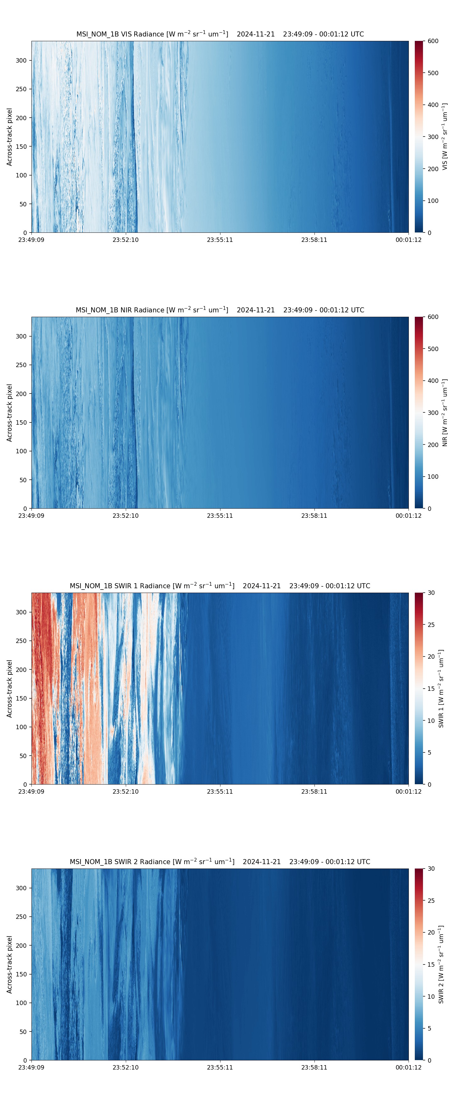
- ECA_EXBA_MSI_NOM_1B_20241121T234932Z_20250621T190621Z_02754G
Metadata Summary View Full Metadata
- ECA_EXBA_MSI_NOM_1B_20241121T234932Z_20250621T190621Z_02754G
- Dataset
- 10.57780/eca-b3bc031
- -67.382541 -165.518639 -71.819024 -170.897301 -76.038098 -179.307449 -79.77193 166.041471 -82.285283 139.289457 -82.279268 102.922358 -79.758429 76.230481 -76.021872 61.616123 -71.801993 53.223426 -67.365508 47.853645 -67.498333 46.915741 -67.867156 44.009355 -72.407442 48.574751 -76.797056 55.880915 -80.822676 69.488977 -83.743188 98.551852 -83.750368 143.632219 -80.837242 172.78161 -76.813647 -173.571446 -72.424428 -166.249404 -67.883915 -161.676466 -67.515285 -164.581253 -67.382541 -165.518639
- 2024-11-21 23:49:32 / 2024-11-22 00:00:39
- EarthCARE
- MSI
- 2024-11-22 00:00:39
- MSI_NOM_1B
- PDGS-CPF
- 2025-06-21 19:03:57
- 1B
- M-L1
- 5.0
- ZIP
- 356180643
- NA
- BA
- epsg:4326
- NOMINAL
- AUTOMATIC
- DESCENDING
- 2754
- 2024-11-21T22:45:43.104Z
- 48.517646277378496
- NOMINAL
- 2754
- G
- DEFAULT
- Alternates
- Atom format
- OGC 10-157r4 metadata
- OGC 17-069r3 metadata
- STAC metadata
- ISO 19139 metadata
- JSON-LD metadata
- JSON-LD (schema.org) metadata
- JSON-LD (GeoDCAT-AP) metadata
- RDF/XML metadata
- RDF/XML (schema.org) metadata
- RDF/XML (GeoDCAT-AP) metadata
- Turtle metadata
- Turtle (schema.org) metadata
- Turtle (GeoDCAT-AP) metadata
- HTML
- OGC 17-003r2 metadata
- Data
- Previews
